*This post was originally written September 17, 2019
_______________________________
Thru-hiking has been on my list of goals for a long time now.
Why thru-hike? Because it’s there.
Several years ago (before the movie and its boom in popularity), my Dad sent me an email, which included a passing remark about the book Wild by Cheryl Strayed. I was at university then and didn’t have the time to add to my long list of reading material.
Fast forward a few years, following my Dad’s passing, and I found a copy of a book that my Dad had written just before he died. The book was about an 1,100km thru-hike of the Great Divide Trail, on the border of Alberta and British Columbia. Reading it was like talking to my Dad. Like a part of him was still alive in the pages. The main character, with obvious similarities to my Dad, detailed the preparation for the trail and all the things to think about while on the trail – like blisters, ticks, wildlife encounters – and I felt like in a way I was being guided should I decide to do something like this.
In the book there was also mention of Cheryl Strayed, so I finally decided to read Wild. And there I was, reading about a solo female hiker in her twenties who was hitting the trail to heal her soul following the death of a parent…
In a nutshell, that’s exactly what I was doing when I thru-hiked the East Coast Trail.
I grew up in Newfoundland. But I hadn’t been back there for about three years. It’s where my Dad passed away, and there was a lot of baggage I needed to close the door on for a while when I last left. Going back there was hard. A lot of old emotions came bubbling up to the surface for me to deal with. Shadow work, in essence. And while a part of me had dreaded going back, in the end I was sad to leave. The hike helped me to work through things and change my perspective. It gave me a way of connecting deeply to the land and reclaiming this place for my self – transforming what it’s meant to me in the past. Becoming something new, my own.
I wasn’t sure what I would find on the trail, or how exactly it would heal me. I just knew this thru hike was something I had to do.
Trail Prep
I spent a week or so researching, planning, and prepping to hit the trail.
I had a place to store my van for the planned 15 days. I had a friend willing to drive me to the southern trailhead (about 100km south of town- Mount Pearl/ St. John’s).
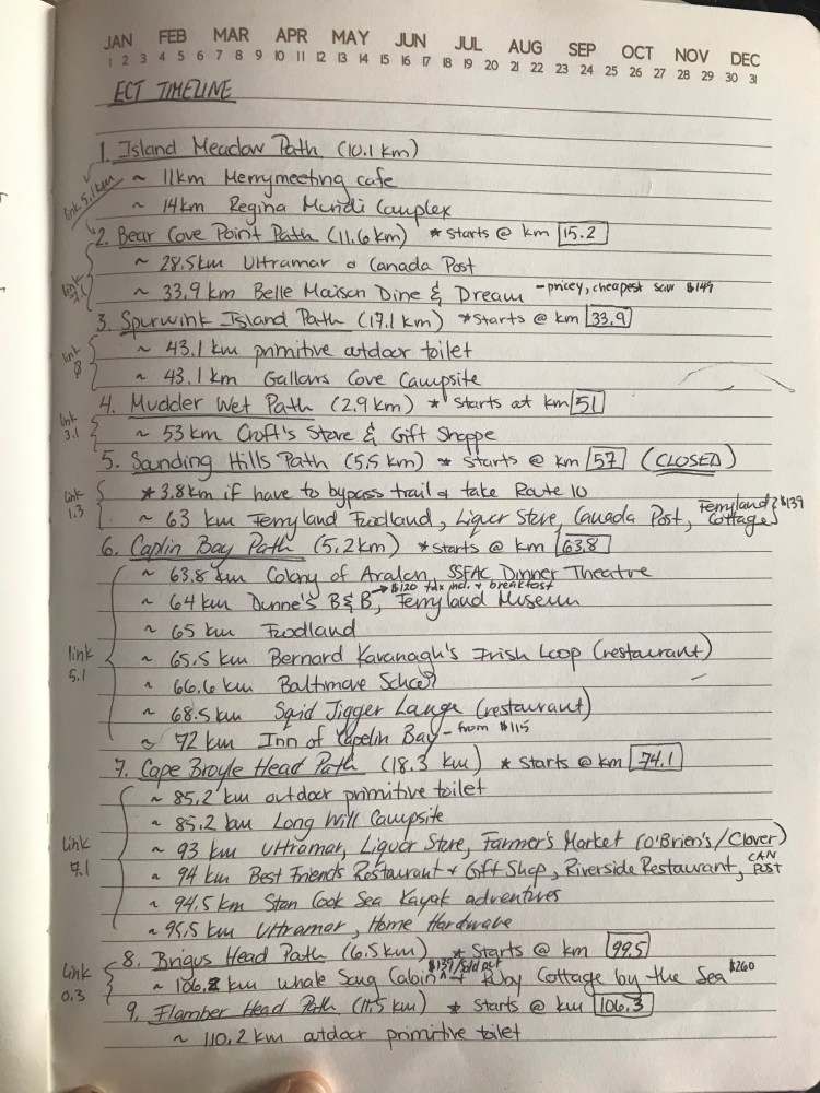
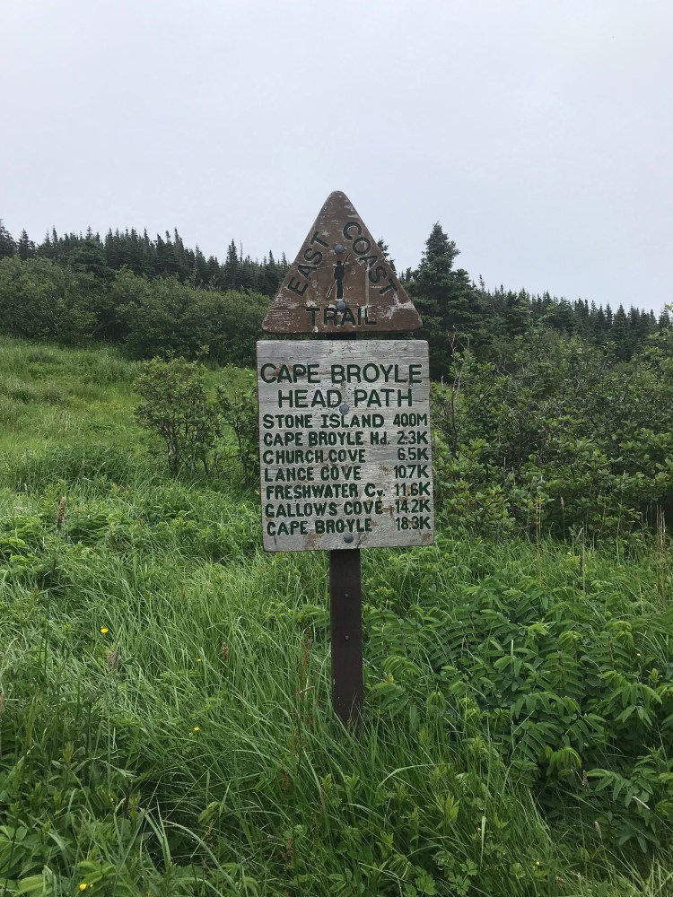
I bought the map set from the East Coast Trail Association (ECTA) which covers 24 paths, plus two draft maps for the two paths that are not yet “hardened to ECTA standards” (White Horse and Piccos Ridge). I poured over these maps and calculated total kilometres, distances between trailheads (up to 7km on road in several cases), places to restock, where to sleep (I spaced out one campground and an Airbnb with mostly random camping and a handful of “wilderness campsites”), and even where I would have access to toilets. I planned each day with a goal distance in mind.
I then did a bunch of research pertaining to best practices and gear.
Animals
Luckily, there are no black bears on the Avalon Peninsula, so I didn’t have to worry about bear spray or containers or hanging my food downwind of camp. I did get odour proof bags to keep anything smelly (food, toiletries) in though, to prevent squirrels or other small animals from being tempted to get into my pack or gnaw a hole in my tent overnight. I had chosen to keep my pack in the tent with me overnight, and good thing, too, since whatever was kept under the vestibule (shoes, gaiters, etc.) could be covered in slugs, ants, or carpenters come morning.
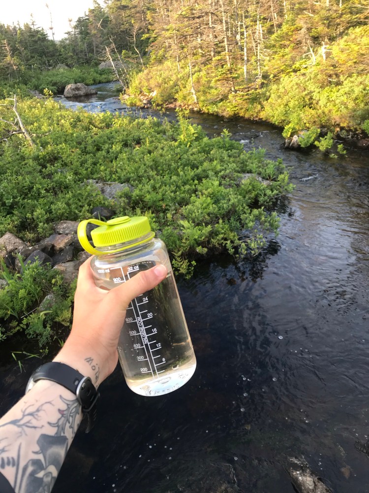
Water
I schooled myself in getting water on the trail – picking up a filtration system and treatment, as well as learning the signs to look for that would indicate a good or bad source. For example, moving water is better than still water, clear water is better than water with a hue, avoid water with active growth like algae or scum, avoid water near farmland as it could contain pesticides or fertilizers, avoid water close to roads which could contain oils and pollutants, stay upstream of industrial facilities, and avoid high (human) traffic areas which might contain human waste.
While a water filter is great for filtering out bacteria, protozoa, and parasites, it won’t do anything about viruses. Getting a virus from fresh water is not as big a concern since they are species specific – so being in the wilderness where there aren’t as many people and those who do pass through are hopefully following best practices for relieving themselves about 200 feet from running water – should keep the risk for viral transmission pretty low. But I like to hope for the best/ prepare for the worst, so I treated my water as well – using Aquatabs as an economical option, though you may see people mention a Steripen online (but this is pretty expensive).
You can of course boil water as well. Iodine has been a popular option but there are several drawbacks.
I found some good information here and here.
Hygiene & Health
In terms of not getting sick, hygiene is critical – making sure to ideally wash hands (hand sanitizer is good but not as good) – I used Camp Suds and clean water – after using the washroom, and especially before eating. A concern for many on the trail for long time frames is diarrhea or dysentery. If this were to occur, of course hydration and replacing electrolytes would be a priority. While many bring anti-diarrheal meds, I opted for some herbal remedies in my first aid kit. This included ginger powder in capsules (antimicrobial, anti-emetic) and chamomile tincture (antimicrobial, relaxing nervine, bitter to aid digestion; in alcohol to also augment the killing of bugs). Here is an article I found extremely informative.
No. 2
Of course – there is a proper way to poop in the woods. I prioritized real toilets/ pit toilets. But in the event that nature called in the middle of nowhere – dig a hole or pack out. I had biodegradable toilet paper with me (which can be buried) and FYI even if you have “biodegradable” wipes – they need to be packed out.
Clothing
“There is no such thing as bad weather, just inappropriate clothing.”
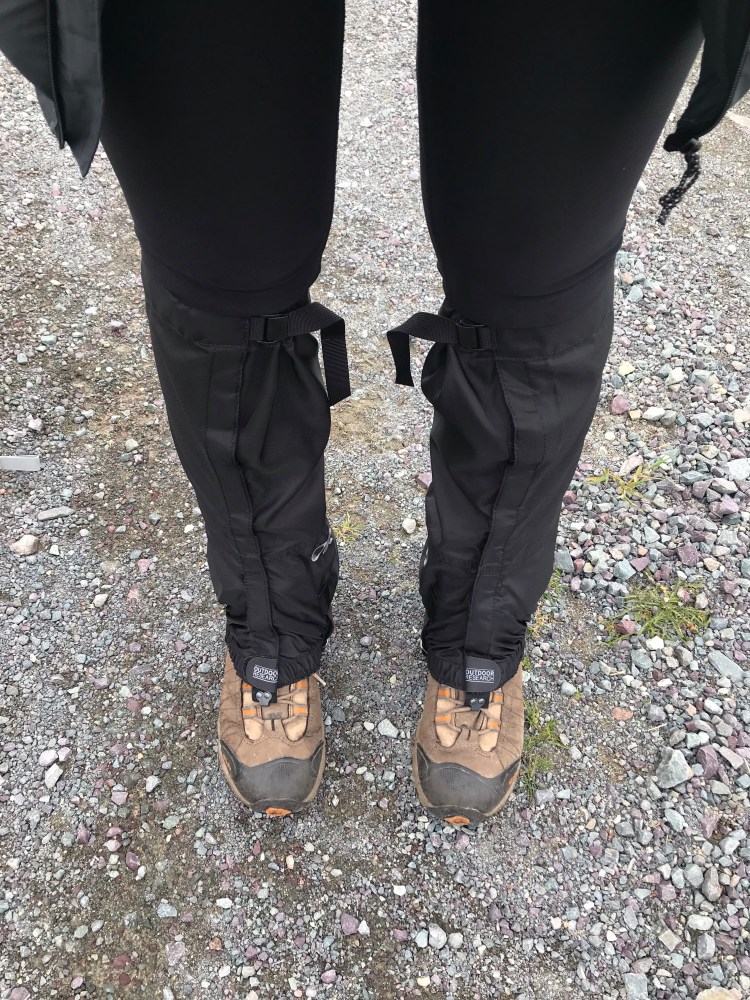
I found an amazing article on choosing hiking clothes here. It details optimum clothing materials, the genius in layering, and other strategies to keep you comfortable and prepared on the trail. When it came to the ECT, there was a lot of rain, so I was really happy to have my rain jacket and pants. Waterproof boots are key. I loved using gaiters as they protected my legs and clothing from being scratched or covered in mud, as well as keeping rocks, evergreen needles, or pests out of my shoes. A hat was great for shelter from the sun, black flies and mosquitoes, as well as hiding the state of my hair. And having moisture wicking, antimicrobial undergarments made a huge difference. Some recommend wearing bright colours, especially in hunting season, so that you are easily distinguishable to hunters.
Staying Relatively Clean
This article has some great tips. When you’re sweating every day and don’t have access to a shower – you have to get creative. My favourite tip was rinsing clothes. Every night I hung my hiking clothes on caribiners inside the tent to dry out and in the morning (because I was too tired at night and I usually only set up camp as it was getting dark) I would put 1/2 – 1 cup of water into a little bag mixed with a few drops of Camp Suds. Then I’d swish the smelly areas of my clothing in the water, giving it a good rub, before ringing it out. It was important that I do this in a place far removed from water sources. And it worked like a charm so that I felt fresh as I started each day. It teaches you about conservation of water on the trail, too. I also used wipes on my body at the end of the day and had an outfit that I only wore to bed.
Lactic Acid, Sore Muscles, Overuse Injuries
In the interest of being prepared, I looked into lactic acid. I knew that I had long days on the trail ahead and didn’t want anything to get in my way. I didn’t find this to be an issue in the end, but I was glad to have some strategies up my sleeve. These included staying hydrated, rest (so the body can move lactic acid out), deep breathing (more oxygen to muscles), stretching before and after activity (circulation and relieves tension), taking magnesium, and drinking orange juice before activity (vitamin C and folate are thought to help).
I generally assumed I would have sore muscles and that they would have to strengthen along the trail. They certainly were stiff each morning, so I made sure to stretch.
A few times on the trail it seemed like I was developing an overuse injury. Prior to beginning my thru-hike I had had a bout of plantar fasciitis in my left foot, so I’d picked up a little massage ball to roll out the bottom of my foot – it helped for the muscles in my shoulders and back, too, due to the heavy pack. My right hip started acting up about 6 days into the hike and so I looked up hip flexor stretches – it never developed into anything worse. One of my knees began giving me trouble at about day 12, flaring up randomly and causing me to limp, but that seemed to go away, too. Finally, I had prepared for blisters by bringing a “Blister Medic” kit from the local outdoors store. It didn’t help with prevention as I applied moleskin to hot spots. And I ended up with some pretty nasty blisters that I had to clean and bandage daily. These were caused mostly by the super rough terrain on the ECT. A teacher of mine had shared a method of toughening up the feet with me prior to embarking on my travels, but unfortunately I hadn’t had time to implement it (next time!). Apparently if you soak your feet in tea daily for a few weeks prior to a long hike, and ideally during the hike, the tannins in the tea will toughen up the skin (like tanning leather) making you more resistant to wear and blisters!
Gear
Once I felt like I knew what I needed to prepare for, I got to making a list of all the supplies I would need, and going out to purchase them. Price was certainly a factor, but for the main items quality was really important to me. I also took into consideration weight and durability. Here are some of the key items I had on the trail with me:
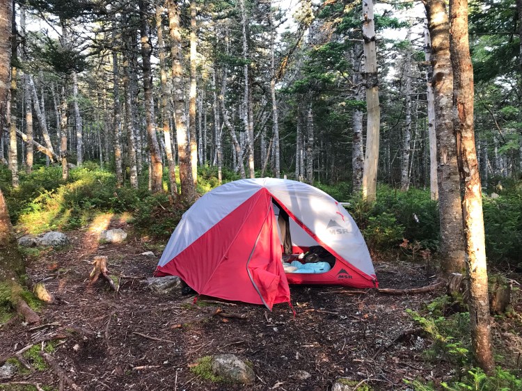
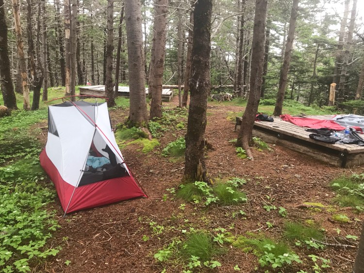
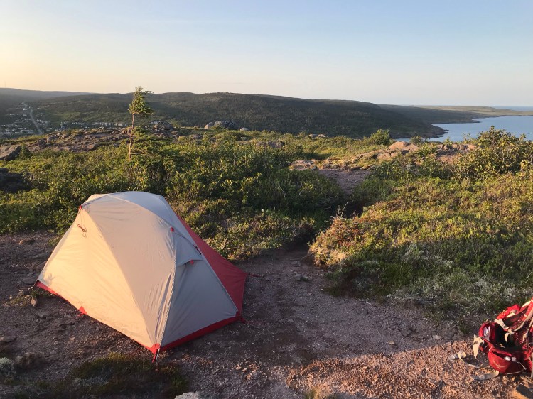
- Tent + Fly + Footprint – I went with the MSR Elixir 1 – while it might have been nice to have a two-person tent for the space, the one-person allowed me to random camp in smaller spaces and was more lightweight (4.76lbs – sure, you can get a 2.5lbs tent but you’re probably going to pay a lot more). Ideally I was eyeing the Hubba NX – but the store that had it was selling it for twice the price of the Elixir! This tent also comes with a footprint (fly not shown below).

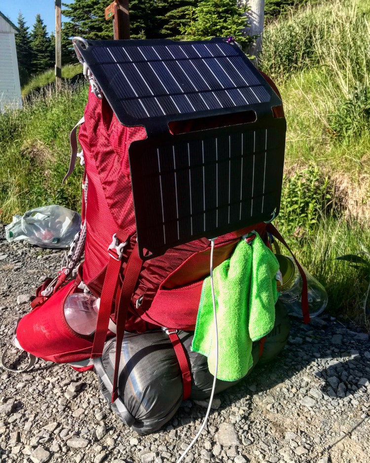
- Pack – I went with the Osprey Aura AG 50 – This one felt the most comfortable when I tried it on in the store. I had no gauge for whether I might need the 65L instead of the 50L, but went on the advise of an associate who said that 50 should be sufficient, especially since I wasn’t going to be carrying a lot of food (restocking every day or two). And the 50 turned out just right. While I got a medium (4.18lbs), I might have gotten away with a small since I lost a bunch of weight on the trail and by the end the hip strap would be tightened all the way and still not feel tight enough to keep weight down on my shoulders. I liked having the ability to hang things from carabiners off this pack and having pockets in the hip straps was great for easy access to essentials without the need for taking the pack off.
- Sleeping Pad + Inflater – The MEC VectAir Insulated Sleeping Pad is wonderful. It keeps you elevated so you don’t realize you’re actually sleeping on rocks or roots or uneven ground, creating an air gap which also keeps you from feeling the cold of the ground. It’s super light (1.7lbs) and folds down pretty small.
- Sleeping Bag – The MEC Delphinus 0C Down Sleeping Bag was super cozy. It was lightweight (2.1lbs) and affordable. While I grappled with the decision of down or synthetic (knowing NL is prone to wet weather) – down being rendered fairly useless when wet – I vowed to keep my sleeping bag dry, and I succeeded. Though since it is a mummy bag my stiff muscles did yearn to sprawl out at night.
- Waterproof Hiking Boots
- Gaiters (scratch resistant, waterproof)
- Water Filter
- Water Treatment
- Nalgene Bottle – what makes these special, you might ask? They’re BPA free so you can pour boiling water into them without worrying about leaching chemicals, they have wide mouths for quick and easy fill ups, they’re virtually indestructible, dishwasher safe, leak proof, and have a measuring cup feature.
- Toiletries: wipes for face and body, deodorant, toothpaste and brush, toilet paper (coreless! And you can get biodegradable), Camp Suds – wash hands/ body/ dishes, hand sanitizer, compact mirror, lip balm – ideally with sun protection, eye drops, mini containers)
- First aid: Blister medic, bandages, disinfectant (hydrogen peroxide, rubbing alcohol), antimicrobial ointment (I had made a salve with St. John’s Wort previously, which is antimicrobial, a pain reliever, and helps with itch – which I truly believe helped speed up the recovery of my blisters – also working great on bug bites), tick removal kit (though ticks were hardly an issue on these trails).
- Sun Protection: Sunscreen, Sun Glasses, Hat, you can also get UV protected clothing.
- Clothes: quick drying, antimicrobial, UV protected. Highly recommend moisture-wicking/ antimicrobial in all clothing, but the underwear was a great investment. I personally brought enough underwear to get me to each shower, 4 pairs of socks (1 for overnight), 2 sports bras, one long sleeve shirt, one short sleeve shirt, one pair of shorts, one pair of running tights, rain pants, rain jacket, down jacket, t-shirt for bed, leggings for bed, and an extra long-sleeve midlayer when cold.
- Food: dehydrated/ freeze dried meals, instant smoothies, electrolyte tabs, energy gels, gummies, energy bars, GORP, any liquids you’re okay with carrying/ camelling up at restocks.
- Maps (waterproof and tear-resistant) + compass (I did use my compass, too, one morning when I took a wrong turn onto a side trail – I found it much more reliable than my phone’s compass).
- Knife
- Trowel
- Microfiber towels (for showers, but this was super useful when I was trying to dry my tent out after rain by wiping it down).
- Bug repellant – I used Shagg Off, purchased at Hempware in St. John’s, an all natural product that really did wonders on the trail – especially while putting up or tearing down the tent/ using the bathroom in the forest, when the black flies or mosquitoes would descend.
- Sandals – for showers or to give your feet a break around camp – or even river crossings (but I didn’t bother/ it wasn’t really necessary on my trek)
- Bathing suit – optional – can use sports bra/ underwear.
- Odour Proof bags
- Ziploc bags to keep various items dry, carry accessible toilet paper, pack out garbage.
- Waterproof stuff sack for clothes (I used a 13L and strapped it onto the outside of my pack. This and some clothes inside also served as my pillow at night).
- Pack rain cover
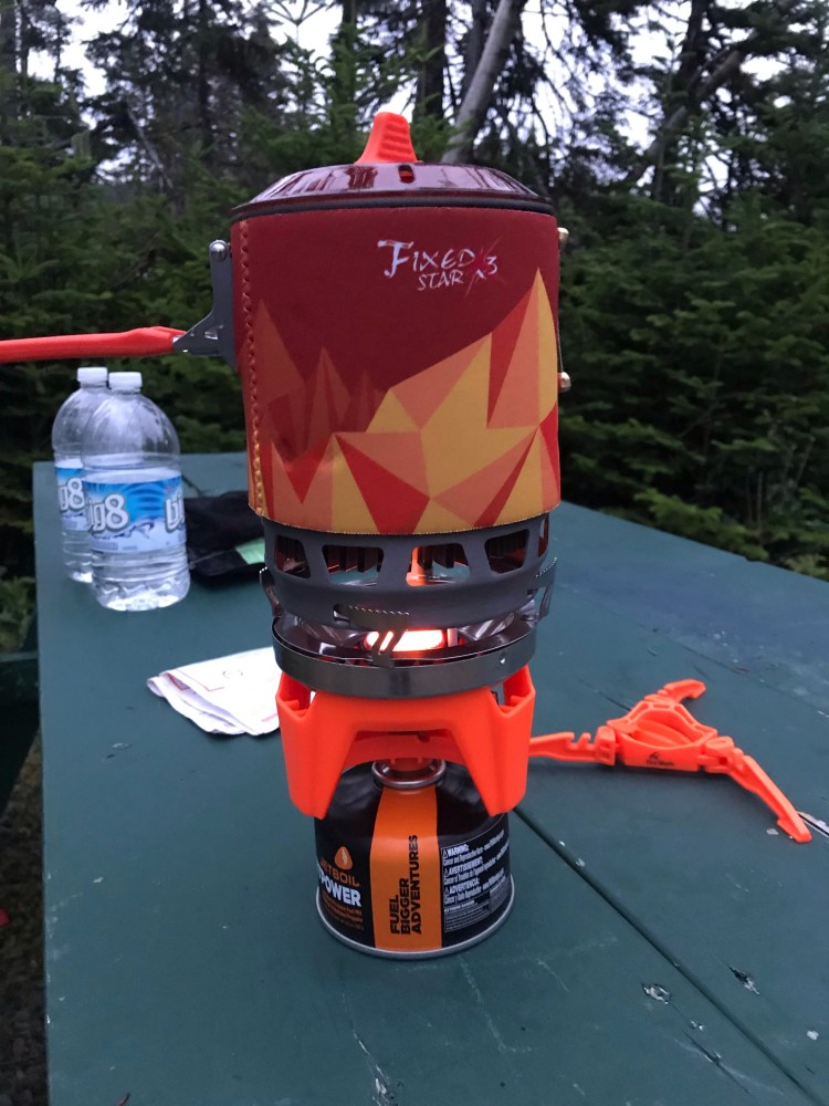
- Camp Stove and fuel – I had the Fire Maple X3 – similar to the Jet Boil but cheaper. Works well.
- Mini waterproof wallet for cash and cards
- Glasses or contacts if applicable (so you can see those sweet sweet views!) Side note: my glasses fogged up when things got real sweaty so I carried them – and dropped them – and they eventually broke… contacts can be a little tricky in terms of keeping things hygienic. I had eye drops with me to prevent infection, as I was also rubbing my eyes in the mornings.
- Light/ lantern – this saved my ass one night when I had to set up the tent in pitch black forest and it also is essential for inside the tent once the sun has gone down.
- Whistle
- Check to see if you need a wilderness permit where you are going (don’t need for the ECT)
- Cook set – Optional. I just boiled water and poured it into the dehydrated food packs – no clean up required (and I was so tired at the end of a day, this was a big plus).
- Tape – for fixing broken equipment or gear
- Weatherproof, nylon rope
- Warm hat and gloves
- Sport watch
- Carabiners
- Small bag of laundry detergent (I make my own with grated Dr. Bronner’s bar soap and washing soda).
- Massage ball
- Other: emergency space bag/ reflective blanket, day pack, trekking poles (I was glad I didn’t have these as they would have just gotten in the way in my opinion – at least on this trail), poo bags, garbage bags (I used these to keep some stuff dry in my pack, and a small bag for dirty laundry), poncho, anti-diarrheal, phone, utensils, travel candle/ lighter/ matches, usb cord, charger, flashlight, batteries, liner socks.
Other Considerations
Before hitting the trail I posted on social media my anticipated timeline – where I would be and when. By doing this, if I went missing for some reason there would be a record of where I might be found. I also posted updates online most days of my progress (with the exception of when my phone died or I was out of service).
I kept on top of the forecast (rain) in order to plan my days accordingly – if I needed to start earlier in order to get as many miles in before the rain started.
Leave No Trace!
Other Resources
Randy Best – ECT Thru Hike – in depth look at backpacking the ECT.
East Coast Trail Association – Trail and prep info, any trail closures to expect.
Newfoundsander – a blog on NL sightseeing: the ECT, icebergs, capelin, whales, berries.
Iceberg Finder – track the bergs, when and where!
Spin The Globe Project – backpacking: what to bring and things to keep in mind.
Lint Hikes – experienced thru-hiker.
Beardsworld – experienced thru-hiker.
The Hike
Day 1
{15km}
I now walk into the Wild
-Chris McCandless
Before I knew it, it was time to hit the trail.
Since I was also doing “vanlife”, I had stayed at Pippy Park Campground the night before hitting the trail so I could do laundry and shower and make final preparations.
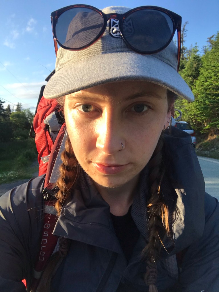
The morning of Day 1 arrived. I dropped off some valuables at a friend’s, then dropped off the van near another friend’s place. I’d been in such a mad rush to get everything I needed to done that I wasn’t exactly packed by the time my friend picked me up to go to the trailhead. So I basically threw a bunch of stuff into my friend’s car and figured I would pack my pack on the way.
But I also had been in such a rush that I hadn’t eaten a real breakfast and looking down at my pack in the car had me car sick. So I resorted to sorting what I did and did not need, leaving a reject bag with my friend and watching her drive off (she had to speed to work) as I stared down at my overflowing pack on the ground, and the reality of what I had gotten myself into hit me full throttle.
Then the black flies descended.
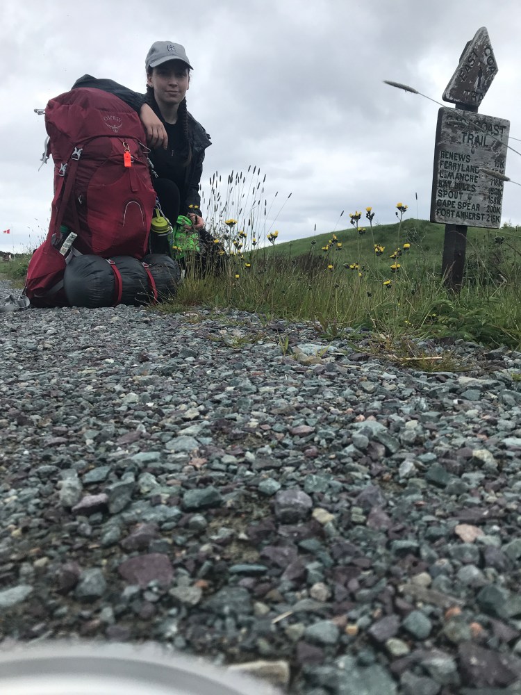
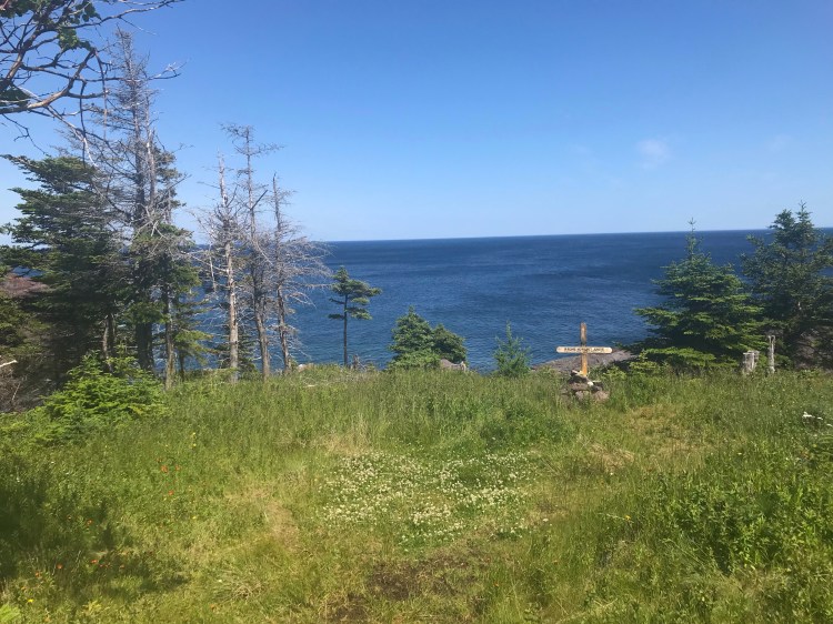
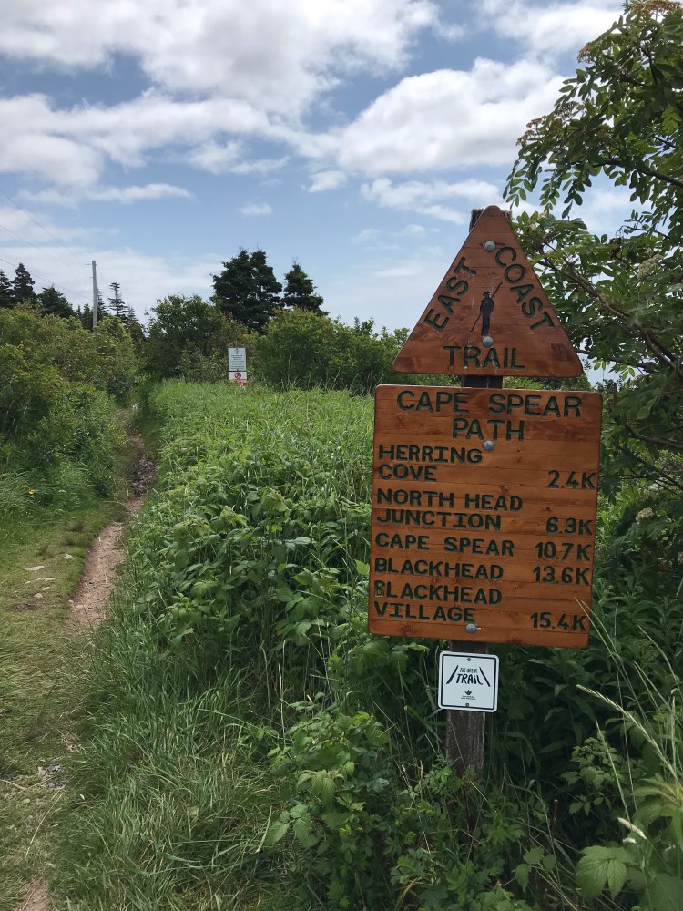
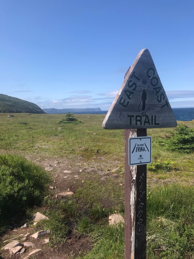
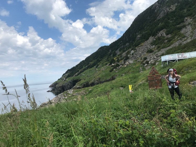
It took about an hour for me to get everything relatively sorted in my pack (swatting flies and frantically applying my bug repellant), get to the trailhead sign, and take some photos. Then I took my first steps of what would be a 15 day journey, rife with pain, gain, blood, sweat, and tears (all worth it).

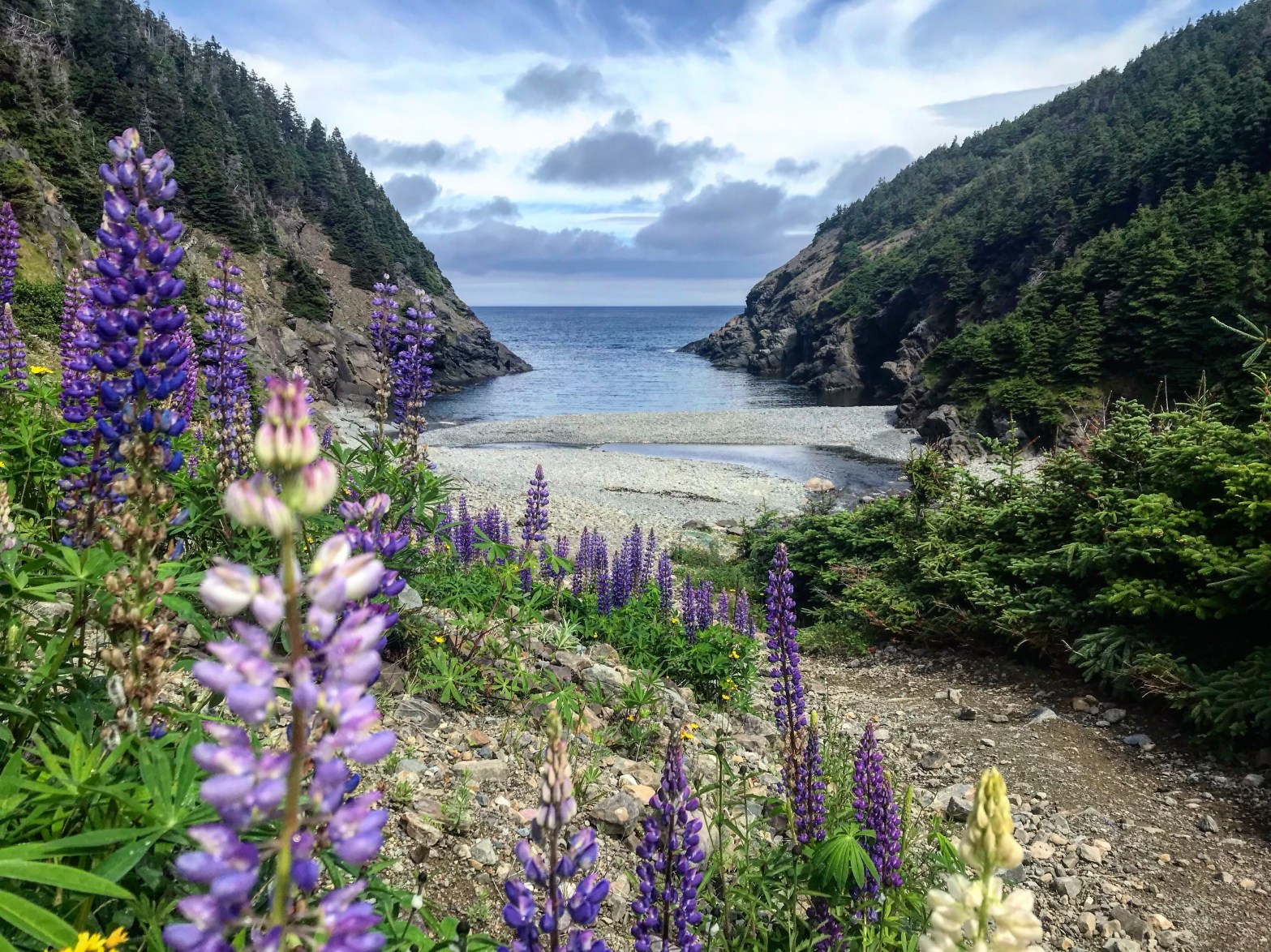
The first path was Island Meadow Path (10.1km, rated moderate difficulty, going from Cappahayden to Renews). I had no issues on this trail. It was overcast and began to rain and drizzle, giving me the opportunity to break out my rain jacket and waterproof pack cover.
As I hiked a thought popped into my head: “Don’t be an idiot”. It became one of several mantras for me on the trail. It kept me on my toes, made me wary and careful. It somehow felt like something my Dad would say in dry humour.
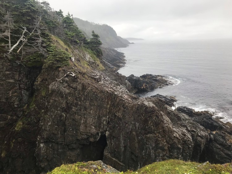
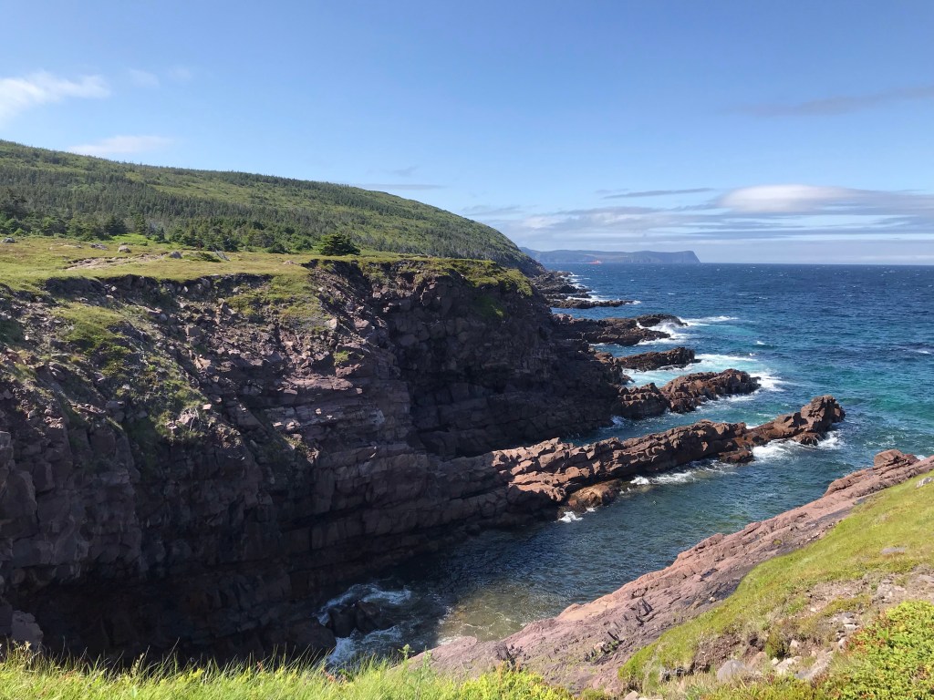
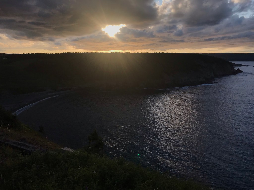
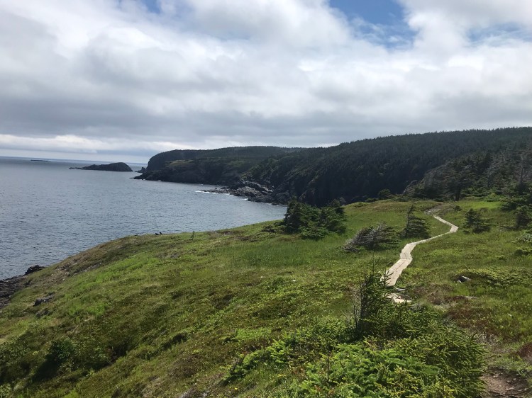
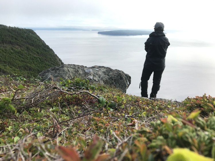
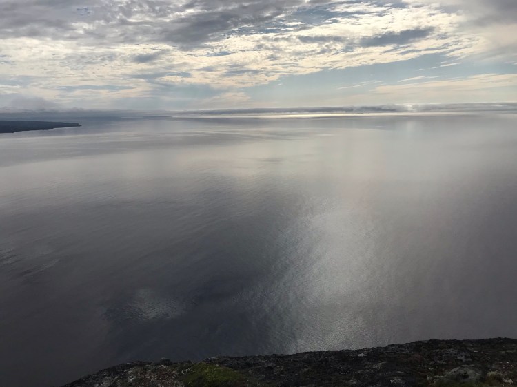
As I took in the clouds and waves, the exposed land and those who lived here, I thought of the extremes of this environment, of its weather. On the coast you are exposed. But extremes make you stronger, teach you lessons – in nature and in life – of how to weather whatever comes your way.
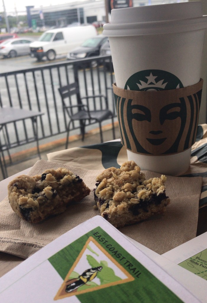
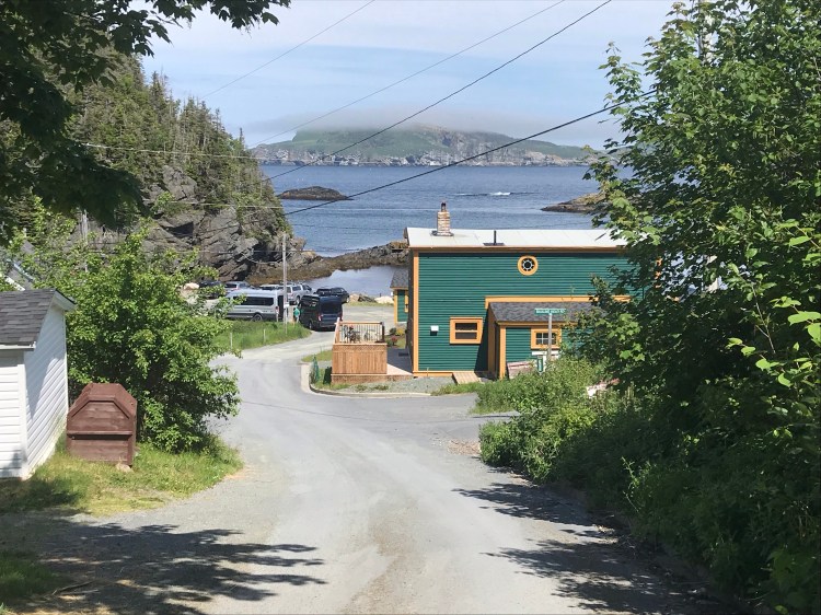
Because I had started my hiking later in the day, I wasn’t able to get as far as I’d planned. As rain threatened and daylight hours began to run out, I finished Island Meadow Path and began to walk the “community link” (roads) to the next trailhead – a 5.1km link. Had it been earlier in the day I could have stopped in to Merrymeeting Cafe (food, drink, souvenirs).
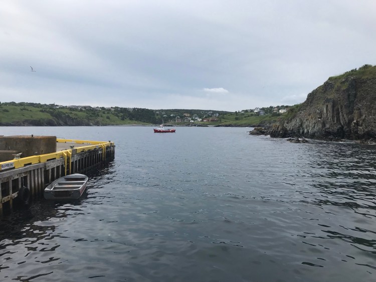
Then a tourist couple offered me a ride. And while I was hesitant (because I hadn’t decided if I wanted to be a stickler – not because of the risk of hitch hiking – they were genuinely nice), ultimately I gave in due to the looming rain and dark. They were a couple from BC who’d just gone out to dinner. We chatted as I directed them, we passed by some goats, and within a few minutes arrived at the next trailhead sign. I thanked them and was on my way.
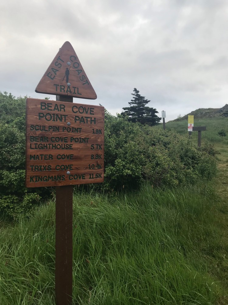
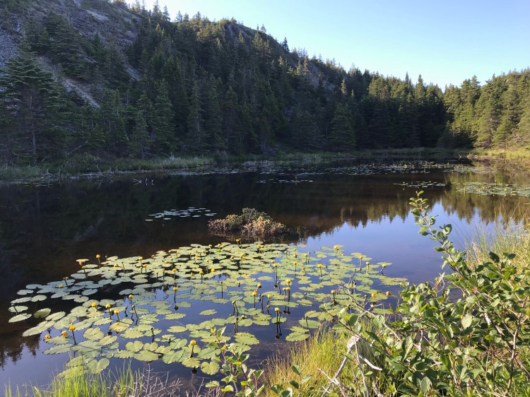
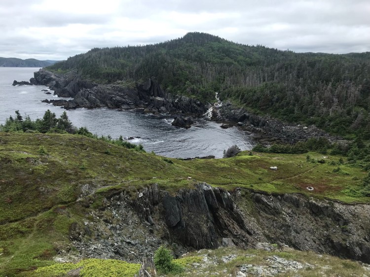
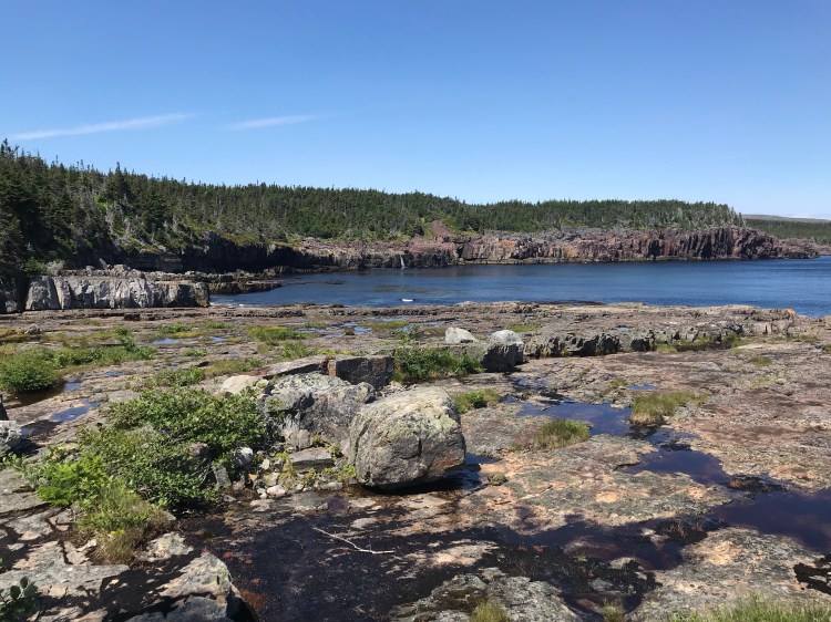
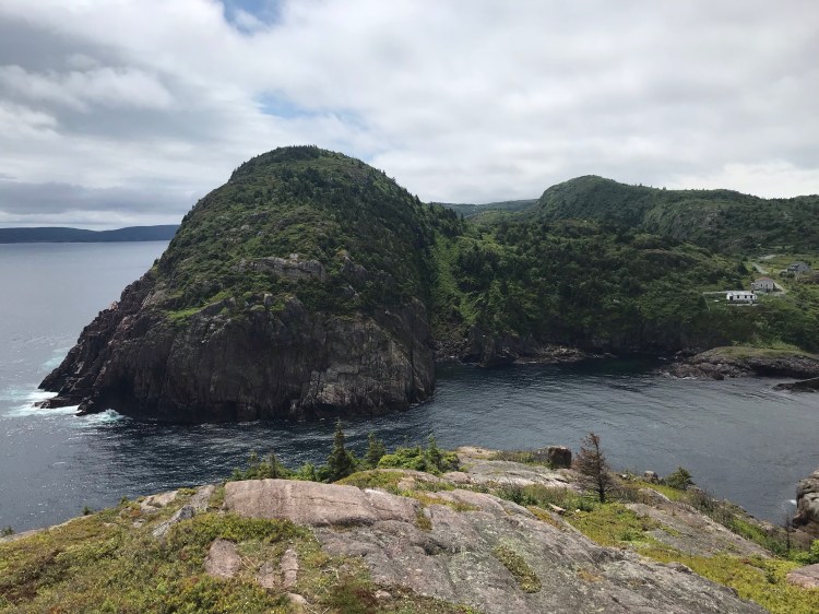
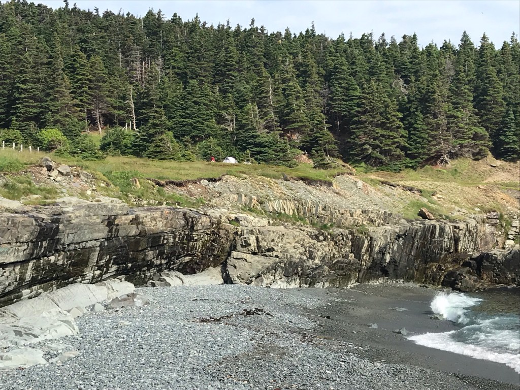
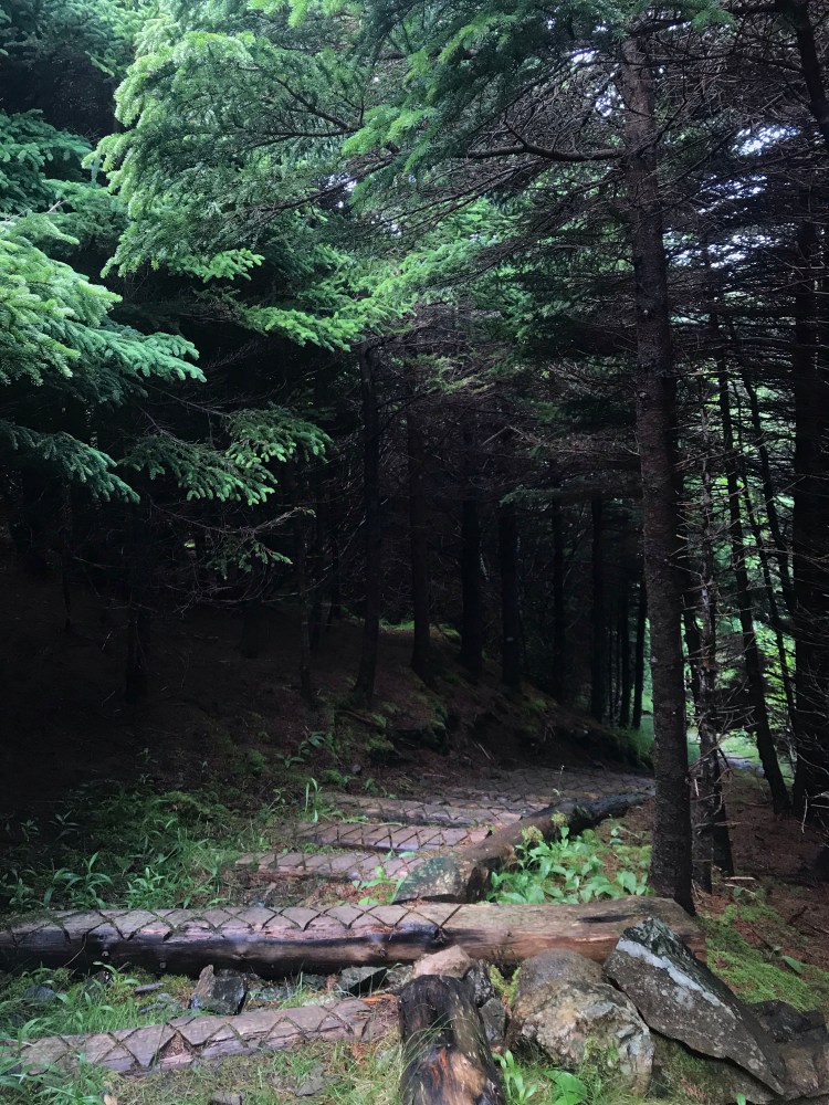
I was now on Bear Cove Point Path (11.6km, moderate, Renews to Kingman’s Cove). Time to find a decent spot to random camp before it got too dark. I crossed coastal meadows and headed into forest, weaving in and out of the trees to see ocean waves crash on cliff and rock – as I would grow accustom to over the following weeks.
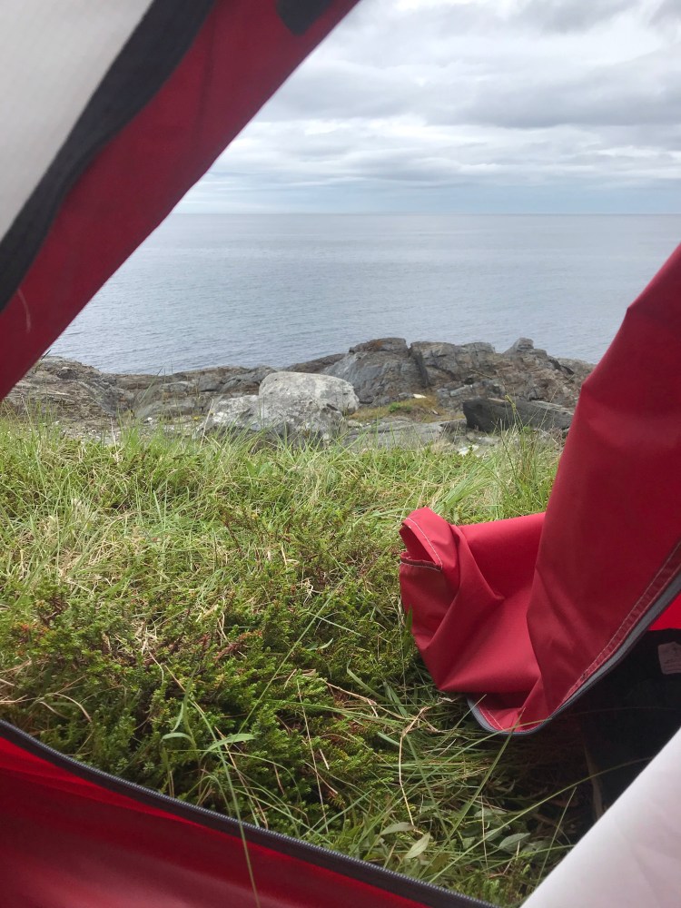
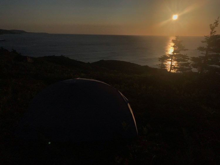
Just in time, a few kilometres in, I settled on a remarkably flat outcropping of ground cover at the edge of the woods and up a small rock ledge, which was to one side of the trail and a bit of rocky beach – just high enough that I wasn’t worried about the tide washing me away. I set my pack down (not yet knowing that this would be a highlight of my days to come) and proceeded to set up camp for the first time!

Day 2
{19.2km}
Morning burned off the fog and cloud and it proved to be a beautiful sunny day. I didn’t see (or hear) a soul at this spot and happily began my second day of hiking.
I decided to get creative and put my feet (and fresh socks) into the “poo bags” I’d brought before putting them into my hiking boots. My wet socks from day one smelled of bog water. I knew that my feet would not have ventilation with bags over them, but they were getting wet from rain and plants and puddles anyways. And I discovered that sweaty socks smell much better than bog water socks!
The major adjustment for the first few days on the trail was to carrying the pack – I developed some bruising on my shoulders and hips, as well as sore muscles, but eventually my body got used to it and got stronger. I thought of how muscle fibres rip and heal in order to become stronger.
I looked back at the land I’d traversed so far. Seeing it fade from where I’d come – like where I’d come from in life – there was a sadness in nostalgia, but also a pride in how far I’d come.
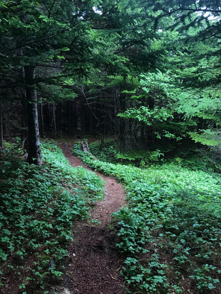
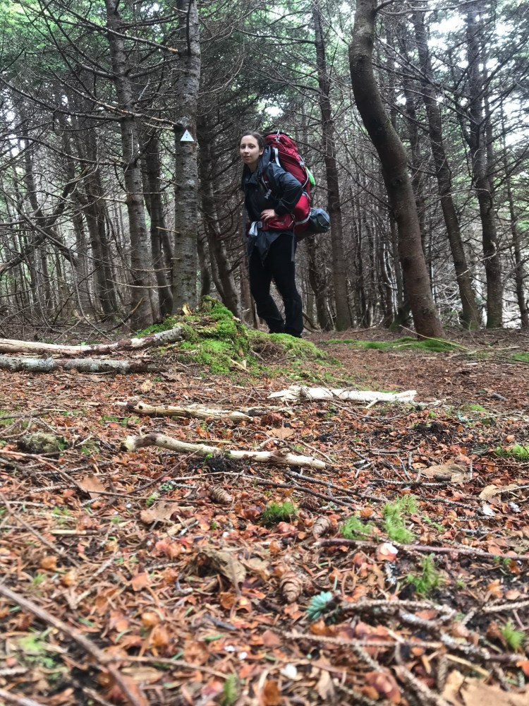
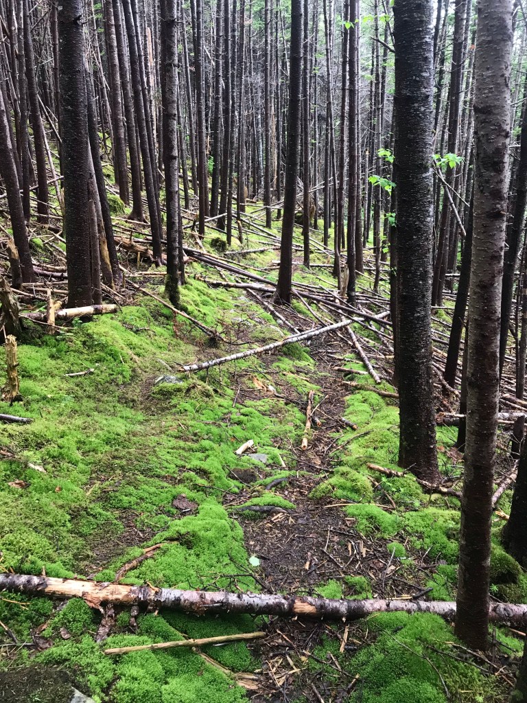
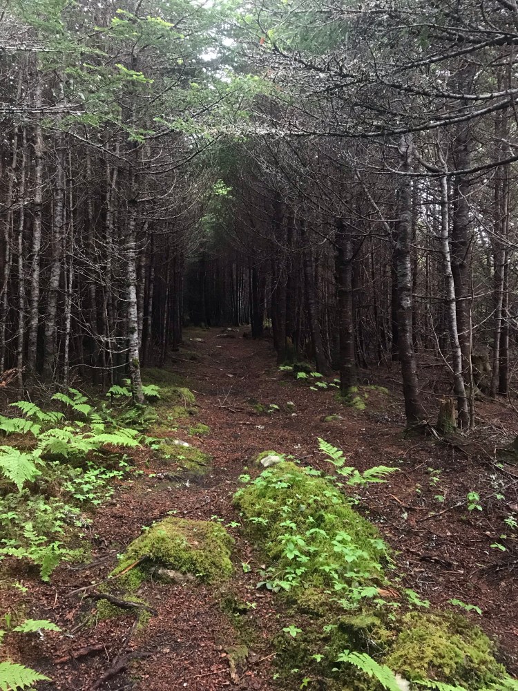
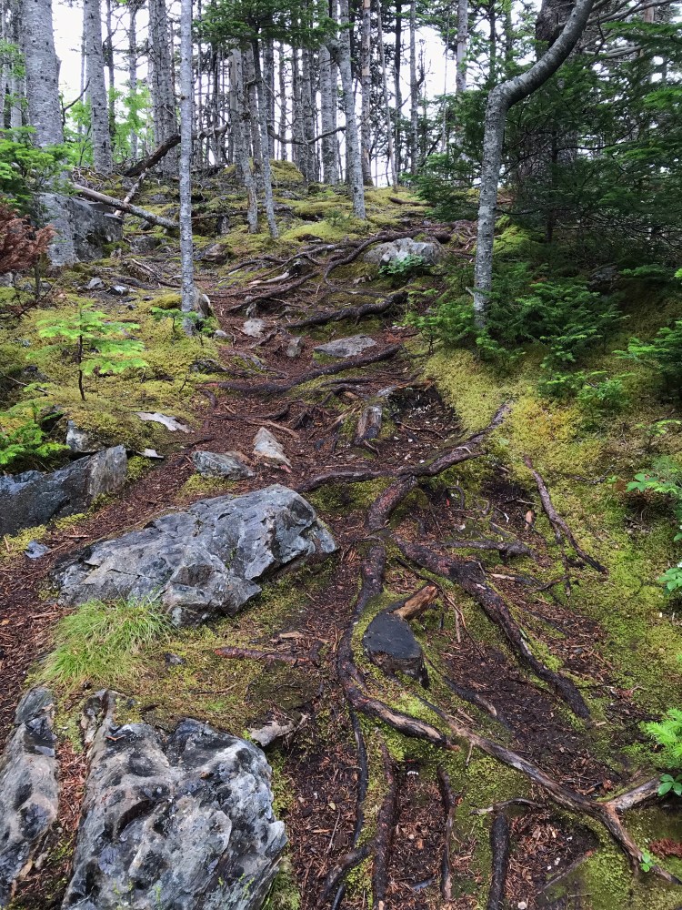
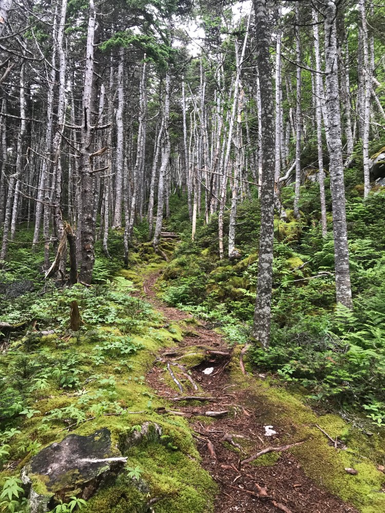
The rest of Bear Cove Point Path kept me in the forest quite a bit and there was quite a bit of “bushwacking”. You could say I became one with the trees. I lost count of how many spider webs my body (often face) cleared from the trail.
At one point I remember stopping to look around and there was complete silence. Not even the sound of the ocean was audible, just my own breath and heartbeat. It was a memorable moment.
Following Bear Cove Point was a 7.1km link to the next path. I walked a few km to an Ultramar to restock and camel up and it didn’t take long for a friendly local woman to offer me a ride. I obliged and she told me all about a couple of girls she’d given a lift the previous summer. She was the second person to ask me if I was doing the hike alone, responding with, “you’ve got some nerve!” But if I let doing things alone stop me from doing the things I want – I’d miss out on a hell of a lot in this life. Thanks to her generosity I was able to make up some ground from Day 1 and get to my intended campsite for the night.
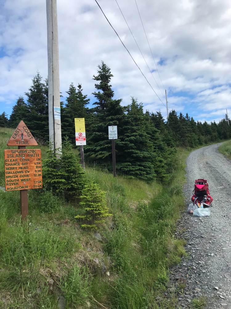
I was now on Spurwink Island Path (17.1km, difficult, Port Kirwan to South West River).
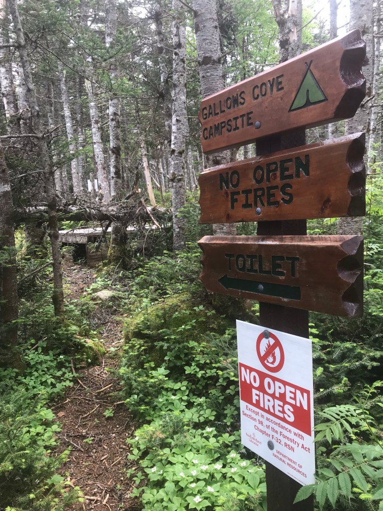
I started from the trailhead around 6pm, so I was racing the sun (sunset around 9pm) to get 9.2km to Gallows Cove Campsite (a wilderness campsite). Typically, I was finding that my average hiking pace was 3km/hr. The first 4.5km to Chance Pond River were a breeze and took only 1hr15mins. But the terrain became more difficult after this, with hills and mud and fallen trees. I was excited though, because I knew I had a stunning view coming up at Berry Head (1.3km before the campsite) – and it did not disappoint!
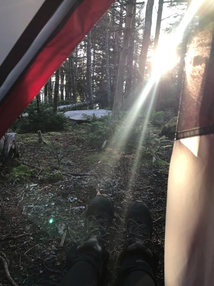
I didn’t want to rush past this view, and I have no regrets, but I did end up having to set up camp in pitch black. I got to the campsite as it was getting dark. There were raised wood platforms for tents and it only dawned on me that my tent would not work on these after wasting time trying to set it up. I gave up and scoured the ground for a relatively flat spot. I found one, muddy, but that’s all I could do. It got to the point where I was setting up my tent by feel instead of sight. I hung my lantern in a nearby tree and looked around, my heart filling with dread at what might be lurking in the dark. I snapped myself out of that train of thought fast – pushing back thoughts of the Blair Witch – and focused on the task at hand. Everything would be fine once I was in the tent, I told myself…
And it was! I had a pleasant, undisturbed sleep. A couple of hikers passed through the next day, stopping to chat and have an early lunch. Then I got on my way.
Day 3
{14km}
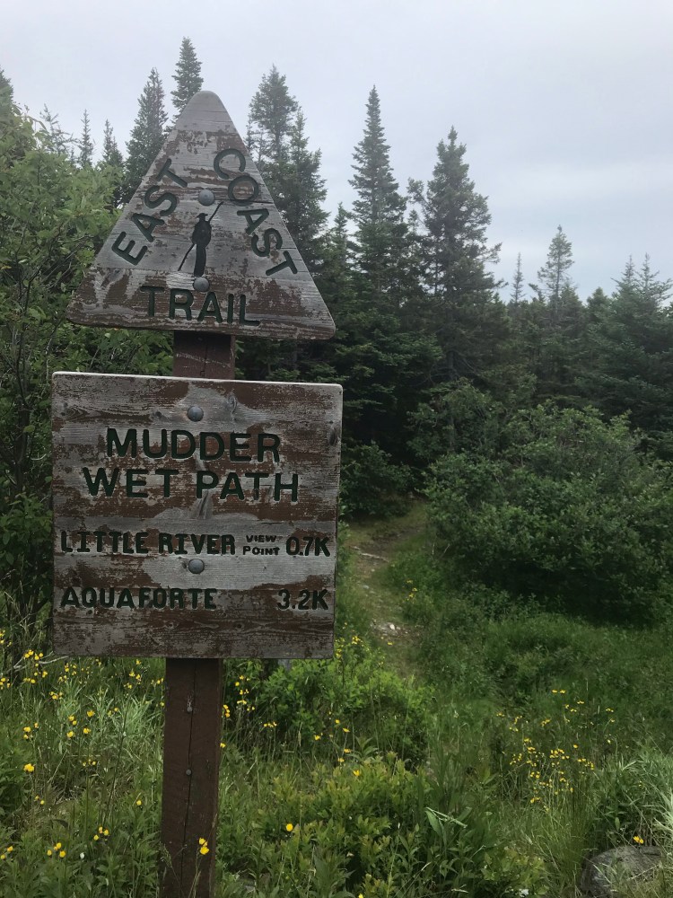
I continued on Spurwink, which meets up with Mudder Wet Path (2.9km, easy, South West River to Aquaforte).
I knew that rain was in the forecast for the evening, but I hoped it would hold off as long as possible.
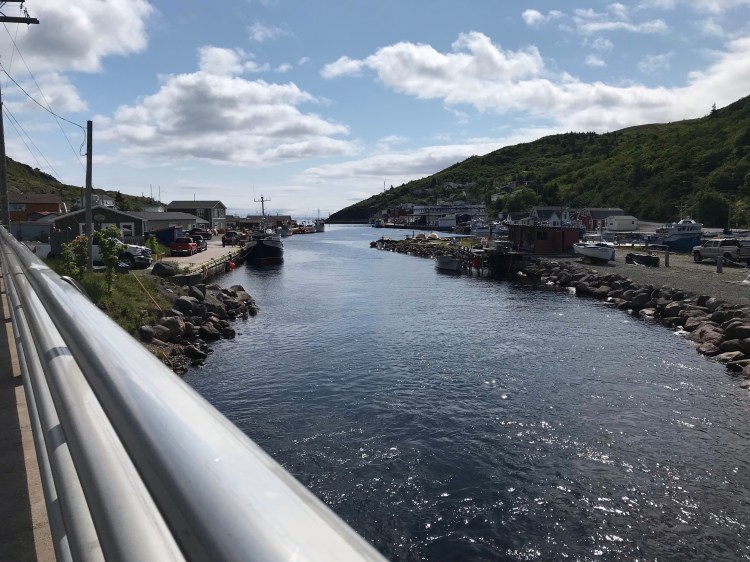
Unfortunately, following Mudder Wet, Sounding Hills Path (5.5km, easy to moderate, Aquaforte to Ferryland) had been closed due to a dispute between a landowner and the city. I planned to bypass the trail, following Route 10, and walk to the Ferryland Foodland to restock. Once again, a kind local offered me a ride – saving me about 5km and some time before the rain. He wanted to make sure I knew about Sounding Hills being closed, remarking that it was a beautiful trail – and what shame it was that a silly dispute was keeping people from experiencing it (a sentiment I heard echoed by other locals). This young man said it was the first time he’d ever picked someone up off the side of the road (he didn’t think I looked sketchy – hoorah!) but the impending rain played a part in his offer, and I was grateful.
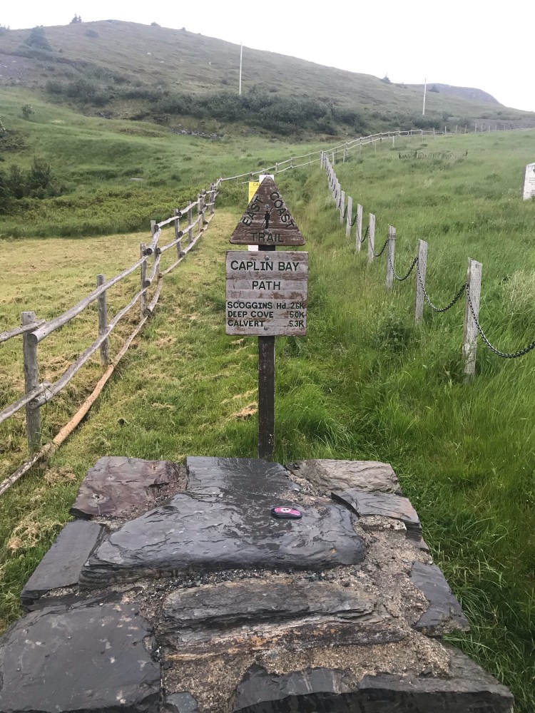
Once my energy stores were replenished (which included a “luxurious” fruit bowl) I headed on (about 1km) to the next trail: Caplin Bay Path (5.2km, easy, Ferryland to Calvert). This is when the rain started.
It was around 7pm, so it made sense to find camp for the night – ASAP. The beginning of Caplin Bay Path brings you up a gravel road and you have the option of continuing on this road or going up onto a grassy hill (where you get a good view of Ferryland and the lighthouse) – not that I could see it with the rain and fog. Since I needed to find a spot to sleep and didn’t want to be so close to all these houses, I ventured up the hill. It took a while to find a level spot, and it was very exposed, but the rain was really starting to come down. I could see houses and roads from here, but I figured no one would bother me in this weather.
Everything got wet. I was wet, the inside of my tent got wet, my pack was wet. It was wet.
Once sheltered inside the tent I towelled things off, especially the inside of the tent. I hung up my clothes, got some food in me, and tried to sleep. But it was not a good sleep. I was continually woken up throughout the night by the torrential rain and relentless winds, hoping my tent could withstand the assaults. I was also continually towelling off water from inside the tent, which I assumed was condensation from all my wet gear already in the tent.
Finally, morning came.
Day 4
{21.2km}
What a relief that the rain had stopped. I could tell that my tent was worse for wear, but I dried it off as best as I could and hoped for sun so it could dry out the next night.
I made a pit stop at a little restaurant called Bernard Kavanagh’s Irish Loop for a quick breakfast and restock, then continued on, passing Baltimore school, where I couldn’t help thinking of some girls I used to play basketball with as a kid.
This was a wet but peaceful hike. Once I got off this path I had a 5.1km jaunt to the next trailhead: Cape Broyle Head Path (18.3km, difficult to strenuous, Calvert to Cape Broyle).
But during the jaunt I began to feel a bit off. Specifically my stomach – I was feeling slightly nauseous. The sun had come out and I wondered if I was just overheated or needed a break and some fluids. The dark part of my mind automatically considered worst case scenarios – such as having caught a bug.
Once I reached the Cape Broyle Head Path trailhead I took off my pack, popped a squat, rested and refuelled. I decided to add some of my chamomile tincture to one of my water bottles so I could continually hydrate and dose myself with medicine. I took a couple of ginger capsules as well. I considered my hygiene thus far and vowed to do better (though I thought I’d done well, I became meticulous).
It was a stroke of luck that a previous teacher of mine happened to message me around this time. He told me he was rooting for me and that if I needed anything – a ride, a restock, anything – to let him know and he’d be there. This gesture couldn’t have come at a better time, as I contemplated going onto an 18.3km trail, where there would be no easy exit if the state of my stomach got worse.
I grappled with the decision to move forward for a little while, but I’m not an easy quitter, and I got some more encouragement in the form of a crow feather and glancing down at the time when it happened to be 3:33pm. I also saw a bald eagle. I took heart and carried on. And on the bright side, I was on my way to a wilderness campsite (Long Will Campsite) – where there could be other people and there would be a pit toilet.
The trail lived up to its rating – it was difficult. Not only did it feel like the climb wouldn’t end to the “top of the cape” (“your mountain is waiting, so get on your way!”), but because it had recently rained much of the trail had turned into a river. I was not river-crossing, I was traversing the river, hoping not to slip and fall.
About four hours and 11.1km later, I reached the campsite, and for the first time on this trek ran into people who’d be spending the night in the same spot as me – and I was grateful.
The nausea and upset stomach lasted for a few days, but luckily never got any worse. I kept taking chamomile and ginger. And ultimately concluded that it was a sign of my body being stressed from exertion. Due to my sensitive stomach I was getting most of my calories from liquids – as I didn’t want to aggravate anything.
Day 5
{18.9km}
I knew rain was in the forecast again for Day 5, supposing to start around mid afternoon. I attempted to get an early start on the day- but for me that meant my hike started around 10am. I was up early, but morning chores always take me a while (stretching, bathroom, spot washing my clothes, eating, checking maps, packing up, drying out/ tearing down camp, etc.).
The last seven or so kilometres on Cape Broyle Head Path somehow seemed even more treacherous than the previous night’s adventure and I was glad to come out the other end. It’s a 7.1km link to the next trailhead, and I made my way to the nearby Ultramar and O’Brien’s Clover Farm Supermarket (which has a bathroom) to do my usual camel up/ restock routine.
With the looming rain, I was once again greeted by a generous local who offered me a ride to the next trailhead. This gentleman was heading that way anyways and assured me he was not a serial killer (awkward laugh) and gave rides to many thru-hikers, recently two men from Germany.
Had I been anywhere else in the world I might have been declining all these rides, but growing up in Newfoundland I knew it was a pretty safe place. I used my gut to decide whether to accept a ride or not. And I was fine with not walking all of the roads in between trailheads because I’d come to hike the trails, not the roads, and sometimes (like when rain was expected or dusk was approaching) it was practical to accept a ride.
I was dropped off at the beginning of Brigus Head Path (6.5km, moderate, Admirals Cove to Brigus South). Sadly, since it was overcast and foggy, I didn’t get to see the full spectrum of views on this trail.
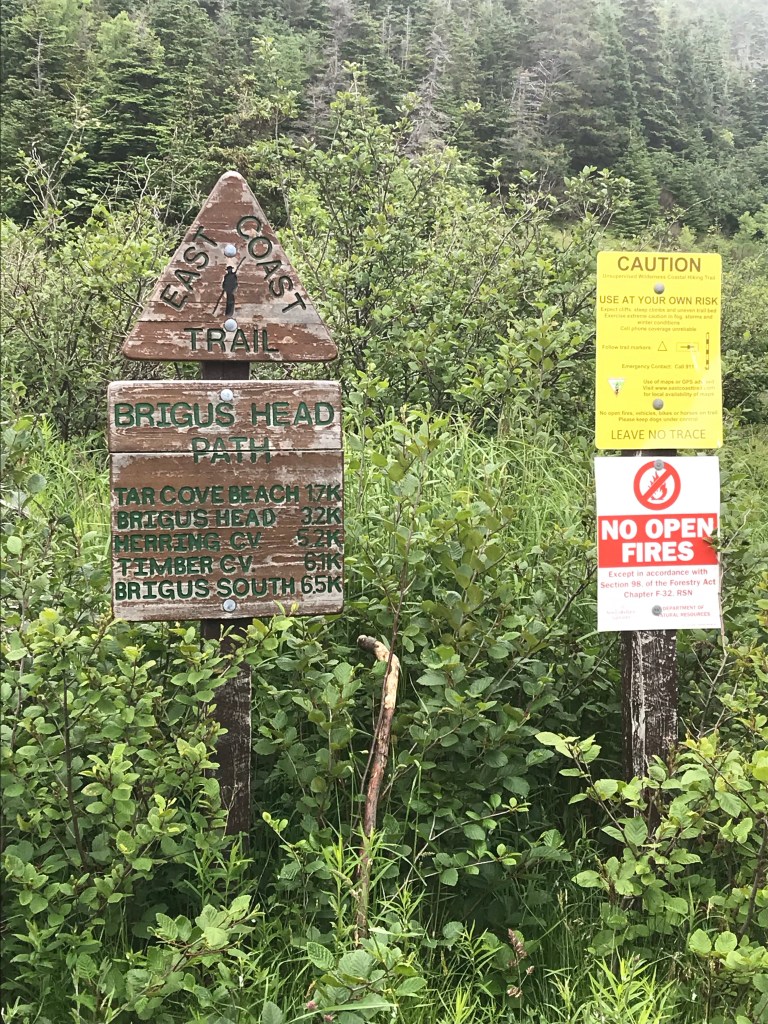

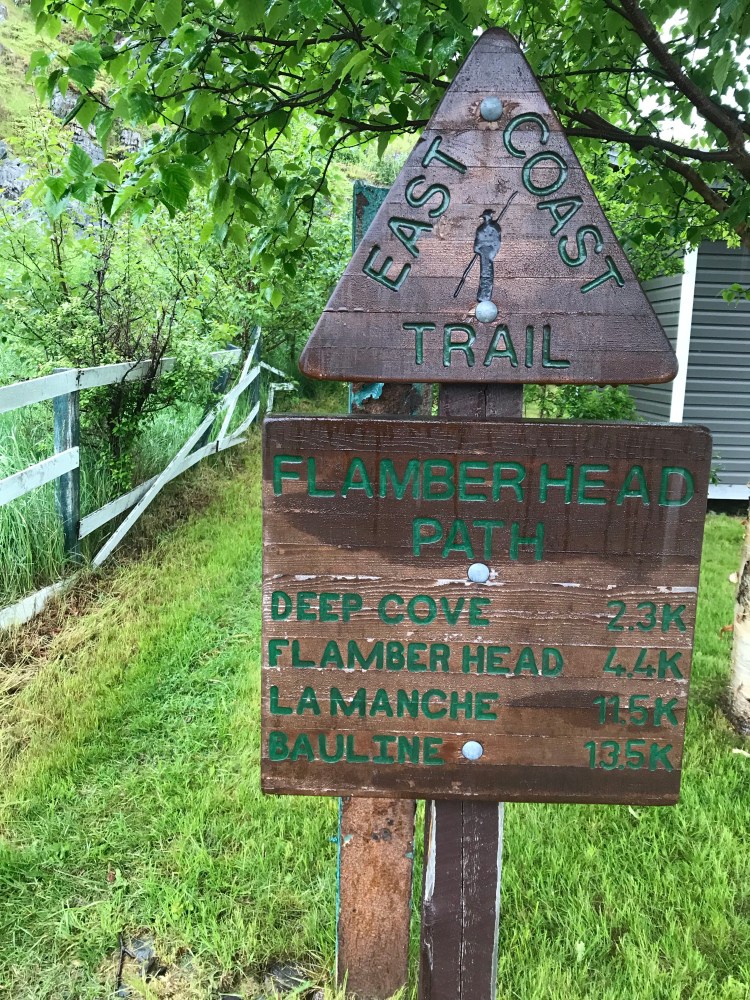
I was making good time. The rain really started to come down when I reached the end of this path – it poured for a while and I got pretty wet as I brushed up against plants. It was only a 300m link to the following trailhead and soon I was on to Flamber Head Path (11.5km, moderate to difficult, Brigus South to La Manche Village).
This path quickly turned into one of my favourites (moreso on day 6). I only had 3.9km till I hit Roaring Cove Campsite, another wilderness campsite. I hoped for a break in the rain, and somehow – I got it. This path begins with an ascent through brush and between two private properties. You emerge on oceanside rock outcroppings. Conditions were wet and slippery, so I took my time – “slow and steady” was another mantra for me on this thru hike as it was better to get somewhere in one piece than risk injury or falling off a cliff.
I remember my phone dying on this portion of the hike, since it had been a while without sun and the opportunity to charge my phone from my solar panels. I passed one male hiker going in the opposite direction, a day hiker. We made small talk and I kicked myself for telling him I was headed for the campsite in a few kilometres – a lone girl in the woods, easy pickings for weirdos. And how was I to know who was best kind and who was a weirdo? Better safe than sorry. You live you learn.
Luckily, upon arrival to the campsite I was greeted by a group of four, so I would not be alone that night. That put my imaginative mind at ease. The rain was fully stopped by now, and I was surprised to see that they’d successfully started a fire.
I set up camp and not long after it started to rain again. But I knew it was supposed to end by morning and I was fine with rain as long as I didn’t have to set up or tear down camp in it.
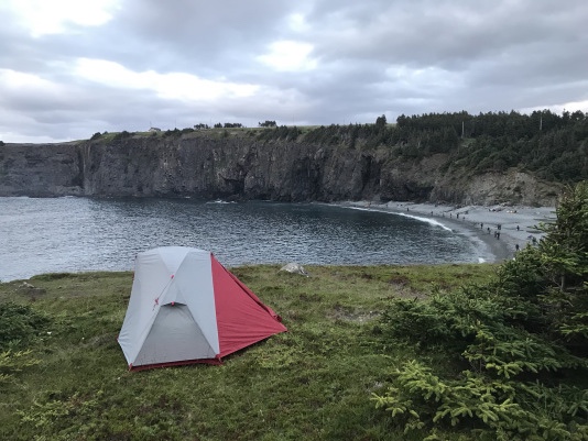
My spirits were high – and tomorrow I would stay at my first real campground in La Manche Provincial Park, where I would get to shower and do laundry.
Day 6
{9.6km}
Day 6 began with the most treacherous river crossing I would face on my trek. Probably made worse by the recent rain, the river for which the campsite was named was wide, powerful, and with only a few large stepping stones spaced out across. It was lined with mud and things were slippery.
I ended up crossing this river three times. First, without the pack, to get a feel for the best route and footing. Then, I dawned my pack – which of course changes how you move/ your weight and centre of gravity- and went for it. Somehow, I did it, without falling in, and I let out a howl of relief and joy, laughing to myself at what anyone within earshot might think upon hearing it. Yup, the forest had laid claim to my wild soul. (Or maybe I was losing my marbles).
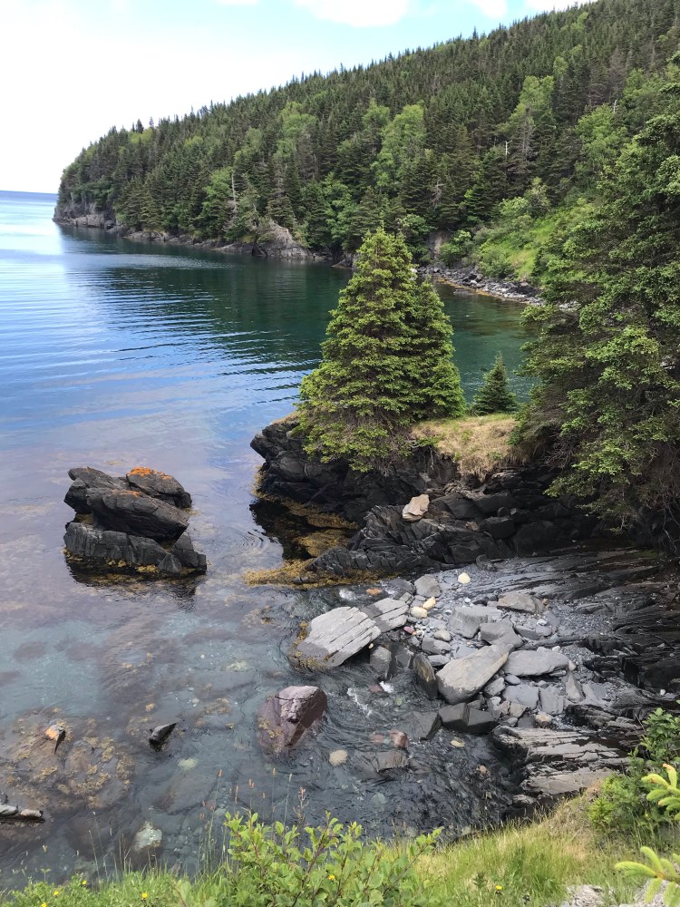
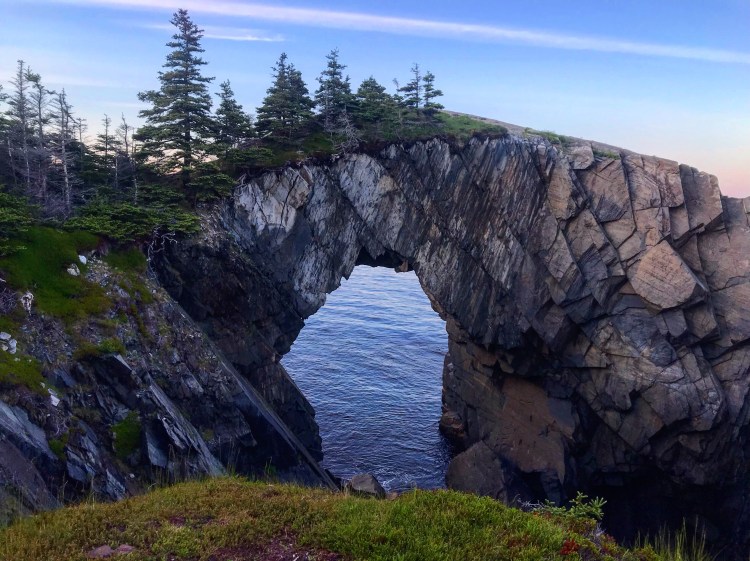
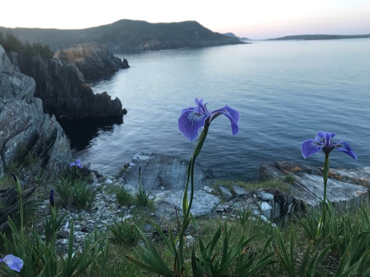
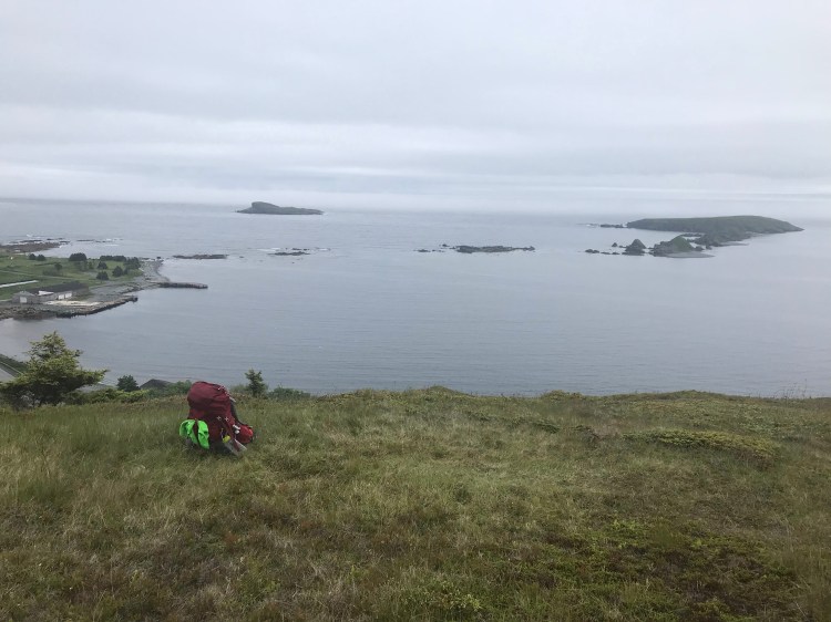
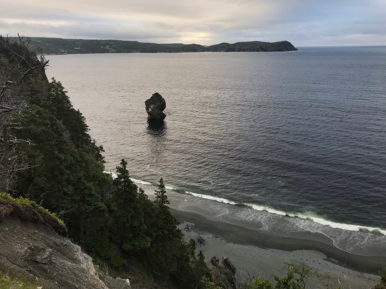
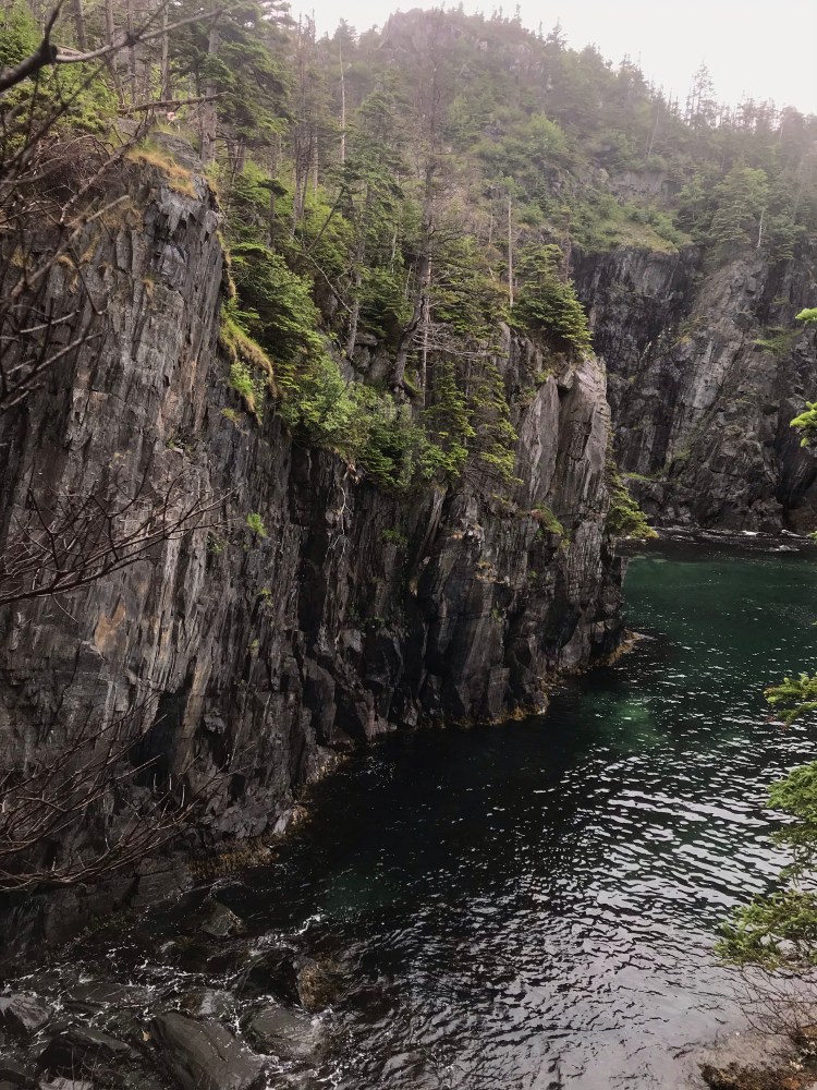
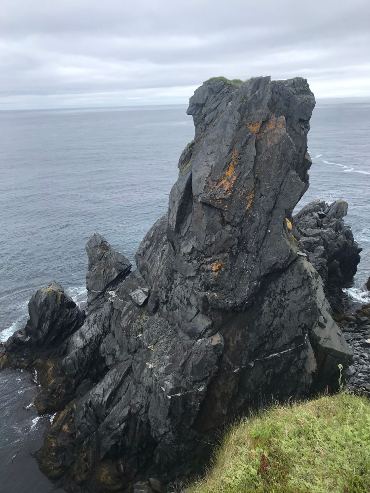
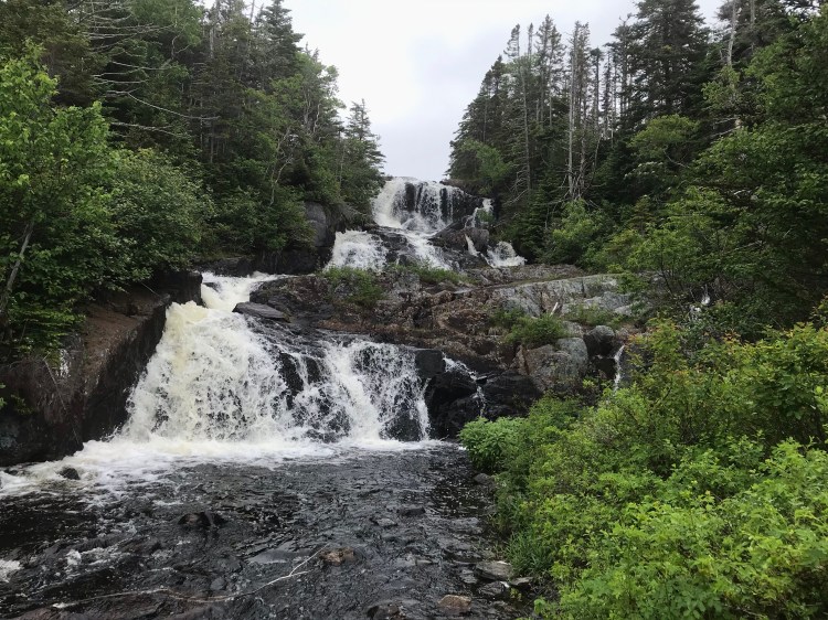
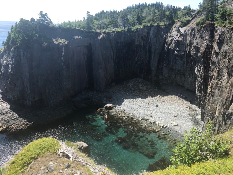
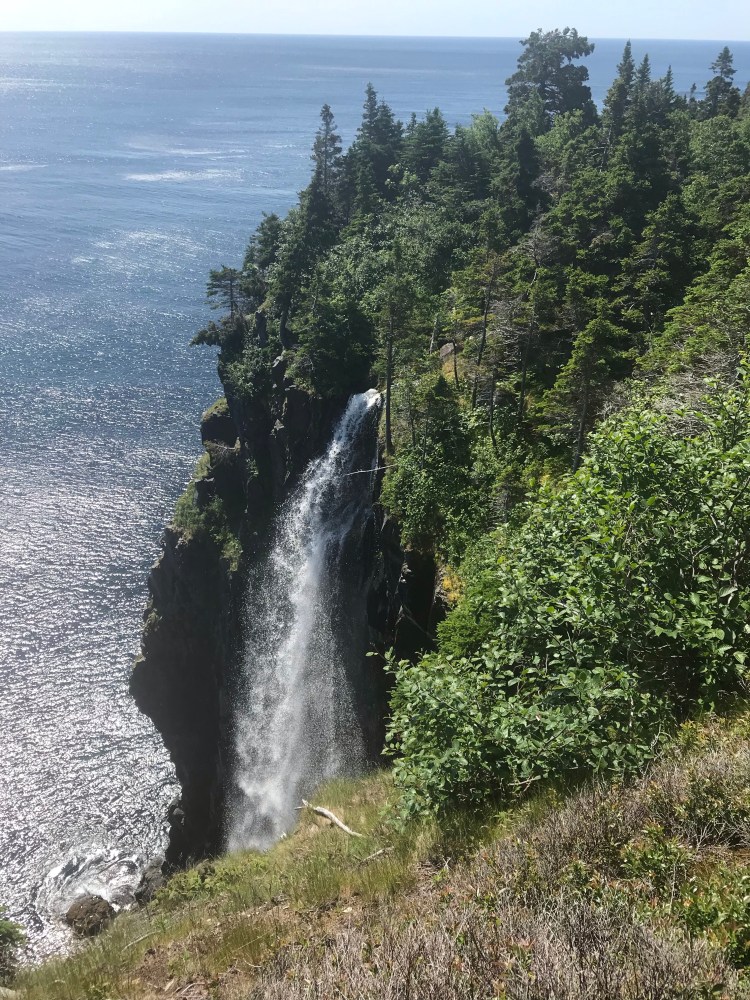
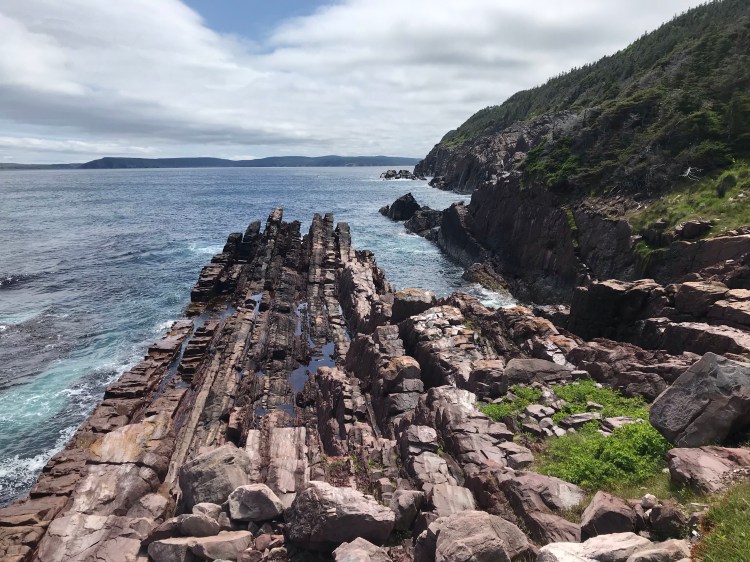
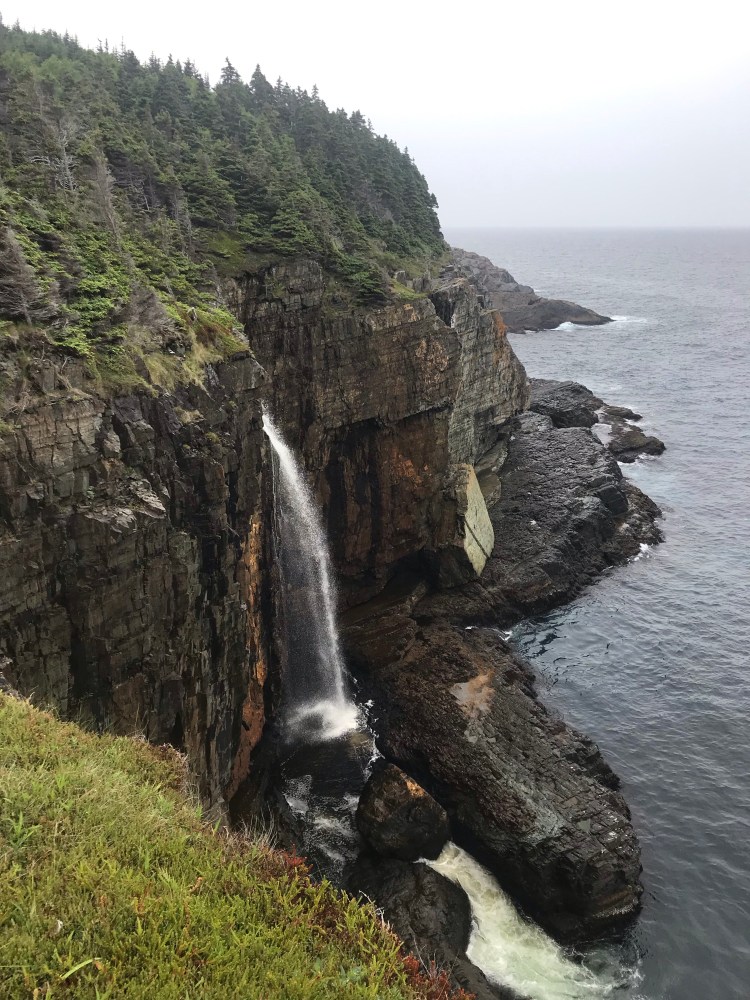
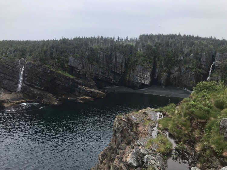
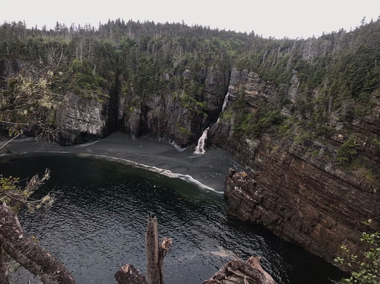
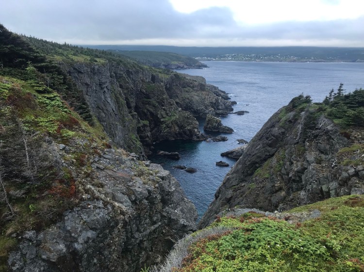
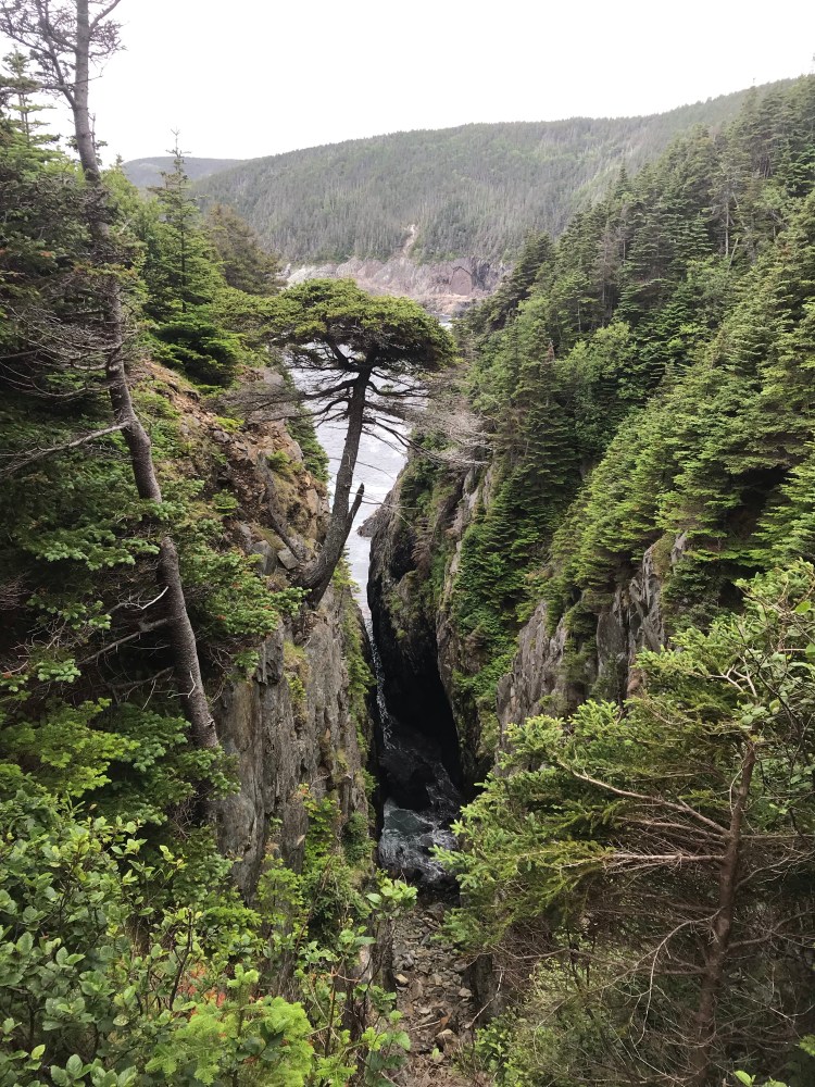
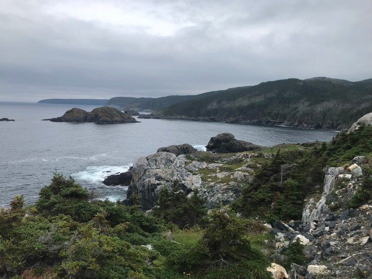
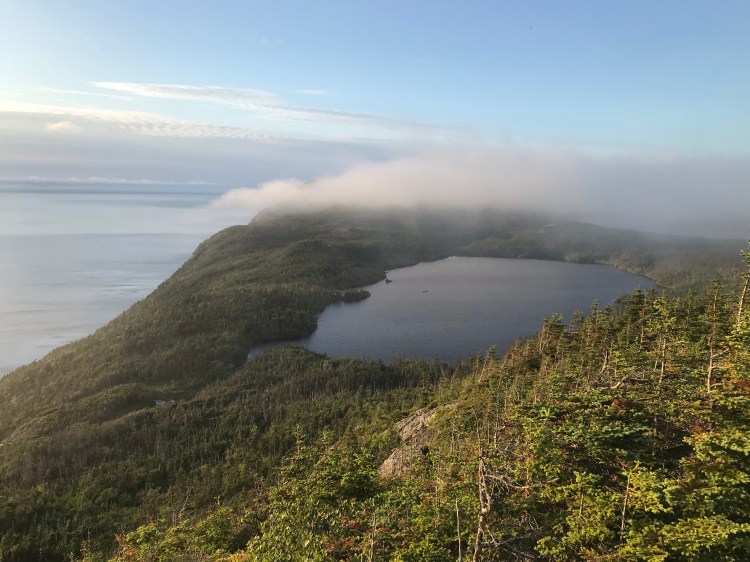
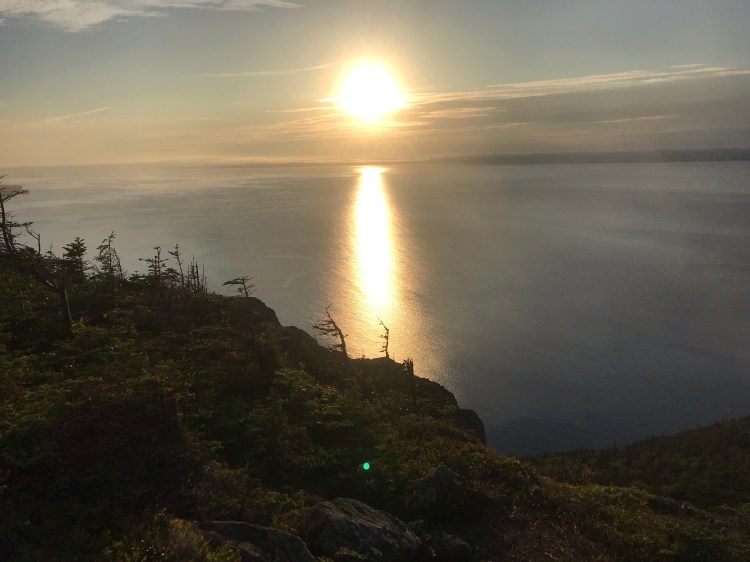
I was rewarded for my river crossing with the stunning views on Flamber Head. The sun was starting to peak out from behind the clouds and I made my way to the lookout where 360 degree views took your breath away: coastal cliffs, green grass, rock formations, waterfalls… each cementing this path as one of my favourites.
Not too far after this I passed a beautiful, big waterfall. Either would be good lunch spots – but I was more of a snacker, especially with my sensitive stomach.
I did, however, stop to try and spot whales, when a couple from the Pennsylvania told me they had just seen some. I had been so caught up in meeting my daily kilometre quotas up to this point, that I hadn’t seen any whales – despite several hikers raving about them – because I wasn’t making time to slow down and look.
No luck this time, but I took in the aquamarine waves crashing and swirling beneath me against the rugged cliffs. Eventually, I wouldn’t need to look for whales, I would be able to tell they were there by the sound they make with their blowholes.
With only a few kilometres to go to the end of Flamber Head Path and La Manche Provincial Park, I hit a wall. I ran out of steam, and despite it becoming a beautiful day, I started to feel emotionally and physically depleted. On top of my sensitive stomach, which was the reason for my low energy, and nausea, my hip was starting to act up and a fear began to form that I might be developing an overuse injury. What else could go wrong? I was caught in a dark mindset.
I plugged on, head down, until I finally made it to the park entrance. Once I’d finished Flamber Head Path, it was another 2km or so on an access trail to the campground. This was a shorter day, kilometre-wise, but I was tired. After checking in I remember sun showers falling and I just started to cry.
One day at a time, I told myself. Take a shower, you’ll feel better. Do laundry – clean clothes will make a difference. Use your camp stove and have a real meal. There is water here you can boil to top up your water stores.
I was 6 days down and 9 to go. I was almost half way there.
I also had my first blister. The pain wasn’t too bad (yet) and I used the comfort station as a more sanitary place to pop, clean, and bandage the blister. My heel was starting to rub raw and I had a couple of blood blisters starting to form, but I did what I could, using my Blister Medic.
A hearty dinner and a good sleep, plus a second shower, and I really did feel better in the morning.
Day 7
{21.6km}
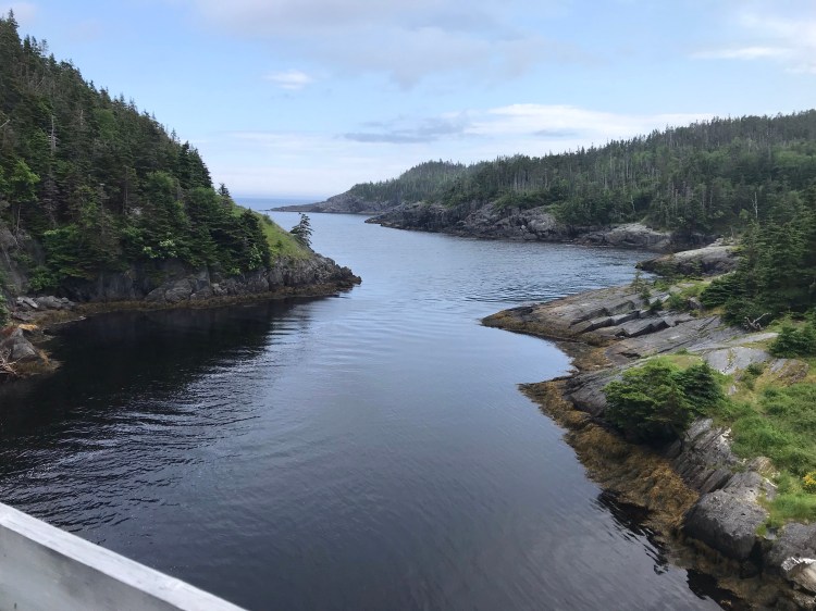
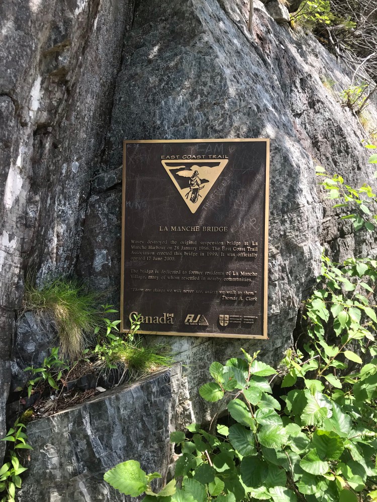
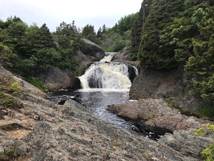
I retraced my steps on the access trail to La Manche Village, where there is a beautiful waterfall as a backdrop to a suspension bridge, which also overlooks the ocean. This is the next trailhead.
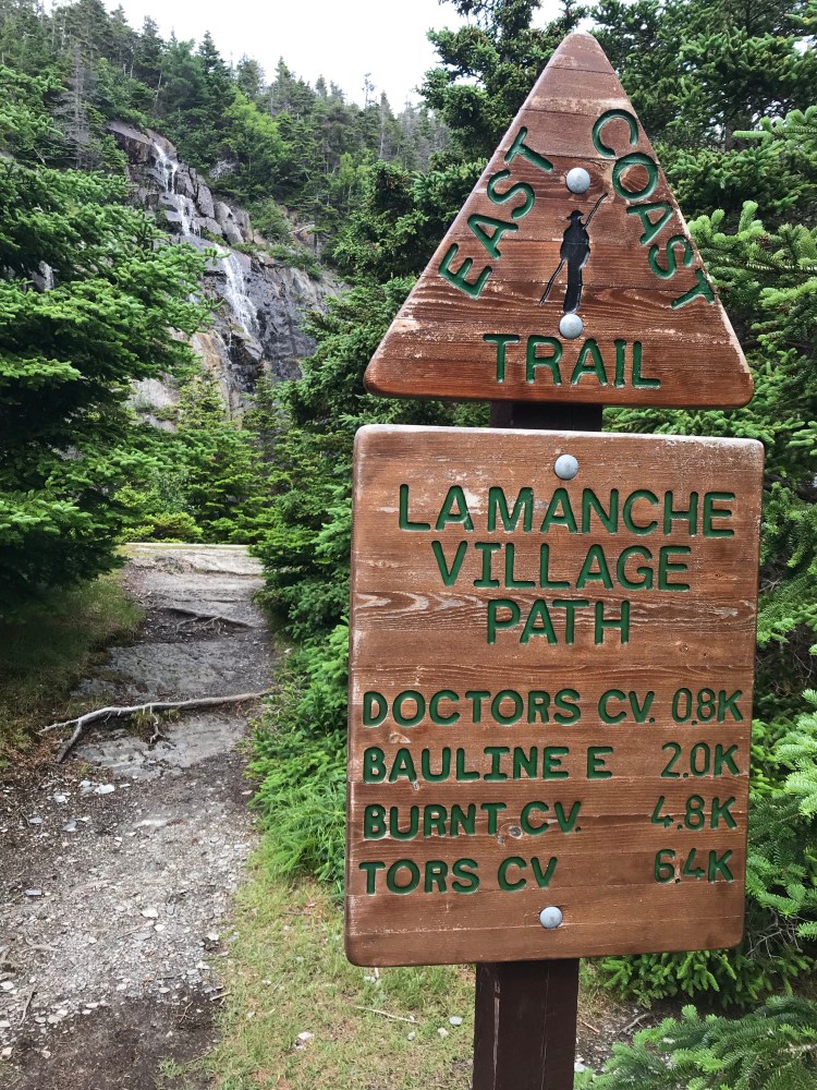
La Manche Village Path (6.4km, easy, La Manche Village to Tors Cove) takes you about 2km through forest and then 4.4km through small towns – Bauline East (where this is a wharf with a nice view), St. Michael’s, and Burnt Cove. A local was nice enough to share with me that there is a clean and free water source across from Burnt Cove Beach (look for a light blue tube on the side of the road) that has been tested, and even the locals fill up on drinking water stores from this source.

Once at Tors Cove it’s a 600m link to the trailhead for Tinkers Point Path (5.1km, easy, Tors Cove to Mobile), which is across from a dilapidated old church.
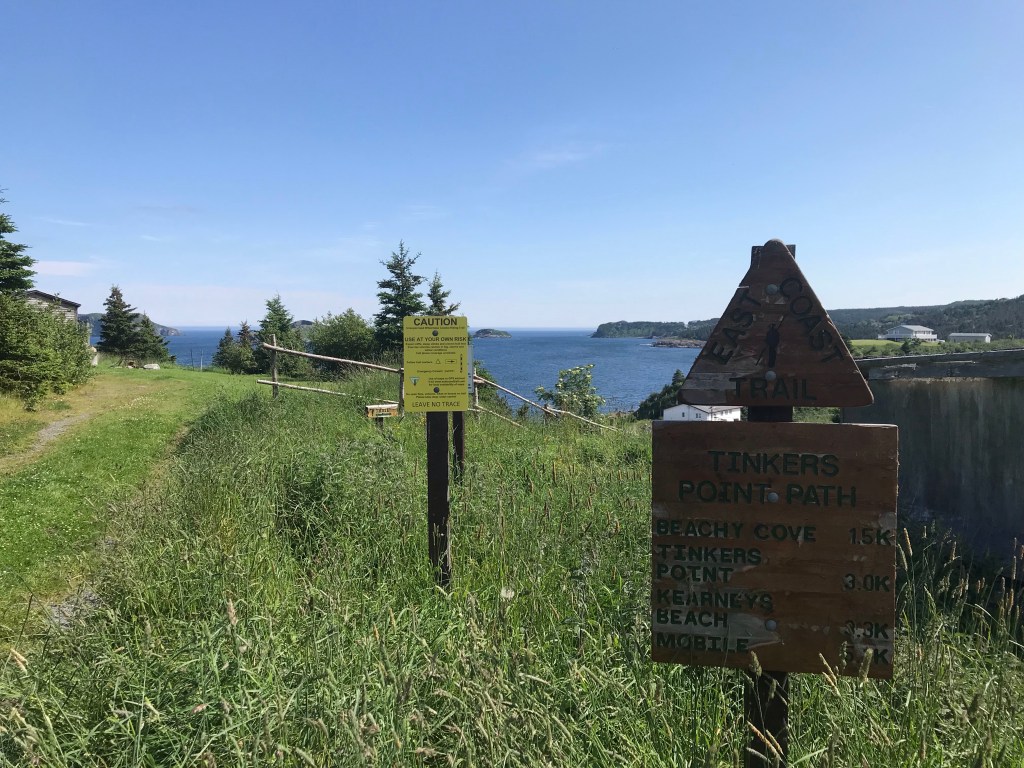
I thoroughly enjoyed Tinkers Point Path. The views really stood out on this clear and sunny day, and it was a peaceful hike.
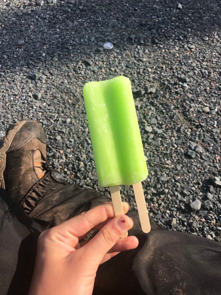
I considered stopping in to Fork, a restaurant following this trail, but decided to keep moving and make a quick pit stop at a convenience store called Rental Hutch. I had been dreaming of popsicles lately and while indulging on the side of the road a local woman coaxed me into accepting a ride to the next trailhead (despite my protest that it was only 1km away).
She was very kind, saying that she lived in Bay Bulls and offering to give me her number in case I needed a ride in the next day or two. I politely declined, not wanting to abuse her generosity.
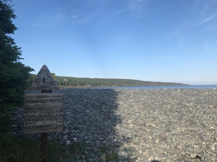
I had one more path to tackle for the day and once again was racing the sun as I embarked on Beaches Path (7km, easy, Mobile to Witless Bay).
Beaches Path is a really nice, leisurely trail. About 1.5km prior to the north trailhead I found a perfect camp spot – a little clearing in the forest that was flat and looked like other had used it, too. But I really wanted to get as many kilometres in as possible, so I pushed on – hoping I wouldn’t regret the decision.
As the sun was setting and I was starting to lose light, I reached the end of the trail. It comes out at a beach with a parking lot and some private houses nearby. I found a grassy area just off the trail and behind some trees that kept me mostly hidden. As I was now more practiced at setting up camp, I had no issue in getting settled before it got too dark. I was graced with the presence of a stunning full moon that night, illuminating my tent and the ocean nearby.
Day 8
{22.8km}
Remember when I said I’d had some blisters forming? Well, Day 8 will forever be the day I remember as the worst pain day for my feet.
Day 7 had been bad, but Day 8 was worse.
Every step was excruciating. I was now cleaning and bandaging my feet every night and morning. On this particular morning I thought that perhaps if I wore two pairs of socks it would decrease on the amount of rubbing. But I quickly learned that it simply meant more pressure on open wounds, aka more pain. I returned to one sock layer and forced myself onward. Mind over matter, I told myself. I dug deep and drew upon my ability to withstand menstrual cramps and several hours of tattooing. You’ve got this.
I could either tap into the pain by thinking about it, or I could ignore it, enjoy the views, and put some miles behind me. I chose the latter.
I’m also just a stubborn human being.
Luckily, it was a sunny day. I stopped in to Needs Convenience to restock, camel up, and grab some more bandages (as I was going through them fast at this point).
The community link to the next trailhead was 5.4km and a gentleman offered me a lift (my feet thanked him) which saved me about 2km. His name was Chris Ryan and he told me about a book he had written called The Bay Bulls Standoff.
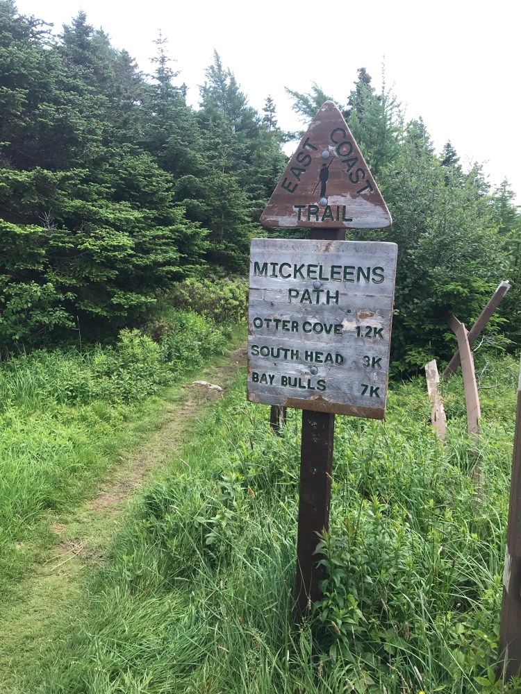
Mickeleens Path (7.3km, easy to moderate, Witless Bay to Bay Bulls) has views of the Witless Bay Ecological Reserve which is noted as a migratory, seabird, and puffin nesting habitat (also visible from the north Beaches Path trailhead).
But what really struck me was the sight I encountered after this path.
The community link to the next trailhead is 5.2km, but I walked about 6km as I decided to detour a bit to restock at Foodland. Had it been near the end of my day I would have loved to stop in at Sapphire Pub for a beer – but as per usual I was prioritizing making the most of daylight hours.
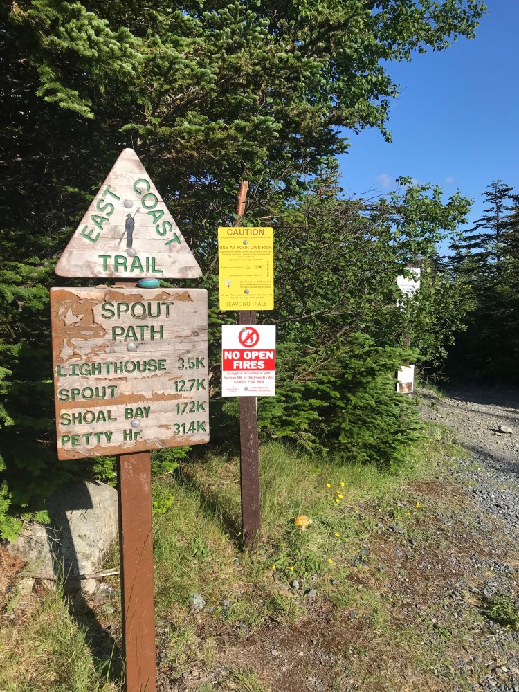
Next up was Spout Path (16.3km, difficult to strenuous, Bay Bulls to Shoal Bay Road), one of the Avalon’s most raved about trails. If you’re doing it as a day hike you need to access this path by Shoal Bay Road from the Goulds, which tacks 6.4km onto your hike, making for a long day, but it’s definitely worth it. I was happy I didn’t have to worry about the extra kilometres, as Spout Path ends where Motion Path begins.
My original plan had been to camp at the wilderness campsite on Spout Path, Little Bald Head Campsite, which was 11.2km in for me. I certainly did not have enough time to cover that distance before sun down, so I resolved to random camp – which I wasn’t particularly thrilled about initially, as I’d wanted to make the most of more civilized sites and pit toilets. But in the end I was content with how things worked out as there was a younger crowd at Little Bald Head when I got there the next day and I got to camp in a sweet spot overlooking the ocean – all to myself.
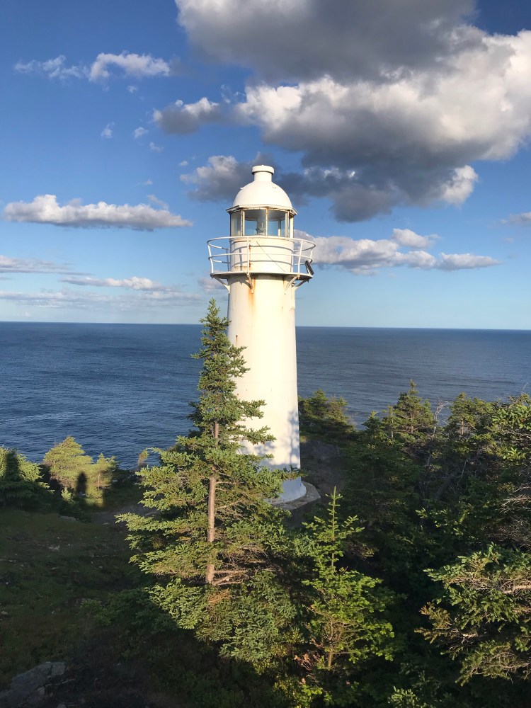
The lighthouse was beautiful against the crisp blue sky as I continued moving – and ignoring the pain in my feet.
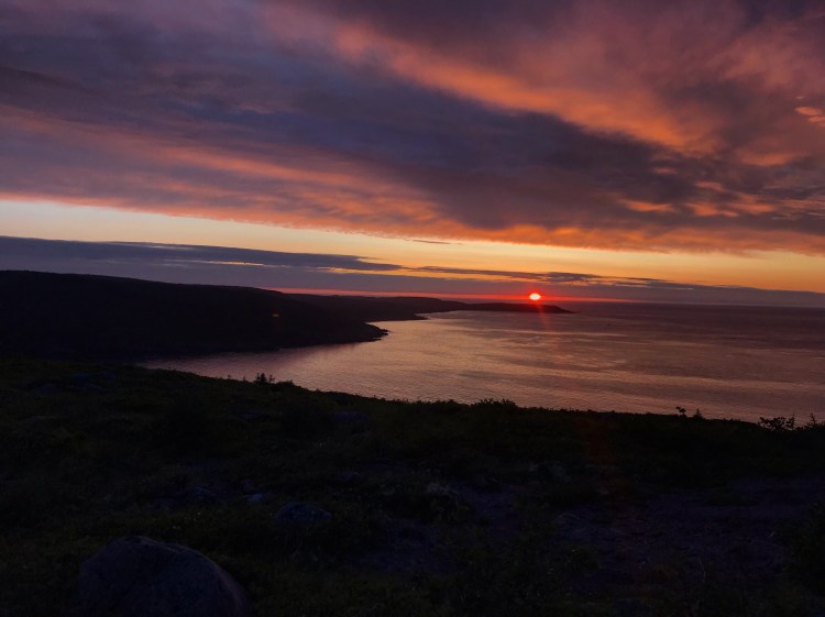
As it got dark I set up camp at Bald Head (about 6.5km in), a little ways off the path (actually a side trail led the way through ground cover to the spot I set up my tent). I got to watch a beautiful sunrise in the morning.
Day 9
{22.8km}
I started my day relatively early (9:30am) and was pleasantly surprised that my feet were feeling a little better – not great, but better, which gave me hope for their recovery. It made me pretty cheerful and made for a great start to the day.
About an hour into my hike I ran into the first other solo female thru-hiker I’d seen on the trail. We chatted and exchanged info. I was blown away when she told me about the time she’d thru hiked the Bruce Trail (we were both living in Ontario) – a 908km trek that took her 22 days, meaning her average daily distance was 41km. My jaw dropped. Especially when I was averaging more like 20km a day. But to put things into perspective, she said she’d allotted two weeks in NL and was afraid she wouldn’t finish the ECT in time – because this trail was much more rugged and trying.
300km in two weeks vs. 900km in three weeks really puts into perspective how tough the ECT really is.
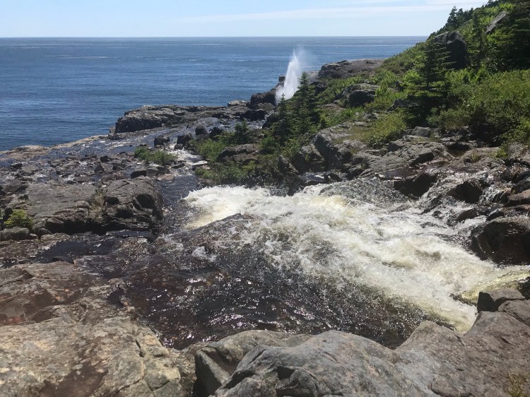
I continued on and took a short break to refuel and take in the scenery when I hit the spout (a wave-powered geyser).
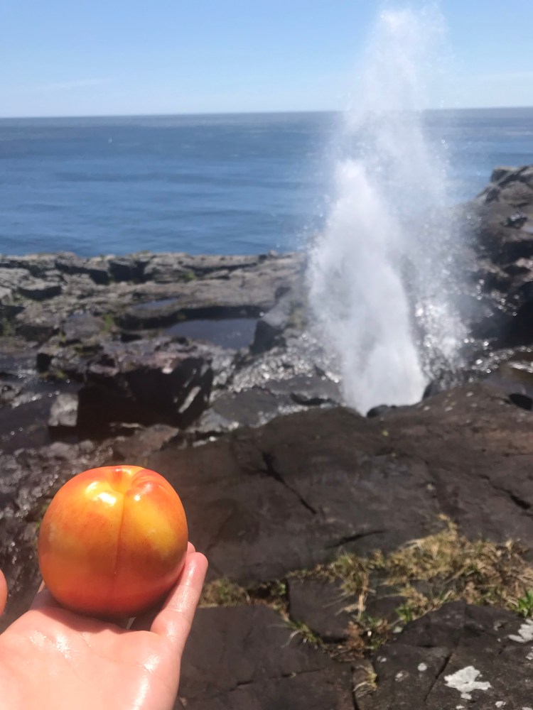
Spout Path really is beautiful.


Next up: Motion Path (13.5km, moderate to difficult, Shoal Bay Road to Petty Harbour). I’d always enjoyed this path (I’d hiked some of the trails when I lived in NL in 2016). It’s called Motion Head because you’re prone to seeing a lot of wave action with the wind here. You’re on exposed terrain, and today proved to be super windy (with the pack on my back I was almost blown over a couple of times).
There is a wilderness campsite on this trail called Miner Point Campsite, located 2km in from Shoal Bay Road. I checked it out for the sake of it. Instead of wood tent platforms, this one simply has flat grassy areas (levelled sites – which I prefer), but it was not my destination for the evening so I kept moving.
With it being a hot day I was going through water super fast (3.5L for the day and rationing to get to morning) and starting to feel dehydrated. I had refrained from gathering water from fresh water sources because this was my first thru-hike and I didn’t want to risk anything that could keep me from finishing the hike. I had a filter and treatment system with me, and I knew what signs to look for in a good water source. Perhaps I was too strict, and I know a lot of people would think I was crazy for carrying all my liquids (2.2lbs/L) with me – but that was what I did for the most part.
So, near the end of my day on Motion Head, I broke down and started crying again. I was hot, I was tired, I was in pain, I was dehydrated, and I was alone. I had one litre of water that I was rationing till the next morning’s restock. As my emotions got the best of me I looked out at the ocean and couldn’t believe my eyes – whales. This was my first whale sighting on the hike!
And these whales weren’t just swimming at the surface, they were breaching – jumping up out of the water and flipping their tails. Three whale boat tours floated nearby. I started laughing through my sobs – it was like the whales were encouraging me onward, saying everything would be okay.
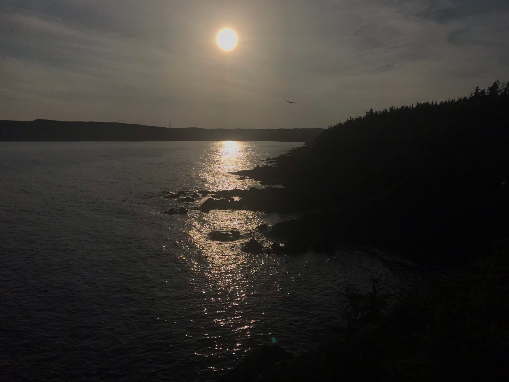
Once again, I took heart. I sat and watched them play for a while, and then kept going. I remember breathing deep as the sun set and I scouted a good spot to set up for the night – the air can be so refreshing on the ocean. It’s distinct, salty scent, filling my lungs and making me smile… And soon I found a decent spot to random camp close by the Petty Harbour trailhead.
Day 10
{24.1km}
After a good night’s sleep, I was excited to start my day. I only had less than a kilometre to Petty Harbour, where I could grab breakfast and get some much needed liquids into my body.
Chafe’s Landing (restaurant) was not yet open and I didn’t want to wait around, so I went to Watershed Coffee House. Me and my pack got a few stares as I sat and enjoyed myself. It’s a 2.8km community link to the next trailhead. I stopped in to Beachfront Variety (convenience store) in Maddox Cove to restock and promptly made my way to Cape Spear Path (11.5km, moderate, Maddox Cove to Cape Spear National Historic Site).
Because the previous day had been so hot, and this day was calling to be just as hot and sunny, for the first time on the trail I decided to wear shorts and a tank. But because Cape Spear Path is pretty exposed – I actually froze from the wind and got a nasty sun burn (yes, I wore sunscreen, but made the mistake of not reapplying). Unfortunately, I couldn’t tell that I had burned until the next morning.
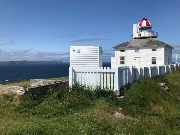
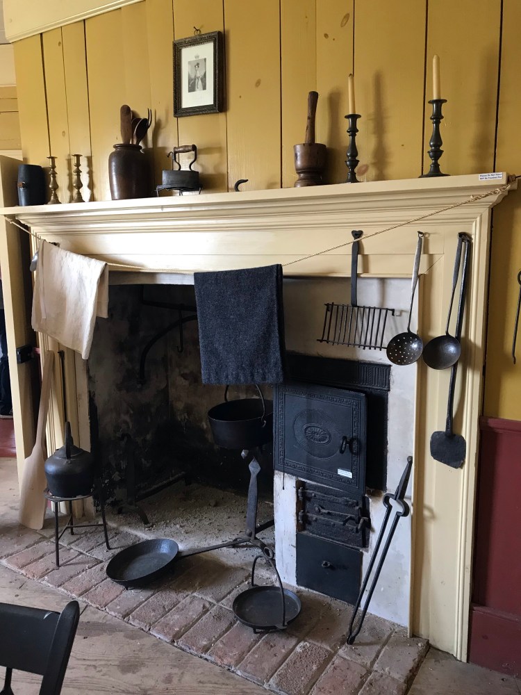
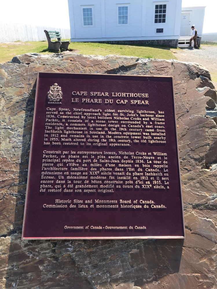
Once I got to Cape Spear I made use of their public washrooms and took some photos – it is, after all, the most easterly point in North America. I even explored the inside of the lighthouse building.

On to Blackhead Path (3.7km, easy to moderate, Cape Spear to Blackhead Village).
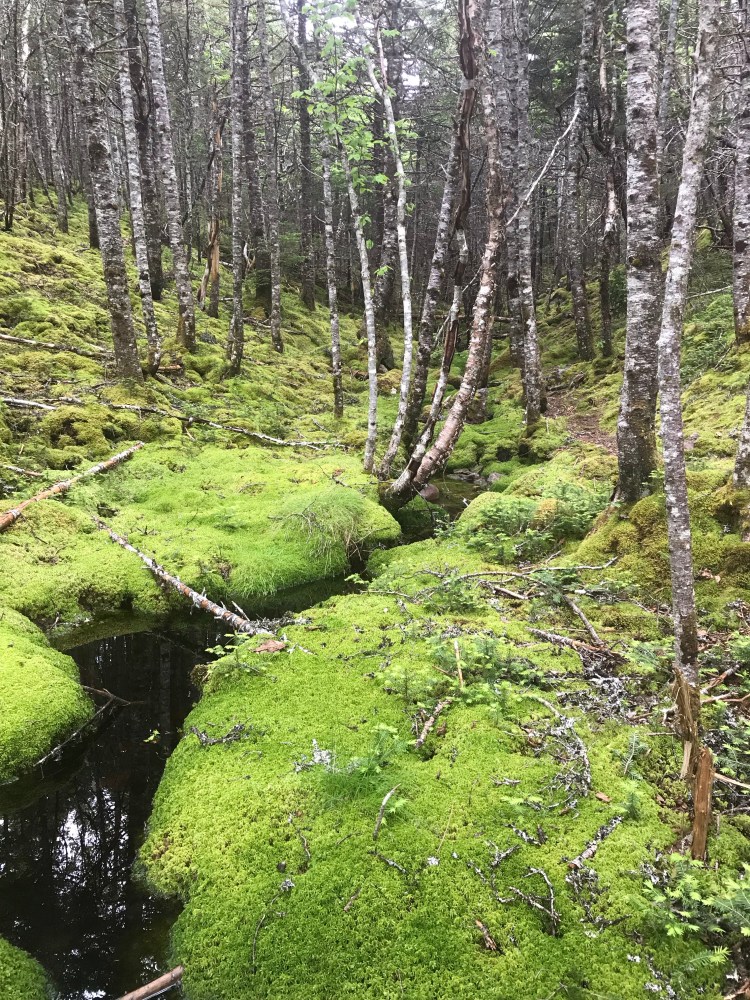
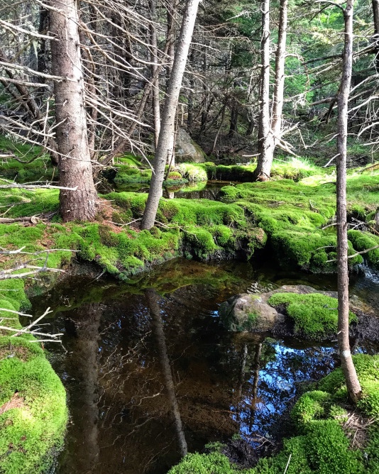
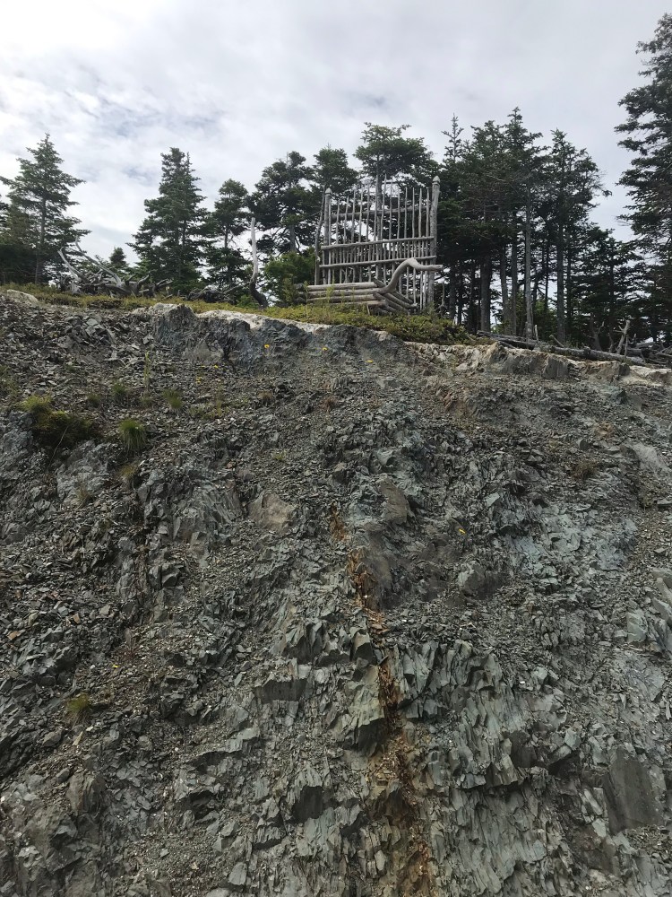
I like to think of this trail as generally up and down. One climb and one descent. My favourite part is near the northern trailhead when you get into forest and there are orange pine needles carpeting the forest floor and lush green moss hugging rocks around quiet streams.
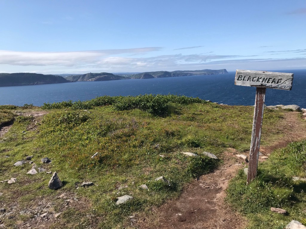
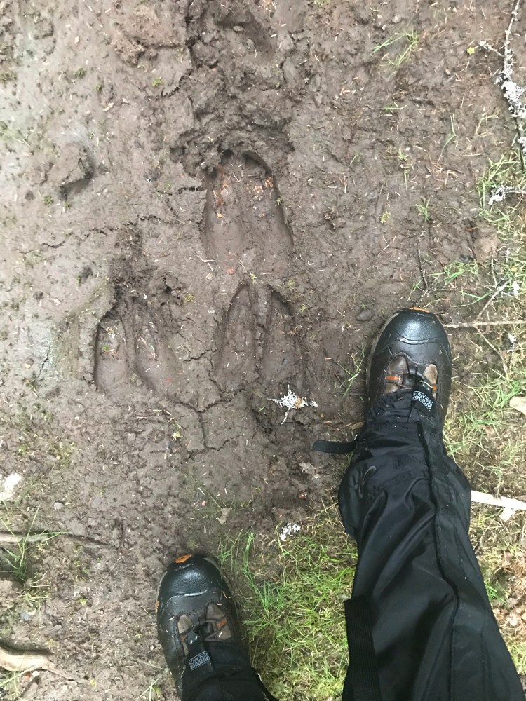
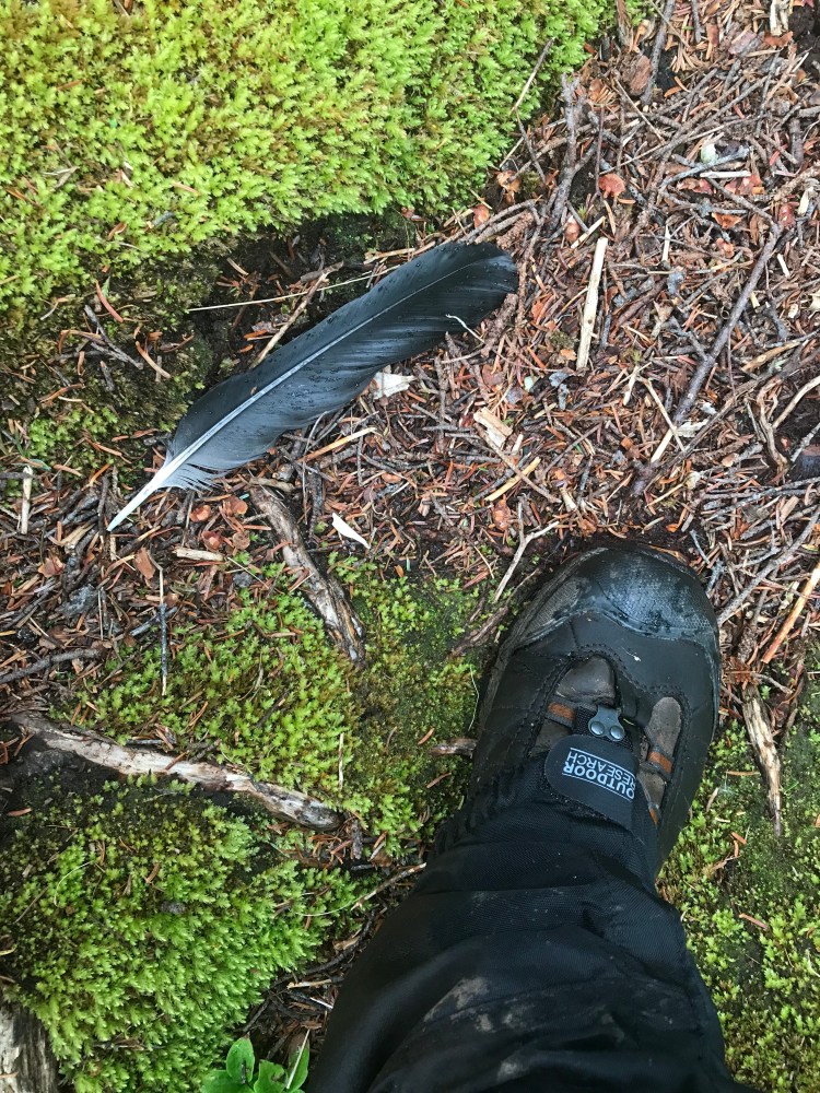
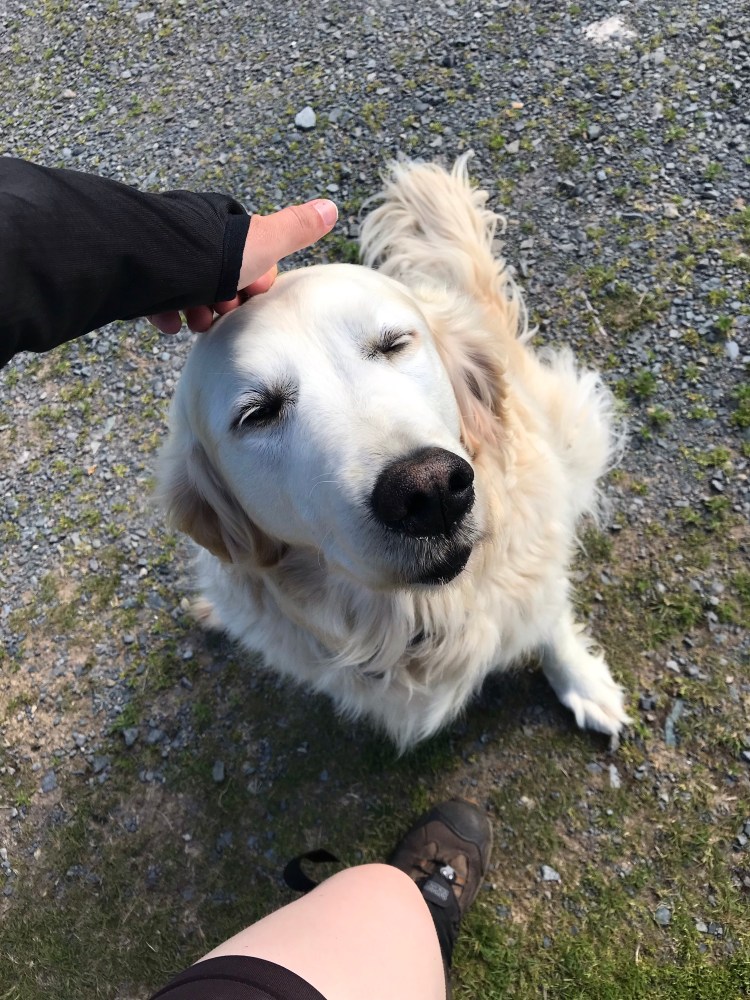
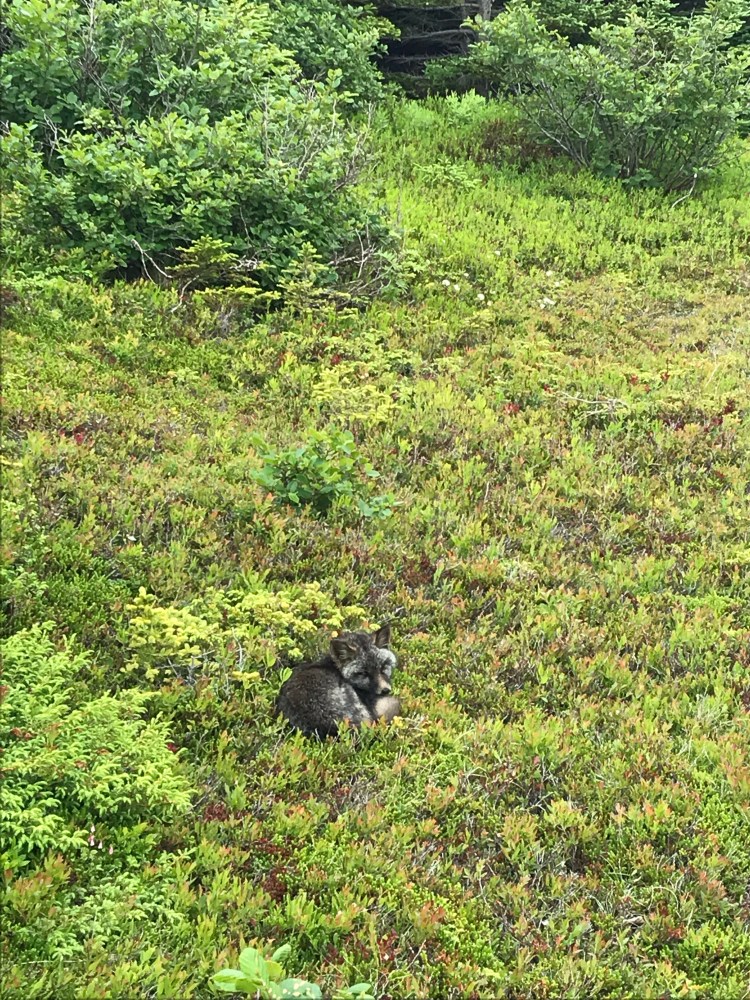
It’s only 200m from Blackhead Path to the next trailhead. I took a break to quench my thirst and had a little visitor…
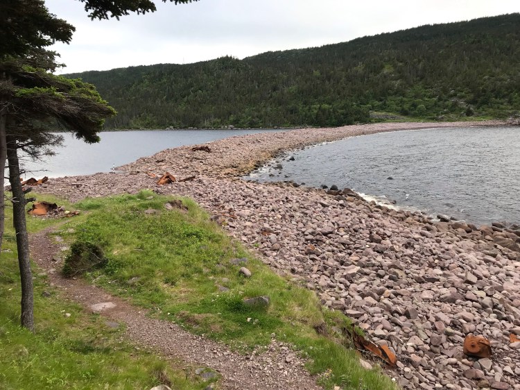
Then it was on to Deadman’s Bay Path (10.6km, moderate to difficult, Blackhead to Fort Amherst) – this is another favourite trail, but only the half from Blackhead to Freshwater Bay – which was my intended camp spot for the night.
It was still sunny and windy when I started on this path, but it didn’t take long for things to cloud over and look stormy. I hadn’t seen any rain in the forecast, but you never know with Newfoundland weather, so I kept my head down and bee-lined it to Freshwater Bay.
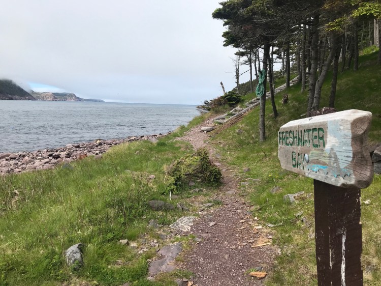

I was the only one at Freshwater Bay, save for a man fishing. I got a little nervous, thinking once again about being a single female setting up camp – a sitting duck. And I was once again lucky, as a large group arrived soon after me and set up camp nearby.
Day 11
{6.9km}
I woke up to the sound of hooves and heavy breathing right beside my tent. I had the fly up, so I couldn’t see anything, but I’m pretty sure I was visited by a moose that morning. It passed by a couple of times – sounding big.
This day began with a short kilometre long detour to Gunners Cove lookout, followed by a long, steep, continuous climb. My lungs and legs were not happy after about 20-25 minutes of ascension.
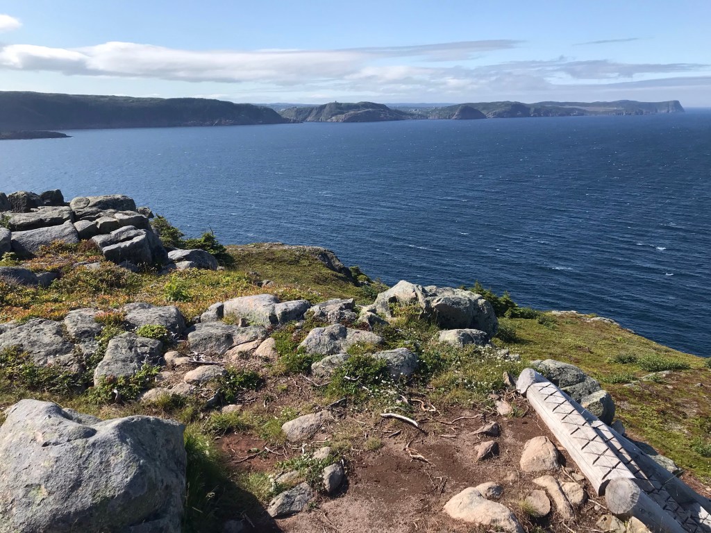
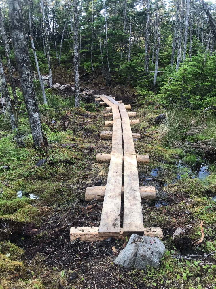
This half of Deadman’s Bay Path is mostly rock, with swimming holes and a view of Signal Hill before a steep descent. I’d done this trail in the past and followed the familiar terrain. At one point I heard voices through the woods – which I thought was strange as it was parallel to me and not on the same trail. Turns out – the ECTA must have done some improvements and created a new trail, as when I exited my path I saw signage pointing to the trail – in a different direction! I’m glad they made some changes, as there was one point where I basically slid down a vertical rock face that was taller than me.
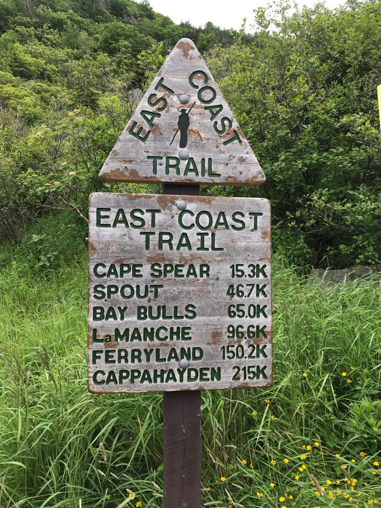
As I exited the trail, I looked back at the trailhead signs. For the first time since I started at Cappahayden, there was a second sign that had the total kilometre count – “215km to Cappahayden,” it read. I, of course, began to cry again. But in my defense – I was tired and due for a shower – and super happy to be spending that night at an Airbnb in St. John’s.
There’s no crying in thru-hiking!
I meandered over to the Fort Amherst Lighthouse and was greeted by a whale. I then called a cab. After checking in at the Airbnb I showered and tended to my feet.
Since my first blister at La Manche I had one pinky toe – the entirety of which had become a blister, and my second big toe which had developed a nasty blister, along with two blood blisters on my heel and a heel rubbed raw. But – the pain was not as bad as Day 8. I had initially decided to go a different route with my second big toe blister – instead of popping it just let it run it’s course. But it became evident that it was going to take over my toe if I let it, growing every day, so I popped it and cleaned it at the Airbnb. I poured rubbing alcohol over the raw skin – and let me tell you – that is pain. But none of my blisters got infected, so I had to be doing something right. My feet would continue to heal and feel better – until I got to the last two (unfinished) trails, which were very rough on the feet
I handwashed my clothes, then went out to pick up a hearty meal from Yellow Belly’s and a few cans of beer. A friend came over and I think it did me some good to see a friendly face after 11 days on the trail. I was tired and running low on motivation for the remaining four days, but I continued to tell myself: one day at a time.
“The mind quits way before the body.”
Day 12
{24.4km}
I, of course, showered a second time before leaving the airbnb. I had been lucky to be under a roof as it had been quite cold the day before (11 degrees C) and rained overnight. Having a hearty meal also gave me noticeably more energy.
I restocked at a Needs near Bannerman Park, then walked through the Anglican Cemetery to Quidi Vidi and around the lake to the next trail (about 4km from my Airbnb to the trailhead).
If one was so inclined they could have walked from downtown St. John’s to Signal Hill and done the 4km hike there, then followed Ladies Lookout path from Cabot Tower down to Quidi Vidi. But that was adding something extra to my day and I had already done that hike several times in the past, so I kept things simple.
Similarly, if one had the time, or if I had been at the end of a day, Quidi Vidi Brewery is a great place to stop for a beer or a flight!
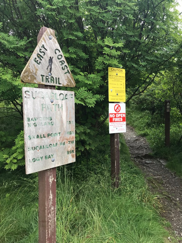
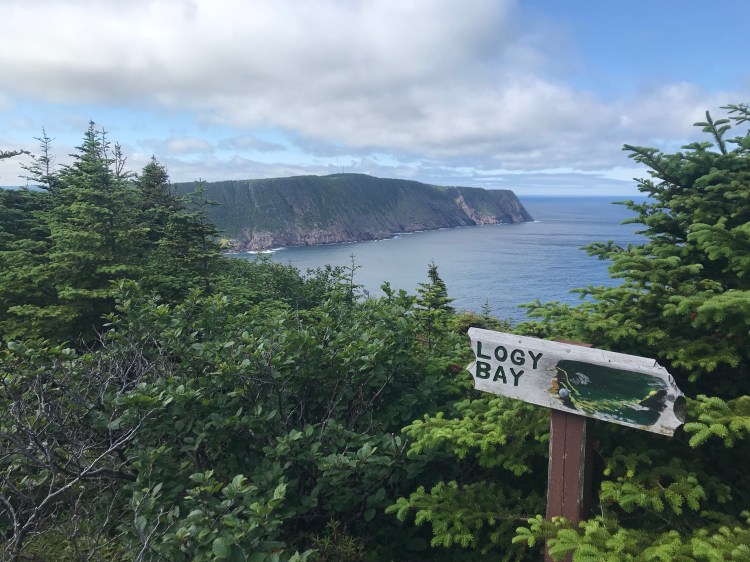
Sugarloaf Path (8.9km, moderate to difficult, Quidi Vidi Village to Logy Bay) is another popular path on the ECT. You definitely start to notice a lot more people on the trails closer to St. John’s.
This trail begins with a climb up Bawdens Highland, which rewards you with views of St. John’s and Quidi Vidi. Eventually it passes through the Robin Hood Bay Waste Management Facility, and comes out at the Ocean Sciences Centre in Logy Bay.

I decided to take a small detour after reaching the end of Sugarloaf Path towards a Needs Convenience to restock. I walked 3.5km to the Needs, which also had a liquor store attached. Based on something my friend had said, I decided to pick up a mini bottle of liquor and took a swig each night. Partly as a treat for another day under my belt, but also because my friend said people use liquor to kill potential bugs in their stomachs when in the wilderness – made sense to me, so I figured, why not?
Shortly after restocking a kind woman with a Newfoundland dog in the back of her van offered me a lift to the next trailhead.
I was now on another of my favourite paths: Cobbler Path (5.1km, moderate, Outer Cove to Red Cliff Road, Logy Bay-Middle Cove-Outer Cove).

This trail takes you past the remnants of Pinetree Line Radar Station, descends to ocean level at Cobbler Brook, then climbs through forest. You finally come out at Torbay Point – which is well worth the extra time for the views – and then meanders easily through forest for 0.5km to the path’s end.

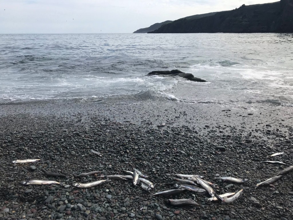
I walked the 3km link to the next trailhead at Middle Cove Beach and set up camp here for the night. There is a porta-potty at the beach. And I was pleasantly surprised to find that the capelin were rolling! People were making fires on the beach and bringing buckets to collect the fish.
Day 13
{24.8km}
It was an easy start to the day with Silver Mine Head Path (2.4km, easy, Middle Cove to Torbay).
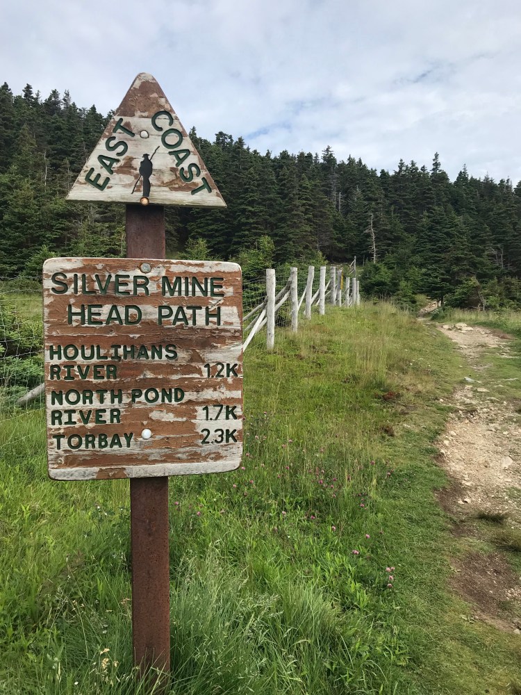
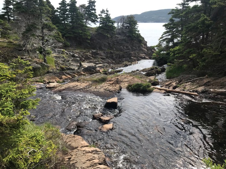
There is a river crossing to be careful with, but other than that it’s an easy section of the trail.

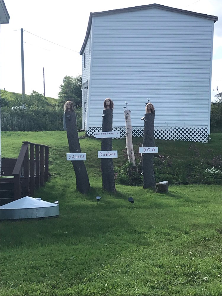
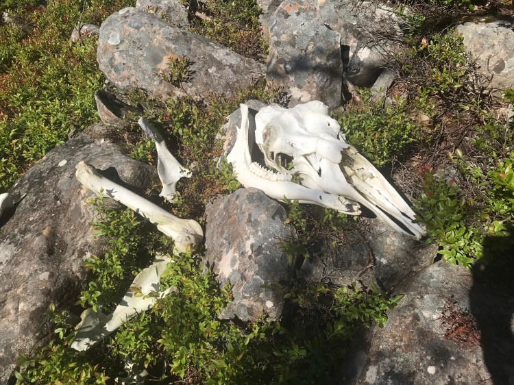
And following this path was another interesting sight…
The southern trailhead onto Father Troy’s Trail (8.7km, easy, Torbay to Flatrock) off Spray Lane was closed so I walked to the designated alternate access at the end of Moore’s Valley Road. On the way I restocked at PJ’s Groceteria. My glasses had broken on the trail and this store had a section with outdoor equipment, as well as office supplies, so I picked up some tape for temporary repair, and batteries for my lantern (which wasn’t as bright anymore). It was still sunny at this point, but I knew there was rain in the forecast for the evening, so I made this a quick stop.

Father Troy’s takes you along the coast, an old fishing dock, and through farmland, before exiting at Flatrock – where it’s not hard to see where the town’s namesake came from. As I exited the trail it had become dark and cloudy.

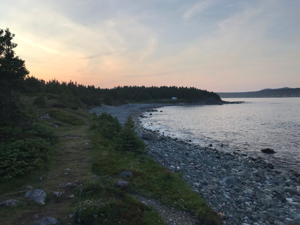
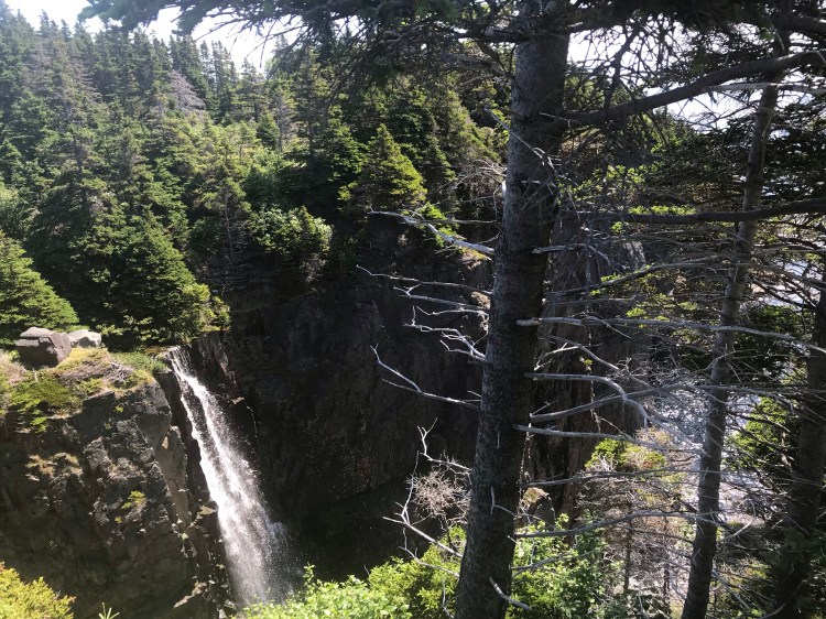
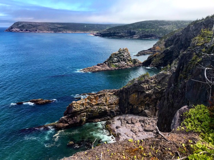
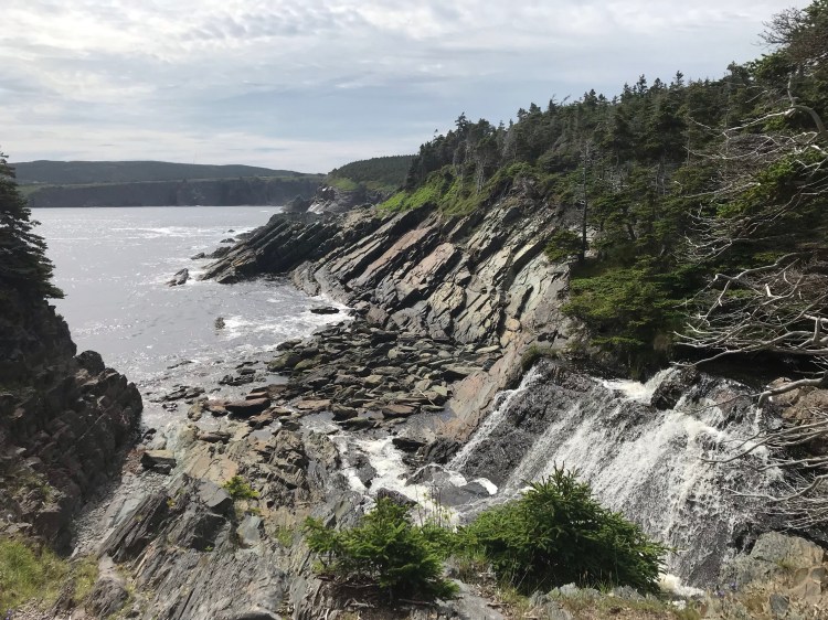
The community link through Flatrock to the trailhead for Stiles Cove Path (15.1km, moderate, Flatrock to Pouch Cove) is 1.5km. I was impressed with Stiles Cove Path from the moment I stepped in front of the trailhead sign, with tall red rocks standing above the ocean, beckoning, a prelude to the beauty to come. This path would quickly become among my favourites on the ECT.

Just past this trailhead sign is a beautiful, roaring waterfall. The trail takes you through serene forest and after a couple of kilometres you reach Red Head – an exposed grassy area. I considered setting up camp here for the night, as it was not yet raining, in order to avoid getting wet. But 16km or so was not nearly enough to meet my quota for the day, so I pushed on. There are a few access trails that meet at Red Head and I accidentally took one of these, with a creeping feeling making itself known that I’d gone off course due to the lack of ocean views. I used the two nearby towers as landmarks and my maps to get myself back on the main path.
I was ready for the rain when it started, with rain jacket and pack cover in place, and luckily it was just a light rain. I expected it to get harder, but hoped I’d find a decent camp spot before then. Stiles Cove had several camping options, but you could tell they get consistent traffic, and I didn’t like the idea of potentially being disturbed in the middle of the night – out in the middle of nowhere – by strangers. But the cove and waterfalls (yes – plural) here are stunning.
As I kept hiking, and it kept raining, and the trail was sticking to thick forest and brush, I started to worry (based on the look of my topographical maps) that I might not find an appropriate spot to random camp. But my despair was finally vanquished when I came out of the forest onto a vast clearing overlooking the ocean. I scoured the groundcover- laden area and settled on a decently flat spot. It was still a light rain, but began to pour shortly after I settled myself in the tent. I was very content to have missed the downpour!
Day 14
{24.2km}
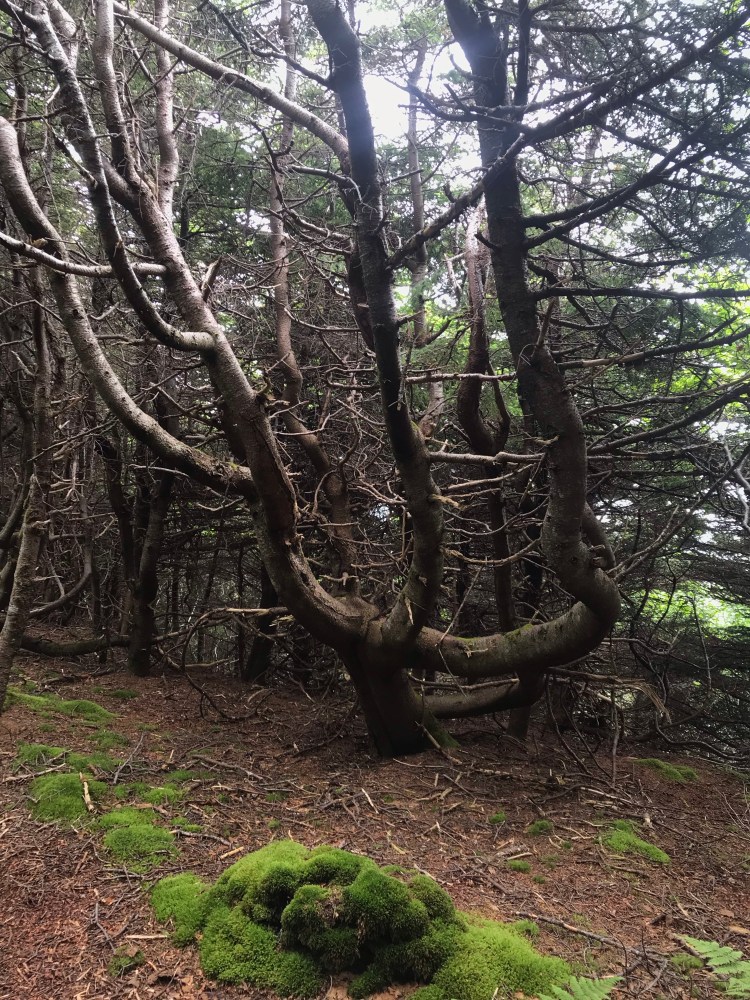
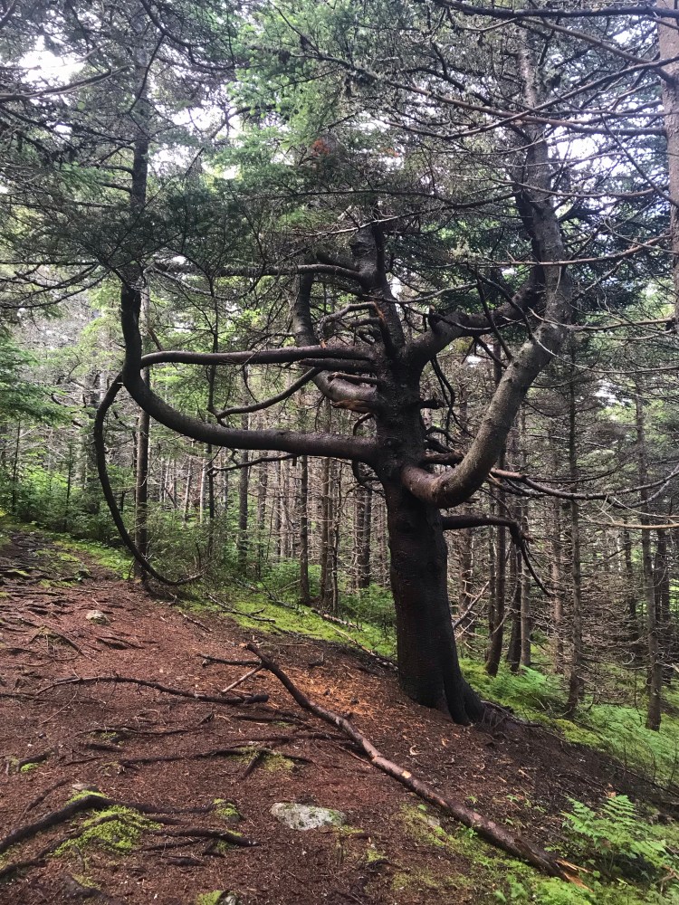
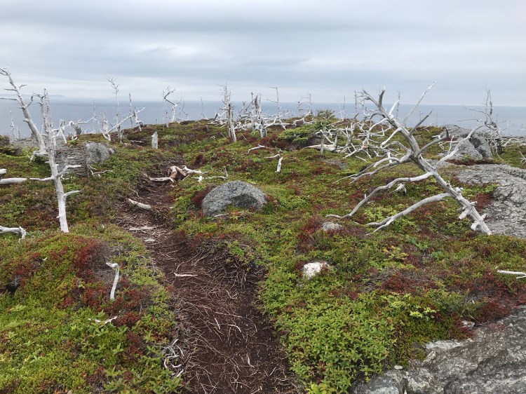
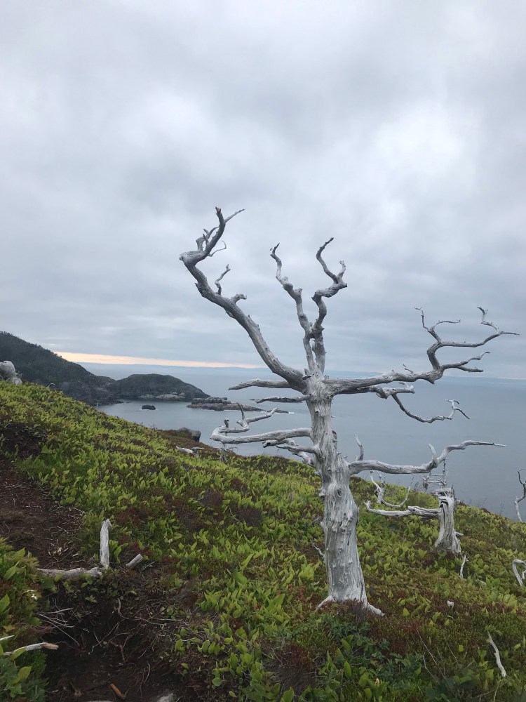
The rain stopped overnight, but the fog lingered into the morning. As I made my way off Stiles Cove Path (I had 5-6km left), the sun eventually came out. Shoe Cove took the cake for views.

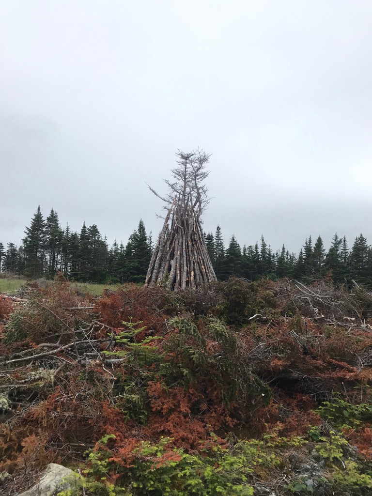
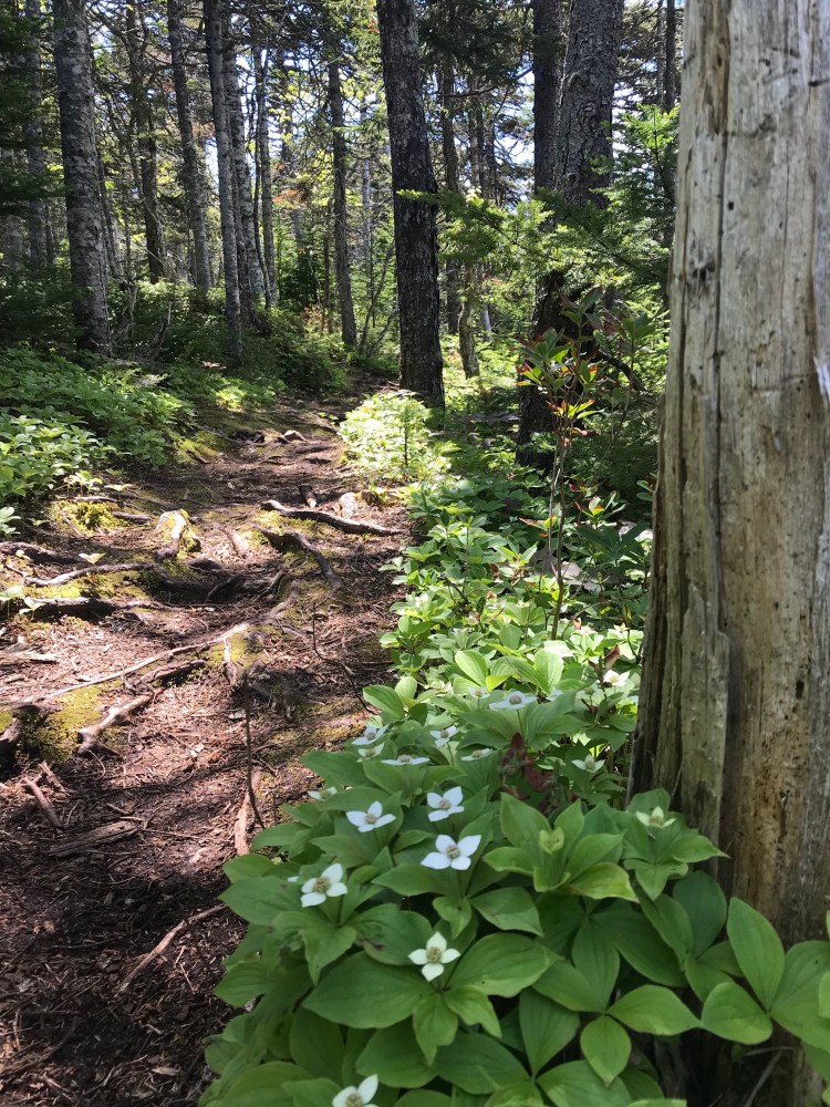
I also saw a pretty cool tree – I dubbed it “The Octopus Tree”.
About 0.5km past the exit off this path is D&L Convenience, where I made my final restock. As I camelled-up outside the store, a local man offered me a lift (the kilometre or so) to the next trailhead. We made small talk and when I told him I’d lived in Toronto for a while he proceeded to list off the main streets of the downtown area in auctioneer fashion – I couldn’t even list them slowly and was left impressed by his sharp mental faculties.
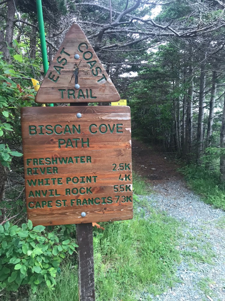
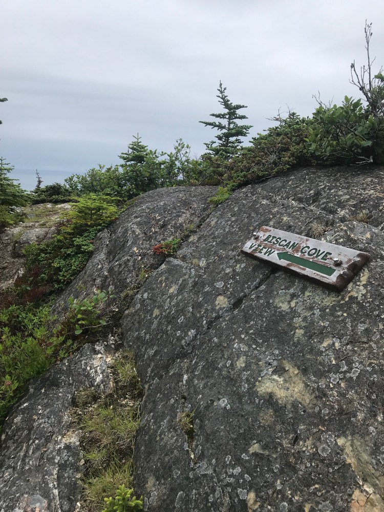
Up next: Biscan Cove Path (7.3km, moderate, Pouch Cove to Cape St. Francis). Just prior to the trailhead sign is a commemorative sign for the Water Witch Shipwreck.
I passed a father son duo not long after getting onto this path. This was their first day on the ECT and first path as they embarked on their own thru-hike to Cappahayden. They had decided to forego White Horse and Piccos Ridge (as many of the thru-hikers I’d met had) due to their status as “not hardened to ECTA standards” and having a reputation for being very tough. They asked me if I had any advice for them as I was almost done, and I was reluctant – as everyone has different experience levels and skill sets. But one motto I think everyone can use on this trail is “slow and steady”. If you rush it you won’t take the time to enjoy the views or watch for wildlife, and more importanly you increase the risk of injury. We wished each other luck and parted ways.
Part of me agrees that if you’re doing the thru hike for the enjoyment and want to be safe – definitely, bypassing the two unfinished paths can be a smart move. But as I’ve mentioned before, I’m stubborn, and I knew that I, personally, couldn’t in good conscience say that I’d hiked the whole ECT if I didn’t do these last two trails. Other people also suggested doing White Horse and Piccos Ridge first just to get them out of the way – which of course makes sense. But I figured I wouldn’t quit so close to the finish line. And this way I wasn’t so green – I myself had been hardened by the ECT in preparation for these challenging trails.
Biscan Cove Path also had its challenges. There was quite a climb, things were wet and slippery, and I had my first misstep where my foot went fully into a river while crossing. Luckily it was just my foot, I wasn’t hurt, and my pack stayed dry.

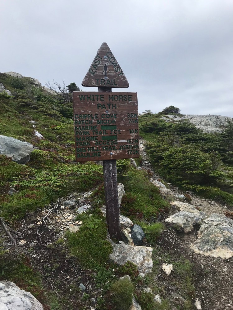
I came out in Cape St. Francis and walked 600m north to the next trailhead: White Horse Path (17.5km, {super} strenuous, Cape St. Francis to Bauline). Here you begin at the northern tip of the Avalon Peninsula, changing direction to travel south along the western side of the peninsula, and being able to see more NL coast across the ocean as you look west.
This trail begins with a climb over stark white rock. After an ascent and descent (where there is also an alternative access path if you want to bypass this first part – but why bother do the trail if you’re not going to do it in full?) you enter forest.
I heard voices here and was excited to ask some hikers about the trail conditions – but it turned out to be a group of three young guys who didn’t look like hikers, so I refrained. One smiled at me and his eyes widened as he asked, “you’re doing the trail alone?” I assume it was an innocent question, and I didn’t really worry as I doubted anyone in their right mind would willingly follow me into such harsh hiking conditions. But did he not realize that was a creepy thing to ask a solo female hiker?
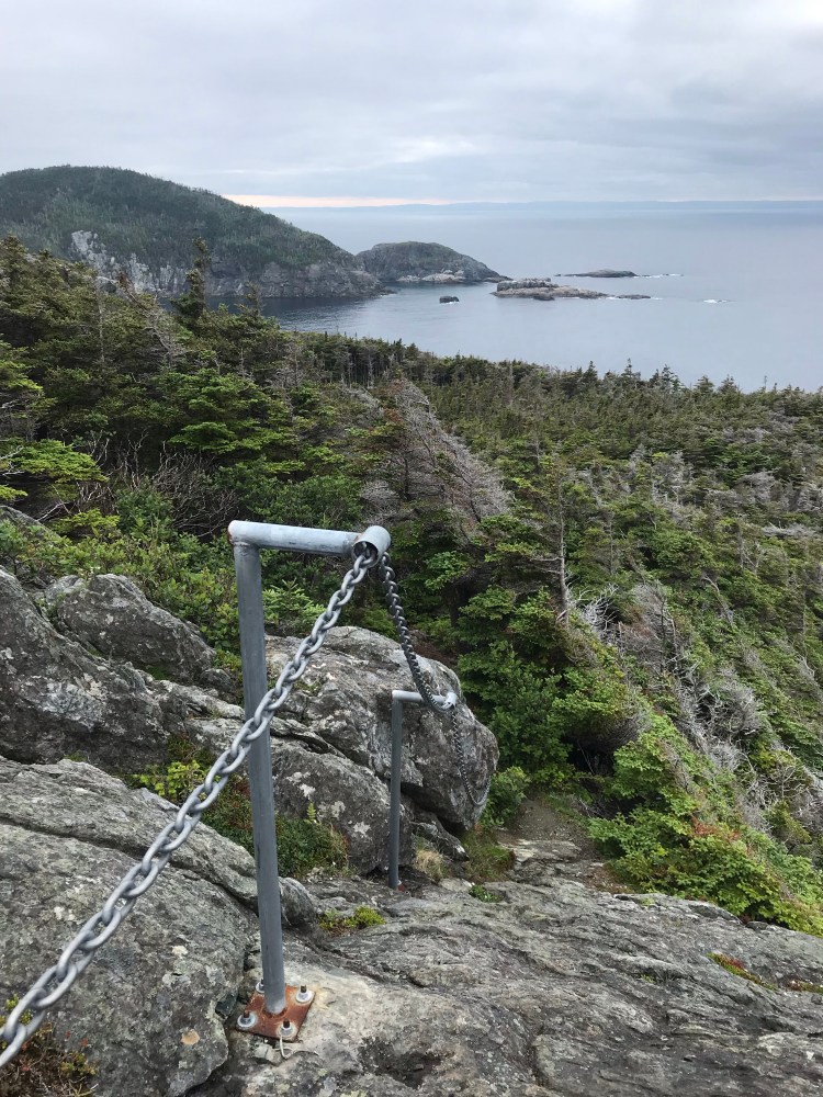
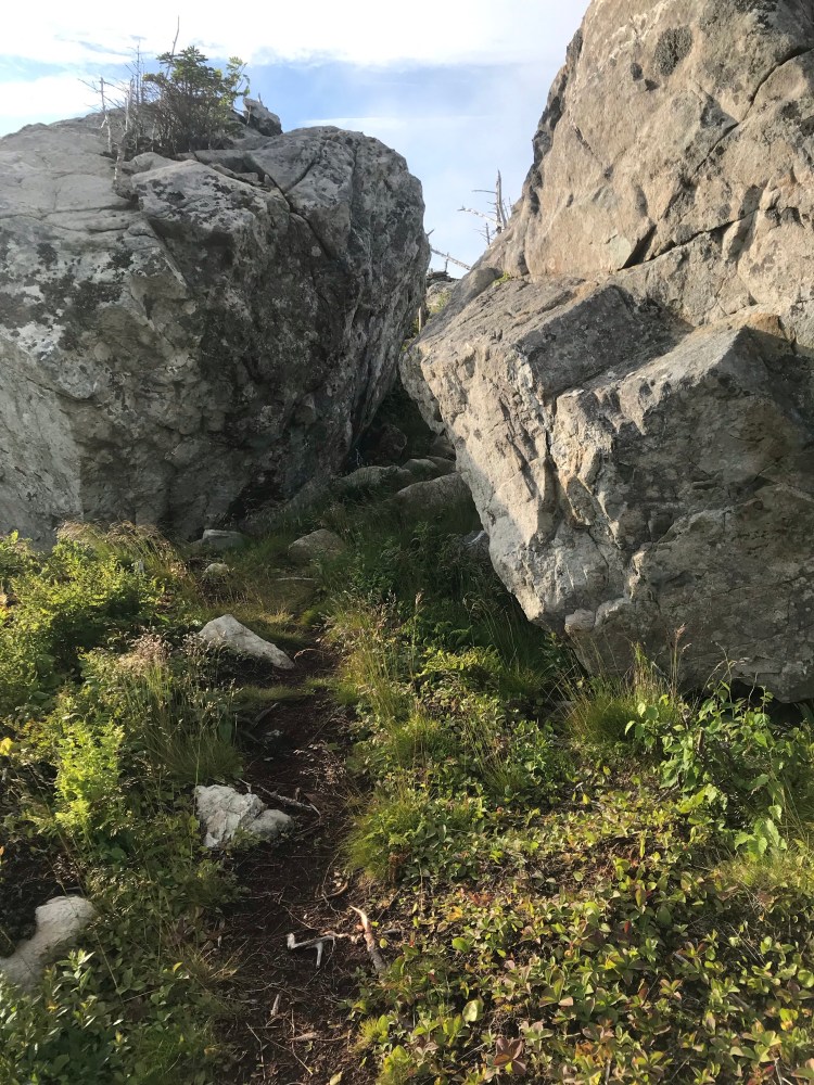
There was a vertical rock face to climb here, and then a chain to hold as you descend the other side. For the first 4km the trail was almost continuous climbing. Slick rock was less desirable for foot placement than mud when it came to these steep climbs. Finally, the trail seemed to reach a plateau and for the most part stayed at a similar elevation for a while. As this is an unfinished path, there were a few signs, but mostly I was following neon ribbons affixed to trees.
After the boys at the trailhead, I didn’t see a soul on this path, though there were a few footprints in mud. Fog had rolled in and it would have been easy to feel uneasy all alone, mist obscuring my view, the promise of night on the horizon. But I was on a mission and my mind was busy with putting miles behind me and not getting injured or falling off a cliff (which I say with some sarcasm, but this trail had the highest risk for falling off a cliff – there were some climbs when I looked behind me and it was basically a vertical drop into the ocean – which was pretty far below. These last two paths have the highest elevations above sea level of any of the ECT sections).
Prospects for random camping were few and far between and as darkness descended I decided to set up camp in between some trees in the forest. This was one of those times I was thankful to have a one person tent, as it just fit. It was a mossy area, bumpy and on a bit of a slant, but it did what I needed.


Day 15
{20.1km}
This was it – my last day on the trail! My body really needed to sleep, so I got a late start to the day. On top of that, when I took a wrong turn onto a side trail and got disoriented, I ended up backtracking about a kilometre (only realizing my mistake when I noticed a very distinct mushroom that I had already passed), adding time and distance onto my day. I took things one step at a time and was overjoyed when I stepped off this trail, walking the 300m through Bauline to the next trailhead.
Final path (!): Piccos Ridge Path (14.5km, {super} strenuous, Bauline to Portugal Cove).

As I approached the final trailhead I came across a father/ son/ grandfather trio who had their camp set up and who I had passed almost two weeks prior in Kingman’s Cove, having just gotten off of Bear Cove Point Path on Day 2. The father and son were from Alberta and the grandfather had come from New Brunswick. They’d done St. John’s to Cappahayden, a few other trails, and were now doing the Portugal Cove to St. John’s portion of the ECT.
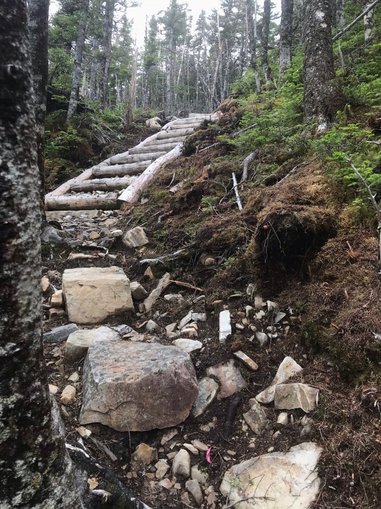
We chatted a bit and exchanged experiences on these two rigorous paths. Apparently these guys had been told that Piccos Ridge was the more difficult of the two – which I did not like hearing at the time, but I can now say that I disagree. White Horse is longer and the climbs are extremely tough on both ends, whereas Piccos Ridge actually has some boardwalks and stairs (White Horse has none) and the descent into Portugal Cove was pretty civilized in my opinion. I was also offered intel on a great water source near a flat clearing perfect for camping, which I made use of later.
The initial climb was pretty tough. Maybe it was because I’d been conditioned from White Horse, or that it was a sunny day, but I didn’t find it to be as bad as White Horse. There were ropes tied to trees to hold on to. It was steep and muddy and slippery, but not quite as “vertical” as White Horse and not as long either – more like 2km rather than 4km.
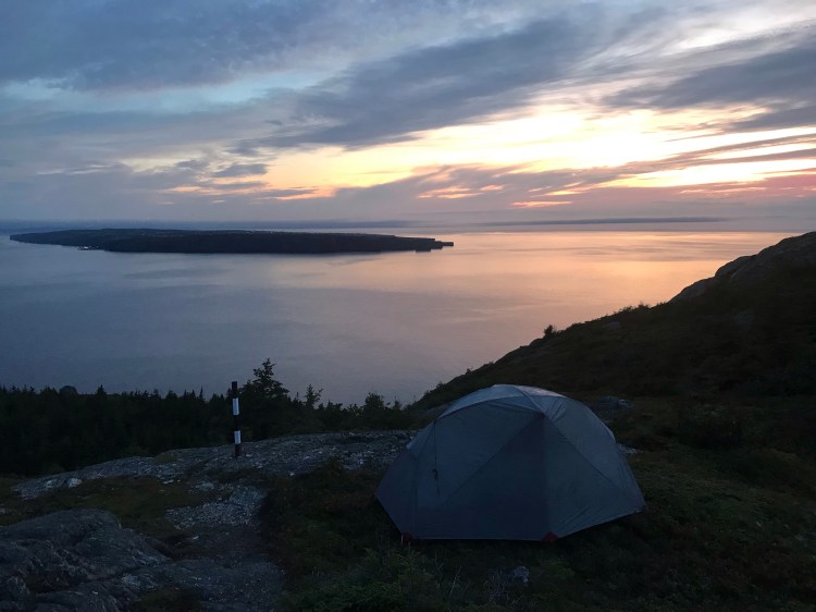
It was a beautiful evening. And while I had my heart set on finishing, I knew I was racing the sun. After 15 days on the trail, I took my first tumble, slipping and falling into a bush (which could have been way worse had I been injured or fallen off a cliff…). I reminded myself, slow and steady, and while I was confident I could reach the finish line if I really wanted to, I decided to camp out one last night on the trail. I set up camp a few kilometres before the end of the path, with a view of Bell Island and the sun setting over the ocean. I gathered water from the aforementioned river (filtered and treated) for drinking and making dinner on my camp stove.
The Finish Line
{4km}
It was a sunny morning, promising a warm day. I had maybe 4km of trail left, so I took my time, simultaneously enjoying myself and eagerly awaiting the moment I passed that last trailhead sign.
I was surprised to see several families (with small children) on this trail, but this portion of the path was definitely more passable, which I assumed was due to its proximity to Portugal Cove (a larger town and near the Bell Island Ferry). One gentleman in a group chatted with me and when I said I was “almost done” (2km from the trailhead by my estimate), he responded that I still had a ways to go… If only he knew that 2km was a drop in the bucket after having come almost 300km.
And then, the moment came.
The trailhead sign came into view, and I began to smile. I had been sure that I would be hit with a wave of emotion when crossing this finish line – surely I would cry. But I didn’t. It felt too surreal.
As I walked down the road, I heard the familiar sound of whale and looked over to see two whales swimming next to me in the calm ocean – as if saying they knew I could do it, and bidding me farewell.
I passed a rose bush and stopped to smell the flowers.
I breathed deep that ocean air – as there is nothing quite so refreshing (though I was craving some watermelon).
A friend picked me up and I went back to their place where we spent the afternoon catching up over beers, vinyl, and a BBQ. The perfect way to end my 15 day trek.
The next few days were spent adjusting to being back in my van and restoring my depleted energy stores. I didn’t have a scale so I have no idea how much my pack weighed or how much weight I had lost (I estimate 15-20lbs). It took a good 1-2 weeks for my body to feel back to normal with the healing of my feet, the waddle I’d developed from being used to carrying the pack, my knees having gone to shit, and a generally stiff body.
Overall
My top paths on the ECT, in no particular order:
- Stiles Cove
- Flamber Head
- Cobbler
- Spurwink
- The Spout
- Tinkers Point
*Honourable mentions to Motion Path and Deadman’s Bay (From Blackhead to Freshwater Bay).
Total Distance: 300km
Average Pace: 3km/hr
The End
Now that some time has passed and I’m looking back on my thru-hike, I am feeling extremely nostalgic and already dreaming up my next thru-hike. Being out in nature has an amazing power to heal – physically, mentally, emotionally, and spiritually. I realized that milestones are important to me. I’ve been in a weird limbo for a while now in my life, and this hike made me realize that accomplishing things is crucial for my wellbeing – I’m just wired that way. Friends and family remarked upon speaking with me or seeing me after the hike that I seemed noticeably more at peace.
So here’s to making our dreams a reality and the next thru-hike…
Copyright © Chronic X-Roads 2020

3 thoughts on “Thru-Hike 2019: A Journey on the East Coast Trail”