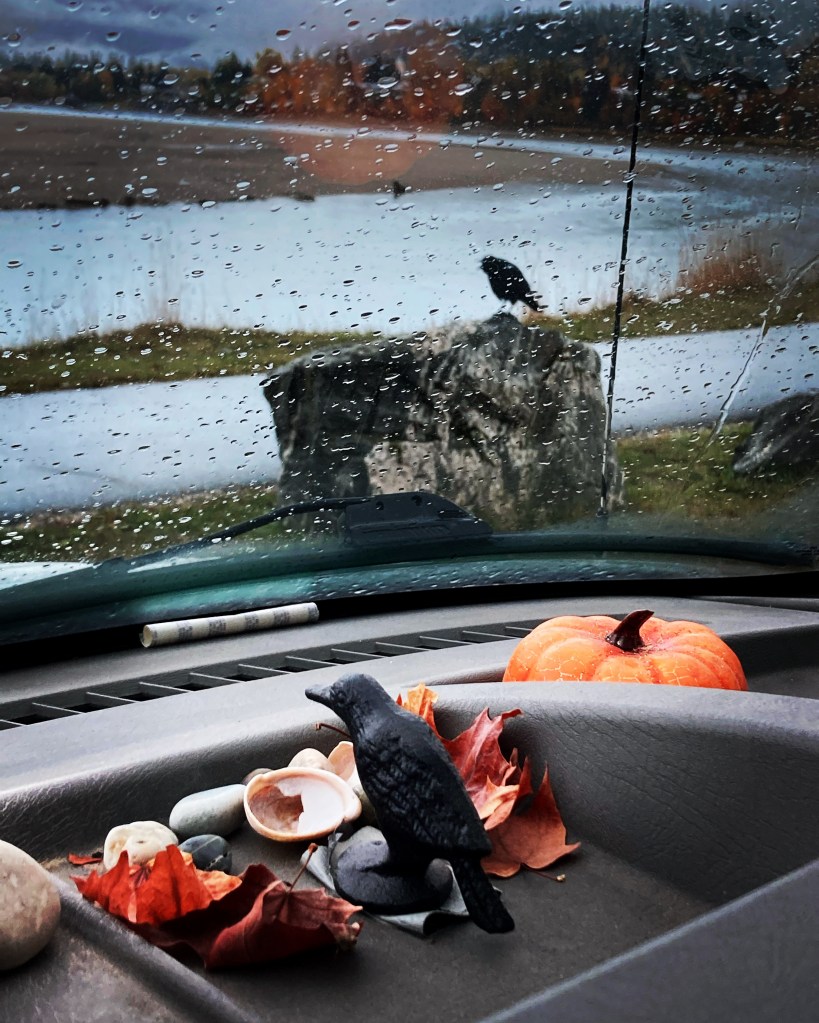
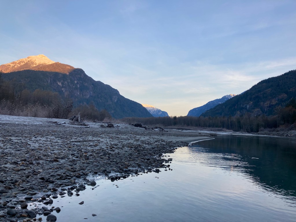
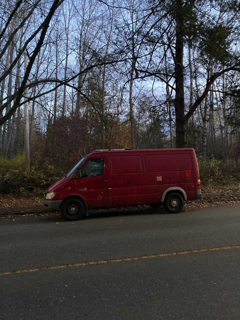
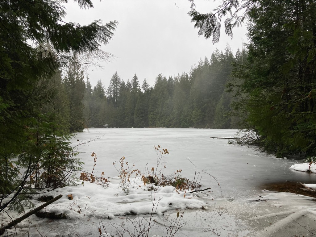
Entering British Columbia was like entering a void of unknown territory.
I’d made a spontaneous leap to leave Ontario and go to Calgary. But I had friends in Calgary. I had an “in”. I was anchored. Not that I’m someone who needs that, or leans heavily on others. But there is a comfort in having it. To be honest, I had been overwhelmed by the social network I’d been welcomed into when I first got to Calgary. This time, I was leaving with no set destination in mind. No purpose but to wander. Winter looming. Alone.
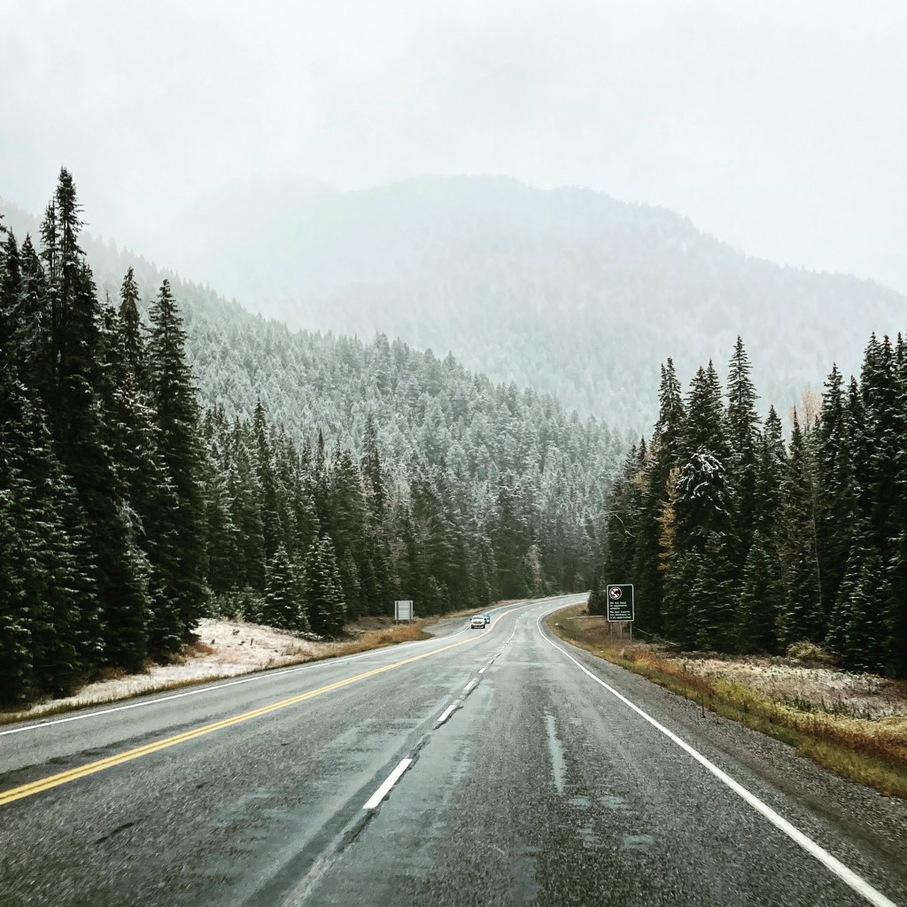
It’s funny how the circumstances of your life can colour how you remember where you were at the time. I don’t mean to sound drab, but this is how I remember entering BC. Crossing the border I was met with a snow squall. The skies seemed to be perpetually gloomy at first. And I truly did not know what was next for me.
Table of Contents
*This post is long and covers a lot – feel free to jump to specific points of interest.
- Table of Contents
- Cranbrook
- Yoho National Park
- The BC Interior
- Vancouver Area Part 1
- Vancouver Island
- Back To Vancouver
- Other Information
- Land Acknowledgement
- Conclusion
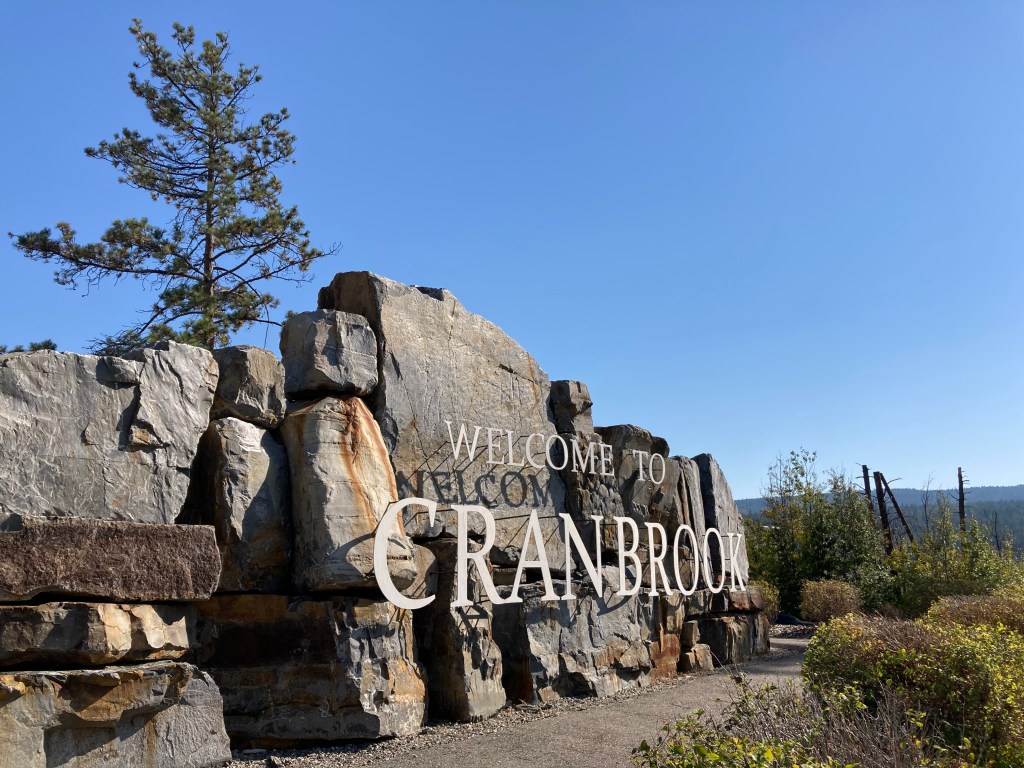
Cranbrook
I flirted with BC before I committed, making two small trips over the border before taking the final plunge.
During my time in Waterton and along Crowsnest Pass, I took Highway 3 a little further west to Cranbrook. As I touched on in my post on Alberta, my Dad wrote a book, and in that book the main character (who reminds me of my Dad) lived in Cranbrook.
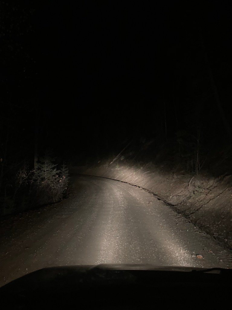
The drive to Cranbrook was not so fun, as it had gotten dark, and there were no lines marking the roads (presumably worn away). Even with my high beams, it was difficult to see. This is the type of driving situation I try to avoid, but if I’m in it then I try to tuck in behind another vehicle, preferably a transport truck.
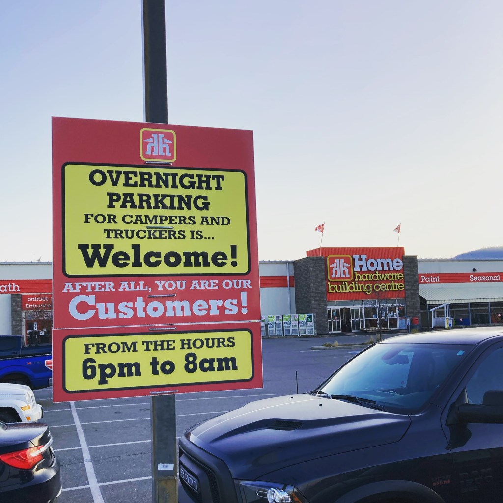
While the Walmart in Cranbrook did not allow overnight parking, I was pleased to find a welcoming sign at Home Hardware next door.
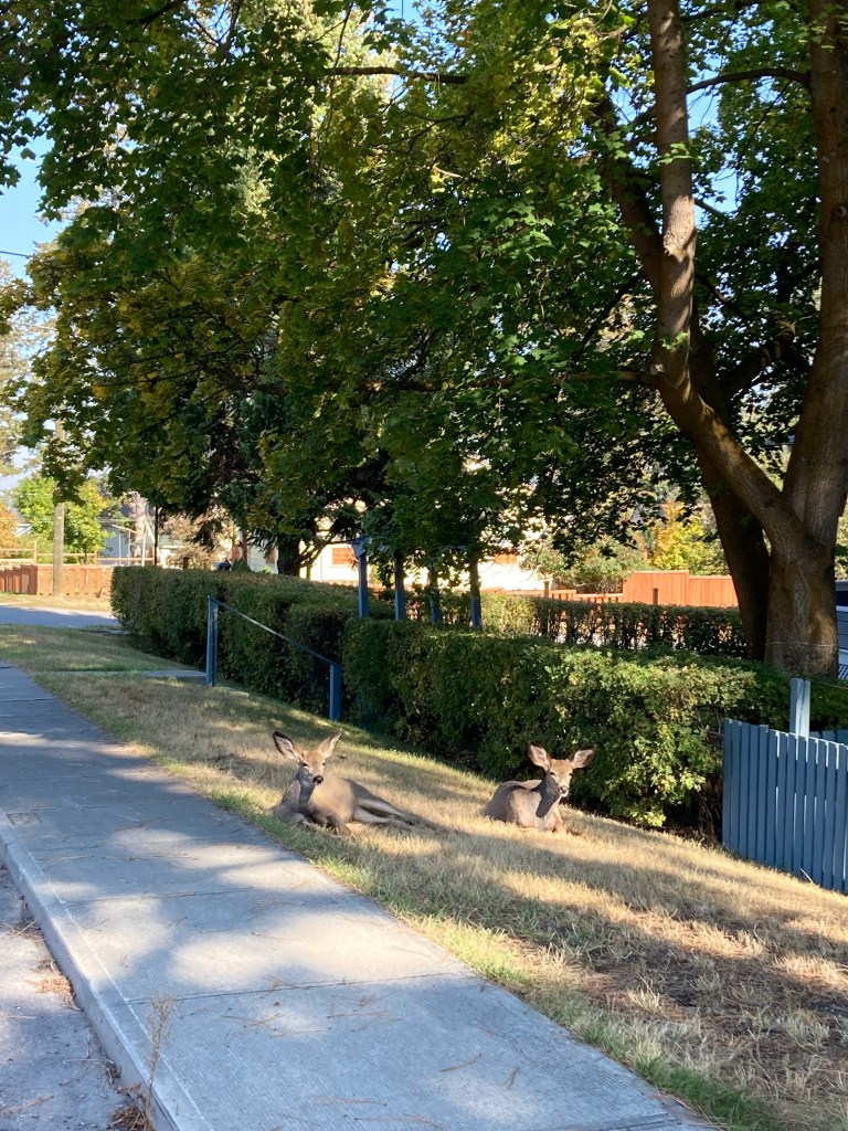
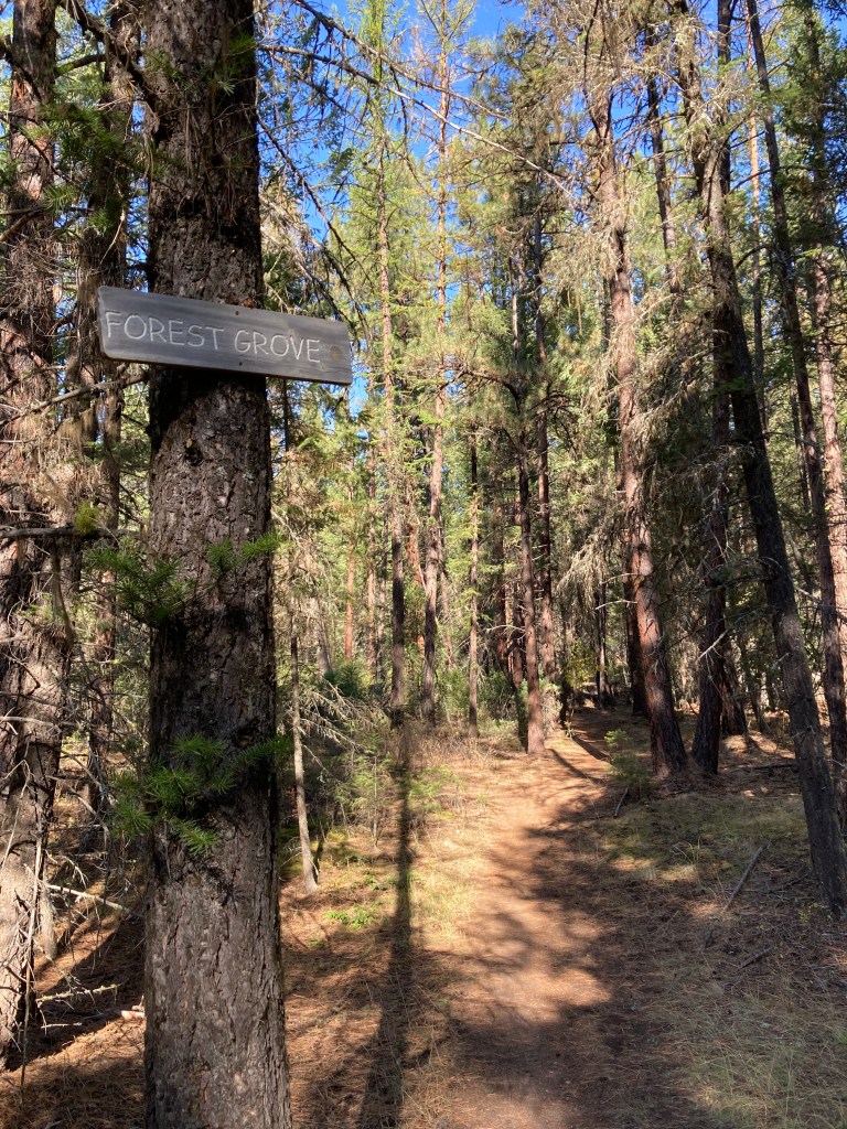
I spent one full day exploring parts of Cranbrook. I happened across a farmer’s market where I picked up my first ever bottle of mead (!). I walked past a couple of deer sprawled out on someone’s lawn. And I headed to Cranbrook Community Forest for a leisurely hike, as I imagined how my dad’s character would have done.
Most of the places mentioned in my Dad’s writing were real. The street the main character lived on, the school he taught at, and Cranbrook Community Forest, where he prepared for hiking the Great Divide Trail.
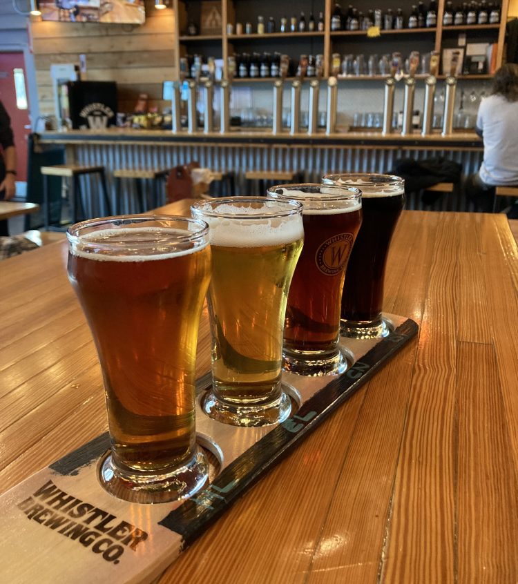
In the late afternoon I hit the road and headed towards Fernie. I remember the road going through a mountainside tunnel, which was a treat. And I stopped in at Fernie Brewing Co., which was quite crowded, and in a beautiful area. The beer was fantastic – my favourite was the What The Huck huckleberry ale.
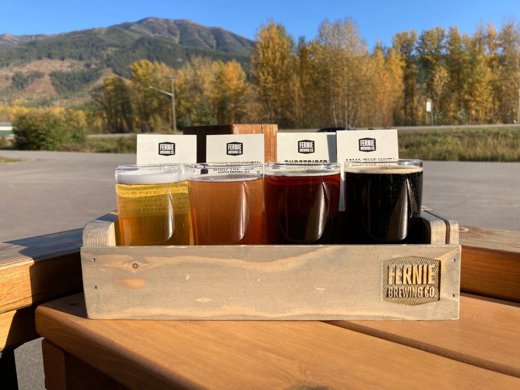
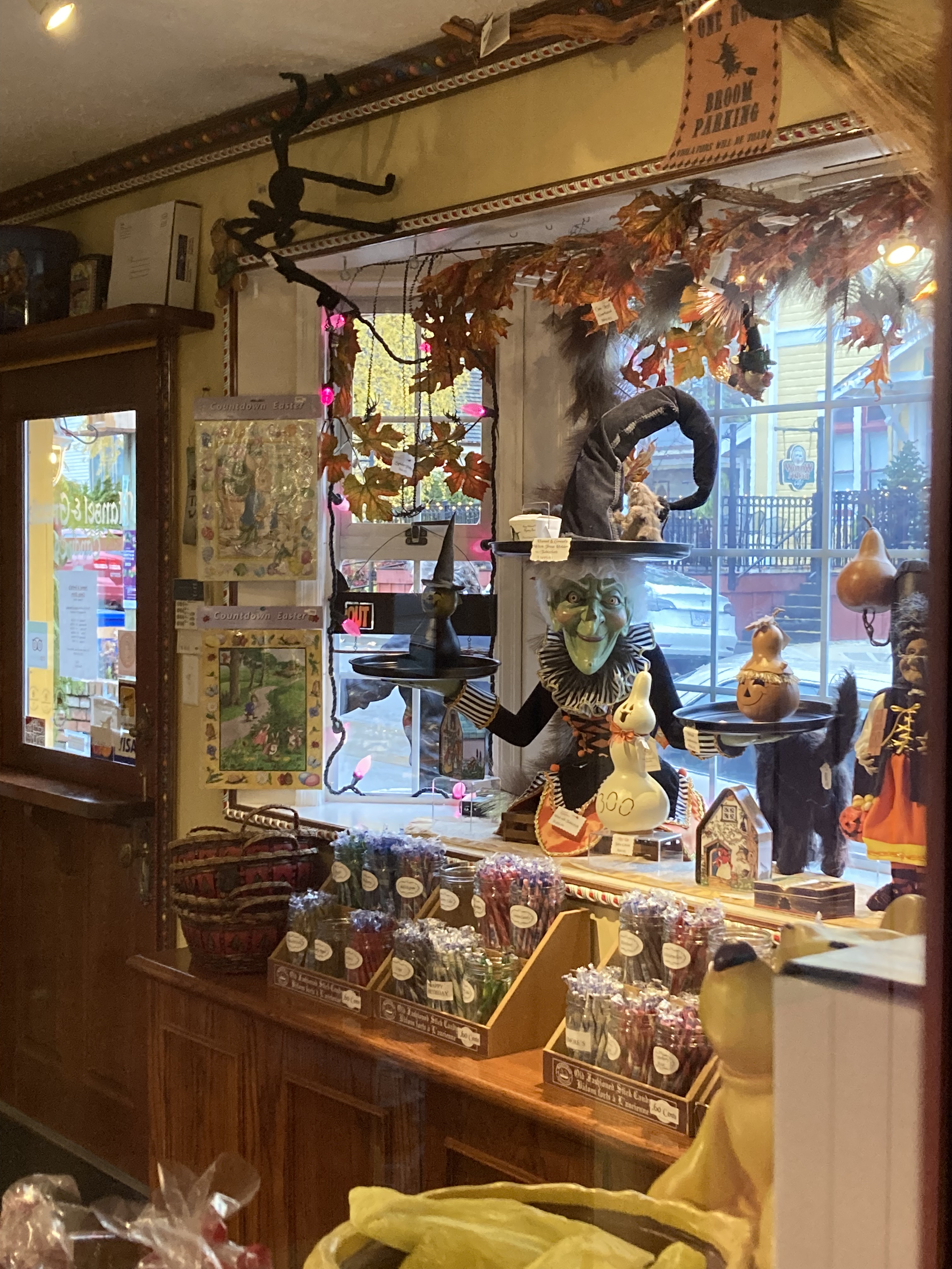
Note to future self: stop in to The Spiral Path next time you’re in Cranbrook (I’m always on the lookout for spooky shops). And definitely revisit Fernie Brewing Co.!
Yoho National Park
My second flirtation with BC was also a destination that my Dad wrote about. But in addition, coming here was an excuse to get at least partway down the TCH, a section of which was closed at the time – making it impossible to get to Golden / the BC interior / Highway 95 (the Columbia Valley). I would have to later take Highway 93 (the Banff-Windermere Highway), which would take me further south, from Castle Junction to Radium Hot Springs.
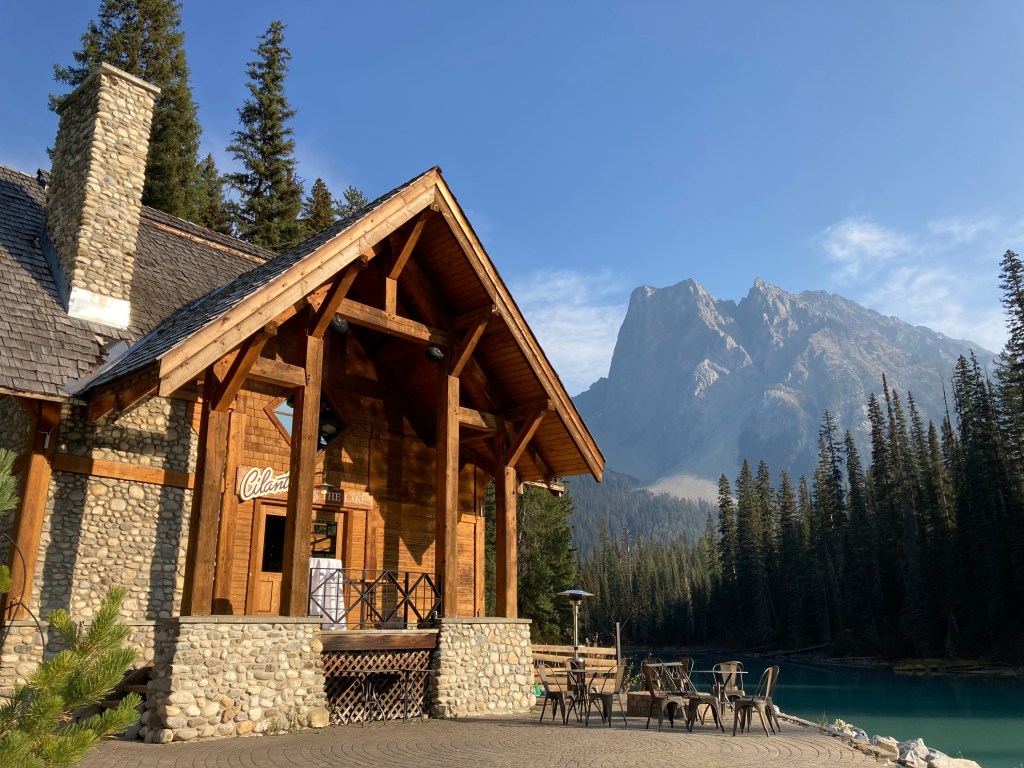
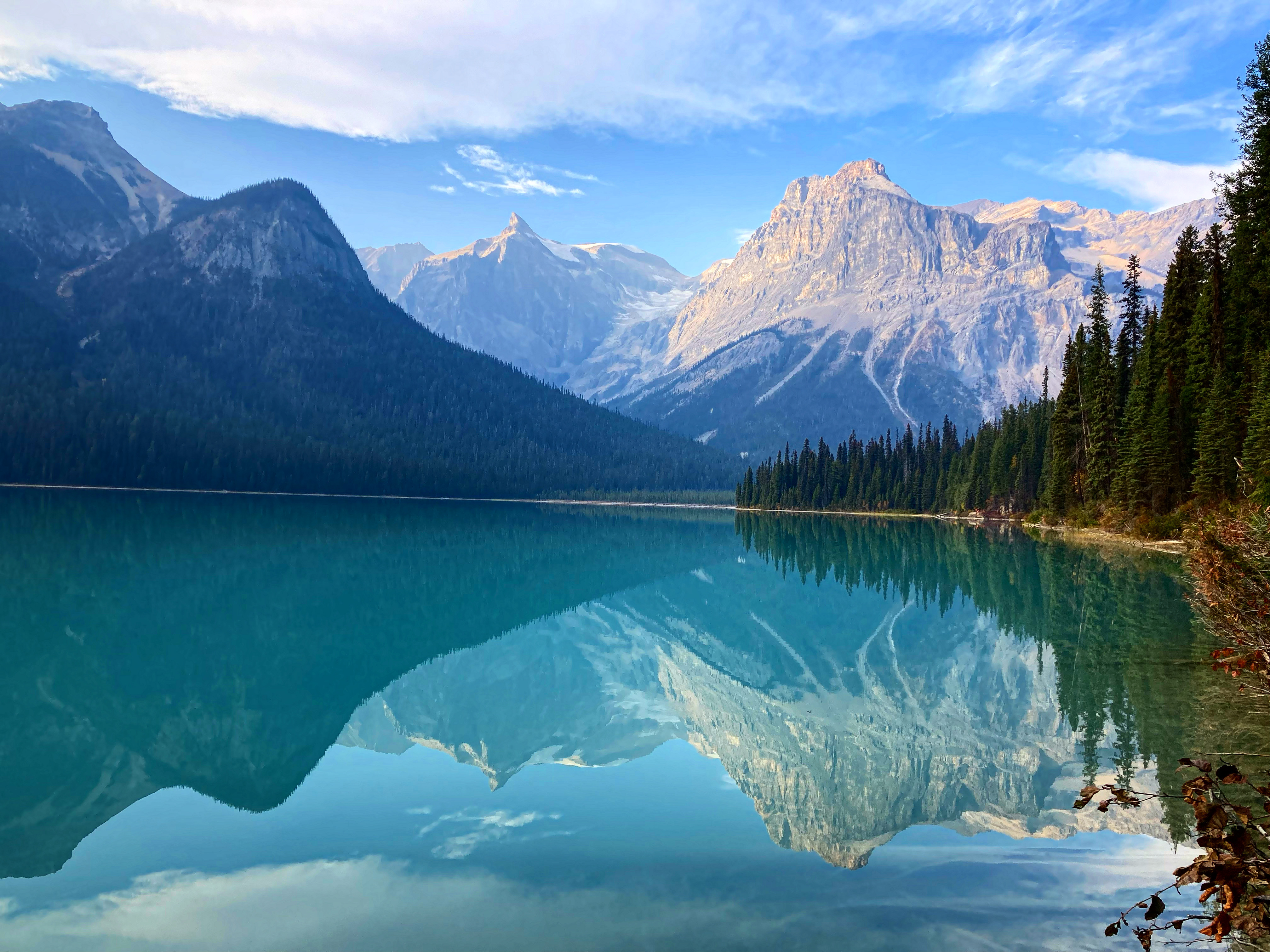
The main draw to Yoho NP was Emerald Lake, just 35 minutes from Lake Louise. True to form, my Dad had superior taste, as exemplified by his characters staying at the Emerald Lake Lodge, a mountain lodge situated right on the lake, whose waters were stunning hues of turquoise, nestled among the mountains.
I hiked the Emerald Lake loop, taking in the many peaks, including Emerald Peak (wondering if they call it Emerald Peak because it’s covered in trees, unlike the other mountains around Emerald Lake). I didn’t have a lot of time, so I didn’t tackle any of the longer hikes, just a stroll around the lakeshore. But it was still breathtaking, with the mountains reflected in the waters. After being in Alberta for so long (so dry!), I had almost forgotten what mud was like – I was now used to dust – but this lakeshore reminded me.
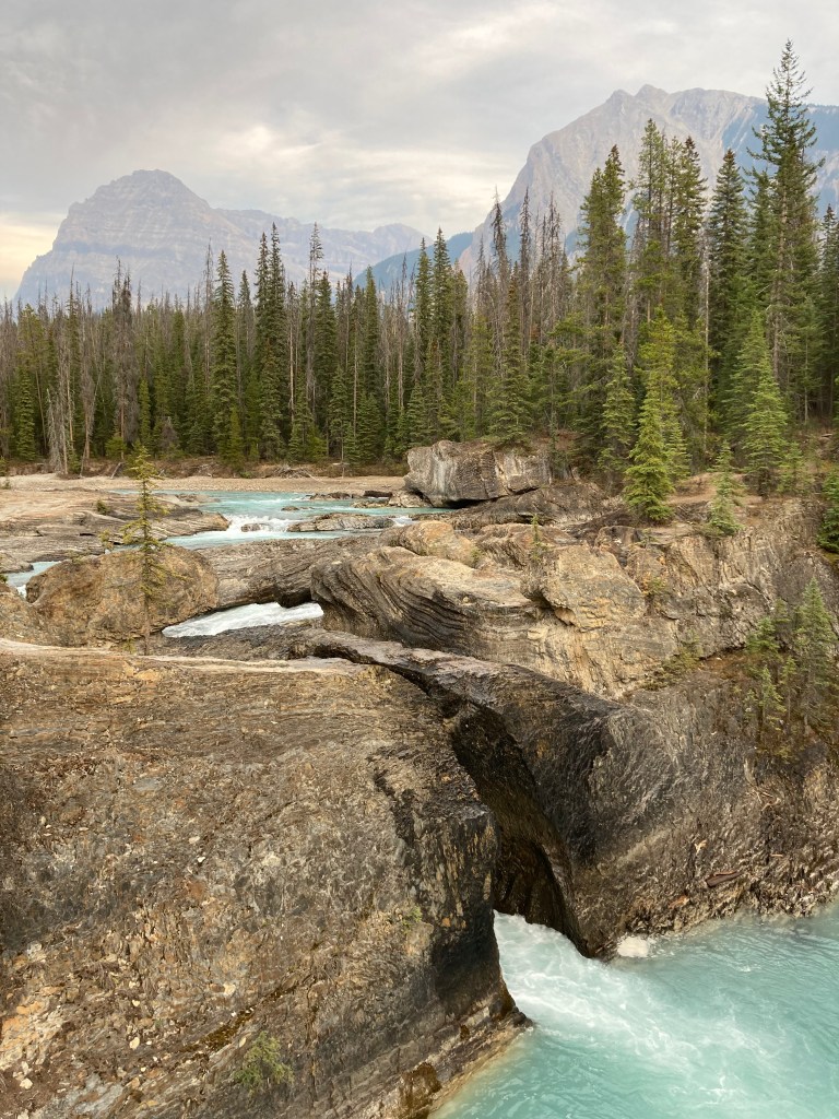
On the way to or from Emerald Lake you can make a stop to see the Natural Bridge, which is a rock formation across Kicking Horse River.
East of here is the town of Field, which also has the Yoho NP Visitor Centre. Unfortunately Truffle Pigs was closed when I passed through.
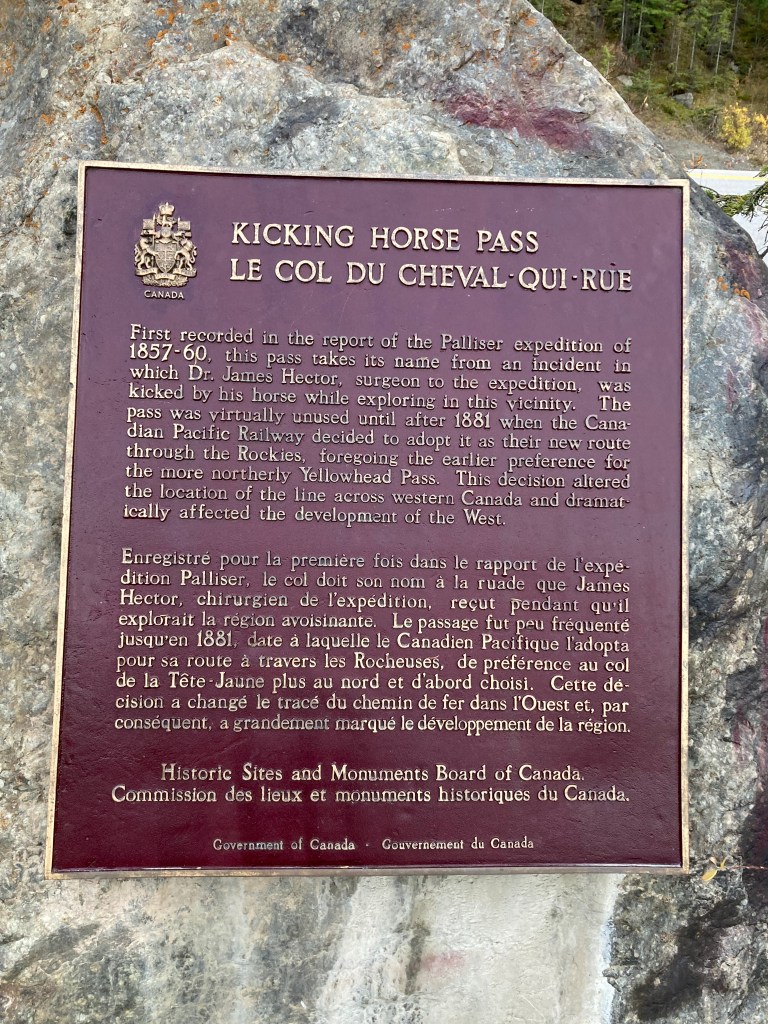
Heading back along the TCH to Alberta I stopped to take in the Spiral Tunnels, a really cool display of train tracks that run through the mountains. These tracks created gentle winding grades for trains as an alternative to previously treacherous steep grades which could lead to runaway trains. This area is near the border between AB and BC, known as Kicking Horse Pass, the highest point on the TCH. It’s places like this in the Rockies where you get a real sense for the rich railway history in Canada.
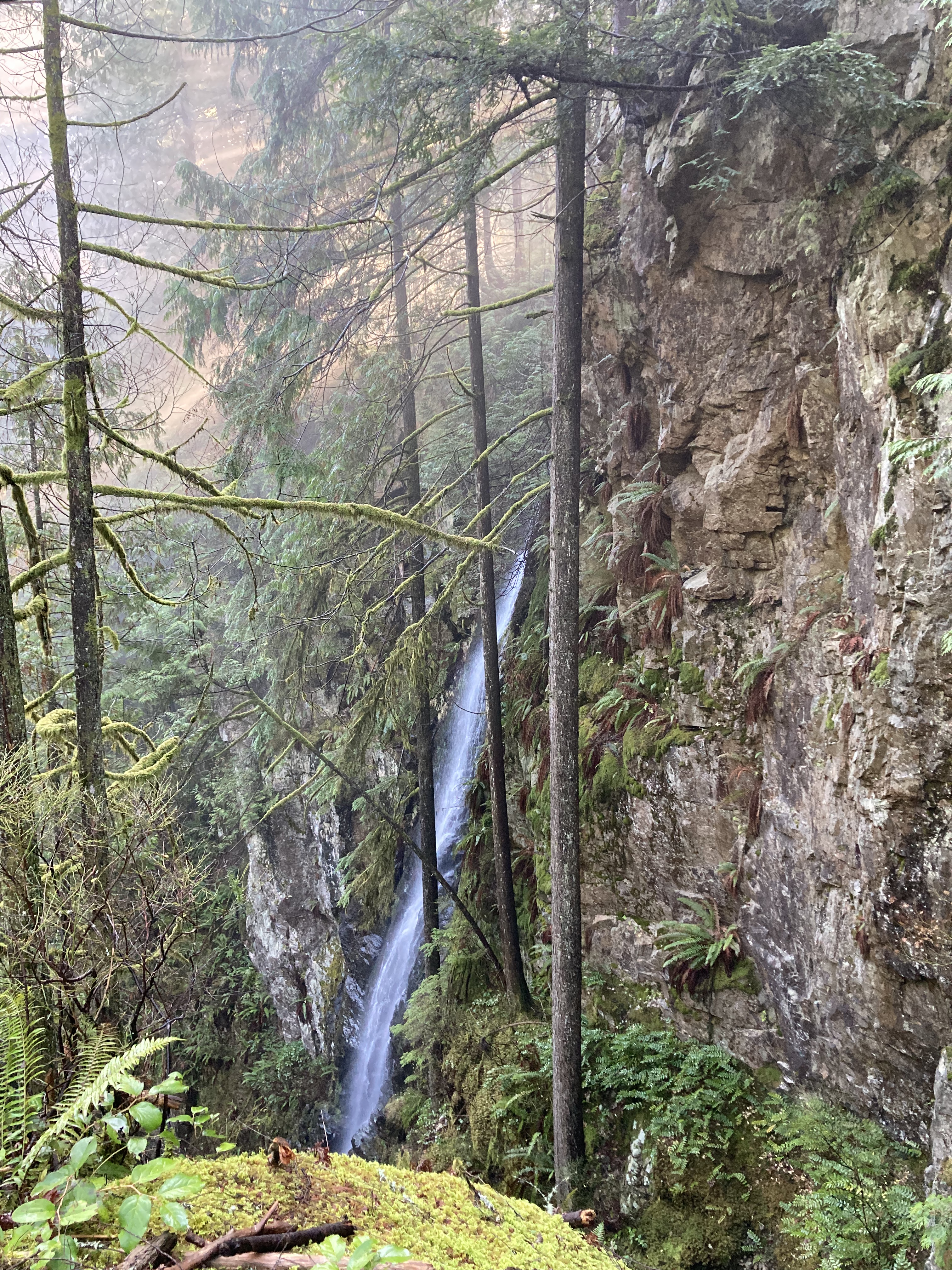
I would have liked to visit Takakkaw Falls, but the access road – Yoho Valley Road – was already closed for the season (this was October). Yoho Valley Road is also the road you would take to see the Upper Spiral Tunnel viewpoint, while the Lower Spiral Tunnel viewpoint is right on the TCH.
For future visits, I have Wapta Falls, Lake O’Hara (a bit more planning to access), and Lake McArthur (near Lake O’Hara) in my sights.
The BC Interior
Hazzah – commitment!
Radium Hot Springs
Getting towards the end of October, I finally crossed the Alberta / British Columbia border for good. I mean, not forever, but I had no plans on when I might get back to Alberta.
The TCH from Lake Louise to Golden was closed, so my next best choice was Highway 93 (which runs through Kootenay National Park) from Castle Junction, Banff, to Radium Hot Springs, taking me on a detour further south in the Columbia Valley.
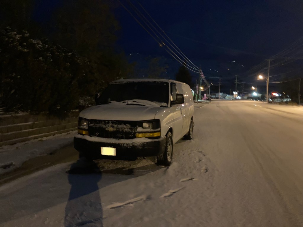
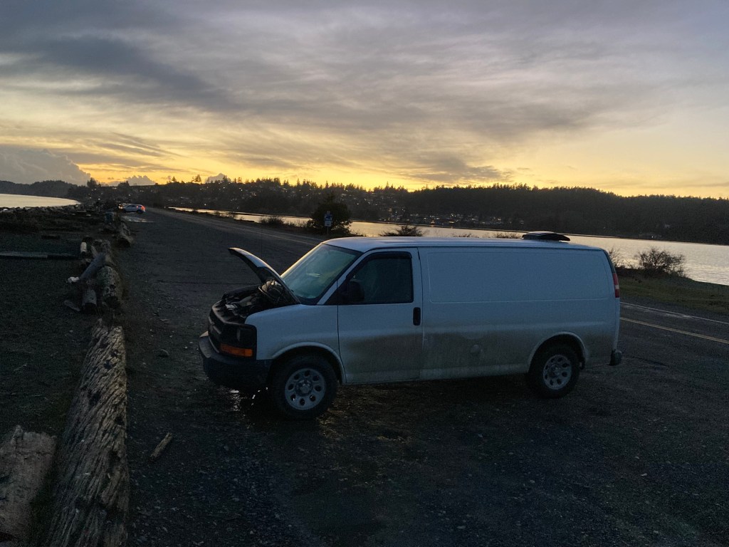
A someone who tries to do as much as I can when taking in places, and is more often late than early, I left the trek through the mountains too late. On a larger scale – I would probably generally avoid late October treks through the mountains in the future. I was not a fan of driving in the snow at all. But also acutely – the night I drove into BC I left at dusk and got hit by a snow squall. That was not a fun time. I like to avoid driving in the dark and in snow, especially while on winding roads, in mountains with a lot of wildlife.
So I tucked in behind a transport truck and white-knuckled it for an hour and a half.
I had a crown land spot lined up (so much relief was felt upon arrival), and found my way there in the dark (several other groups were there when I arrived, with a fire going, so I tried to park at a respectful distance, while unable to see much). I woke up to a dusting of snow on the roads.
After running around the Rockies non-stop for the last while, I took a slower “catch up” day on my first day in BC. It’s good to have pressure-free days, to adjust to your surroundings, process the things you’ve experienced (including the stress of the previous night’s drive), rest, or plan.
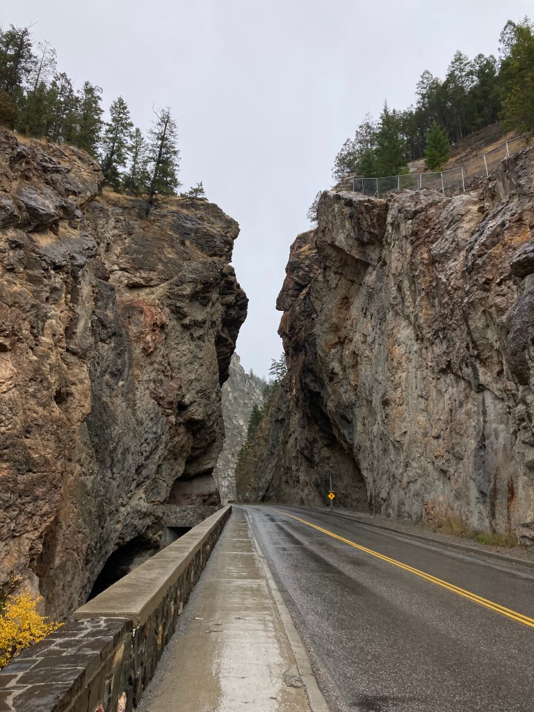
I drove over to the actual Radium hot springs, where there were plenty of people in the steamy waters. There is a cool cliff corridor that the highway runs through (I believe this is Sinclair Canyon) just before you get to the hot springs from town. Next time I’m in the area I’d like to take my time on Highway 93 and see a bit more of Kootenay NP.
I popped in to the Radium visitor centre. And I also drove down to Invermere to run some errands. I then headed north up to Golden and found a laundromat (okay so it wasn’t really a rest day – but you can never really do nothing on the road, you have to keep moving), before heading to my next overnight spot.
Golden
I just passed through Golden, so I don’t have a huge impression to share, other than it feeling like a small town in the mountains. I was pleased to see Halloween decorations at the laundromat. I remember feeling fairly creeped out in the forested area where I slept. You get this sometimes – some areas you don’t think twice, other places you get a weird feeling. The question is, are you bugging out, or picking up on something? I am typically inclined to trust my gut. But then you also consider what time of night it is that you’re arriving and whether you have another place to go (and then maybe sleep with your bear spray and car keys nearby if you decide to stay). I stuck around and woke up to a beautiful sunny morning and dirt/mountain bikers passing by.
Glacier National Park
Glacier National Park (not to be confused with the one in Montana, south of Waterton) lies between Golden and Revelstoke on the TCH. While I didn’t have set plans on where I was headed long term at this point, I was acutely aware that I didn’t have time to do a lot of exploring in the mountains of the BC interior. Winter was setting in quickly at higher elevations, so I was bee-lining it through a lot of places that I would have loved to explore more.
I only drove through Glacier National Park, but the views from the road (Rogers Pass) gave quite an impression, with immense rock faces towering above. I’d definitely love to hike here.
Time also changed back an hour after leaving Golden, and entering Glacier NP.

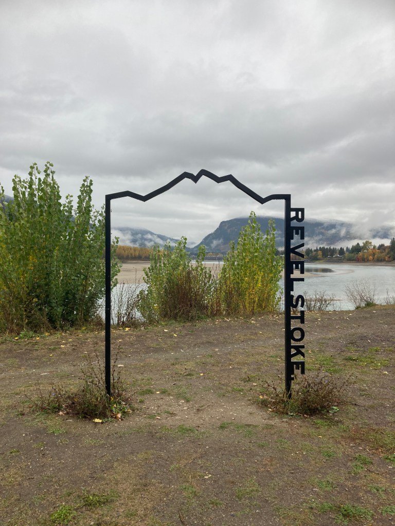
Revelstoke
Two days after entering BC, I arrived in Revelstoke.
The whole time I was here it was rainy and cloudy and I couldn’t see the mountain scenery that was surrounding me. I took the switchbacks of Meadows in the Sky Parkway partway up Mount Revelstoke (National Park) to a higher elevation, but the views just were not visible so I turned back (it’s also slow going up that winding road). Next time I’m in the area I’d love to take the parkway all 26km to Balsam Lake parking area and hike the 1km to the Mount Revelstoke summit – on a clear day!
When researching, I found a cool place just west of Revelstoke called Three Valley Gap Ghost Town – but it was also sadly closed for the season (too bad, with Halloween just around the corner).
Some places are more convenient (or not hostile) than others for sticking around, and Revelstoke was this for me. There was a rest stop just adjacent to Revelstoke off the TCH where I could stay at night. And Centennial Park was a great spot for me to park in the day and research my BC plans as well as walk along the Columbia River and take in my surroundings. I even did a run along the trails here! I try not to make a habit of “loitering” – I think it’s good vanlife etiquette to not stick around the same places too long. That can be inconvenient, but it’s an unfortunate reality that locals can turn hostile if you stand out. Sometimes I want to do things like research from the comfort of my van – but this is also why it’s good to stop in to coffee shops or breweries and research there while sipping on a beverage and supporting local.
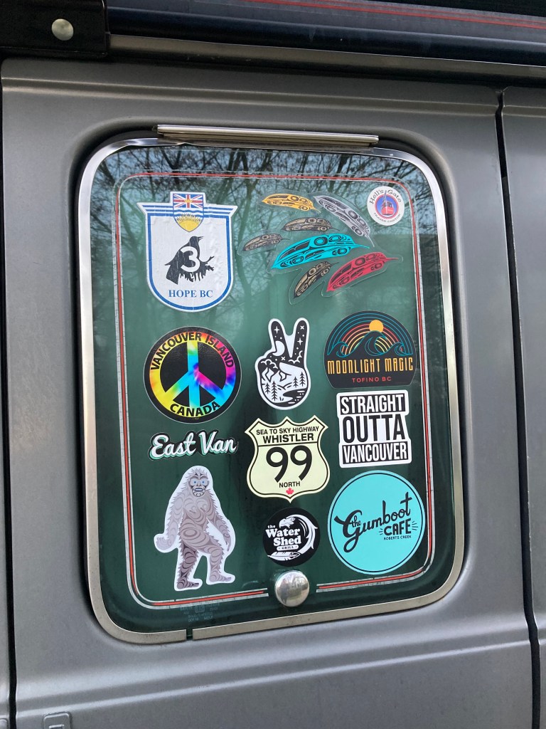
Another way to support the places we pass through is by exploring their downtown hubs and picking up some souvenirs (I can’t tell you how many stickers, postcards, magnets, mugs, shot glasses, and candles I amassed). And I quite liked downtown Revelstoke. I came across a kindred spirit in van form, as well as a car that had me looking for Dean Winchester. I visited some shops and even stumbled upon an outdoors store called Eagle Pass – which was also something from my Dad’s book. It was an outdoor store in Cranbrook in my Dad’s book, but didn’t exist there in real life (I looked!) – so finding it by chance in a different small BC town was a pleasant surprise.
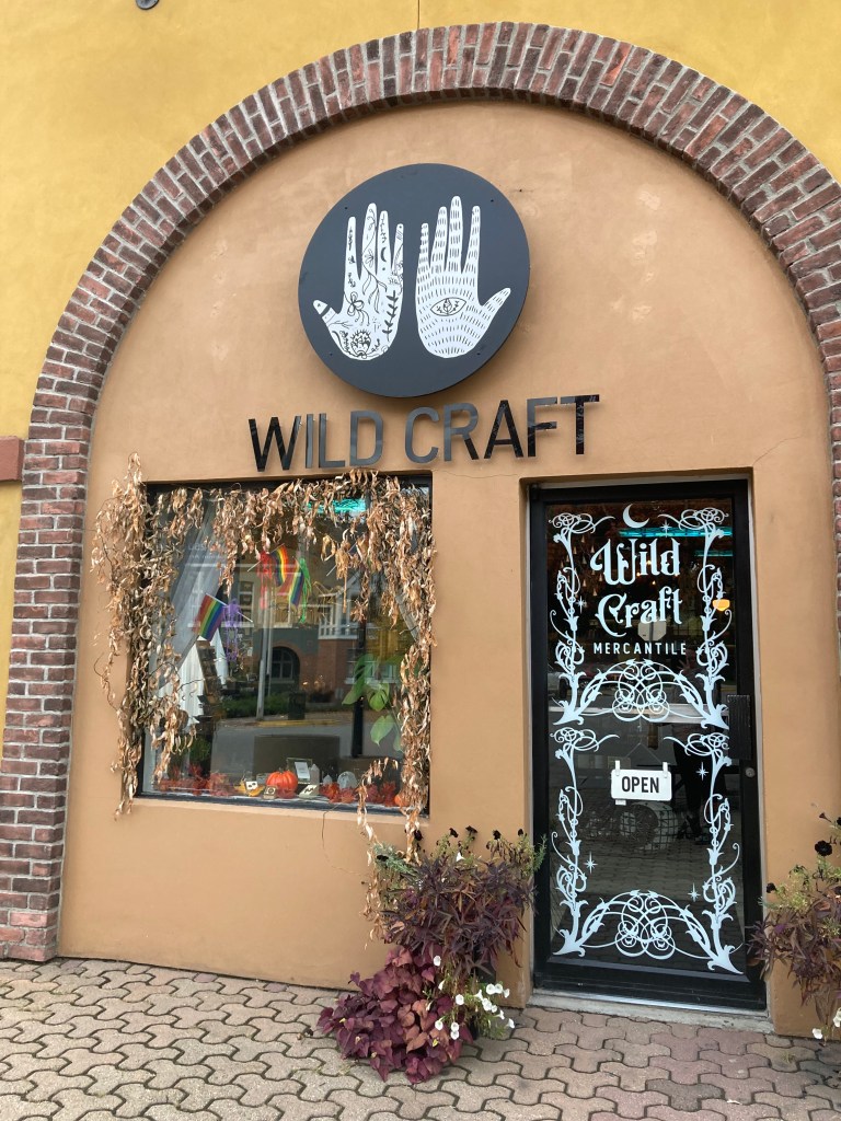
Salmon Arm
“When you start being able to drive around a town without the use of maps – it might be time to leave”. That was a thought that occurred to me on my last day in Revelstoke. So I continued on along the TCH, hitting Salmon Arm a little over an hour later.
I can’t remember if I had any other reasons for stopping in to Salmon Arm, but there was a store here that I really wanted to visit called Wild Craft. I’d followed the owner’s independent business on Instagram for a while, and was excited to see their brick and mortar. It was absolutely lovely.
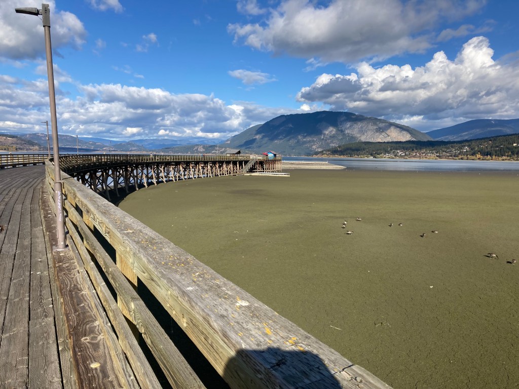
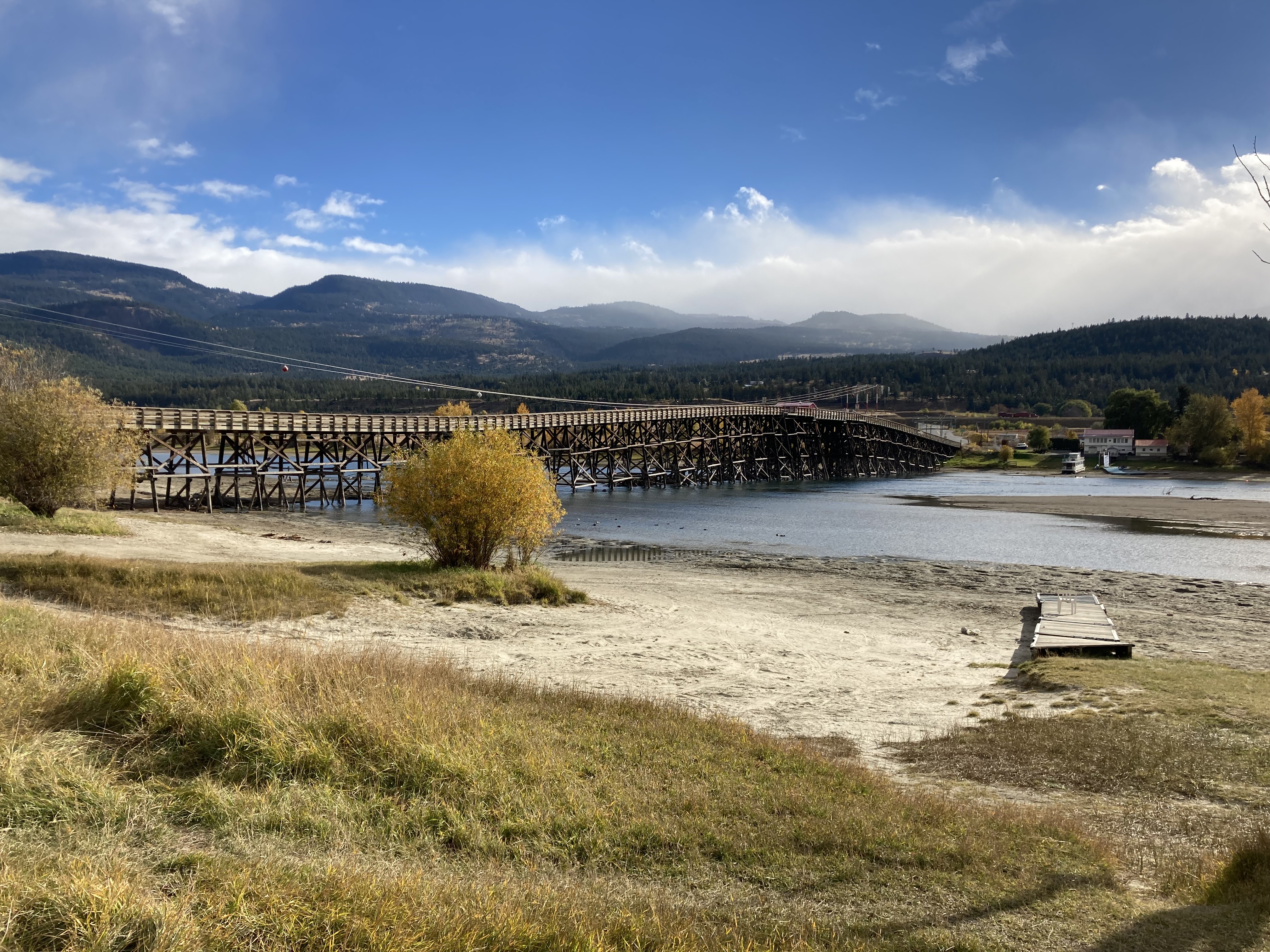
While in town I took a stroll around the downtown area (definitely some cute shops) and mailed some postcards to friends. I also checked out the Wharf on Shuswap Lake (apparently the longest wooden wharf in North America?), which was enjoyable. And a couple of days later, after checking out Kamloops, I stopped in to DeMille’s Farm Market.
If ever I explore the Salmon Arm area again, I might try to see Margaret Falls in Harold Provincial Park, Barley Station Brew Pub, R.J. Hanley Heritage Village & Museum, Shuswap Cider Co., or Canoe Beach.
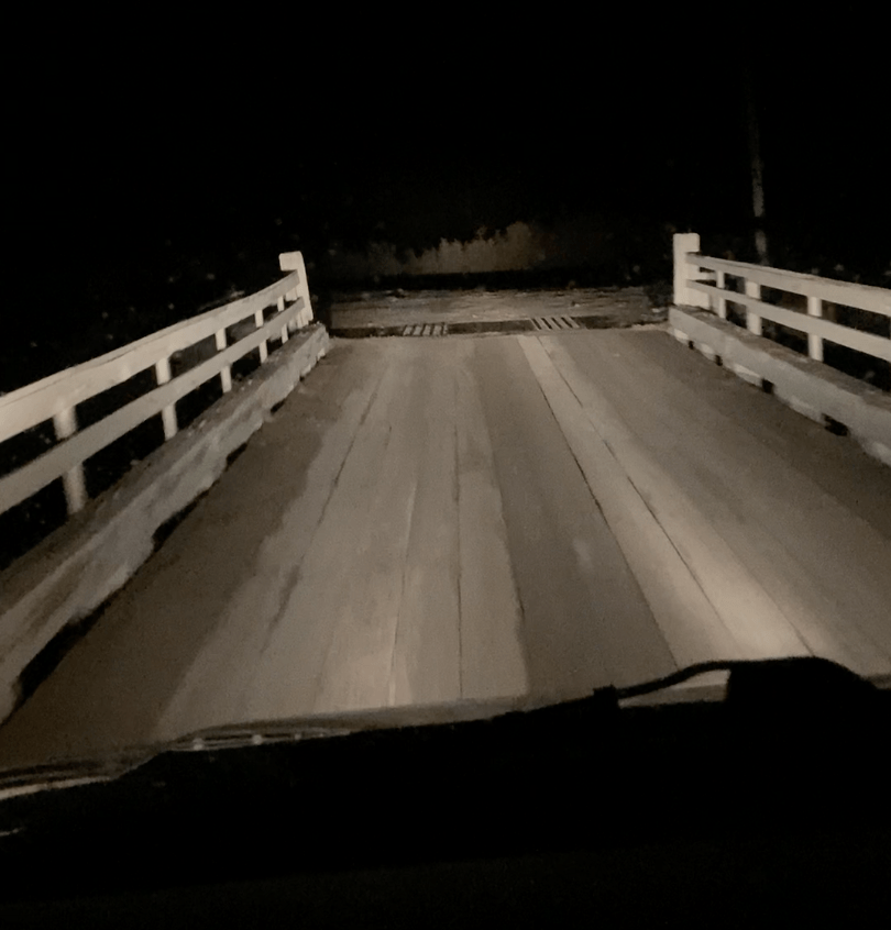
While driving from Salmon Arm towards Kamloops and scouting an overnight spot, I had one of those nights where plans fall through and you’re scrambling to find something nearby. Those nights are always frustrating. My chosen spot turned out to be a no-go, so I had to drive further and in the dark. The next morning I woke up to find that I was in a beautiful area – on a beach, near a train and bridge, with rolling hills and sun shining – so what was inconvenient and stressful in the moment had a good ending (this time).
Kamloops
I would say that an ethos I’ve had on the road has definitely been – if I’m in the area, why not visit? I didn’t have anything specific in Kamloops that I wanted to see, but why not explore? I also remember my mom telling me that there was a point in time when my Dad had considered retiring in Kamloops, Kelowna, or Osoyoos – somewhere in the Okanagan Valley.
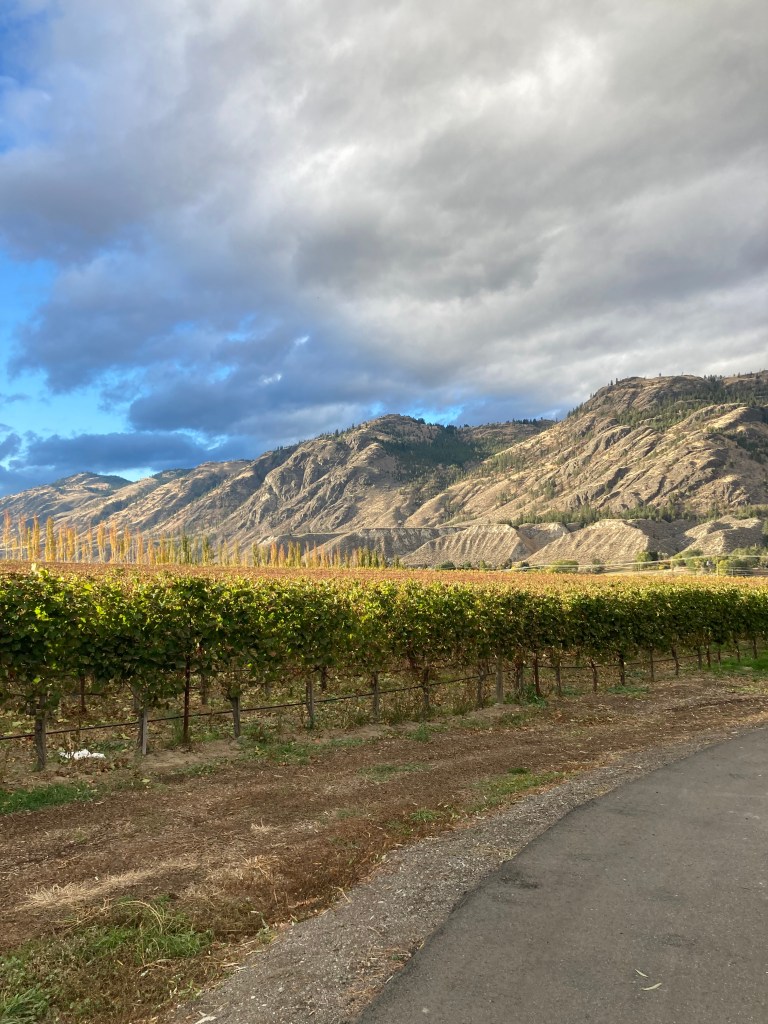
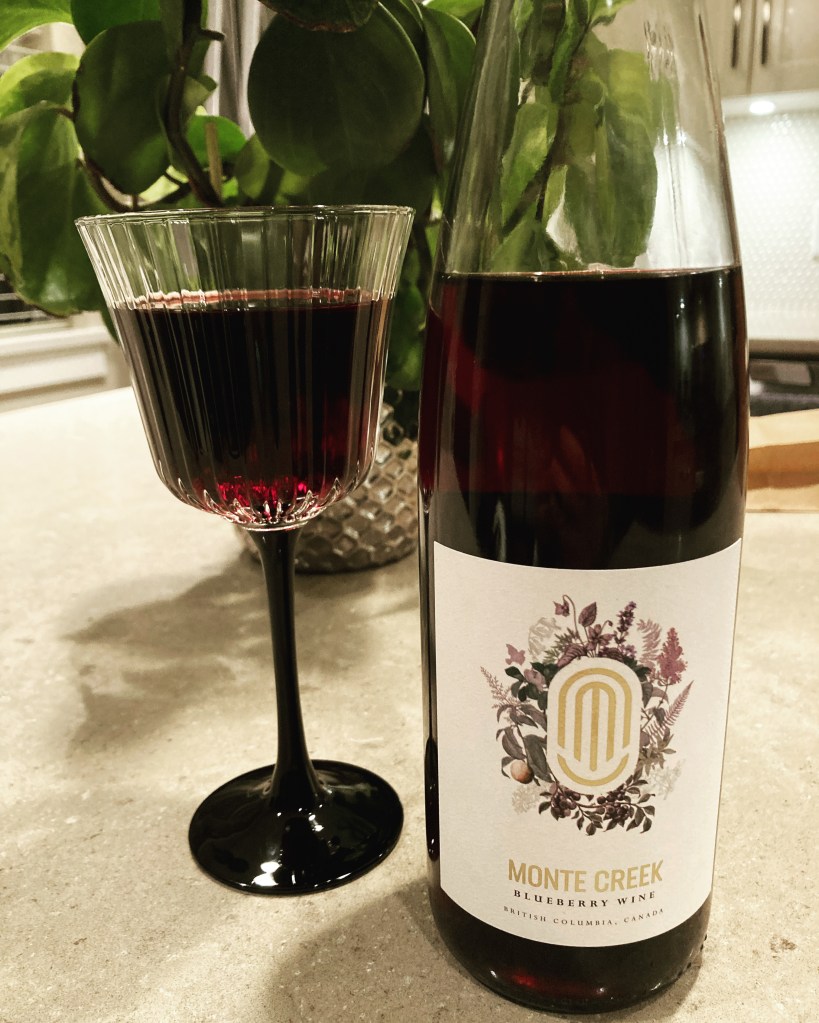
It was just a quick day trip to Kamloops. I walked in Riverside Park and explored the downtown hub. I was kind of reminded of Owen Sound, ON, if I was to compare the city to another (based on vibe). It’s known as Canada’s Tournament Capital – having an extensive history of hosting sporting events. It has a semi-arid landscape. And it has wineries and breweries to explore – I chose to visit Monte Creek winery for a wine tasting, which was lovely.
If I were to return to the Kamloops area I would love to hike among their hoodoos. I’d also like to visit the BC Wildlife Park (closed when I was there). As well as Kamloops Lake Viewpoint and maybe Sun Peaks Village (mountain resort with shops, hiking, etc.).
Vernon
Heading south from Salmon Arm, there were two main stops that I made in Vernon.
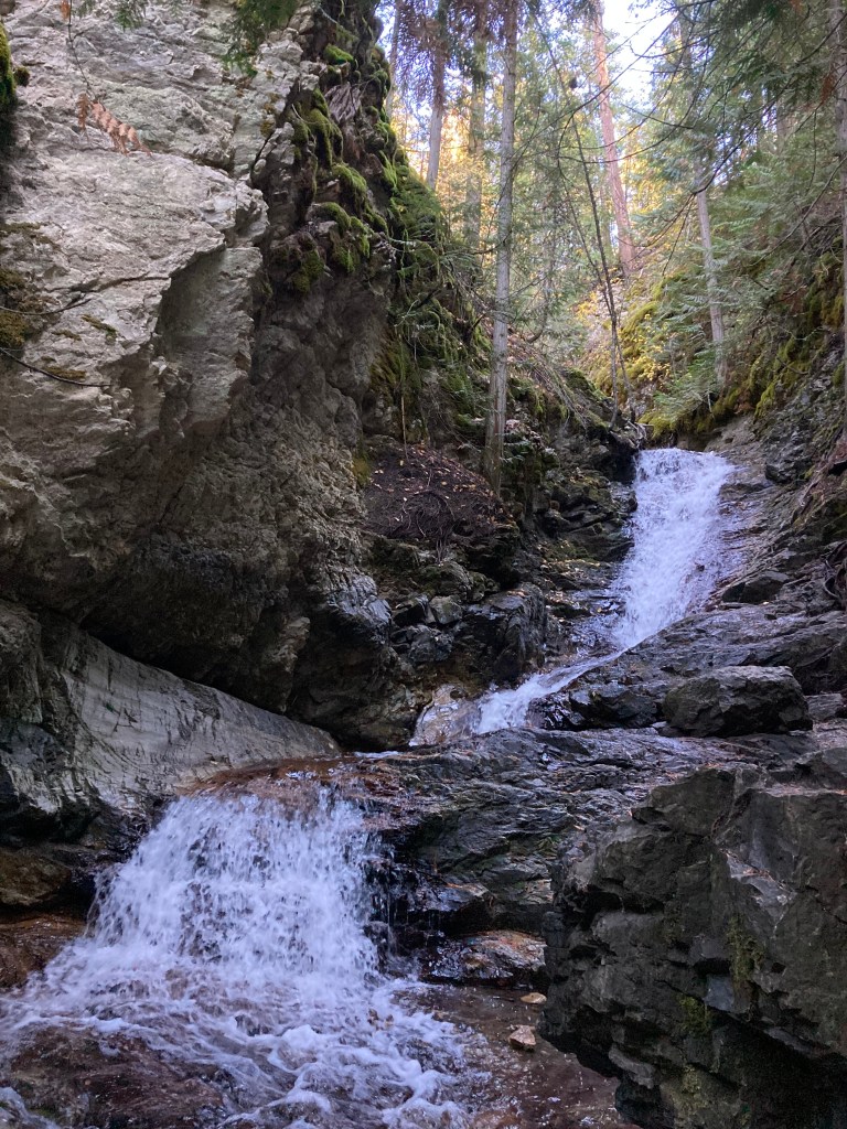
First, was a little hiking trail at BX Falls. I parked at a little lot at the trailhead on Tillicum Road, which was just a short walk from the falls if you just want to see the falls without doing the whole trail. It was a nice, shaded trail along a creek. Pretty laid back, with a beautiful waterfall – great if you’re pressed for time or just want an easy outing.
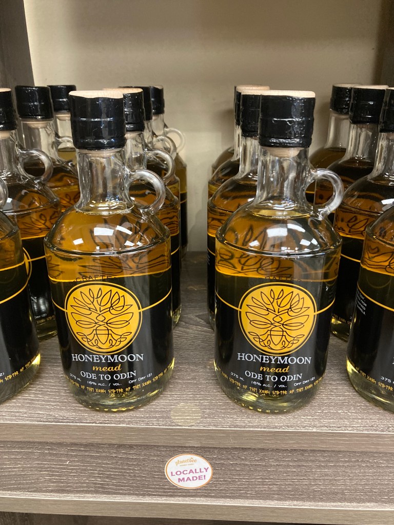
Then I headed to Planet Bee Honey Farm. I am a huge lover of bees and honey and beeswax (candles!) and farm stores, and this place did not disappoint. They had mead, salves, bath and body products… and a contained hive where you could watch the bees.
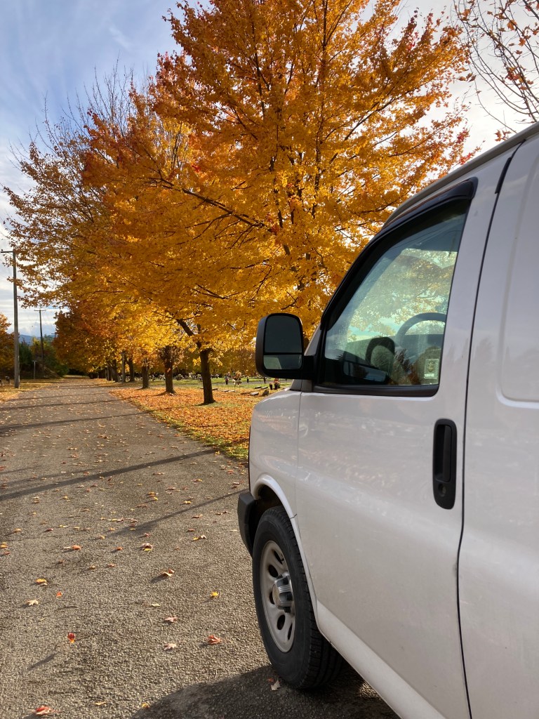
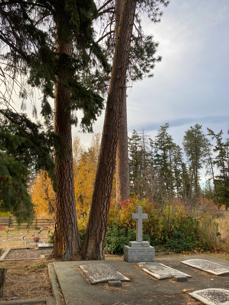
I was in this area around Halloween, too, and decided to go for a walk in a couple of cemeteries. To me Halloween is not just a day of costumes and candy and horror movies, it is a time of remembering the dead, mine included. And there is something about cemeteries that brings a sense of proximity and peace for me, if also sombre. I am something of a graveyard wanderer – I love to see the designs and symbols on old tombstones and tombs, indicative of aesthetic and beliefs from various historical periods.
Next time I’m in the area I’d love to visit Dave’s Goat Walk and the Log Barn 1912, about midway between Salmon Arm and Vernon. Canadian Opals is the only Canadian opal mine where you can pay to dig yourself, located a little outside of Vernon. There is also O’Keefe Ranch, a heritage site. And I’d probably look up the main downtown hub and things to do around Kalamalka Lake.
Lake Country
About midway between Vernon and Kelowna in the Okanagan Valley is Lake Country, which lies among Okanagan/Wood/Kalamalka Lakes. I was invited to spend some time here at a friend’s, getting to slow down and reconnect. That’s one of the great perks of being on the road – getting to see people who usually live far away from you!
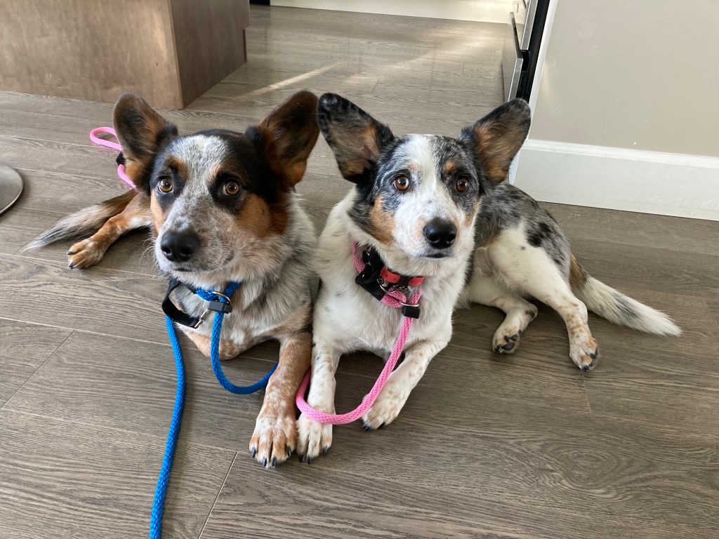
I got to do a couple of runs in the neighbourhood (amid hills, lakes, and vineyards), catch up on laundry, and relax. My friend also took me to a hiking spot that overlooks the valley and lakes (Spion Kop trail to 4 Lakes Lookout), which her and her partner and two pups frequent.
I celebrated Halloween here. I made mulled apple cider on the stove. We gave out candy. Then we walked the dogs while taking in the neighbourhood decorations, and watched a movie.
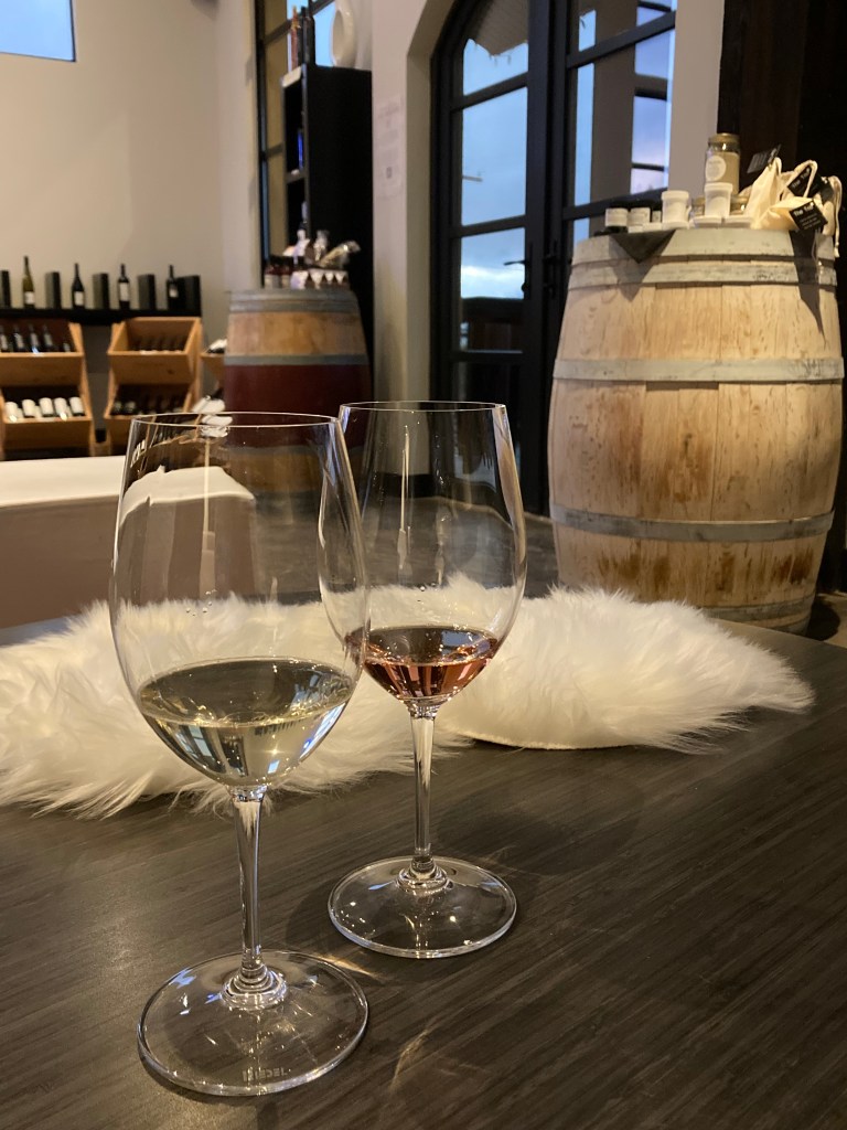
My friend took me to a few local wineries to do wine tastings. This included Gray Monk (classy), Arrowleaf (small, chill, simple, funny server), and Ex Nihilo (nice, accommodating, resident dog). I’m not as big on wine as I am on beer, but with my passion for sampling beer – wine tasting feels quite similar. So I absolutely still nerded out. Plus, the Okanagan is one of the best places for wine in Canada, so it would be a disservice to pass through and not indulge in something the area is known for (in my opinion).
A lady at one of the wineries described BC as God’s country. I had to look this up, and apparently the term refers to untouched or astounding nature. Which, you do wonder about the culture of the places you’re visiting, and I did wonder initially if god’s country was a nod to religion. As another cheeky friend of mine said – which god?
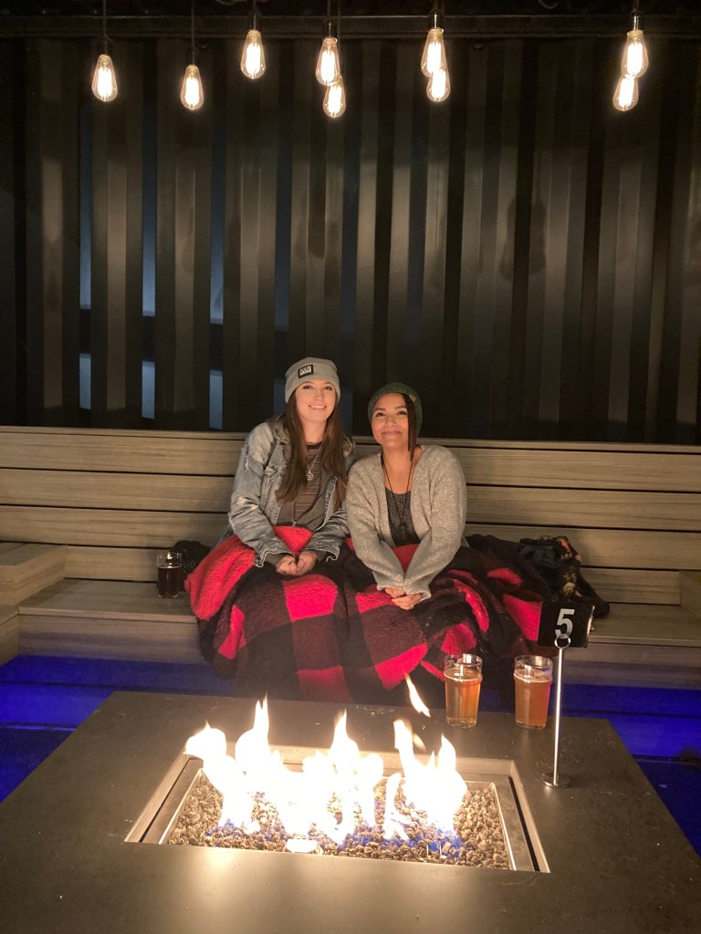
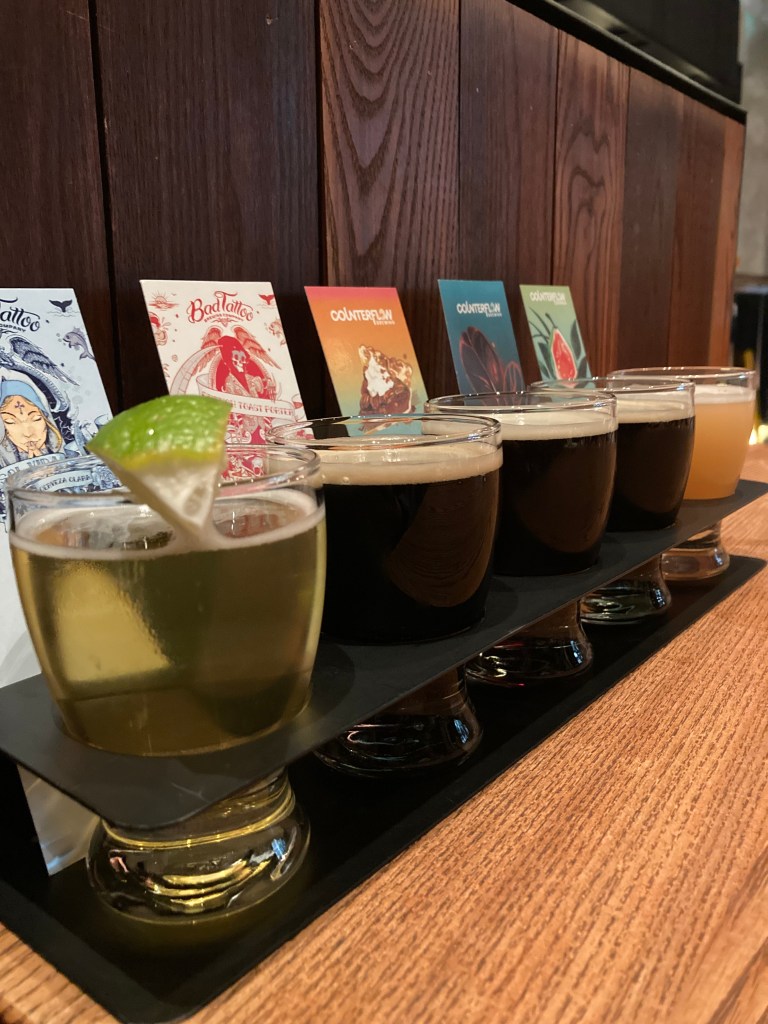
We also went in to Kelowna on my last night to check out a couple of breweries. First was Red Bird, where we sat outside around a fire with a blanket and listened to the live band that way playing indoors. This was when I had the revelation that it’s not just Alberta that has a lot of country music fans (I suppose I’d never really thought about BC’s relation to cowboy culture). We then headed to Bad Tattoo Brewing (now closed), where I enjoyed a flight, including a yummy pecan pie beer and a coffee lager.
It was in Lake Country that I saw my first big snow fall of the year (ominous weather foreshadowing).
But my favourite part of being in Lake Country was the chats, catching up, and time spent with my dear friend.
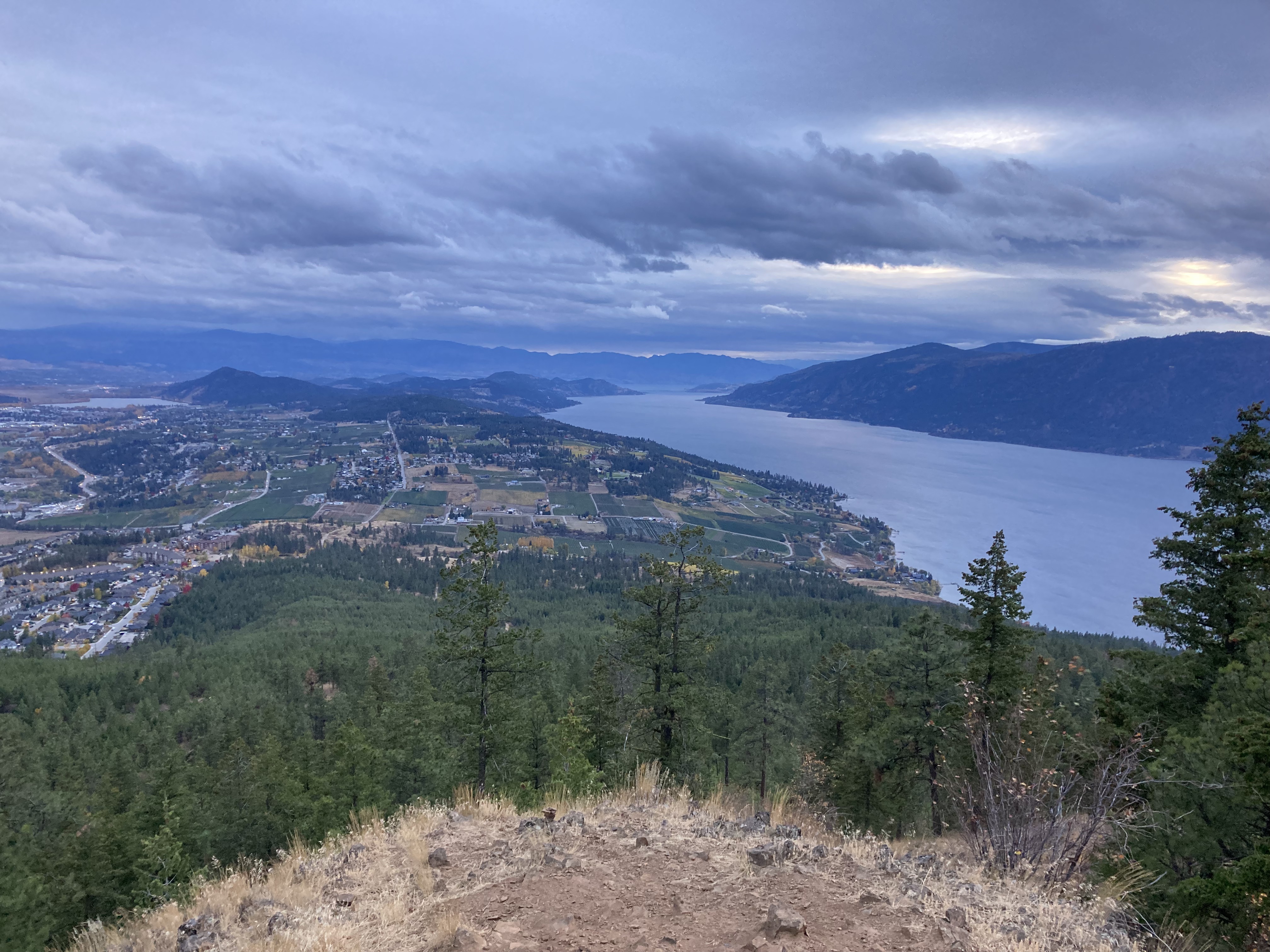
Kelowna
I hit the road again on a late afternoon in early November. I learned the hard way that the risk for poor/winter weather is too great for my liking at this time of year in the mountains/ BC interior. While I am the type of person who would rather spend more time somewhere in order to experience it fully, instead of rush to the next destination or keep to a schedule – at this point I was more on a mission to get to the coast. So I only spent the afternoon in Kelowna, stopping in to the visitor centre, walking along the waterfront on the edge of Okanagan Lake (Kerry Park, City Park), and through a portion of the downtown streets.
Obviously Kelowna has a lot more to offer, with provincial parks, beaches, vineyards, orchards, and mountains. Some standouts that I would like to come back to are Myra Canyon (trestles), Paul’s Tomb trail/Knox Mountain Park, Mount Boucherie, Bear Creek PP, beaches, Quail’s Gate winery, Mission Hill winery (Canada’s winery of the year on many occasions), The Hatch winery (looks like a truly unique and creative experience), Frind winery (located on a beach!), Jackknife Brewing (punk/metal?!), Kangaroo Creek Farm, and Kelowna Farmers & Craft Market.
South of Kelowna, approaching Penticton, is Naramata Bench, a scenic area with many acclaimed wineries.
Osoyoos
Other than my stop in to Nk’Mip (pronounced Inka Meep) Cellars Winery in Osoyoos, the next couple of days were among my least favourite on the road.
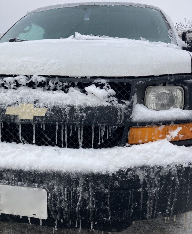
The overnight following Kelowna brought a decent accumulation of snow. I’d stayed at a Walmart and in the morning I was clearing off the windshield and van roof. The snow was still coming down and it was early enough that the city hadn’t been able to do much snow removal or safety precautions on the roads (plowing, salt/dirt).
I was no stranger to cold nights in the van. But BC was a wet cold, which is much worse than Alberta’s dry cold. I’m pretty good at powering through discomfort though, and I kept telling myself that it would be warmer near Vancouver.
I took Highway 97 south. I can’t remember why I headed south rather than west from Kelowna. I want to say there might have been an obstruction on the highway at the time, but it is also possible that I simply wanted to see Osoyoos. Being a desert-like semi-arid environment, Osoyoos is the kind of place that calls to me. The joke was on me though as everything was covered in snow. I’ll just have to go back sometime.
The roads were fairly atrocious out of Kelowna and through Penticton. They got better later in the day when the plows finally came through. But there was very poor visibility, so I didn’t get to take in views as I drove or do much in the towns.
Lucky for me, despite the weather, Nk’Mip Cellars Winery was still open and offering wine tastings (I was the only one there, but they were nice enough to indulge me). Nk’Mip is the first indigenous owned winery in North America. Located in the hottest and driest area of Canada. And it was so so lovely!
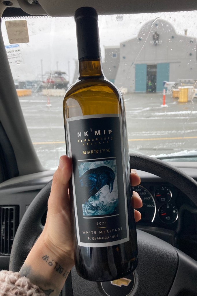
The gentleman who did my tasting was friendly but not overbearing and let me try an extra wine – which I ended up buying (best wine I have ever had). I thought I wouldn’t like a dry wine, but it was super refreshing, and would be lovely chilled on a hot day. It was the 2021 Mer’r’iym White Meritage, considered a white Bordeaux. My host gave me a lot of wine facts, which I appreciated. I don’t think my palette is very distinguished (yet), but I enjoyed learning and sampling.
Following this bright spot within the 48 hours of hell… it was time to sort out where I would overnight in Osoyoos. There was a fantastic looking crown land area that I found – but that was out of the question due to the snowfall. I had even tested the track going into this spot, which was up an incline (covered in snow), and it wasn’t long before I lost traction. Luckily I didn’t get stuck. But I should have known better than to even try. This turned into a great teaching moment, which hammered home the importance of knowing your vehicle’s limits, keeping an eye on weather, and not risking being in a remote overland location if the forecast is calling for snow (you might not be able to get out), or even lots of rain (depending on the terrain, for example areas prone to mud/mudslides). The roads were bad enough, with snow and black ice. I saw a few vehicles stuck/ in a ditch off the road the next day. My mantra for such situations became: don’t be an idiot.
I was down to my last resort – street parking. So I drove around town, which felt a bit like a ghost town in these winter conditions, until I settled on a spot.
At this point in my vanlife experience, I was still new to stealth “city” parking. I would check local parking restrictions/bylaws/signage, and avoid residential streets. Had I been referencing iOverlander I might have come across more crowd-sourced options. But I was left to my own devices, fending for myself the old school way. I was grateful that my van was not immediately identifiable as a campervan (save the MaxxFan, but I like to think not everyone knows what that is). While there are definitely times that I wish I had a more alluring exterior to my van – roof rack, ladder to the roof, permanently affixed solar panels, extra carriers for various items like bikes or gas… this is why I kept my van super plain – to keep my stealth factor up.
Shoutout to towns who are not insanely strict with their parking and signage – I did not get a knock overnight.
I left this spot before sunrise, basked in the glory that is my van’s heating system (fun fact: a van’s heat, and especially the recirculation air setting, takes moisture out of the air – which helps in humid environments). It was -8C with the windchill. I headed to the Osoyoos visitor centre before starting my trek west – back on Highway 3 / Crowsnest Highway.
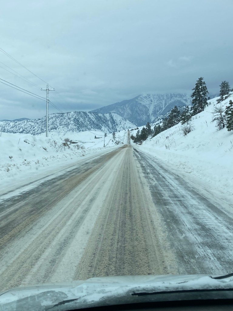
I spent three hours white knuckling it through mountain passes to get to Abbotsford. Most of the highway had snow buildup on it. There were areas where I got caught in a lineup behind other cars and transport trucks that were sliding around. I was super cautious and tense. And I can’t tell you how relieving it was to come out of the mountains near Abbotsford. It was like the sun came out as soon as I got there, the roads became clear and dry, and the temperature was much warmer. It was like I’d entered another world! I was so happy.
Next time I visit Osoyoos I definitely want to experience it in warmer weather and take in as much of that desert-like landscape as I can. I’d really love to check out the Osoyoos Desert Centre, Anarchist Mountain Lookout, Spotted Lake, and Moon Curser Vineyards.
Abbotsford Area
I didn’t really do anything in Abbotsford, but I did stay in the Mission area (about 15 minutes north) for a few days. It just happened to be one of those convenient areas with a good overnight spot and daytime spot.
You could see the mountains all around the area, and I figured the hiking could be good, although I knew the season had passed, and I had no desire to venture into the mountains again after just escaping. I was more focused on what was ahead – namely Vancouver and the island.

I did visit Matsqui Park (along Fraser River in Mission), Lepp Farm Market (show me a farm market and I will probably go there), and Keeping Road – which some have called the most haunted road in Canada…


For the future I would love to visit Maan Farms & Winery – I came across their pumpkin spice wine recently in Ontario and when I looked them up I was in awe of their autumn set up – sooo many pumpkins and Halloween events! Also, I think Lakeland Flowers could be a lovely place to visit. And of course if I was in the area I would look into hiking, breweries, and best wineries in Fraser Valley.
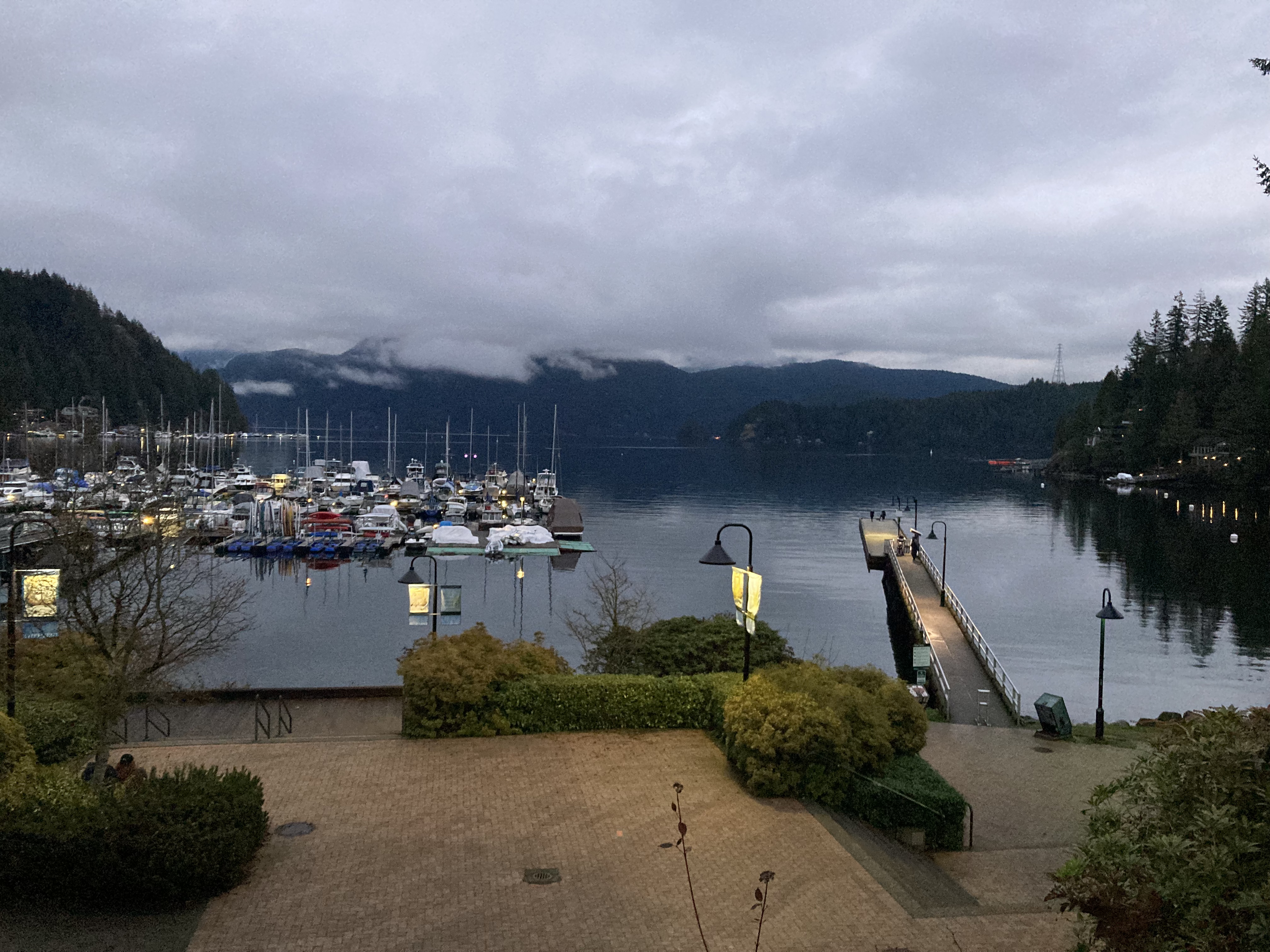
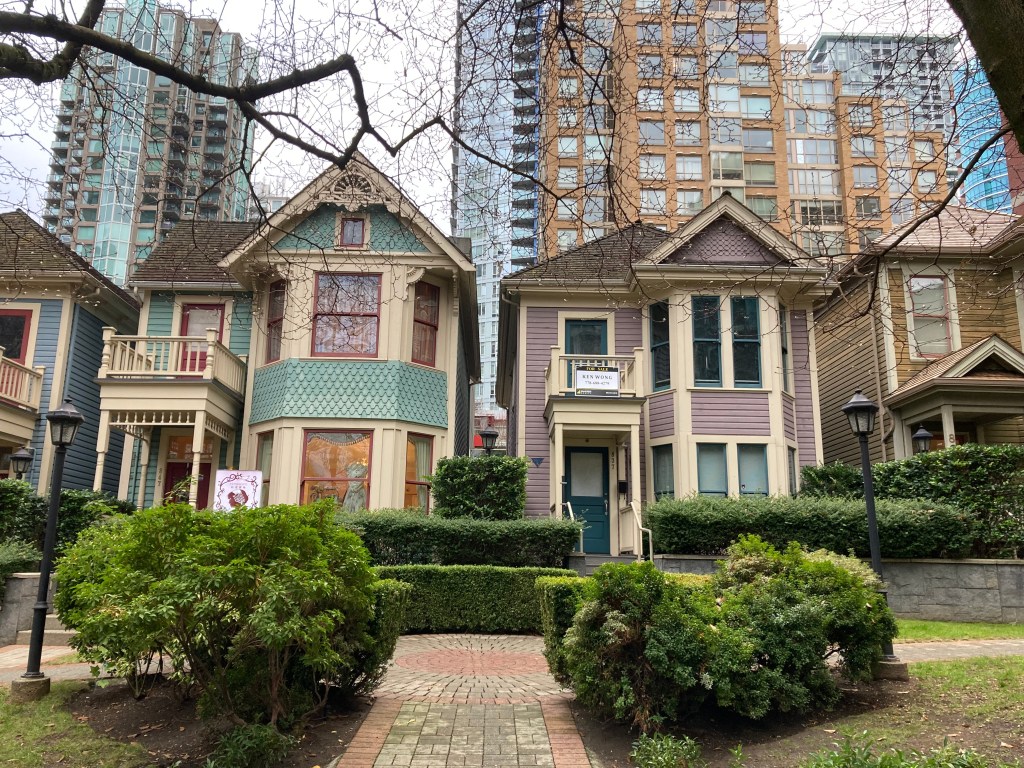
Vancouver Area Part 1
The City
I made it! My first time in Vancouver!
The only time I’d been in BC before this adventure was as a kid on a family trip. We went to Vancouver Island and spent most of our time near Victoria. So I’d never been in mainland BC or to Vancouver City.
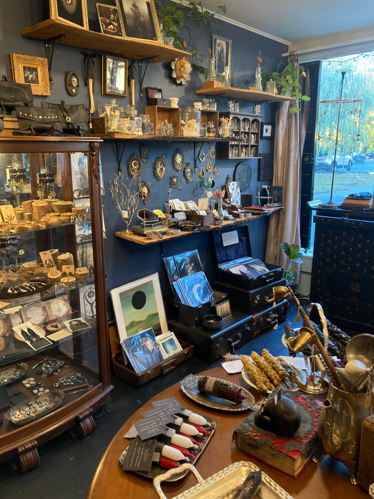
I drove into the city to meet up with an old high school friend. We walked along Commercial Drive in East Vancouver and then I checked out the shop Raven’s Veil, which I’d been wanting to visit for a long time, and was a treat!
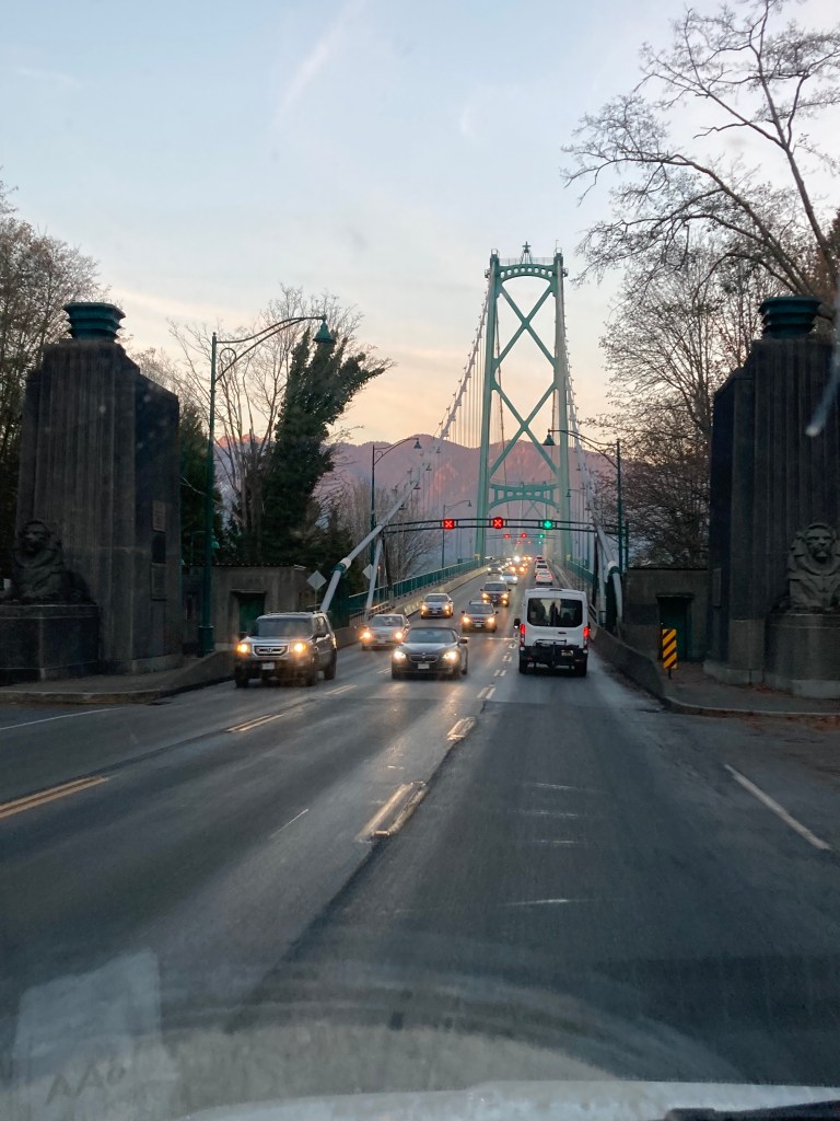
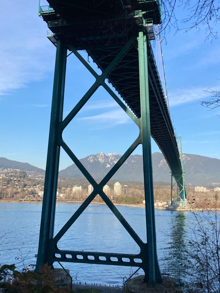
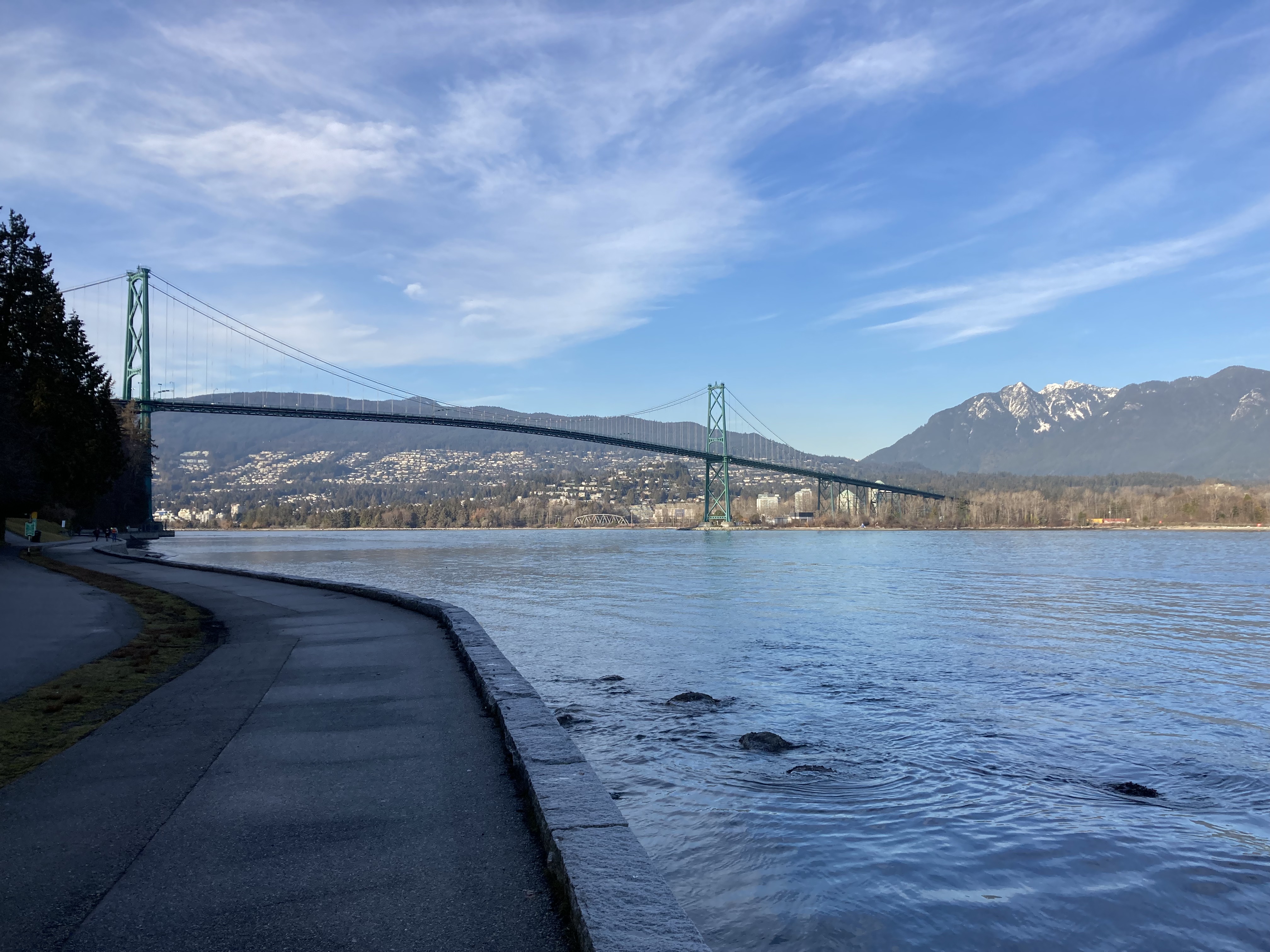
I then found an overnight spot in North Vancouver, which was a street near Capilano Mall that had a bunch of RVs and other vans lining it. I drove through downtown, through Stanley Park, and over the Lions Gate Bridge, then settled in for the night.
Sea to Sky Highway
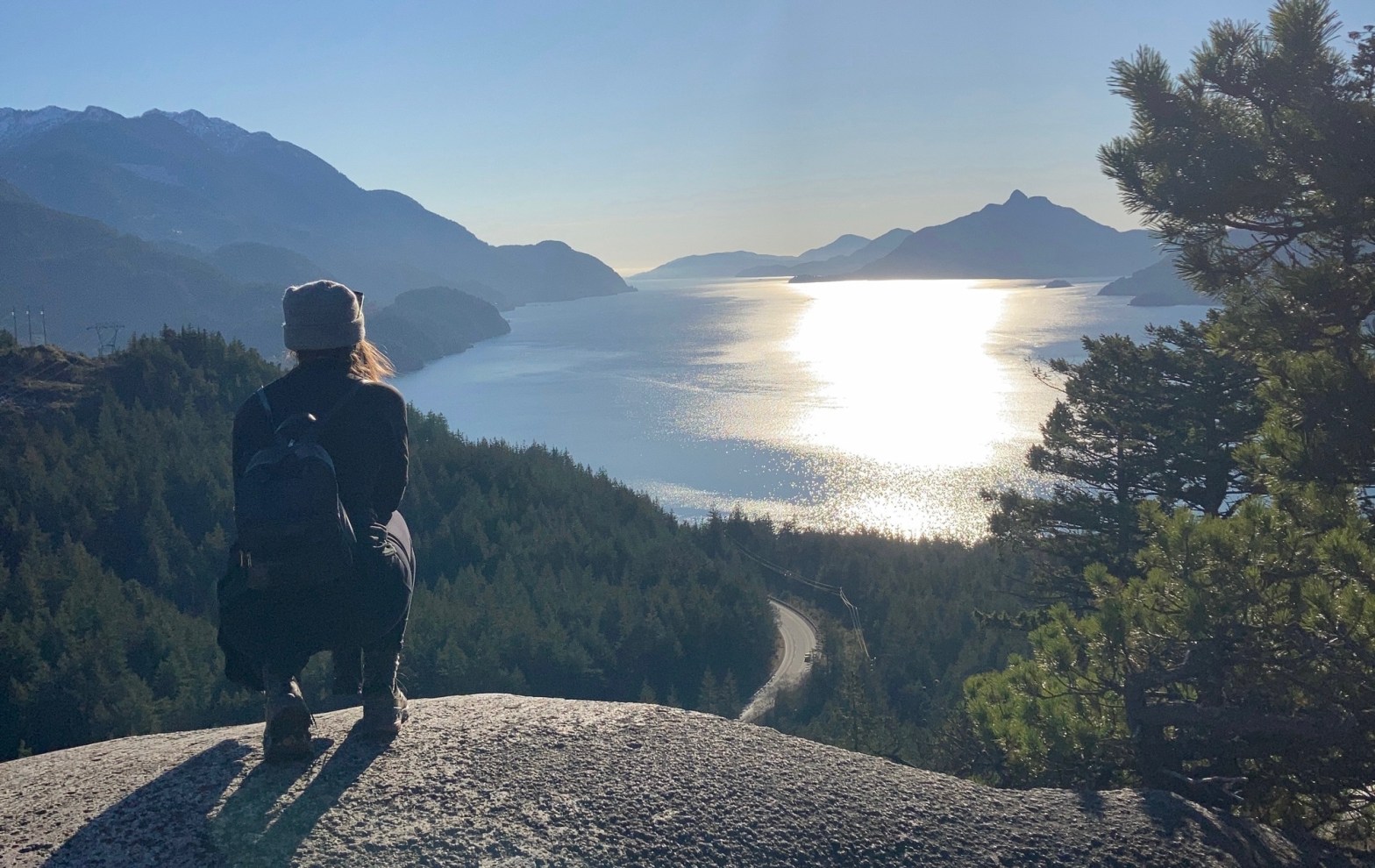
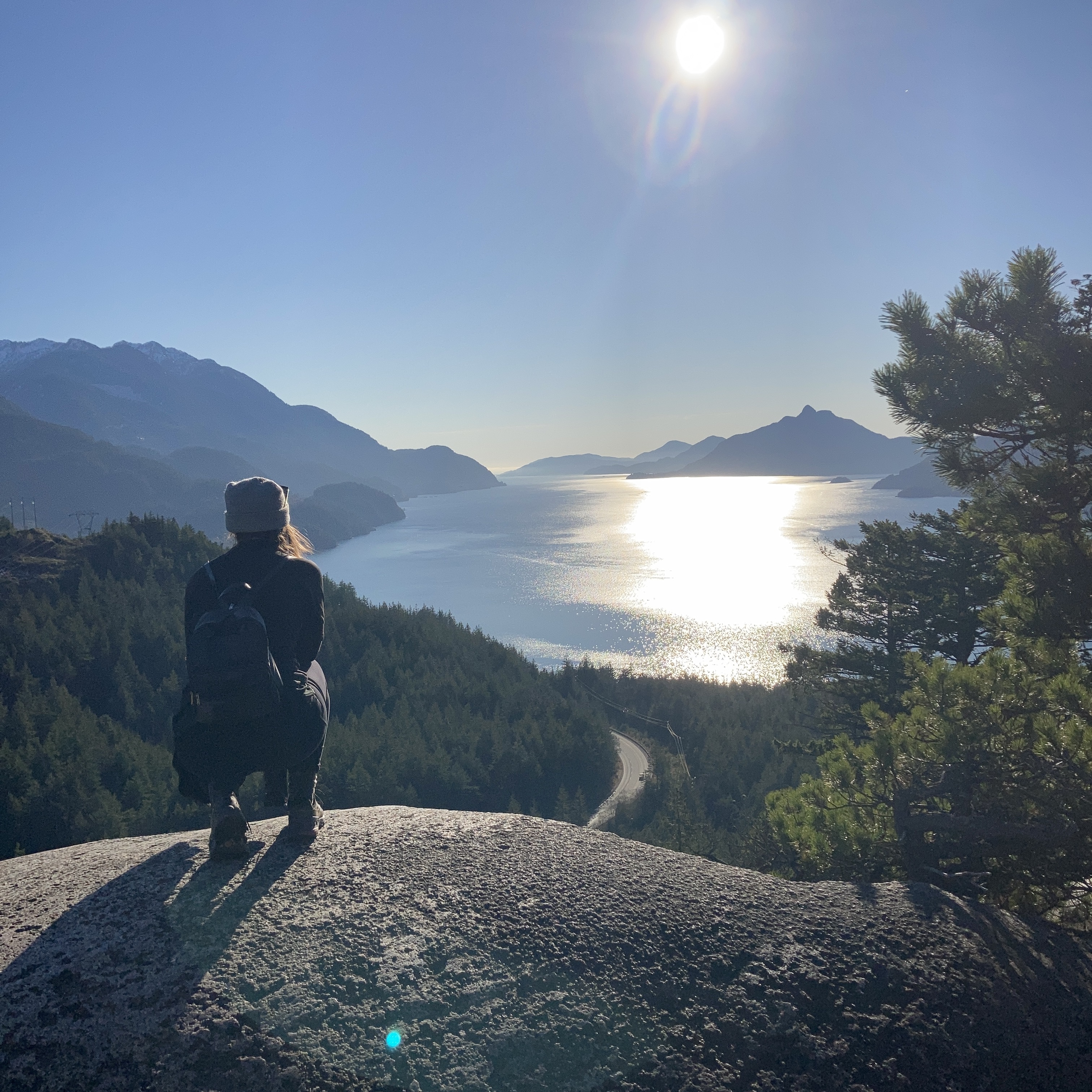
A deeper exploration of Vancouver City would come later. The next morning I headed up Highway 99, the Sea To Sky Highway, which runs 160km from Vancouver to Pemberton via Squamish and Whistler. There are many destinations to check out along the way as you drive along Howe Sound into the Coast Mountains.
I suppose I did just say that I was avoiding going back into the mountains… but the Sea to Sky felt like something I just couldn’t pass up.
On my way to Squamish I did the loop hike in Murrin Provincial Park. It was a great day for it and it was nice to get back into the forest. I followed this up with a stop at Shannon Falls, which was beautiful.

Spots I’ll be adding to my list of places to visit next time I’m on the Sea to Sky include (south to north) Tunnel Bluffs hike (maybe), the Sea to Sky Gondola (maybe), *hiking Stawamus Chief peaks, hiking to Garibaldi Lake (my preference would be to go to *Panorama Ridge as a day hike for what look like the best views of the lake from above, though it is a long slog at 28km and 1,623m elevation gain – an alternative would be to hike to Garibaldi Lake and stay at the campground then hike to Panorama Ridge the next day); and taking in *Brandywine Falls.
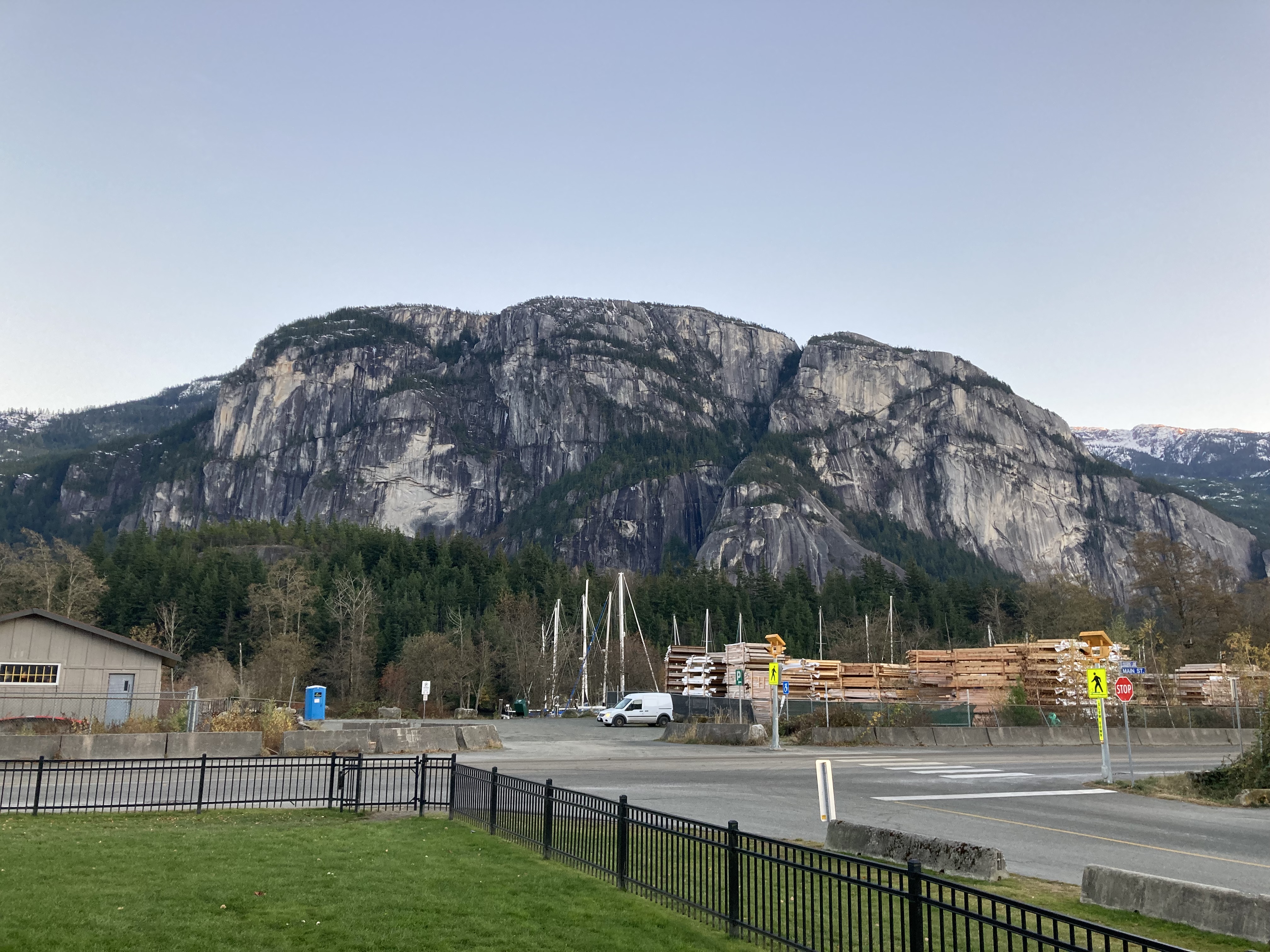
Squamish
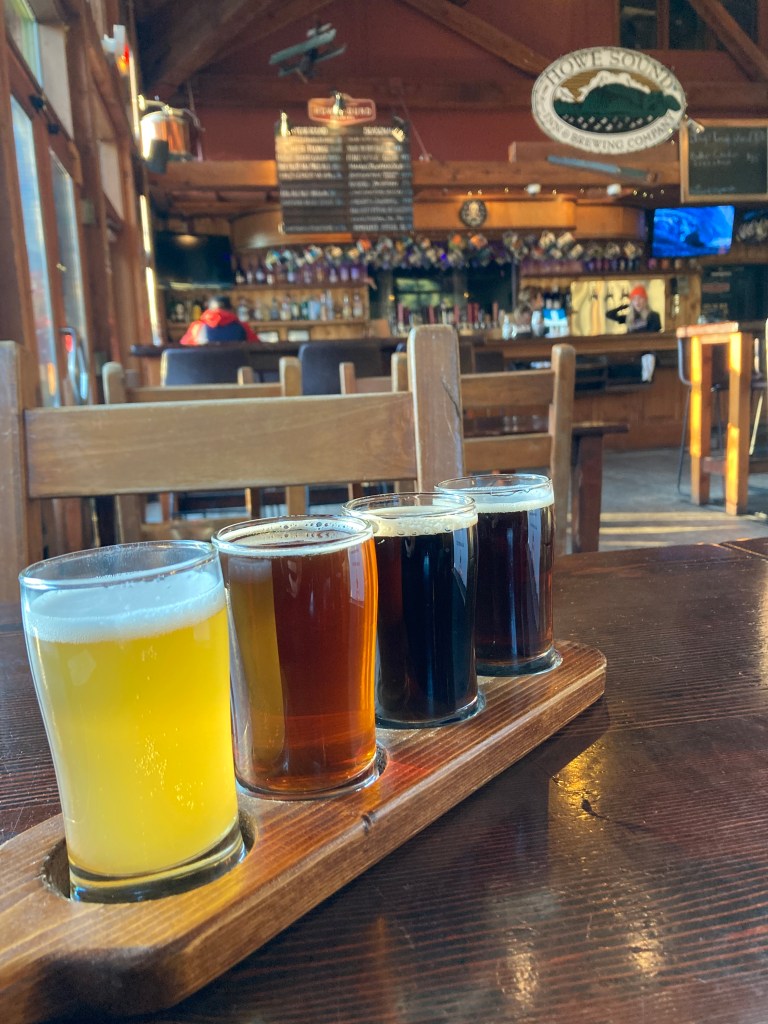
After Shannon Falls I headed to downtown Squamish (it’s truly amazing how much you can see and do in one day!). I walked along the main street, Cleveland Avenue, exploring various lovely shops, and taking in the views of Stawamus Chief. I then stopped in for a flight at Howe Sound Brewing.
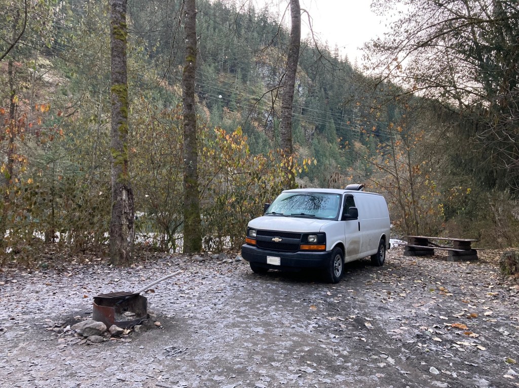
My overnight spot was a little out of the way, on account of learning that a certain portion of Squamish (including the Walmart) had a new bylaw that prohibited sleeping in vehicles. I found a recreation site on Squamish River and made my way there. It was a bit eerie arriving after dark, and it seemed a little messy in some sites (giving the impression that some homeless stayed here), but I had no issues. The reviews on Free Campsites speak to mice getting into vehicles, but I had no issue with this either – perhaps because it was the off season and not as many people were there/ attracting mice, and my food storage was good. I woke up to a frigid morning and took a walk along the river, with mountain views, frozen water, and frosted leaves. There were wild salmon and bald eagles flying overhead – not surprising as Brackendale, north of Squamish, is dubbed the eagle capital of the world.
I actually did chance sleeping at the Squamish Walmart the next night. I can’t remember why, but probably because I saw plenty of other RVs and vans there, and I didn’t want to do the long drive to the Squamish River site again. I ended up sleeping two nights here without issue.
I also visited the Squamish Adventure Centre, which had a gift shop and cute little coffee shop. Apparently Squamish is the “adventure capital of Canada”. And I have to say, I quite enjoyed Squamish. You know when you just have a feeling about a place – you are either drawn to it or not? Well, Squamish is a place I would look forward to visiting again.
Somehow I came across info on Duffy Lake Road, an extension of Highway 99 from Pemberton to Lillooet, with the option of continuing on to complete a loop called the Coast Mountain Circle Tour, which extends from the Sea to Sky and loops through the mountains back to Vancouver, totalling about 700km. This would be a summer adventure for me, should I ever feel called. Gold rush towns do sound fascinating, like Lillooet and Cache Creek (with Hat Creek Ranch and an 1862 roadhouse). There is even a town named D’Arcy… Something to chew on. (Note to self: there is also something called Hell’s Gate on this loop… it’s the narrowest point of the cliffs on Fraser Canyon).
Finally, a fun fact. The Netflix show Virgin River filmed scenes near Squamish.
Whistler
Less than an hour north of Squamish on the Sea to Sky highway is Whistler, home to a ski resort and Olympic Park, having hosted events for the 2010 Winter Olympics.
I’m not big on winter sports, but it was neat to take the place in, and it can be fun to explore ski resort villages with their fancy shops. But boy – was it cold!
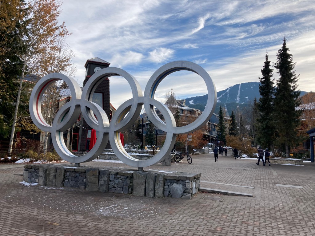
The best parts of my visit to the Whistler area happened on either side of exploring the ski village.
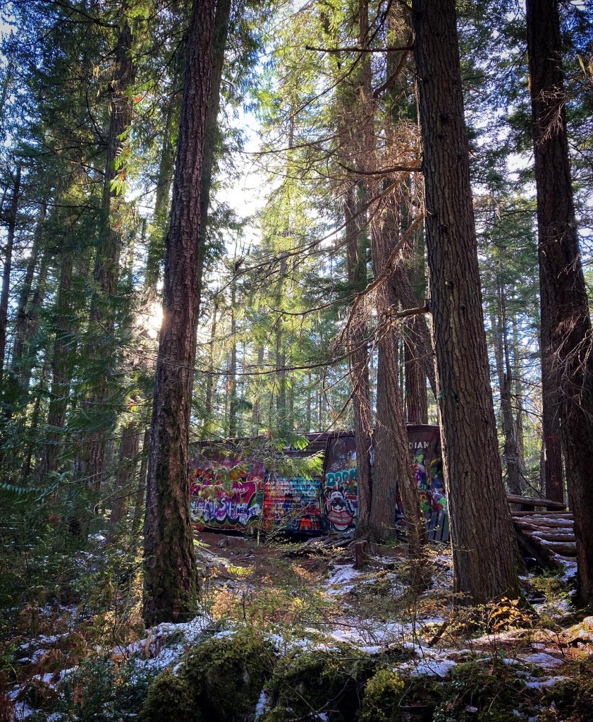
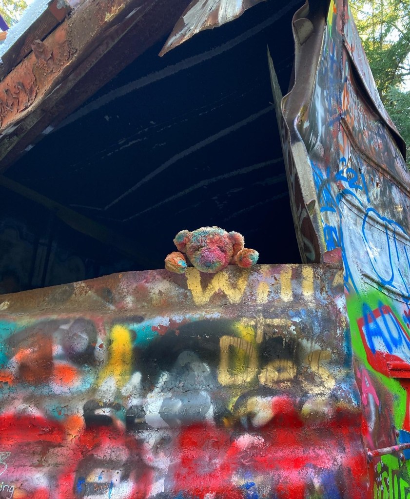
On the way there I hiked the Train Wreck trail. It’s an easy trail through the forest to the site of an old train wreck, where train cars are scattered, decorated in graffiti.
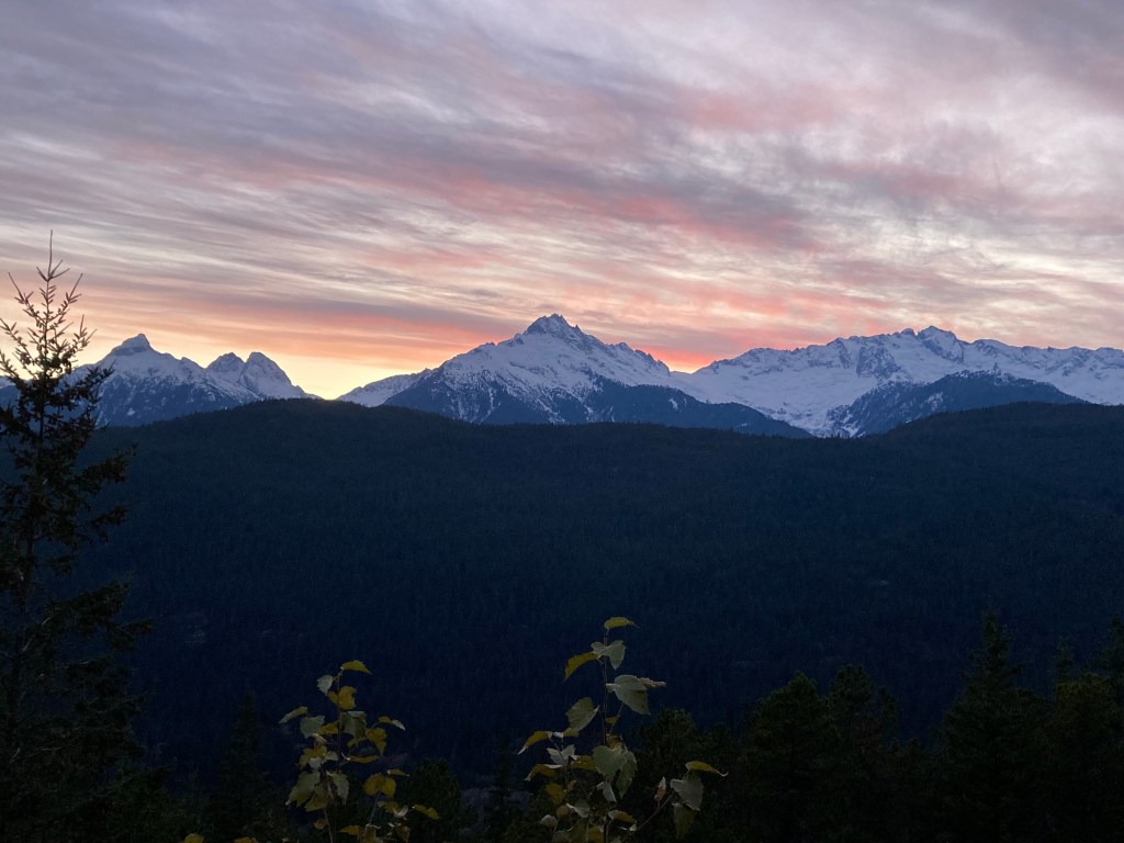
I ended my day at Whistler Brewing Co. (taking a case of their honey lager with me) before driving back towards Squamish for the night. On the way, I stopped at the Tantalus lookout, taking in Tantalus Range with its jagged snow-capped peaks at dusk.
I’d made note of Joffre Lakes being super blue and quite a popular spot (though it is northeast of Pemberton on Highway 99) – so I’m adding that hike to my list of future destinations.
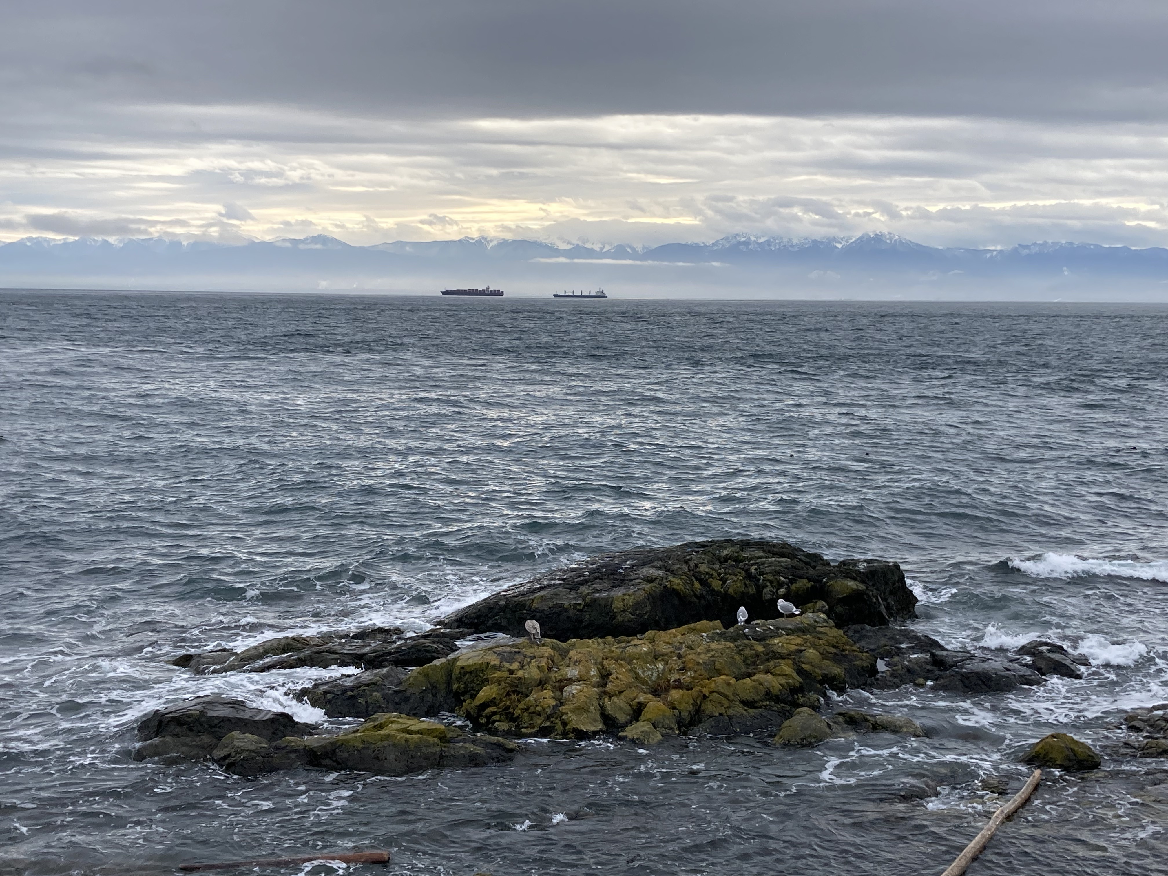
Vancouver Island
From Nanaimo to Tofino
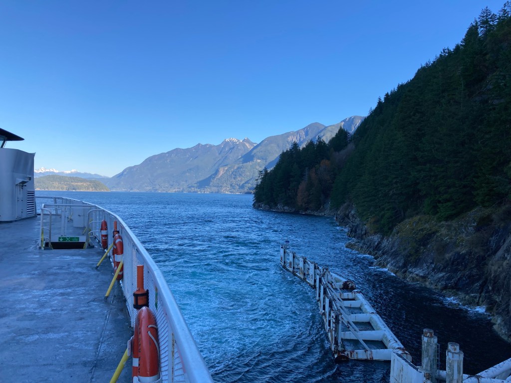
I got up early the next morning and drove south from Squamish to Horseshoe Bay to take the ferry to Nanaimo. I managed to squeeze on the 10:40am ferry and not have to wait till 1pm for the next one. Upon arrival in Nanaimo I found a park to stop at to do some planning (even if you have an overnight spot lined up, you never know if you’ll have service once you get there). I was going to drive north and west across Vancouver Island, heading to Tofino, with a few stops along the way.
I drove about an hour, and about 15 minutes before Port Alberni I stopped at a turnout for the night.
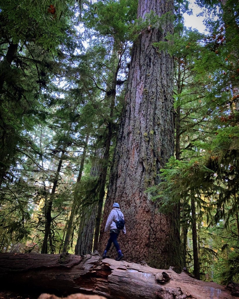
I was up early the next morning and headed straight to Cathedral Grove in MacMillan Provincial Park. I’d been here with my family as a kid, and by now you know I’m going to retrace those footsteps. The trees here make you feel humbled and small and peaceful. There are giant Douglas Firs, some around 800 years old. Why go to BC if not to be dwarved by the trees? And I was able to find the exact tree that we had taken pictures with last time. This is definitely a special place.
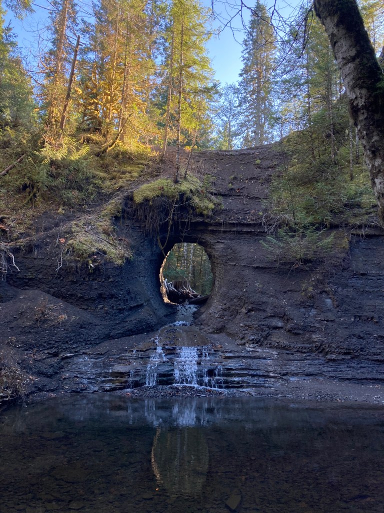
Next I went on a little hike to the Hole in the Wall (also just before Port Alberni). It was easy to get to, and being adventurous I decided to climb through the hole to see the other side. I could see this being a popular swimming hole in the summers.
I headed to Port Alberni, stopped in at a park, explored a little local shop, then spent the night at the Walmart. Port Alberni is located at the head of the Alberni Inlet and is know for Salmon fishing. I’ve also seen that crime can be high here, though I made a note that violent crime was usually between people who knew each other.
Days were getting noticeably shorter now, as it was mid-November, so I had less daylight to work with while visiting places. I’m certainly not a morning person, but I was waking up well before sunrise in order to maximize time and experience. I try to avoid driving after dark, so I was usually heading to my overnight spots as the sun went down. You really are on the sun’s schedule on the road – and I kind of like that.
Any future visits to the Port Alberni area, I might consider hiking to some waterfalls, like Qualicum Falls.
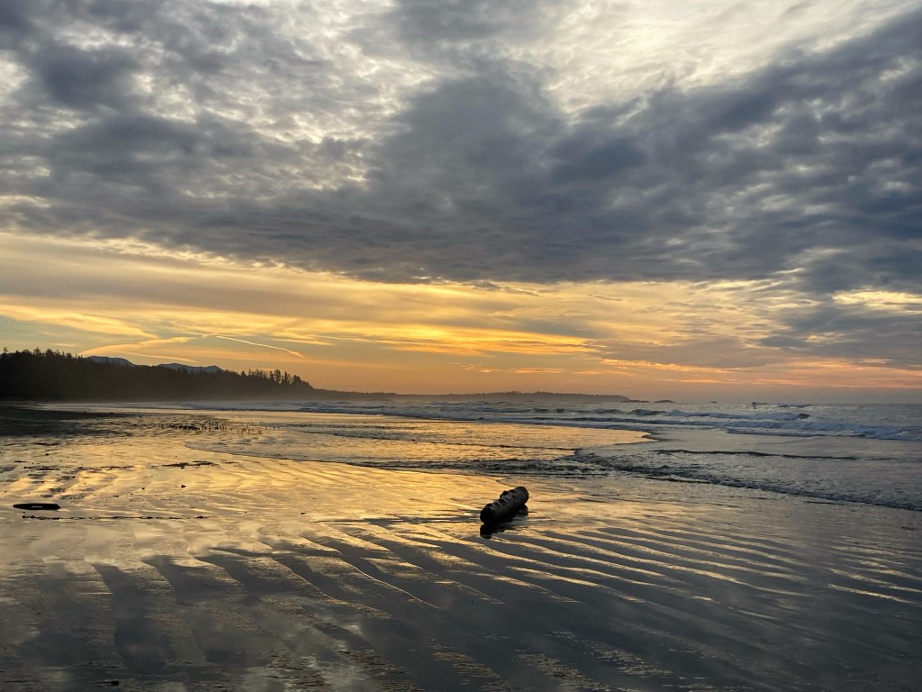
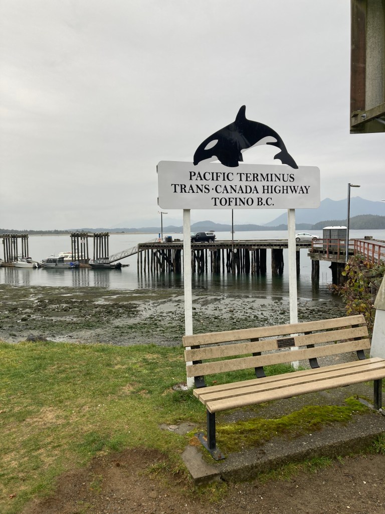
Ucluelet, Pacific Rim National Park, & Tofino
Next stop: Vancouver Island’s west coast – the Pacific Rim.
It takes about 1hr20mins from Port Alberni to the Pacific Rim Visitor Centre (for reference it’s 2.5hrs from Nanaimo and ~3.5hrs from Victoria), which sits at the intersection of Highway 4/ Pacific Rim Highway. You can either turn right here towards Tofino or left towards Ucluelet. It’s another half hour to Tofino, through Pacific Rim National Park Reserve. Or about 15 minutes to Ucluelet along the peninsula.
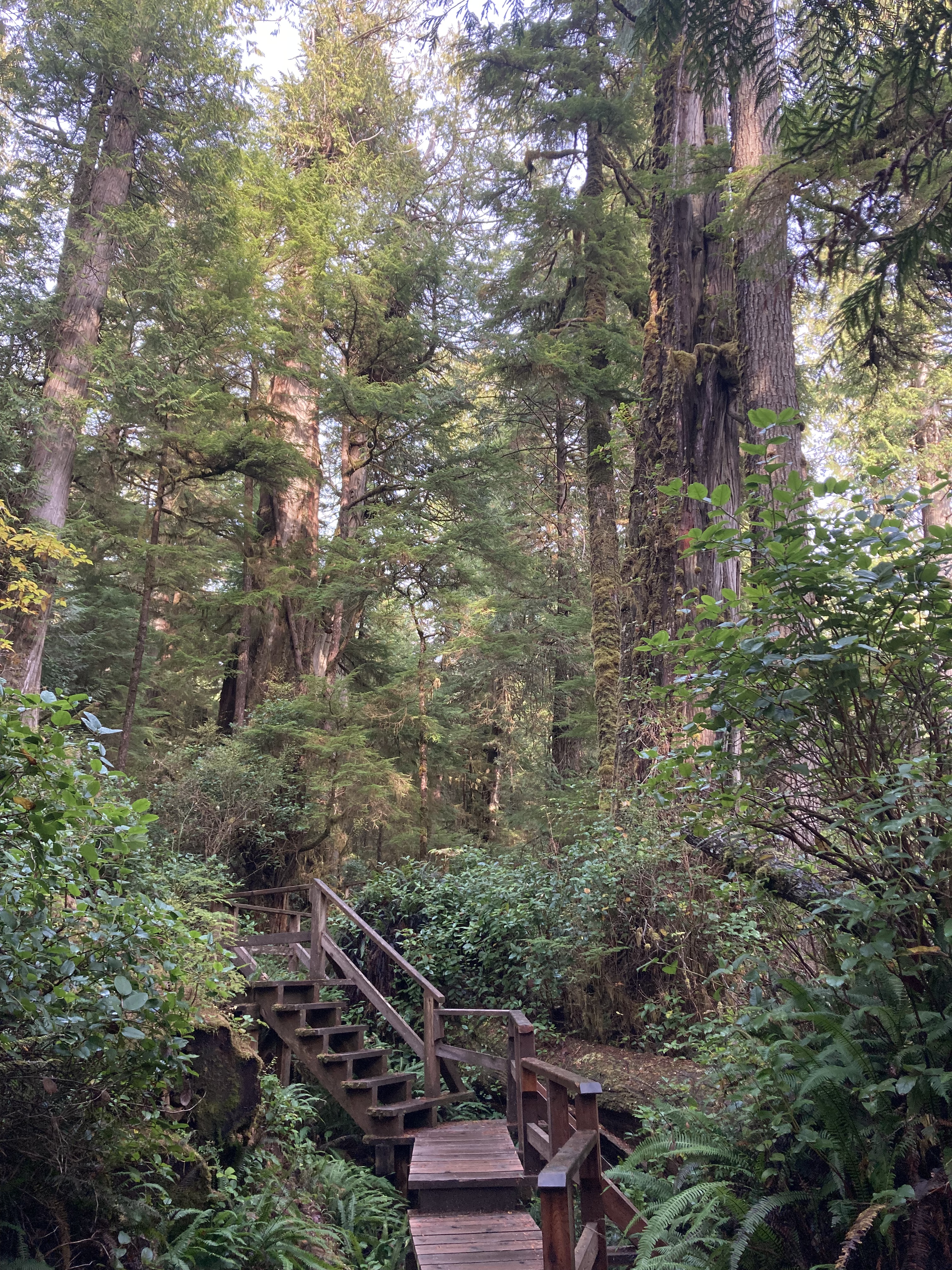
I got a serious amount of things done here on day one. First, I headed to Ucluelet and the Wild Pacific Trail, an 8km coastal trail near the end of the peninsula. I tackled the Lighthouse Loop (2.6km) that takes you along the shore right at the tip of the peninsula. Just being on the ocean and smelling the briny air made me so happy. I’ve always had a weird relationship to the concept of “home”. I’ve never felt like I had a hometown. I think sometimes we have to go out and find home. But there is something about the ocean that feels like home for me. Next I did the Ancient Cedars Loop (1km), which had some pretty big trees.
Then I headed into Pacific Rim NP Reserve and hiked the Rainforest Trail, which comprises two 1km loops, one on either side of the highway. There were sections of boardwalk that had a thin layer of ice – wood is already slippery when wet, so this was another level. But it was really lovely to witness these huge trees and the moss hanging from everything.
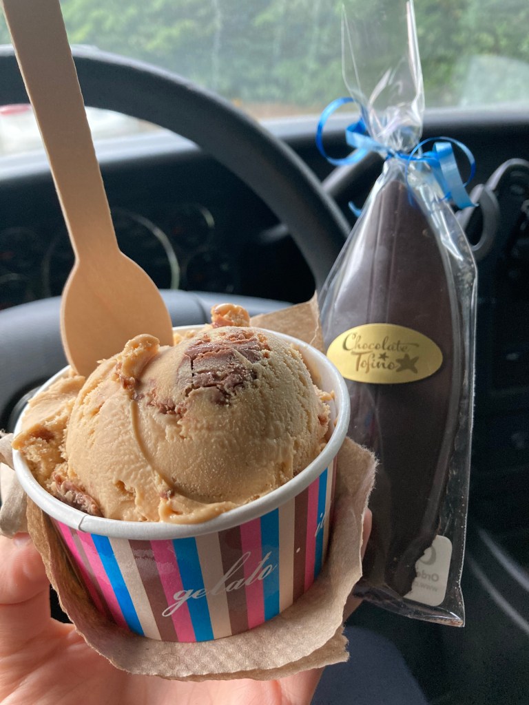
I stopped in to the Tofino visitor centre (note that there is a Tofino visitor centre and a Pacific Rim NP visitor centre). I find Visitor Centres can be a neat place for souvenirs. Followed by Chocolate Tofino – I’d heard good things about their Salted Caramel Gelato. While I’m not a big foodie, I do like to indulge in local claims to fame or whatever is seasonal or local that a region is known for. Chocolate Tofino is a cute little shop off the highway, part of a small hub of other shops, including the Tofitian Coffee House, a surf shop, a little grocer, and Tacofino – while I was on the west coast fresh fish tacos became a staple for me for sure!
And then the time came… for Tofino Brewing Company.
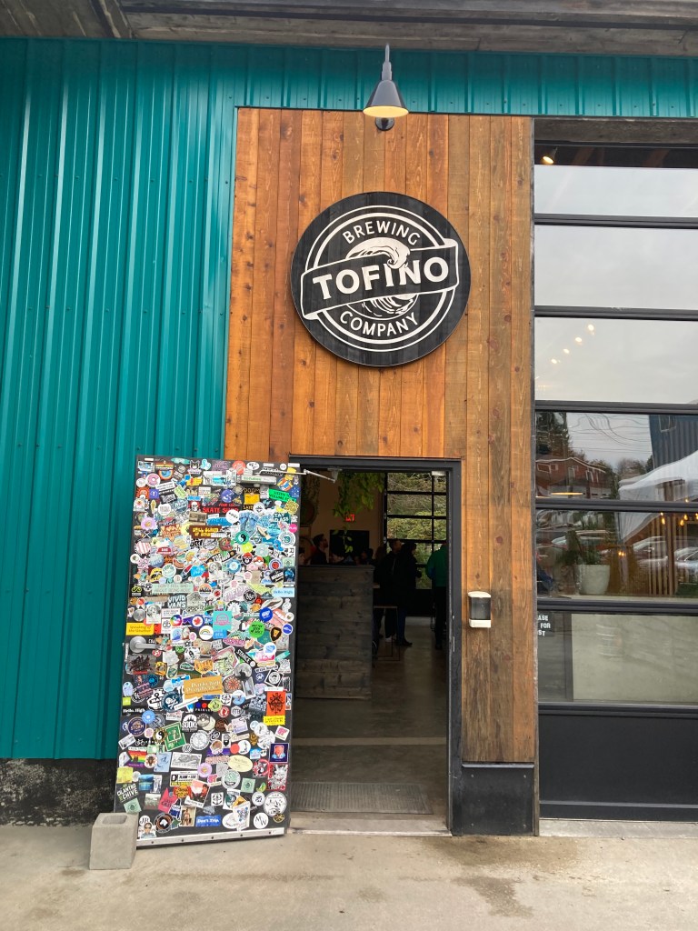
It was quite busy at the brewery. Standouts from Tofino Brewing Co. were the Kelp Stout and the Spruce Tree Ale!
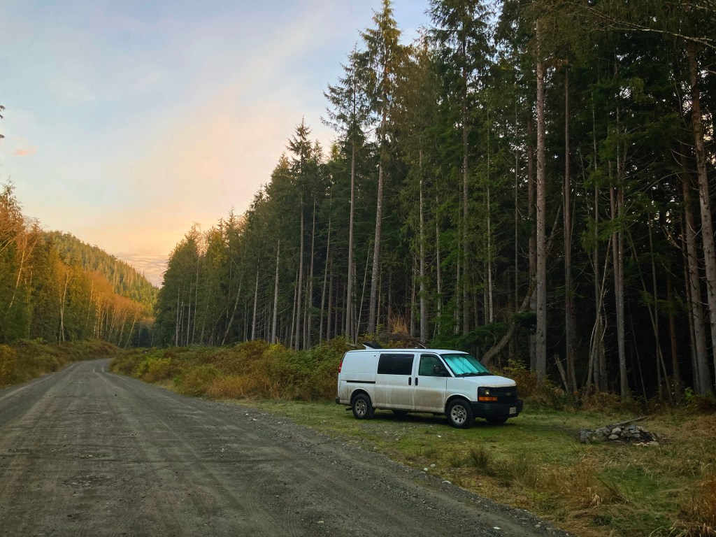
My overnight Tofino spot was a bit out of the way, and not in Tofino at all, but reliable. Being shoulder season, I didn’t have to worry about anyone else beating me here. It was crown land, down a dirt road, in the woods, off Highway 4.
Tofino prohibits overnight parking. As a small tourist destination, they try to limit vehicle congestion. I also understand the incentive to have campers, campervans, and RVs putting money into local campgrounds and accommodations. I did stay a night at one of the local campgrounds, but when you’re full time on the road it’s obviously economical to park for free much of the time. That said, there has been a crack down here on unauthorized / dispersed camping in the last few years – such as on this backroad near Kennedy Lake – due to illegal camping and people not packing out what they pack in. Crown Land camping is permitted – and hopefully will remain available – as long as people observe the regulations and know where that land is (it borders on national and provincial park lands).
I look at the above picture now, and think of how I have since learned that Vancouver Island has the highest concentration of mountain lions in North America. You could say I was blissfully ignorant of that fact at the time.
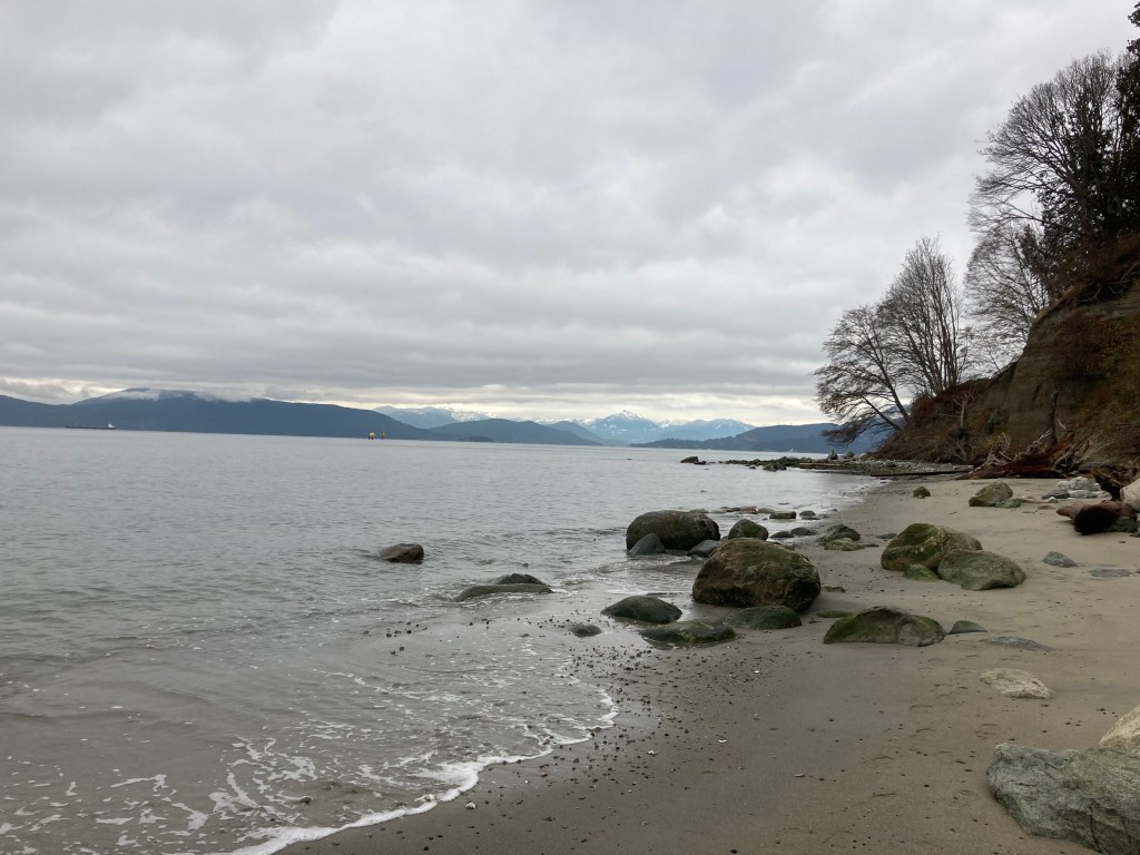
Over the next few days I checked out several of the beaches. I visited the 16km long Long Beach on several occasions, doing some long beach walks, taking in the waves, the sea shells, and Incinerator Rock.
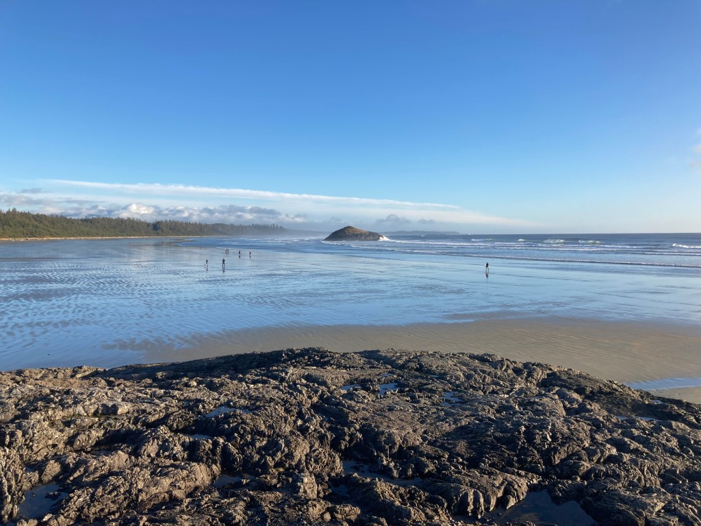
Cox Bay Beach was smaller, nice, had lots of surfers. Chesterman Beach had more views of the land forms visible from downtown, more dry fine sand, and felt more exposed and windy. Tonquin Park/Beach is accessible from town and has a five minute trail hike to the beach. It’s a lovely trail, small beach, with private houses bordering it. The rocks had luscious seaweed and anemone, loads of mussels and starfish visible at low tide… bright orange and purple ones, which made me so happy to see. For this reason Tonquin became a favourite spot.

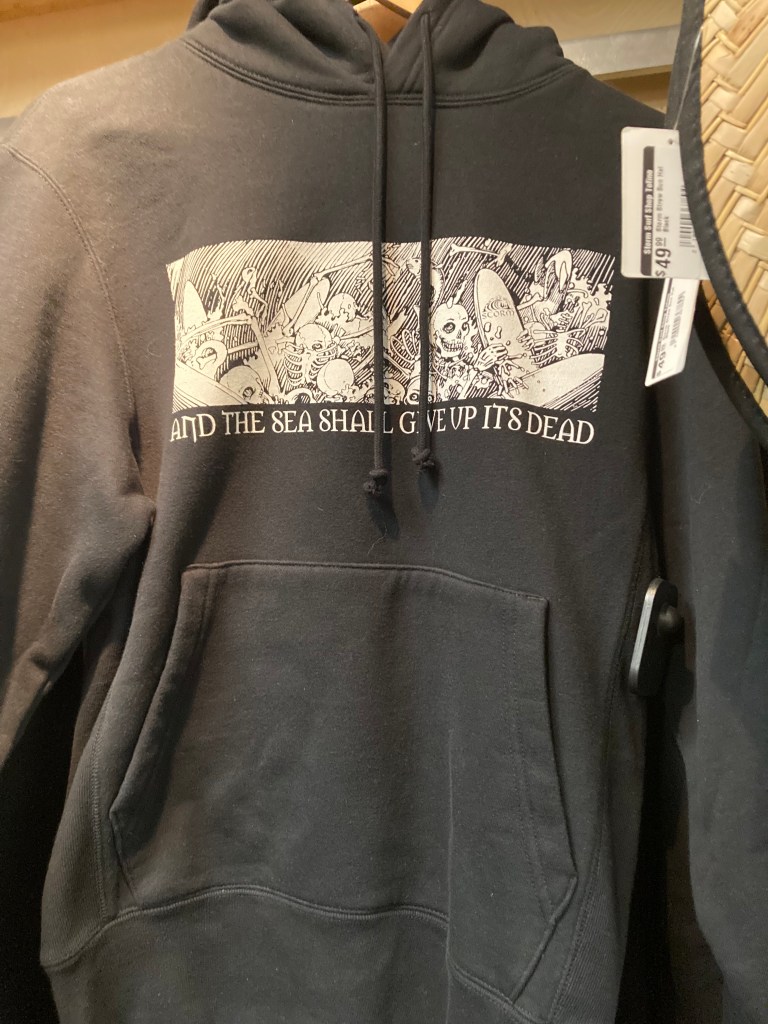
I spent an afternoon exploring downtown Tofino, wandering from shop to shop. House of Himwitsa had beautiful native gifts. Roy Henry Vickers Gallery was lovely to take in. Two Trees Home & Gift was probably my favourite shop. Caravan Beach Shop was small and friendly, with the lady behind the counter from NL – small world indeed! Driftwood Gifts was a bigger touristy store. Storm Surf Shop had a cool design on a hoodie that said “And The Sea Shall Give Up Its Dead”, which I kicked myself for not buying. Salt was pricey but had some cool stuff.
I parked the van behind the Tofino municipal office at Main and Third. Just behind here is a lovely lookout to the many little islands that border Meares Island and create the characteristic views surrounding Tofino.
I got to go for a run along a bike path that parallels the main road through the national park, from Long Beach out, and then I ran back along the beach.
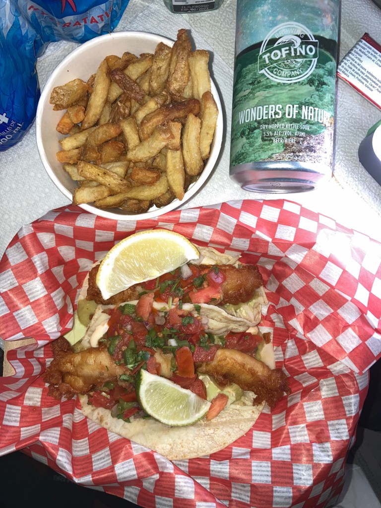
In my search for some good local fish tacos I checked out Surf Side Grill (which is part of a resort and has designated parking spots) off Cox Beach. They use local fish and had great salmon and cod fish tacos!
I stayed a night at Surf Grove Campground, which is on Cox Bay Beach and you can walk a short way from your site right to the water. I watched the sun set here, and took care of business (laundry).
And finally, I learned that Ucluelet is nicknamed Ukee and Tofino is nicknamed Tuff City (supposedly due its past of fishing and logging industries, as well as the rugged environment and weather – making it tough).
It would be cool to visit Tofino and Ucluelet in winter for wave watching, with winter waves up to 20ft, though big waves can happen in late fall through early spring. And it is good to keep in mind accessibility and the effects of storm watch and winter conditions (as well as forest fires in summer).
Good to know – there are wolves in this area, as well as bears, who can sometimes be seen along the coast looking for food at low tide.
For the future I would love to tackle Big Tree Trail, a 4km loop trail on Meares Island, accessible only by water taxi from Tofino, and host to some of the biggest and oldest trees in BC. There are also whale watching tours. And exploring further Clayoquot Sound.
There were road closures on Highway 4 in and out of Tofino and I remember the day I left making a mad dash to get there in time to be let through. Luckily, I just caught the tail end of the line of cars. But it seems construction can be an ongoing thing here. And of course wildfire considerations, which can impact highway accessibility, and whether one should be in the area anyway.
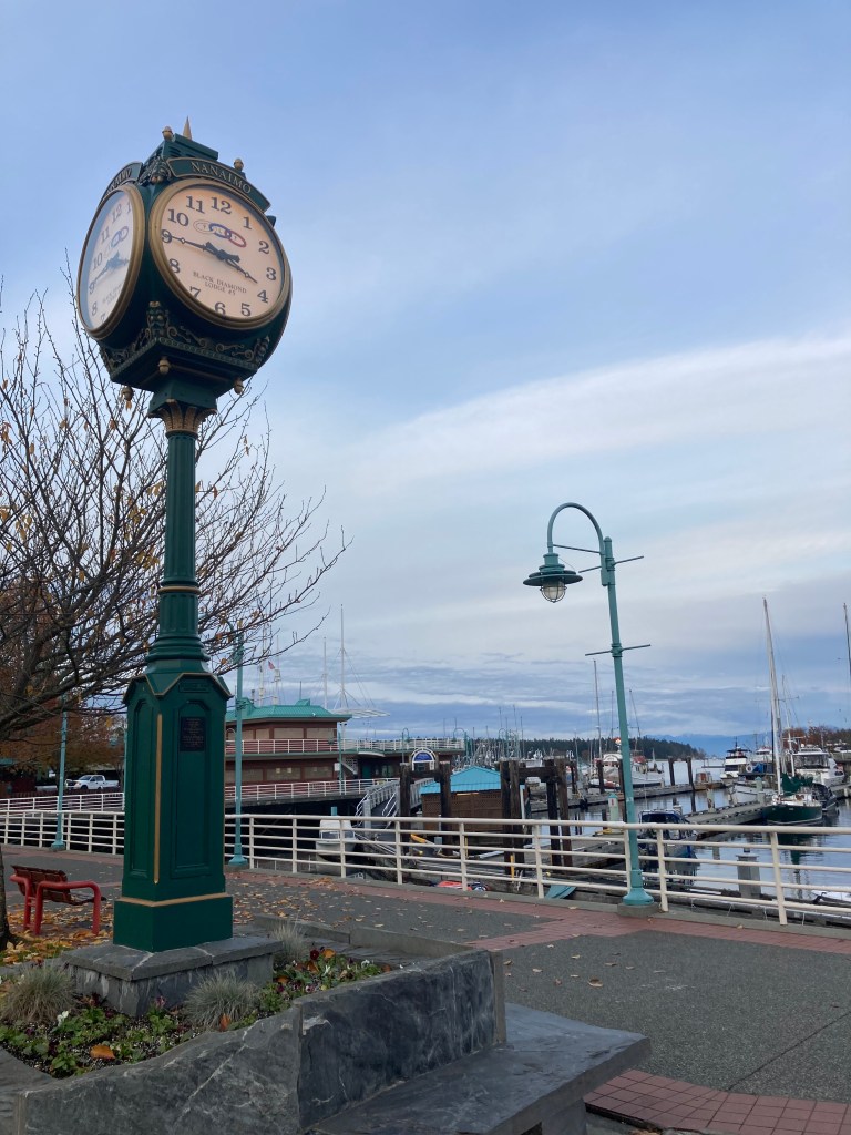
Nanaimo
I spent another night at the Port Alberni Walmart, and visited Cathedral Grove one more time, before heading to Old Country Market / Goats on the Roof, which is about halfway to Nanaimo. Unfortunately, there were no goats on the roof. I suppose it was either bad timing or too late in the season. But the market was nice to check out.
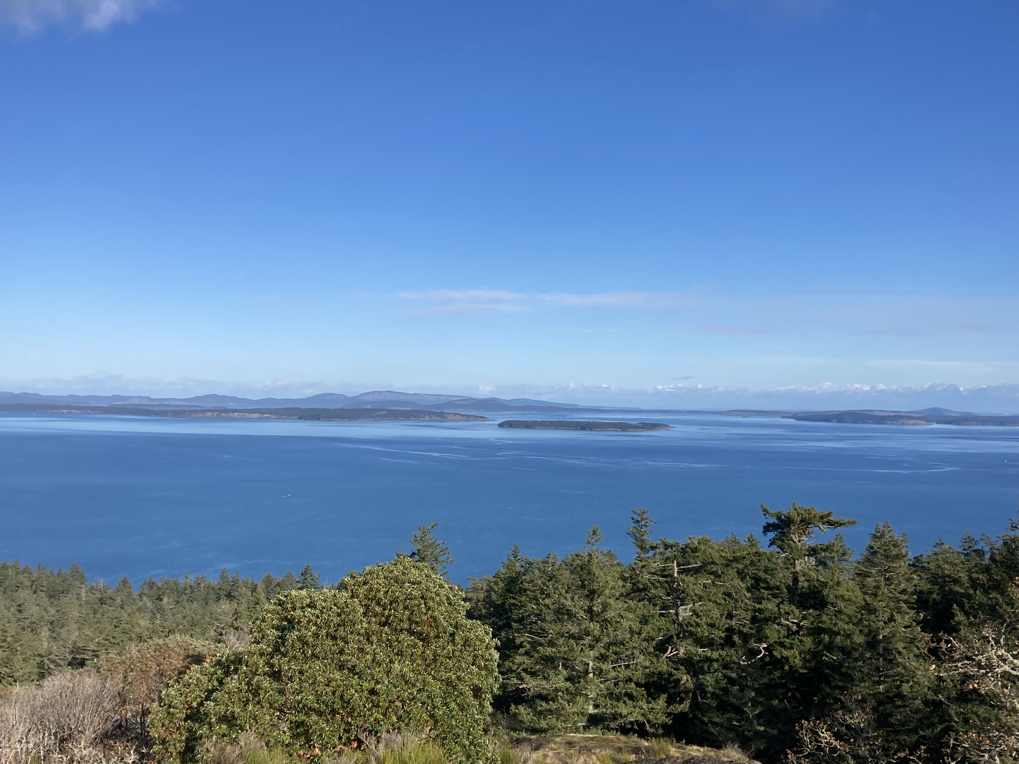
My foray into Nanaimo began with Neck Point Park, which is a not-too-big seaside park with trails along the water and the possibility for sea animal viewing. Across the Strait of Georgia you can catch glimpses of mountains (don’t ask me which) on a clear day!
Nanaimo is known as the Harbour City, previously the Hub City. But my mind goes directly to nanaimo bars, the city’s signature sweet. And wouldn’t you know it – they have a Nanaimo Bar Trail! I of course had to buy a locally made nanaimo bar. Sadly, many of the cafes closed early in the day, but I did get my hands on one.
I had also heard about a Nanaimo Bar Porter, which I tried to find at a liquor store, but they didn’t have it in stock – go figure. Turns out, this beer is made by Vancouver Island Brewing, located in Victoria (but it still seems blasphemous to not have it in absolutely every liquor store in Nanaimo). What’s even more silly is that the only time I’ve come across this beer since was in Ontario (given, that one is made by Muskoka Brewery).
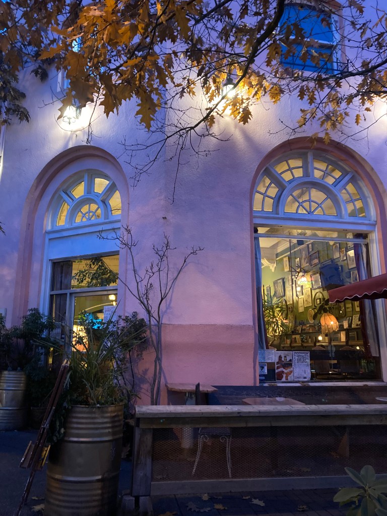
Other than food and drink, I walked along the Nanaimo harbourfront walkway and some of the downtown streets, simply wandering. I stumbled upon Vault Cafe, which was just a really cool spot, from its pink exterior, to the stuff on the walls, to the music playing (NWA when I walked in). A definite vibe.
Should I return to Nanaimo I would for sure hunt for more Nanaimo bars to try. I might also like to head to Ammonite Falls (4.4km round trip). And I made note of Living Forest Oceanside Campground, which looked nice.
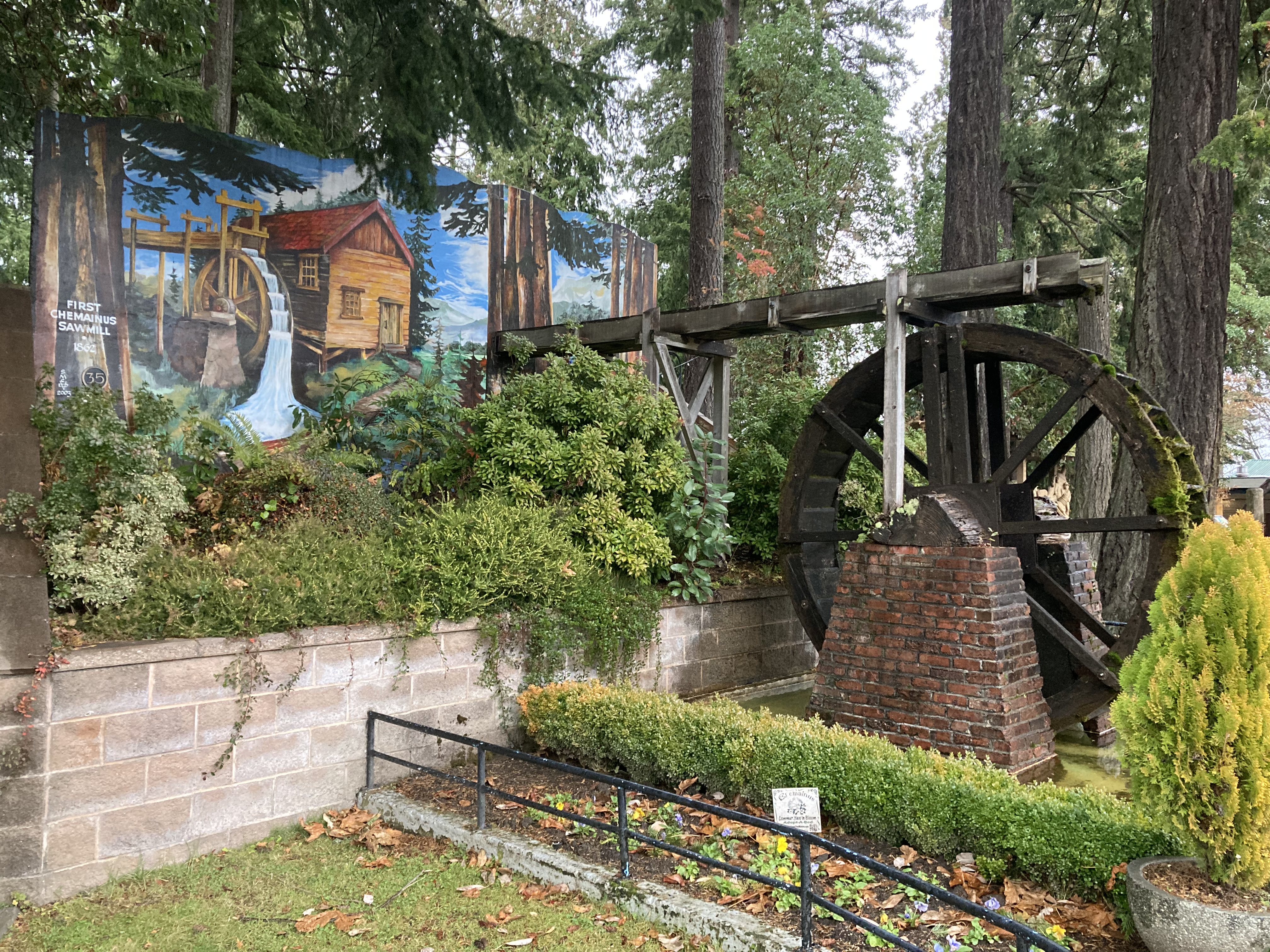
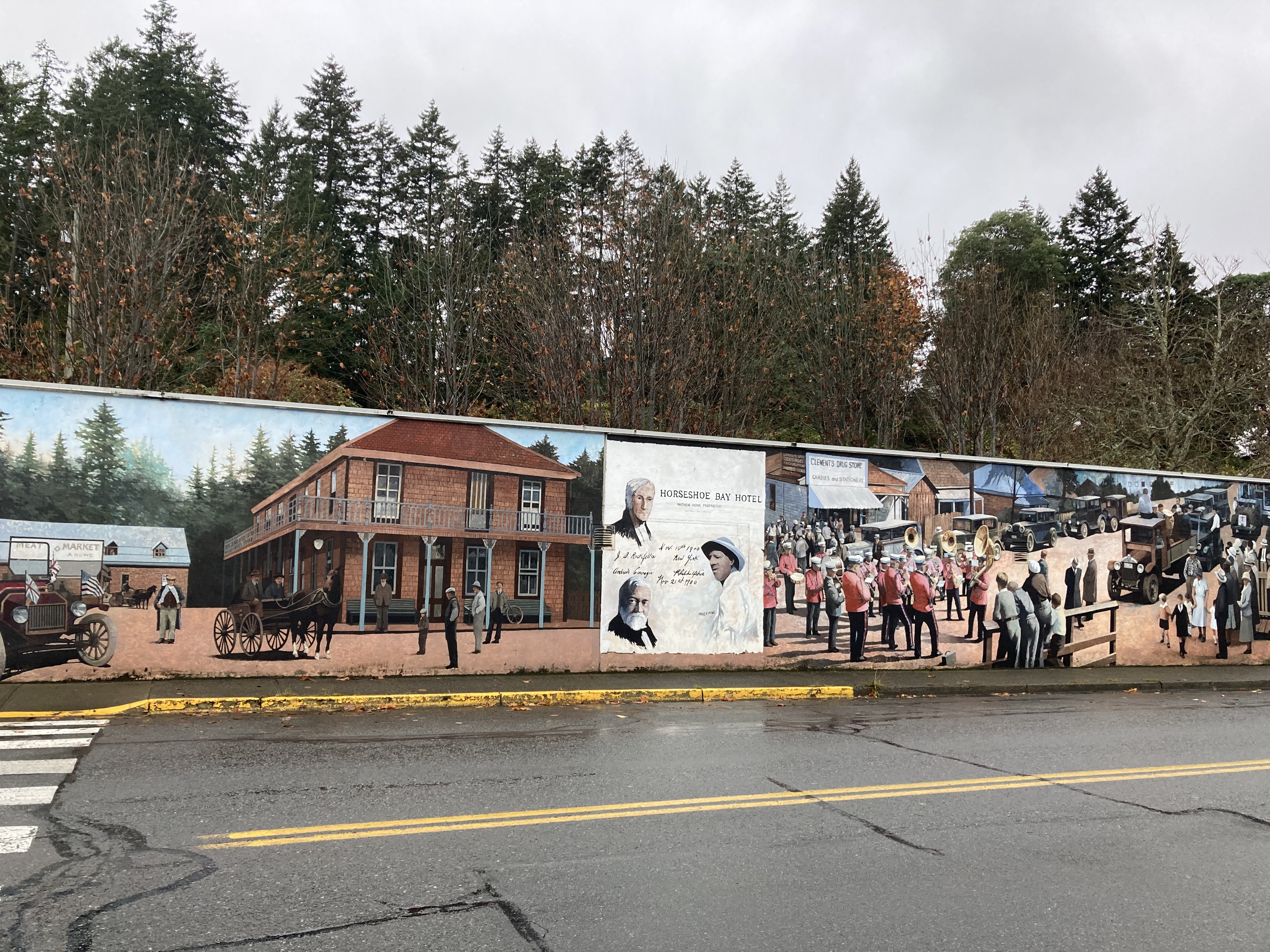
Chemainus
Chemainus, City of Murals, was one of those places I ended up simply out of circumstance. It was already dark and I just needed a spot to park for the night. But it ended up being a delightful experience.
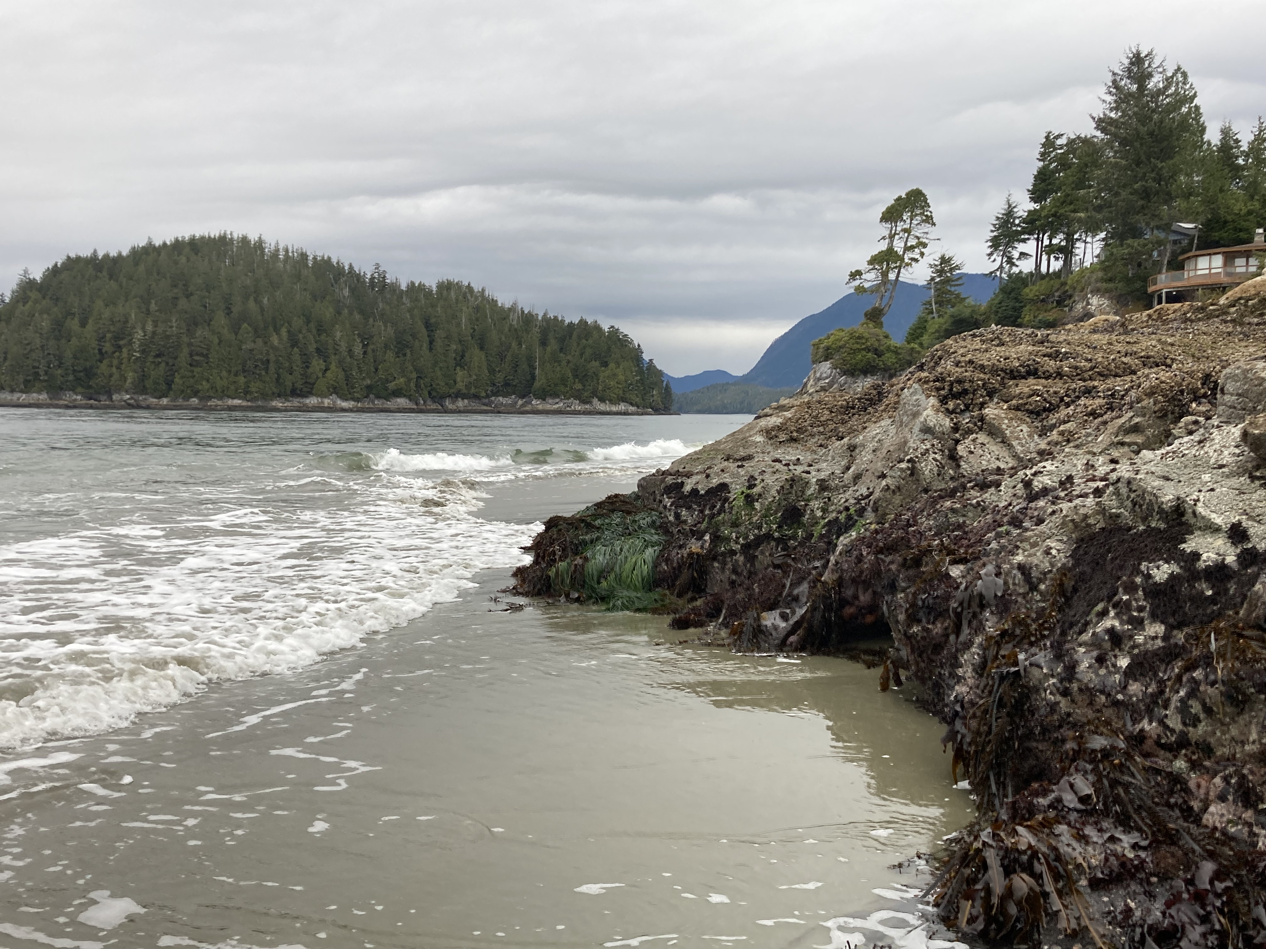
There was an RV already parked when I arrived, which I tend to take as a good sign (but my gut always gets the final decision). The street was very quiet, peaceful. I had no problems, and took time the next morning to explore. The parking spot was right next to the small downtown area, which had a lot of cute shops, and the many murals that Chemainus is known for. There is a visitor’s centre (with parking area and public washrooms). I also walked down to the water, taking in the Salish Sea and architecture of the local homes (there were some interesting ones).
Twenty minutes south of Chemainus, for anyone interested, is Pacific Northwest Raptors, where you can view and interact with big birds.
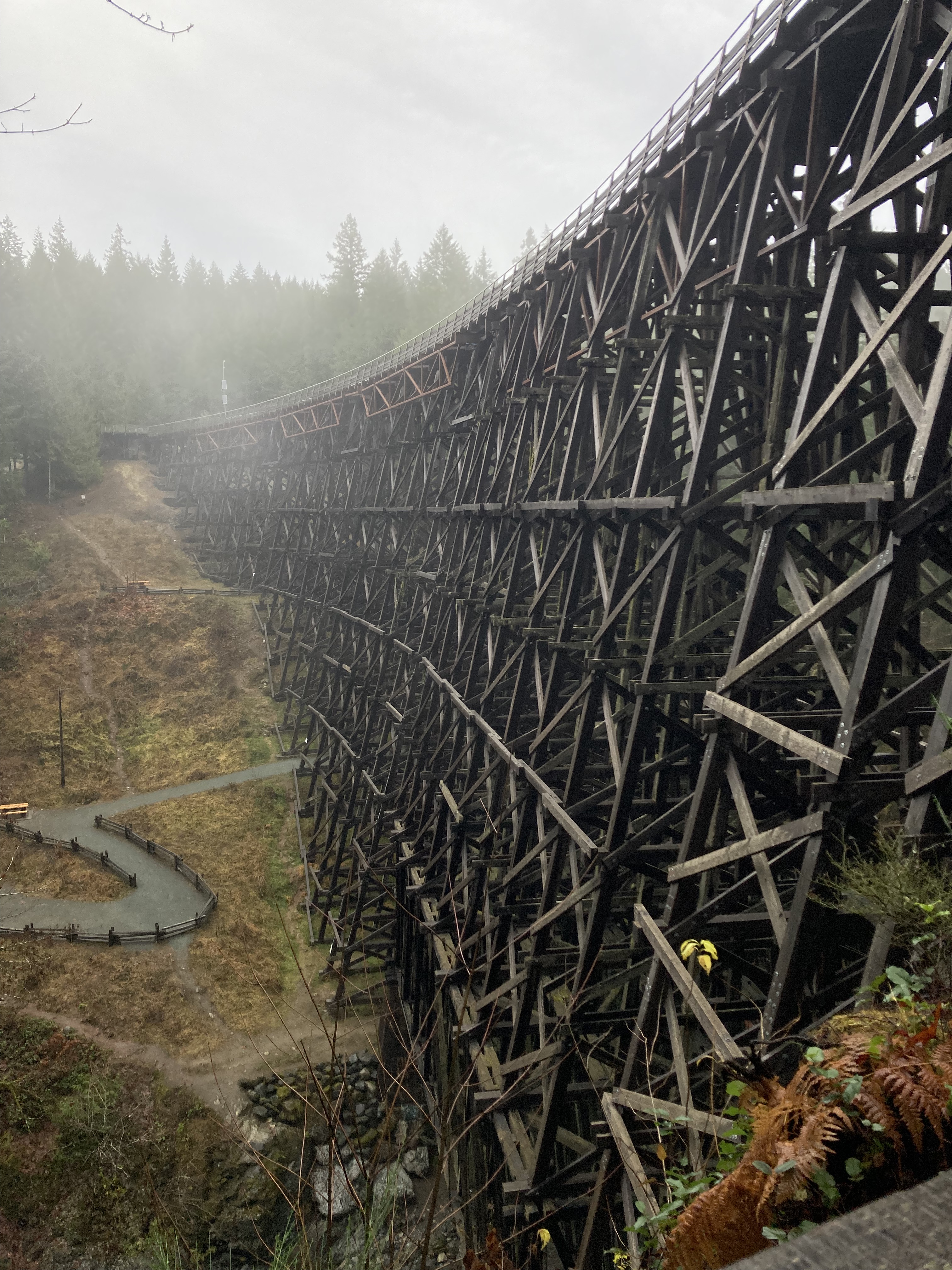
Kinsol Trestle
About a 45 minute drive south of Chemainus, on the way to Victoria, is the Kinsol Trestle. Built in 1920, and in use until 1979, it is a stunning example of one of the tallest free-standing timber railway bridges in the world.
Goldstream Provincial Park
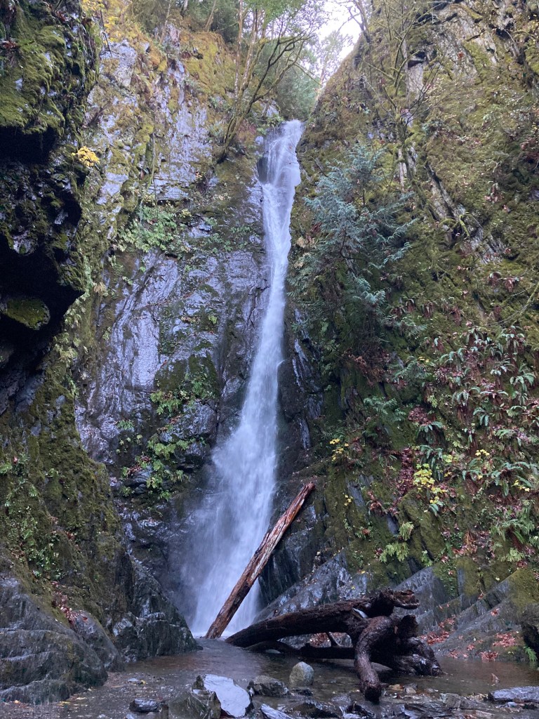
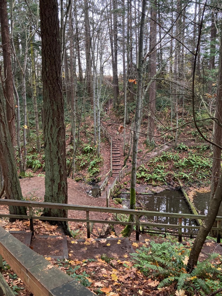
Another 45 minute drive south (getting ever closer to Victoria) is Goldstream Provincial Park. Perhaps not a stand out stop for many, but I have childhood memories here, too, and I never seem to tire of chasing ghosts of my past (at least ghosts I care about).
Stand out features include the Niagara River waterfall, spawning salmon in autumn, and hiking trails among big trees covered in moss. There is also camping and an interpretive centre that’s good for kids.
Colwood
I arrived in Colwood (just west of Victoria) with the intention of touring Hatley Castle, in Hatley Park National Historic Site. While it was too late in the season to partake in a guided tour, exploring the gardens and grounds was permitted until dusk. Part of Royal Roads University, this building is still in use. There were peacocks on the property. Fun Fact: Hatley Castle was in X-Men! But honestly, I just love a castle.

Colwood became my unofficial home base while in the Victoria area. I found a few street parking spots for overnights. These developed with some trial and error as well as flukes while getting to know the area. I took a chance on a carpool lot, despite there being signage (but also evidence of others doing it) – just one night as it was a last minute spot and I found better options afterward. Plus, you don’t want to make a habit of areas you shouldn’t technically be in. I also don’t like to stay in one spot too long. So I will cycle through different spots if possible if I’m staying for a while in the same area.
I found a street where I saw one other van but otherwise it was mostly empty. I stumbled across another street, which was more packed, and had several other vans and RVs. Then I took a chance on a turnout on a wooded road, after seeing another van there, which I would guess I shouldn’t have been parking at, but I had no issues (I also arrived after dark and left before sunrise) – and it was peaceful there. There were tall trees lit up by moonlight, and then early in the morning I was close to the waterfront for sunrise.
I don’t particularly like to park in larger cities overnight, and I was aware of Victoria’s higher crime index (with people expressing they did not feel safe there at night), so Colwood was a good option for staying out of Victoria.
The crime rates were quite low here, with Colwood being rated one of the safest cities in BC. It was right in the middle of various areas I would frequent. And the Colwood waterfront by Esquimalt Lagoon, overlooking Juan de Fuca Strait, where many locals would park in the day, was a beautiful spot where you could see boats and mountains (presumably Port Angeles, WA). I even saw seals here. And I could spend down days or planning days – one afternoon even doing some work under the hood of the van to replace the blower motor resistor.

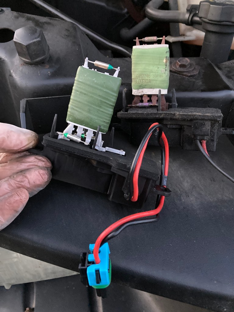
The second fan setting for air/heat in the van stopped working. I learned that this can be a common occurrence and that the blower motor resistor needed replacing. I had consulted my mechanic and he was nice enough to suggest that it could be something I could manage myself and sent me a youtube video on how to do it (aka it was nice to not be treated like a girl who couldn’t do anything mechanical). I then found the part I needed at a local auto parts shop and proceeded to make the switch. It felt good to turn on the fan afterward and have the problem fixed.
I also learned that this part can overheat and even cause fires, and that I should periodically check the pins on the wire harness to make sure they’re not blackened (mine looked good).
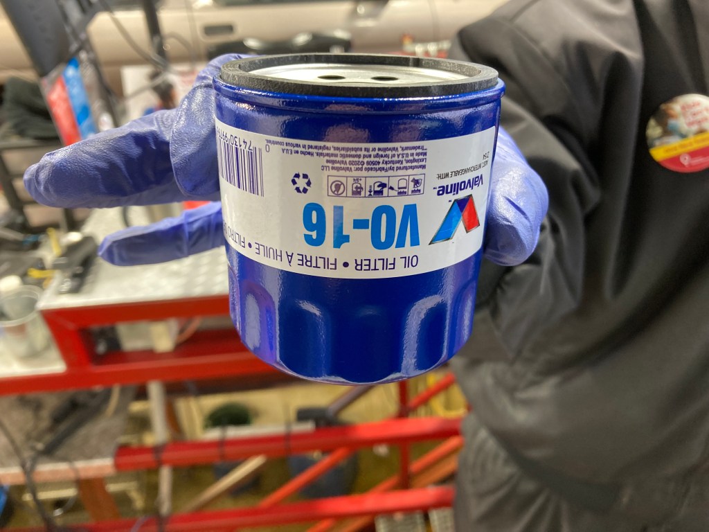
It was in nearby Langford that I experienced my first Great Canadian Oil Change. Which was convenient. And I would use such a service again in the US for my next oil change. I have seen mixed reviews about these drive thru oil change service centres, but it truly is the most convenient option on the road.
It’s places like Colwood, which are convenient for you to stay a little while, where you can slow down and catch up on getting some personal things done. Whether that’s servicing your van, researching your next moves, slowing down to relax and not feel rushed through an area, or for personal reasons – places like this are truly appreciated on the road.
Victoria
There was so much to see, both in the heart of Victoria, and in the surrounding areas. Luckily, I’m quite good at seeing a lot in a short period of time.
UVic
I have a curiosity of campuses (coming from an academic background, pondering a future that may entail going back to school, and enjoying the architecture), so I spent a little time walking around the University of Victoria campus. Mostly, I walked through some trails and gardens on the outskirts, and then did a little loop among the campus buildings. It was okay. They do offer graduate programs in psychology (my background), so it was a relevant exploration for me.
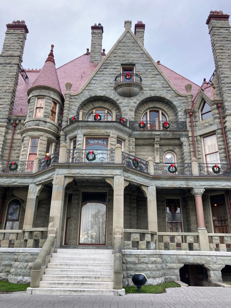
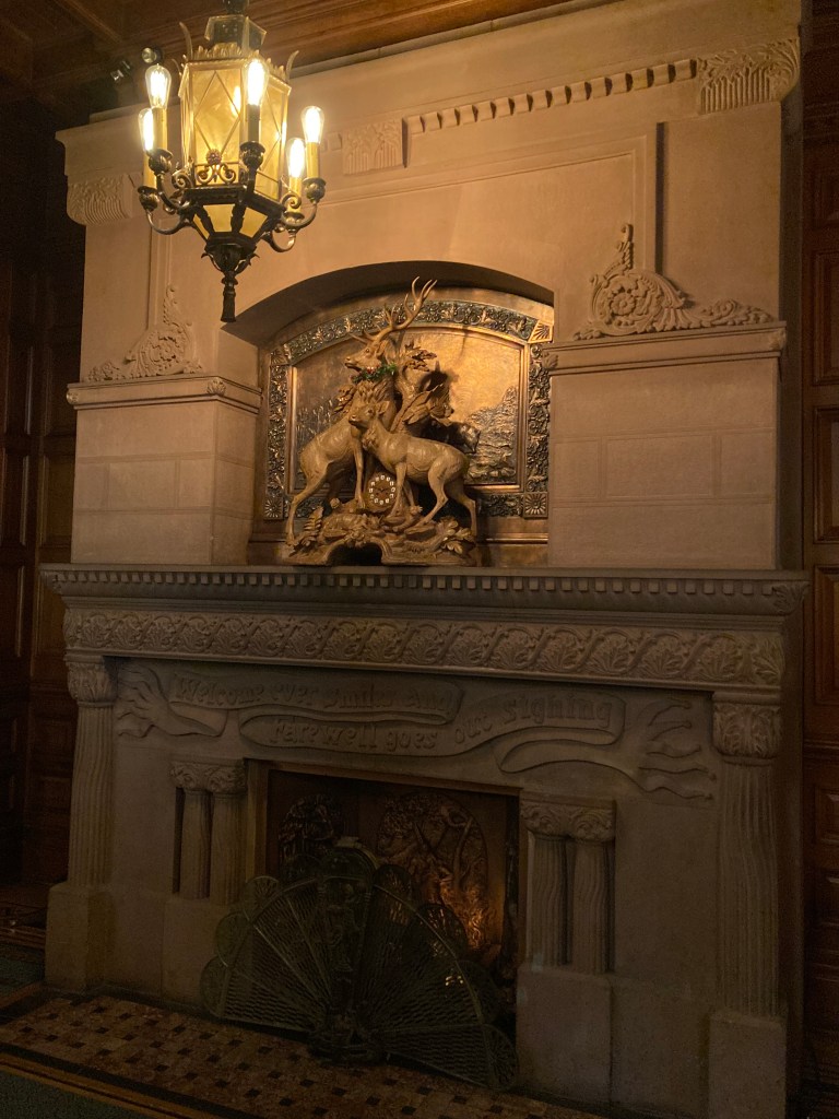
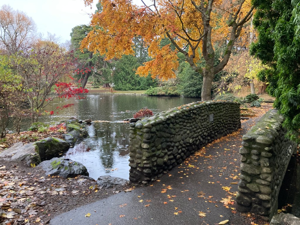
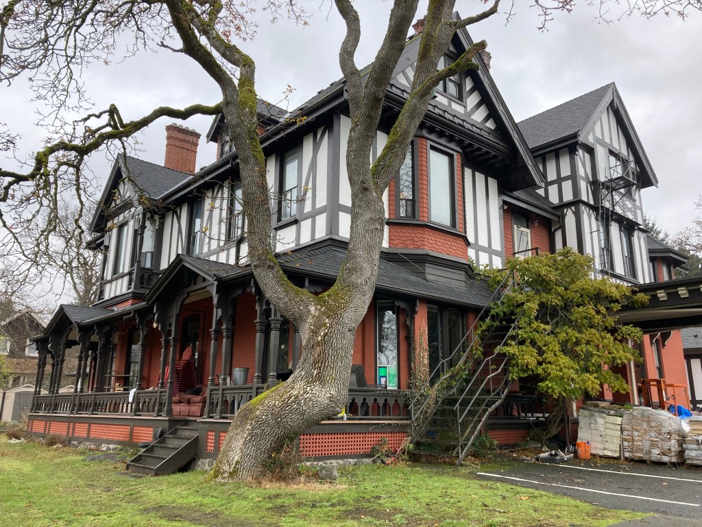
Craigdarroch Castle
Another castle! Completed in 1890, commissioned by wealthy business man Robert Dunsmuir, who did not live to see its completion. I absolutely loved taking in the architecture and decor, as well as hearing the history of the family.
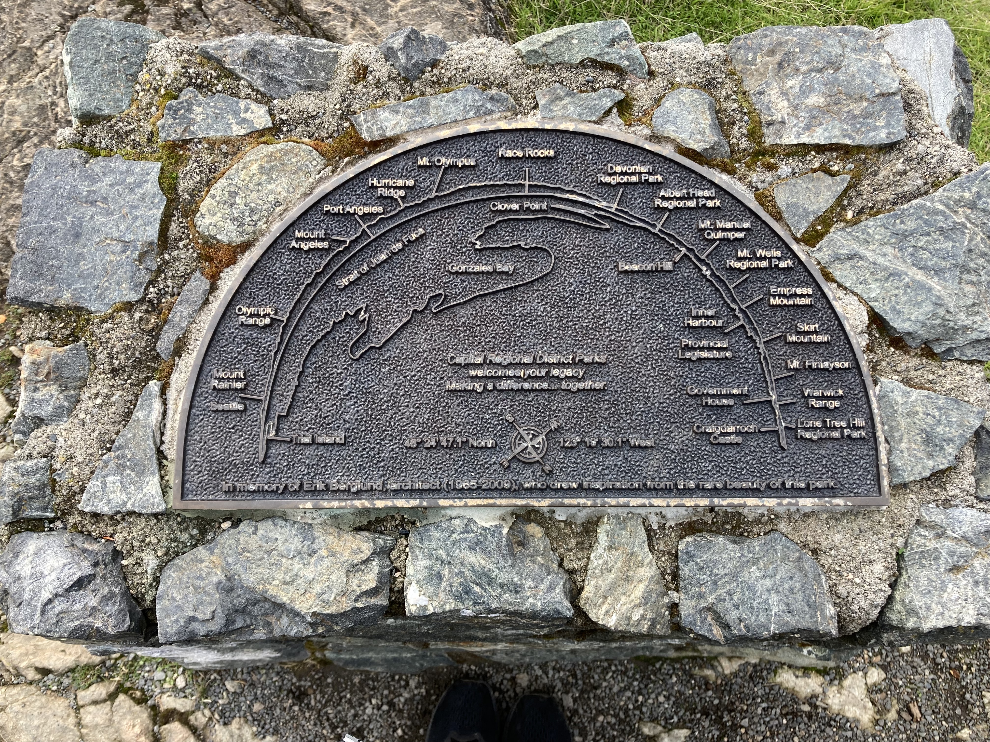
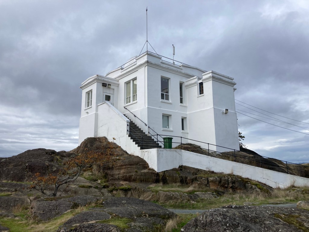
Gonzales Observatory
Through narrow, crowded, hilly streets, to a little hilltop park, is Gonzales Observatory. There are views, with a little plaque telling what mountains were where on Washington’s coast and in what direction Seattle lay! It was by no means the most stunning thing I witnessed in Victoria, and yet, it might have been the most magical. I felt close to Seattle. I was close to Seattle. Even the vibe in some of the streets in Victoria reminded me of Seattle. I was in the Pacific Northwest. The PNW. And I could almost see one of my favourite places on earth.

Clover Point Park, Ogden Point, Beacon Hill Park
Along the southern coast of Victoria, along Dallas Road, are some points of interest, all of which offer views across the Salish sea to Port Angeles and the mountains in Olympic National Park.
Clover Point Park is a little outcropping of land where you will find the Point Zero monument, marking the start of the Trans Canada Trail.
West of here is Ogden Point, where you will find a sundial, restaurants, and a wharf that takes you out to Breakwater Lighthouse.
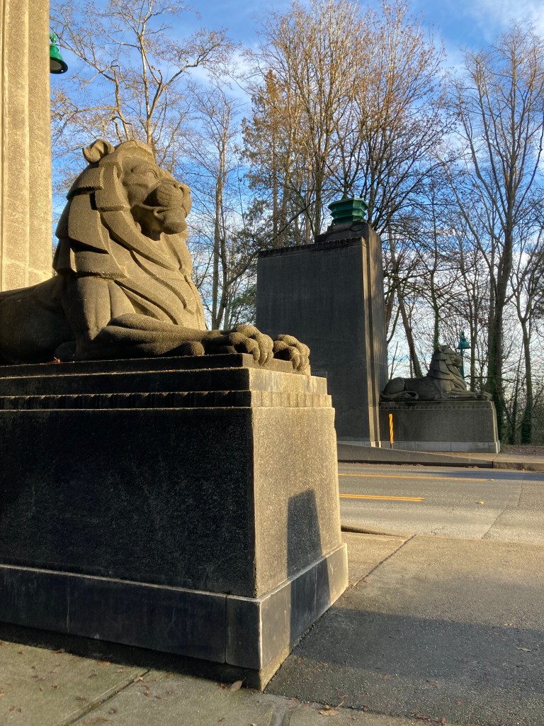
Between Clover Point and Ogden Point, along Dallas Road, is Beacon Hill Park, which I meandered through on my way to downtown Victoria. Beacon Hill Park is pretty. There are trees with roosting peacocks. There is the Mile Zero monument, marking the beginning of the TCH. There is a terry Fox statue. And there is the world’s tallest totem pole.
Dallas Road was actually quite convenient as it had plenty of parking, and it was a nice area, so I preferred to leave the van here and didn’t mind walking from here to downtown.
Downtown Victoria
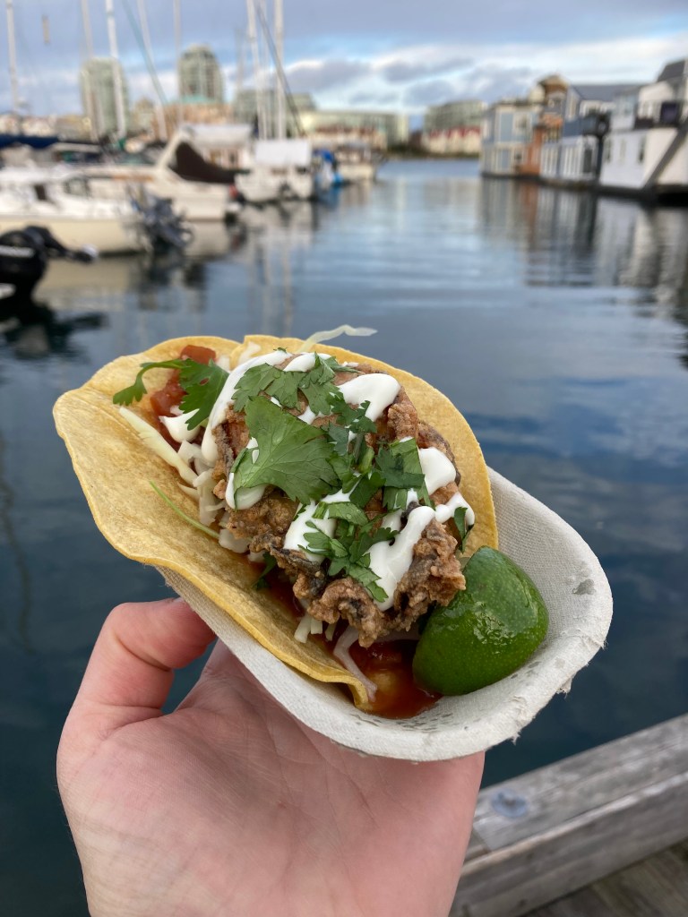
Just about a kilometre from Ogden Point is Fisherman’s Wharf Park. Here you will find shops (though many were closed when I went), cool floating houses, and seafood restaurants. I got an oyster taco and to this day it is the best fish taco I’ve ever had (fish tacos became my go-to on the coast – I love indulging in local fare).
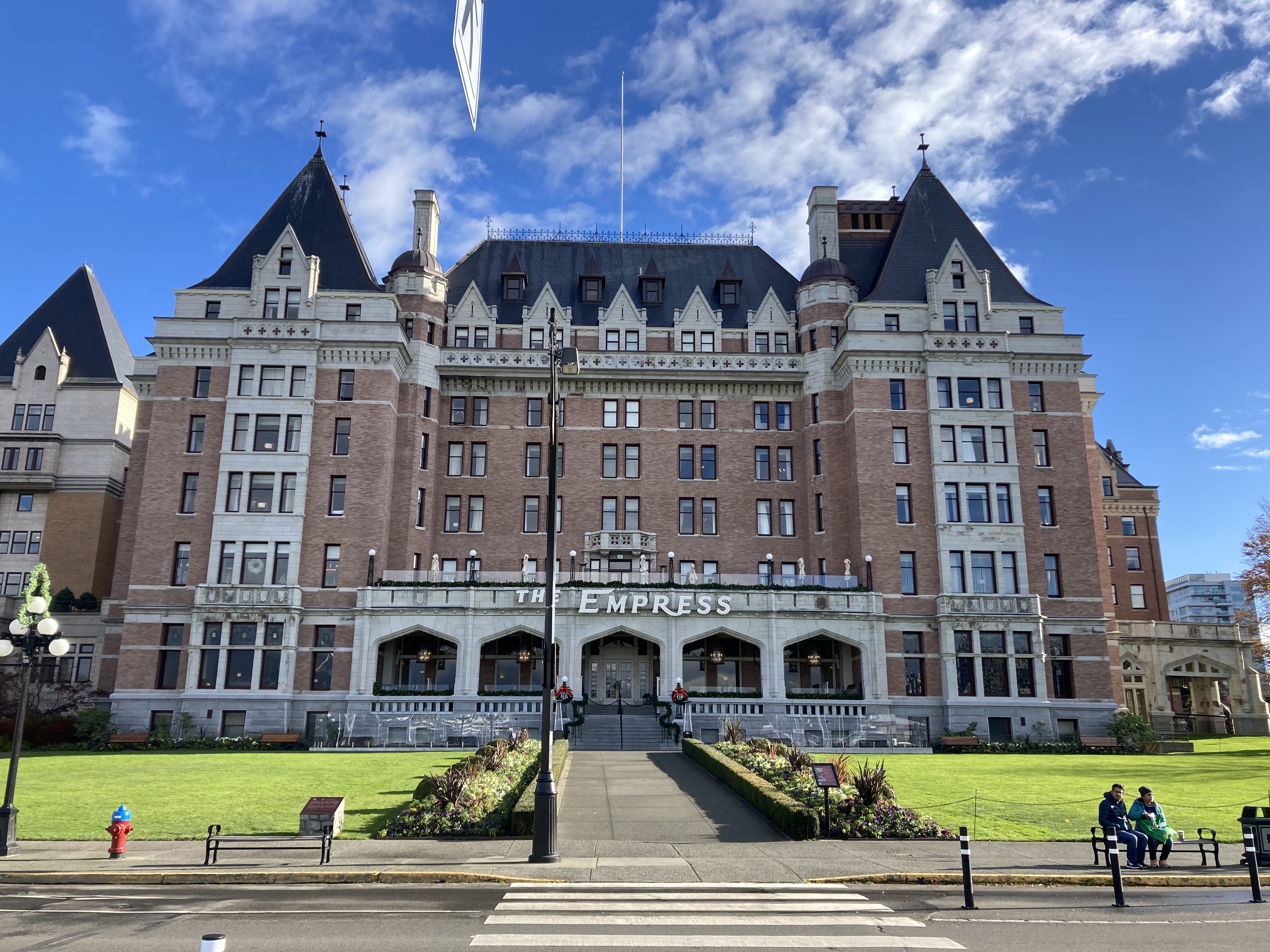
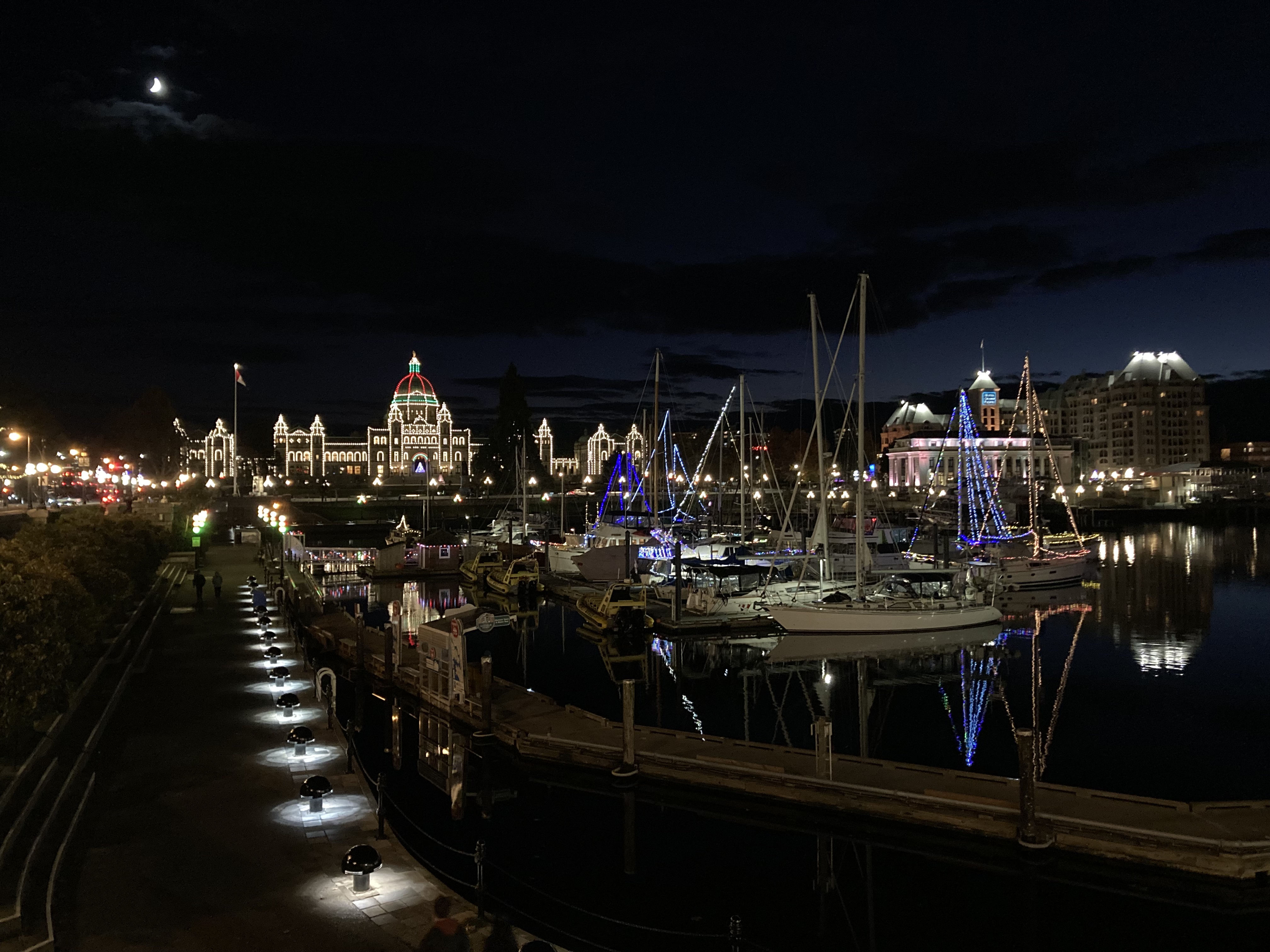
Another kilometre walk takes you to Inner Harbour, which is the waterfront hub, and a great central starting point for exploring the surrounding areas. I remember visiting a souvenir shop here as a kid. Nearby is the Legislative Assembly and the Fairmont Empress (said to be haunted!), both very pretty, both lit up at night (it was almost December, after all).

Someone even asked me directions while I was touring downtown – which meant that I might have looked local, and also – I was able to answer, which felt good.
I kind of just walked around Victoria. I had an errand to run at an MEC. And I eventually wanted to make my way to a brewery. But I mapped out some notable places and made a point of walking through them.
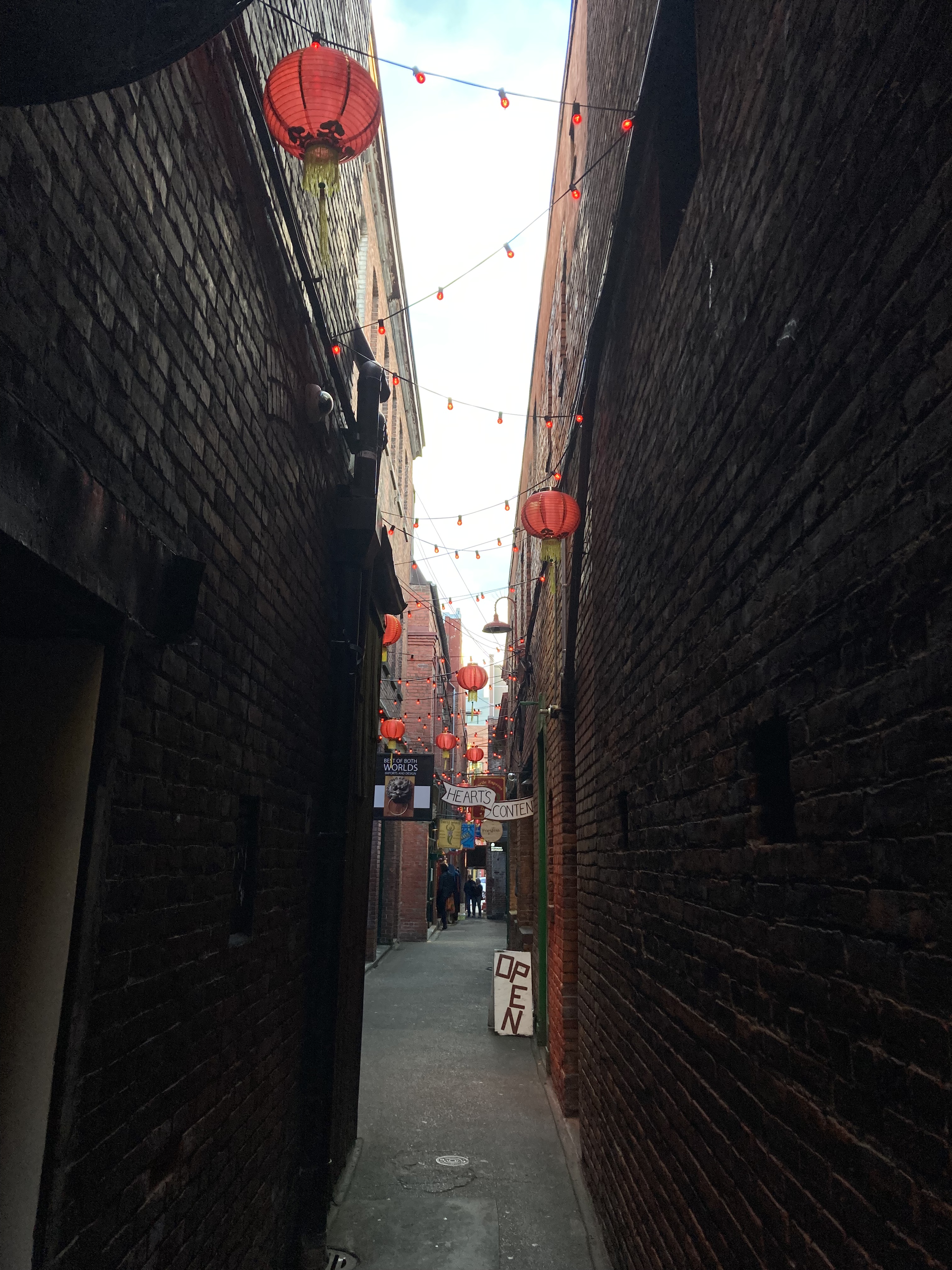
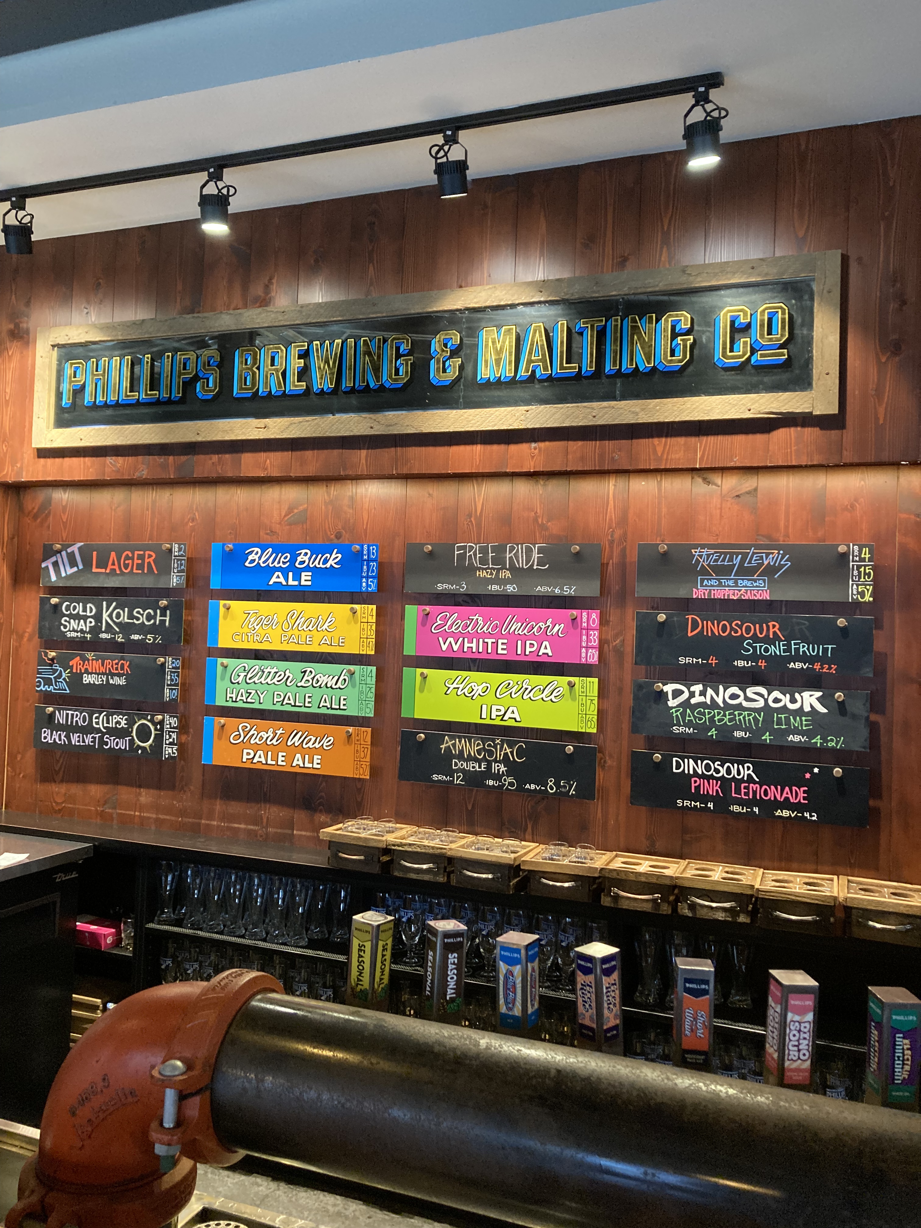
On a friend’s recommendation I stopped by Red Fish Blue Fish for more fish tacos, but they were closed. There was Bastion Square (historic old Fort Victoria, lots of pubs and restaurants) and Market Square (brick courtyard with various shops). Fan Tan Alley, the very narrow and long brick alleyway in Chinatown, which was probably one of my favourite spots, has some really cool shops, but used to house gambling clubs (popular in the 1940s and commonly raided by police) and opium factories (before opium was made illegal in Canada in 1908). Finally, I got to Phillip’s Brewing & Malting Co. – “inspiration through fermentation” – for a flight and to warm up and relax after walking around out in the cold for hours. I enjoyed it, and they played decent music.
Special shout outs to Fluevog (I adore their shoes) and the all black goth house I came across.
Mount Douglas Park
Hiking up Mount Douglas (north of downtown Victoria) was another nostalgic endeavour. You get lovely views at the top, and it’s always nice to take a break from roads and cities with nature.
Other
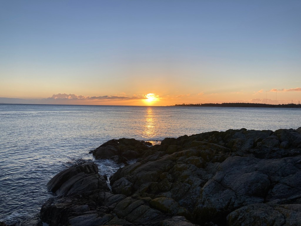
If it was a nice day I would often try to catch the sunrise over the water, like one morning at Ten Mile Point.
It was during my time in the Victoria area that I first noticed wet spots and condensation in the van, which is worse in winter, in a humid climate like on the coast. I had Concrobium with me, sprayed for prevention, and kept an eye on things. I mostly found these wet spots where the van’s metal wasn’t thoroughly insulated (by the back doors and wheel wells), on windows, and on liquid containers.
On my final morning on the island I checked out the Rockland neighbourhood. I was trying to remember where my family stayed when I was a kid. And while the area felt familiar, I couldn’t be sure. The homes here are historic and beautiful- many are mansions that have been turned into apartments. I also roamed the Government House grounds.
Next Time
The first time you tour a place is often for seeing the main attractions. The next visit is for things you missed the first time, and branching out to more obscure holes in the wall. Here are some spots I made note of but never got to:
- *Butchart Gardens
- Point Ellice House Museum & Gardens – another old home that teaches you about the history of the area.
- Victoria Bug Zoo?
- Butterfly Gardens?
- Fort Rodd Hill National Historic Site (old battery and first lighthouse on the west coast of Canada – not far from Hatley Castle and Colwood waterfront / Esquimalt Lagoon).
- Salt Spring Island – mostly because my family went here.
- West of Victoria: Port Renfrew! The West Coast Trail – I want to thru hike this at some point! Mystic Beach on Juan de Fuca Trail! And more, I’m sure.
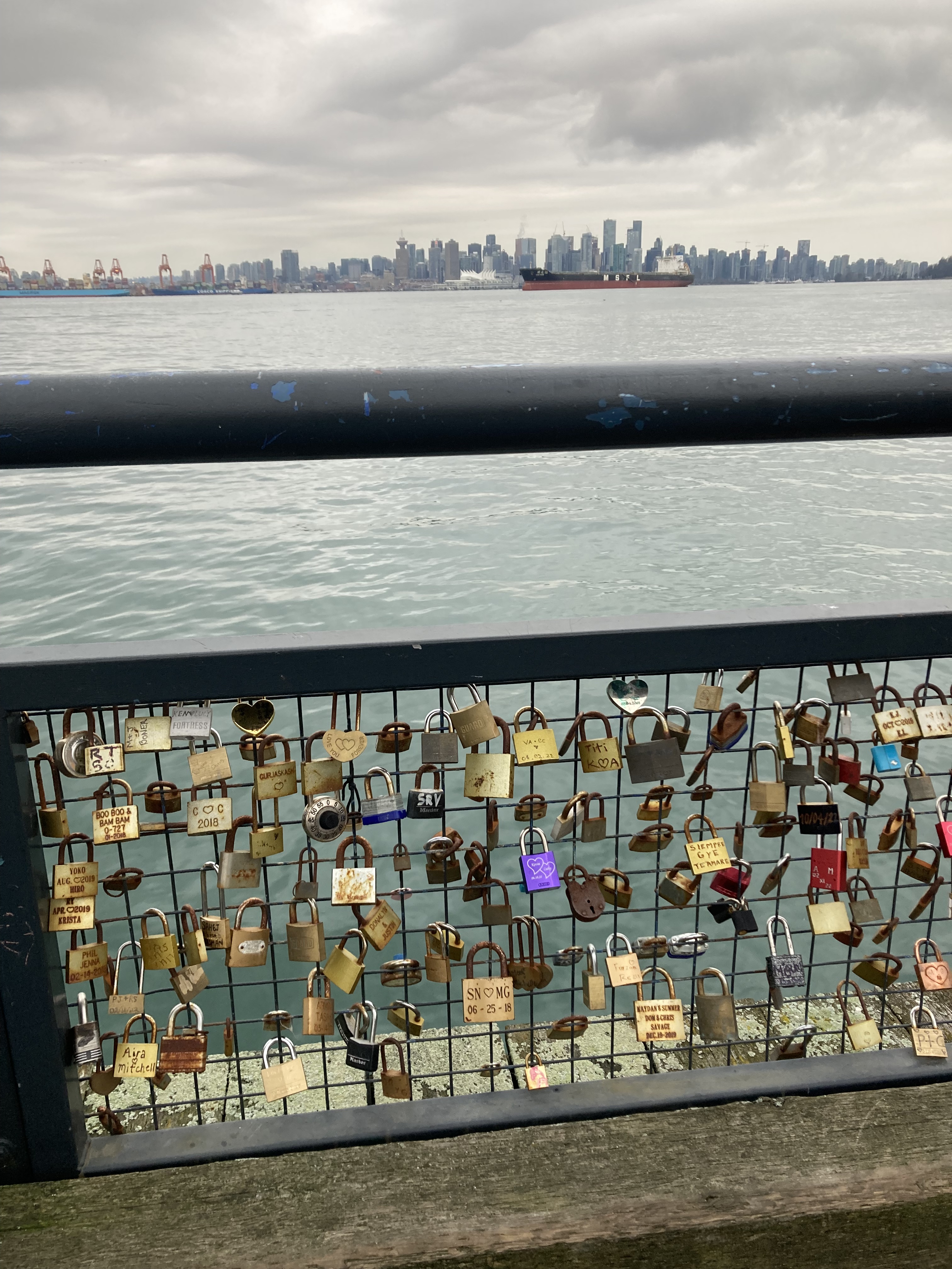
Back To Vancouver
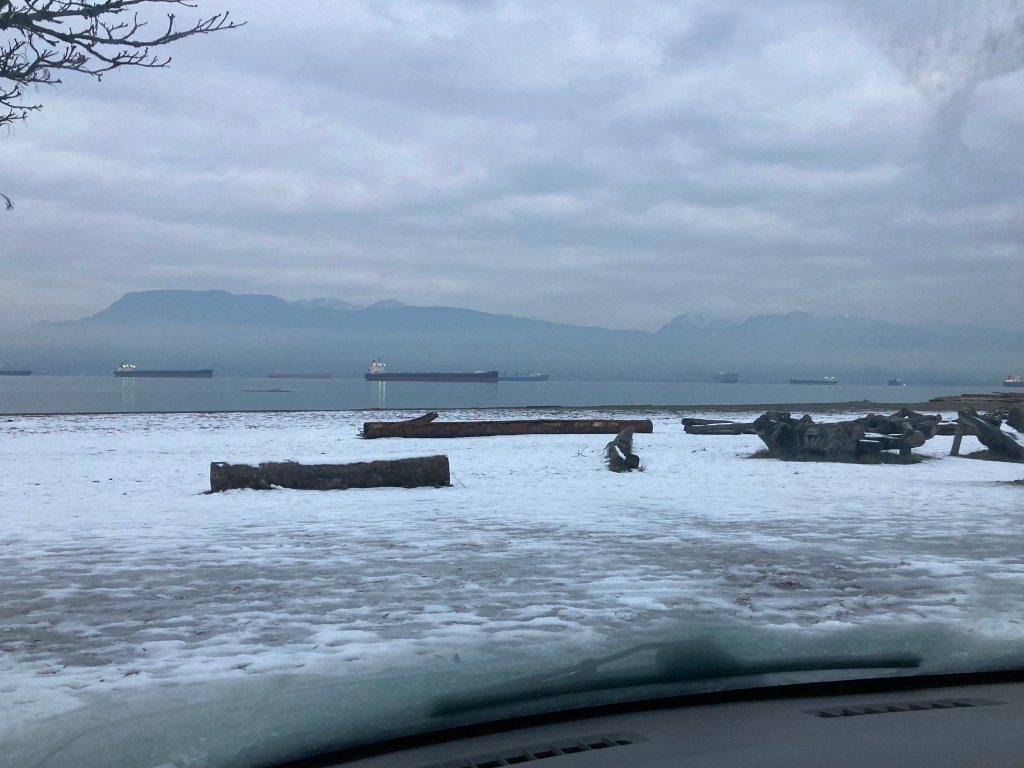
UBC Area
I took the ferry from Victoria this time, back to Vancouver. I had a package to pick up from a Canada Post near UBC (the traffic was horrendous). Then found some last minute street parking for the night. I was near Spanish Banks Beach, which has signs prohibiting parking overnight (as most parks do), although that didn’t seem to stop people. This beach has views that look out over Burrard Inlet to ships, the Vancouver City skyline, and mountains.
I decided to do a quick little walk through of the UBC campus nearby. This campus is definitely bigger and more impressive than UVic. I walked down to Wreck Beach – it’s pretty, but note the 370 stairs you need to climb to get to and from.
Langley
I drove an hour back east to make a quick pit stop into Langley to visit a specific shop (Phoenix Rising Emporium). So I couldn’t tell you what Langley is like, but I can tell you I avoided nearby Surrey (I hate to stereotype, but I had no reason to visit, and I’d heard of the high crime and gangs).
It was another last minute difficult night of looking for parking. Lots of suburbs in BC have bylaws restricting “overnight camping” and RV parking. I usually avoid residential areas as a rule, but ended up street parking somewhere in Coquitlam out of necessity – sometimes you have to work with what you’ve got and you just want to go to bed. It was along a stretch of curb with other vehicles that was at least not in front of any residential homes. It was a busy area in the morning and I left early.
I’m sure hearing about finding parking is not the most interesting thing to read, but it does contribute to a lot of vanlife, and sometimes is the bane of your existence.
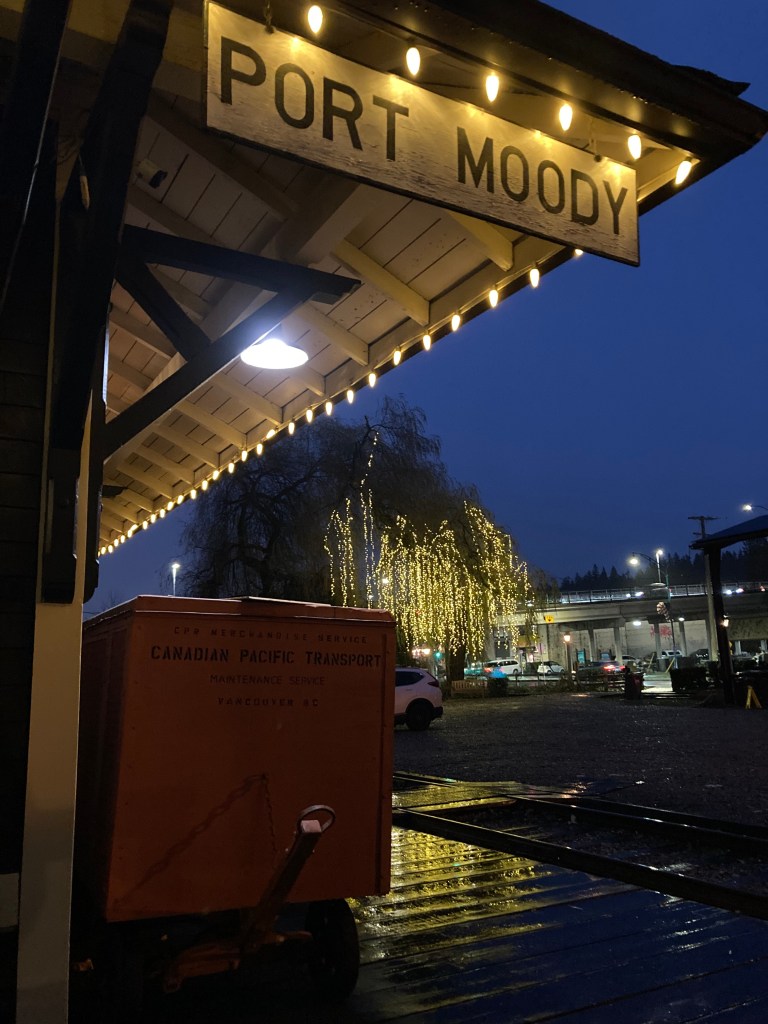
Port Moody
I ended up in Coquitlam because my next stop was Port Moody. A friend had suggested it, so I thought I’d check it out. I tend to make note of places and then when I research them I organize the spots I want to visit geographically so I can hit them in an order that makes sense.
Port Moody was interesting. As a general vibe, I liked it. Not least of which is the fact that it has a “Brewers Row” – aka a street with several breweries. But also because it had a rustic moodiness, and some interesting things happened here.
First, where did I go? Well, I did a bit of hiking at Mundy Park. It was pretty, with fresh snow on the trees and a frozen pond.
I walked by Port Moody Station Museum – it was closed so I couldn’t go in, but it was lit up with string lights outside, and if memory serves there were informational plaques around. This museum is said to be haunted, so of course I was interested in it.
I walked along Brewers Row, and while I considered going in to Moody Ales, it seemed to be hosting quite a boisterous crowd, so I walked over to Fraser Fermentation instead.
On my way to Fraser Fermentation, while in the middle of a cross walk, a turning vehicle almost hit me. It was a girl on her phone and she slammed on the brakes maybe a foot or two from me. It definitely gave me a jolt.
I got a flight, as I do, and appreciated the experimental options at Fraser Fermentation.
Then I had an experience in the brewery that got me thinking about whether I’d become “feral”. A girl had come over to me and asked how I was doing. I’m not good with thinking on my feet anyway, but because of the ambiguity, not knowing their intentions, I responded a bit abruptly – I didn’t think I was rude, but I wasn’t overly friendly. It’s probably how I would react to a random guy hitting on me in the wild – my guard goes up – I’m not rude, because you fawn for self-protection, but not openly inviting engagement either. This girl throws her hands up in the air and sort of goes, “whoah, okay”. As if I was being rude and had offended her. I felt bad. That’s when I realized it was just another employee – not my original server, no clarification that they were taking over my table or checking if I wanted another round or the bill. It was a misunderstanding. But it got me wondering about how the social isolation of being on the road solo longterm might affect one’s social skills. Was I becoming “feral”? We saw how society’s social battery was affected during the isolation of the pandemic, and people talked about being rusty in social situations. And I’ve always been a bit socially awkward. I’ve also lived in Toronto – where people aren’t overly friendly. Which doesn’t condone being rude, but I understand the various factors that contribute to me being a shy person who usually keeps to themselves. Plus, stranger danger is a real thing. I think being solitary offers many perks, I like my alone time, I need a good bit of it, but there are downsides, too – cynicism, social anxiety. All in all, I think I just misread the situation, I don’t actually think I’m feral. But I do think a solitary lifestyle can change you in ways.
Port Moody felt like a little small town bubble on the outskirts of a big city. It was foggy and moody. I liked it. I would go back. It was also where I made some strides with my little small business that I do on the side. All in all, a mostly good, interesting experience!
Burnaby
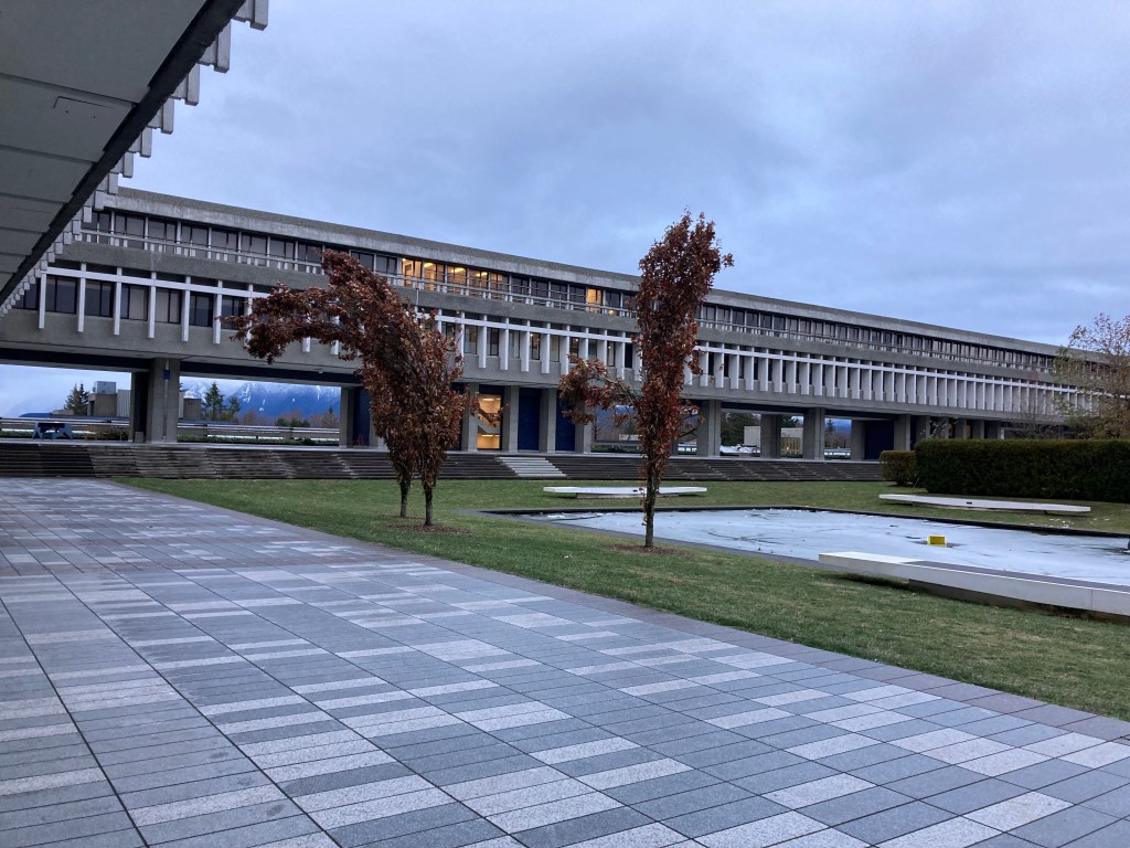
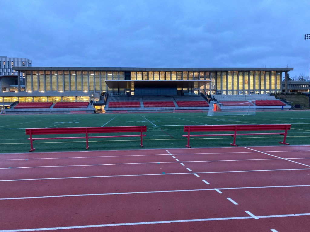
The final installation of my higher education exploration: Simon Fraser University. Up on a big hill in Burnaby, ten minutes from Port Moody.
I had another reason to come here though – when I was 15 I ran in a national track and field meet here. My Dad came on that trip. And while the experience of running in that meet is not one of my fondest memories, running in general and my Dad are the parts that matter. I actually decided to go for a run here, through campus, on some trails, and a few laps on the track. It’s a really nice facility, and it definitely brought back memories.
Deep Cove
Another friend told me of their visit to Deep Cove, featuring seal and starfish sightings, so I decided to check it out. While I didn’t see any seals or starfish, I will say that this was a very nice little area. I would love to live in a place like this. There’s just a feeling. And it does also have a little street with cute shops.
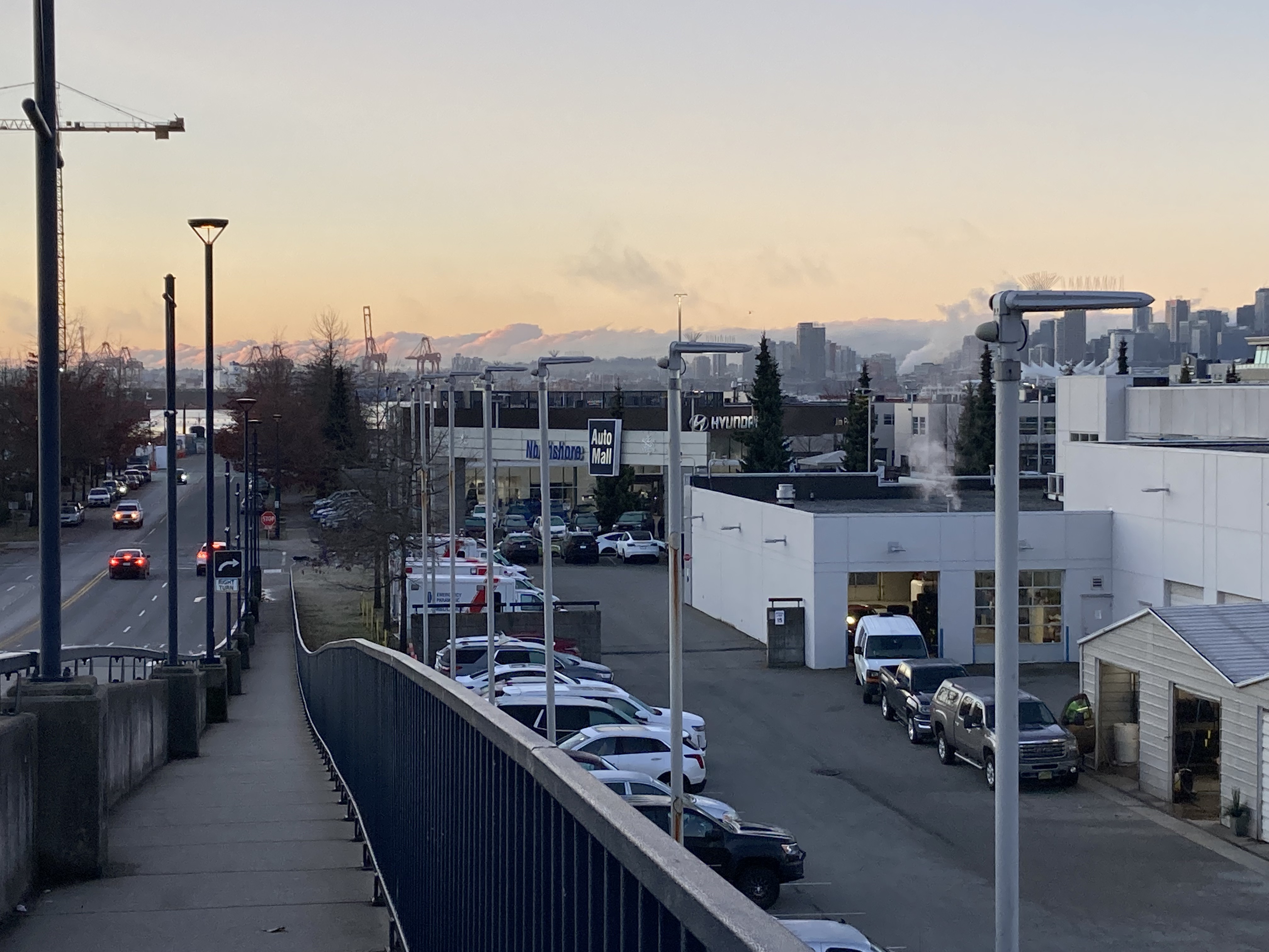
North Vancouver
When it came to Vancouver, like Colwood near Victoria, North Vancouver became a bit of a home base for me. I did my laundry here, had a convenient facility for showers, and had a reliable overnight parking spot.
The unsavoury memory attached to North Vancouver was that this is where I needed a big repair done on my van. I had brought the van in for regular servicing, and they found issues with the steering rack and tie rods that needed to be addressed. It’s never fun to need repairs like this on the road, but it’s something you should be prepared for the possibility of. I was a ball of stress, it was unfortunate, but it felt good to know things were being taken care of.
After dropping off the van I decided to walk to Capilano Suspension Bridge. I can’t remember why I didn’t end up buying tickets, but I remember being disappointed to find that they have the area completely walled off and I think the ticket prices seemed steep to me so I bailed.
The auto mall where I’d dropped the van off was pretty close to Capilano Mall near my overnight spot, so I returned to the mall to pass time while I waited for the van to be ready. The part needed for the repair had to be ordered in, so the repair would need to happen the following day. Luckily the van was driveable and I was able to pick it up for the night rather than book a hotel. I’m also wary of leaving my van in the hands of strangers with all of my possessions in the cargo bay – but to an extent, sometimes, what can you do?
Day two of repairs I decided to walk to the downtown area of North Vancouver and explore. You could look south to the Vancouver skyline. And I popped into a shop called Earth & Sol.
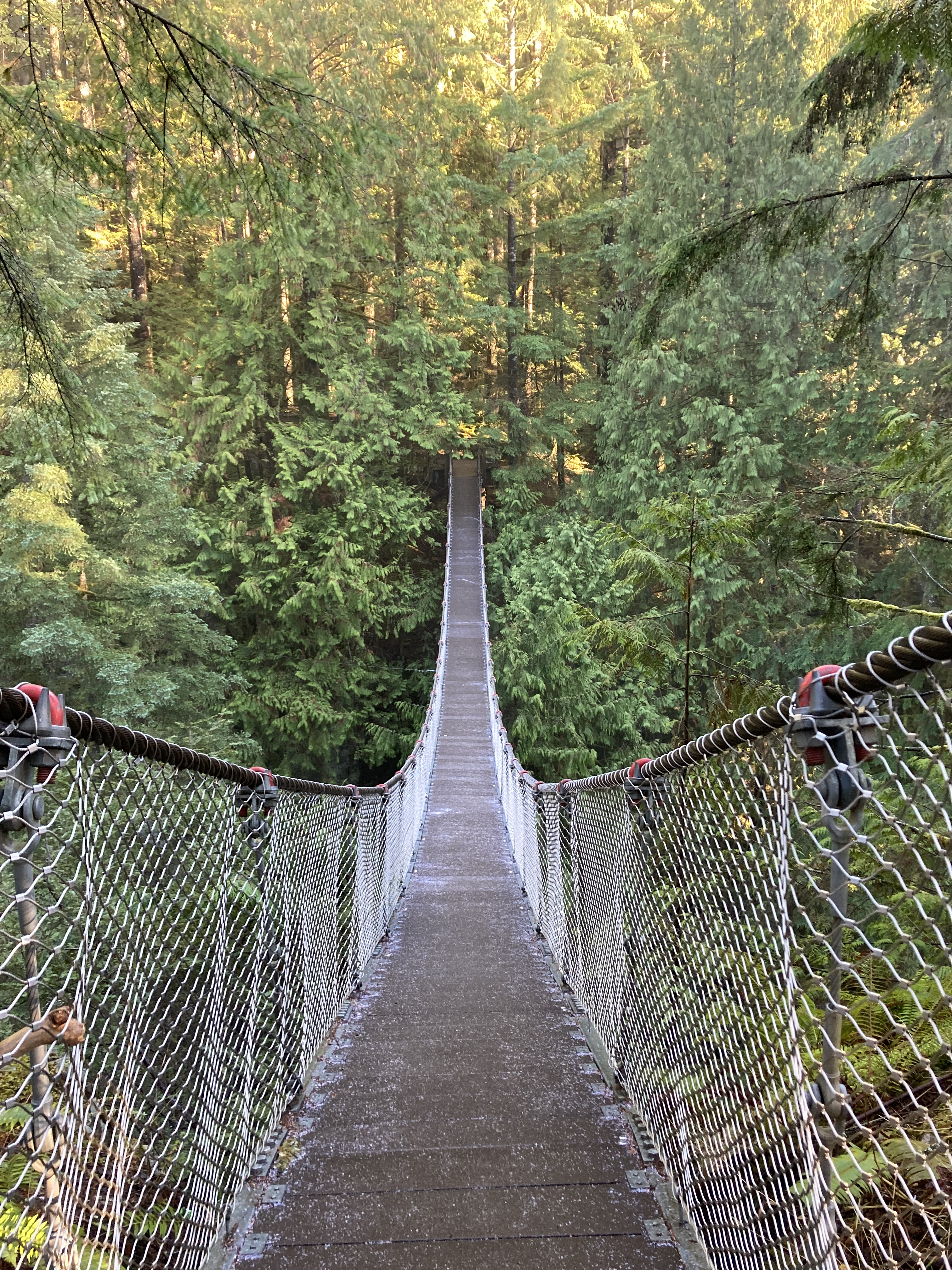
After getting the van back for good, I visited Lynn Canyon Suspension Bridge. So I got my suspension bridge fix – and this one was free. I think I just paid for parking. I crossed the bridge (which was icy), took in waterfalls, and hiked a loop through the forest. It was beautiful.
Oh and – Strider finally got a wash:
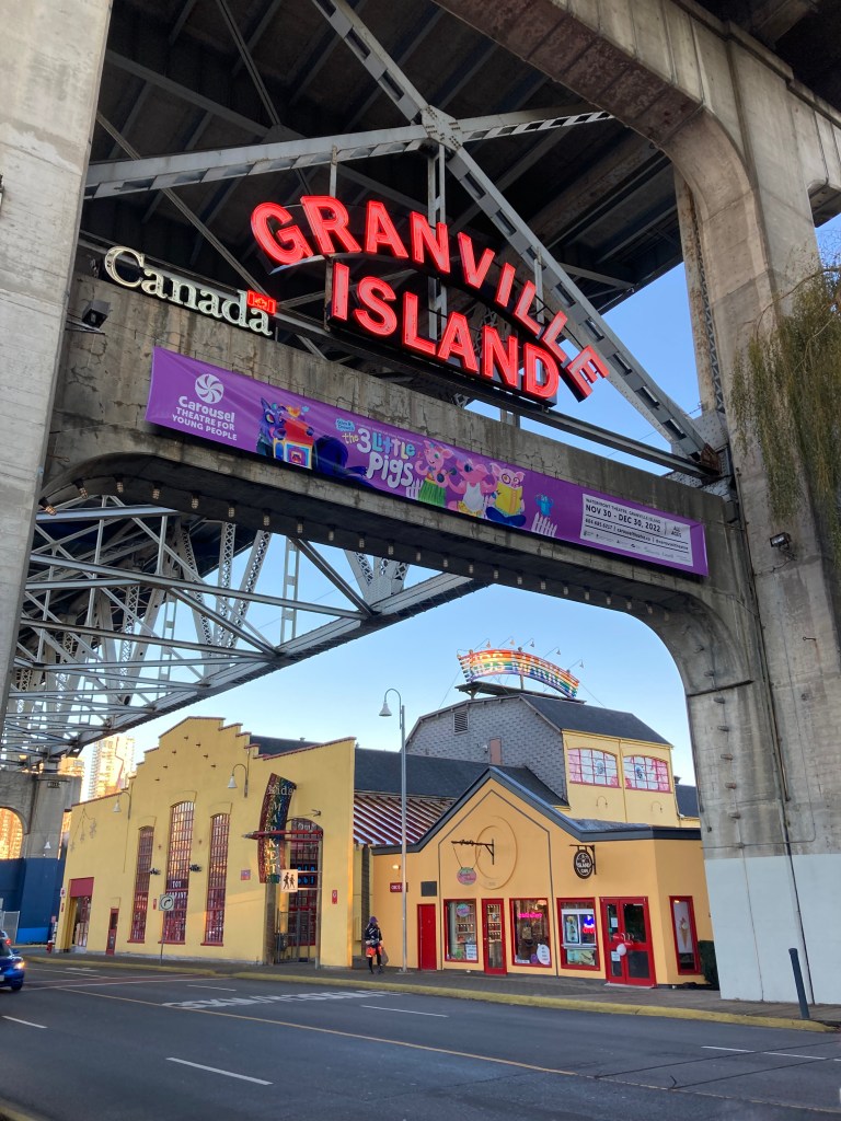
Granville Island
This was a favourite. I made my way to Kitsilano Beach, walked along the water, then headed to Granville Island.

Kitsilano Beach and Vanier Park (within walking distance of each other and very close to Granville Island), in view of Sunset Beach, comprise a pretty area. I don’t think I could tire of viewing the Vancouver skyline against the backdrop of mountains, especially on a clear day.
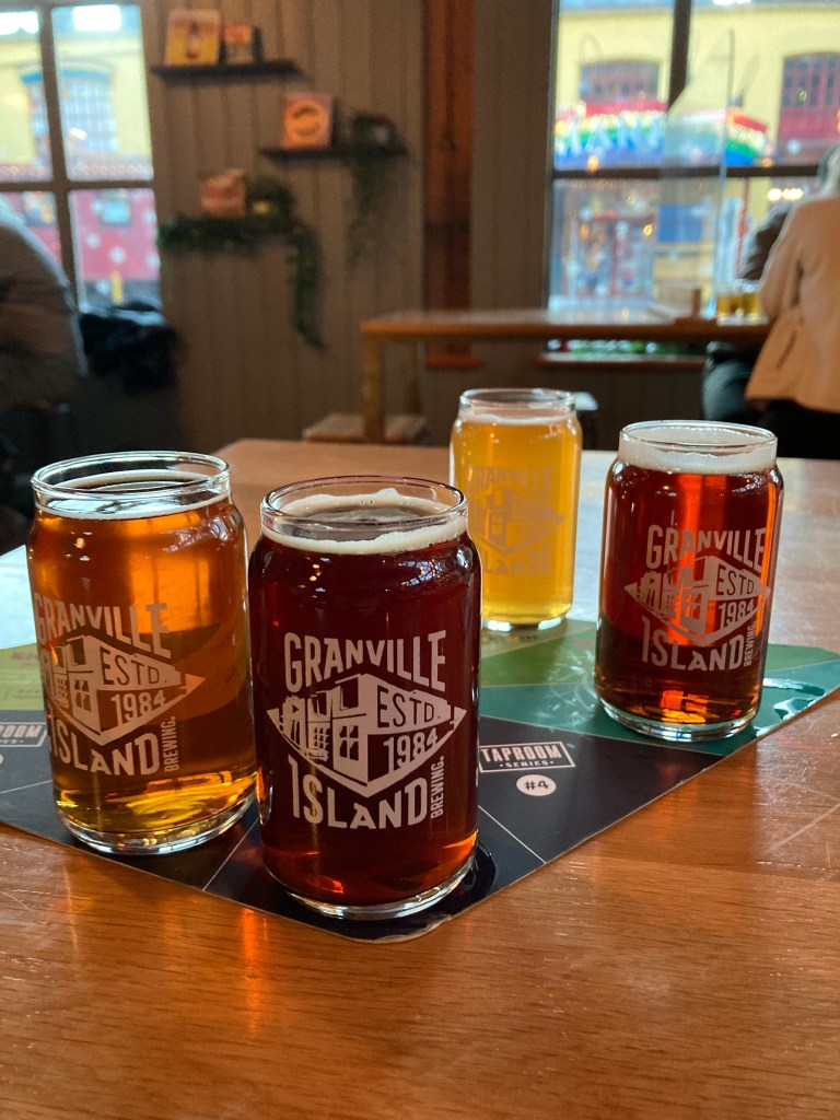
Granville Island was just fun to walk around and explore. Of course you’ve got the Public Market, where I picked up some treats – like salmon jerky! There are a bunch of cool shops around (a broom shop, The Crystal Ark). And a stop in to Granville Island Brewing was a non-negotiable, which I quite enjoyed. I went mostly for seasonals, with the Lions Winter Ale, Sunshine Coast Heifeweizen, Hexenbier Marzen, and Winter Ale Chocolate Orange. I even bought a little tasting glass as a souvenir! A good impression was made.
Stanley Park
Stanley Park sits between downtown Vancouver and the Lions Gate Bridge / North Vancouver. There is a large parking area next to Coal Harbour between the park and downtown. So this was a good spot for me to leave the van while exploring.
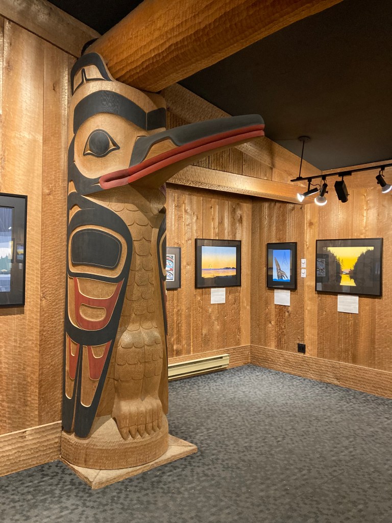
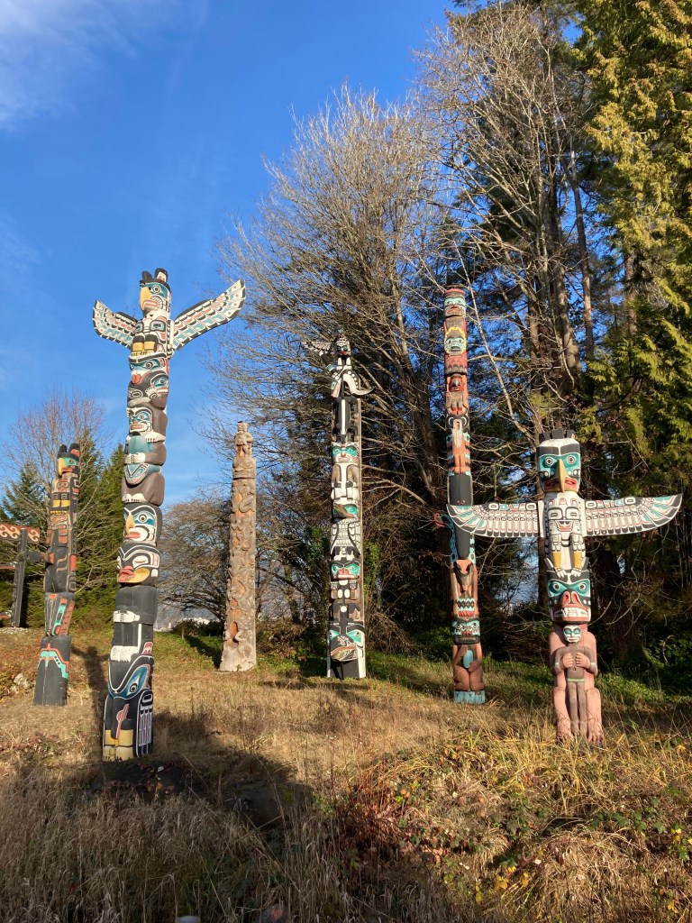
I spent a leisurely, sunny afternoon wandering the park. I walked along the seawall, the stone wall and walkway that runs along the border of the park and harbour, taking in the views of the Vancouver skyline, Deadman’s Island (an old burial ground, now home to a naval base, and said to be very haunted), North Vancouver, the mountains, and Lions Gate Bridge. There are totem poles (Stanley Park is on the unceded territories of the Musqueam, Squamish and Tsleil-Waututh peoples), there’s a gift shop, and trails that run through forest. I saw a starfish on the seawall. And at night the boats in the harbour were lit up with string lights.
Downtown Vancouver
I suppose I worked my way from the outside in – leaving downtown Vancouver for last on my travels through the area.
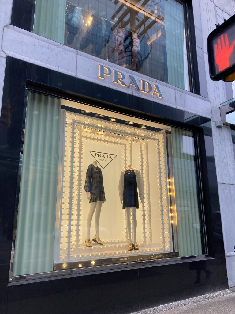
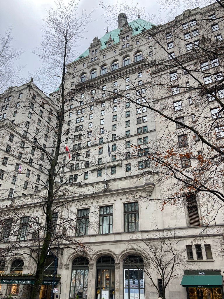
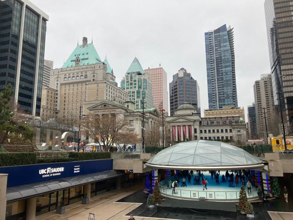
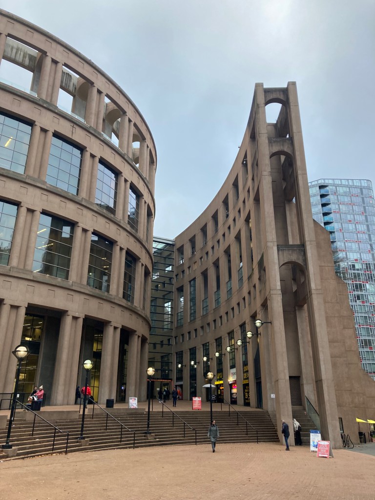
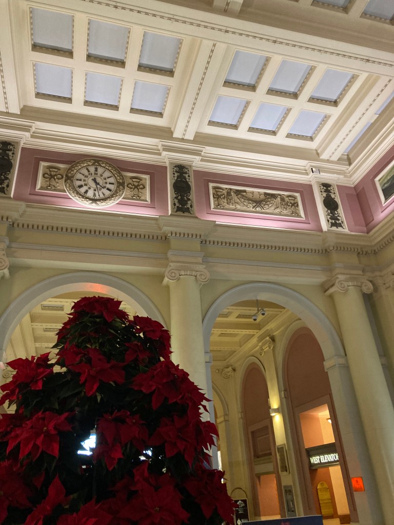
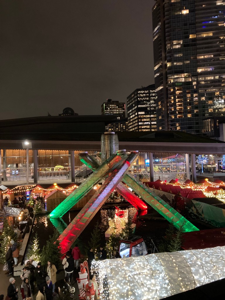
I spent a full day walking around downtown. It was a short and enjoyable walk from Stanley Park, where I parked again, to the downtown core. I walked along Alberni Street with its luxury shops (Prada, Saint Laurent, Jimmy Choo, Coach, Louis Vuitton). I took in Fairmont Hotel Vancouver and the Marine Building (an art deco building “designed to resemble a huge, ornate crag, encrusted with starfish, crabs and other marine life”). I walked down Granville Street, where nightlife is centred, known generally as the Granville Entertainment District, and past the Commodore Ballroom, where so many bands I’ve loved have played (including Nirvana in 1991, before and after Nevermind blew up). I went past Robson Square (which had an outdoor skating rink) and through Yaletown (a trendy neighbourhood – dining, nightlife, dress to impress, OPUS, celebs, best seafood, e.g., Blue Water Cafe). I walked by the Hamilton Street Victorian Houses and over to BC Place Stadium, where there are statues of Canadian athletes, including Terry Fox, and from which I got a view of Science World (the big silver orb). I marvelled at the architecture of the Vancouver Public Library on my way to Gastown, where I waited to watch the Steam Clock chime. Here I visited shops like eccentric Canadian shoe designer John Fluevog’s flagship store and design studio, with its “art deco-inspired footwear”. Gastown is another area of Vancouver said to be haunted. And next time I’m here I really want to visit the new Arcana Spirit Lounge. I walked past Harbour Centre, where you can ascend to do the Vancouver Lookout. I walked through the Waterfront Train Station, which was an interesting mix of pink and ornate white trim. I took a break at Steamworks Brew Pub with a flight (Kolsch, Pilsner, Lager, Red Ale, and an Imperial Breakfast Stout – which I definitely earned with all that walking). On my walk back to the van I explored Canada Place and its Canadian Trail, a walkway which has sections like tributes to the cities of Canada, and I made a point of walking past the Olympic cauldron from the 2010 Winter Games.


As I said – I can see a lot in a short period.
Next Time in Vancouver
I like to do my research before exploring a place. I like to know what the main attractions are so I can rest assured that I’ve made informed decisions when choosing what to see. Or so I can prioritize what I’m most drawn to in whatever window of time I have.
After a long time on the road, you start to realize that most places consist of a similar basic foundational structure – riverside parks, the downtown core, financial districts, entertainment districts, industrial areas, an arena, etc. I like to try and see the “tourist attractions”, even if they’re not fully my cup of tea, because they are popular for a reason and usually inform the history of a place. I appreciate architecture and old things. But it’s usually the people, culture, unique landscapes, and history that are most colourful and set a place apart. I try to see as much as I can the first time I visit, this allows me to focus on things I’ve missed or my favourites on subsequent visits. And I’ve learned that not everything is worth seeing, but you also don’t usually know that without trying (beware blogs that amp things up without due cause).
With Vancouver – Granville Island, Stanley Park, and Gastown stand out for me.
But you really only scratch the surface when passing through.
Next time I’m in Vancouver I’d like to revisit my favourite spots. I’d like to discover some lesser known haunts. As mentioned, Arcana Spirit Lounge. I want to get tickets to see a band at Commodore Ballroom. Maybe I’ll go to Science World. I’d love to hike up Grouse Mountain. There’s Pacific Spirit Regional Park near UBC and Sunset Beach/English Bay Beach on the other side of the water from Vanier Park.
And are there more castles?
Border Prep
The time had finally come – I was going to cross into the United States.
My time in BC really was like driving into a void. I had no final destination. I was just wandering. And I wasn’t going to go back, only forward. I’d hit the coast, winter was looming, and I’d always dreamed of this road trip – down the west coast.
I get quite nervous crossing the border, so I was dreading this. I don’t know why – I’m like the least likely person to be a criminal. Though I suppose that’s what a criminal would say. I have had not so fun border crossing experiences. And I don’t think the white van and alternative lifestyle elicit the best impression. Plus I’d recently heard that a friend of a friend had been turned back at the border. So I was nervous. But I couldn’t not try.
Of course I lost my Visa card at some point while walking around Vancouver the day before. I cancelled it. And went into the states without a credit card, which would prove to be frustrating.
But I’d serviced the van. I’d tidied the van. I’d done my research to make sure I was prepared. I threw out a can of tuna. I got gas.
All that was left to do was drive south and hope for the best.
Other Information
BC Crown Land Camping (Recreation Sites)
When I crossed into BC I found that their information on crown land camping, or what they call recreation sites, is a lot clearer than what I had found in Alberta. They have a website, and maybe it’s just me, but I found it to be well laid out and easy to navigate.
I still like to primarily find spots using iOverlander. But I do like to also check local regulations (whether that’s crown land or municipal bylaws). Often there are signs at the entrance to crown land areas that let you know what is allowed. There are places, like Tofino, where you want to know the borders to provincial or national parks – BC has interactive maps for their recreation campsites, too. And while many sites are free, some have fees ($10-$15).
While recreation sites like these are convenient, they are likely not accessible in the winter (depending on the area and how much snow or mud there is). I made the silly mistake of thinking I could get into a spot after snowfall in Osoyoos (never again – quick way to get stuck). So an alternative might be checking out winter camping sites that are open (I found a site for that) – for those crazy enough (or prepared enough) to do vanlife in the Canadian winter!
I know not everyone does campgrounds – YMMV – I myself did them every so often for the amenities and experience and to switch up my overnight routine. But I’ll include here a link to an article on top rated campgrounds on Vancouver Island anyway, as I’d made note of it.
Road Conditions & Tires
Seeing as how I was travelling through BC and the mountains as winter loomed, keeping an eye on road condition reports and knowing local tire regulations were important.
Drive BC is a good resource for checking current road conditions. Since one of the main highways through the rockies from Alberta to the BC interior was closed, this would have been a good site to check. Also with the onslaught of the snowy season, and possibility of avalanches. Though map apps are pretty good at diverting your course if roads are closed.
Tire requirements for winter driving in BC are enforced on select highways from October 1 to April 30. Larger commercial vehicle require winter tires or chains. Passenger vehicles require winter tires, which can include studded winter tires, plain winter tires, (mountain peak symbol), all weather, or all season (mud and snow tires with the M+S symbol).
When you’re travelling in a van and all your possessions are in said van, you’re probably not going to be carrying four massive tires with you to change over once the seasons turn. Safety should never come at the expense of convenience, but I imagine you can add this to the list of reasons why vanlifers move locations in alignment with the seasons. That and I think most nomads prefer warmer temperatures. Not all – I know there are many who enjoy winter sports and tough it out through Canadian winters in their vehicles (all the more power to you). But I am not a winter person, or a winter sports person. I am also more of a low maintenance person – and warmer weather is both less messy, and more enjoyable (to me).
Warmest Winter Cities
I was kind of just going with the flow at this time – going where I wanted to go, while the weather still permitted it. And I managed to keep to some of the milder areas of Canada (before fleeing when the coldest months descended). Don’t get me wrong – it was still cold. I toughed it out. That said – in the future, if I can’t go south, I would either upgrade to a quality heater, or destination hop while staying in longer term accommodations. Just because you can survive unsavoury conditions, doesn’t mean you should.
Plus, being cold can be dangerous. Hypothermia should be on people’s radar.
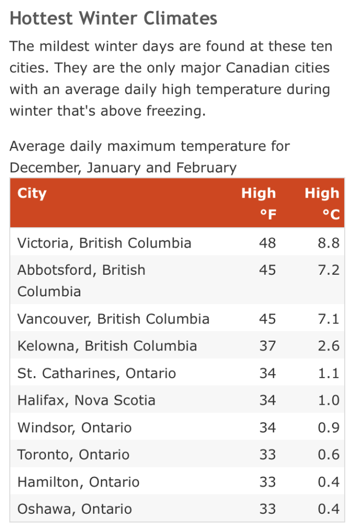
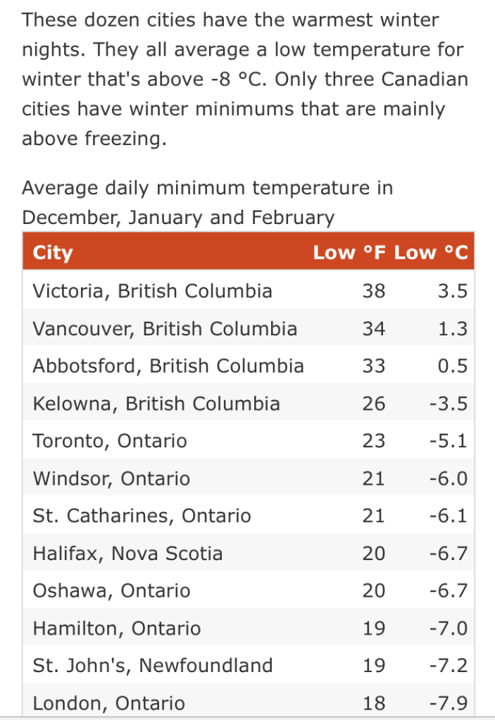
I did some research into the warmest cities in Canada during winter. The results are overwhelmingly southwestern BC (Victoria being the winner, followed by Vancouver, and Abbotsford) then southwestern Ontario.
I will also say that humid sub zero temps have a different bite to the dry cold of the prairies. The same way that humid heat is much more unbearable than dry heat. While I love the ocean and being on the coast – humidity offers up several nuisances and discomforts.
Safety
As stated above – the cold can pose a threat to your health and safety. Hypothermia should be a consideration in the fall and winter. But there’s also the possibility of carbon monoxide poisoning should anything go wrong if using a portable propane heater – this is why I decided not to use one. I had bought one, but I was nervous about it and ended up returning it. The cold was the lesser of two evils in my mind. Also, propane heaters add to the moisture in the air, and I was battling to prevent mold in the van – another thing that can make you sick and another reason I love dry climates. Winter being especially inconvenient for getting condensation in the van as I would heat the interior and any cold metal of the van’s body, which was cold from outside, created the perfect dynamic for condensation against the warm air inside. Over the years diesel heaters have become the more popular option (vented to the outside and creating dry heat), but I was on the road and planning to go south so I never got to the point of an installation. I suppose there are also electric socks, heated blankets (depending on your electrical energy reserves), or the analog hot water bottle.
The other side of safety is being aware of crime rates.
I got into the habit on the road of looking up crime indexes of the areas I was passing through. These were often categorized by types of crime – largely violent crime vs theft. If I was in a big city – such as Vancouver – I would look up which were the most dangerous neighbourhoods and avoid those. Victoria and Surrey stood out as having higher crime rates in BC, although I didn’t go to Surrey, and I felt fine in Victoria (I read that people didn’t feel safe in the downtown area at night, in part because of homelessness).
The more time I spent on the road, the more I would look up crime rates, and be able to compare them to my personal experience. So I got a feel for what the crime indexes actually meant – I could look at the numbers and have a good feel for what to expect. I’ll get deeper into this in my post on California.
If going to places with high crime rates, it just pays to be informed (this is how I later felt when in San Francisco, with its very high rates of vehicle theft, and where I was nervous about a break in to the van). You don’t have to let fear stop you, just be prepared. And Canadian cities would prove to feel a lot safer than some of the notorious US cities.
Discrimination on the Road
I want to touch on this, because it was shared with me: racism on the road.
As a white woman, it’s not something I see as often. Sure, I experience some discomforts as a solo female on the road, I need to be more aware of my safety than men on the road, I get some misogynistic remarks – perhaps on my ability to navigate beer or the van. But I am also extremely privileged and sheltered from the realities that many others face.
I was reunited with a dear friend during my travels through BC, and naturally we had all of the chats to catch up. She’d done the drive from Ontario to BC a few years prior when she moved out west. And so we were comparing some of our experiences on those travels. I spoke of how I was adjusting to BC, some of the expectations I’d had, how some of those lined up and some did not. Having lived here for a while, my friend had more insight to share. She is a woman of colour, her partner is a man of colour, and they’ve had a lot of unsavoury experiences.
Now, Canada gives off this impression that it’s our neighbour to the south that has issues with racism, that we’re the “nice” country – but that’s bull. We have the same issues, we’re just more passive aggressive about it.
My friend’s stories reminded me of how I feel when crossing the border into the states – I am made to feel like a criminal. It feels horrible. Now think about being made to feel that way all the time. In stores, in your neighbourhood – being grimaced at, not greeted, followed, questioned, ostracized. Think about what that does to your psyche.
I think about destinations where my impression may be that the people are nice and friendly – and I have no idea if they might treat the next person like shit because of the colour of their skin. That their niceness is prejudiced. I may be lucky to not experience that first hand, but I sure as hell don’t want that kind of inauthenticity.
My friend had starkly different experiences in some of the same places I had just been. And let me tell you – she is a damn near angel on earth.
Canada – you’ve got serious work to do.
Public Washrooms
Fun fact: did you know that you can just google public washrooms? Some cities provide lists and even hours of operation.
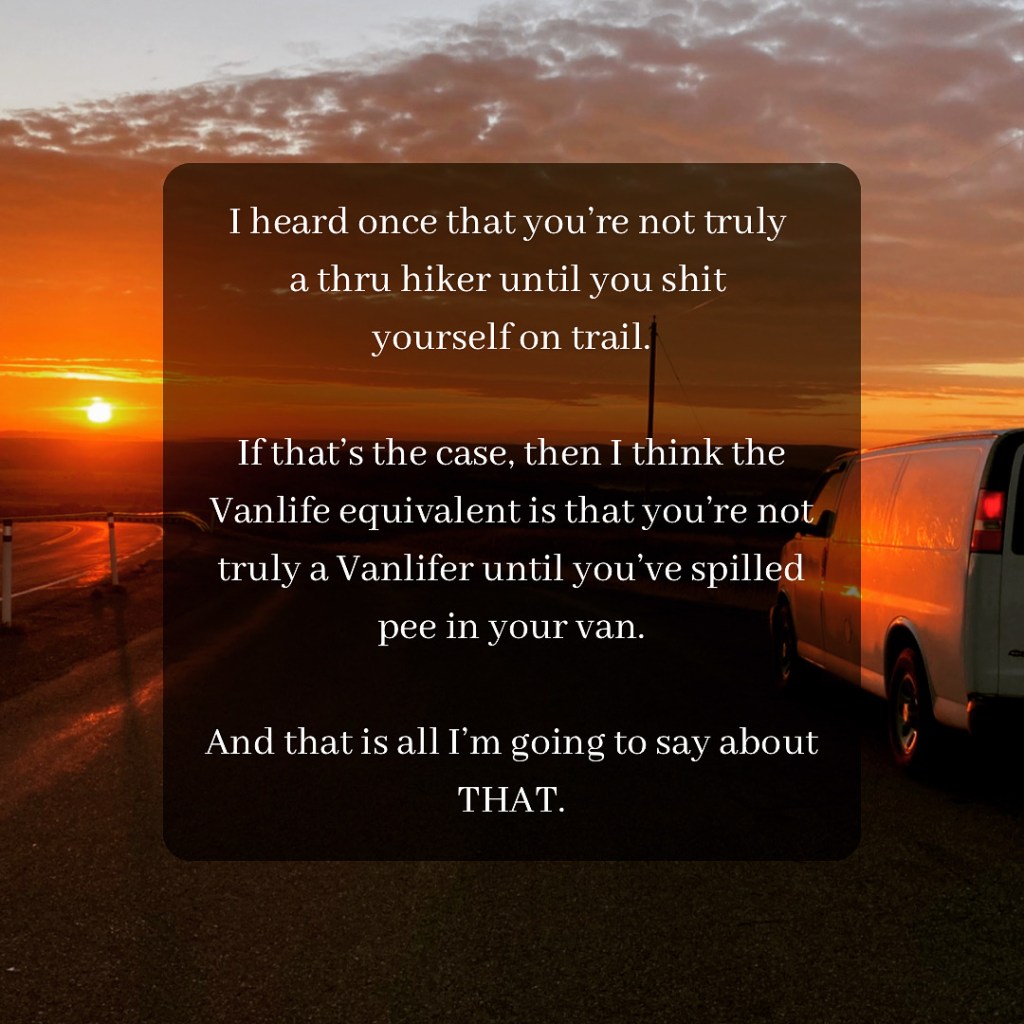
Haunted Places
Searching out haunted places is definitely a pastime I enjoy. So here’s a roundup of some of the haunted BC locations that I mentioned throughout this post.
In Vancouver you’ve got Deadman’s Island in Stanley Park, as well as the Waterfront Train Station and Gastown in the downtown area.
Near Abbotsford you’ve got Keeping Road.
There’s Port Moody.
And in Victoria you’ve got the Fairmont Empress Hotel.
I’m sure there are way more, but these are the one’s I came across in my (light) research and travels.
Beer
I enjoyed the beer in BC. Standouts were Fernie, Granville Island, and Tofino. But I feel like I just scratched the surface. I’ll be covering my experiences in more detail and exploring what else is on offer in my next post, which will specifically be about BC’s craft beer!
Future BC Destinations
A list of some destinations I made note of, but was not able to visit, and would like to in the future (more are mentioned throughout this post):
- Mount Robson – just west of Jasper across the BC border
- Takakkaw Falls in Yoho. Plus the town of Field + Truffle Pigs.
- Mount Assiniboine – just west of Banff as you drive toward Kootenay.
- Kootenay National Park
- Glacier National Park
- Revelstoke. Giant Cedars Boardwalk Trail.
- Nelson BC – on the southern border (it was out of the way as I was further north on my way to Kelowna).
- Wells Gray PP – 2hrs north of Kamloops.
- Penticton
- Joffre Lakes – north of Whistler
- Coast Mountain Circle Tour (from the Sea To Sky highway).
- Hike up Grouse Mountain – Vancouver.
- Horseshoe Bay (where you get the ferry to Vancouver island) / Troll’s restaurant oyster burger/ clam chowder.
- Port Renfrew.
- I want to thru hike the West Coast Trail one day!
- Juan de Fuca Trail
- Butchart Gardens – Victoria
- Salt Spring Island
Land Acknowledgement
It is important to acknowledge the origins of these lands and those who have cared for them. The lands now known as British Columbia, the areas that I’ve spoken about in this post, reside on the ancestral and present-day territories of many indigenous nations.
The Columbia Valley, powerful valley of rivers and mountains, is on the traditional territories of the Ktunaxa and Secwépemc peoples.
The Okanagan Valley, land of lakes and valleys, is on ancestral and unceded territories of the Syilx Okanagan Nation.
Fraser Valley and Abbotsford, with its rich soil and flowing rivers, are the traditional and unceded lands of the Stó:lō people, “the people of the river.”
Squamish, land of mountains, forest, and the Squamish River, is on the unceded and traditional territory of the Sḵwx̱wú7mesh Úxwumixw (Squamish Nation).
Whistler, ancient mountains, forests, and waters, is on the shared, unceded, traditional territories of the Lil’wat Nation and the Squamish Nation, the Lil’wat7úl and Sḵwx̱wú7mesh peoples.
Nanaimo, coastal land of harbours, islands, and ancient forests, is on the traditional and unceded territory of the Snuneymuxw First Nation.
Port Alberni, at the head of the Alberni Inlet, with its deep waters and surrounding mountains, is on the traditional and unceded territory of the Tseshaht and Hupacasath First Nations.
Tofino and Ucluelet, with their ancient rainforests, rugged shores, and powerful Pacific waters, are on the traditional and unceded territories of the Tla-o-qui-aht First Nation in Tofino and the Yuułuʔiłʔatḥ (Ucluelet) First Nation in Ucluelet, the Nuu-chah-nulth peoples.
Victoria, coastal city with its gentle climate and surrounding waters, is on the traditional and unceded territories of the lək̓ʷəŋən peoples, represented today by the Songhees and Esquimalt Nations.
Vancouver, coastal city of mountains and sea, is on the traditional, ancestral, and unceded territories of the Coast Salish peoples: the xʷməθkʷəy̓əm (Musqueam), Sḵwx̱wú7mesh (Squamish), and səlilwətaɬ (Tsleil-Waututh) Nations.
As someone who finds great joy, purpose, and healing when I spend time among natural wonders, I feel a responsibility to respect and honour those who steward and know this land best. These lands are inextricable from their indigenous origins. Being in relationship to the land demands that we recognize this truth. May our explorations be guided by care and reverence. May we be committed to respecting, protecting, and stewarding these places and their keepers, and honouring deep and wise Indigenous knowledge.

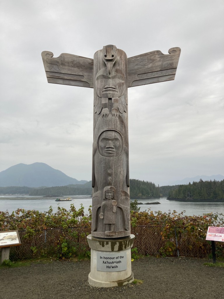
Conclusion
I don’t know if it was the time of year and the cold, or the gloom of the weather on the coast (lots of cloud and rain), compared to Alberta’s plethora of sunshine, but there was definitely a moodiness about being in BC. I’m sure this impression might also have been coloured by the fact that I was roaming with no set destination, a leaf in the wind, and the unknown can put a hamper on things (or be filled with possibility, depending on circumstances and how you look at it).
It was definitely a period of transition for me. Things felt a little foreboding.
But they were also beautiful.
There is a lot more to BC that I would like to explore. But as winter crept in, my attention turned towards the south.
Would I get to cross the border? Where would I go? Even I didn’t know at the time. I’ll cover that in my next posts.
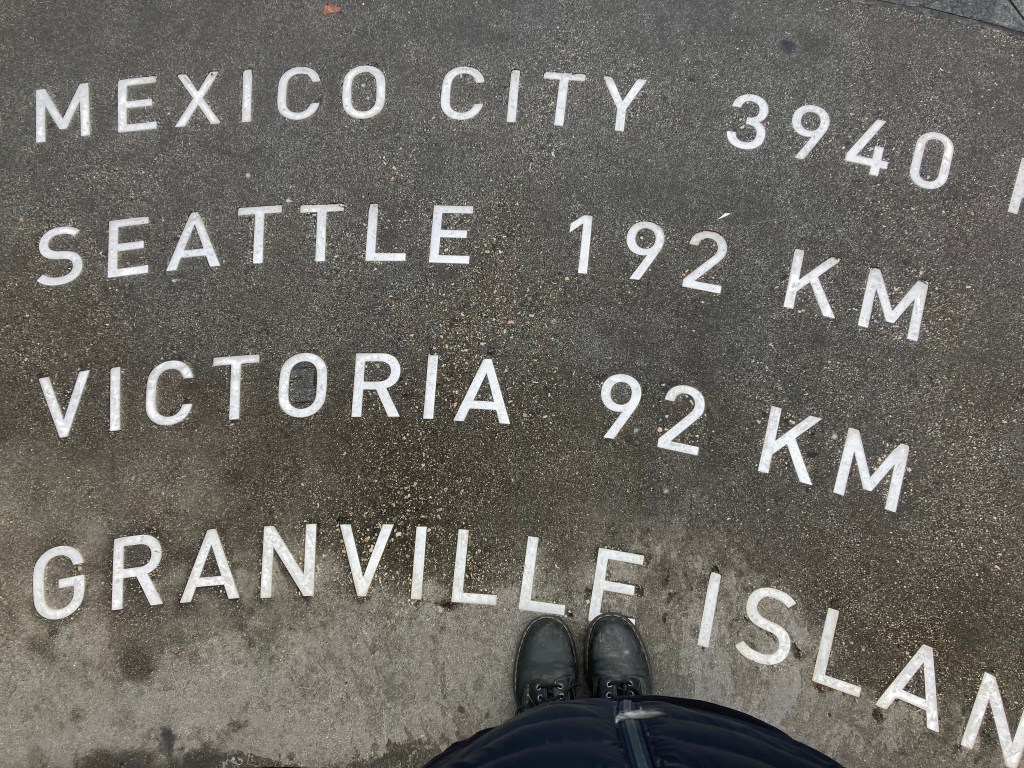
Till next time,
Kat
ChronicXRoads on Instagram
Copyright © 2025 Chronic X-Roads. All Rights Reserved.
