
Things changed and kicked into a higher gear when I left the California coast. You could say that I hit a wall. Figuratively, but also literally – at the Mexico border.
I’d been taking my time as I moved south, keeping to the ocean for the most part. Spending as much time as I deemed fit in the places I found myself drawn. There were few hard plans.
But once I wrapped things up in San Diego the plan was to leave the coast and explore the interior as I made my way back north. I always find I get a bit of a homesick feeling when I leave the ocean. But I knew that I had several locations close to my heart on the horizon.
Table of Contents
SoCal Interior
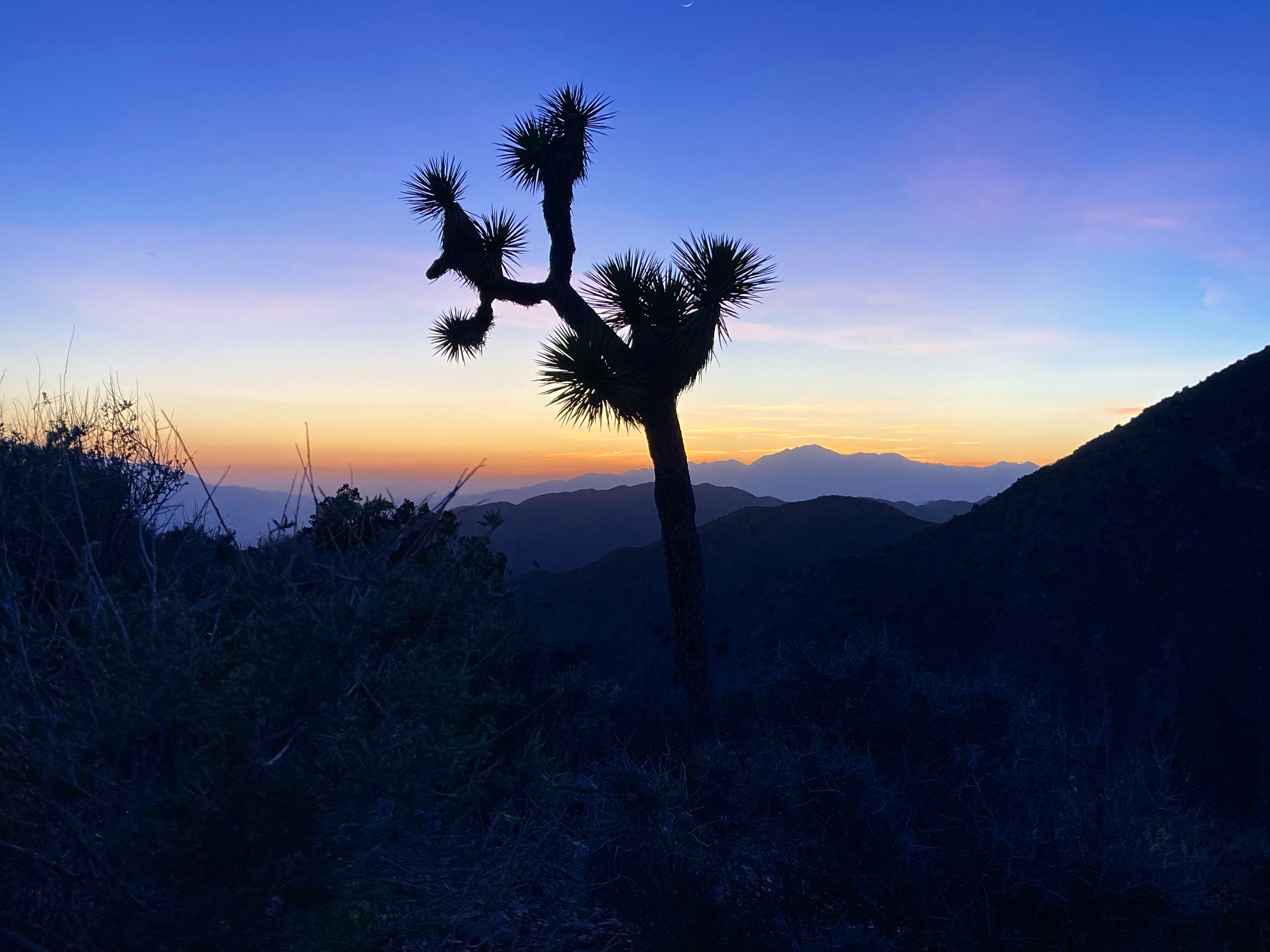
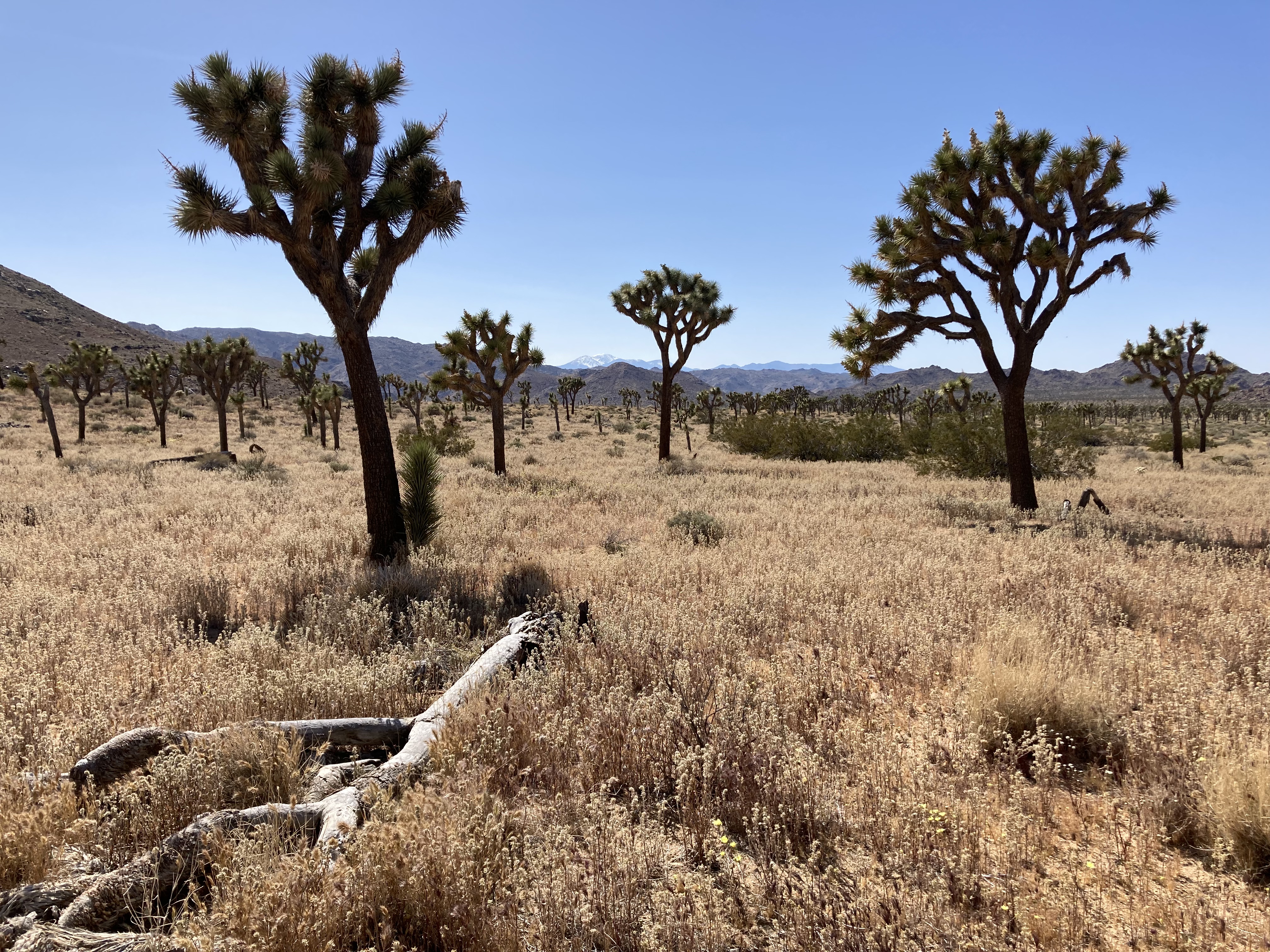
Just as the ocean feels healing to me, I find something equally as healing about being in the desert.
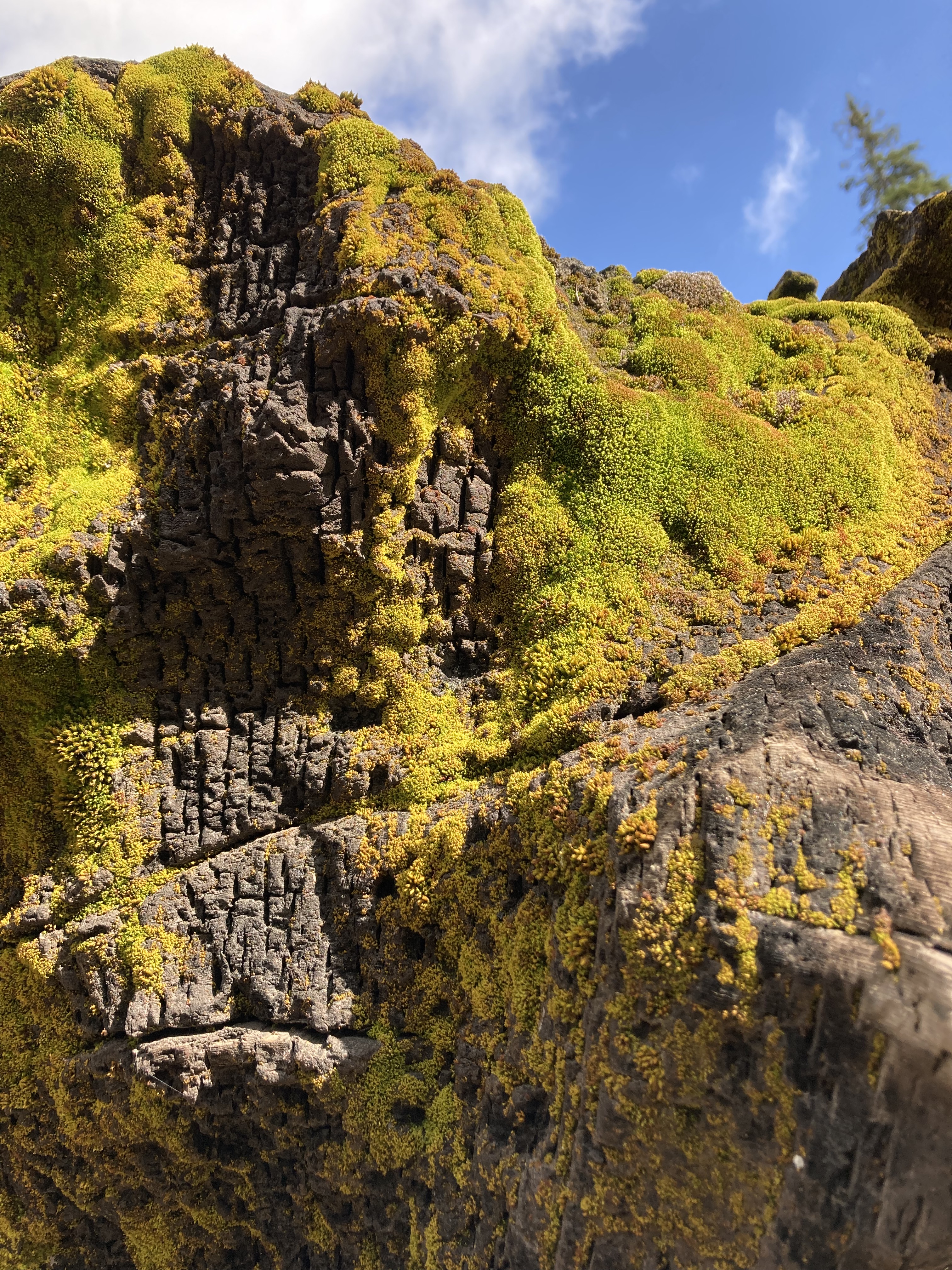
It’s kind of funny, I’ve been questioned for my love of mountains and deserts. I’ve encountered those who would describe them as “just rocks” or barren. To me, the desert is the epitome of strength and resilience and beauty in the face of the harshest conditions. It’s survival. And it inspires me.
I was excited. Not every destination is exciting when you’re full time on the road. Some places are just places to explore because you happen to be there, or out of curiosity. A fraction are places that you have a genuine, deep, personal connection to. I wasn’t just following the coast anymore – I was moreso cherry picking where I was going.
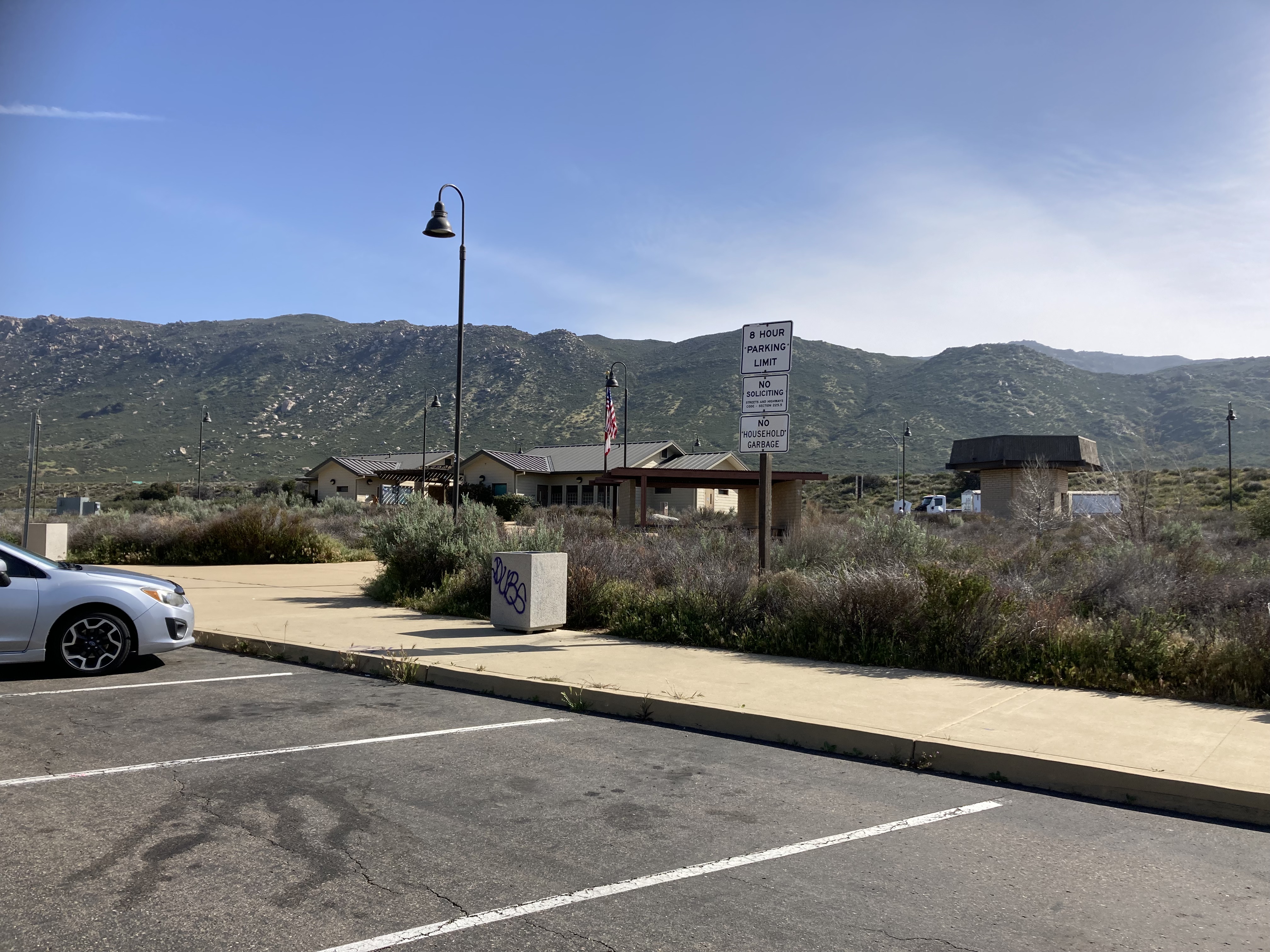
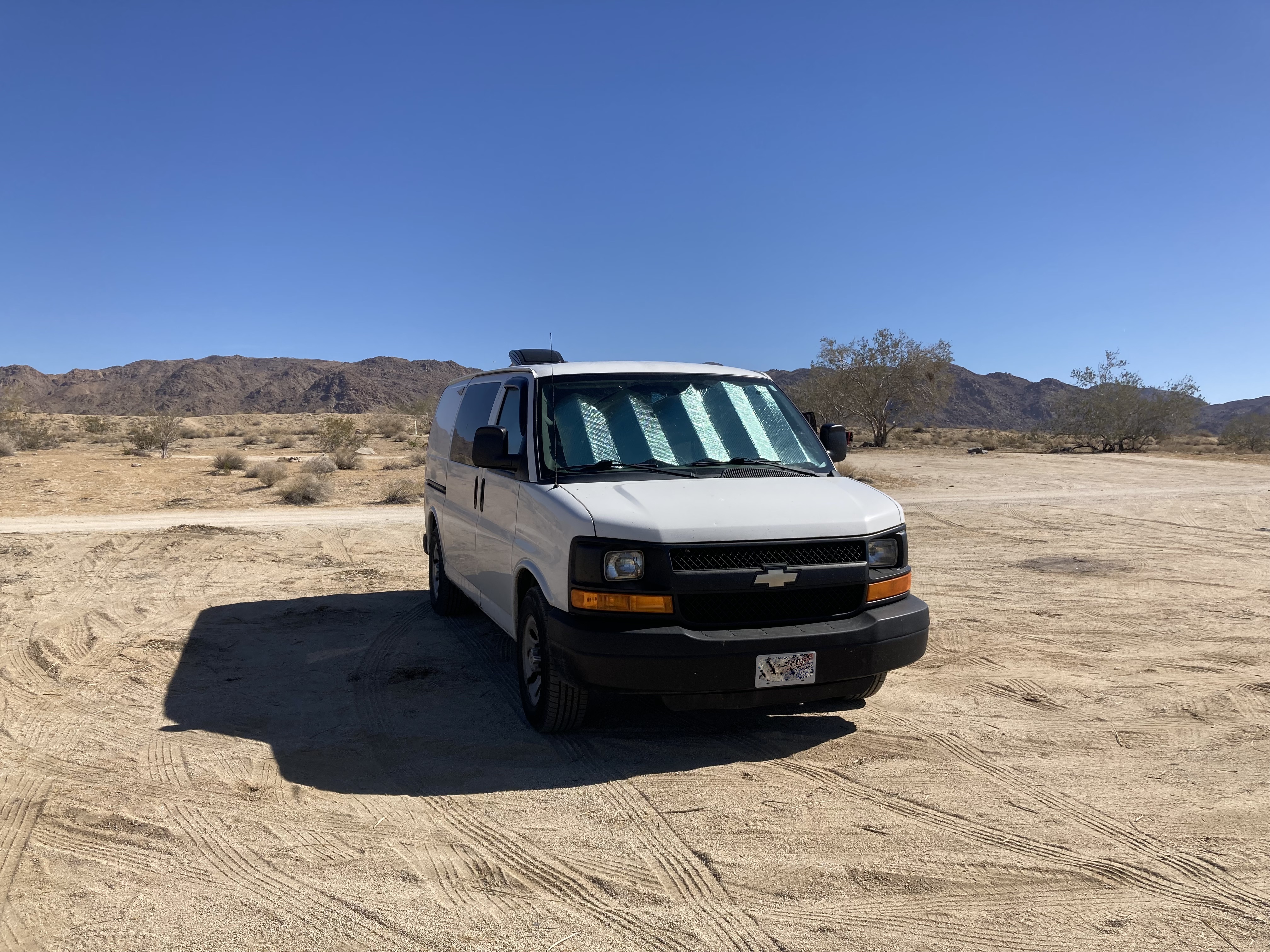
The night that I left San Diego I drove about an hour east and stopped at a rest area (Buckman Springs) for the night. I didn’t know what my surroundings looked like until morning. And just like that, a new chapter of my travels had begun.
The PCT
As someone who’s gotten into thru hiking and done a few trails in Canada – I am very aware of the big three thru hiking trails in the US that run border to border: the AT (Appalachian Trail), PCT (Pacific Crest Trail), and CDT (Continental Divide Trail – which turns into the GDT/ Great Divide in Canada, and is on my bucket list). These three trails make up the Triple Crown – an achievement for those who complete all three. I was also turned on to Cheryl Strayed’s story (Wild) by my Dad years ago.
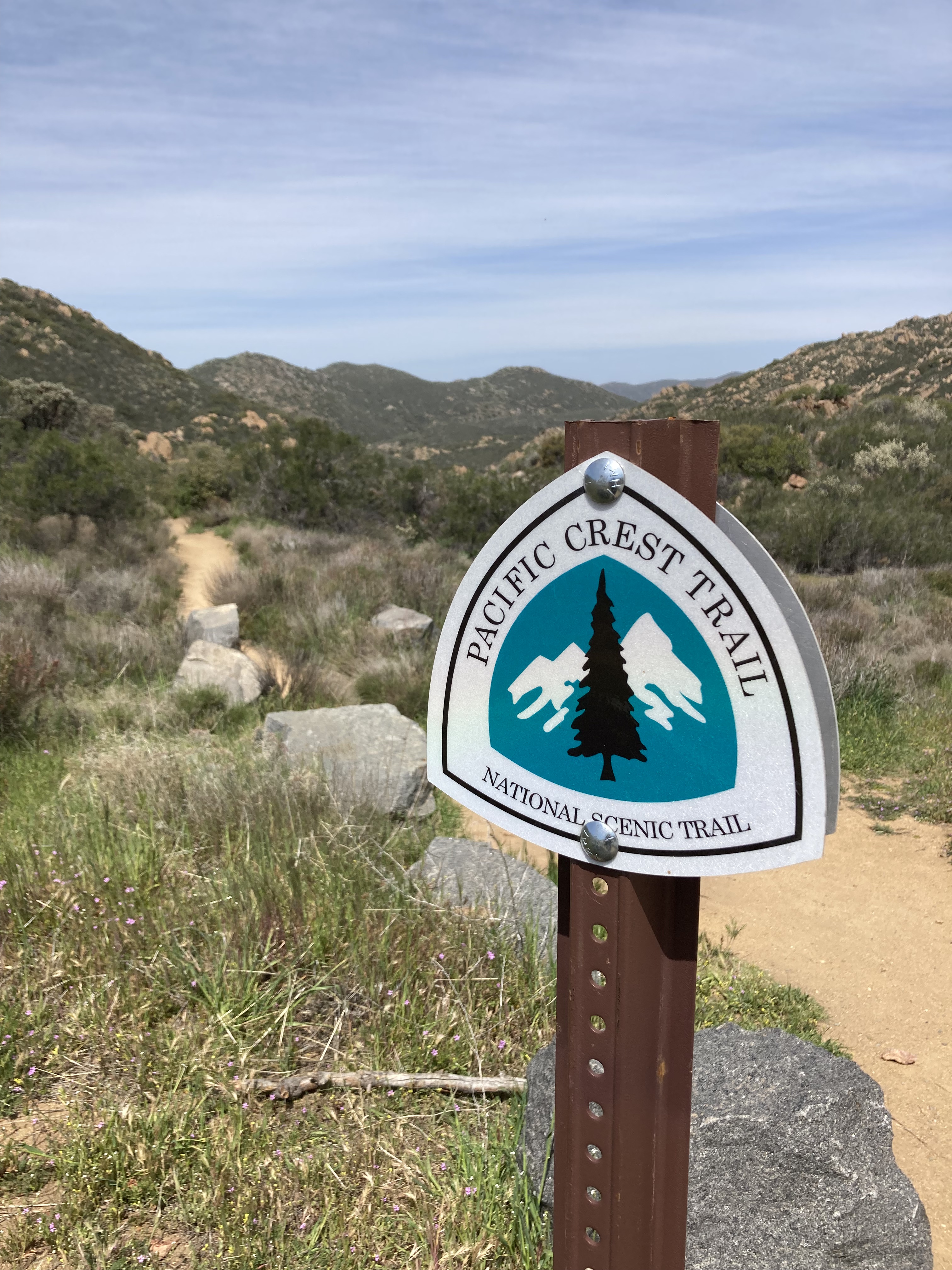
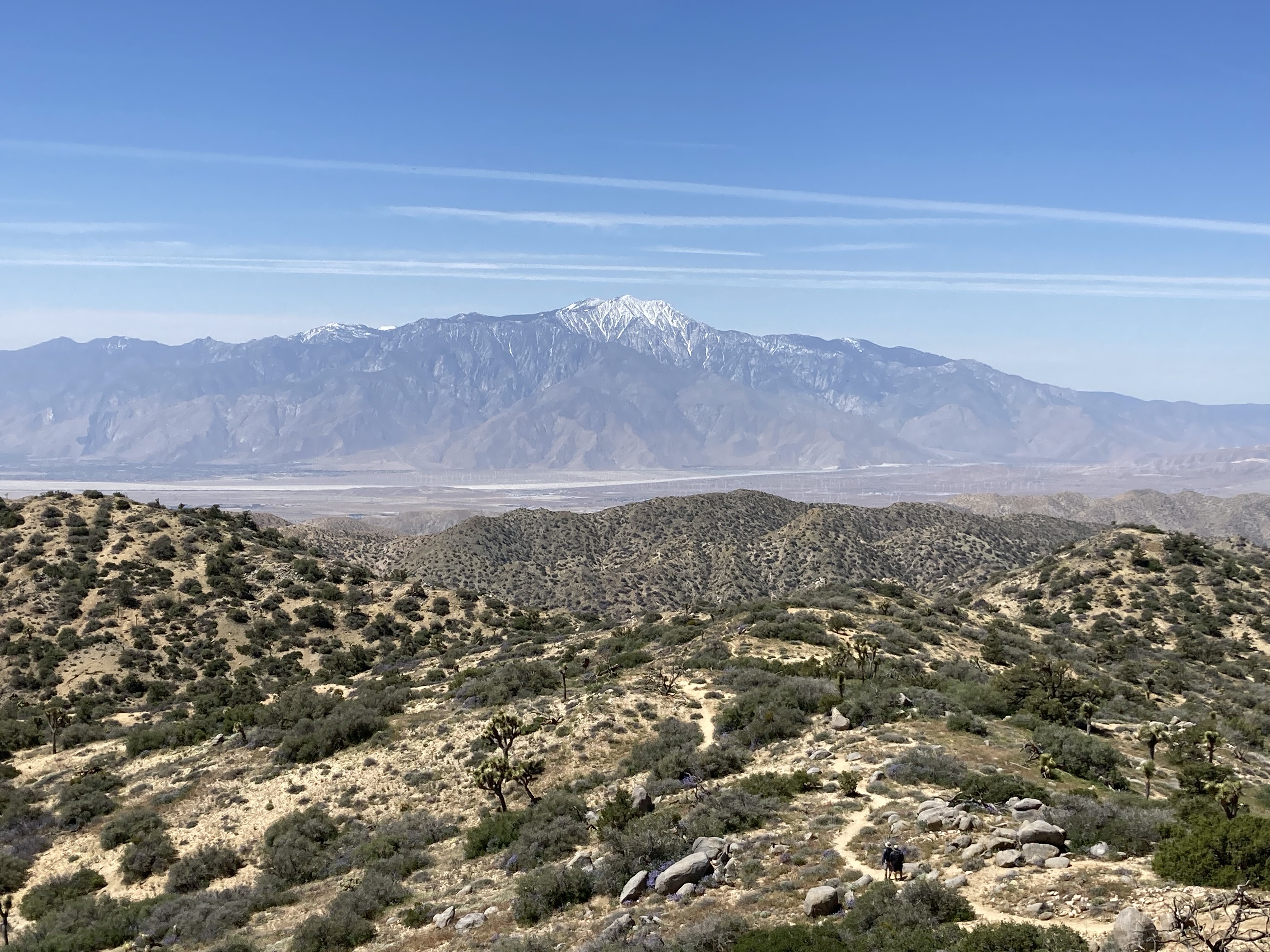
So I had the plan during my travels to try and hike on the PCT at least once in each state that it crosses through (California, Oregon, and Washington). Being so close to the Mexican border, I also planned to go and see the southern terminus of the PCT.
I did a hike on the PCT near Buckman Springs rest area (Pine Valley, SoBo where the trail intersects Kitchen Creek Road). Surreal! I even saw a few thru hikers.
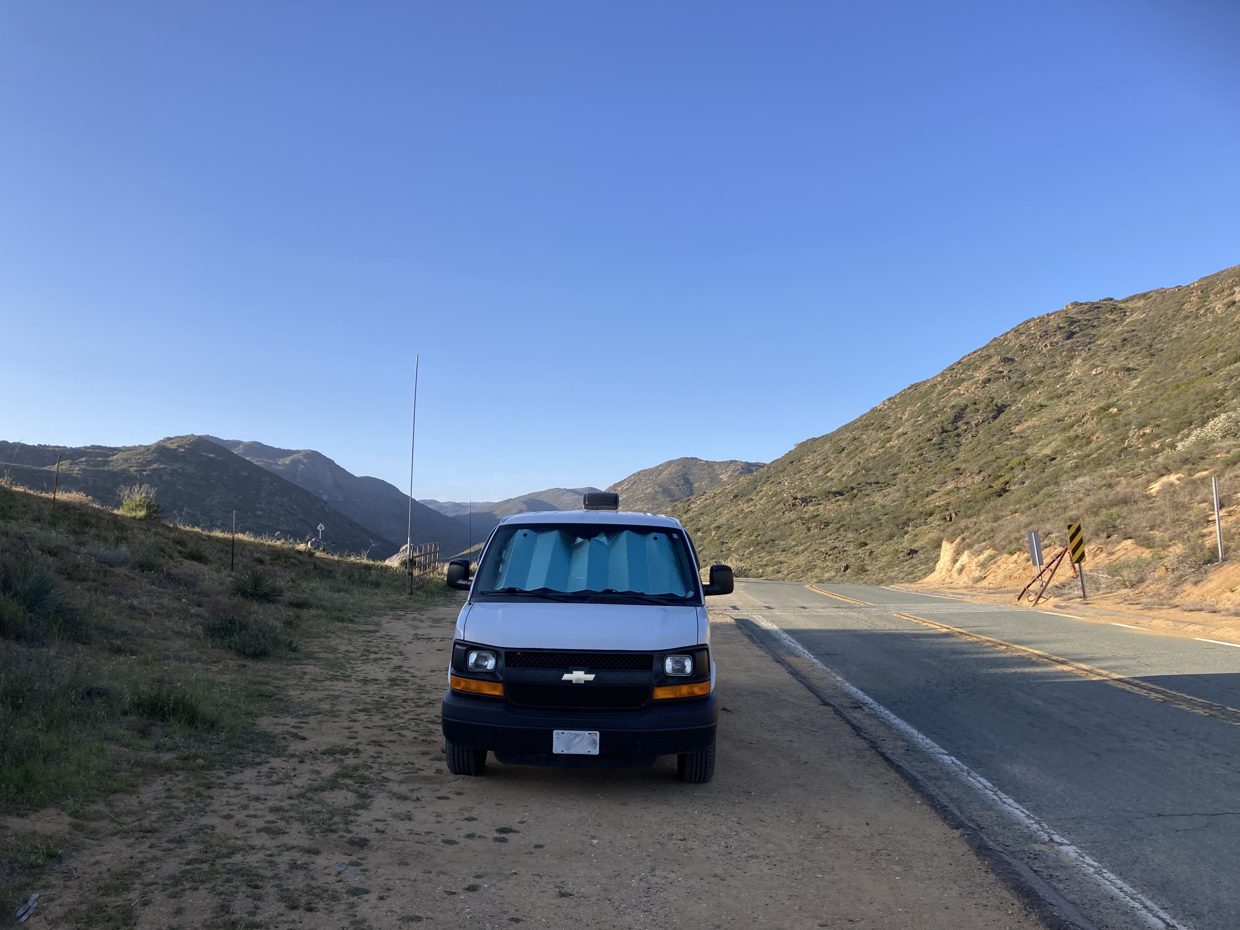
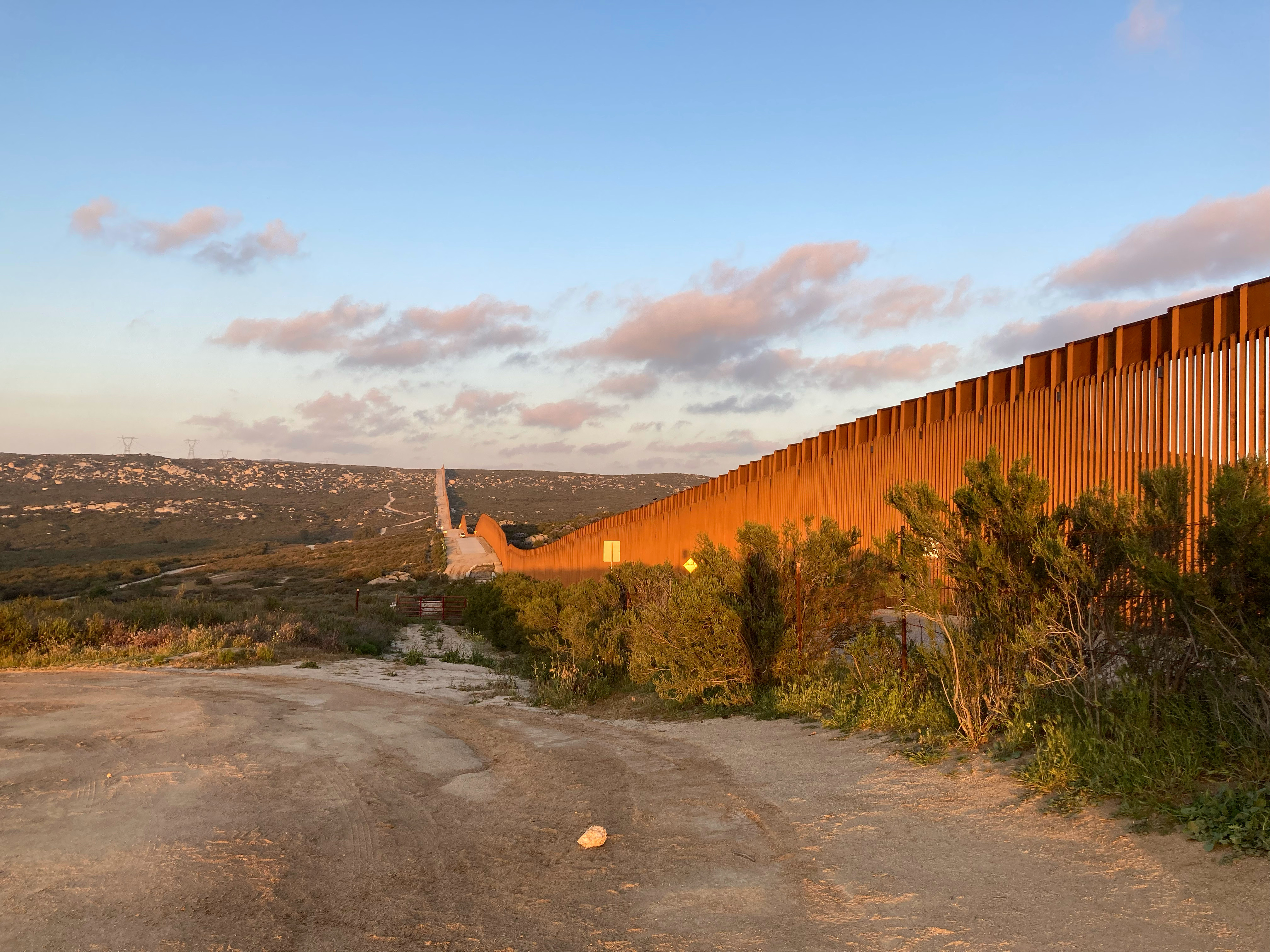
Then I drove about 20 minutes south to the southern terminus marker for the PCT. It was actually a bit daunting, as the marker is right at the Mexico border wall. The wall was huge, looming, and there was a patrol truck and helicopters flying overhead. I certainly didn’t feel like driving a white cargo van was doing me any favours here – and after taking in the terminus and getting back to the van a patrol truck came over to me and the officer asked me a few questions.
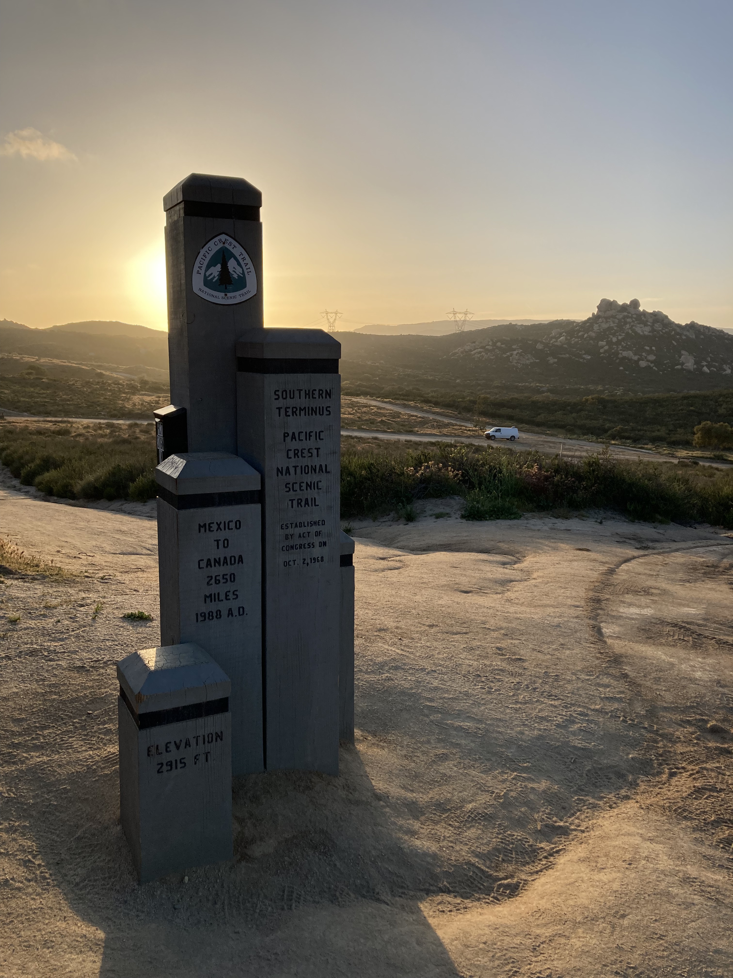
I was relieved to move on from here, but also elated to have seen this place in the flesh. So many legends have stood right here and gone on to do monumentally inspiring things!
Slab City
Another hour east on Highway 8 and I spent the night at another rest area (Jaime Obeso Sunbeam), south of the Salton Sea.
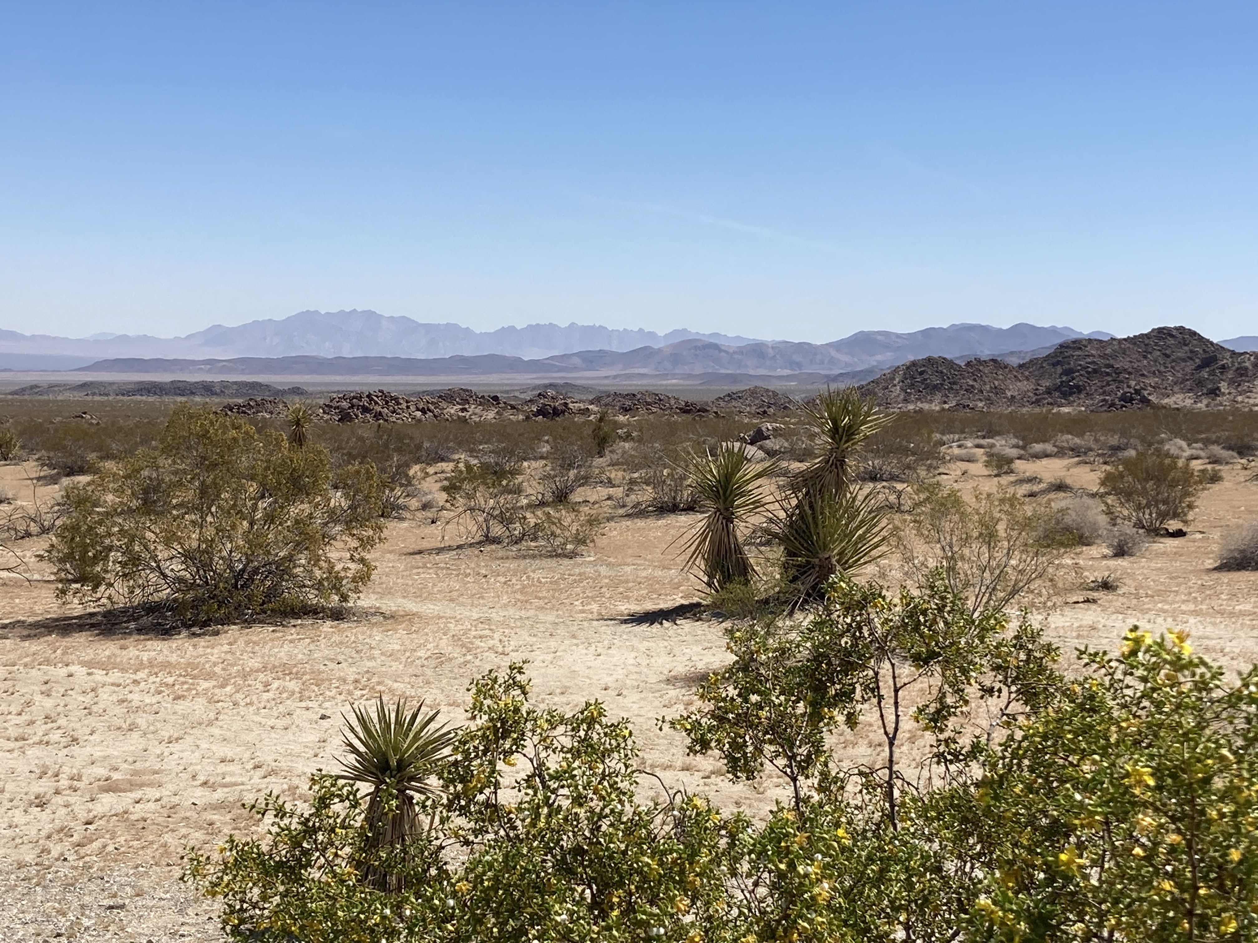
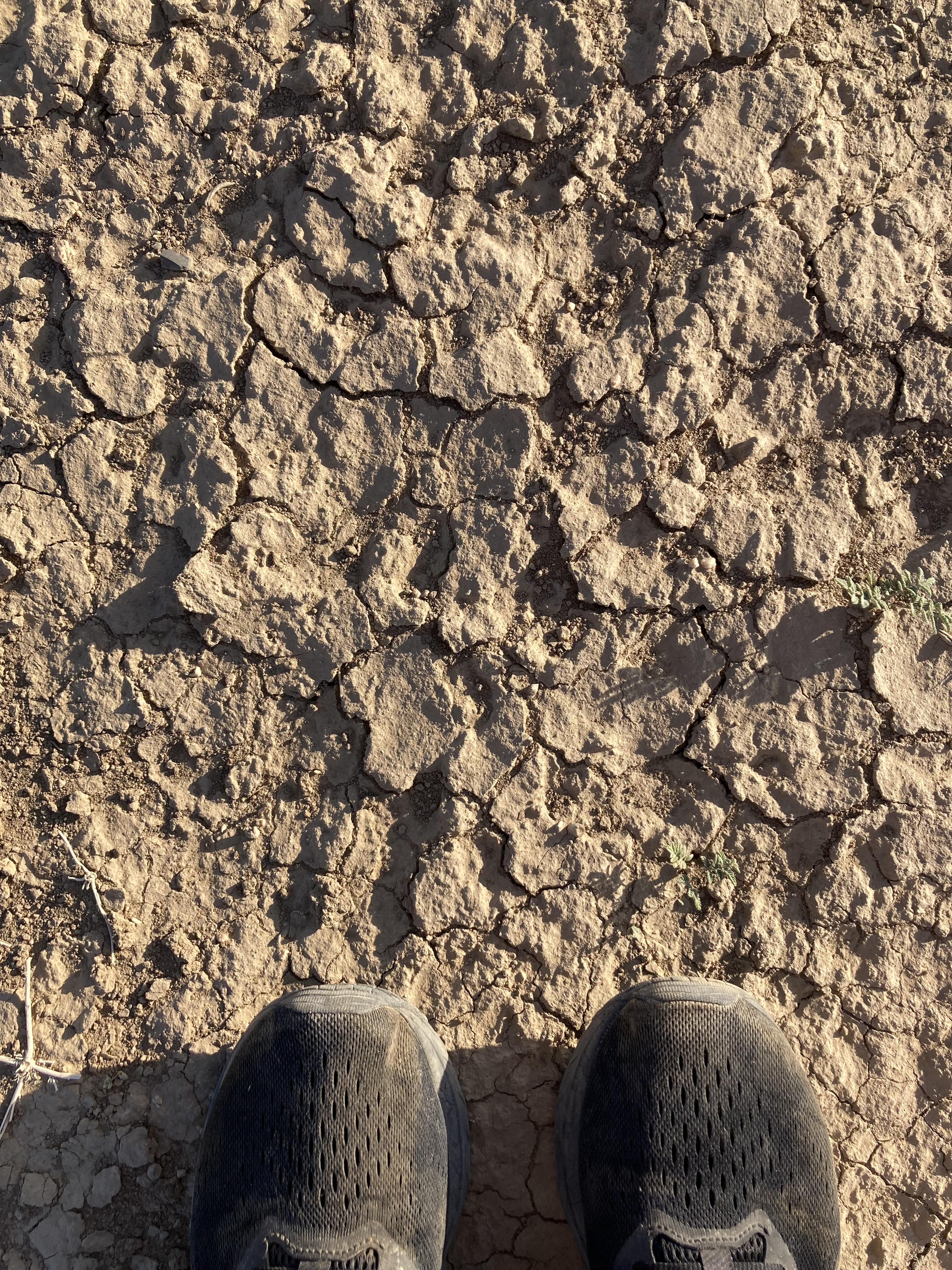
It was here that I started to really feel the shift in climate. Having been on the ocean, I was used to cooler temperatures and humidity. Even as far south as LA and San Diego, I was still wearing sweaters and jackets. But hitting the interior I quickly had to adjust to sweltering conditions. About 25-30 degrees C (at first, it got worse), which was especially hot in a vehicle during the day, with sun (and broken AC).
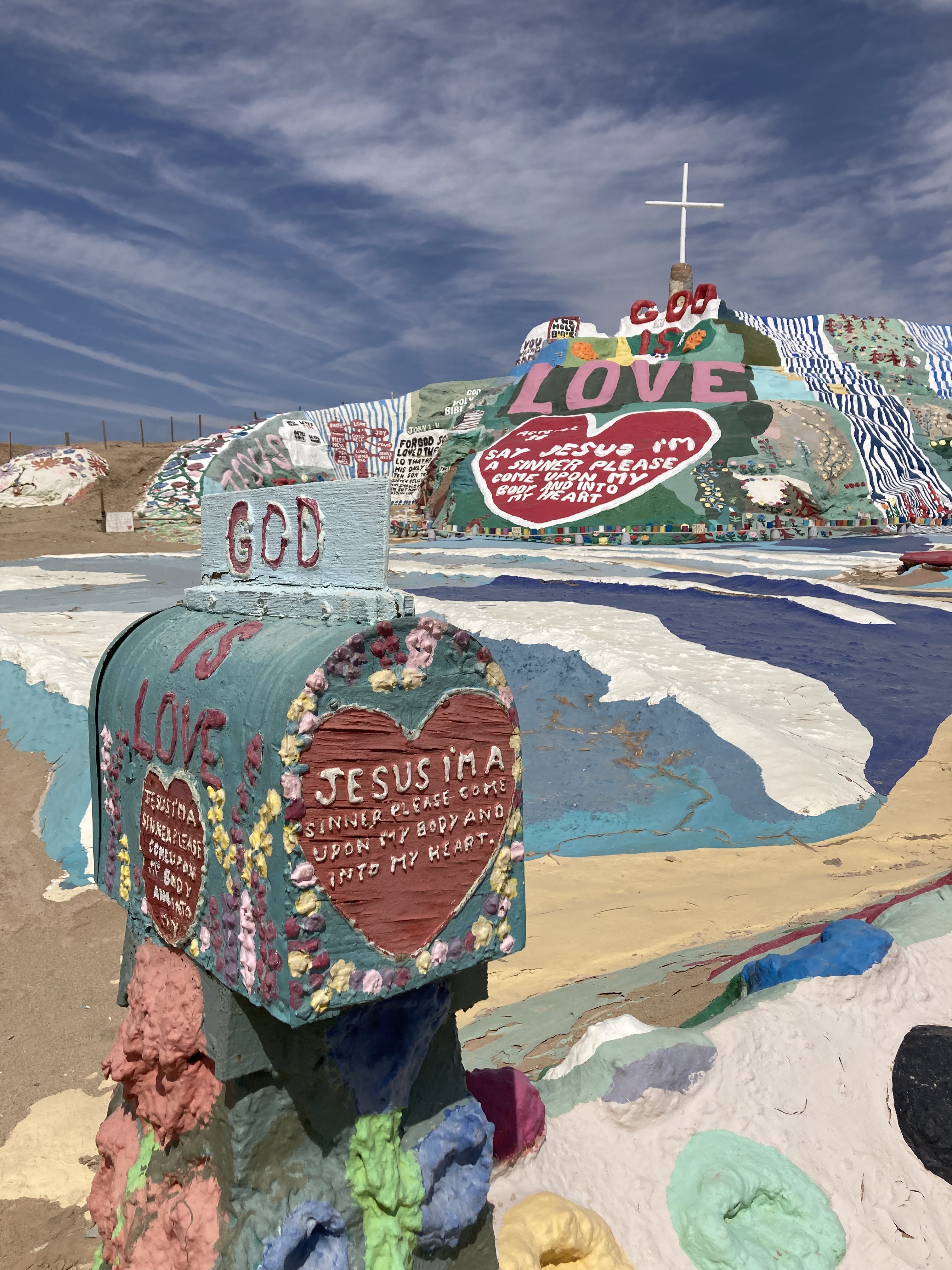
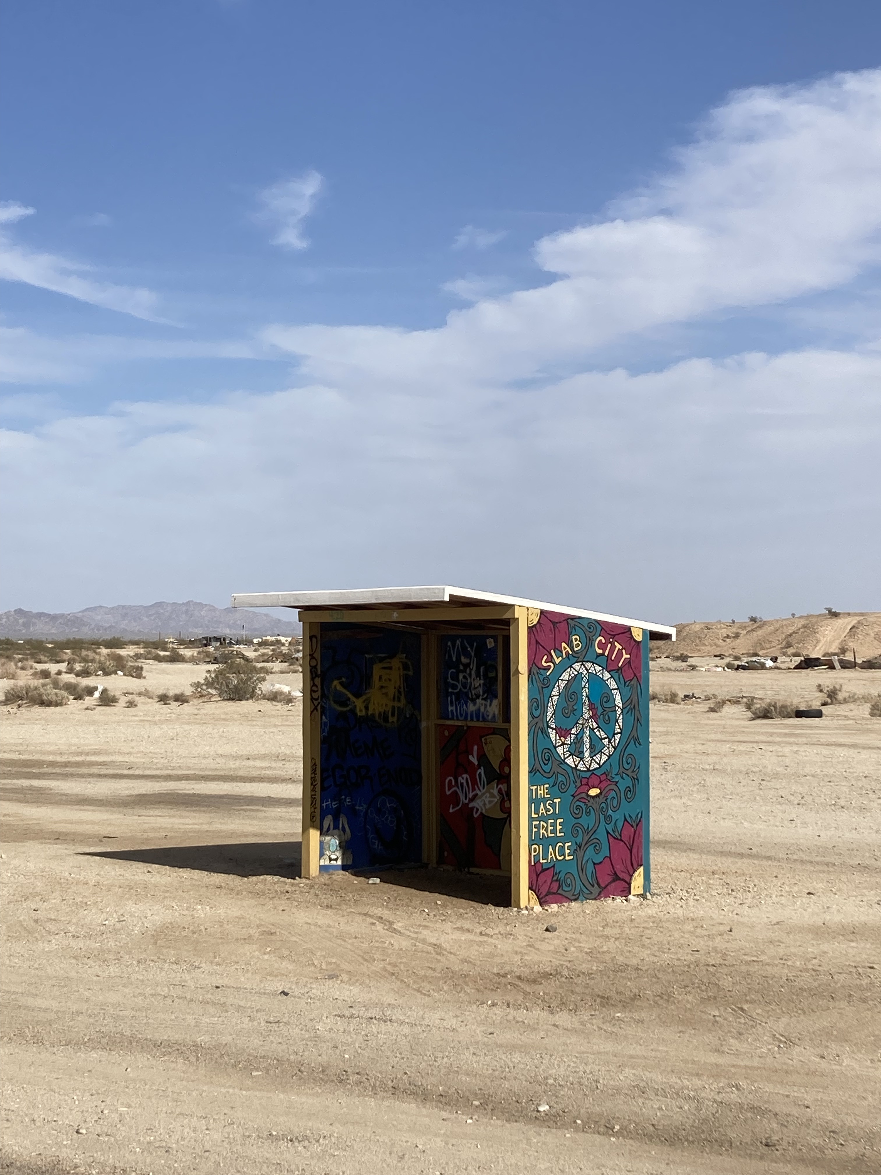
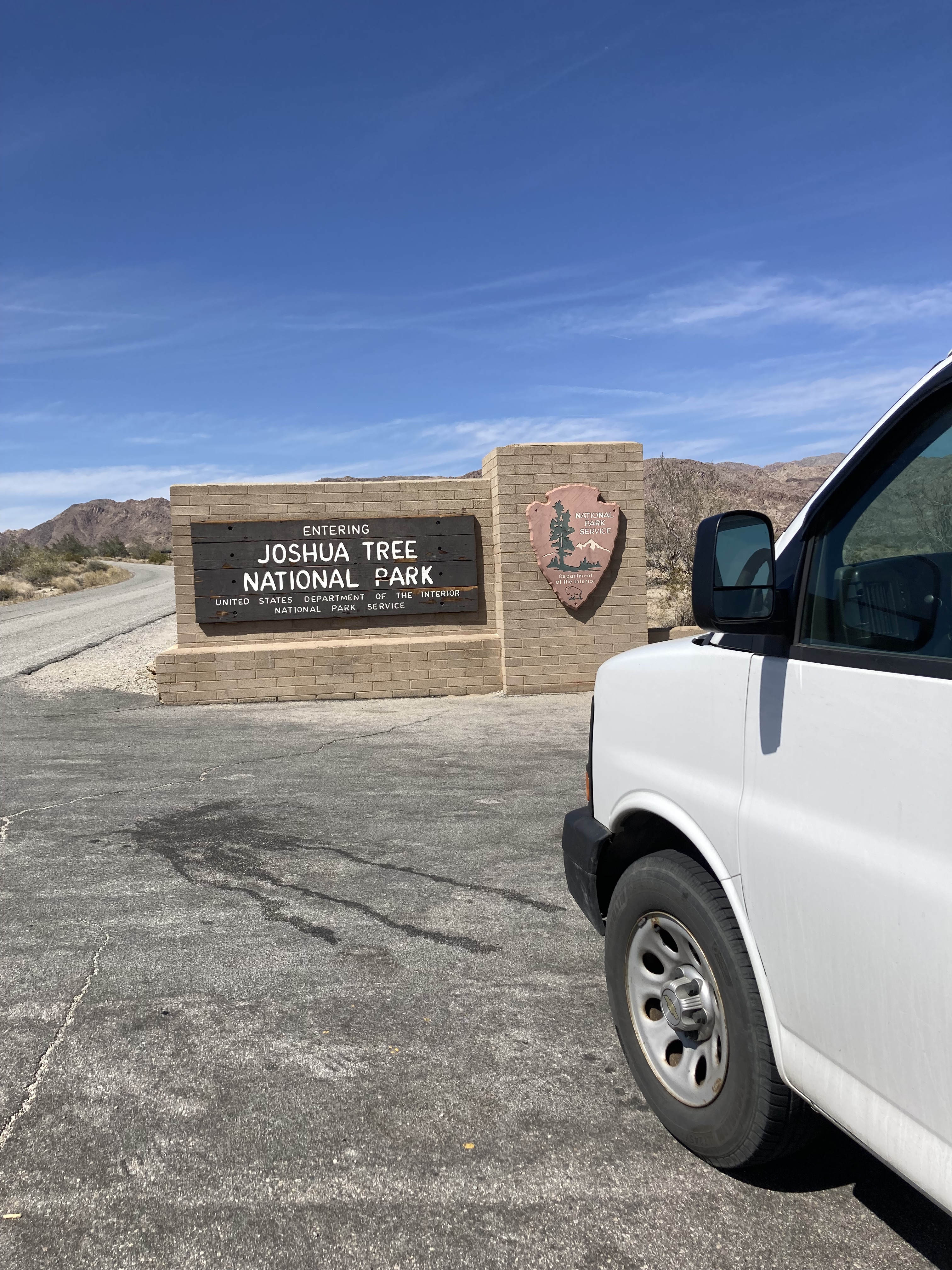
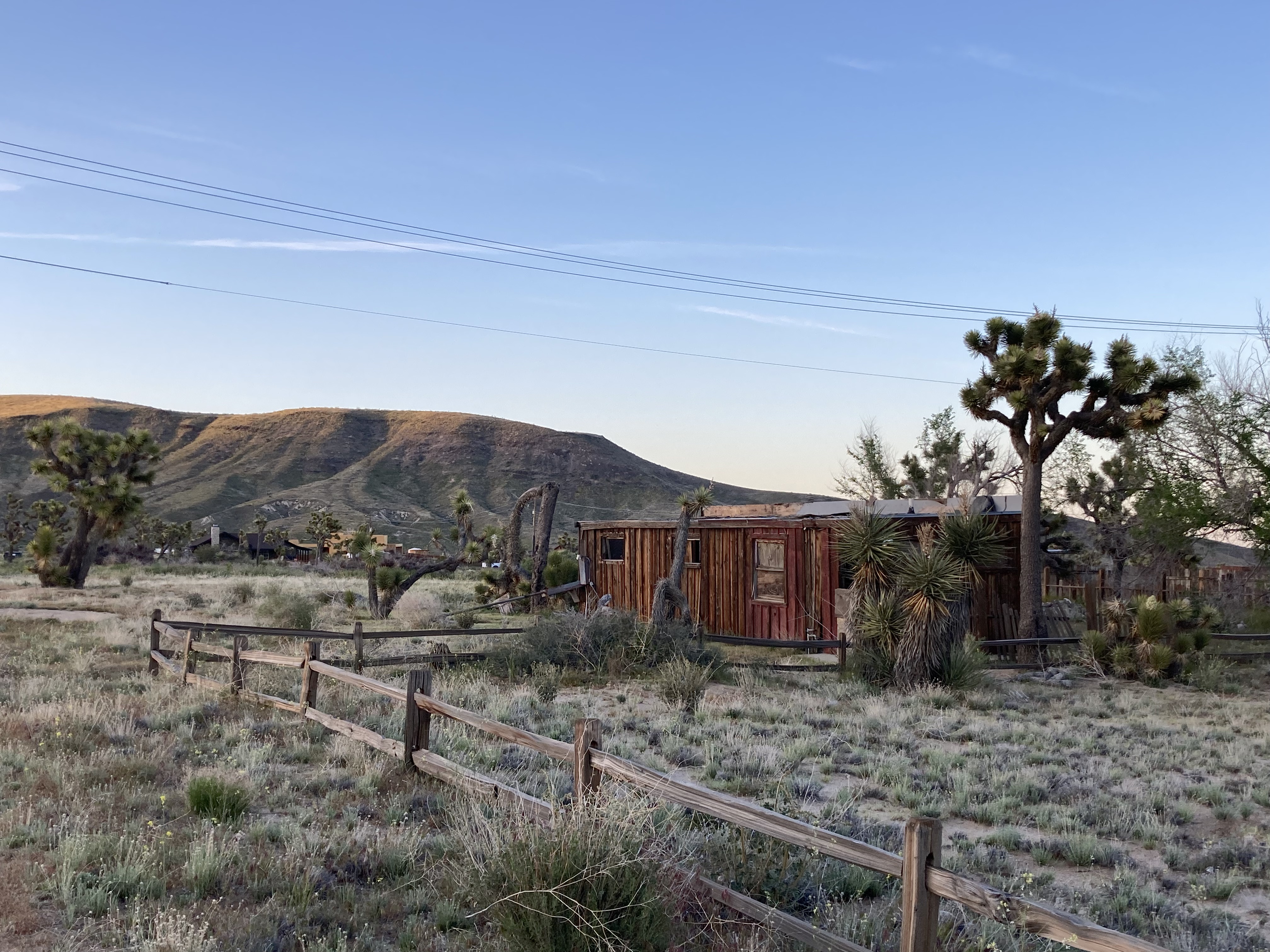
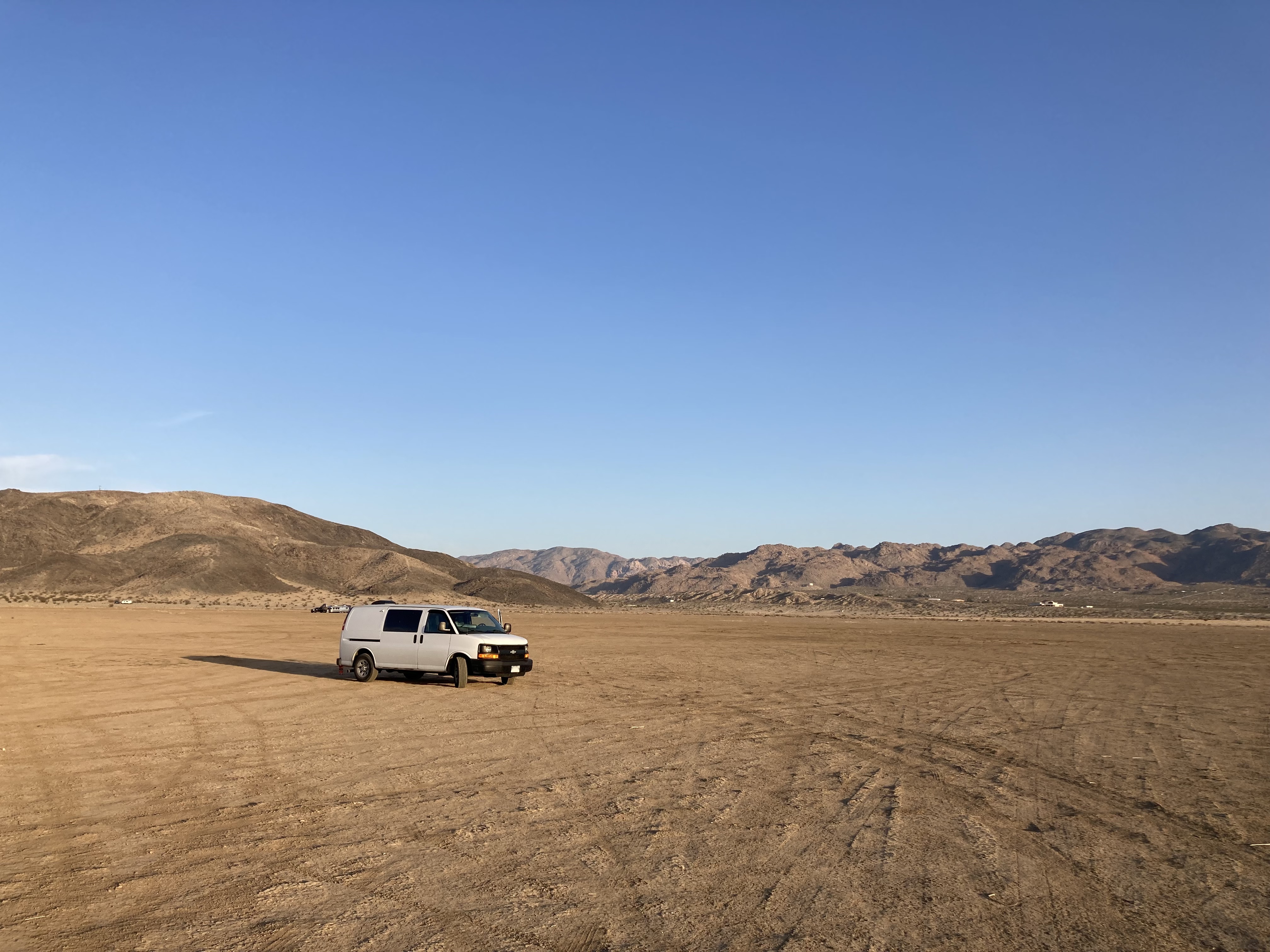
I had an even more exciting destination on the books next – Slab City (or The Slabs) and Salvation Mountain. Located in southeastern California, near Niland, at the southeast side of the Salton Sea, south of Joshua Tree, in the Sonoran Desert.
If you’ve read or watched Into The Wild then you’ve heard of this place. It’s in a category all its own I think. Depending on your perspective, this could be the type of place you’d flock to or avoid. For me, it’s a place of wonder. There’s a special kind of spirit here. It’s the kind of place that can stoke the fires of the human spirit. At least it does for me. I think you see this in Chris McCandless’ story (he spent time here in 1991-92) – and his story is one that spoke to me on a deep level, I have a very soft spot for it, I think I see parts of myself in it.
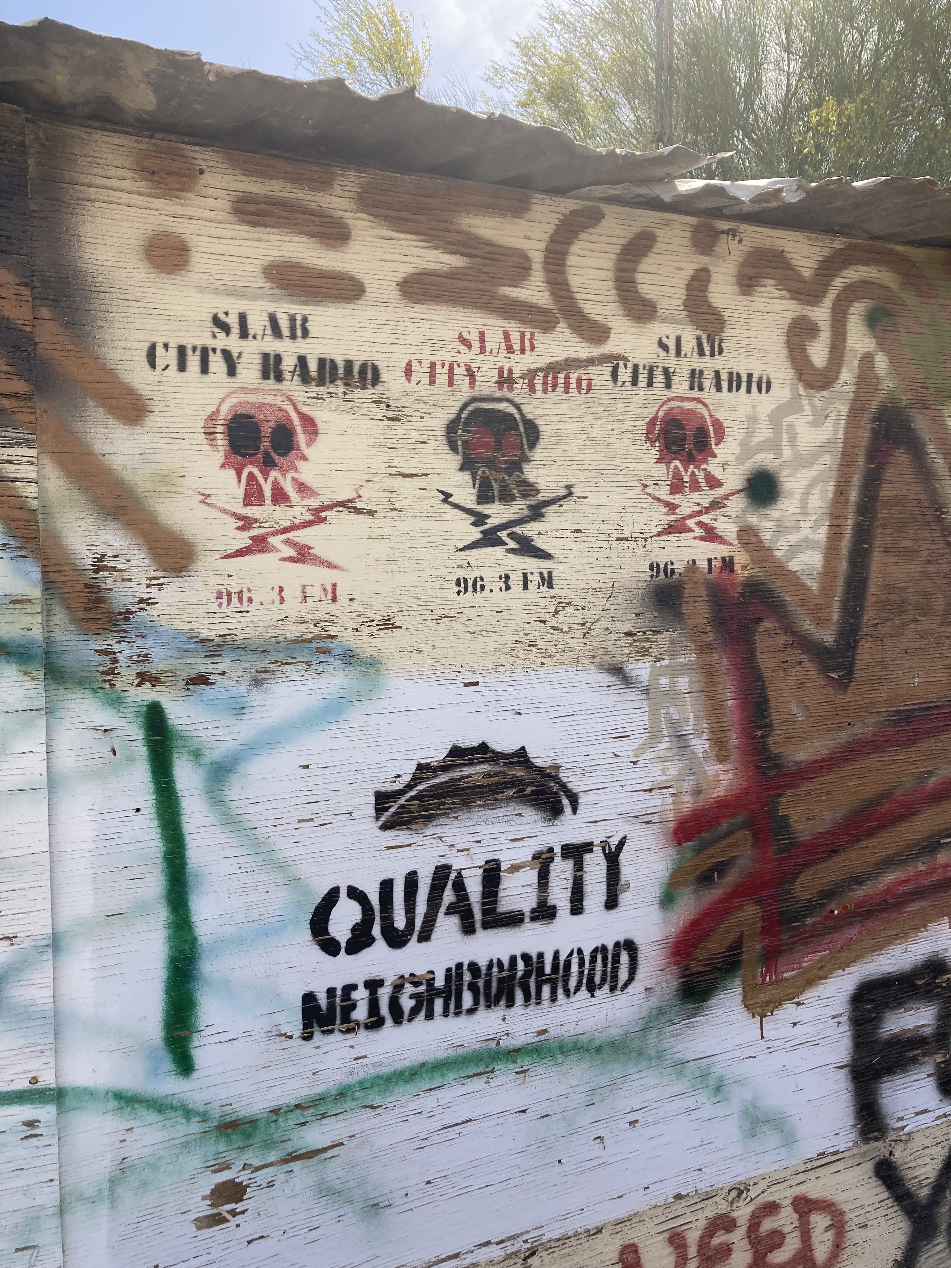
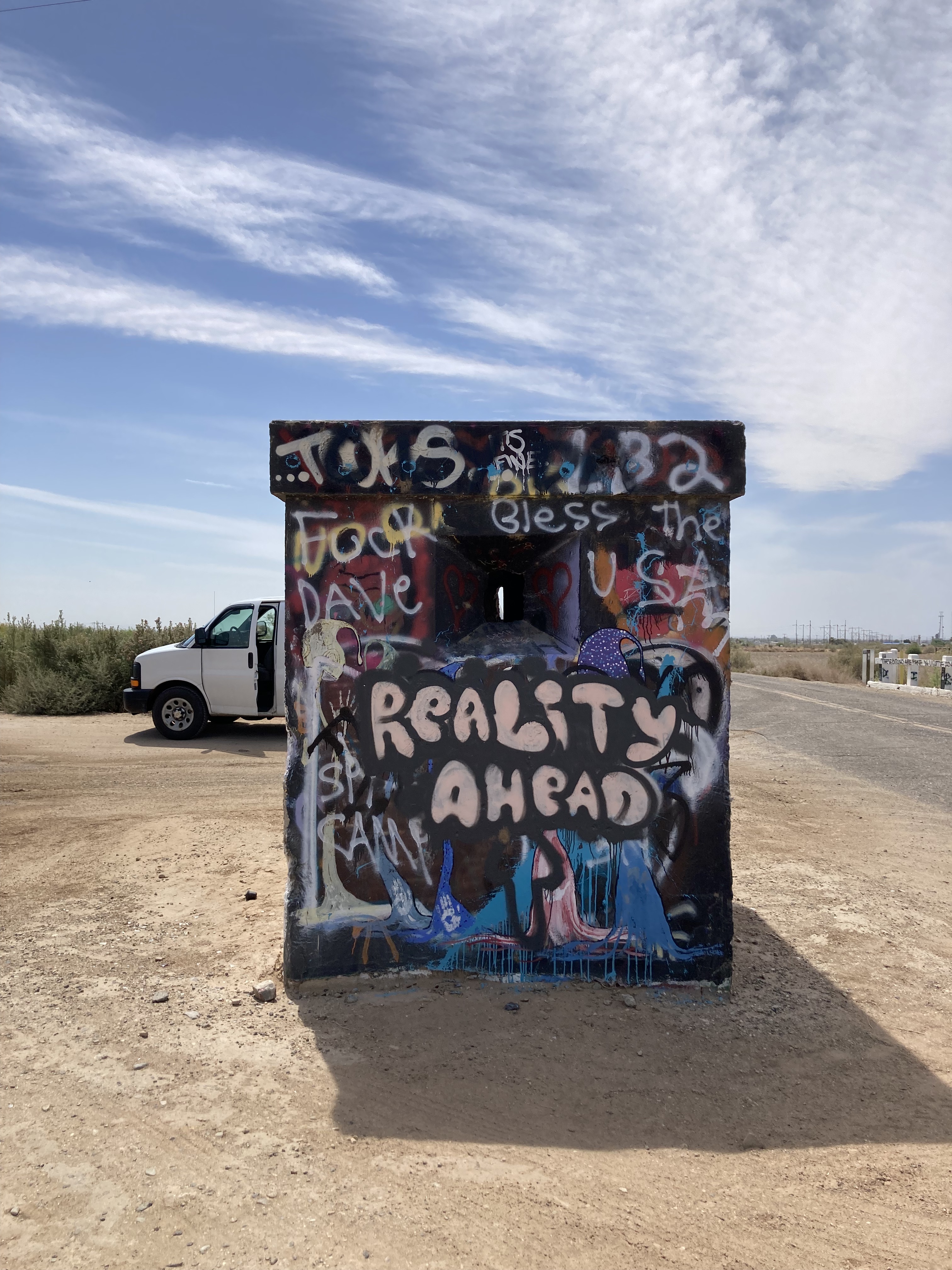
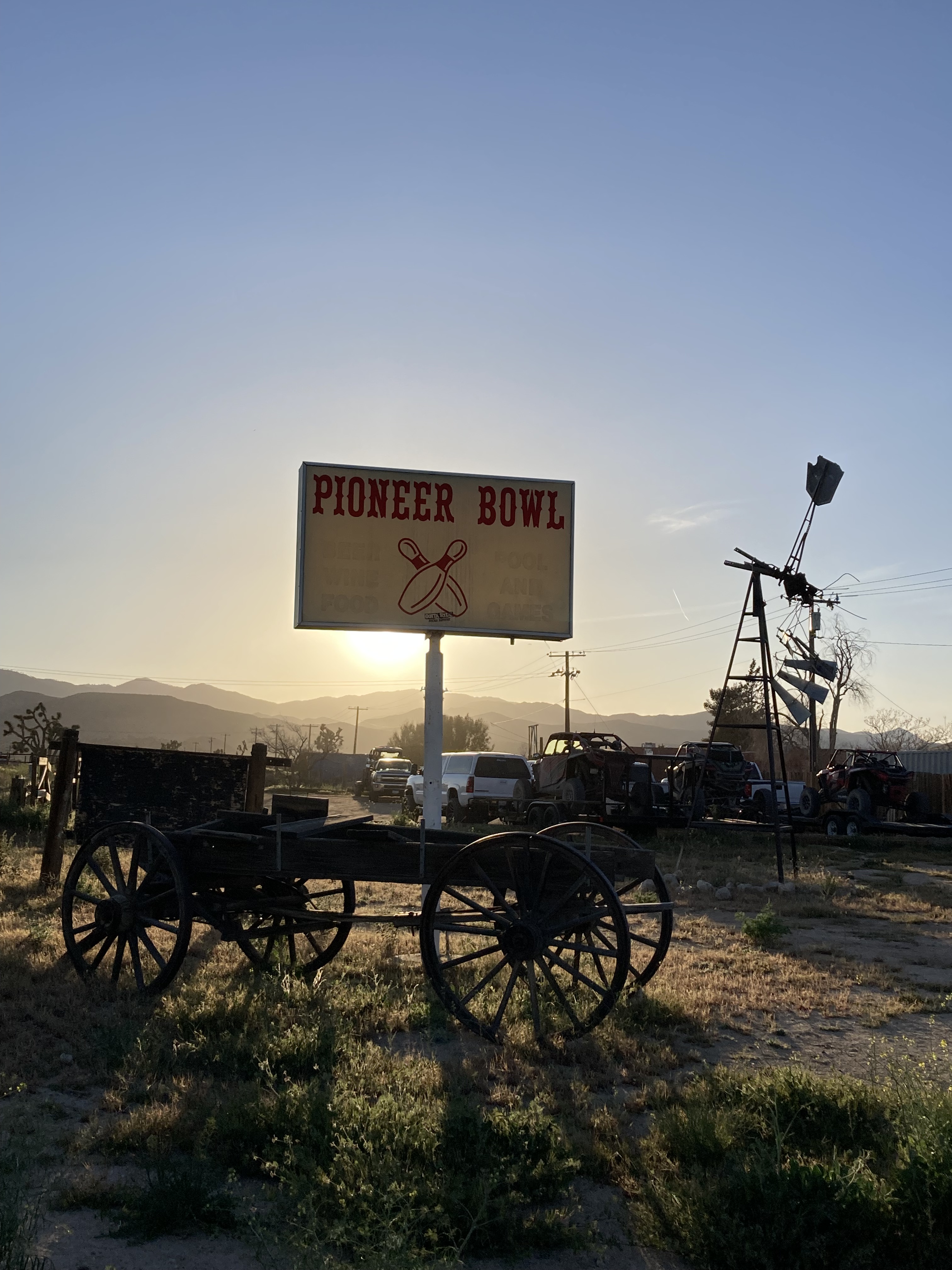
Slab City has been called one of America’s “last free places”. It is an unincorporated, off-grid, alternative lifestyle community built on the concrete slabs of an old decommissioned World War II marine corps base. Marine veterans who had worked at the base were the first to settle here, followed by RVers and the like, and it grew increasingly popular among those looking for free camp sites near Palm Springs. This is a place where people live outside of society, on the fringes.
Some call the Slabs lawless, though locals disagree. I had heard that police do not patrol here unless they are called, but I’m not sure if that’s totally true, and I believe border patrol comes here sometimes looking for people. While, yes, there can be issues with drugs, theft, and fugitives, and people might label it a homeless encampment, that would be too simple and too negative a way to describe Slab City. There is so much more to it.
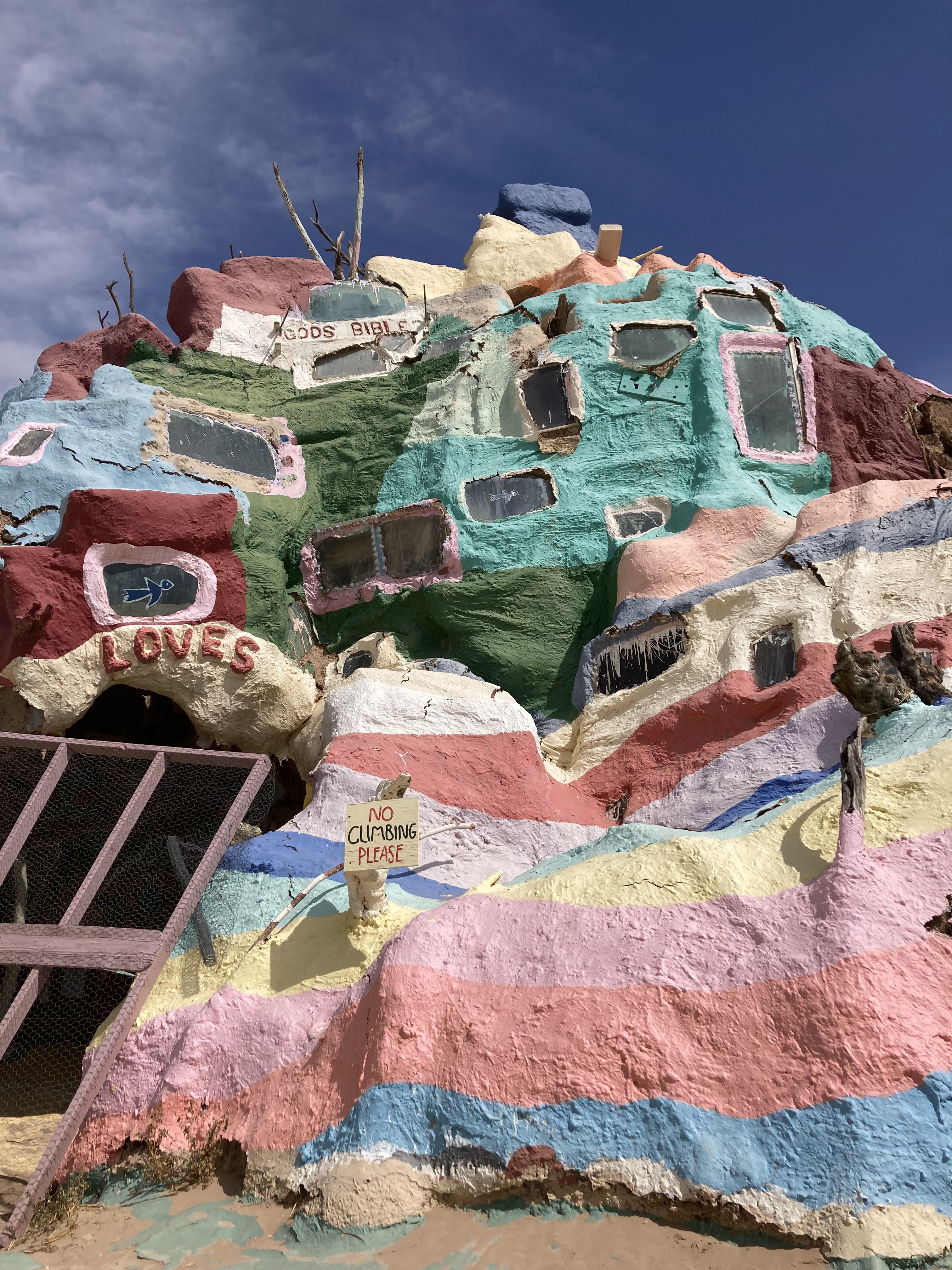
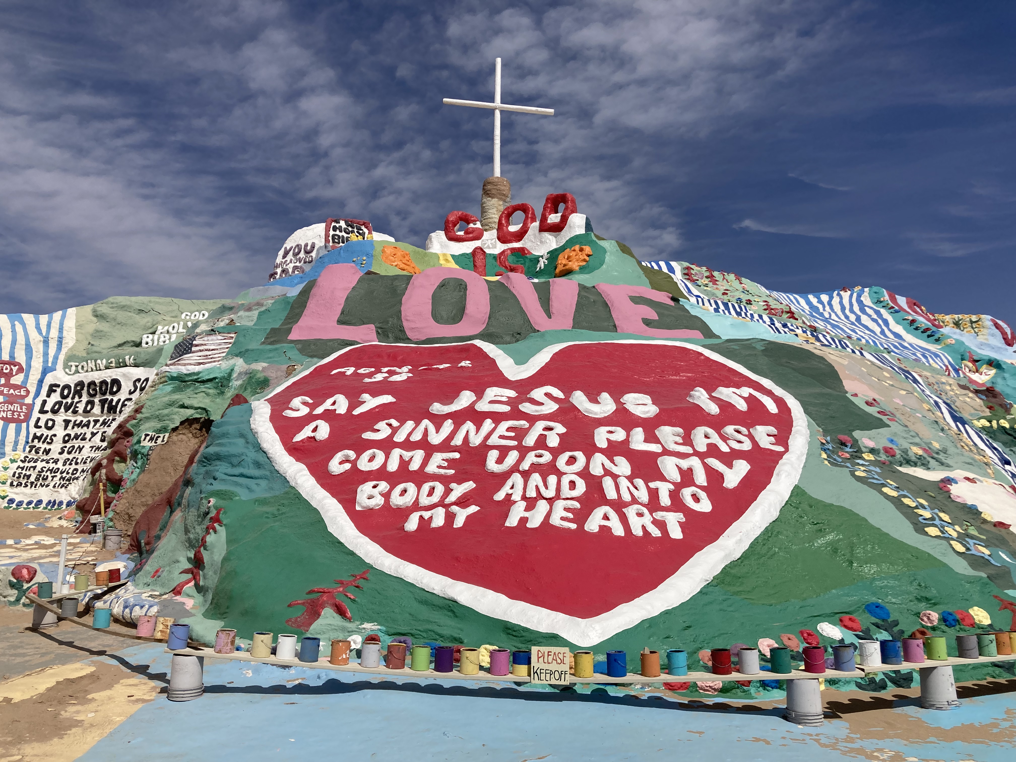
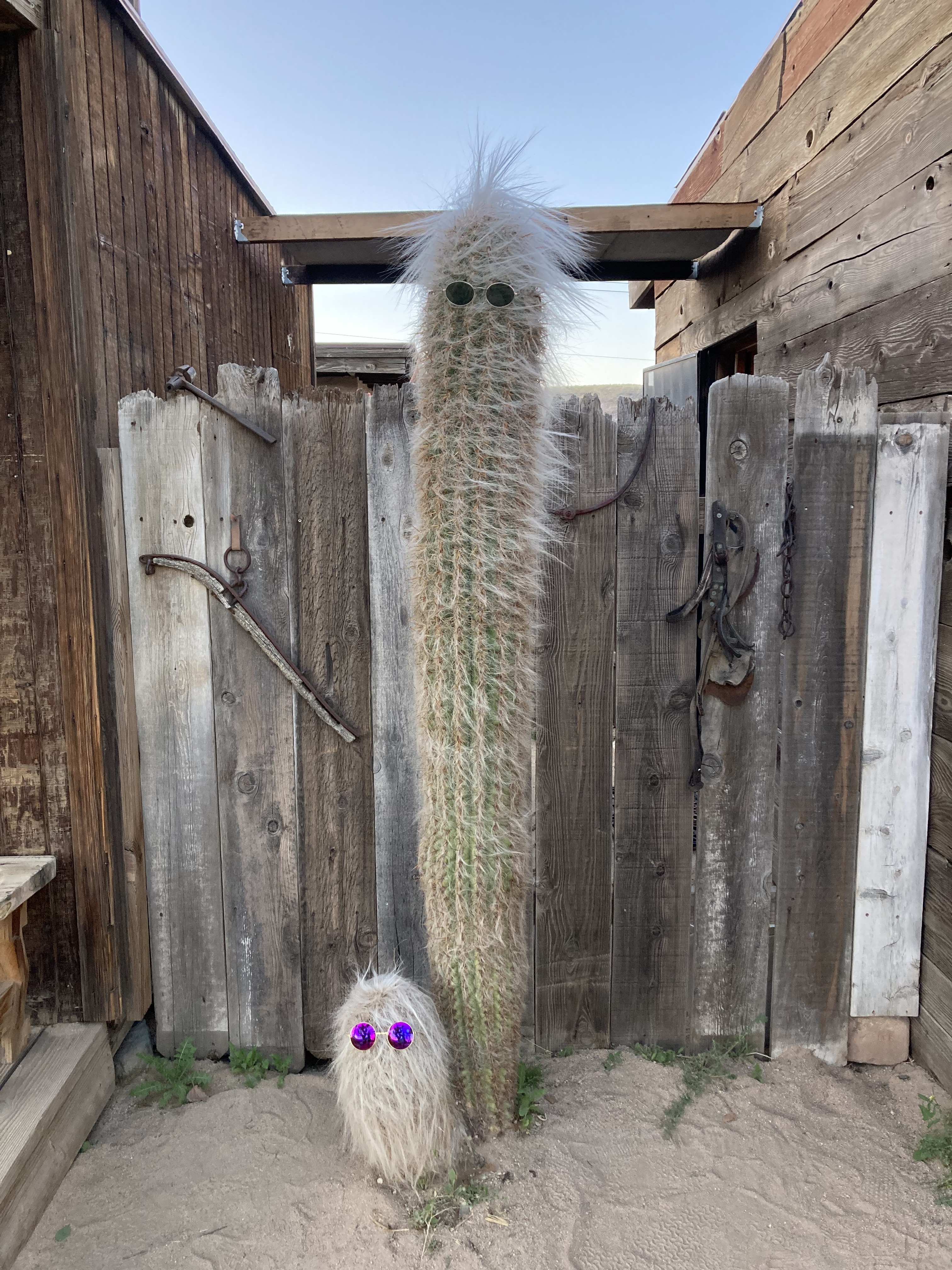
I think Leonard Knight’s story is a prime example of the other end of the spectrum in terms of types of people you’ll find here. Knight came to Slab City in 1984 and began work on what is known today as Salvation Mountain. He worked on this project for 28 years. It’s a folk art monument made of adobe mud and paint, expressing “God is Love”. You don’t have to be religious to appreciate the message, the unique attributes of this creation, and all that went into making it.
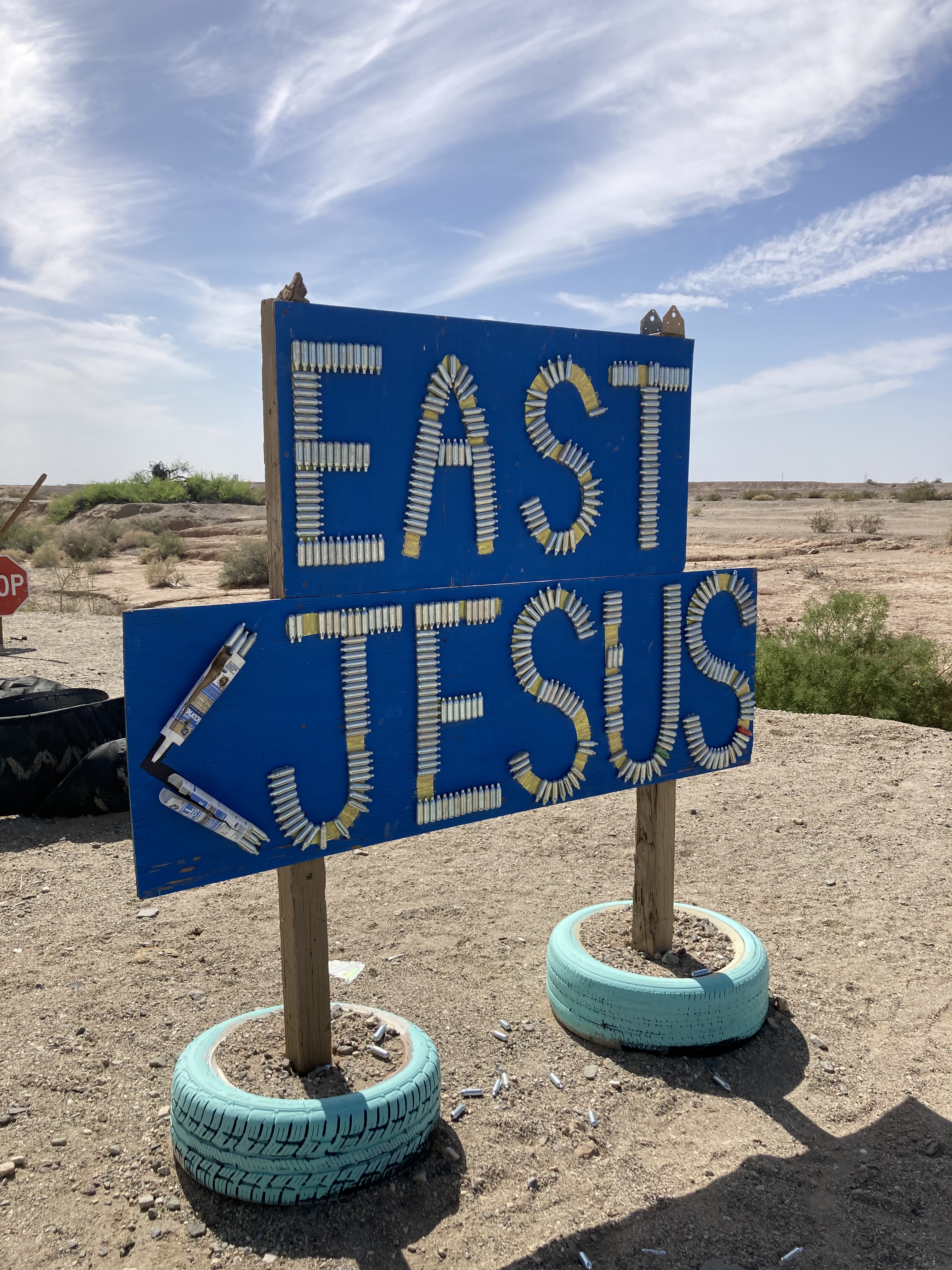
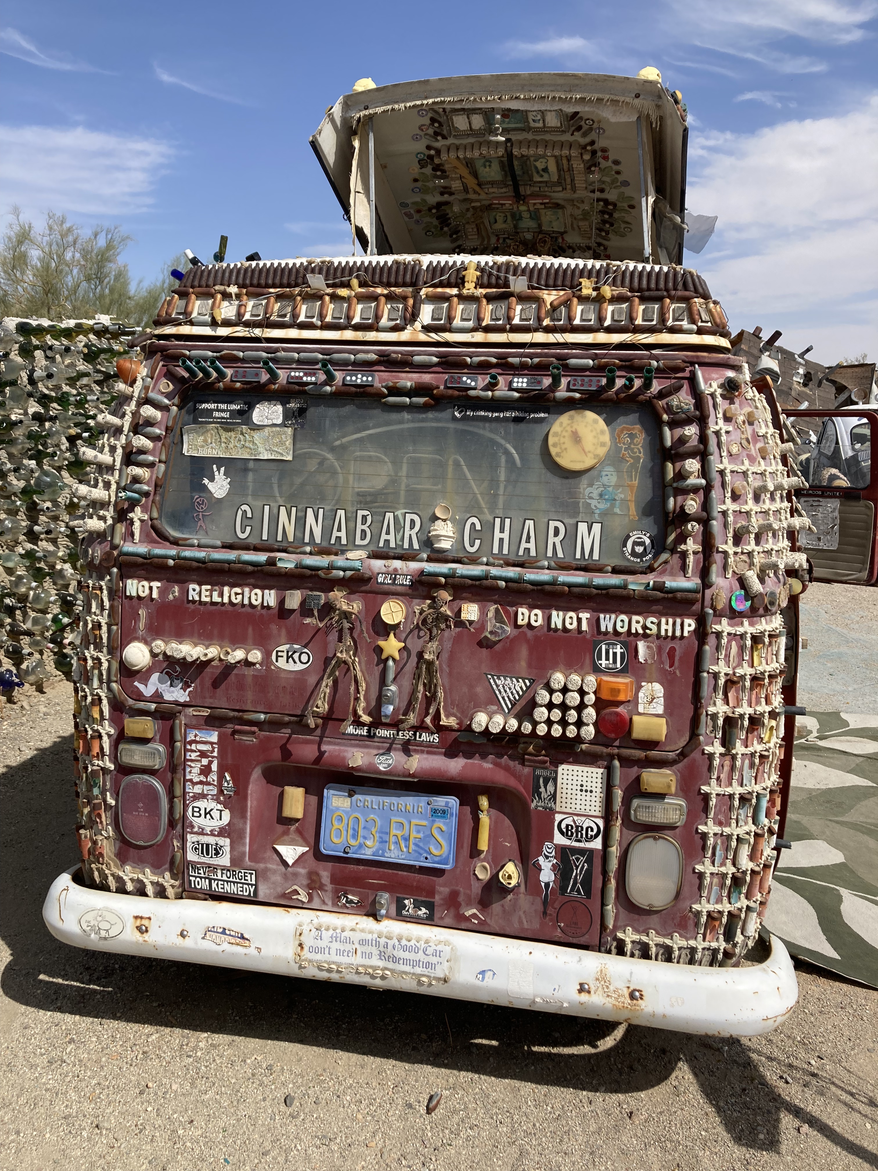
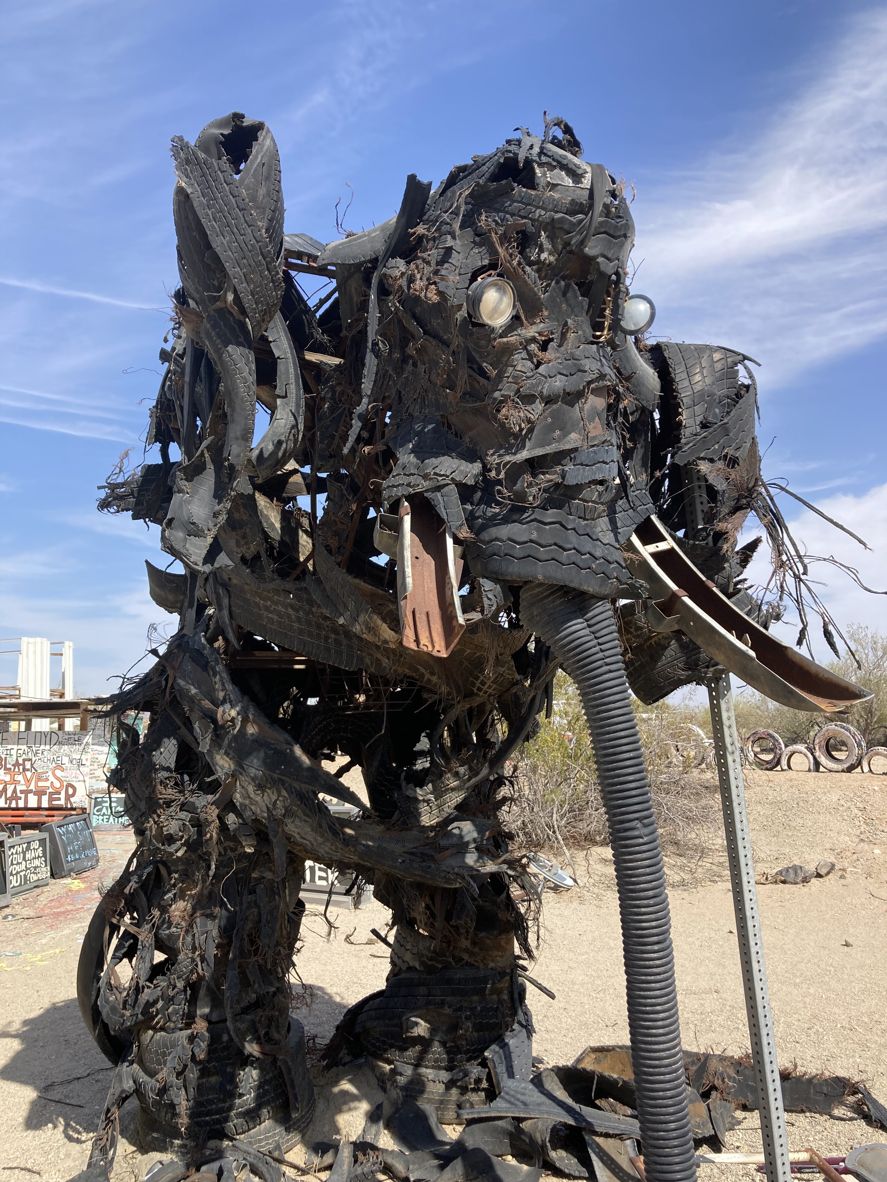
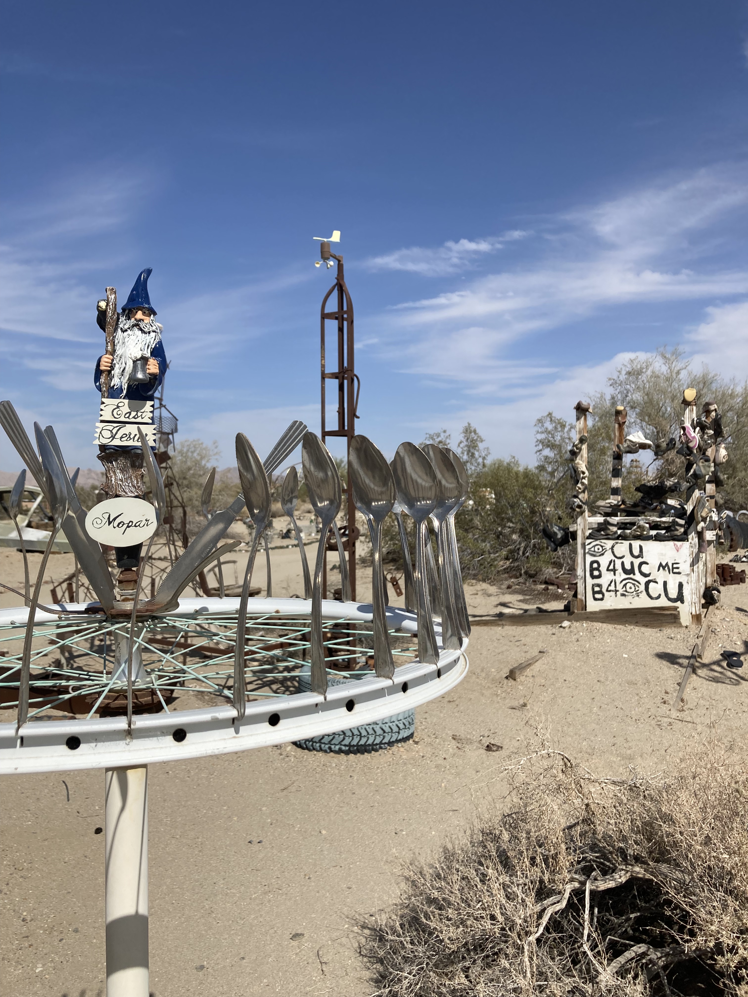
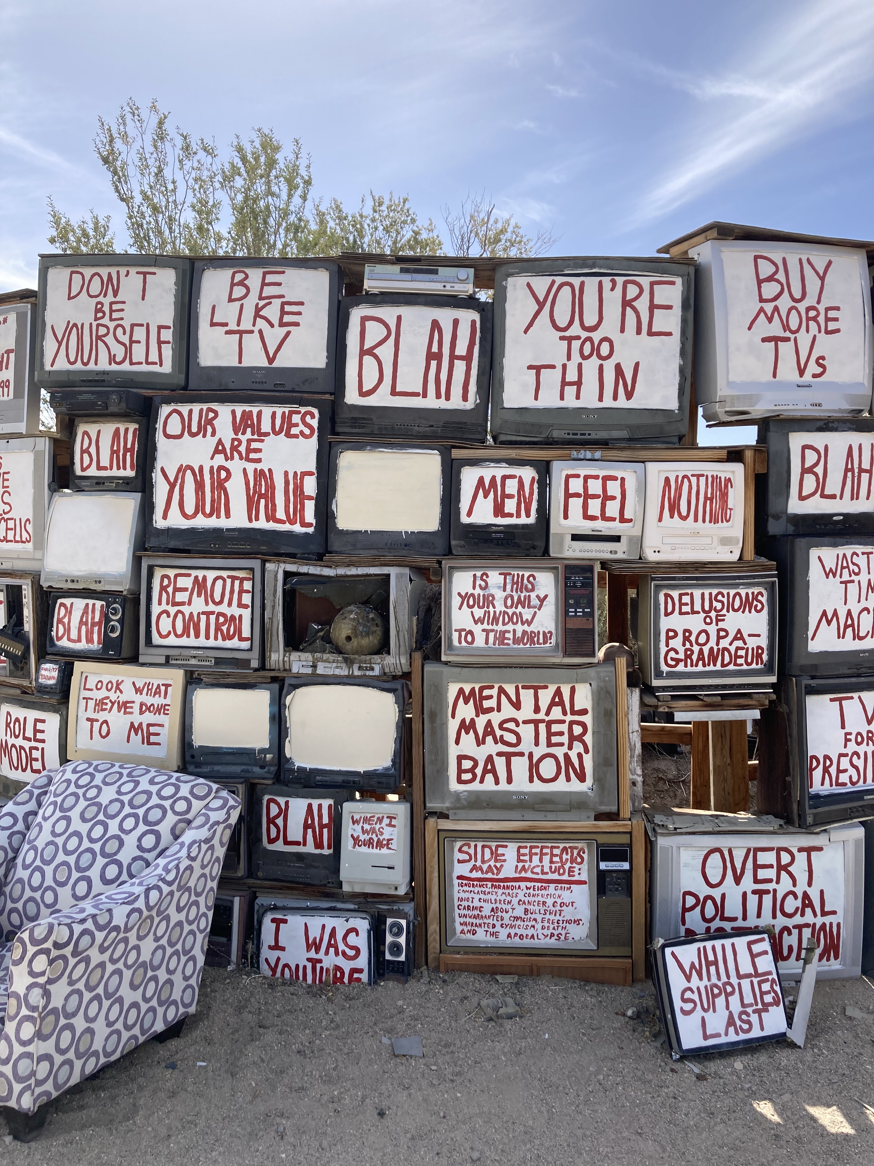
East Jesus is another area of Slab City with repurposed art installations that showcase the creativity of residents. Like a sculpture garden. Weird and wonderful.
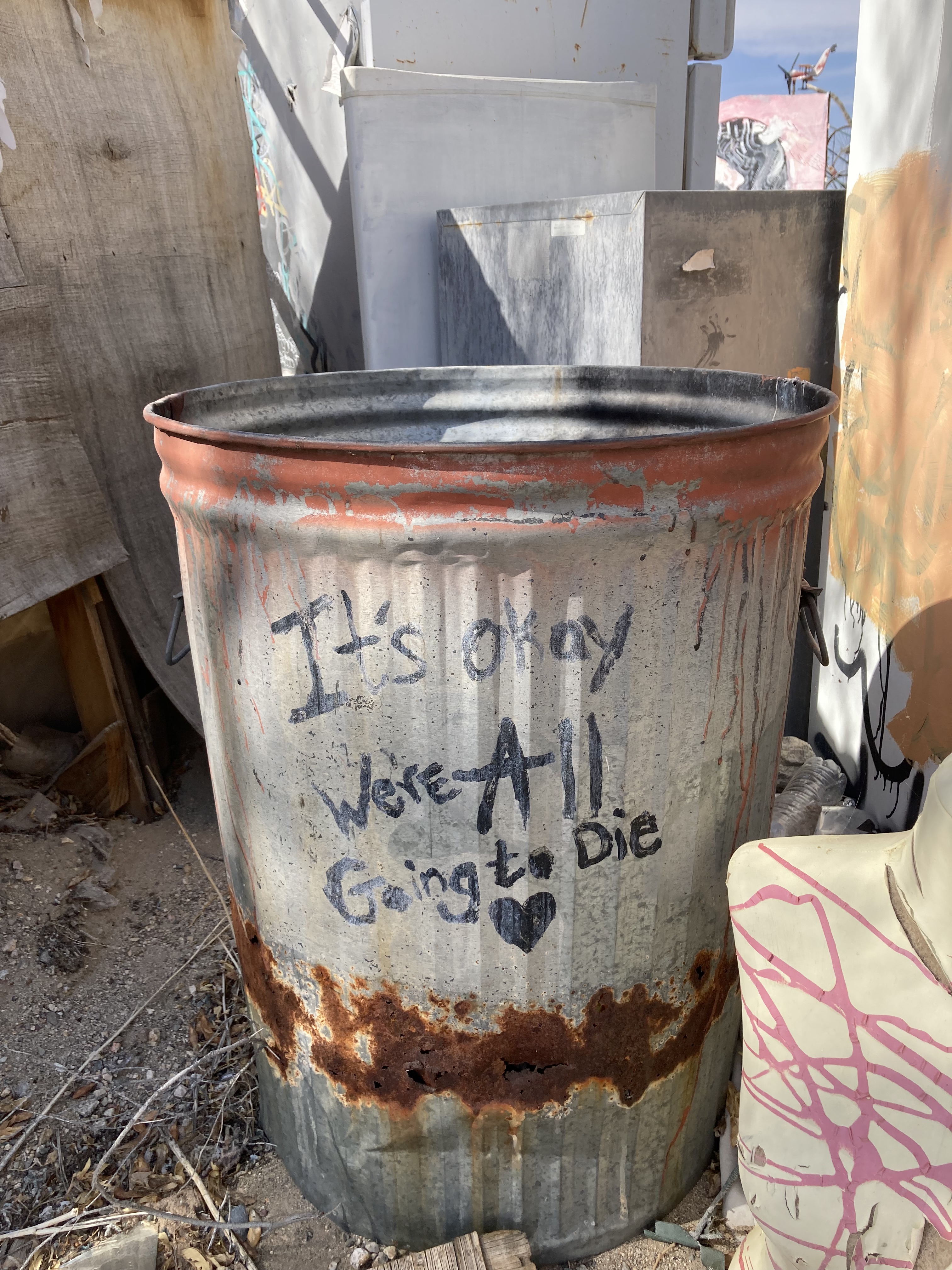
Sure, keep your wits about you, but there is beauty and kindness to be found in Slab City. Artists, outcasts, free thinkers, and travellers spend time here. The population balloons during the winter months with snowbirds. You’ll find 3-4,000 residents in the winter and around 100 (give or take) in the scorching summers (which get to 50 degrees C).
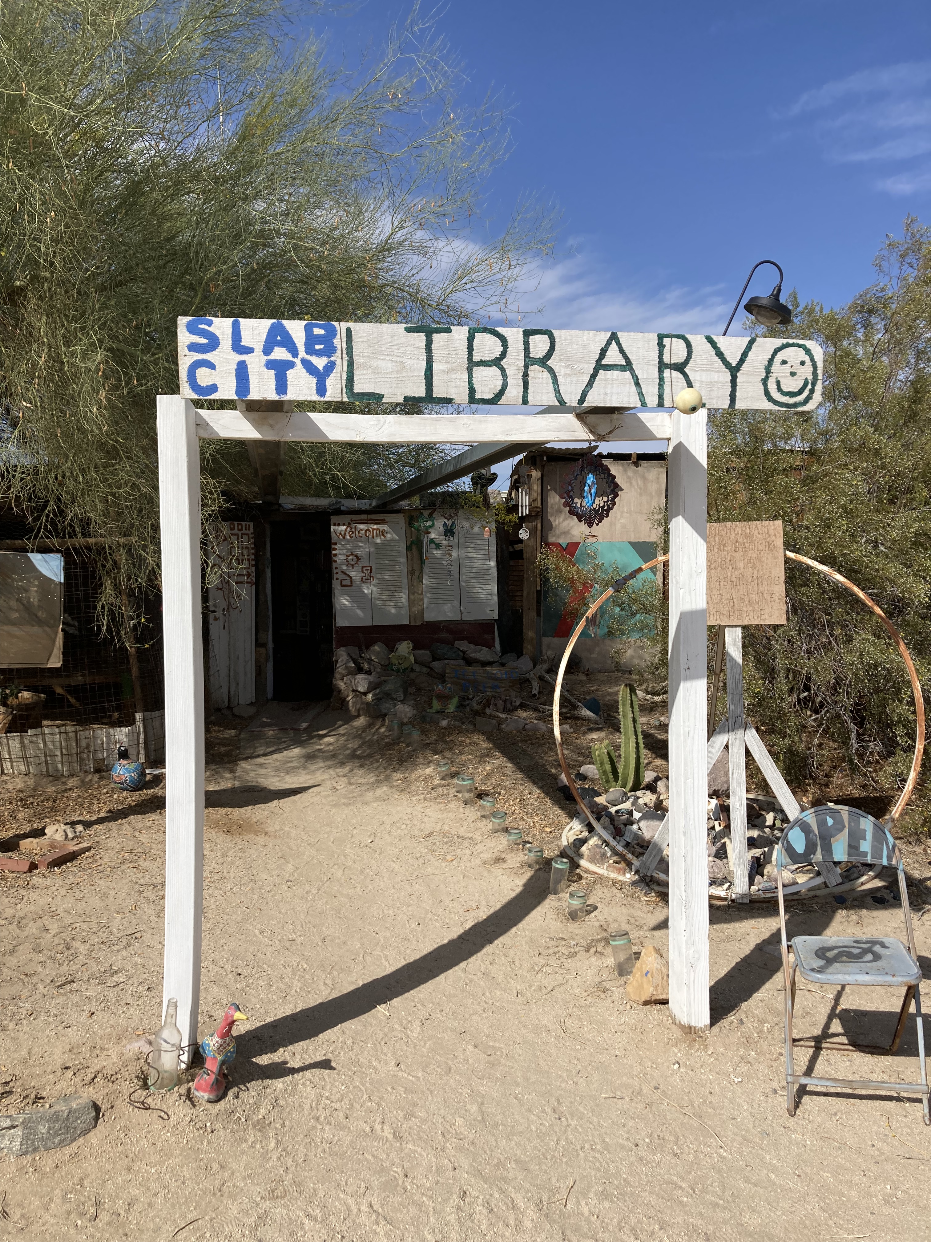
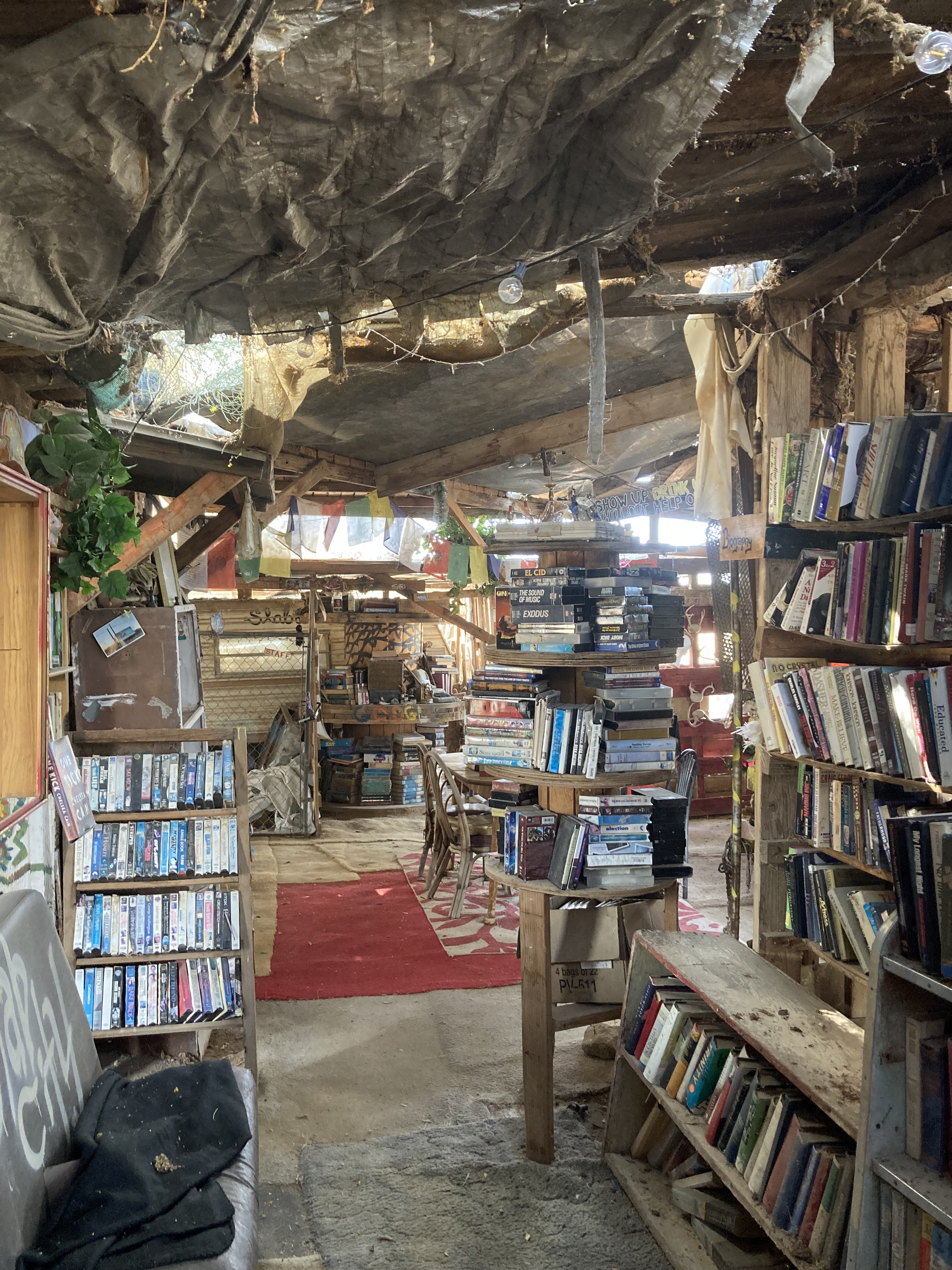
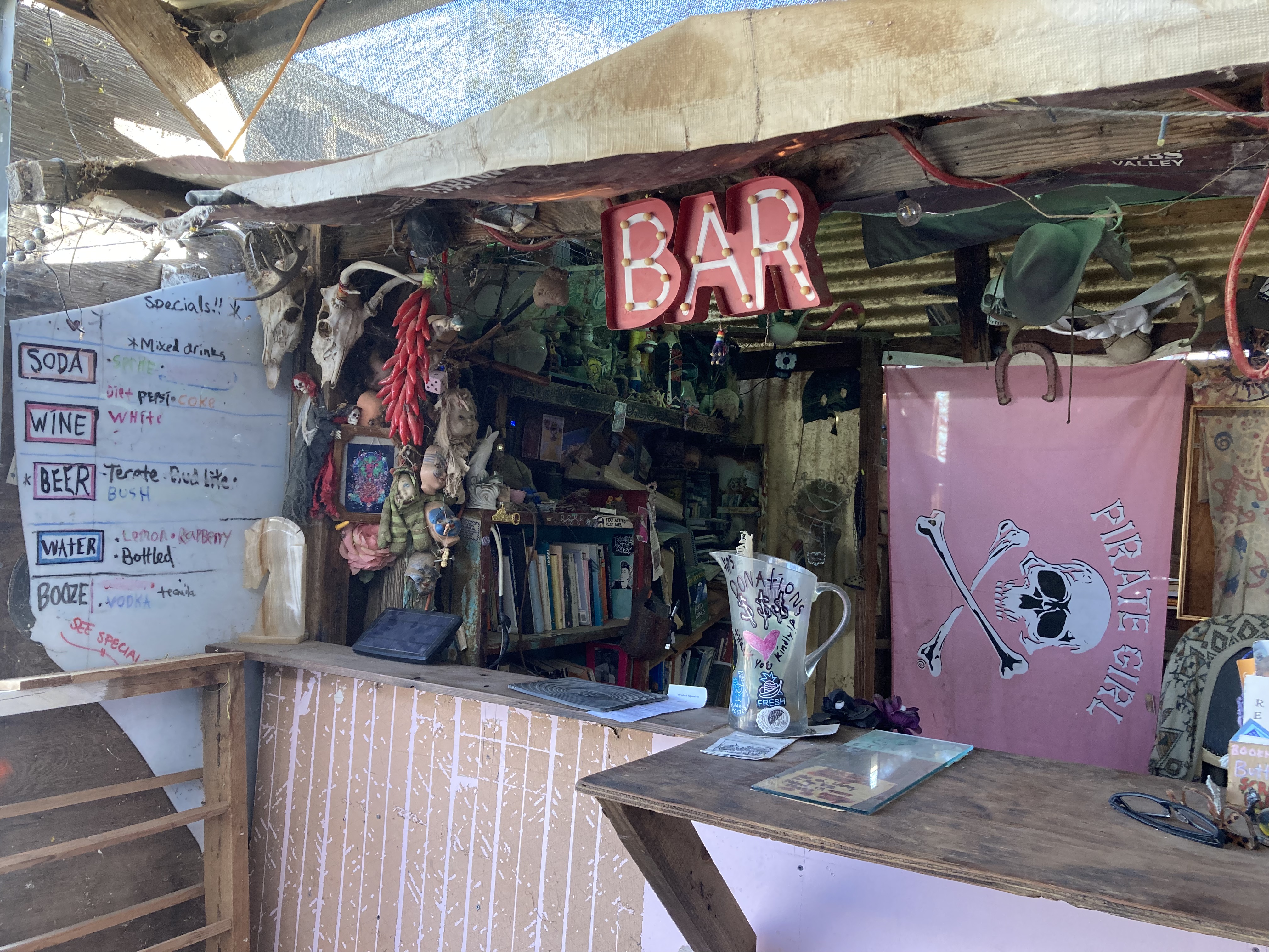
I didn’t stay overnight myself. I did feel cautious, especially being alone, and being new to the area. In the future I might consider one of the AirBnbs, as I would love to get the whole experience and chat with locals. But I got to explore Salvation Mountain, East Jesus, and I popped in to the Library – all dripping in character and oh so fascinating.
The Library was technically closed when I got there, but the guy who works there came out and chatted with me, was super nice, made sure I had water, and let me look around. There are lots of books and there’s a little bar. It’s a cool little spot to explore and get out of the sun.
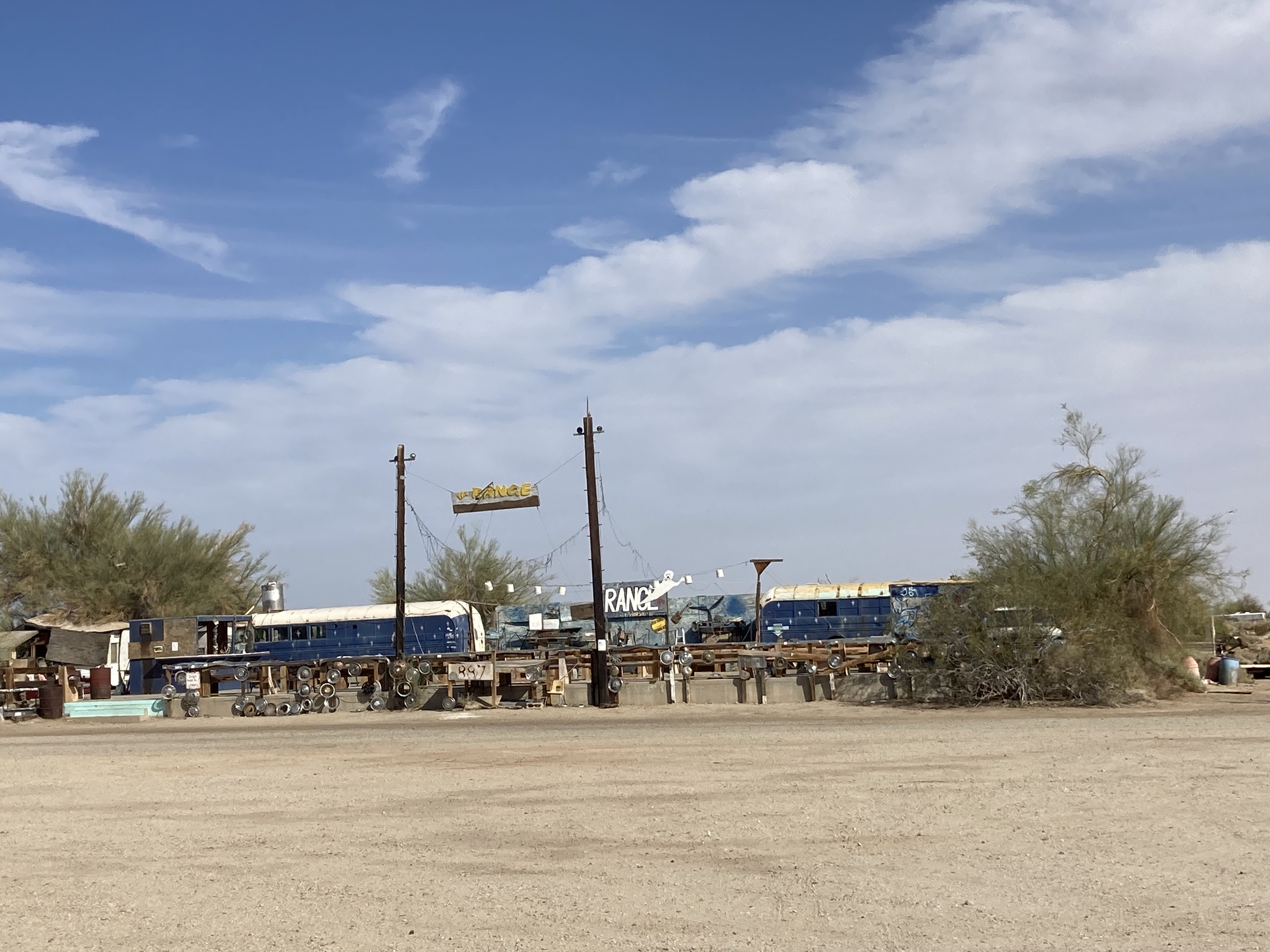
I would also love to be at The Range, the open air “nightclub”, on a weekend sometime. A gathering place made of buses, with drinks and jam sessions.
Hopefully the Slab City land is not sold or repurposed (as there have been talks about this), so people can continue to live here, and its rich character and history can live on.
Note: be careful where you’re driving so you don’t get stuck in the sand. The main roads were fine, but there further in I got the more iffy some areas were. Also consider donating to the areas you visit!
Coachella Valley
After my afternoon in Slab City I headed north on highway 111 towards Coachella Valley.
Two things happened on this drive.
First, there was a border patrol checkpoint. Which I found out is a thing on the roads near the US-Mexico border. It was a bit unnerving, but the agent was quite nice and I had no issues.
Second, my phone, which is my source of navigation, overheated and shut off. I had to pull over, get my phone out of the sun, and wait for it to cool down so I could get maps working and directing me again.
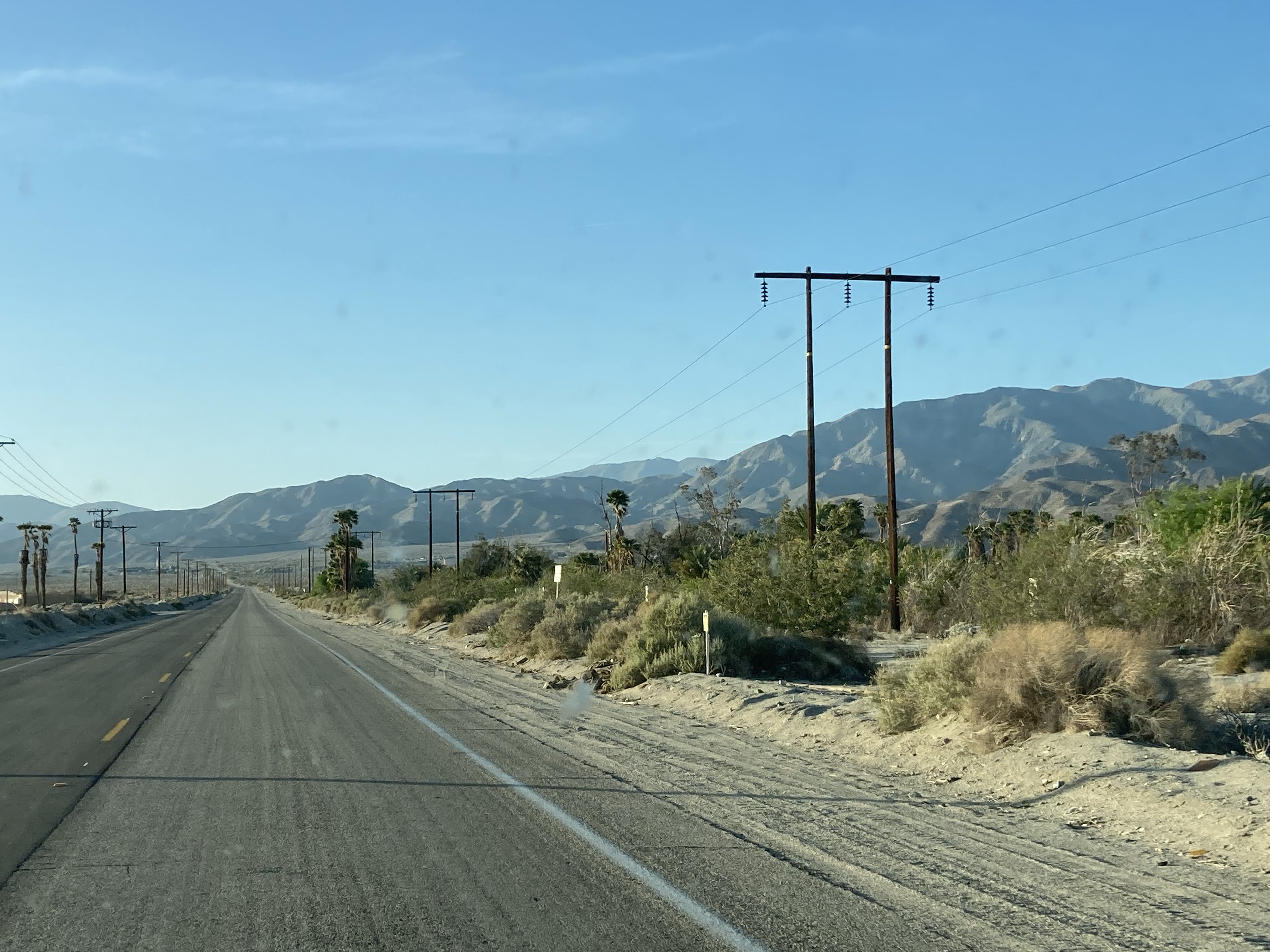
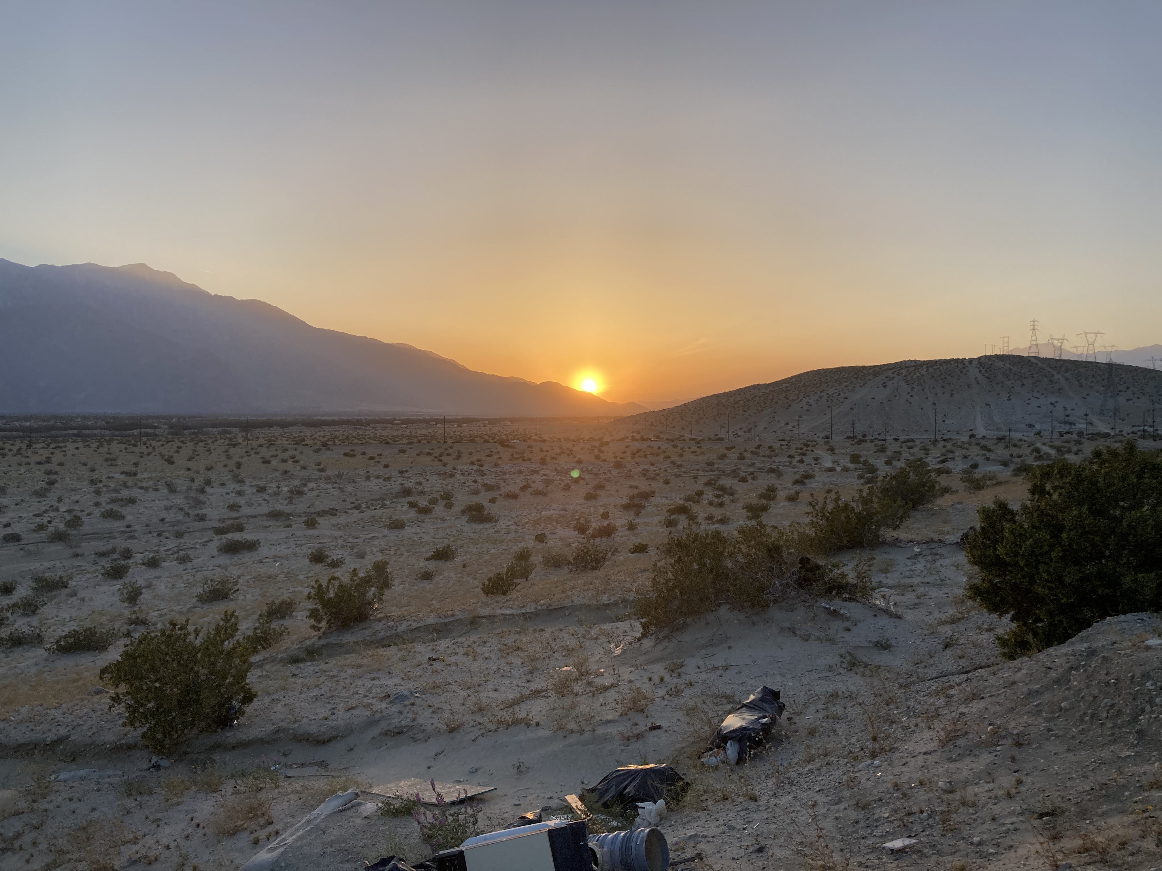
I was in the area of the Salton Sea, in the Sonoran Desert, California’s largest lake. It is known to be saltier than the ocean, and a terminal destination for water runoff. Over the years it has been a recreation destination and an important ecosystem for migratory birds. You can find the Salton Sea Recreation Area and the Salton Sea Wildlife Refuge here. But there are concerns over the future of the lake due to receding water levels and increasing toxicity of the environment for the health of wildlife and as a public health issue for nearby communities (which is why the area is a bit of a ghost town). Bombay Beach in particular is like a ghost town, now with art installations, and definitely a place I’m adding to my list of places I’d like to go in the future.
The drive itself was about an hour and a half, which isn’t bad at all when you’ve got a podcast or music to listen to.
I was listening to very specific music, in preparation for a very specific, niche destination.
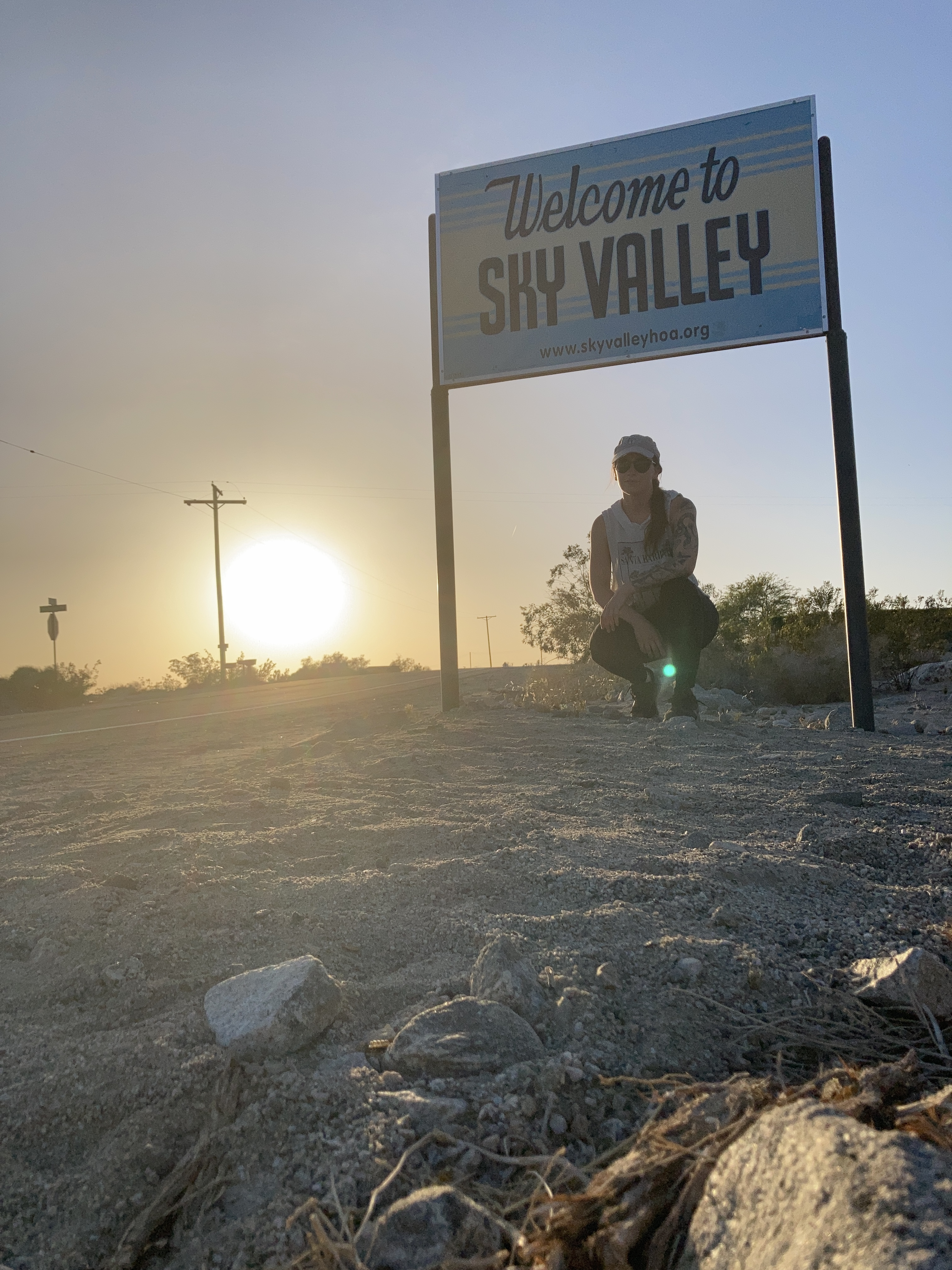
Any Kyuss fans here?
I don’t know if even those who know Kyuss would visit this spot. It’s the location of one of their album covers – at the city sign for Sky Valley, which is a bit northwest of Indio, north of Cathedral City and Thousand Palms, in a more rural area. For me, as a music fan, to be listening to this band, visiting where the cover photo was taken, and in the area where the band originated – there was something special about that. Though to be honest the Kyuss song playing rent free in my head (IMO a masterpiece) was from a different album.
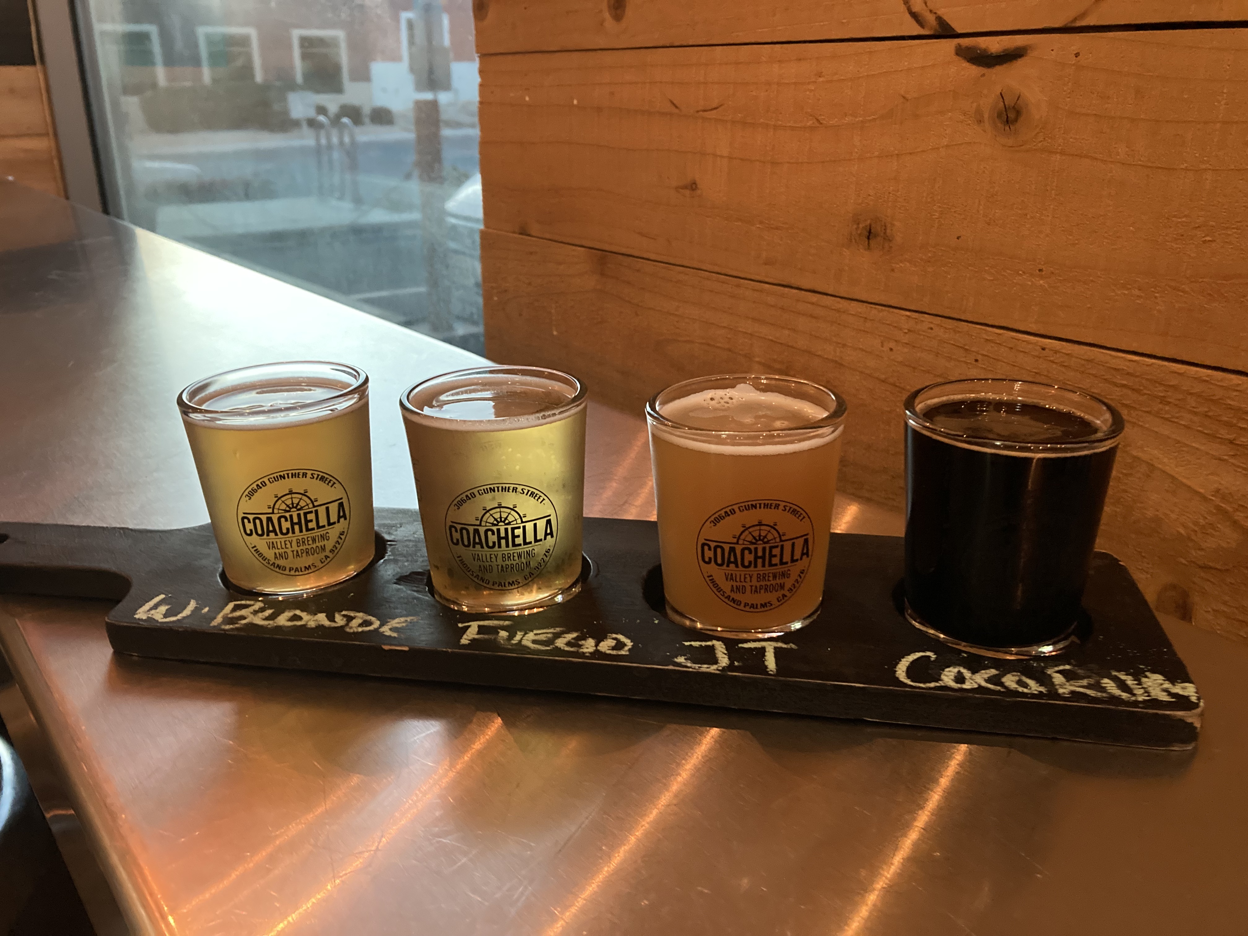
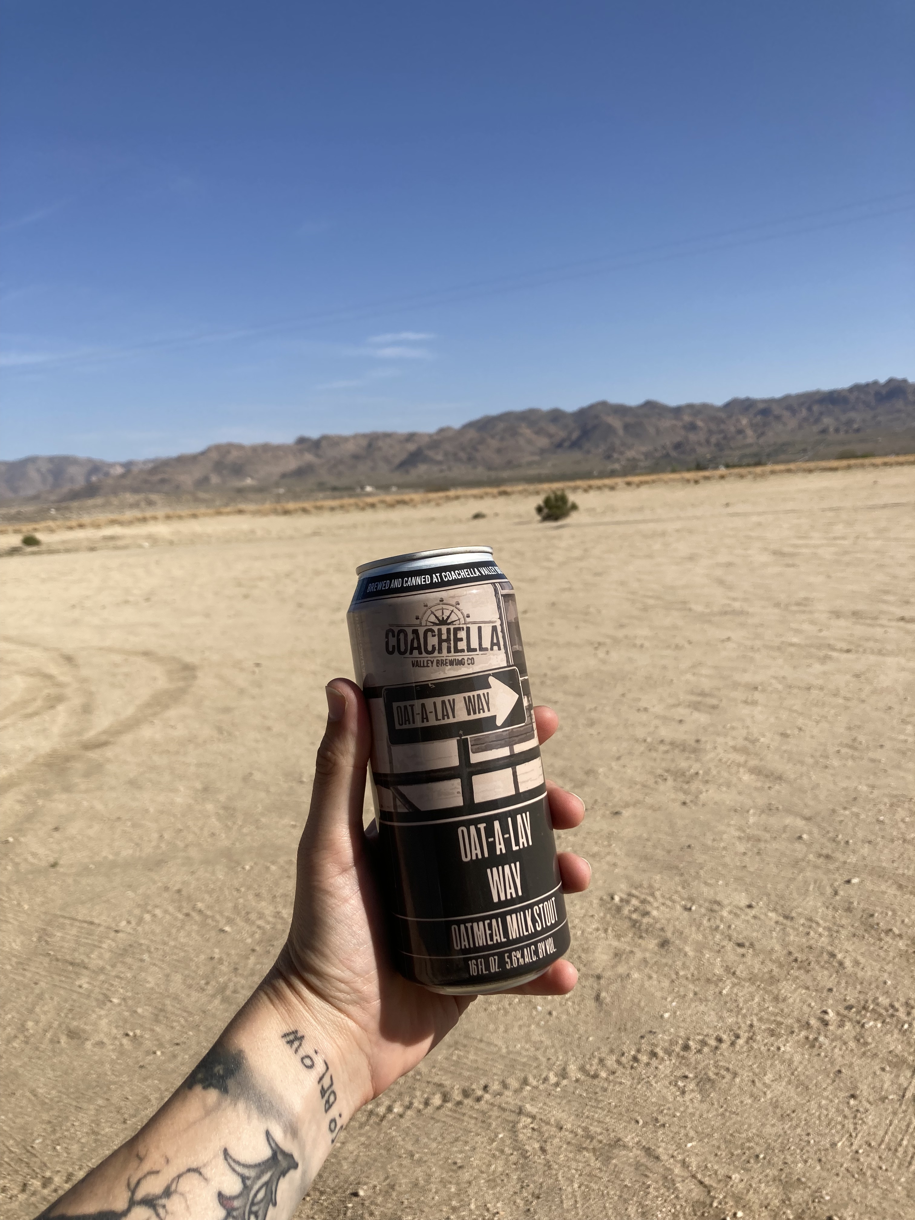
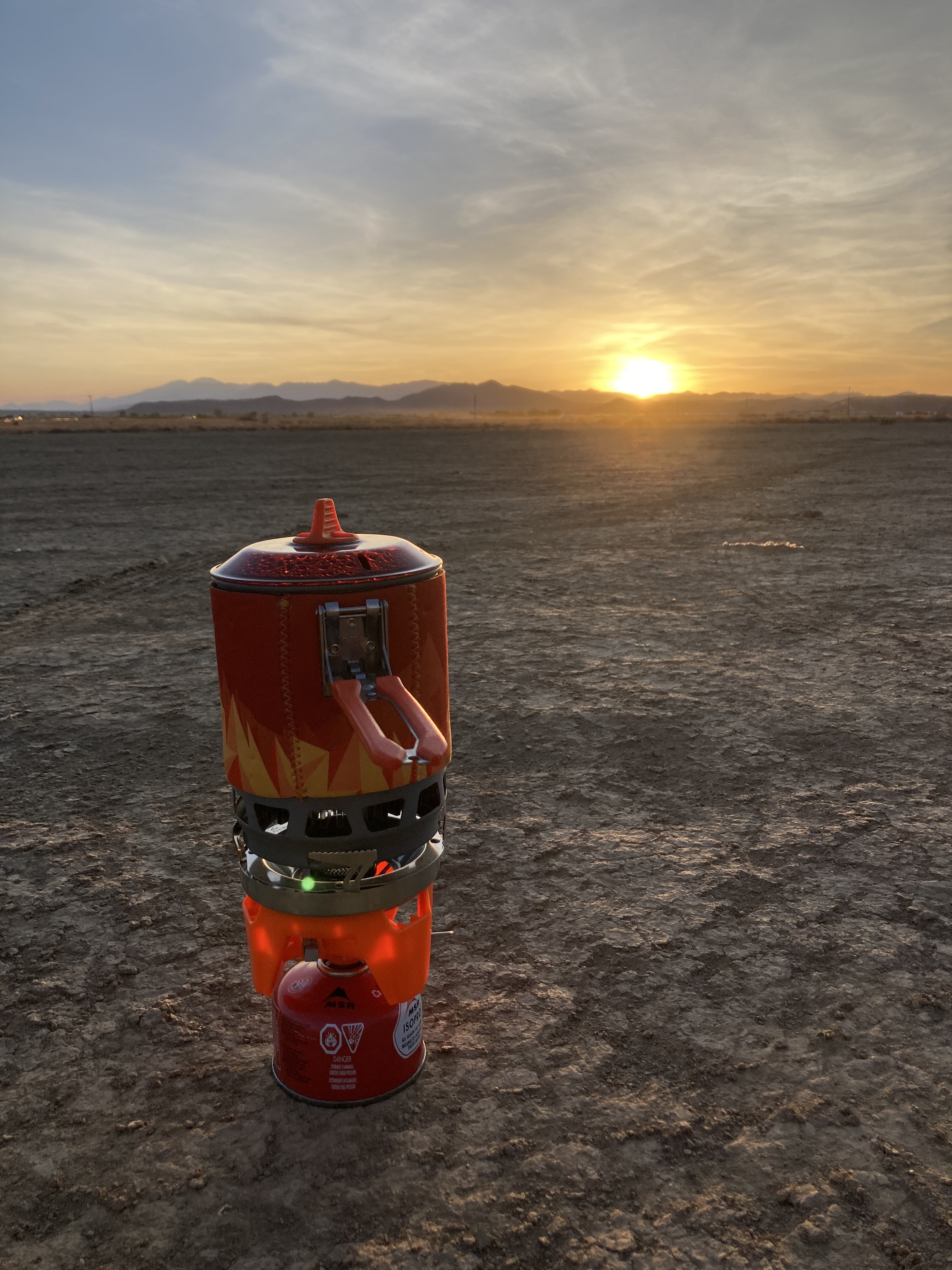
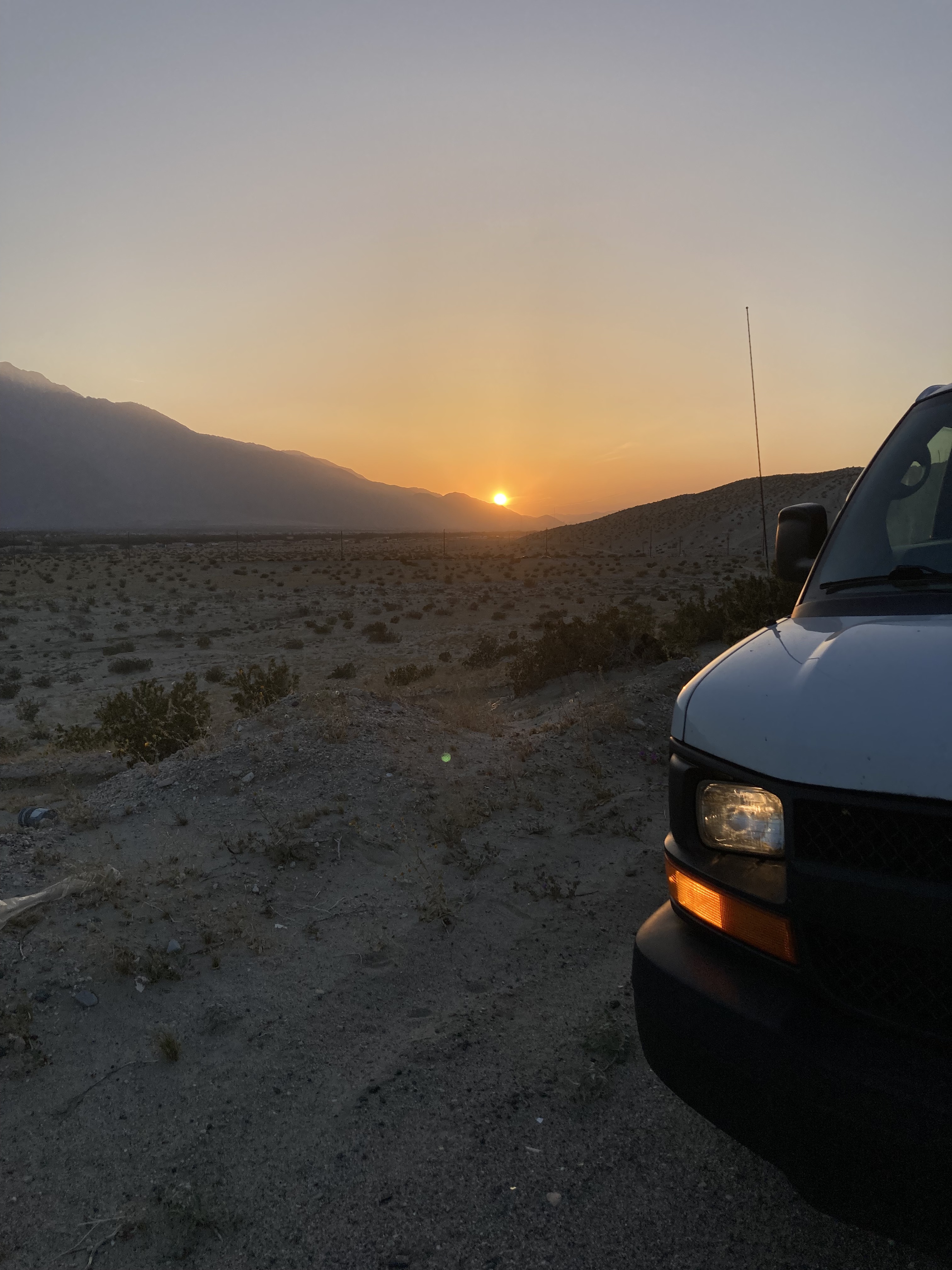
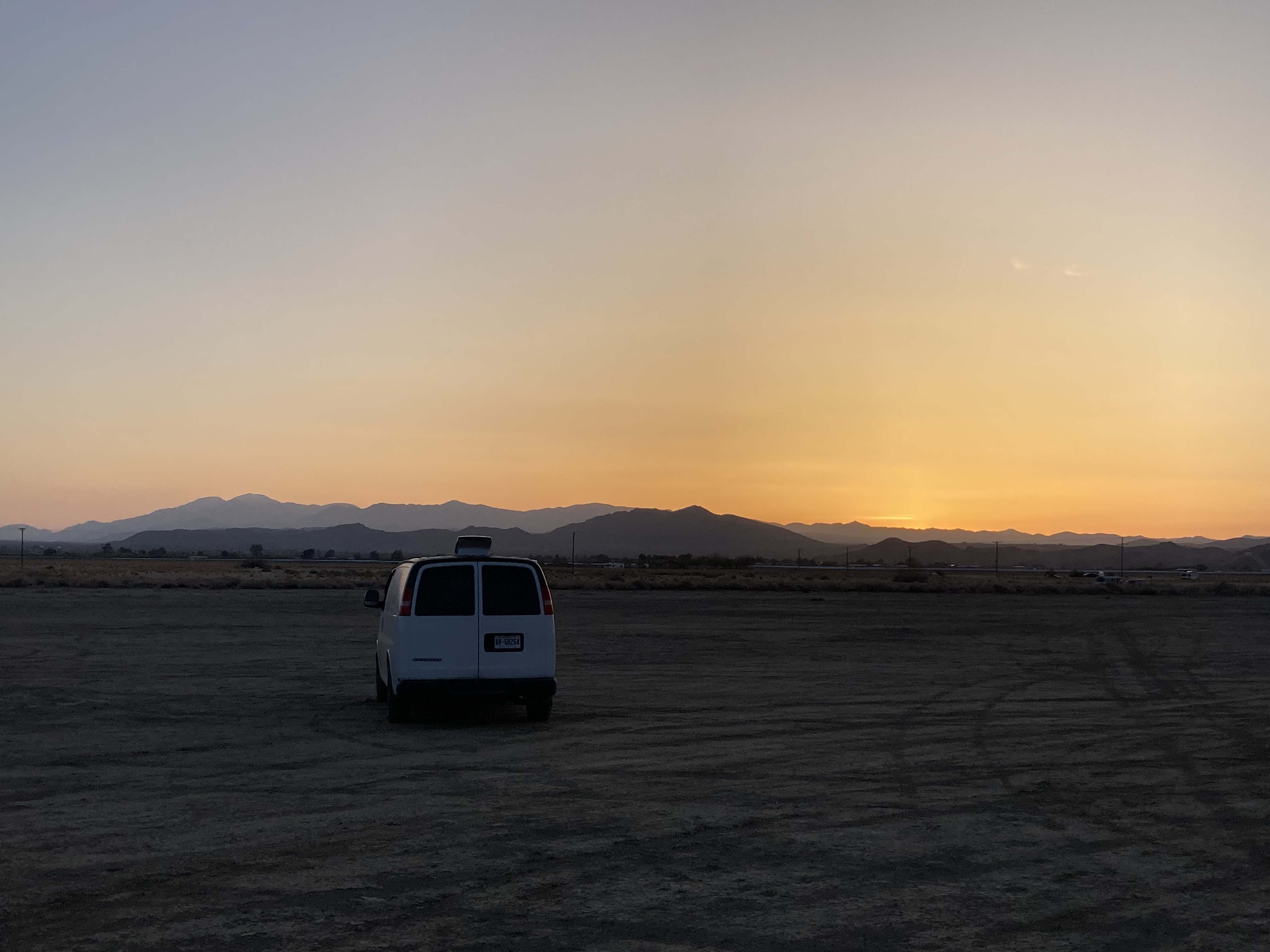
I then drove to a local brewery – Coachella Valley Brewing Co. The sunset over the desert was beautiful. It was nice to end a hot day in the desert with some cold beer, and I used the time to choose my overnight spot – a dirt lot behind Fantasy Springs Casino in Indio.
I would have liked to explore the Coachella Valley/ Greater Palm Springs area more. But the heat was about to get significantly worse, with highs of 37 degrees C quickly approaching in the Coachella Valley. I was heading into Joshua Tree National Park next, and Joshua Tree was showing highs that were 6 degrees C lower than the valley – and that was a difference that mattered. So the plan was to grab an iced coffee and get out of dodge. Sometimes you have to bypass places due to circumstance. And in the grand scheme I was okay with just a quick stop here.
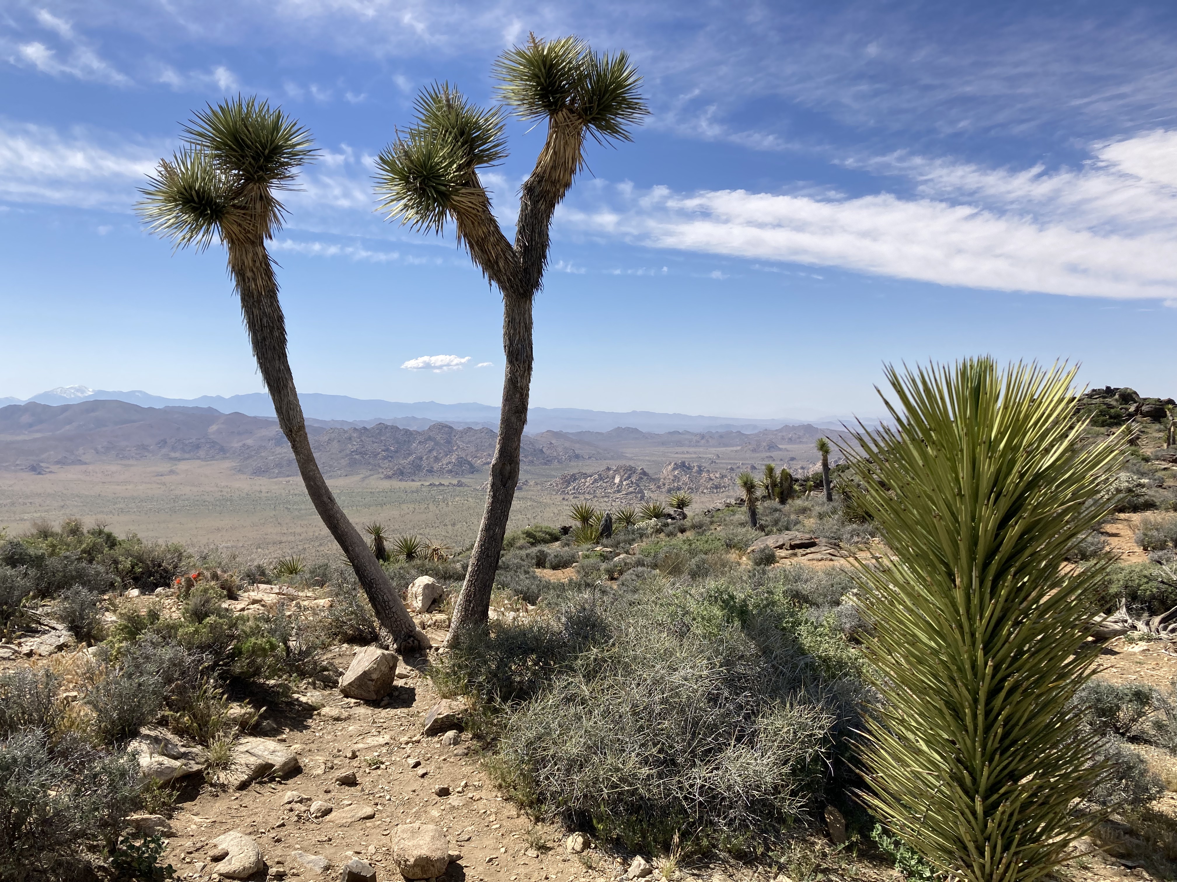
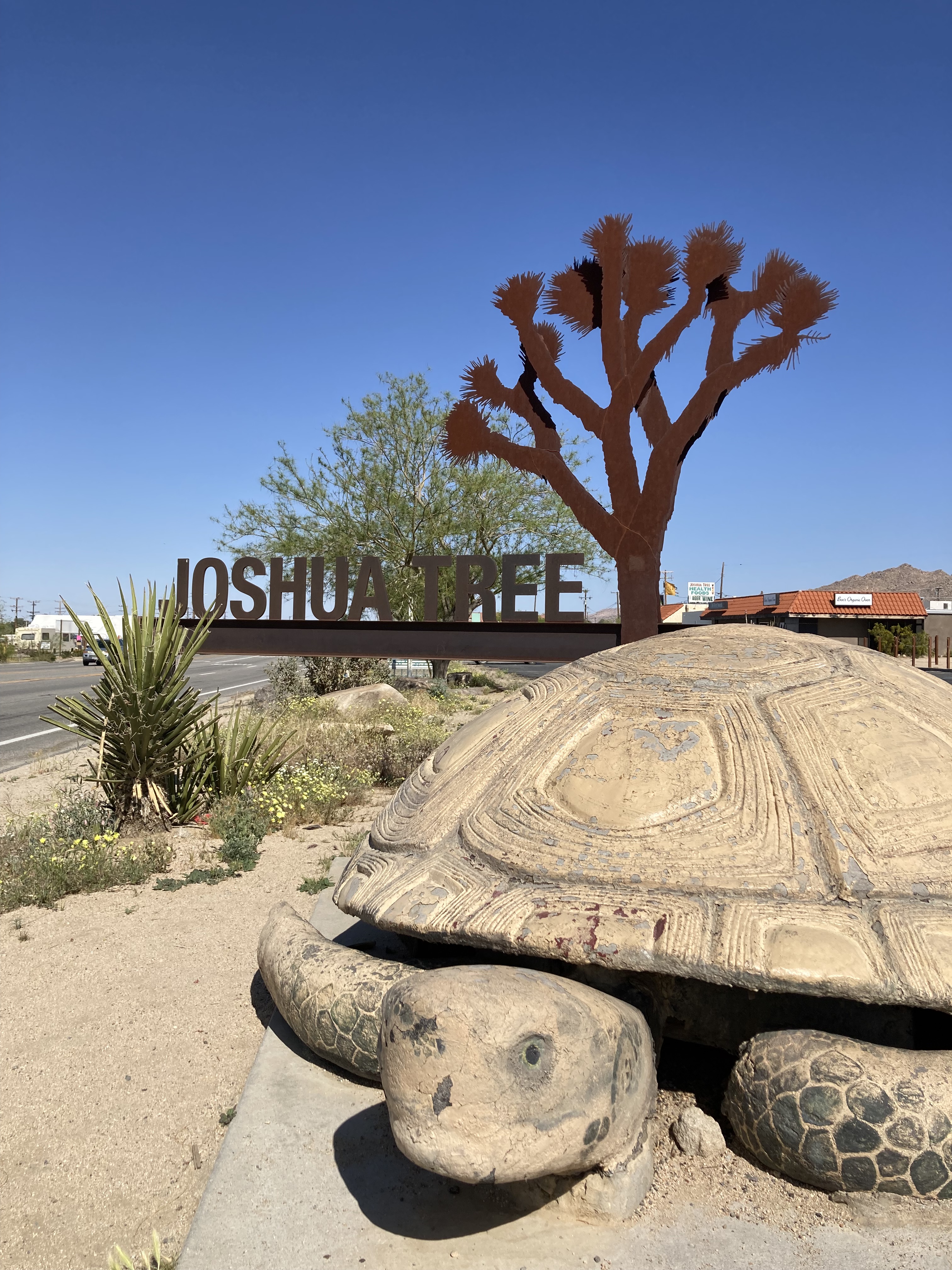
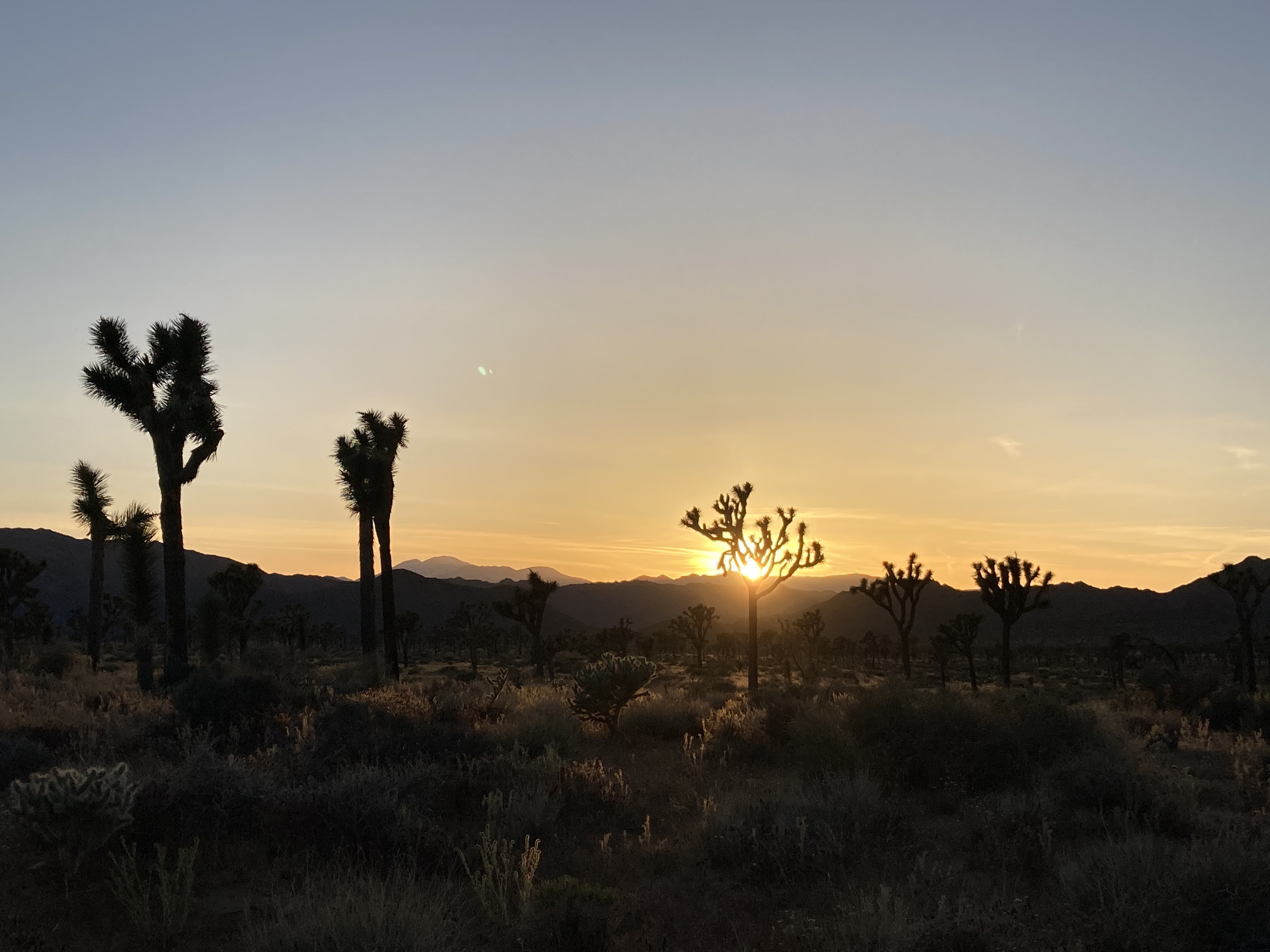
Joshua Tree
Joshua Tree National Park
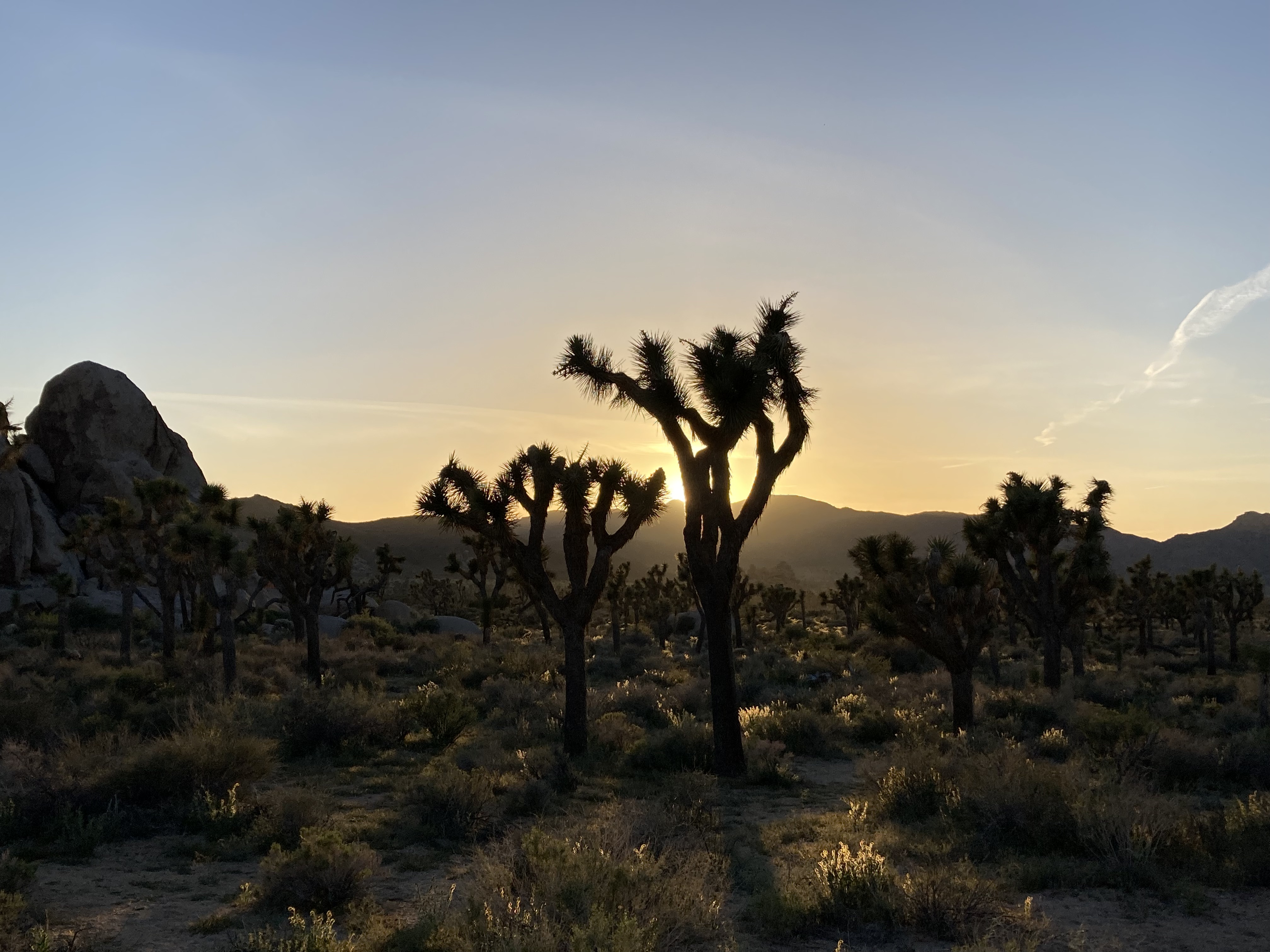
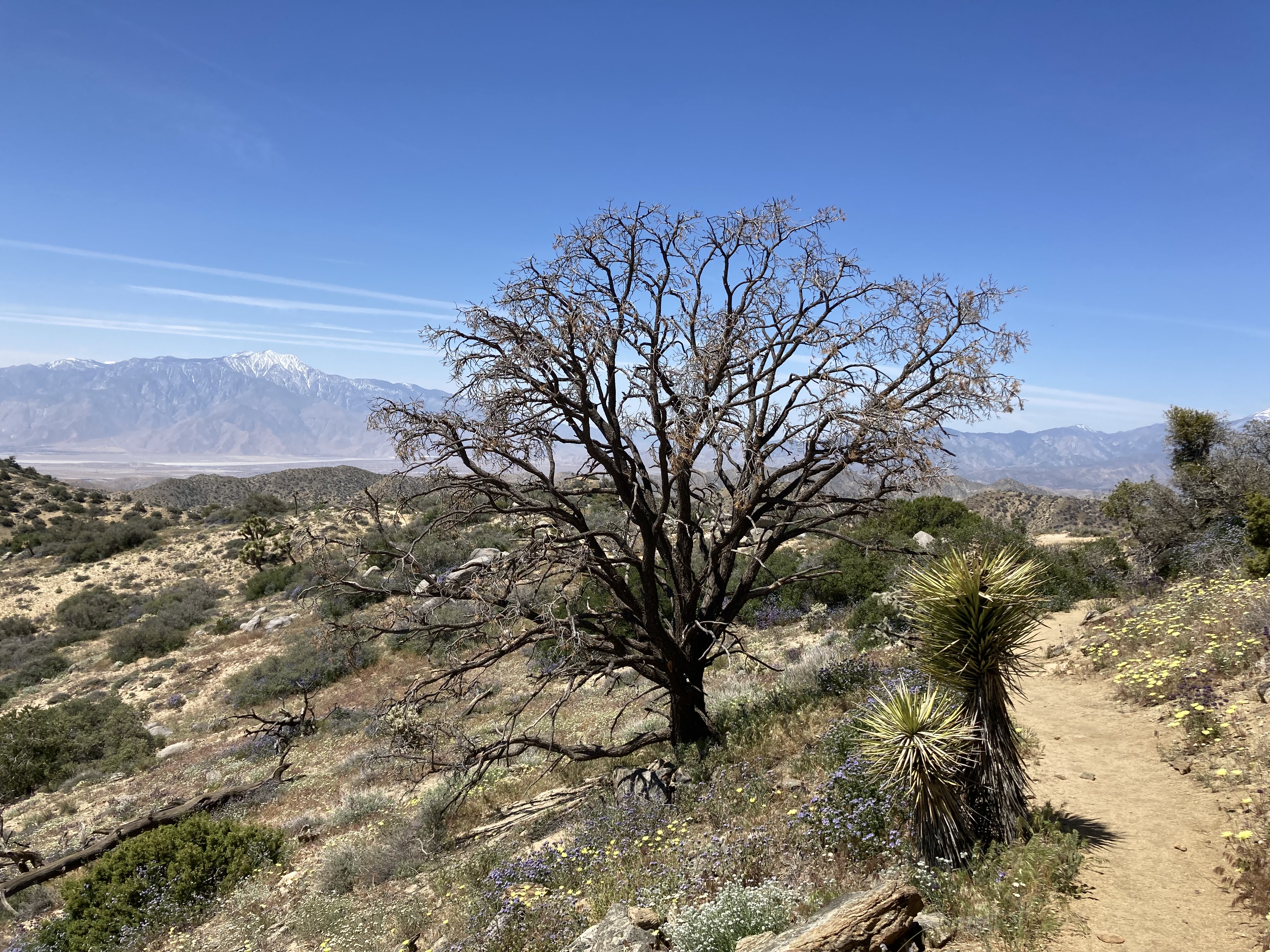
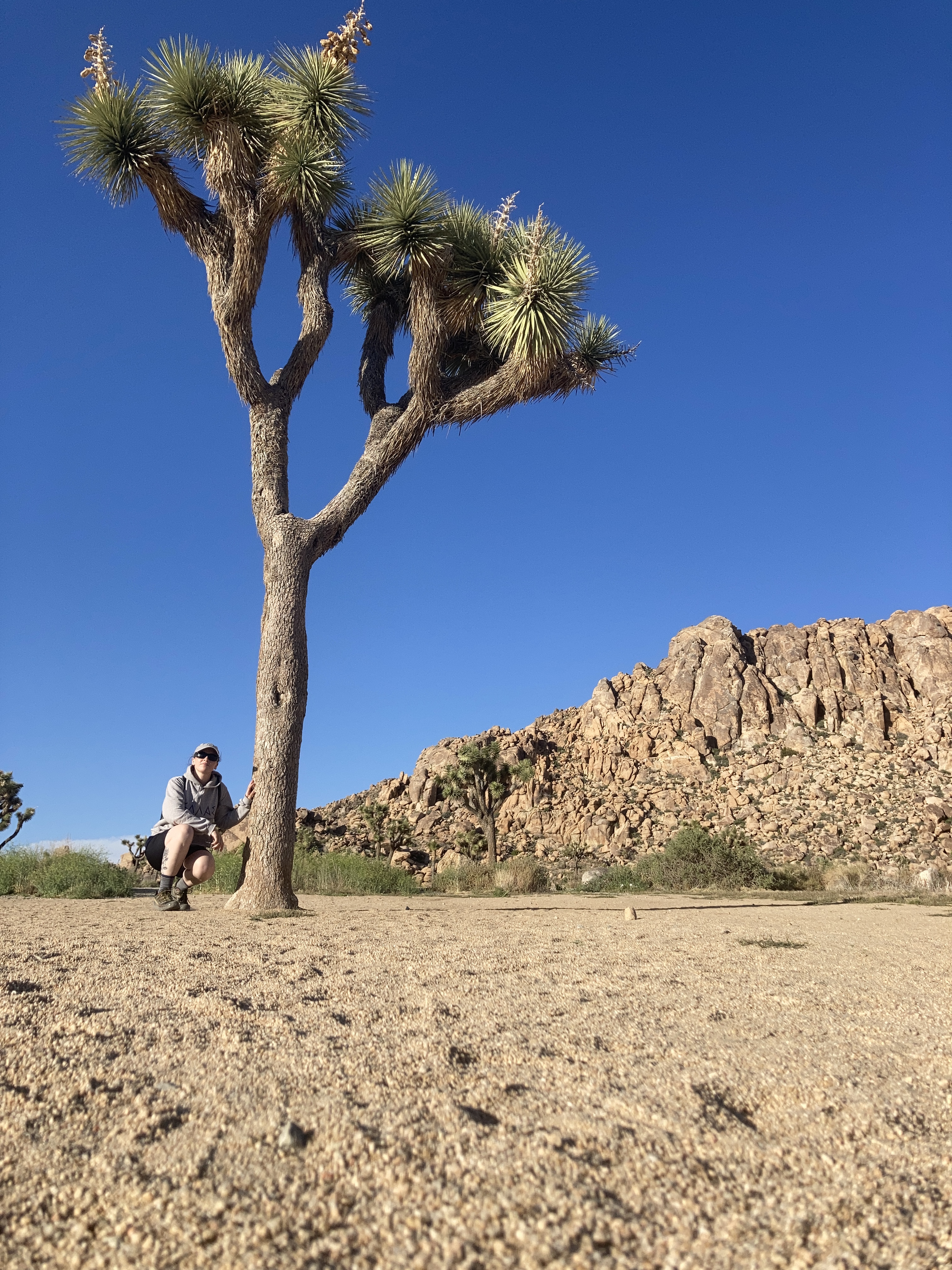
Truly, the Joshua Tree area is one of my favourite places on the earth. I have some sort of emotional attachment to it that I’m not sure I can fully explain.
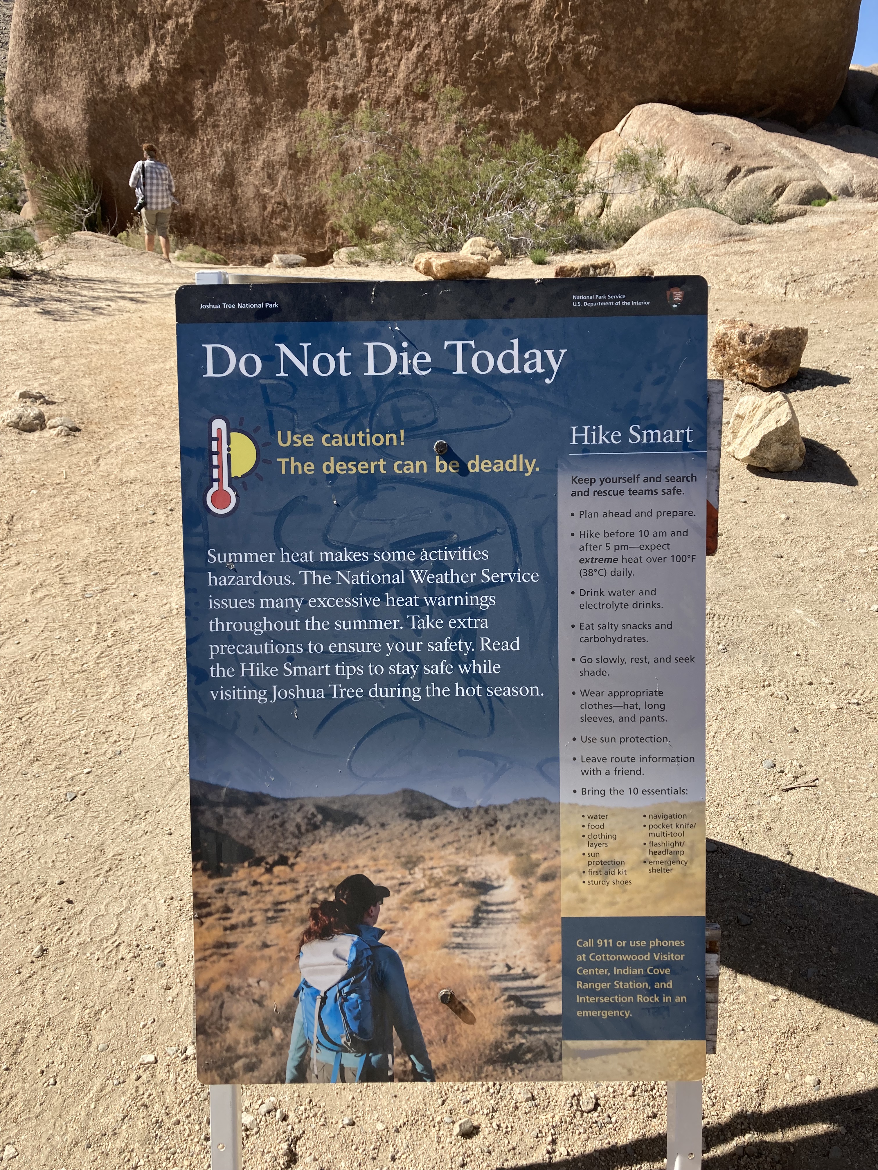
I remember maybe a week before getting here I saw a musician that I follow post about hiking in Joshua Tree National Park (JTNP) and a sign in the park that said “Don’t Die Today”. Which is certainly a slogan that will stick with you. But also, being in the desert is no joke.
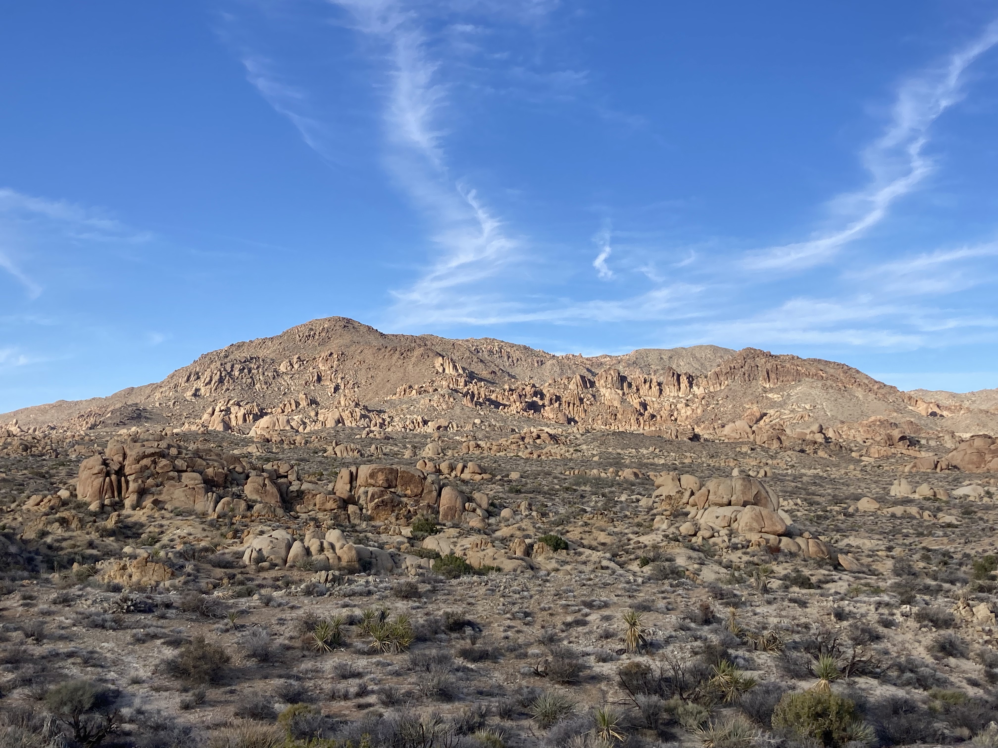
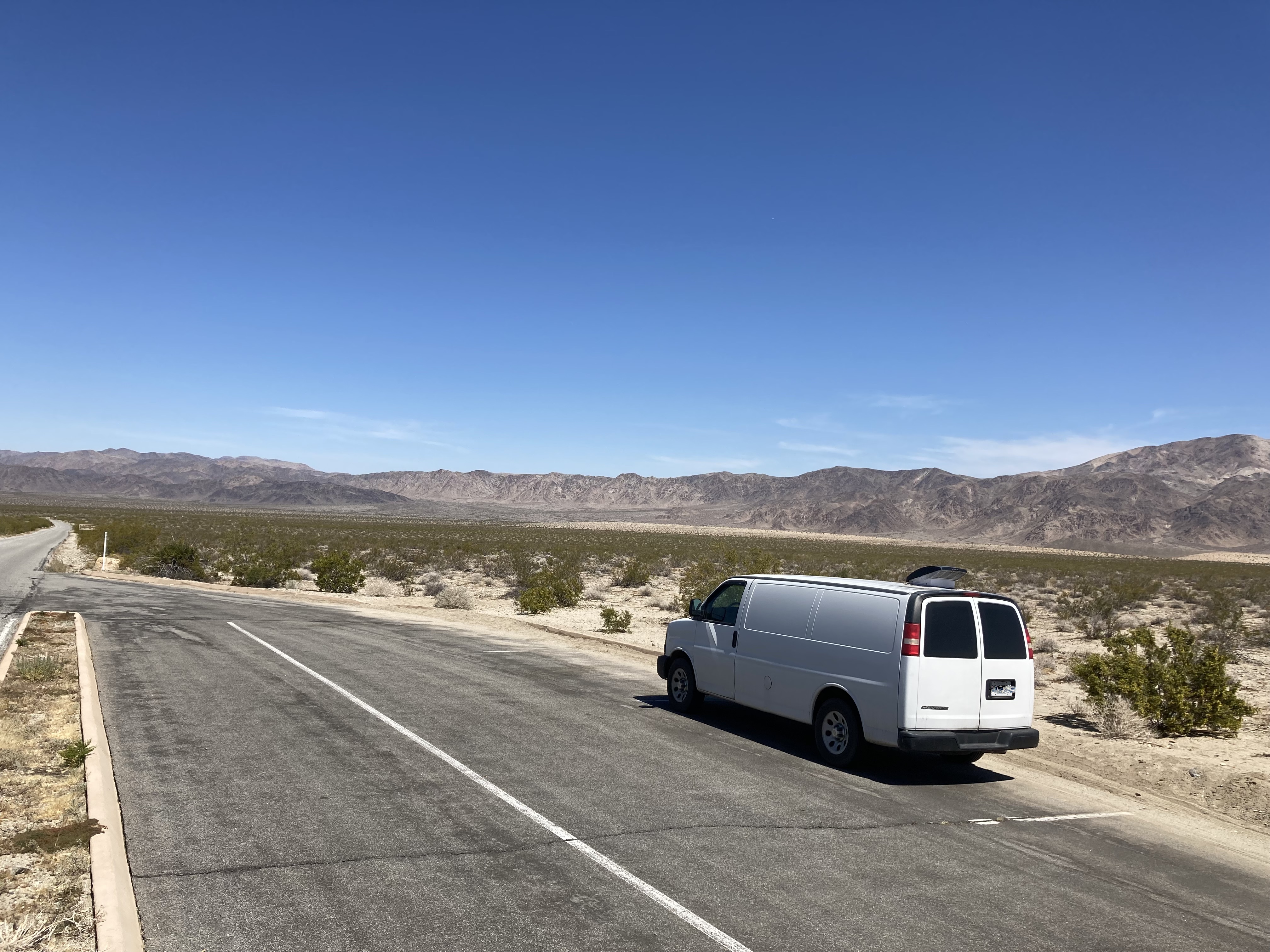
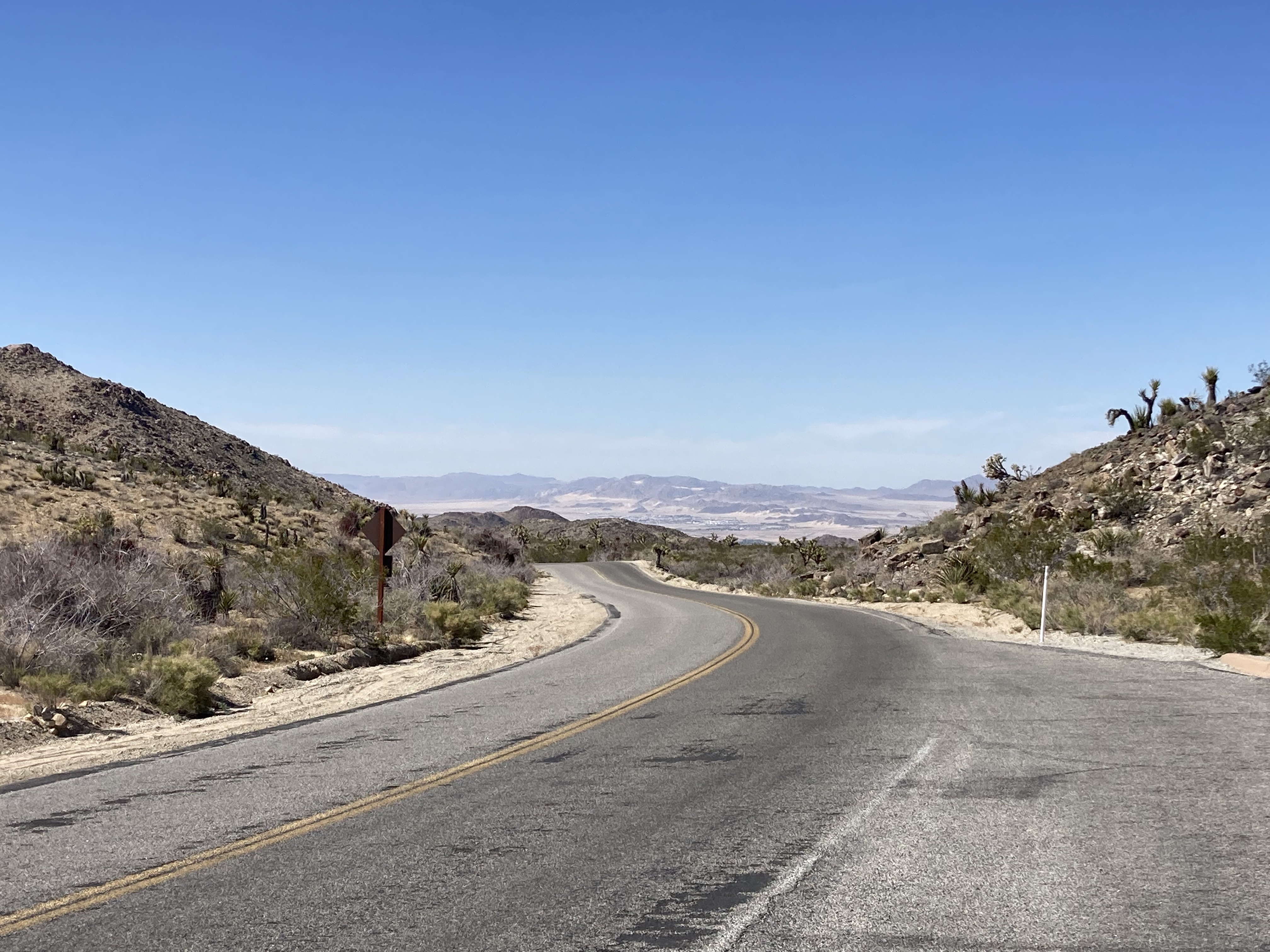
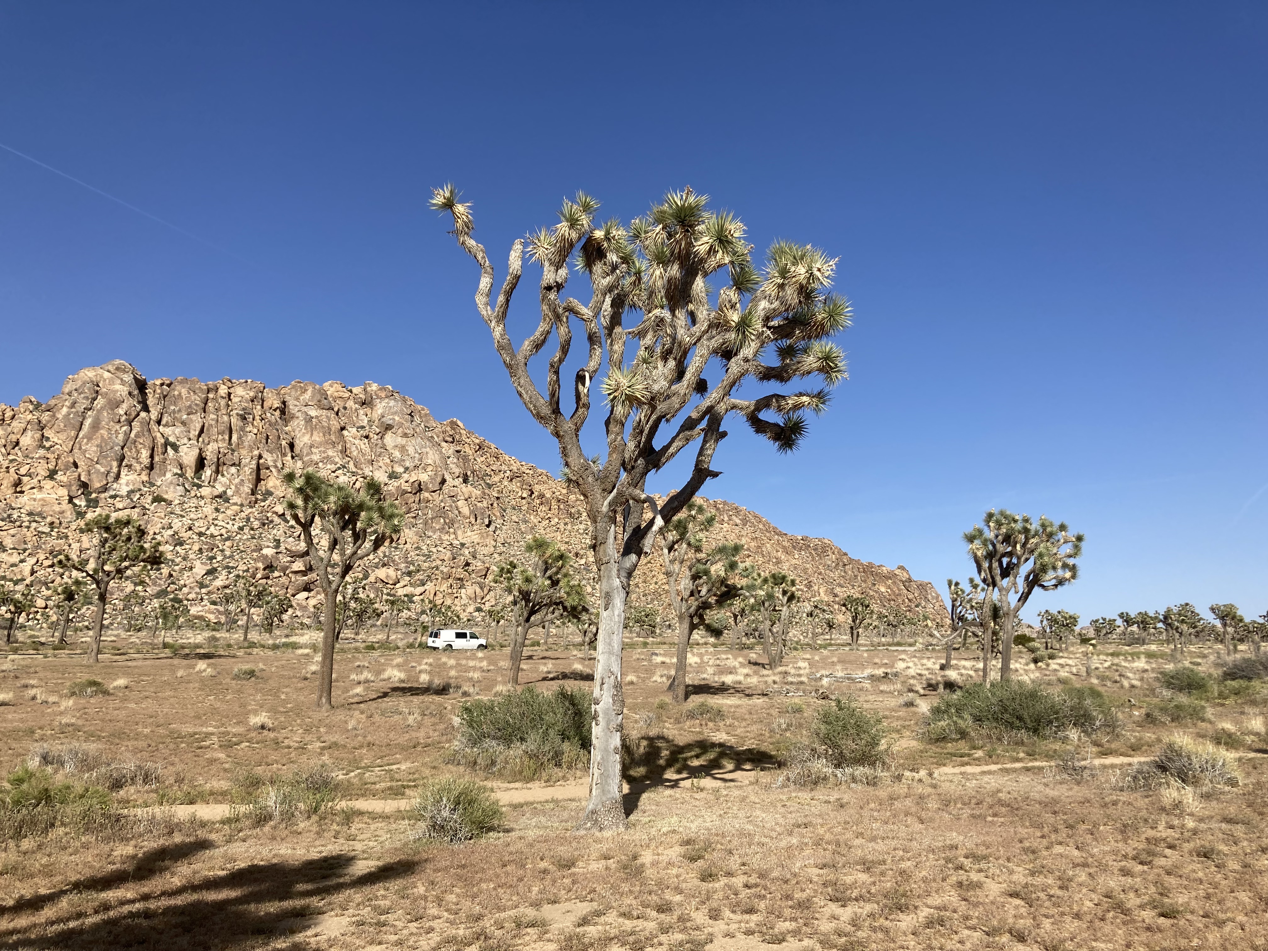
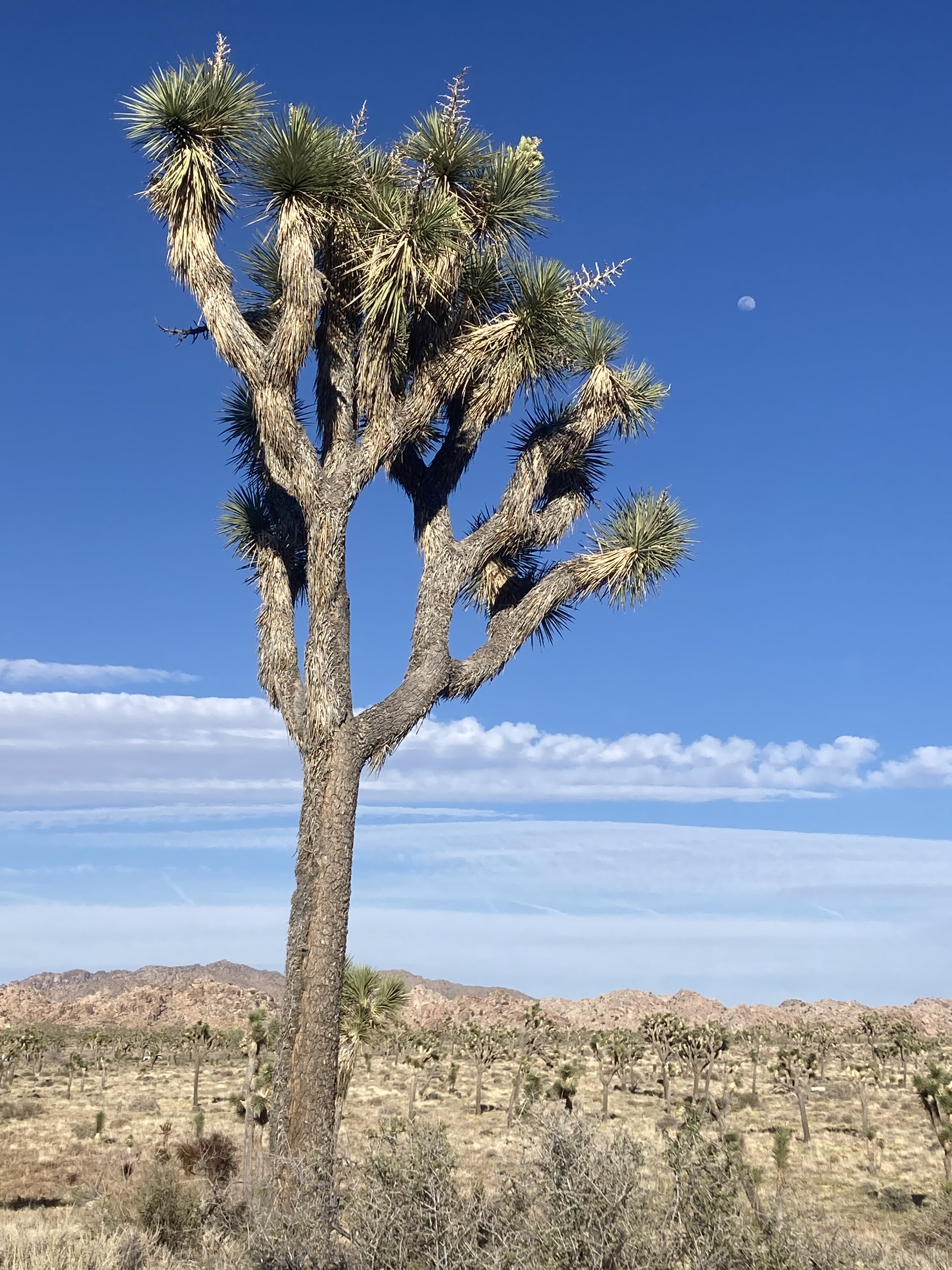
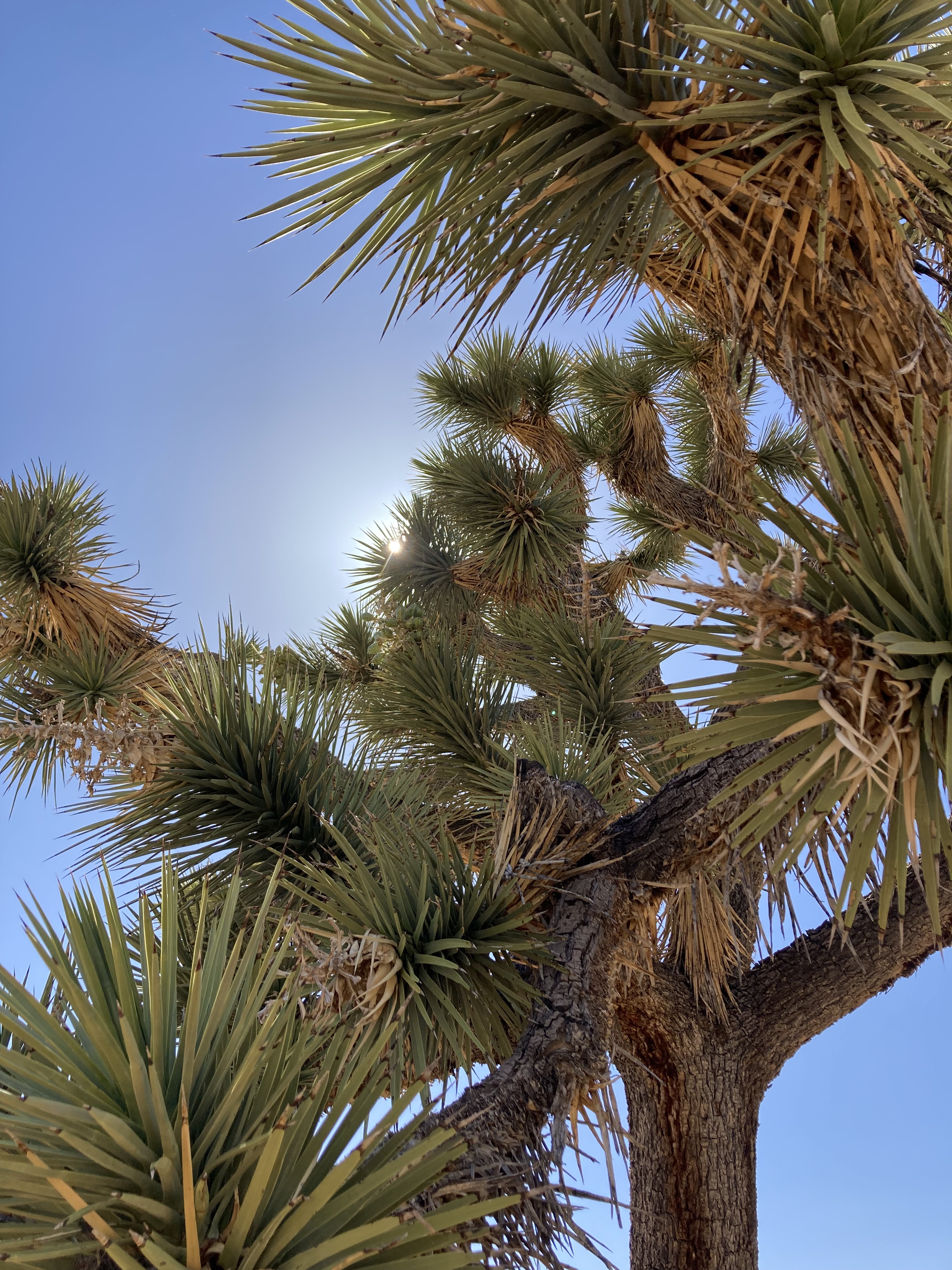
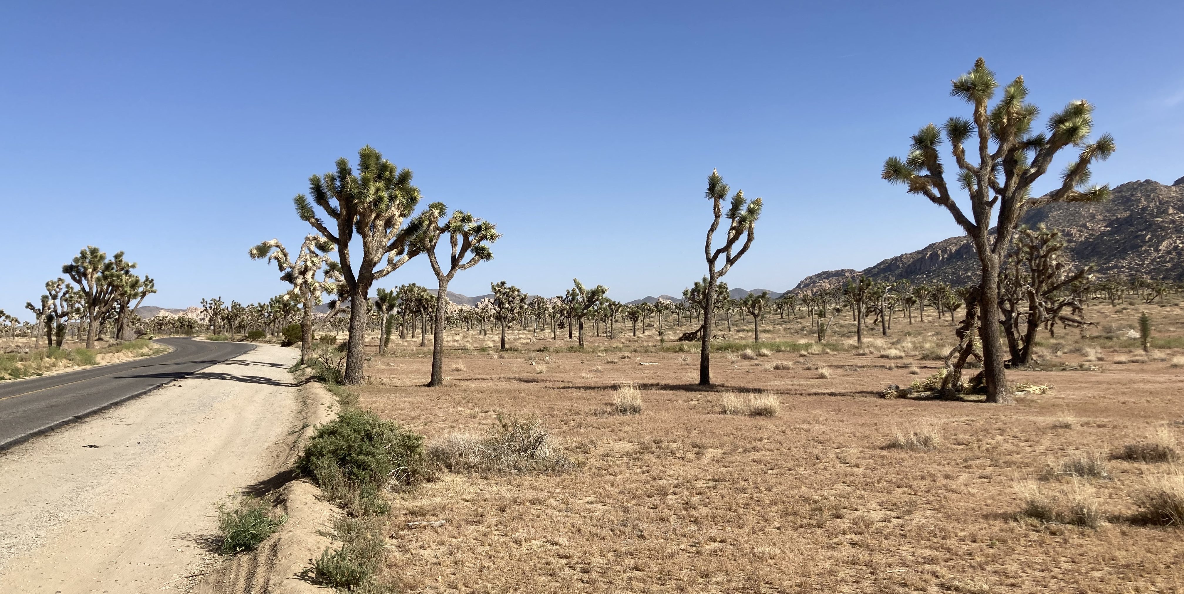
Entering the park from the south, there is no checkpoint or line to wait in. JTNP is made up of both Mojave Desert (western half) and Colorado Desert (eastern half), and the portion from the southern entrance is Colorado Desert. This means that you get to see the landscape and vegetation change as you drive through the park. It is the Mojave Desert, and the area of the park closer to Joshua Tree, that has the characteristic Joshua Trees.
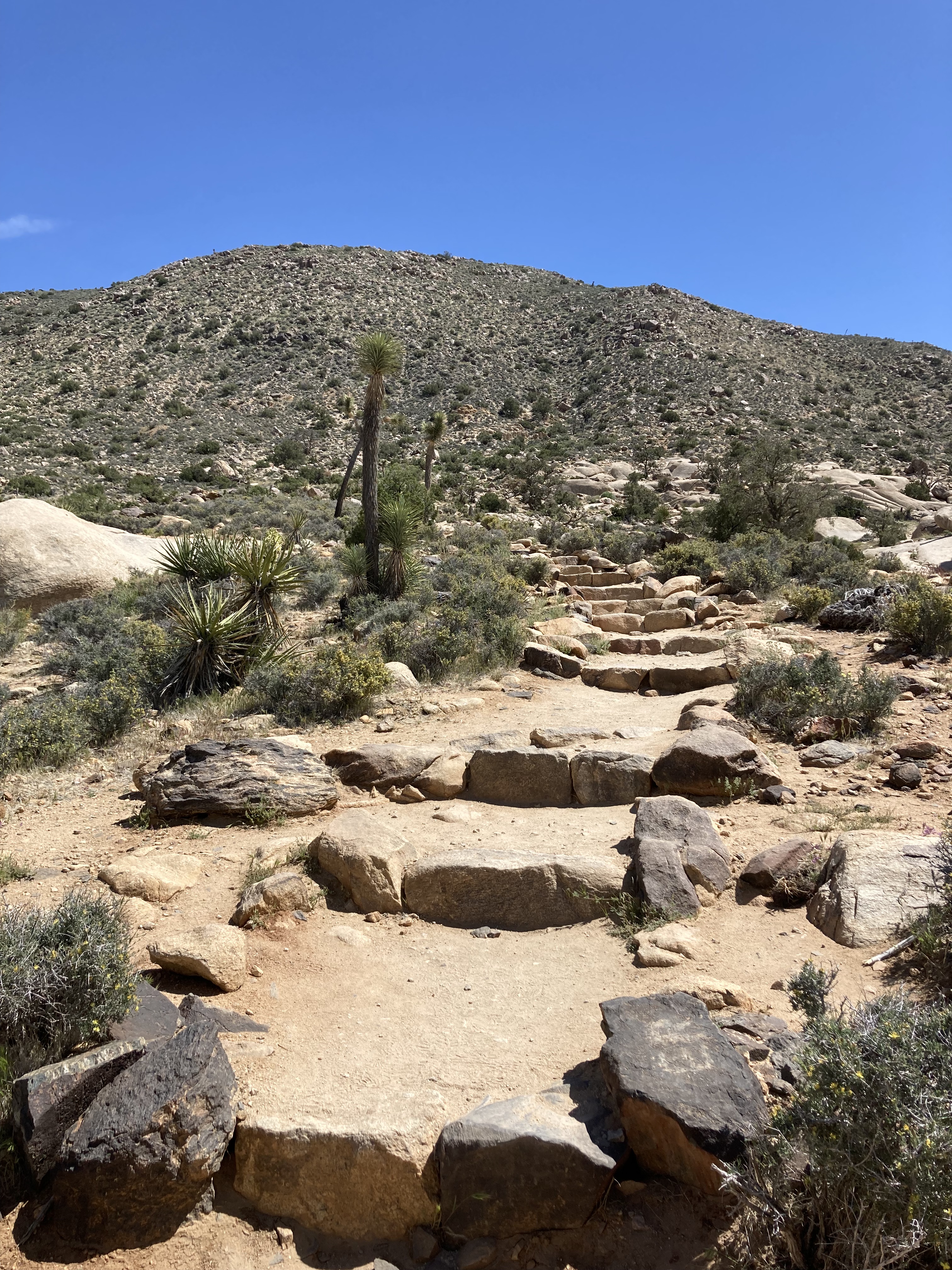
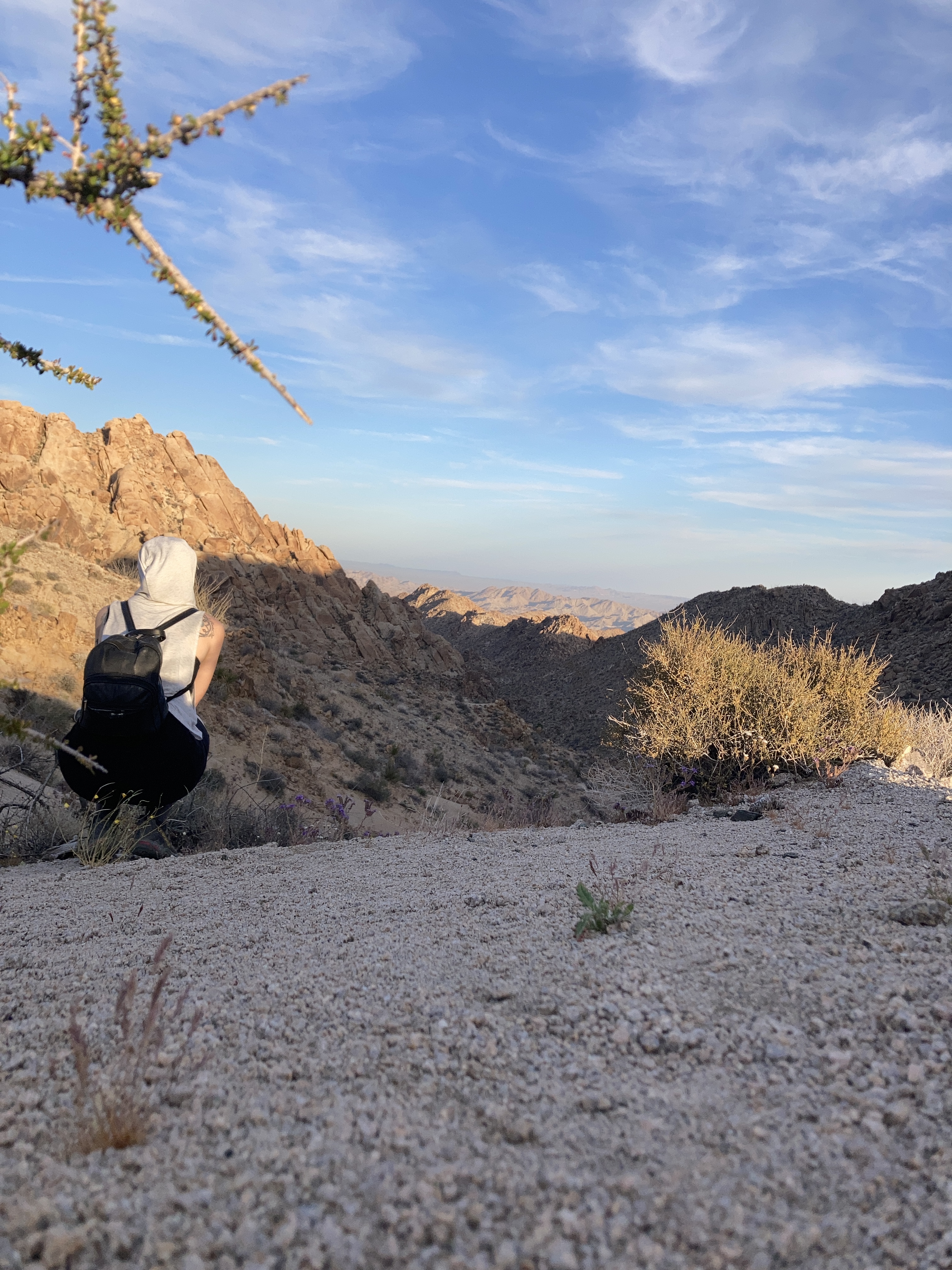
I popped into the Visitor Centre first and then headed to the Lost Palms Oasis hiking trail. The heat was starting to get to me, so I took things slow, carried plenty of water and a snack, and planned to head back to the car if I felt unwell. The temperature shift from the coast to the desert was so extreme that I felt unwell for a few days (nauseous, lethargic), but in that time I acclimatized. It was also nearing the end of the day, so I was hoping it would cool off, and on my way back to the van the sun did start to set, so it did indeed cool down.
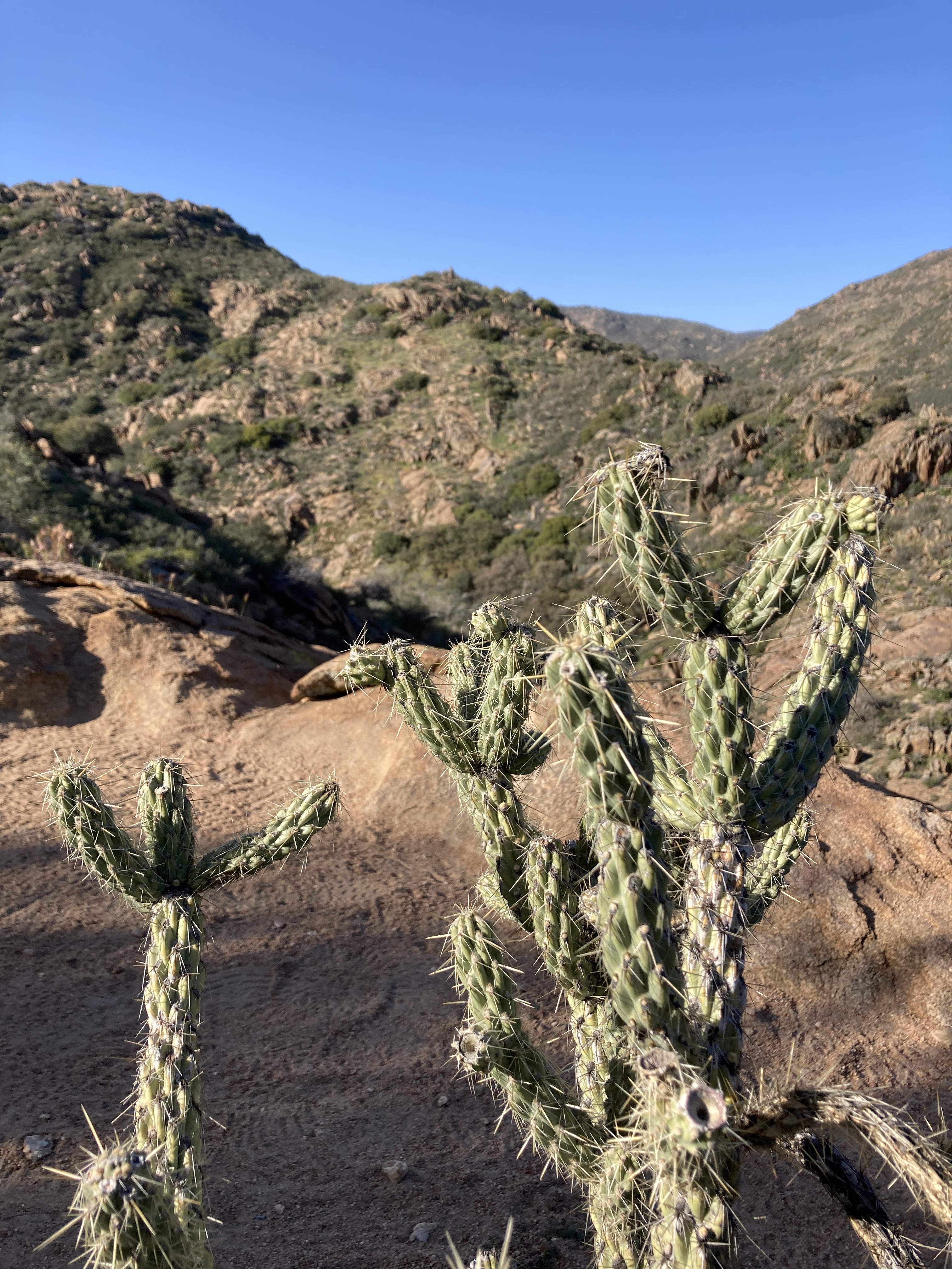
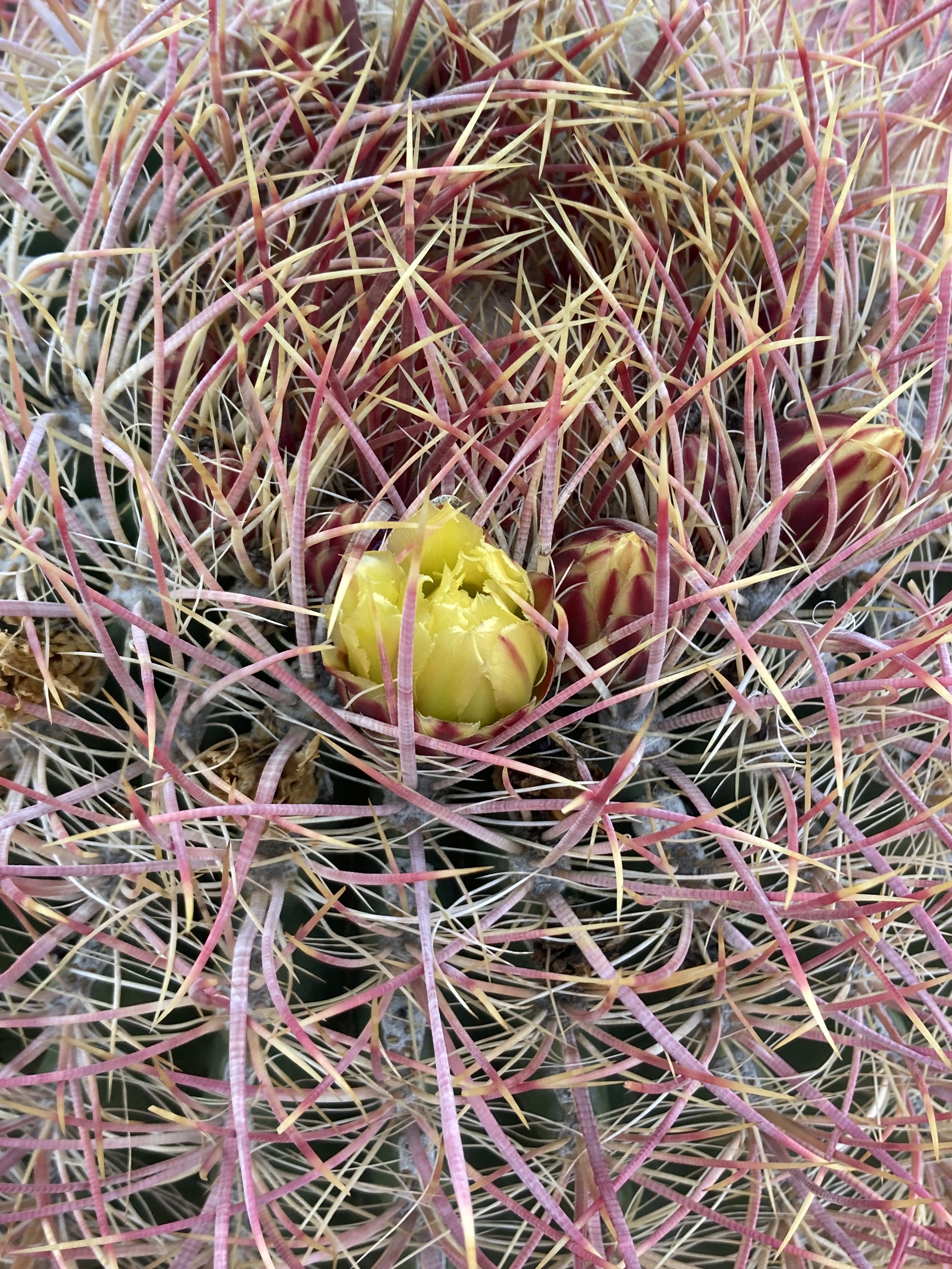
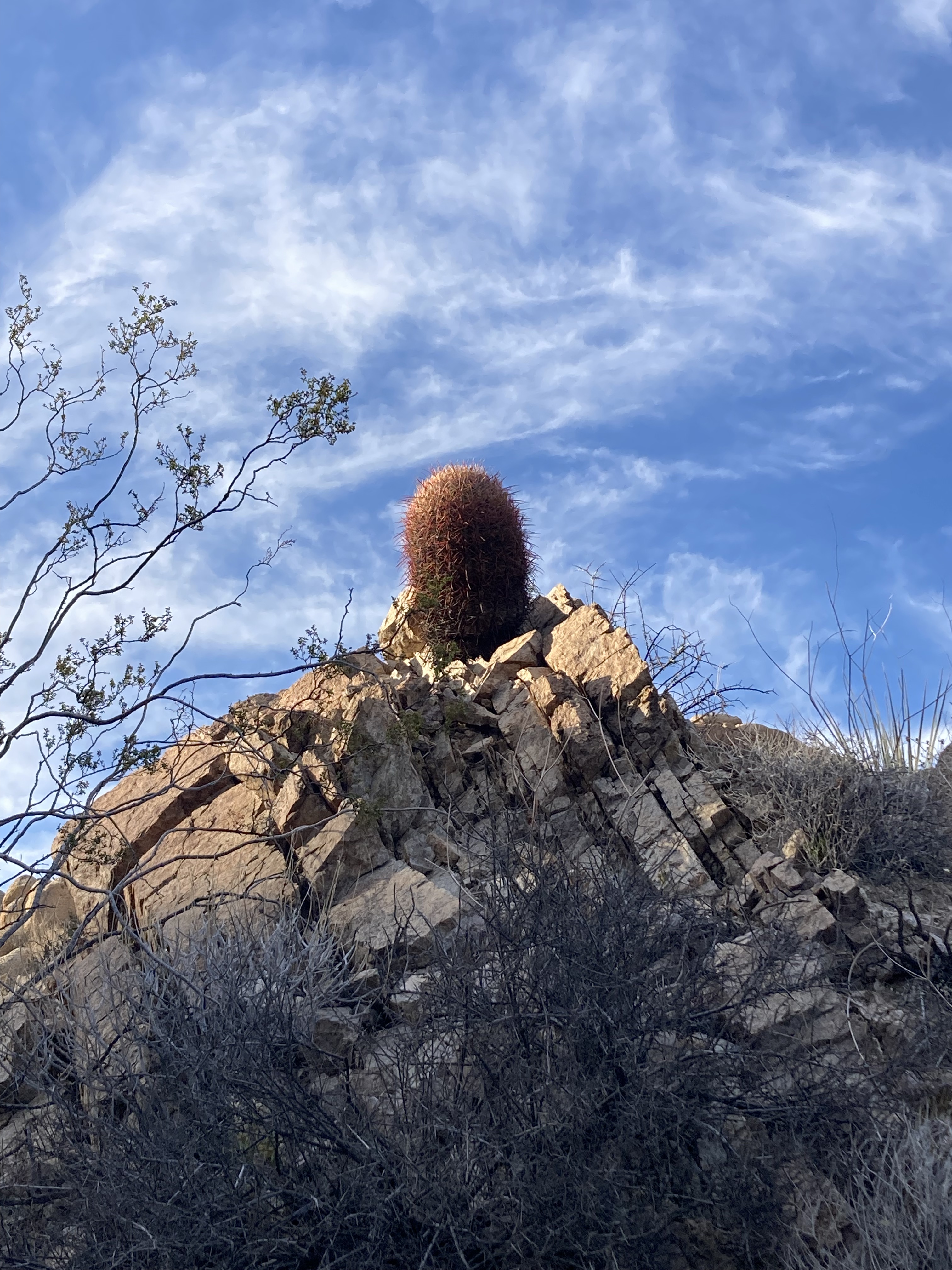
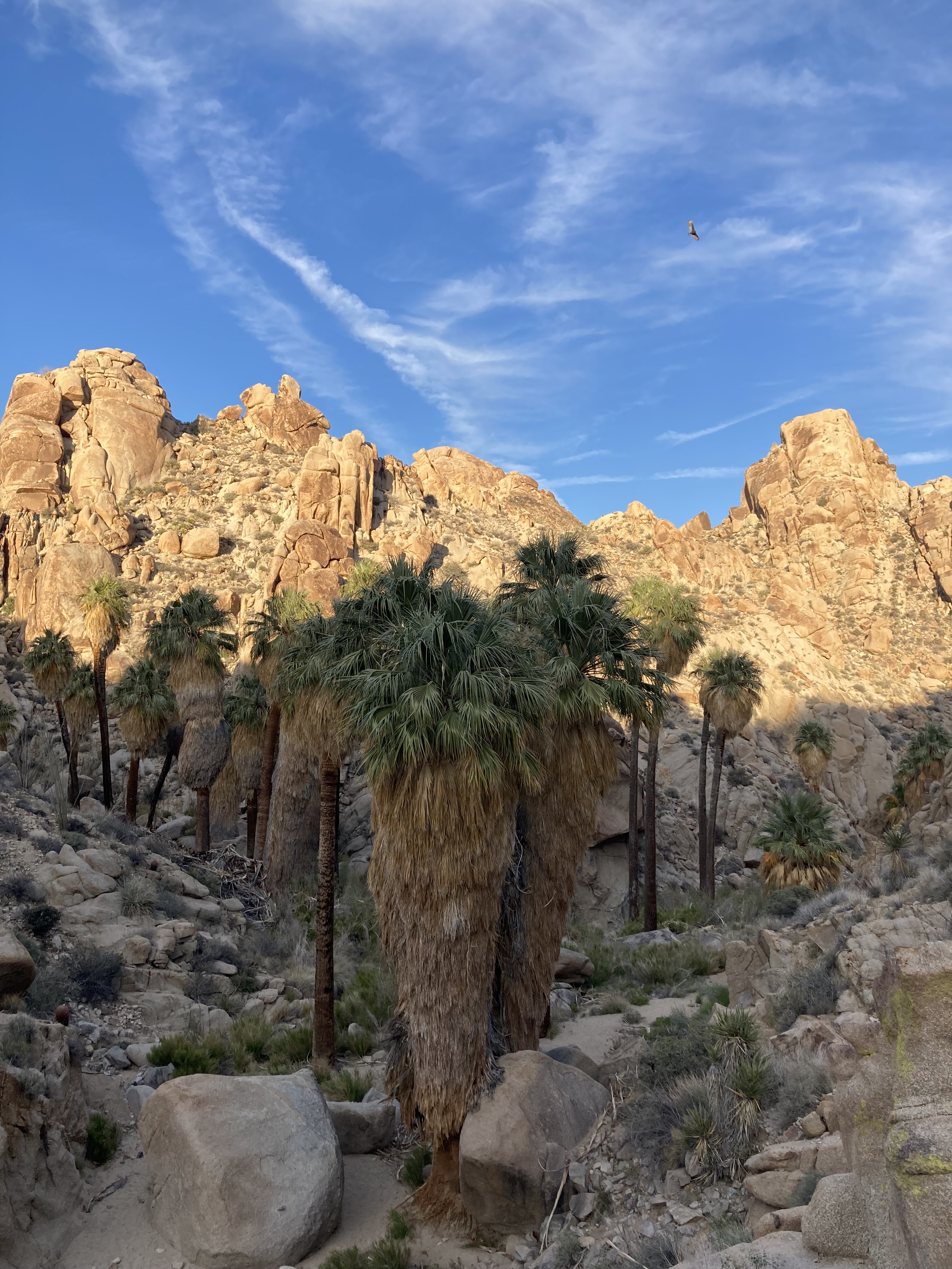
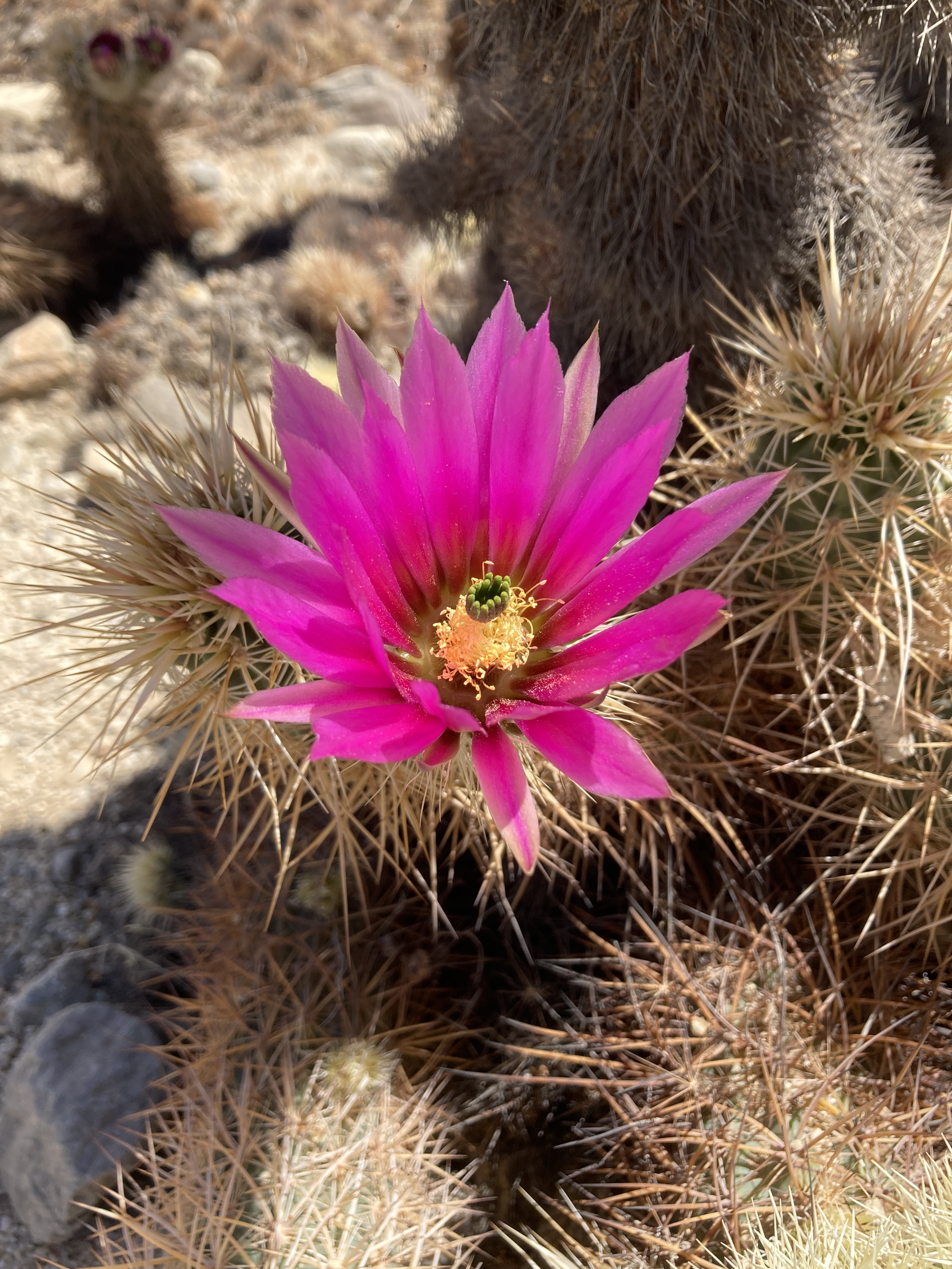
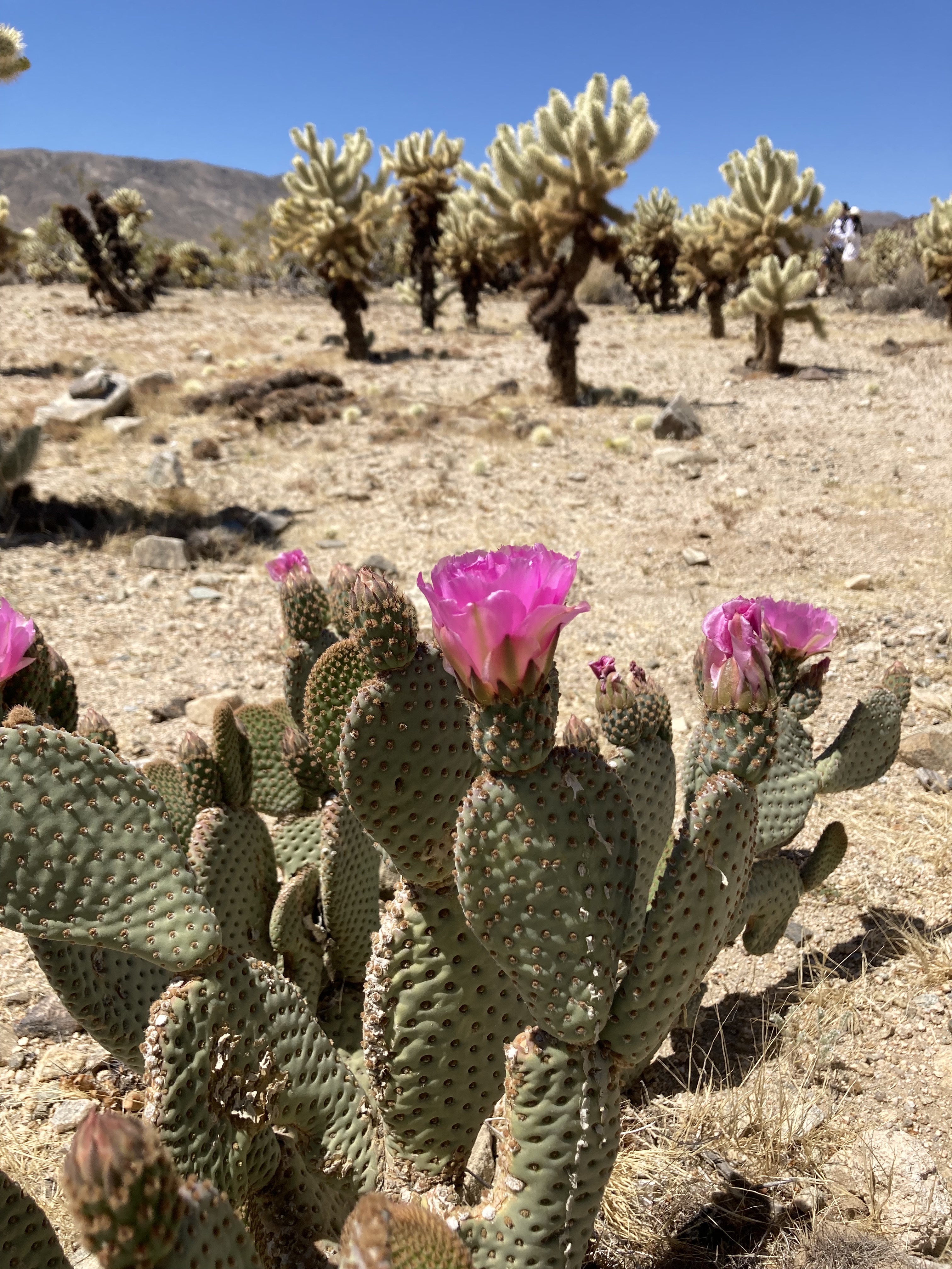
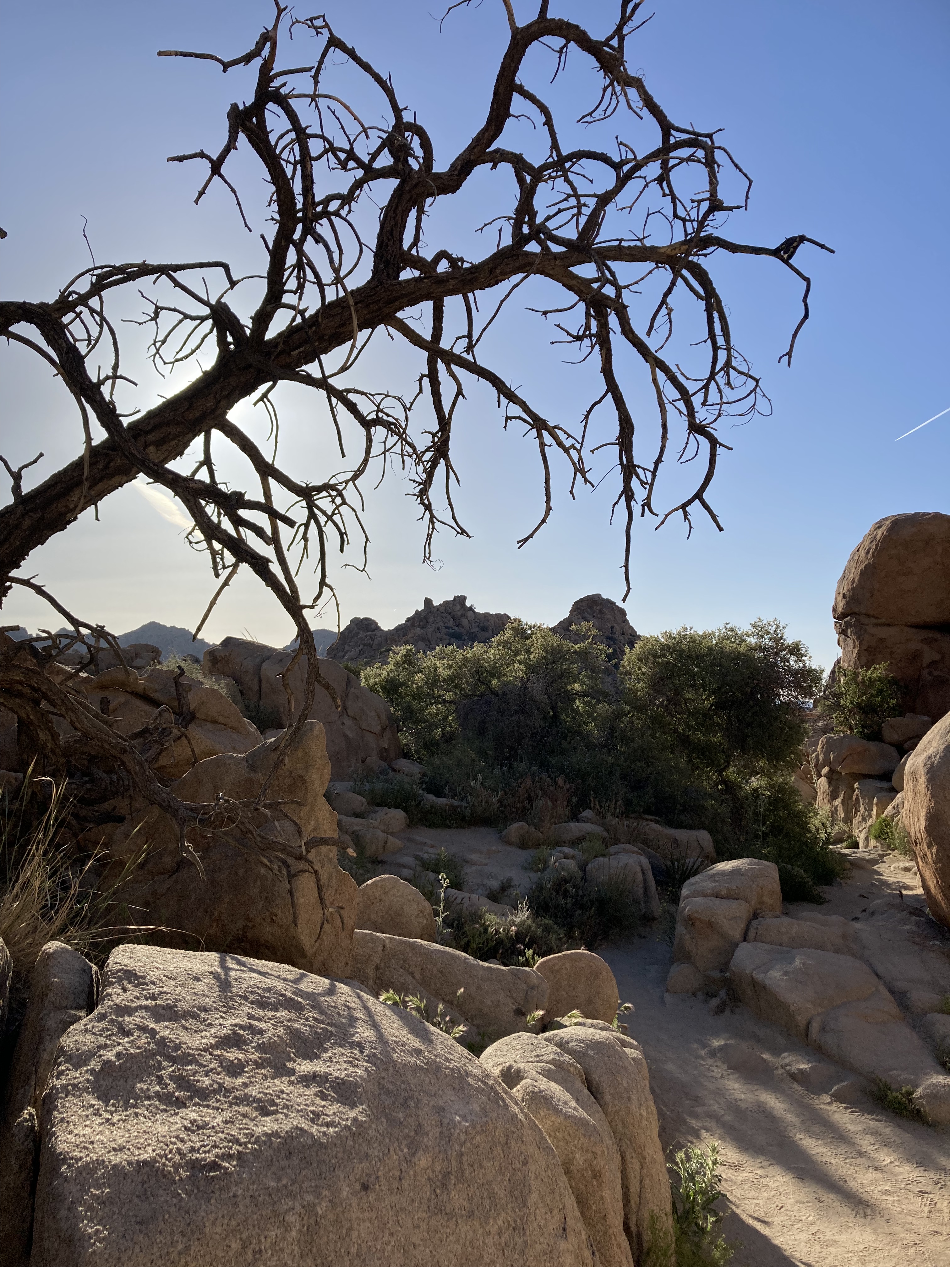
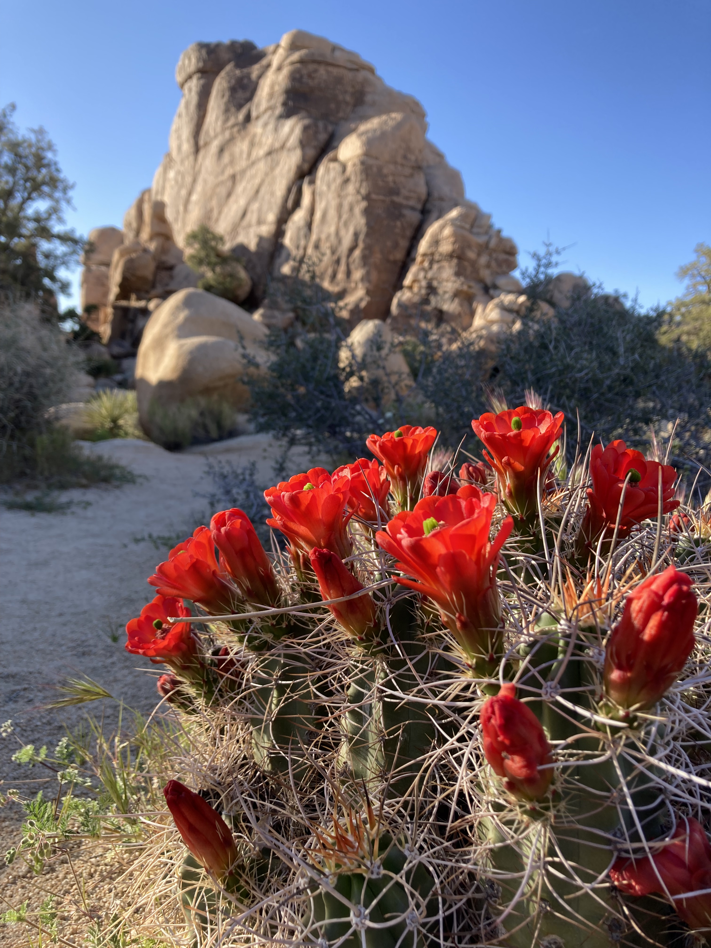
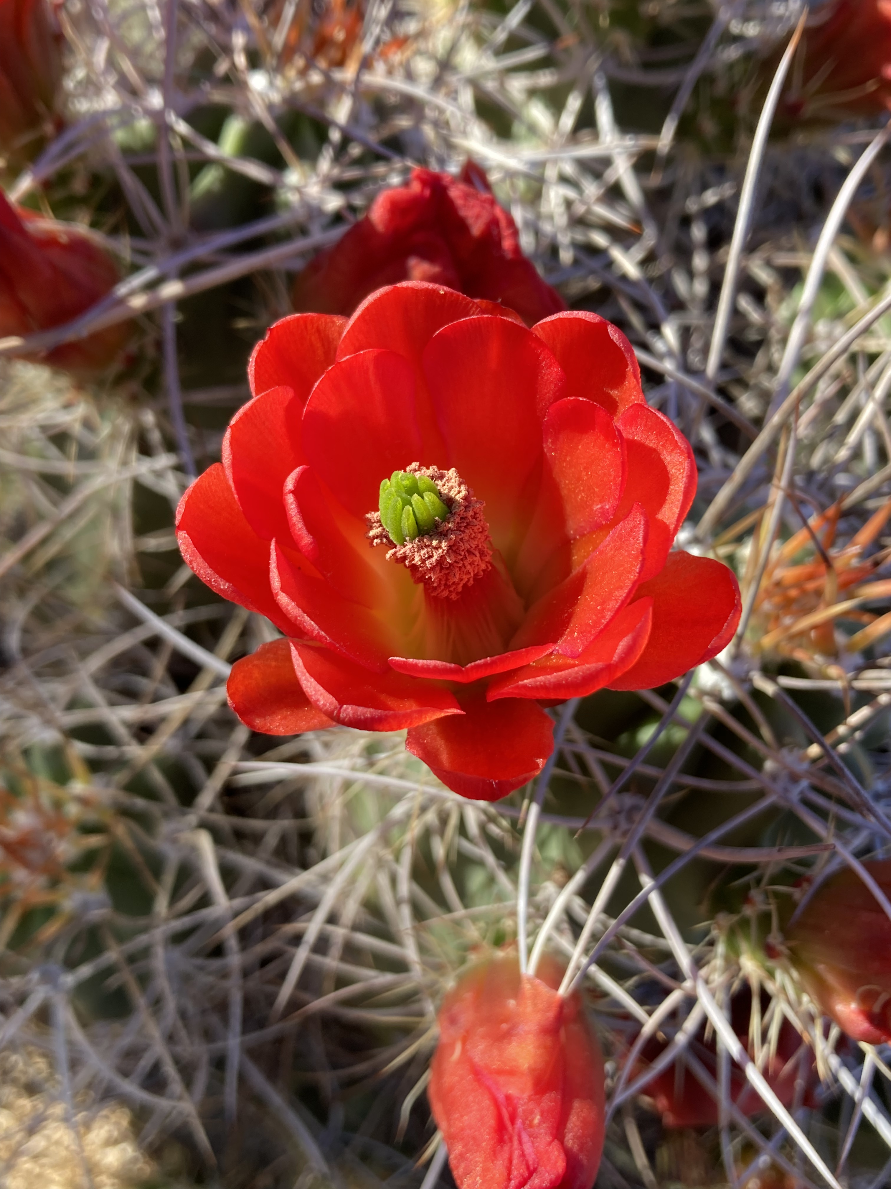
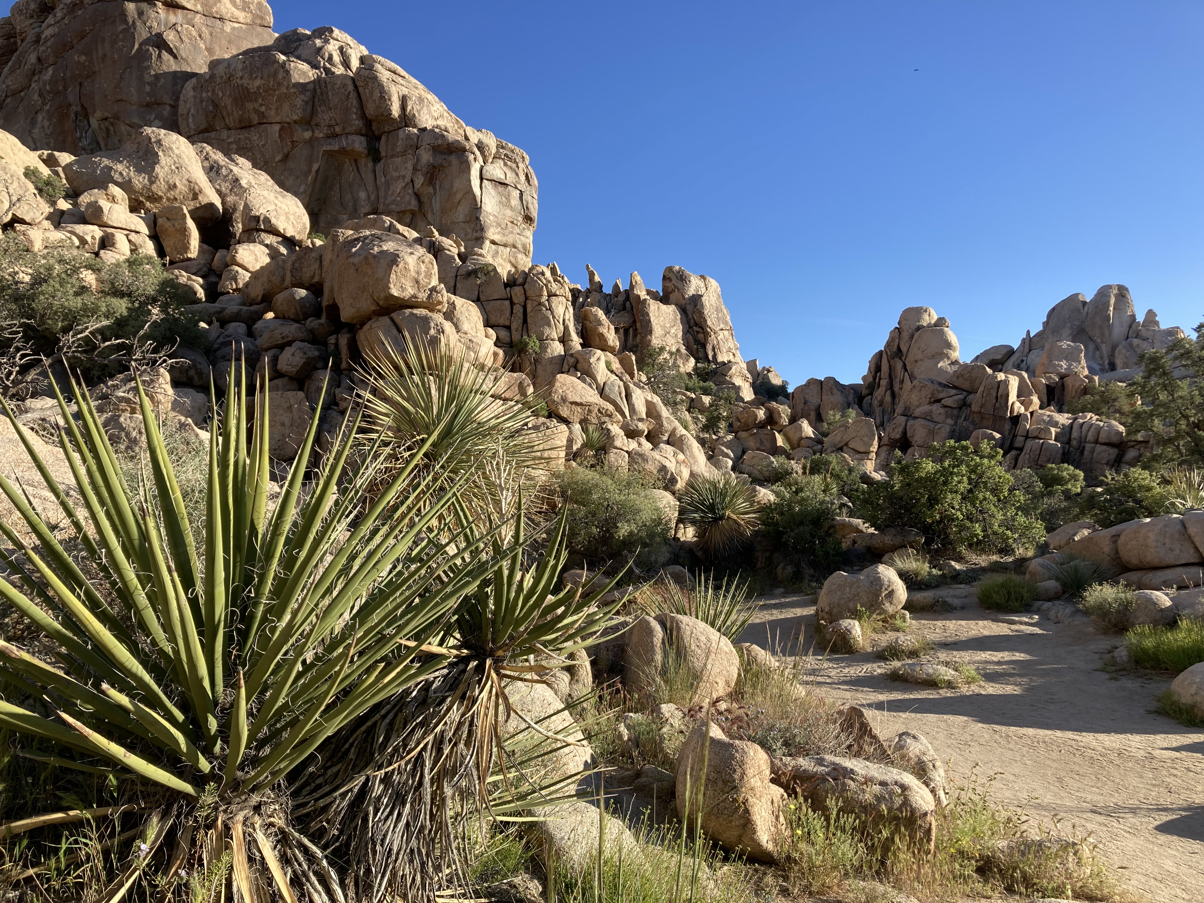
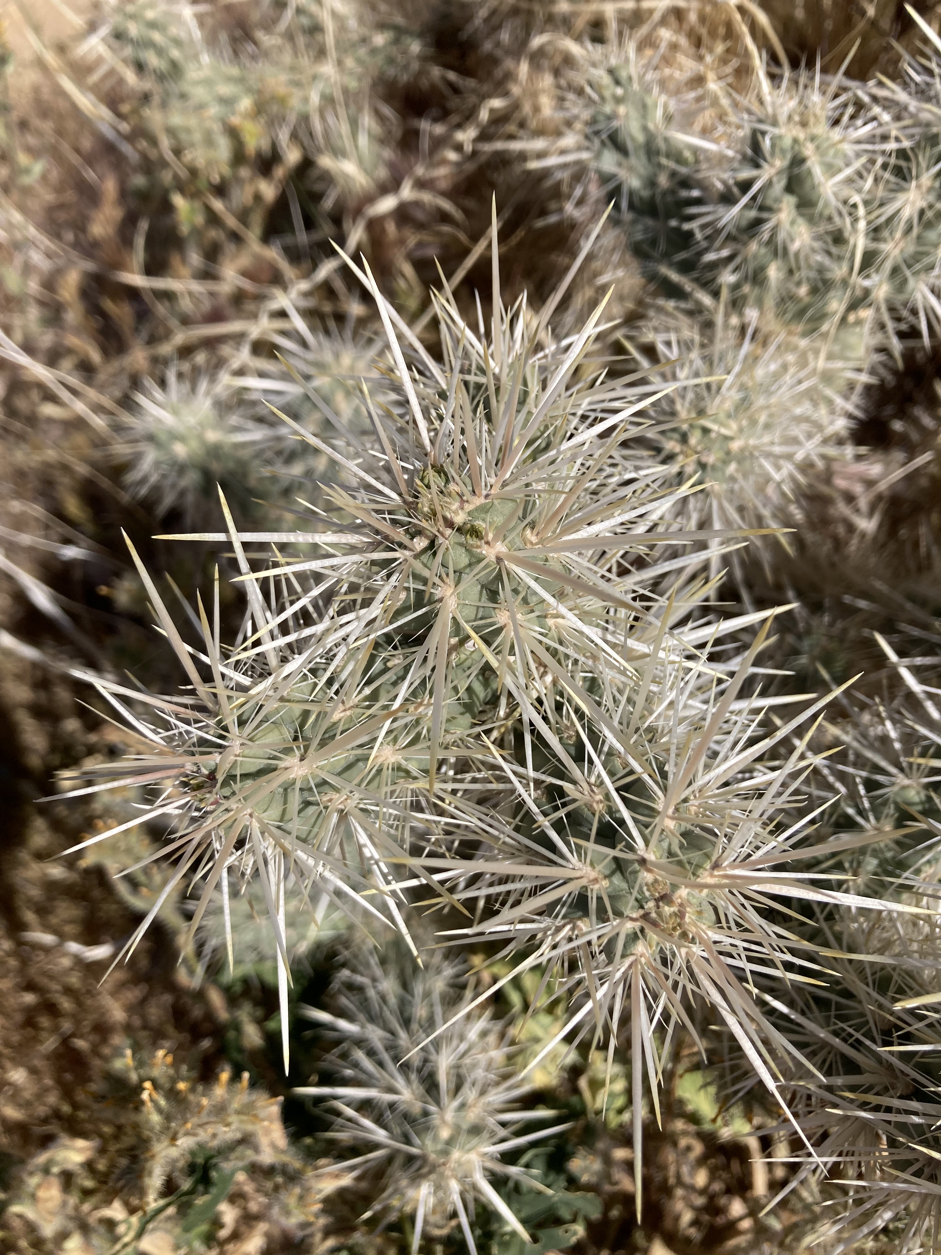
The Lost Palms Oasis Trail looks to be about 12km there and back, and it took me 3 hours. I thoroughly enjoyed taking in the rock formations and the desert plants. To see the oasis was a unique sight, and I’m really glad I was able to do it. Plus, the cacti were in bloom – and I’ve always wanted to visit JTNP while the cacti were in bloom!

I found an overnight spot just south of the southern park entrance, which was excellent. Exposed to the elements (aka no shade from the sun), meant motivation for an early morning, but I really enjoyed it. I like BLM land spots.
Now I could start getting into the meat of JTNP. I was still, continuously, excited. Elated and happy to be here. It was the first time I was feeling pure joy since my friend had passed a few weeks prior. There was a bit of guilt that came with this. But I also knew that he would want me to live life to the fullest. Memento Mori, Memento Vivere.
I spent all day in the park – 9 hours – hiked multiple trails, saw so many cool things. My eyeballs drank everything in with glee. Driving up from the south entrance, I stopped in for some souvenirs at the visitor centre, then took in the expansive open landscape as I drove. I watched the change from Colorado to Mojave Desert.
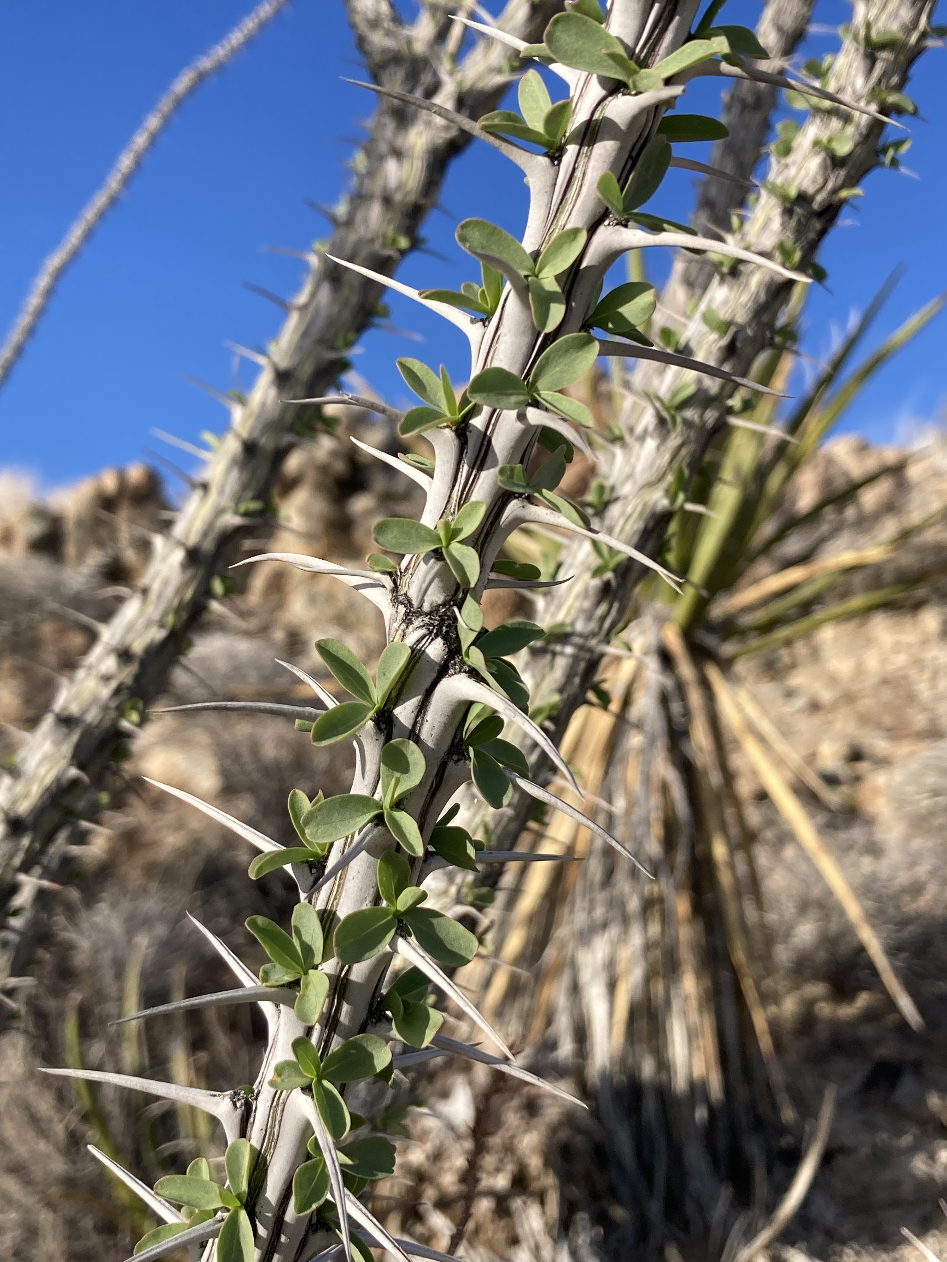
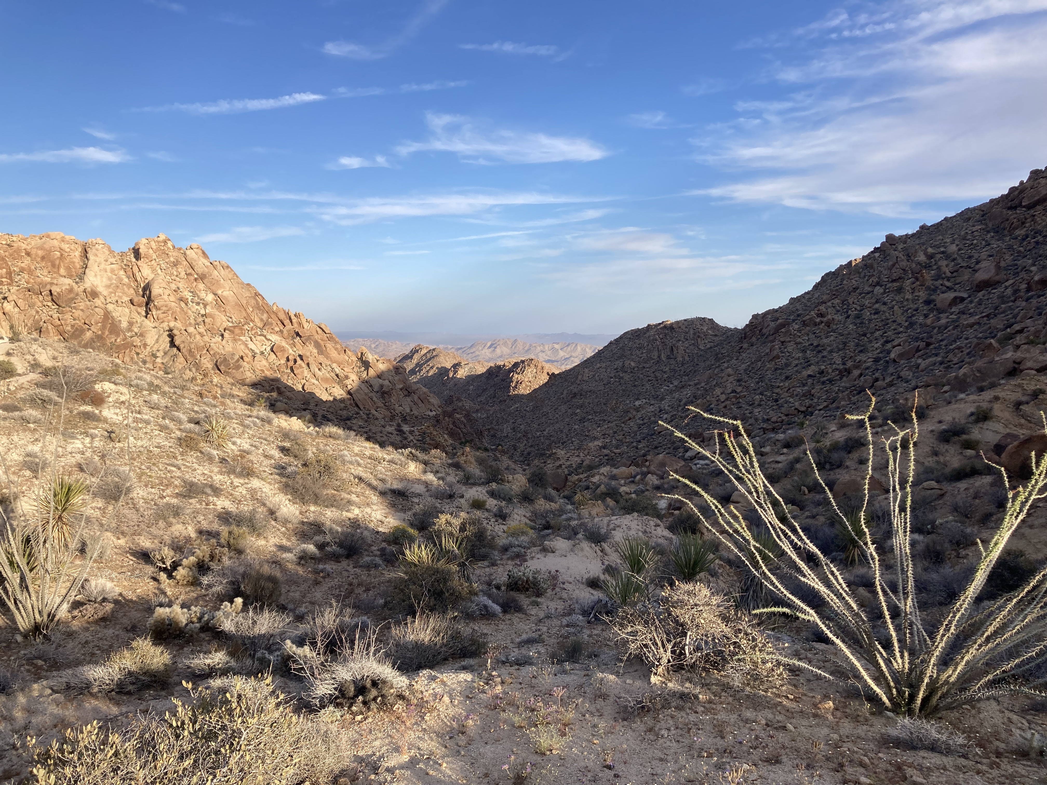
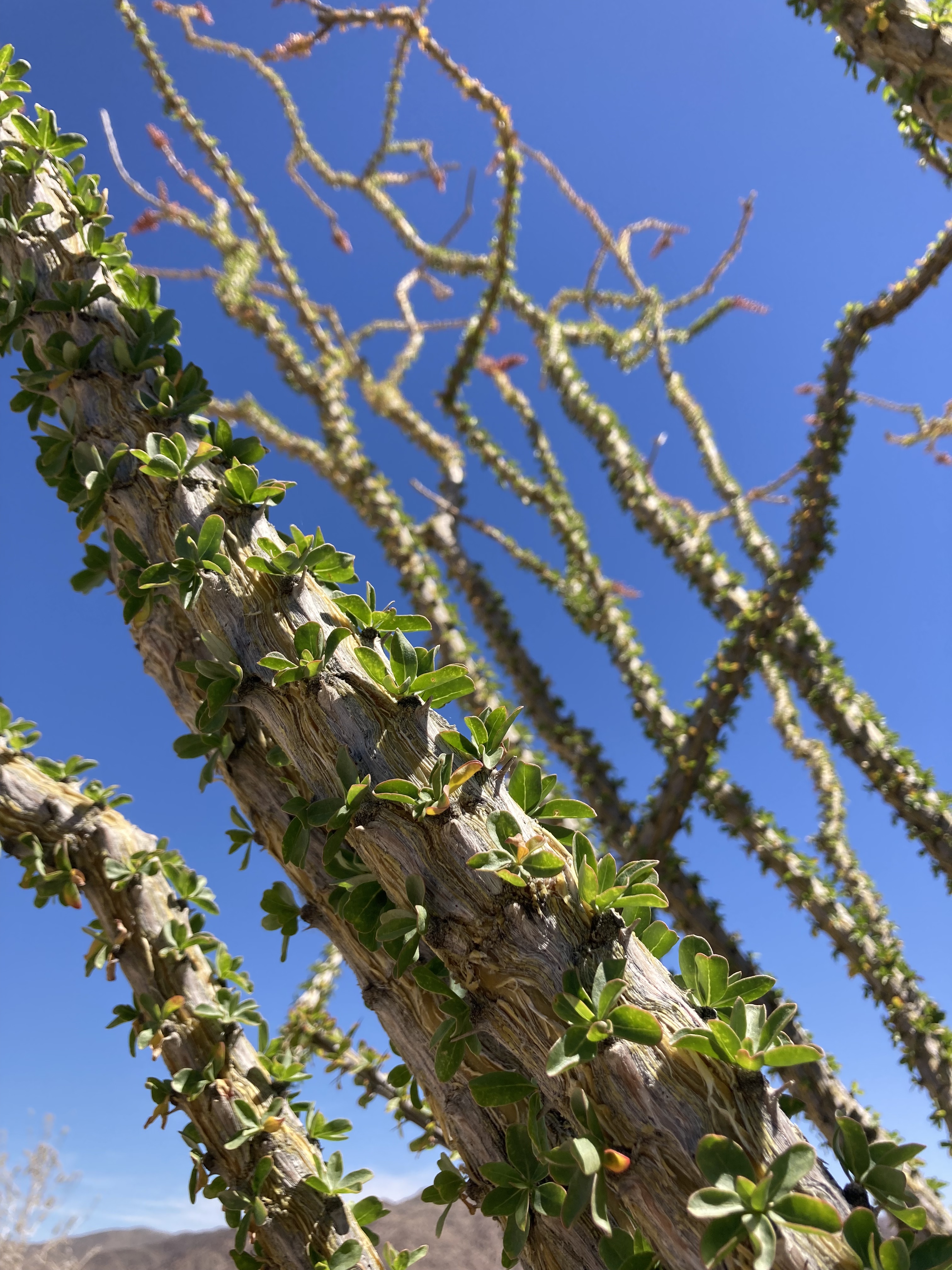
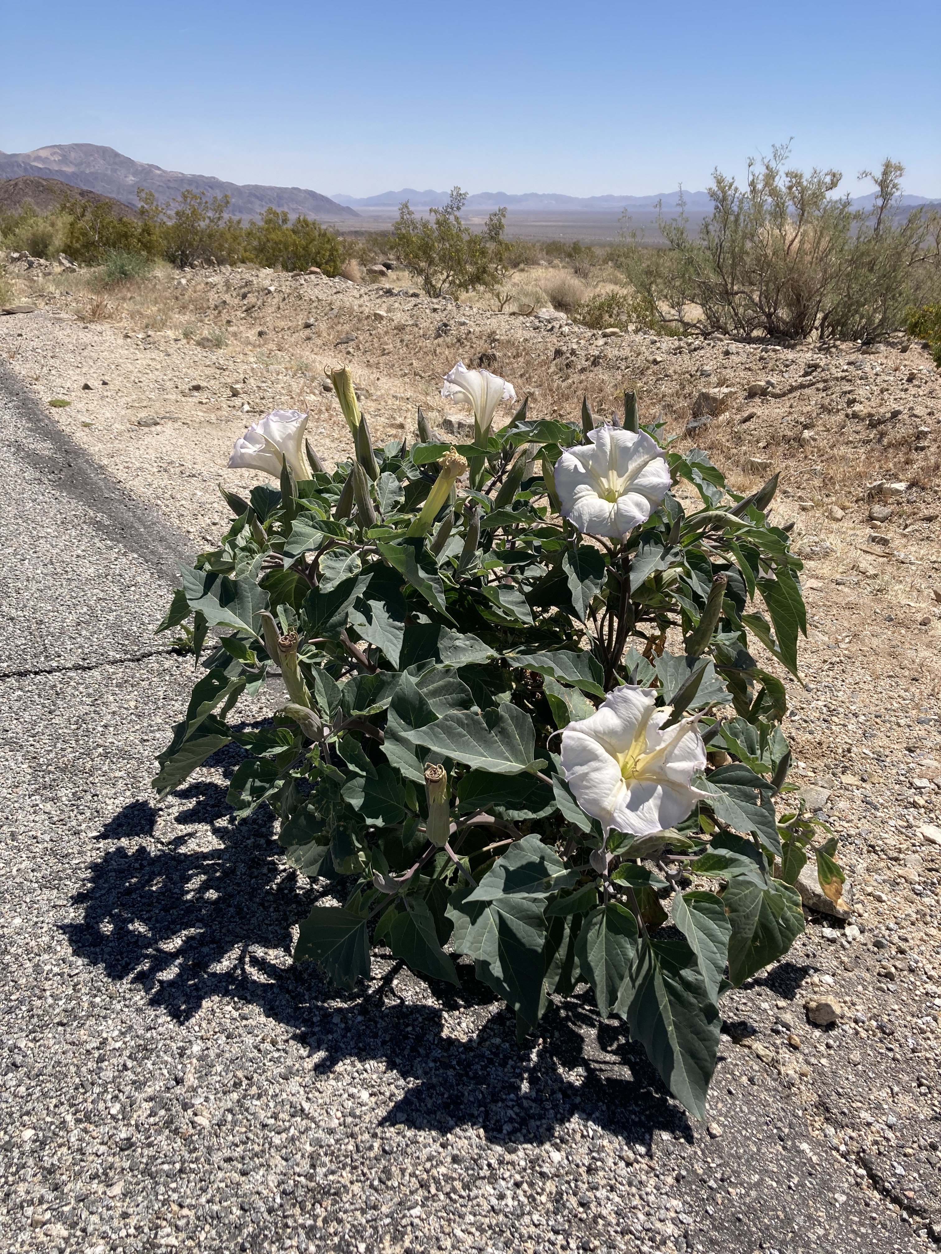
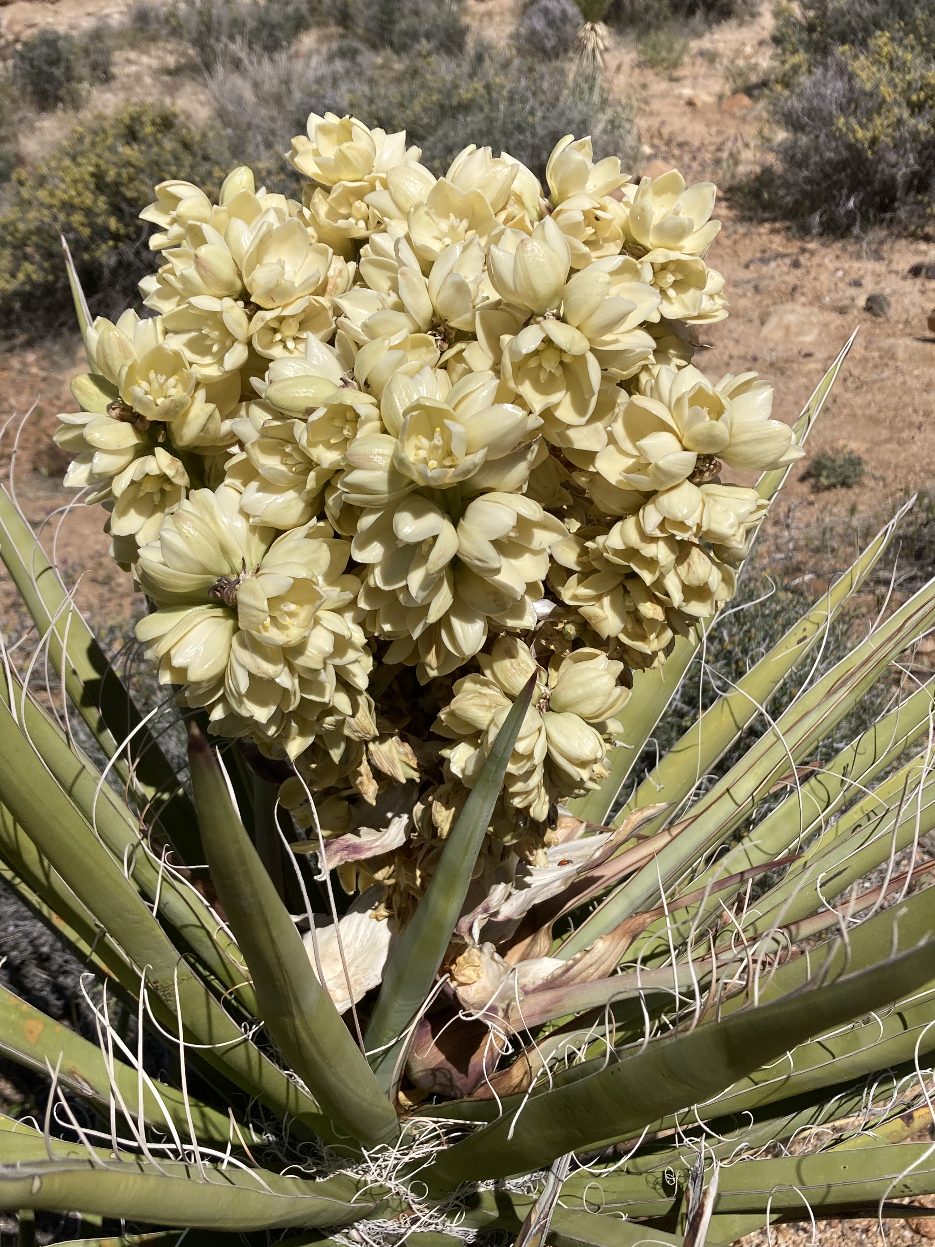
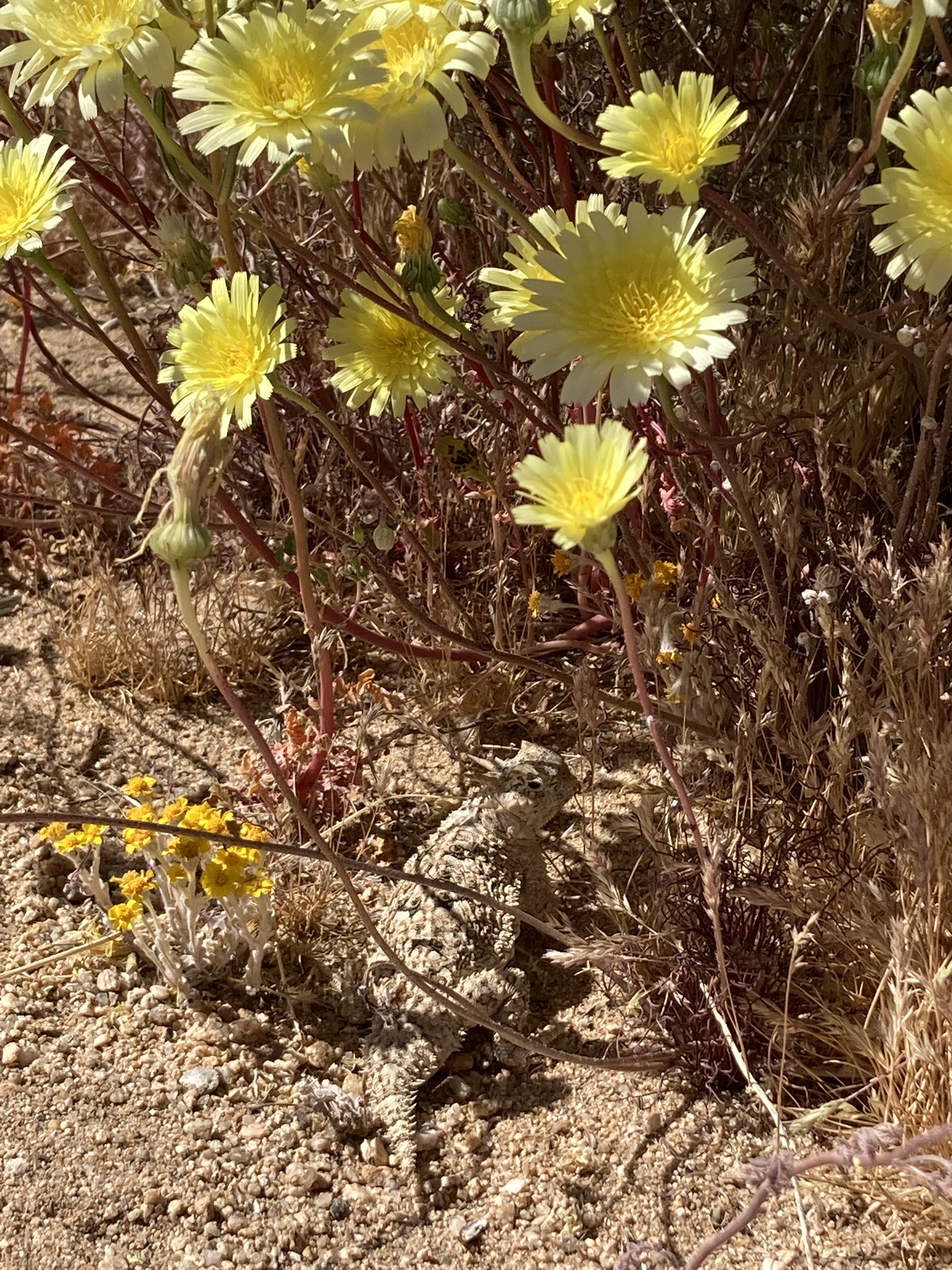
There are plenty of turnouts where you can pull off the main road to take in the scenery. I found myself pulling off the road to take in various plants, like the Ocotillo, as well as a random nightshade (Datura family, also called Western Jimson Weed) that I saw growing in the road.
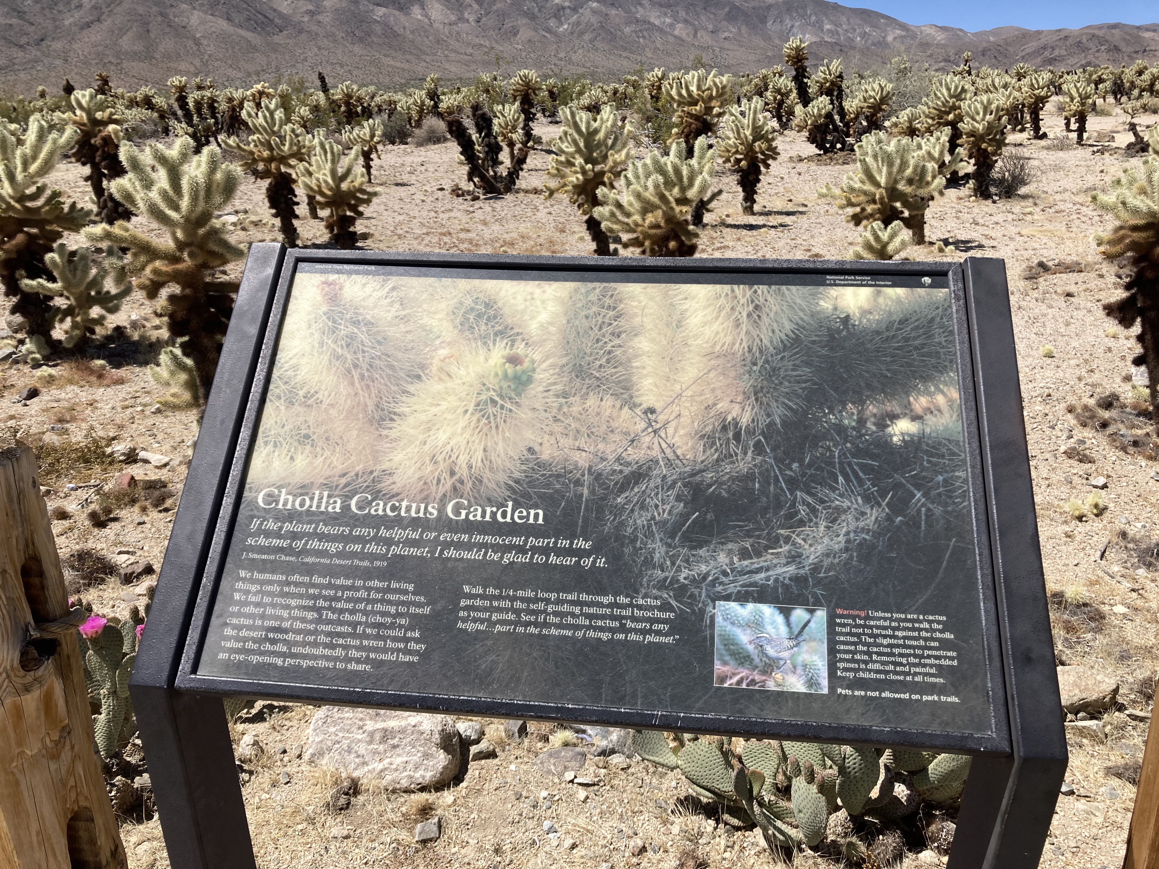
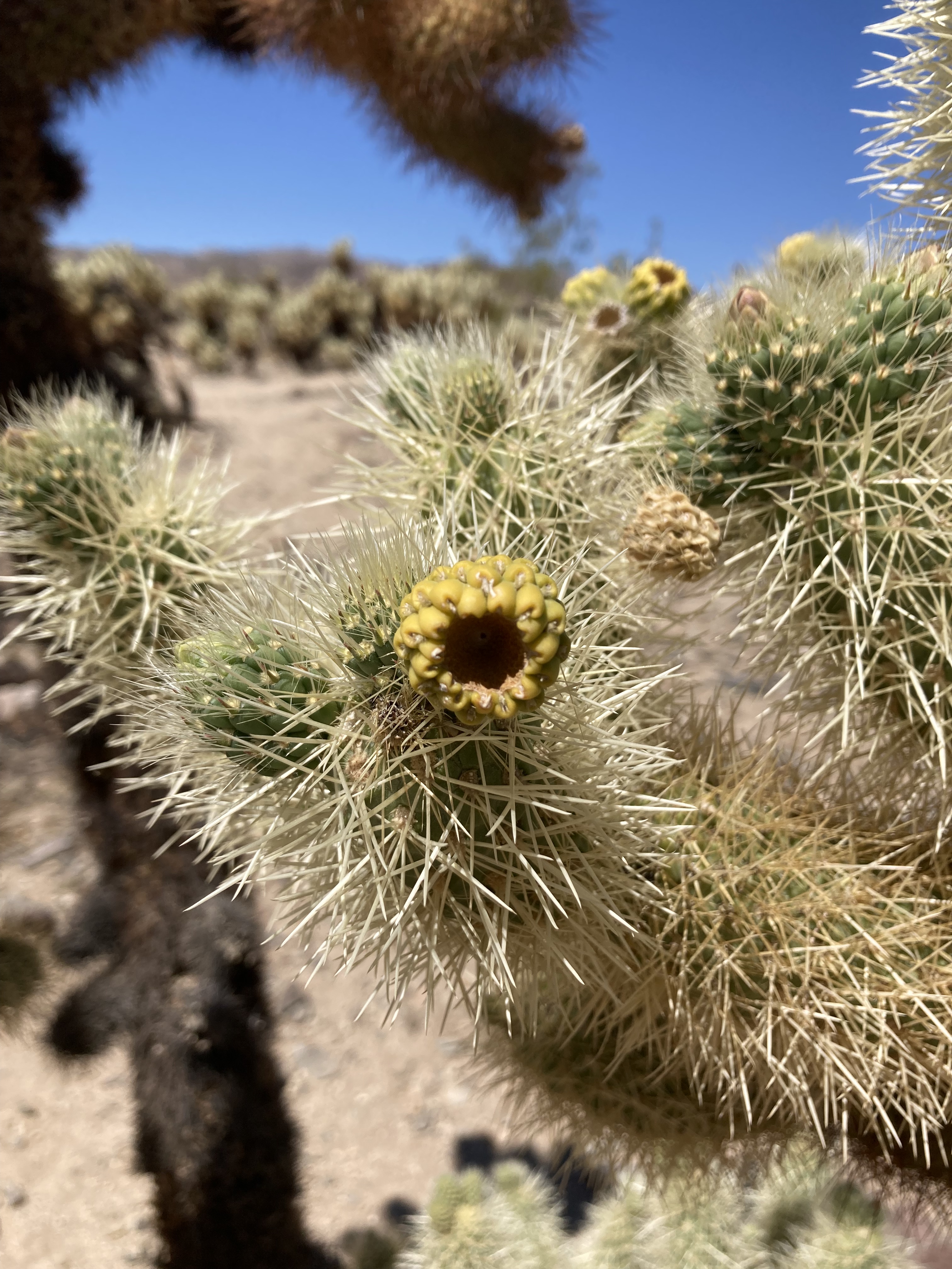
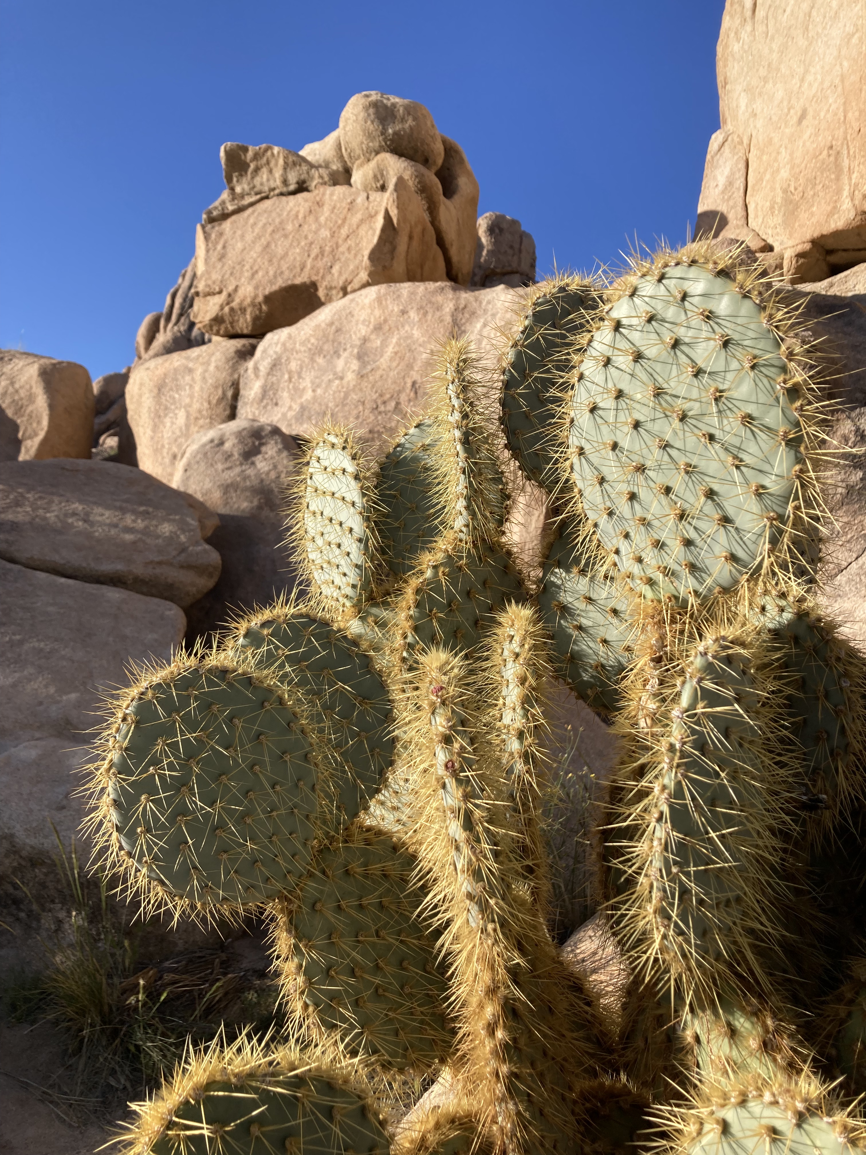
But there are more popular places that you’ll find on the park maps, such as the Cholla Cactus Garden. Lots of people were here when I arrived. But it’s worth the crowds, especially when the cacti are in bloom. There was one woman pulling cactus needles out of her leg, too. I’d love to see this area at sunrise or sunset.
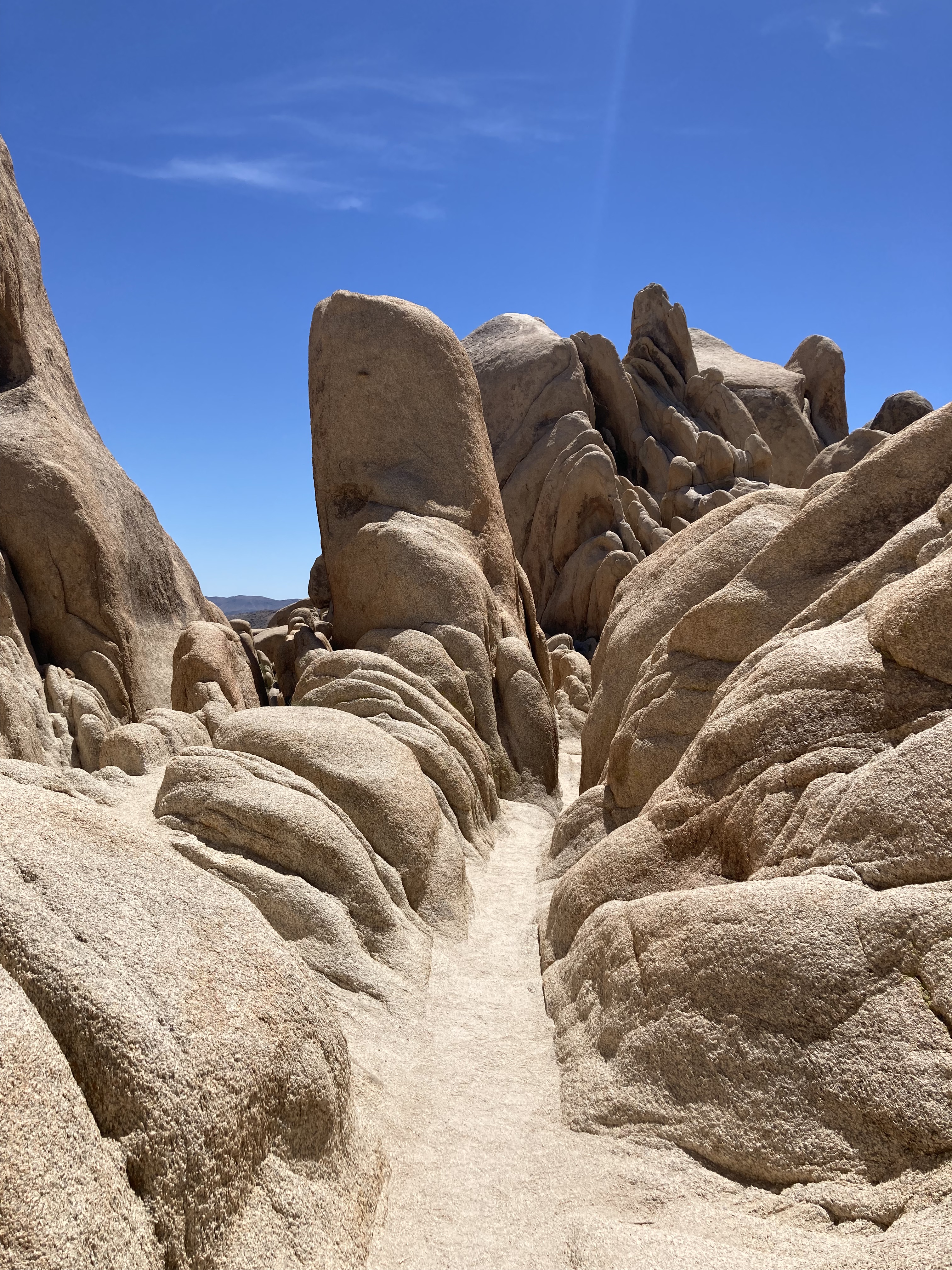
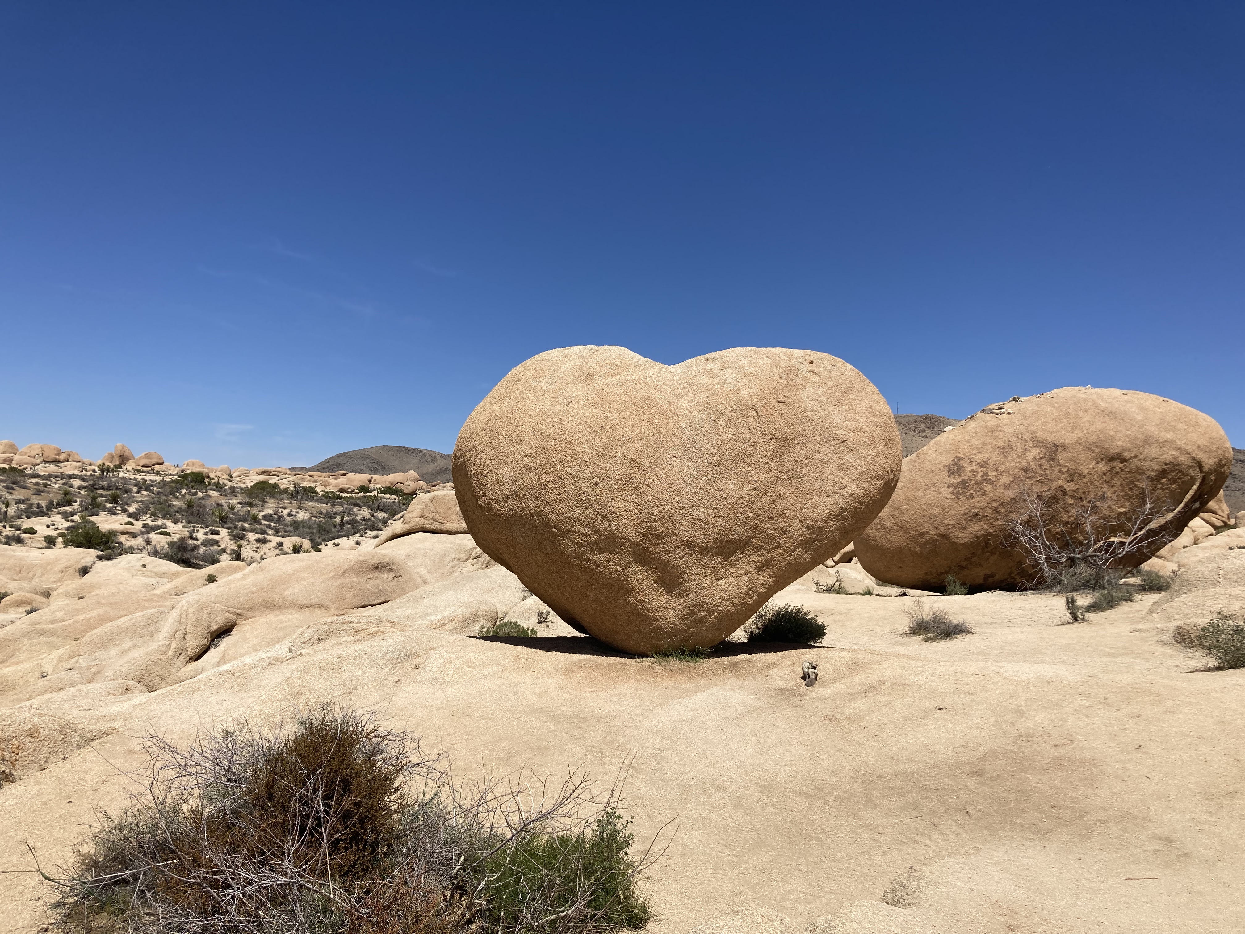
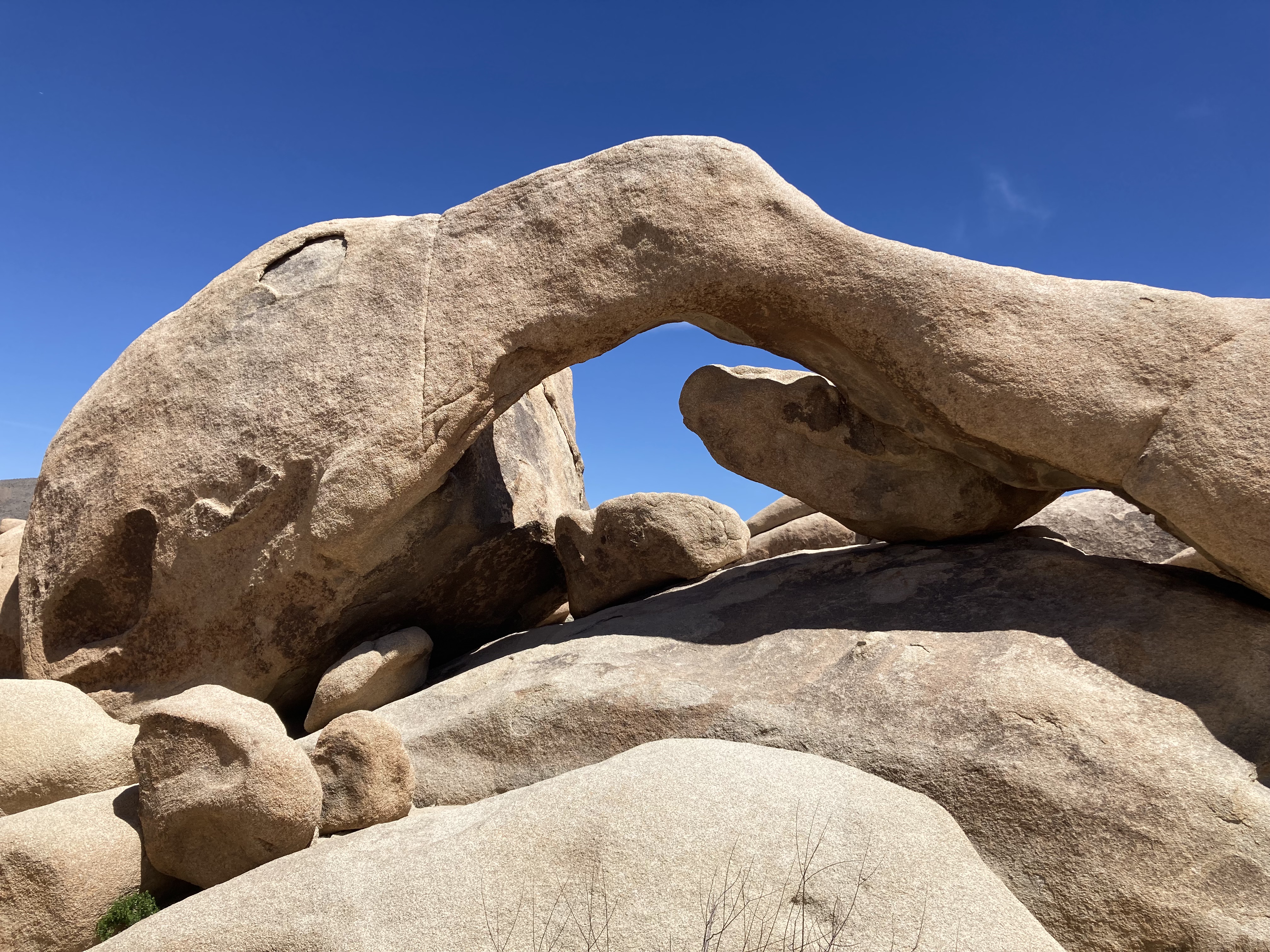
Next I hiked Arch Rock Nature Trail. Which also features a heart-shaped rock.
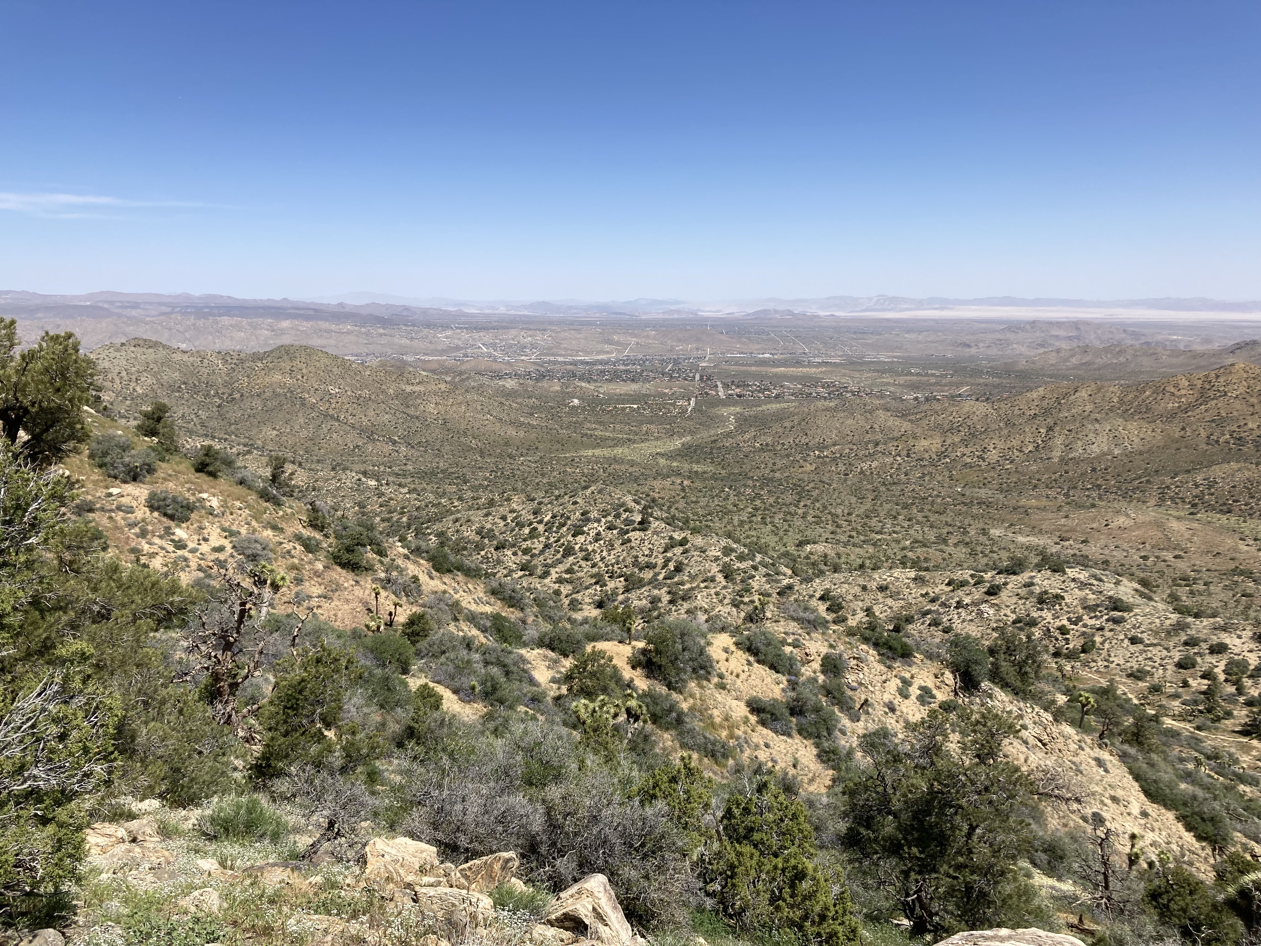
I got a view of the north entrance to the park (at Twentynine Palms):
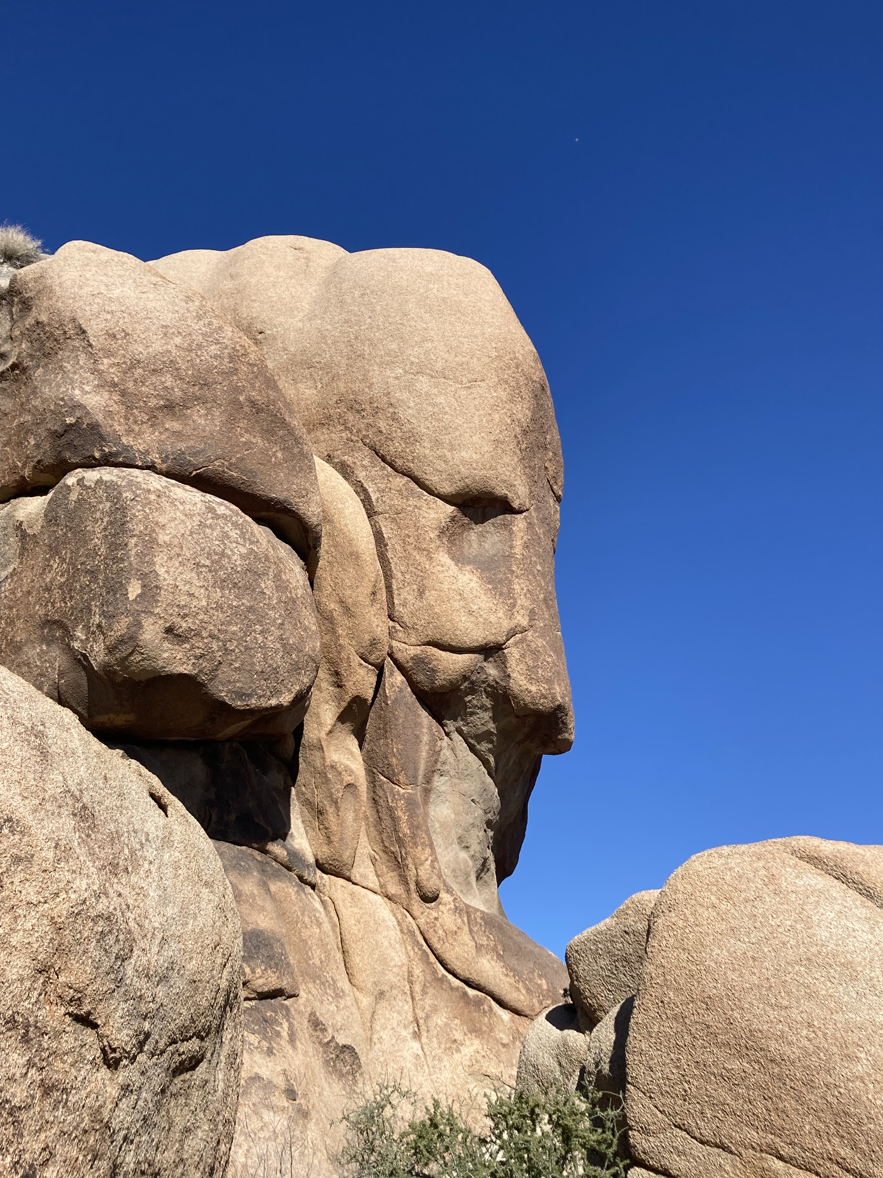
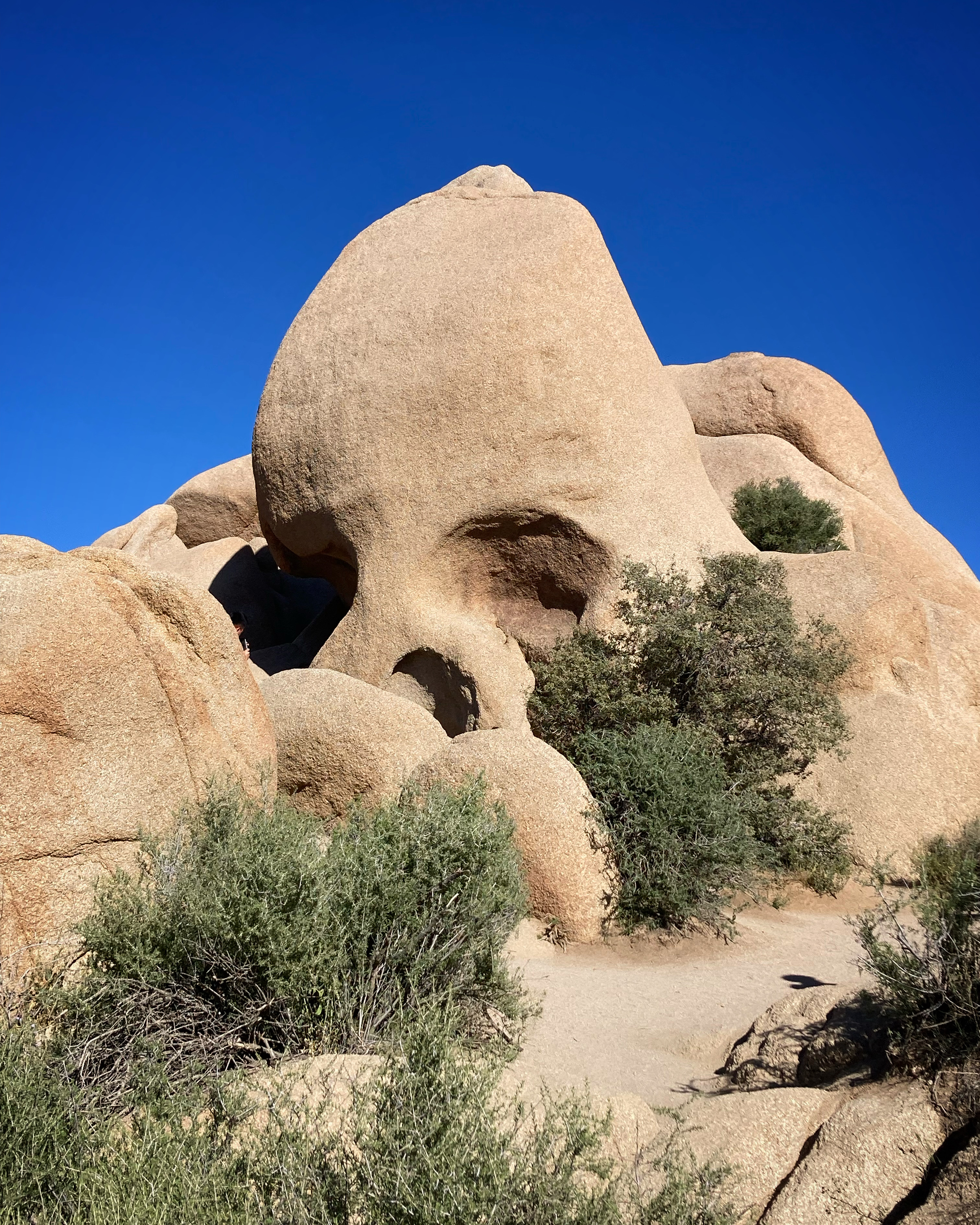
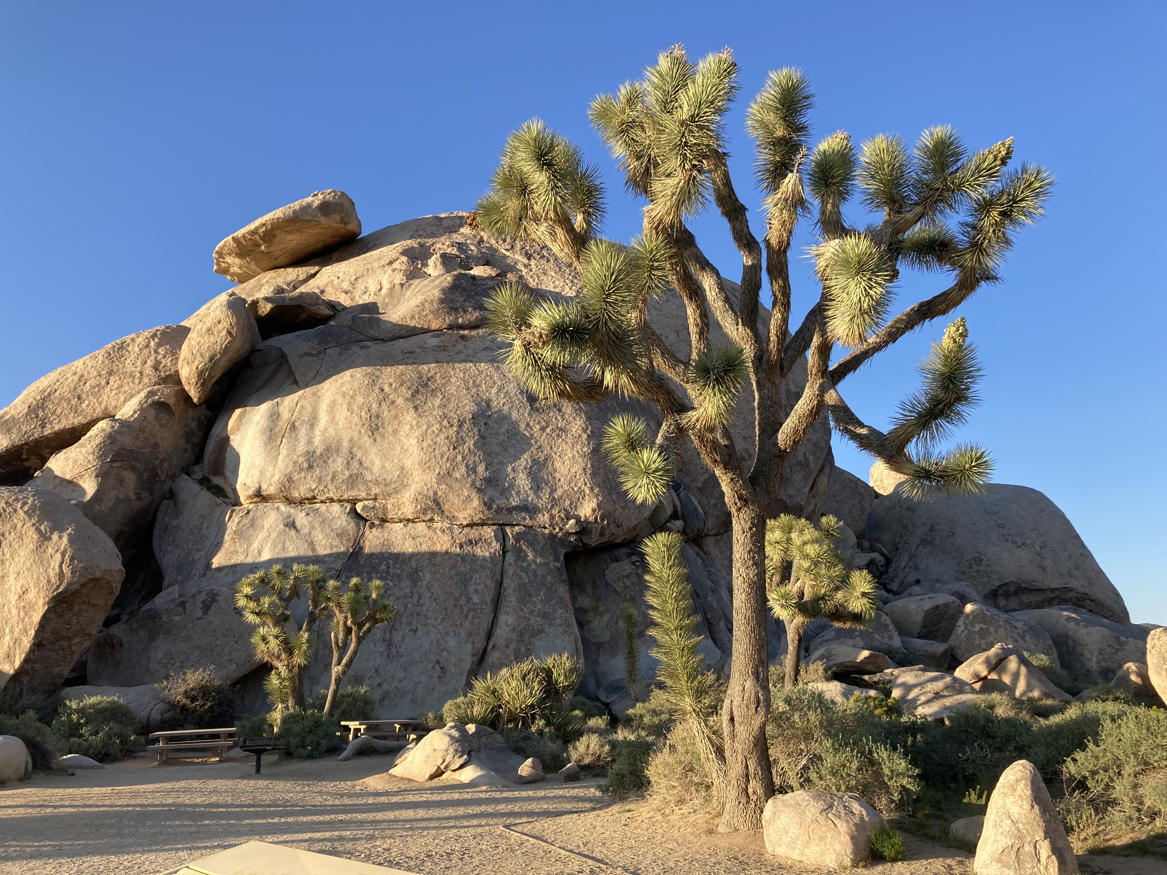
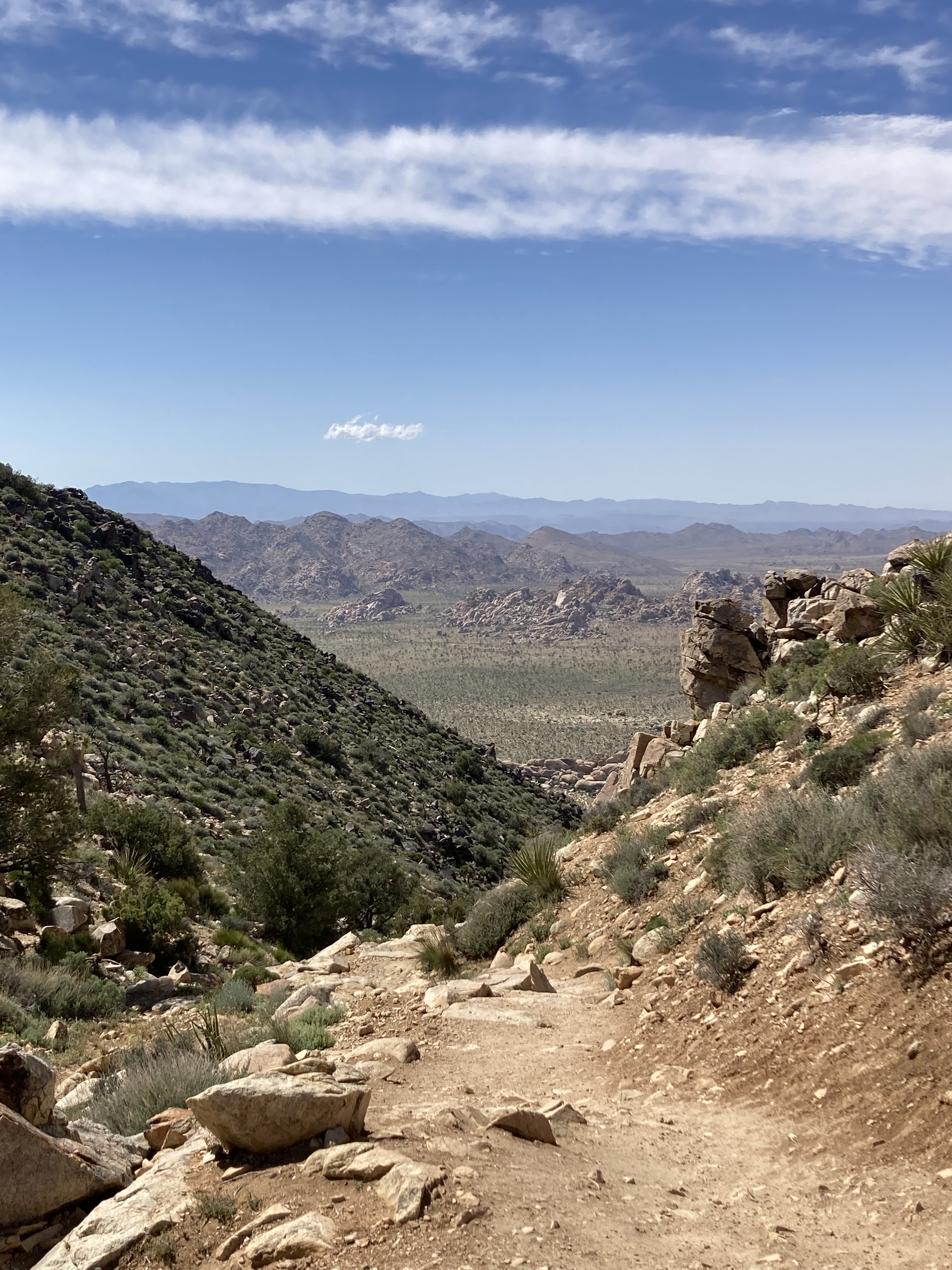
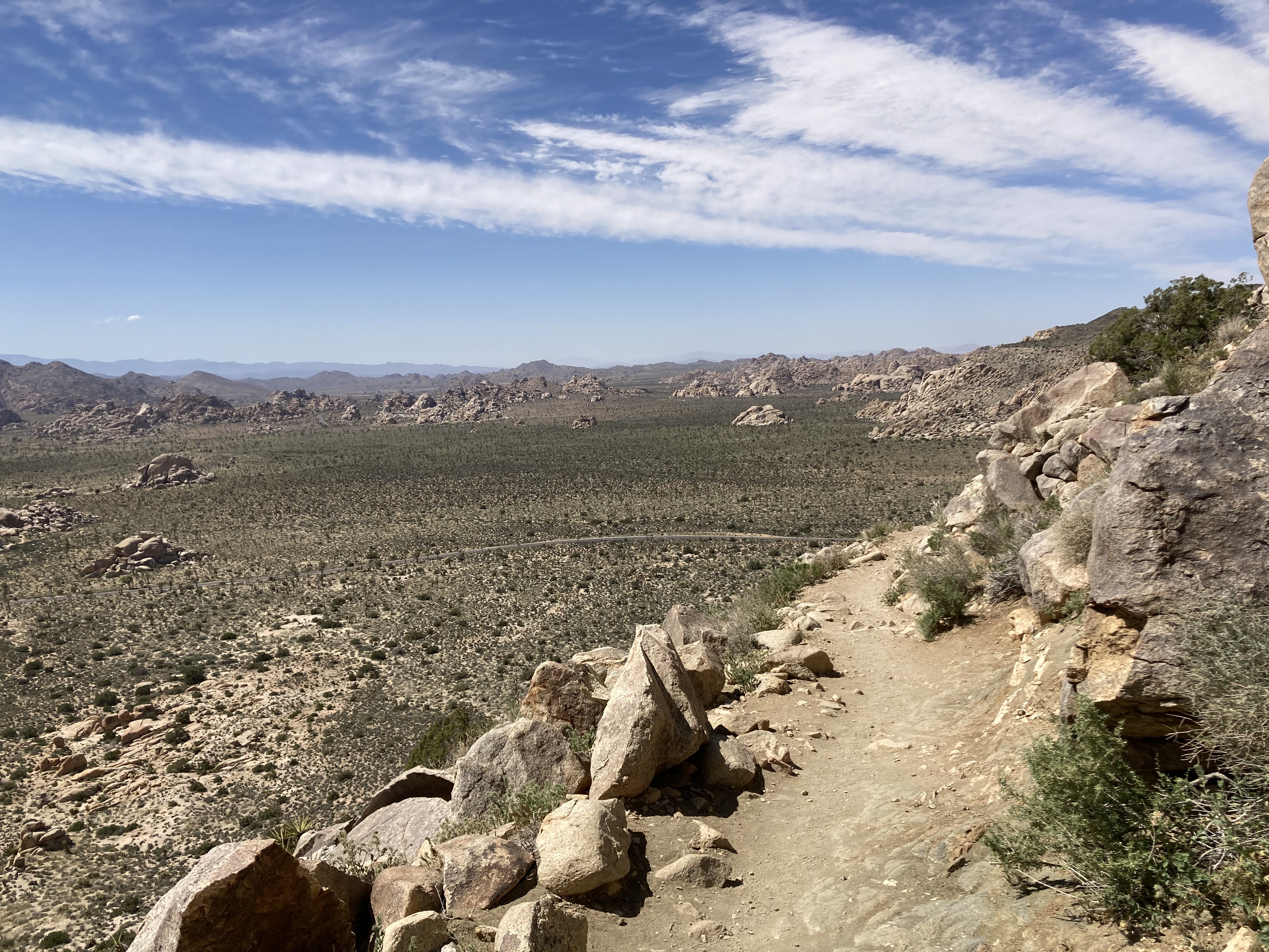
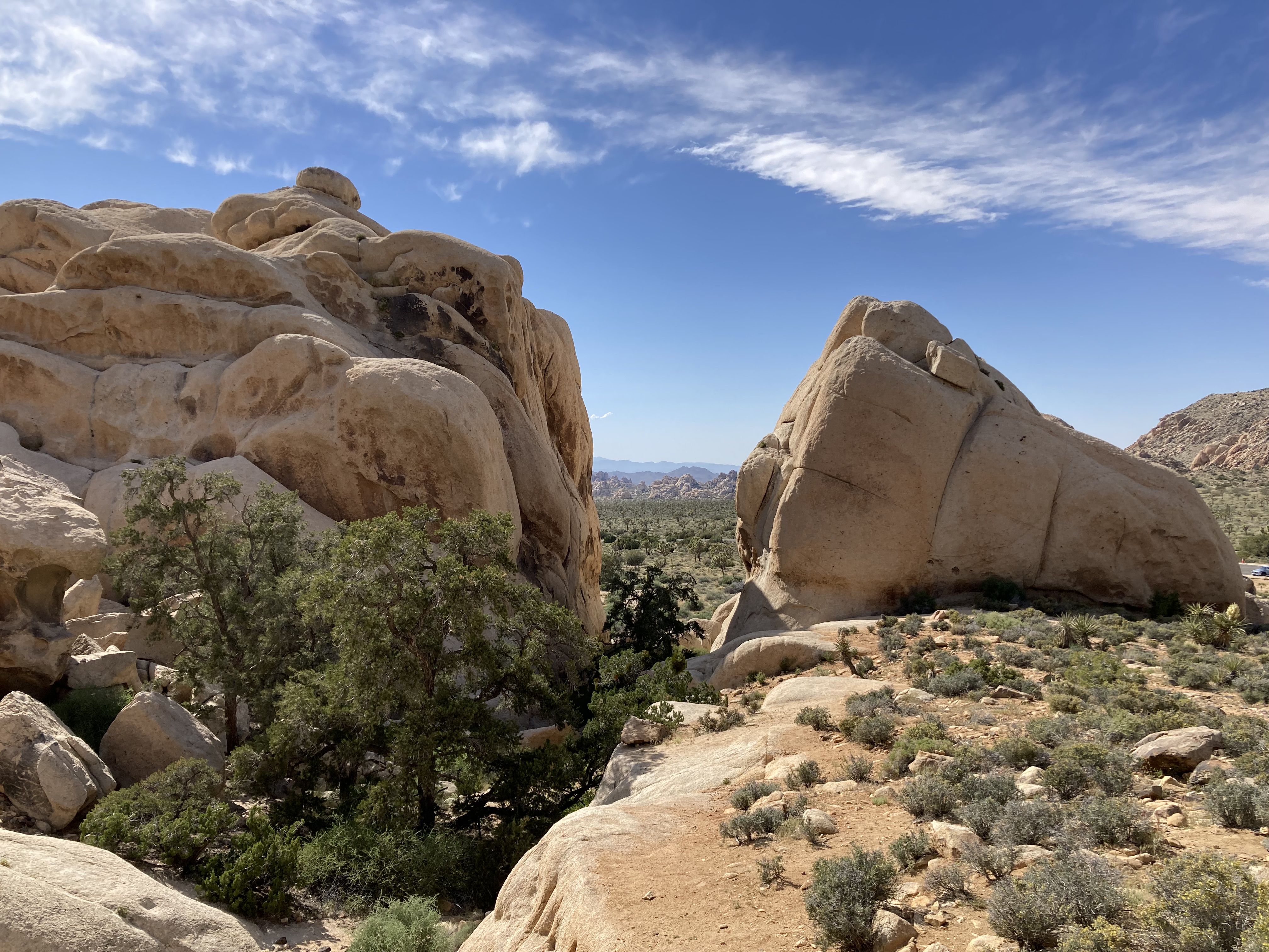
I hiked a trail that took me by Face Rock to Skull Rock.
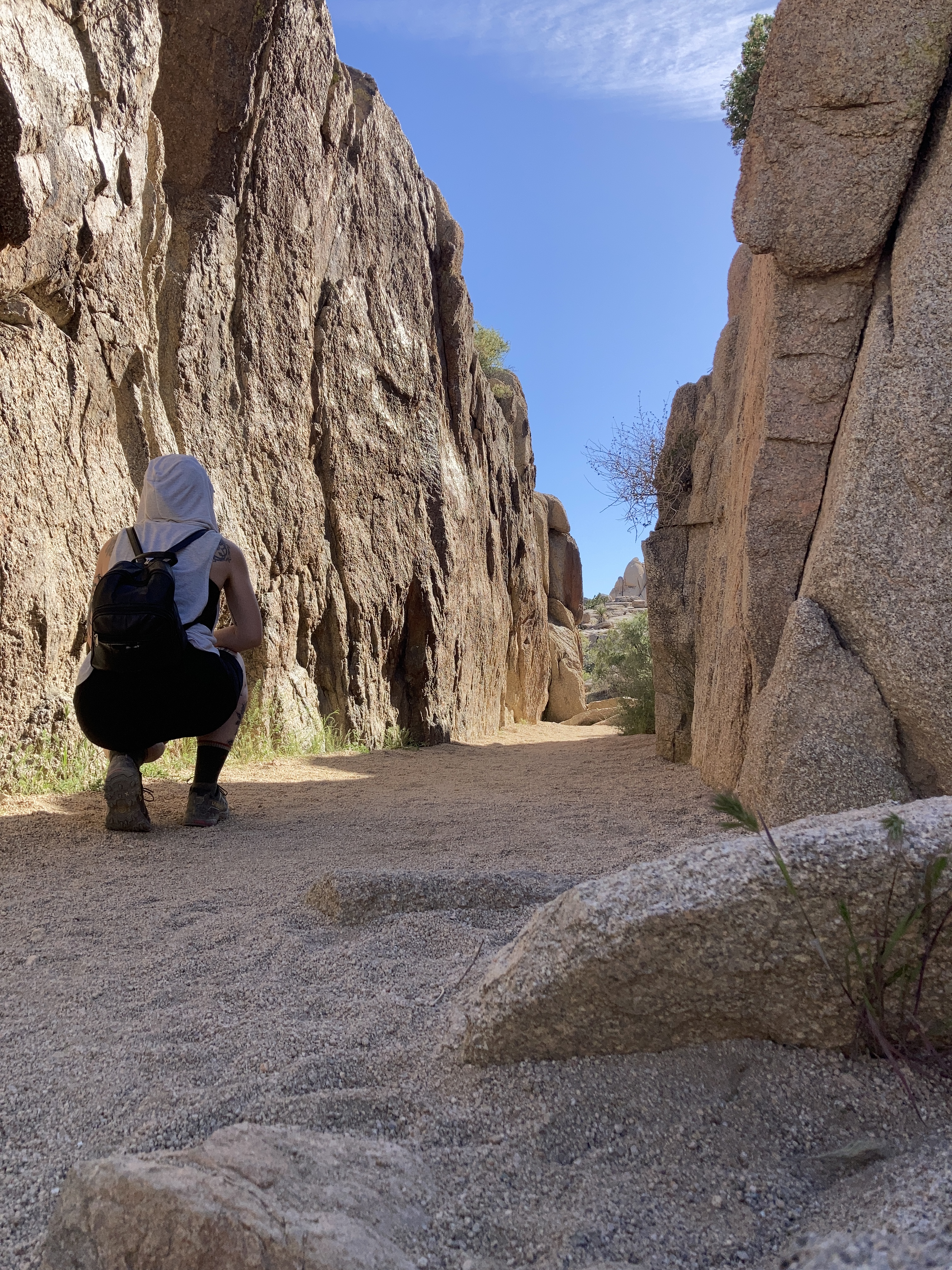
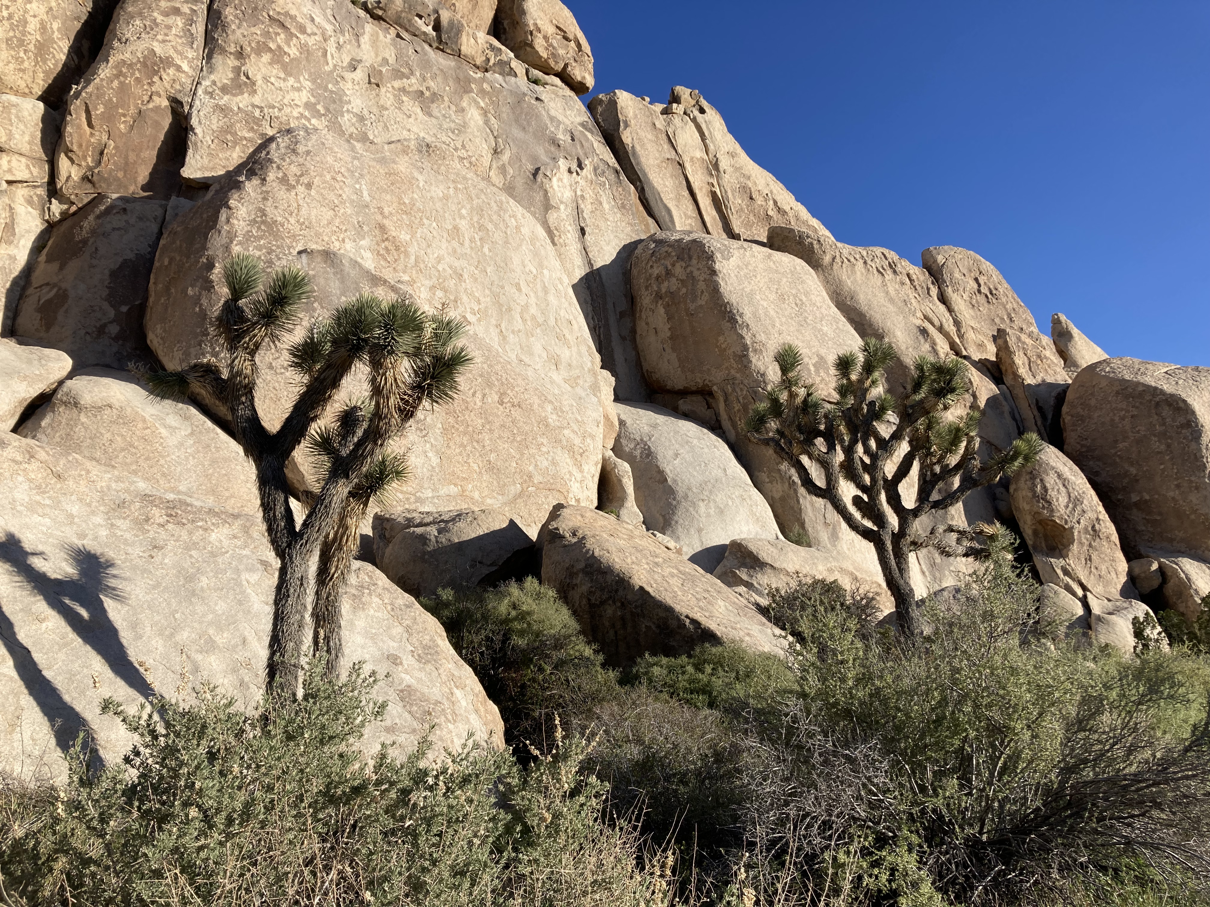
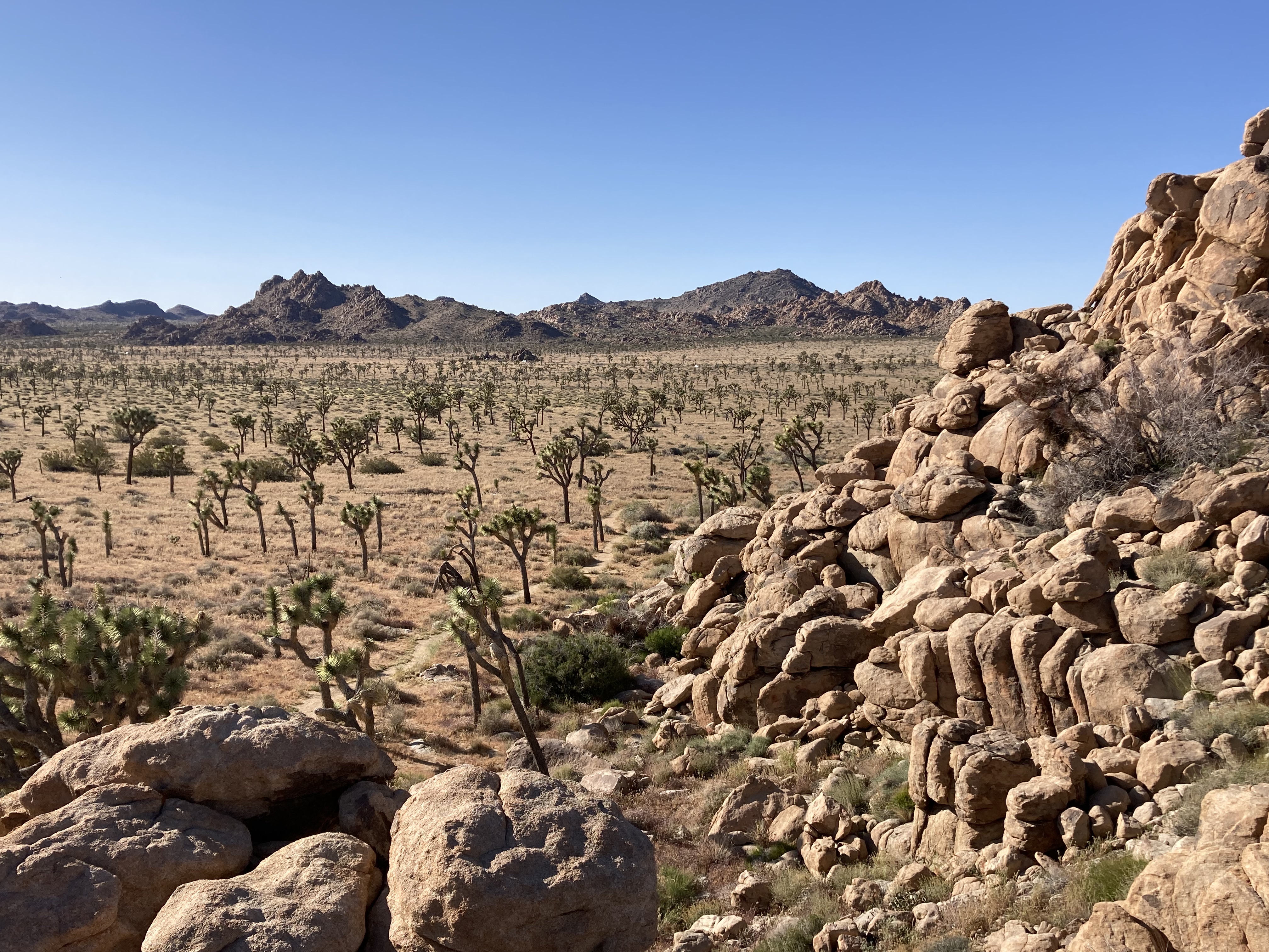
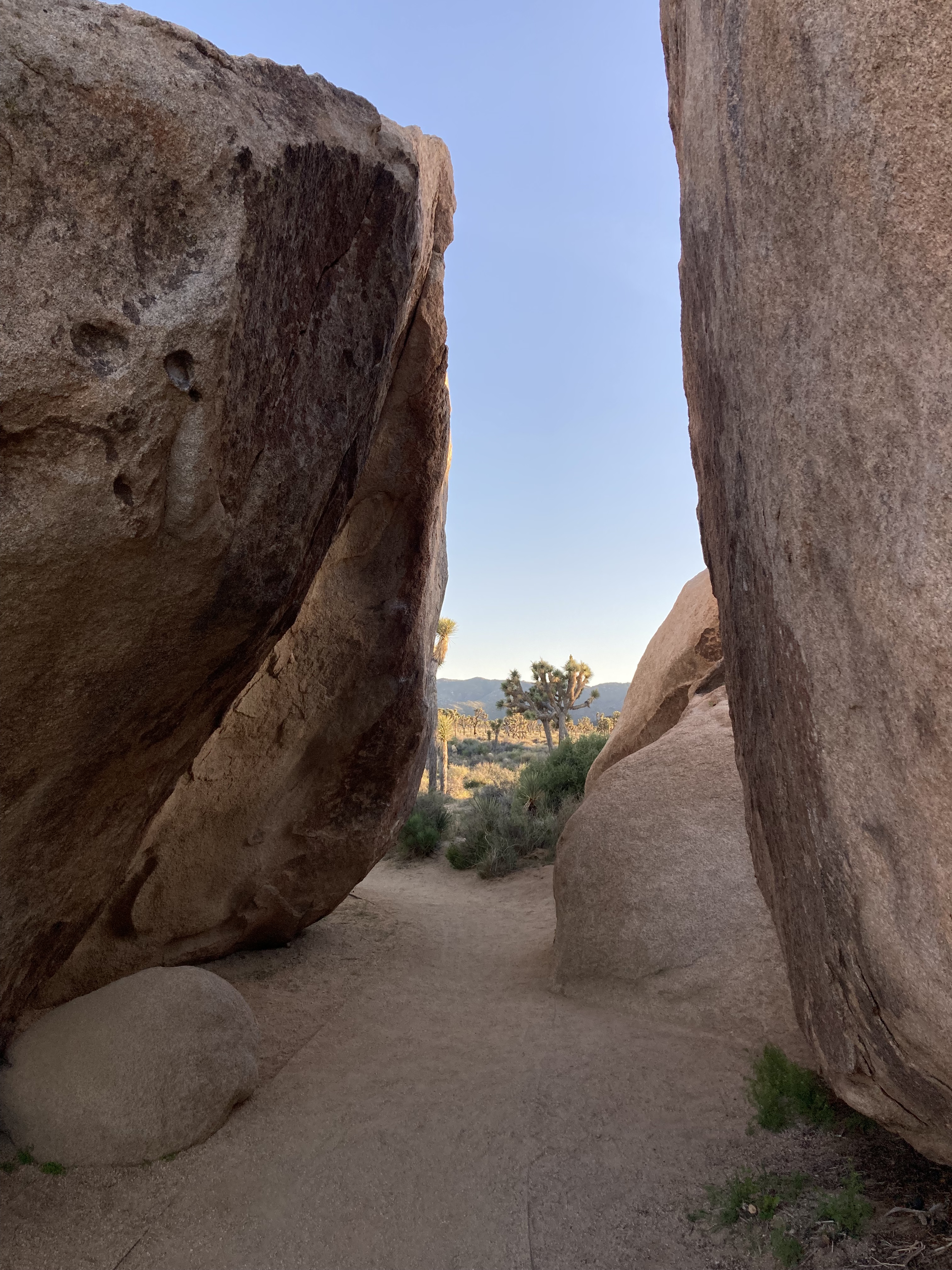
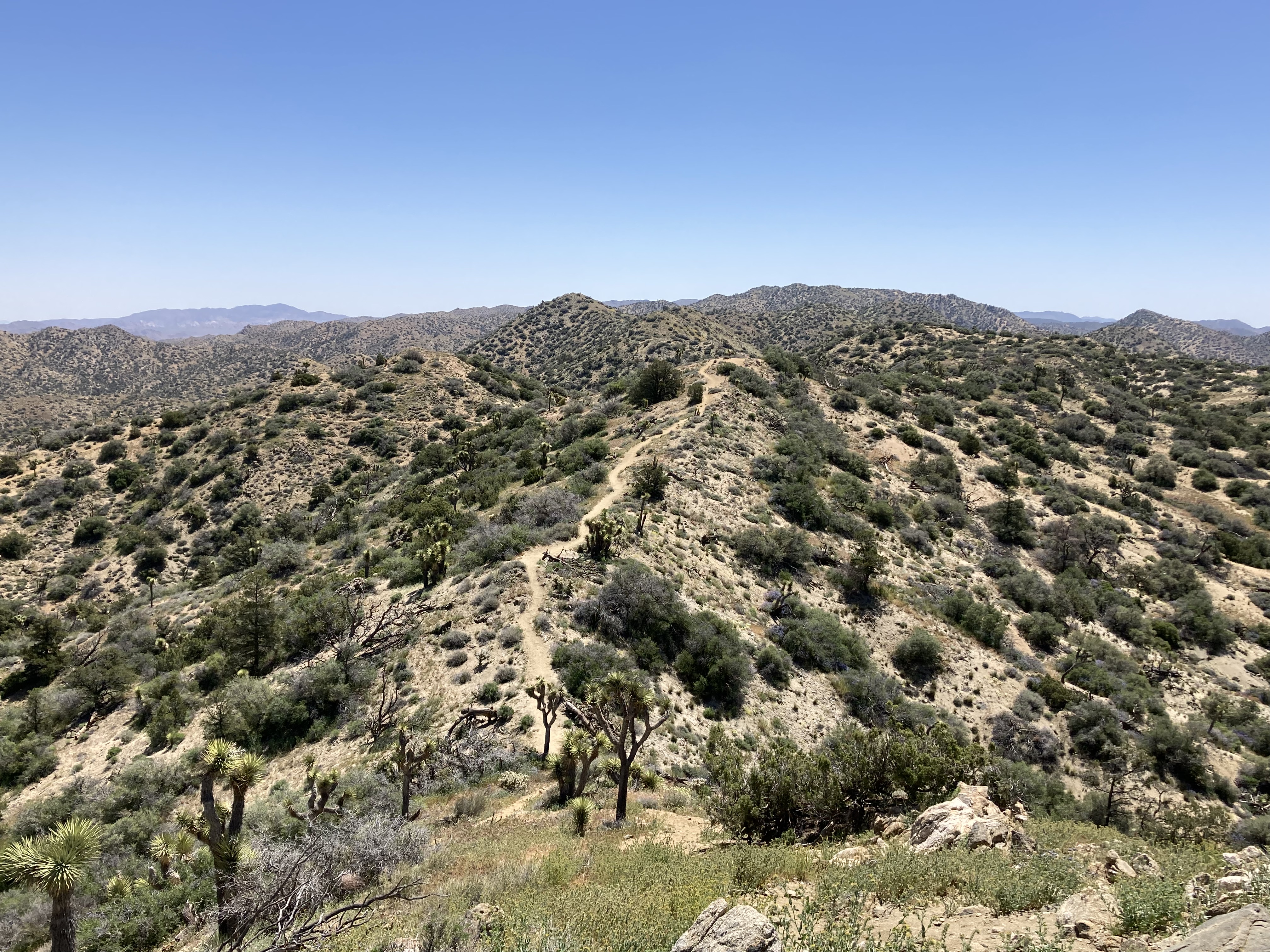
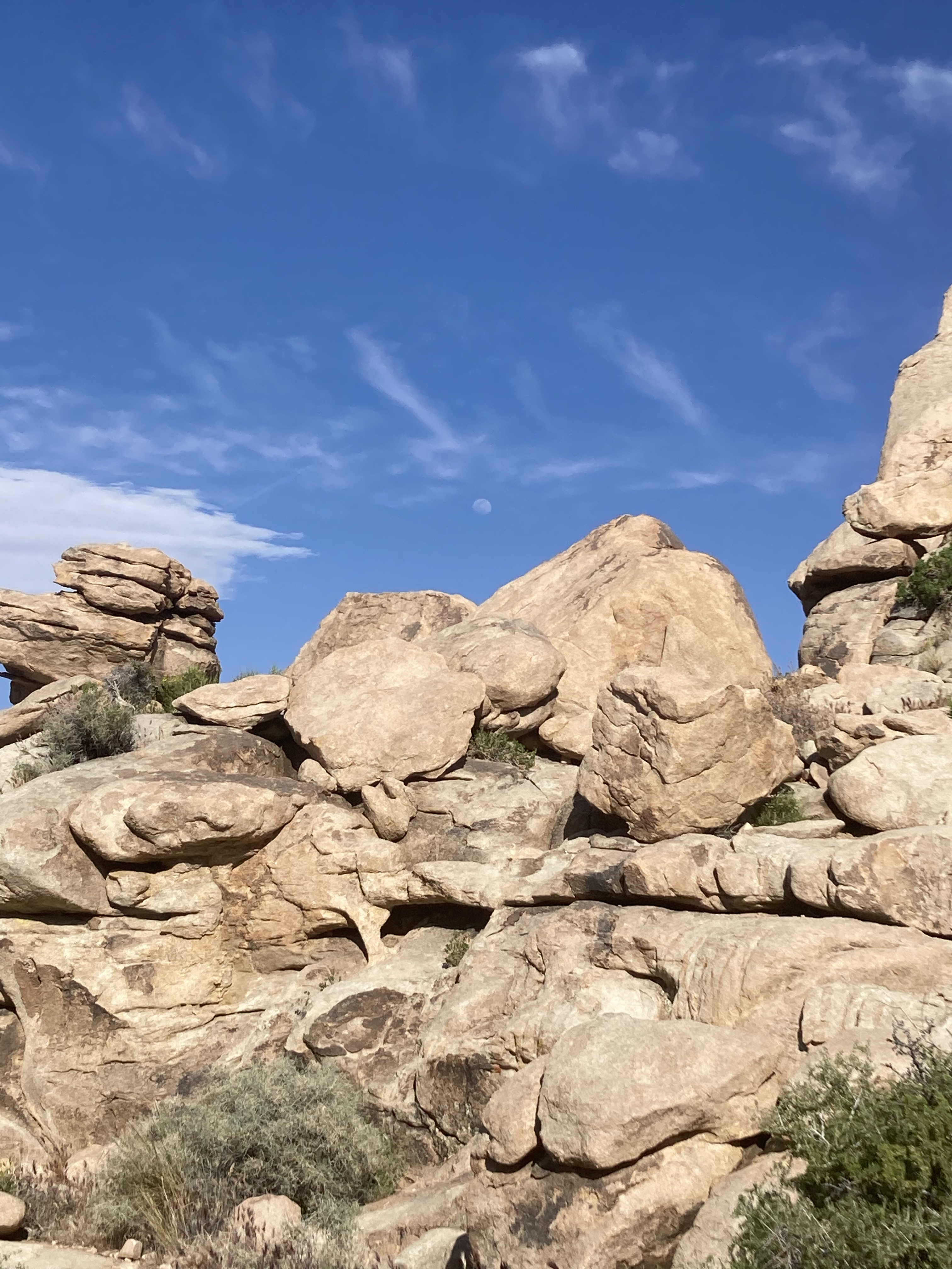
Then I went to the Hall of Horrors. It’s an area with Joshua Trees and big boulder piles, and is a popular area for rock climbing. The “Hall of Horrors” refers to slot canyons that you can walk through. I’m not sure if I had service at the time, because if I did I might have googled how to find these slot canyons. I don’t really like to have my phone on while hiking though, and I just wandered around. I figured I could find what I was looking for – but it eluded me. So in this case I would say know what you’re looking for ahead of time. I definitely got a bit frustrated!
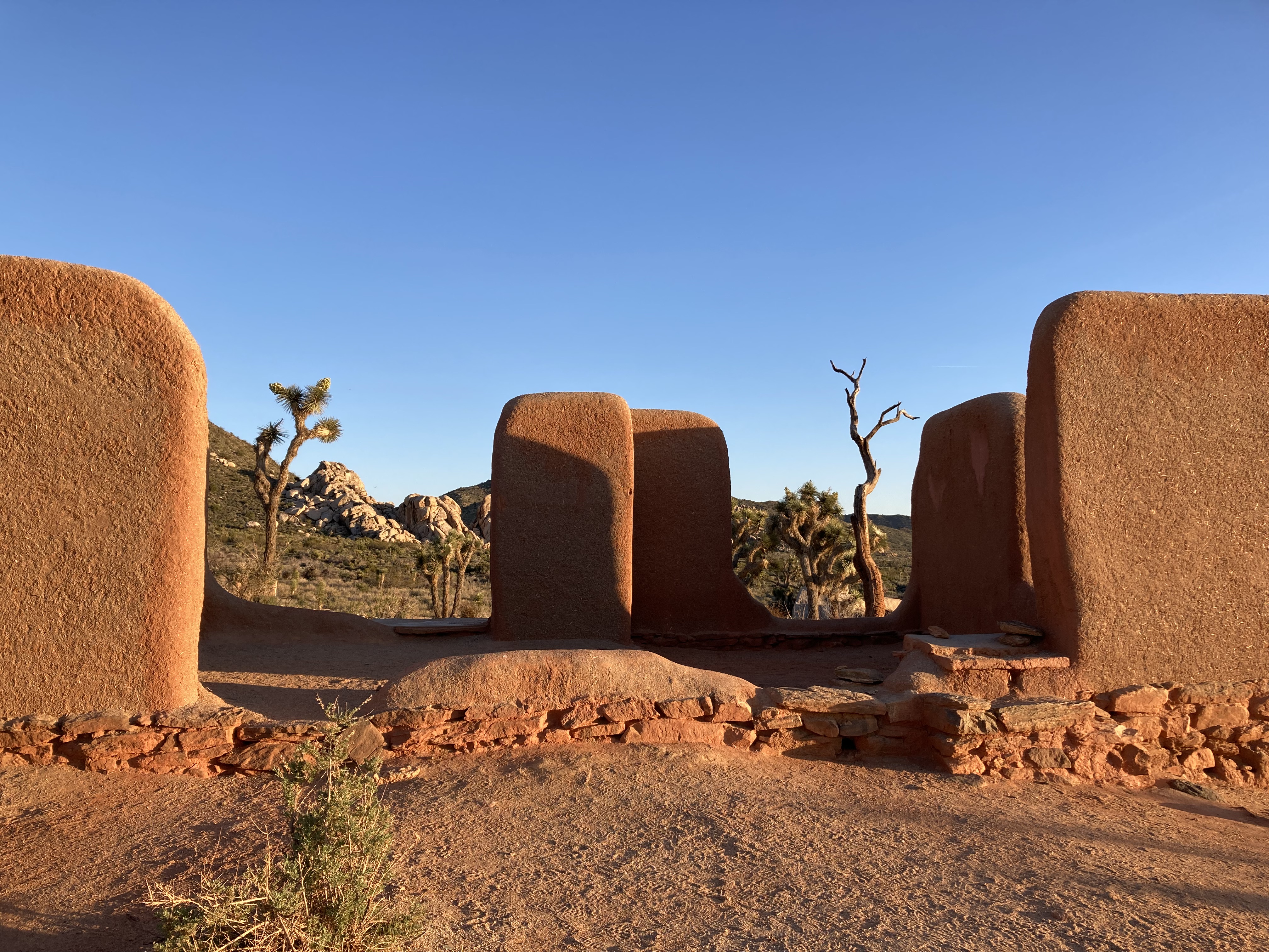
Next up: Ryan Ranch, the remains of an 1896 adobe homestead.
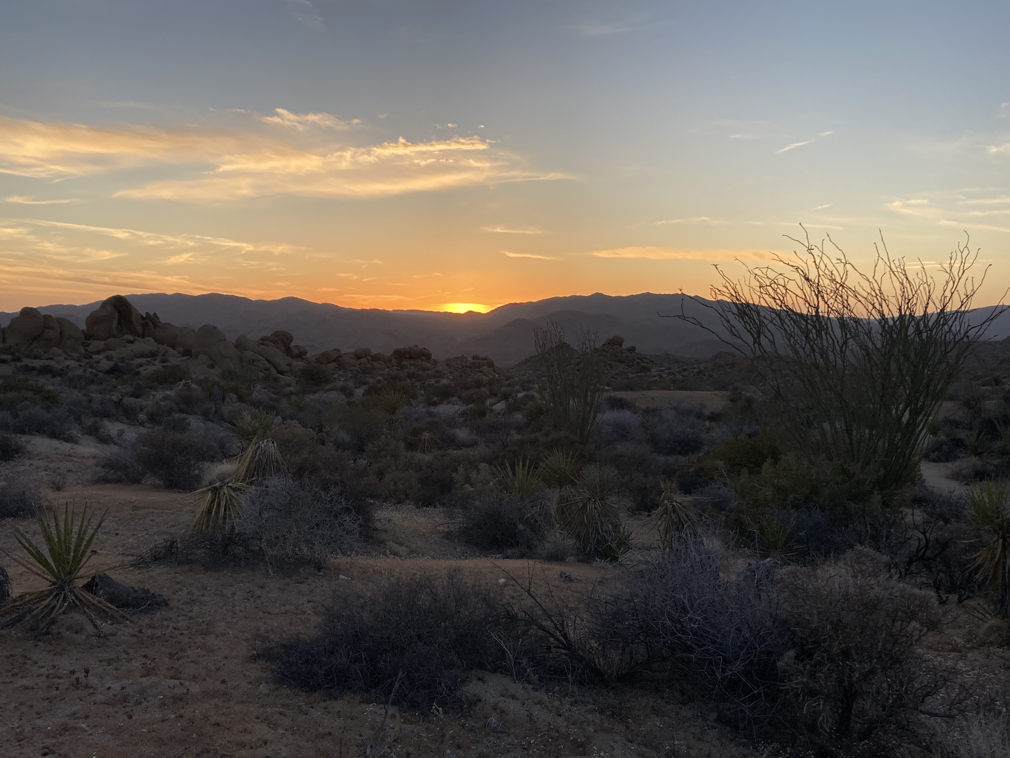
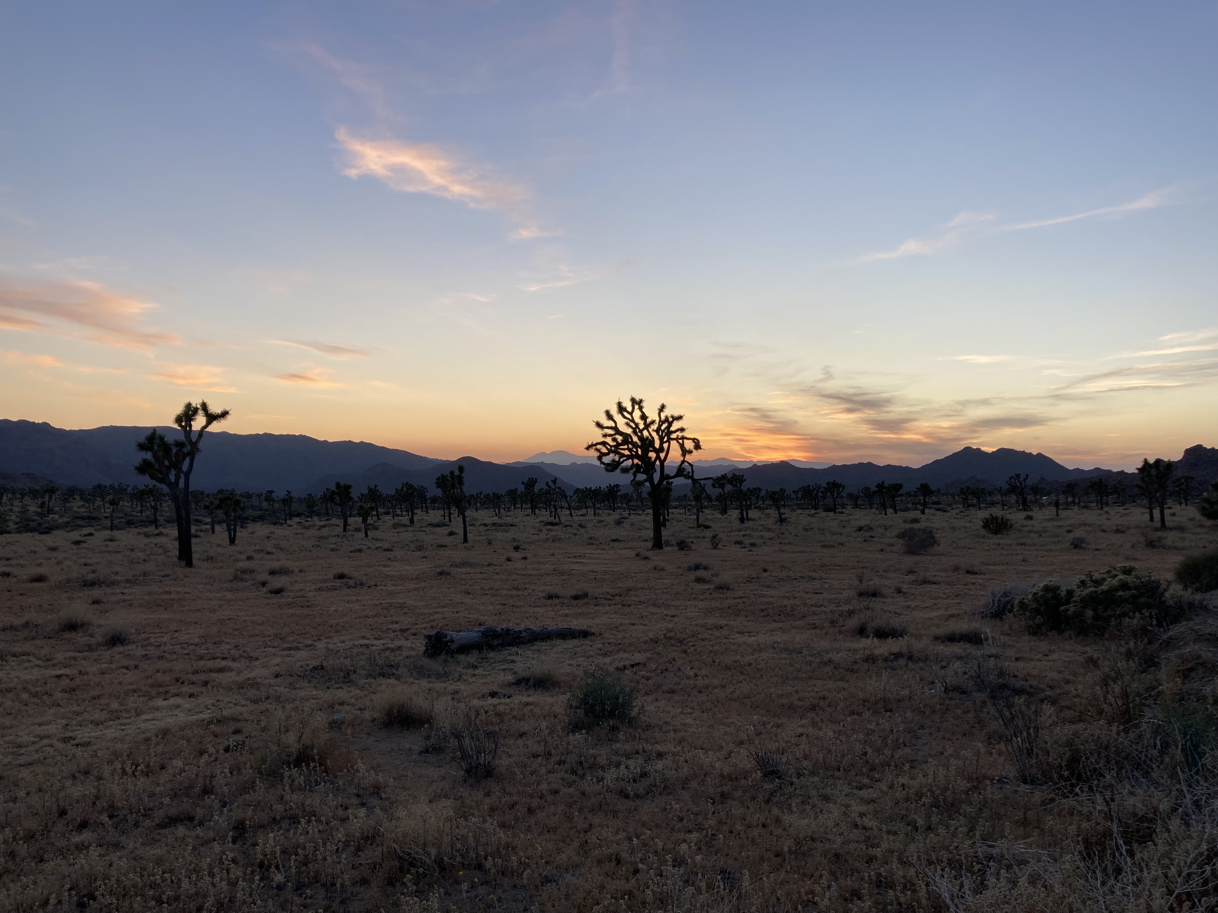
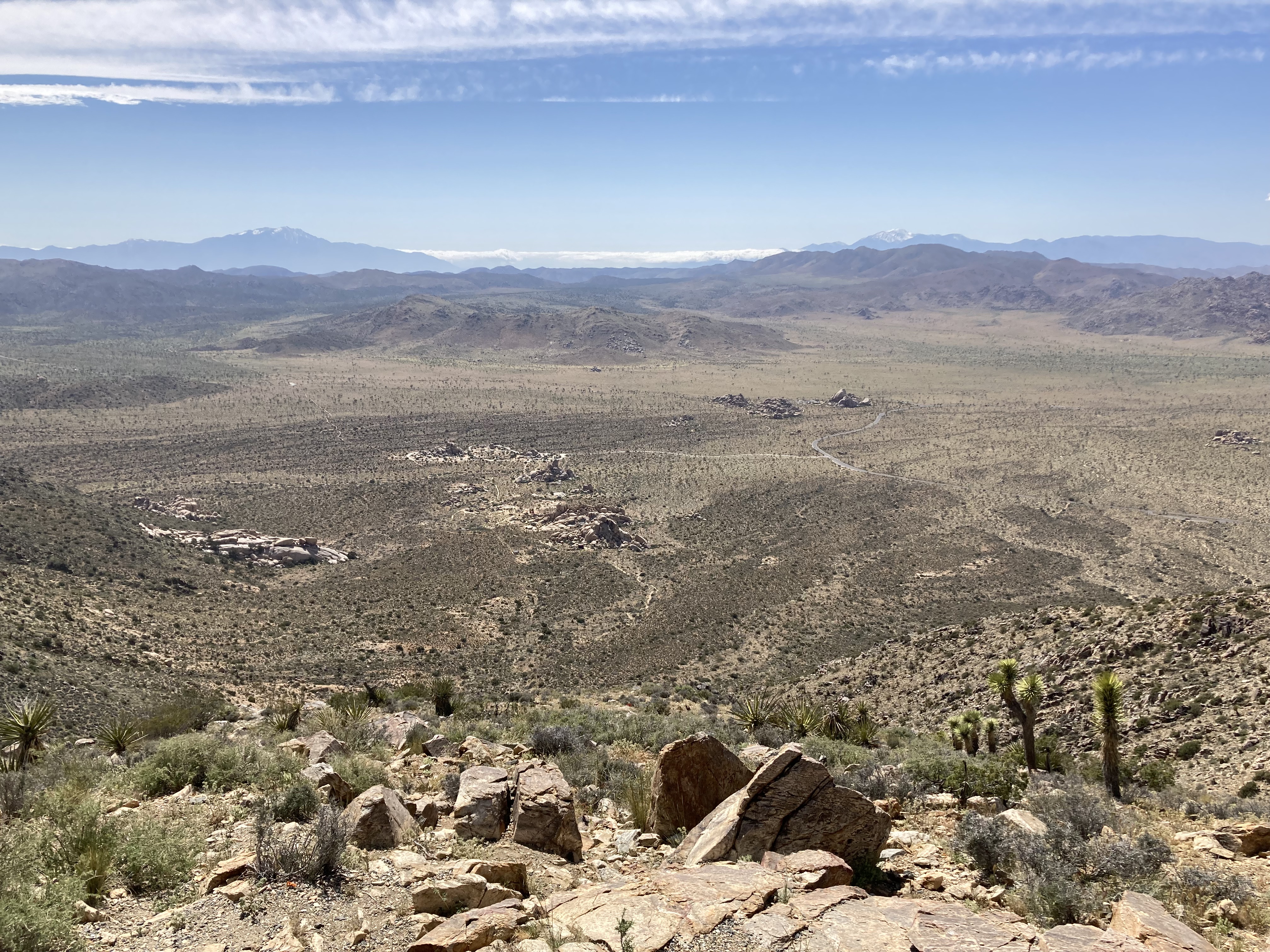
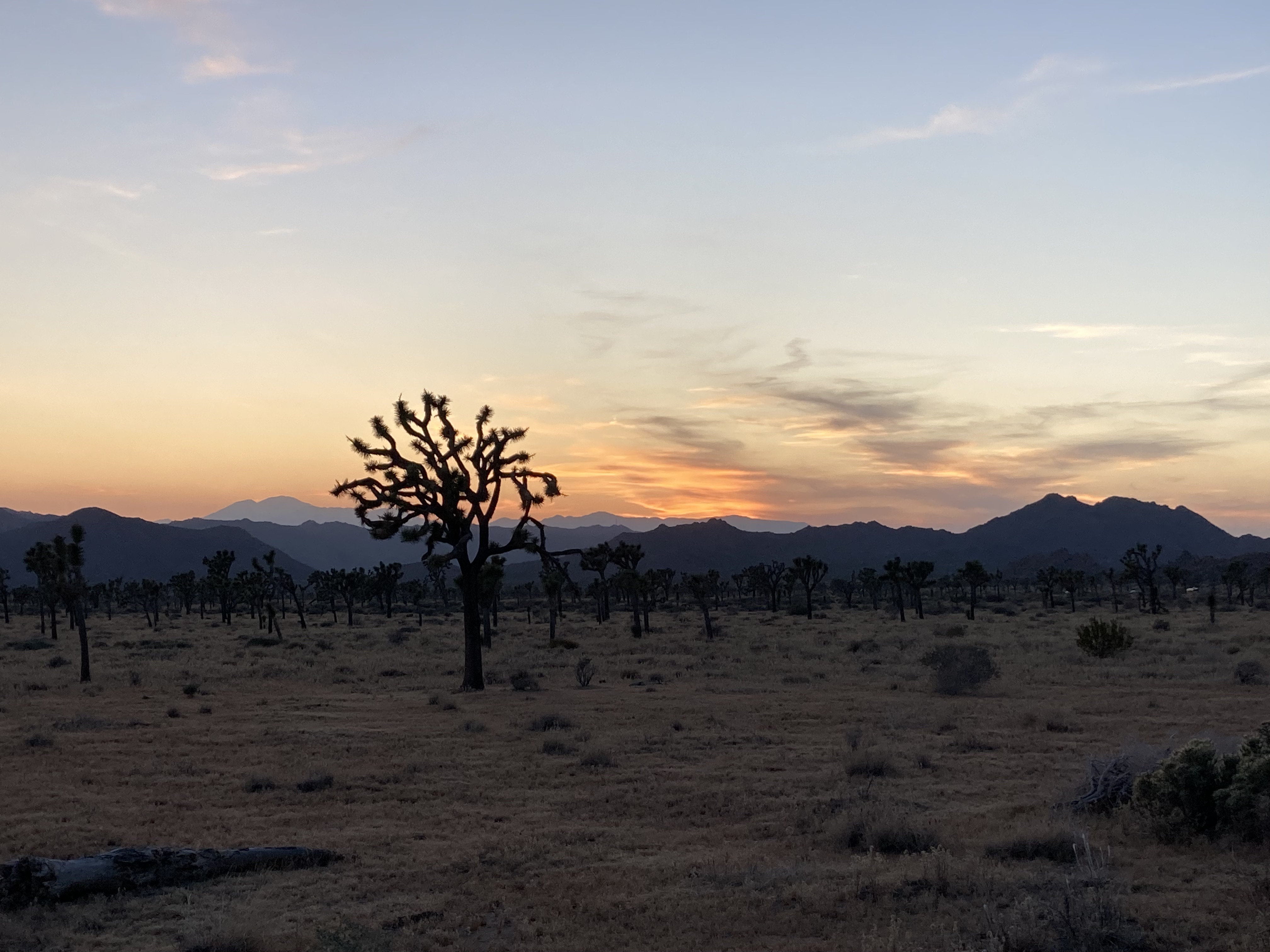
And the cherry on top of a blissful day full of exploration: watching the sunset at Keys View.
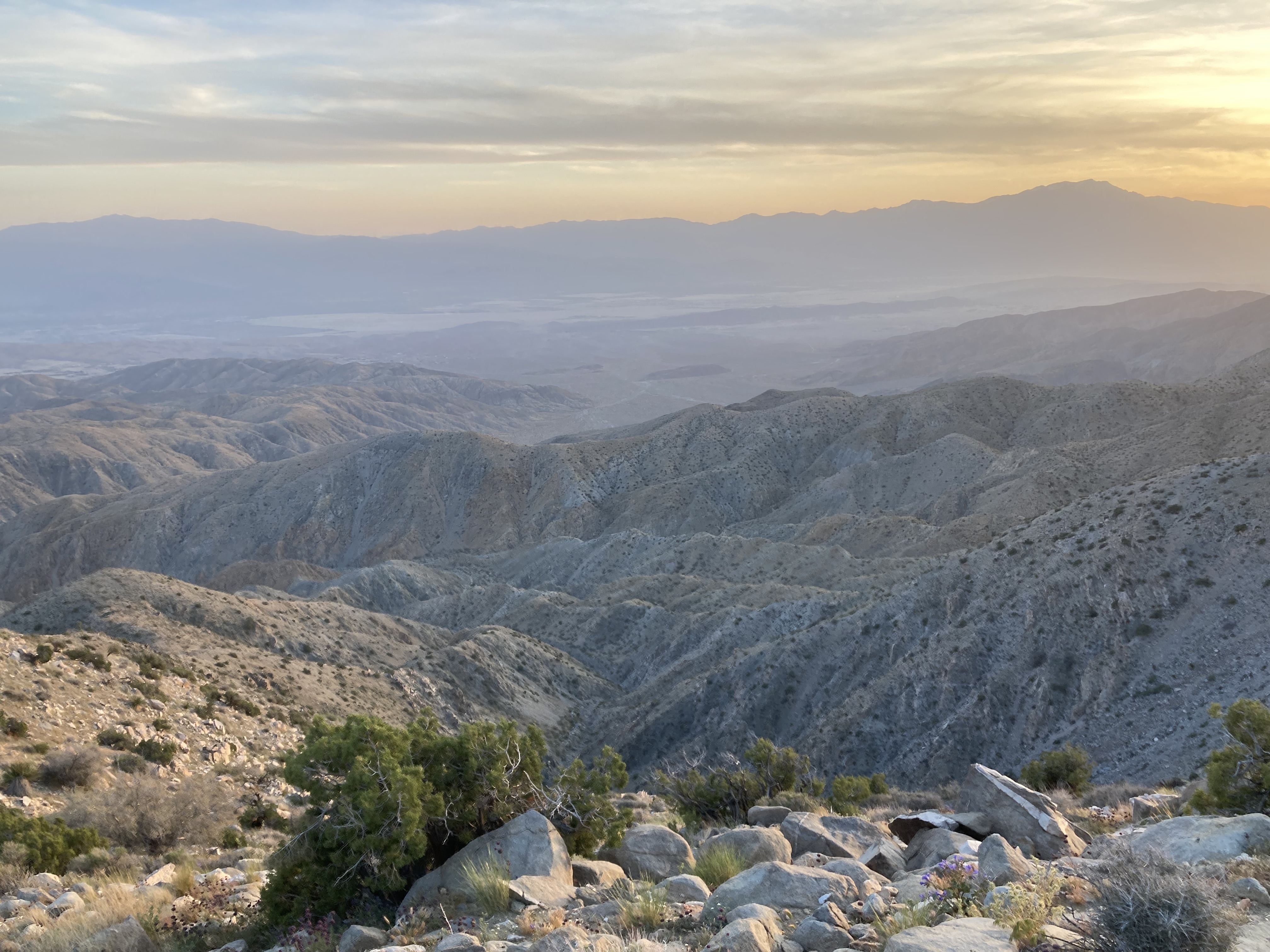
I spent multiple days in JTNP, and watched the sunset at Keys View on two nights. It’s a breathtaking view point that looks south and west, towards Coachella Valley, the Salton Sea, and the mountains.
My home base while exploring JTNP was Joshua Tree. I did try to make a campground in the park work, so I wouldn’t have to drive in and out of the park, and so I could star gaze during the night (JTNP is considered a dark sky zone and one of the best places to star gaze or see the Milky Way). But all of the campgrounds were first come first serve and I just had no luck.
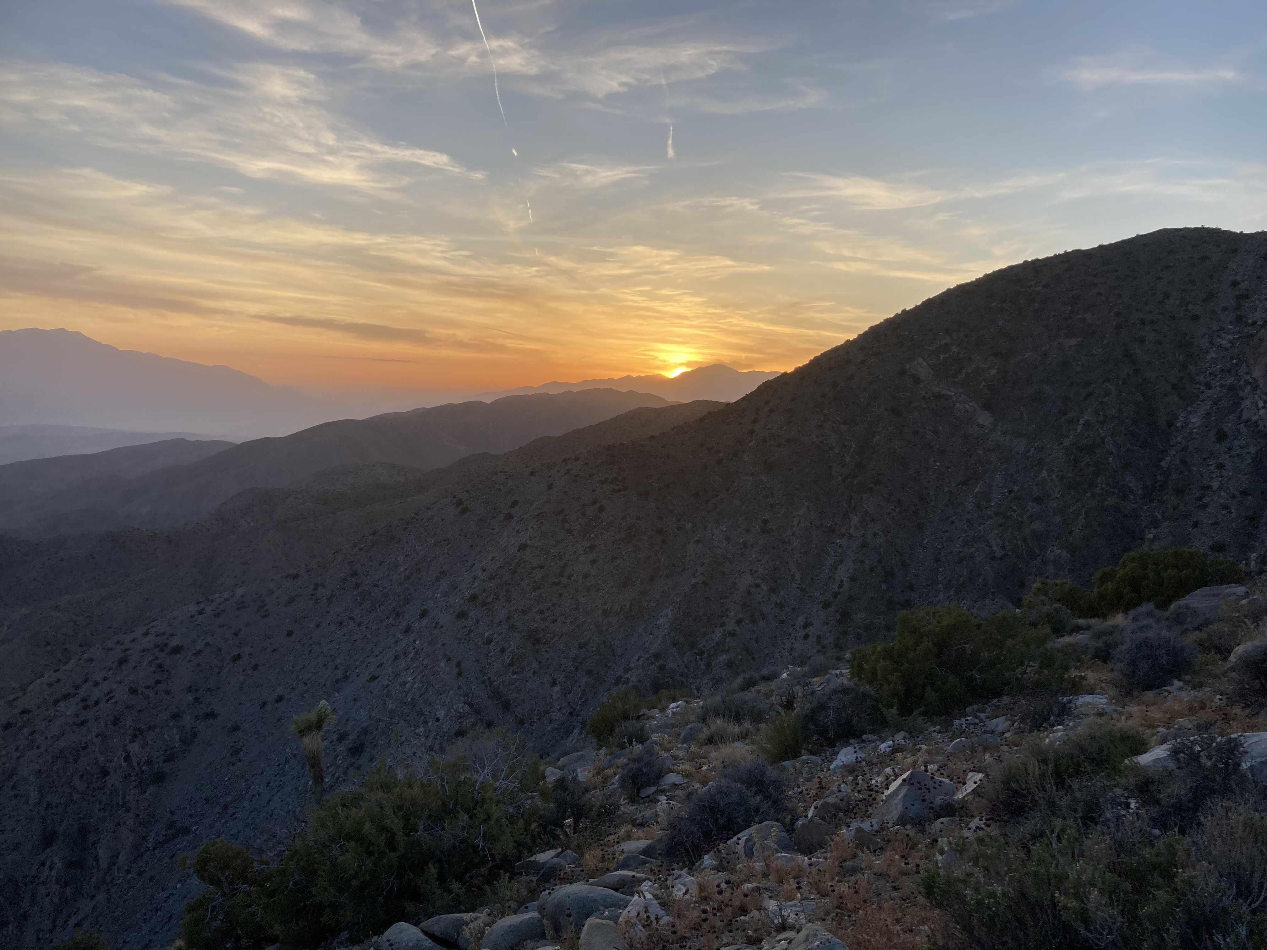
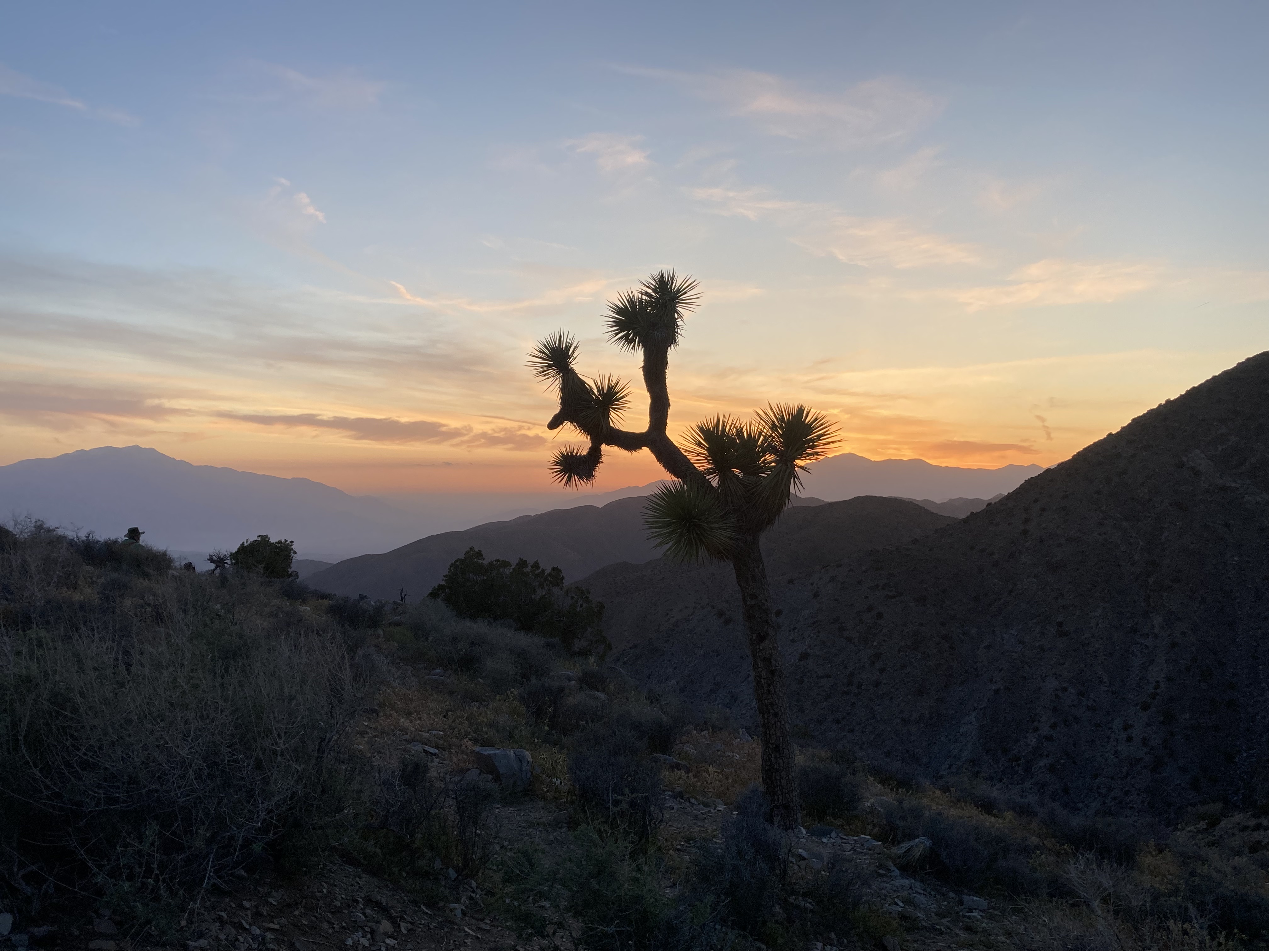
There was another spot in the park, however, that became a favourite spot to watch the sunset. It’s not an officially marked area on the park maps, just a trail at a random turnout that I came across. And I kind of like it that way, because less people came here and I often felt like I had the area all to myself. I liked this spot so much that I came back multiple times and started thinking of it as “my spot“. There was a trail that took you around a mound of boulders, through a Joshua Tree forest, and you could explore branches of trail that veered off down an incline. In the distance, in the west, over the expanse of Joshua Trees, were the San Jacinto Mountains, which I’d look out to while watching the sunset (I bet they glow orange in the sunrise as well). I would climb the rock mound and sit and just take in my surroundings. It was quiet here. I could just listen to the sounds of nature. It was one of those places that you want to appreciate as much as you can, but it resonates with you so deeply that it feels like you can’t absorb it. As if you’re trying to commit it permanently to memory, but it feels like sand slipping through your fingers.
I know it probably sounds silly, but I got emotional when I left this spot on my last night in the park. I didn’t want to leave. This is what I mean when I say Joshua Tree is one of my favourite places in the world.
Another area of the park that I explored was Hidden Valley Nature Trail. It’s a loop trail with a lot of plants, described as a microclimate where a ring of rocks blocks wind and traps moisture, creating a more hospitable environment (great for viewing blooms).
Around the intersection of Park Boulevard and Keys View Road is a short trail at Cap Rock Nature Trail.
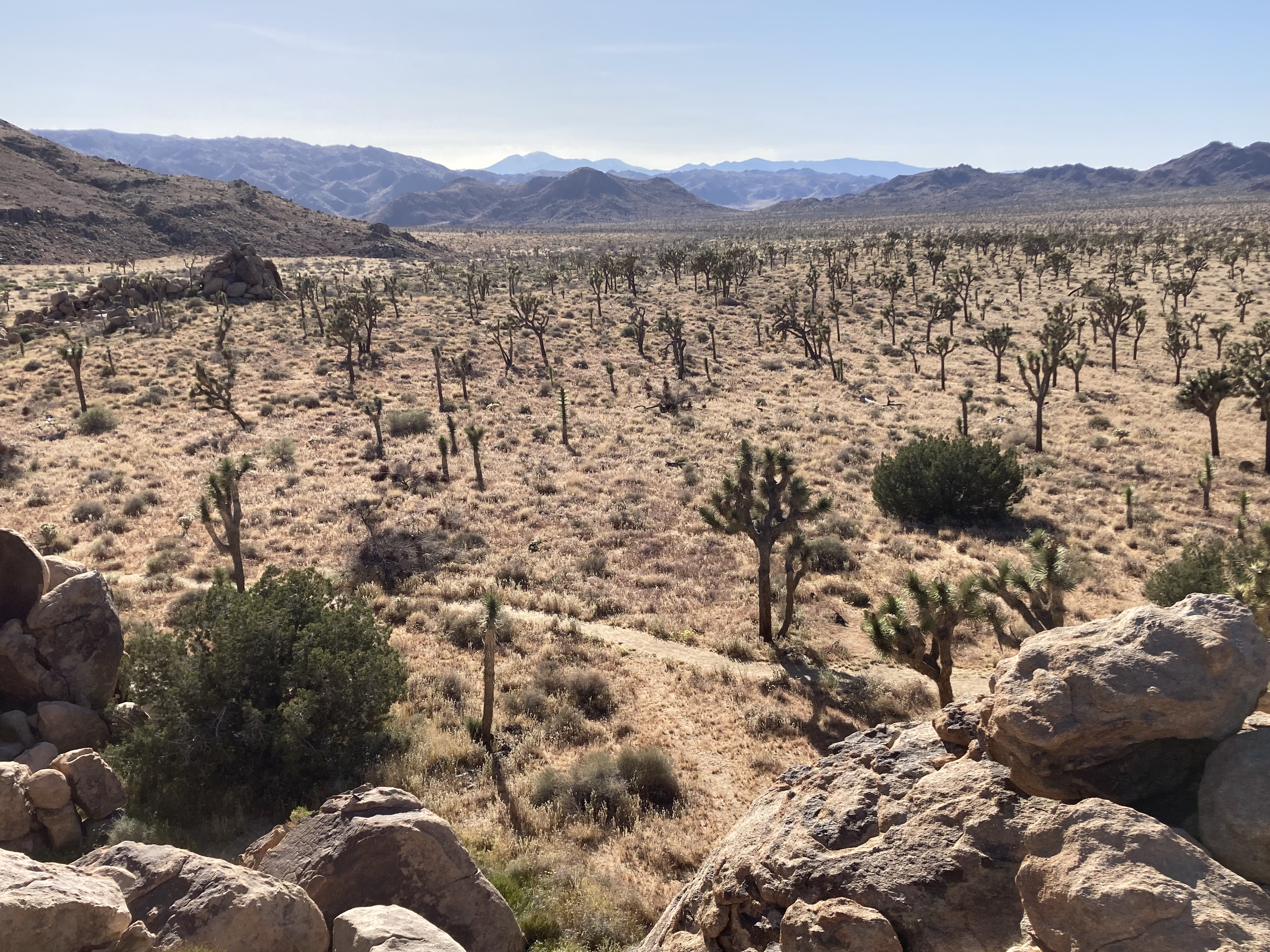
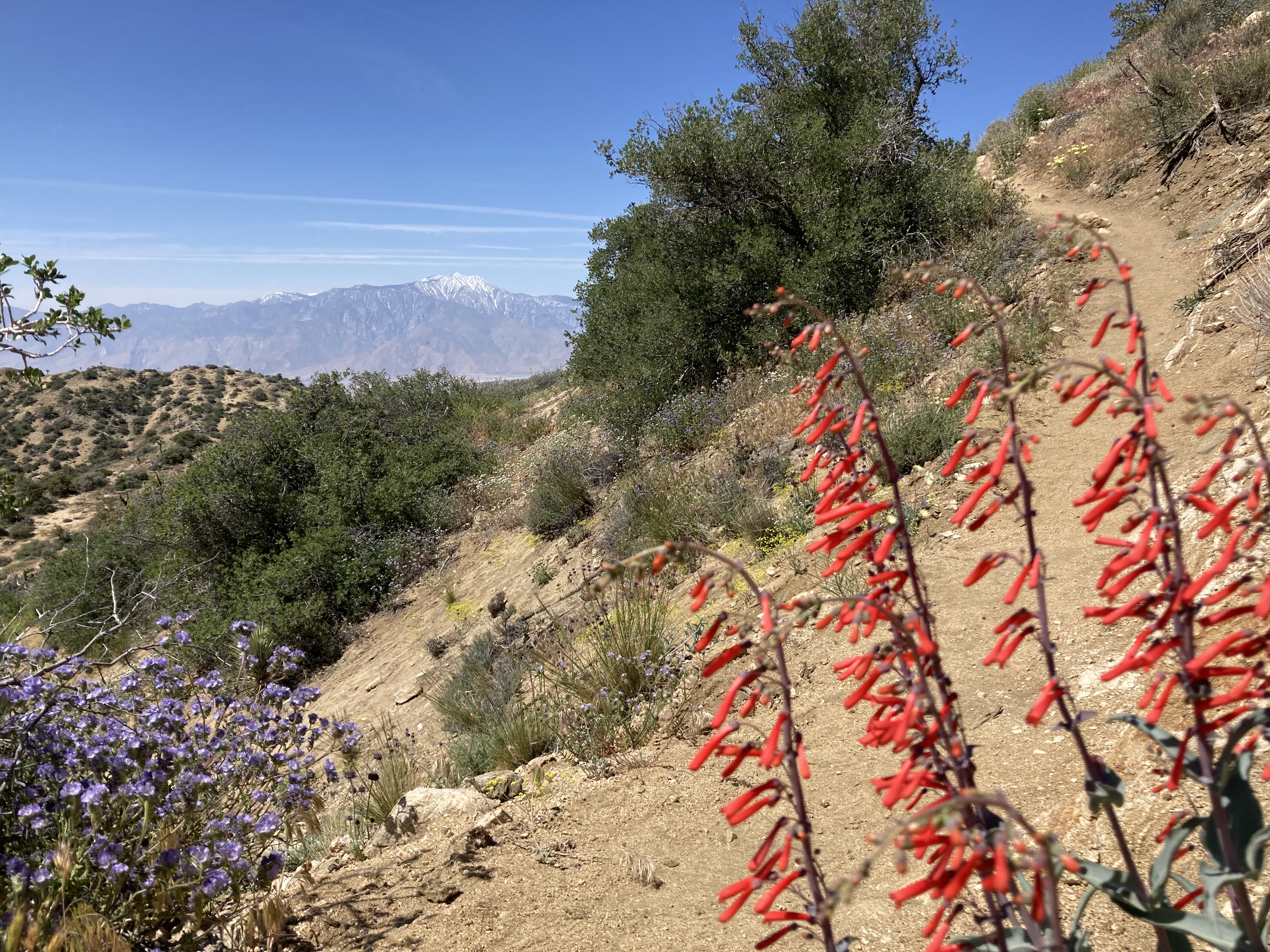
On the far northwest end of the park is Panorama Loop Trail, which can be accessed from Black Rock Canyon Campground. I spent a morning hiking it, starting just before 10am, which is already too late to avoid the heat. I believe it was about 31 degrees C on this day, but somehow I was well acclimated to the heat by this point and felt fine on the hike. The loop took me about 2.5hrs. I really appreciated the Little San Bernardino Mountains, the views of Joshue Tree to the east, and especially the views of snowcapped Mount San Jacinto Peak (10,834ft, left/south) and San Gorgonio Mountain (11,503ft, right/north, the highest peak in southern California, located in the San Bernardino National Forest). This is probably the best view of those mountains from JTNP, certainly the closest.
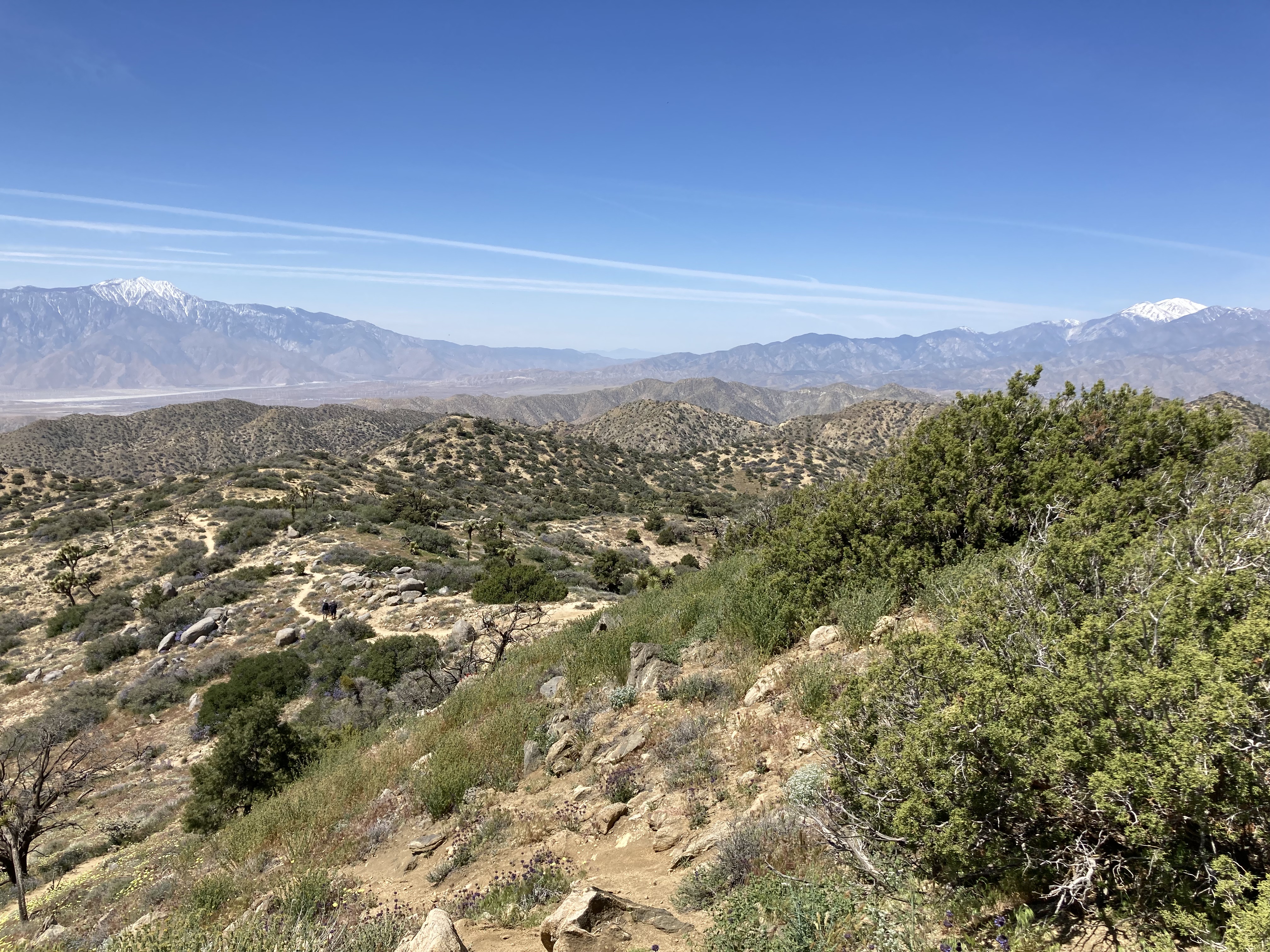
You feel a little further removed from JTNP on the Panorama Loop Trail, even though you are still within the park’s boundaries, as it’s on the edge of the park. There may not be as many people here, and it’s not off the main thoroughfare of Park Boulevard. I quite enjoyed this one.
I also spent an afternoon hiking to the top of Ryan Mountain. So many of the little trails in JTNP are short and flat, but this trail provided some decent elevation gain and panoramic views of the park. It’s a unique view of the park and might be a consideration for watching the sunset (if you feel comfortable hiking back in the dark).
I feel like I saw a lot of what JTNP has to offer, but there were of course still more areas to explore. Some that I’d made note of were Barker Dam (easy hike to a reservoir that occasionally fills with water), Forty-Nine Palms Oasis Trail (hike in the far northeast corner of the park to an oasis, closed in the summer for bighorn sheep to access water at the oasis), Minerva Hoyt (valley of Joshua Trees, meets Hidden Valley, named after the founding force behind JTNP), Big Trees, Covington Crest (easy access to higher elevations; peaks, overlooks, valleys, and some of the largest Joshua Trees in the park), Wall Street Mill (hike to an old mill site and homestead), and Willow Hole (unique rock formations). And I’m sure there is more.
The California Riding and Hiking Trail is a longer 36.6 mile trail that runs through JTNP from Black Rock Canyon to the north park entrance. Permits are required to backpack it, which is said to take 2-3 days. I think it would be a remarkable late fall or early spring hike!
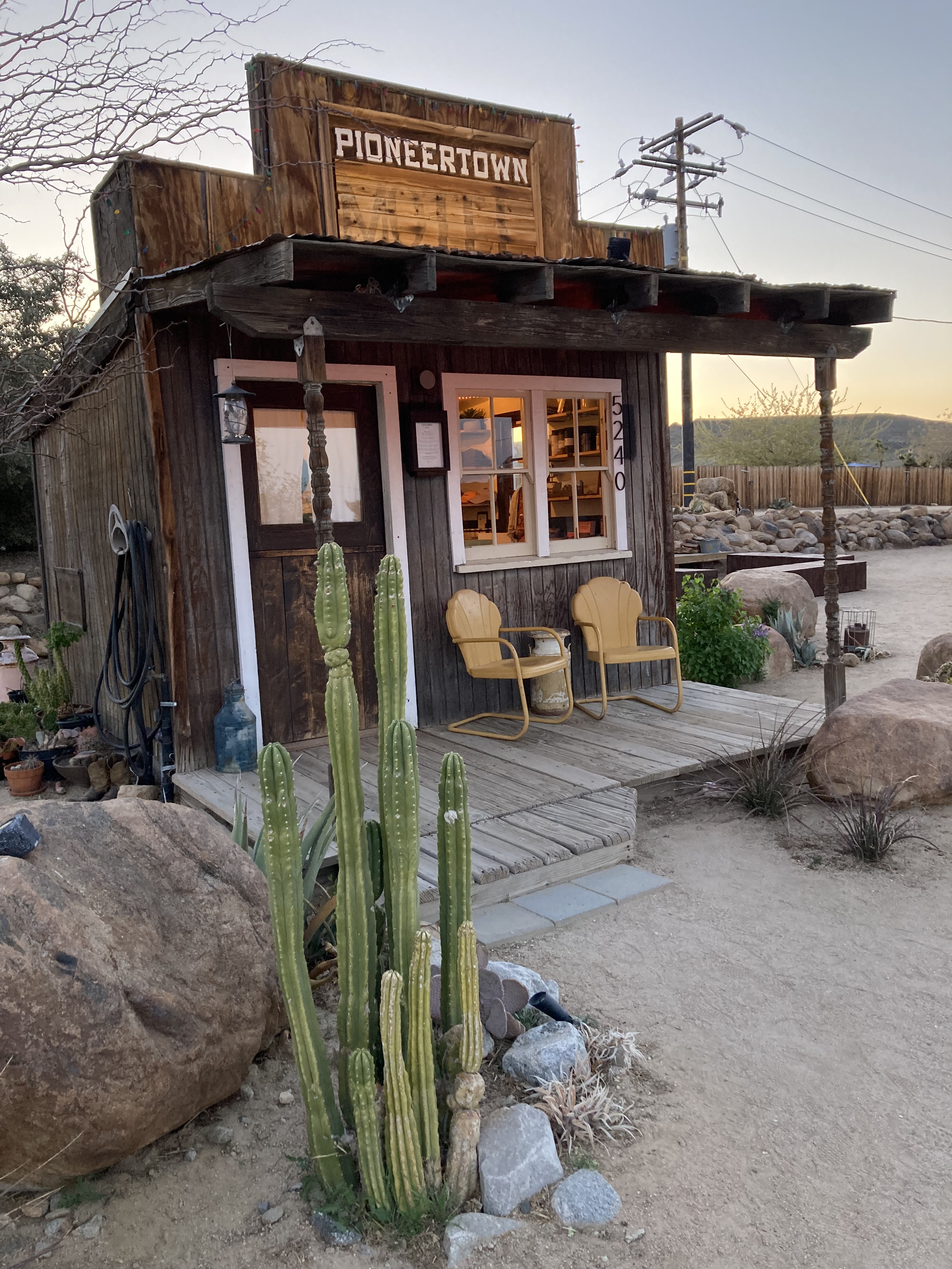
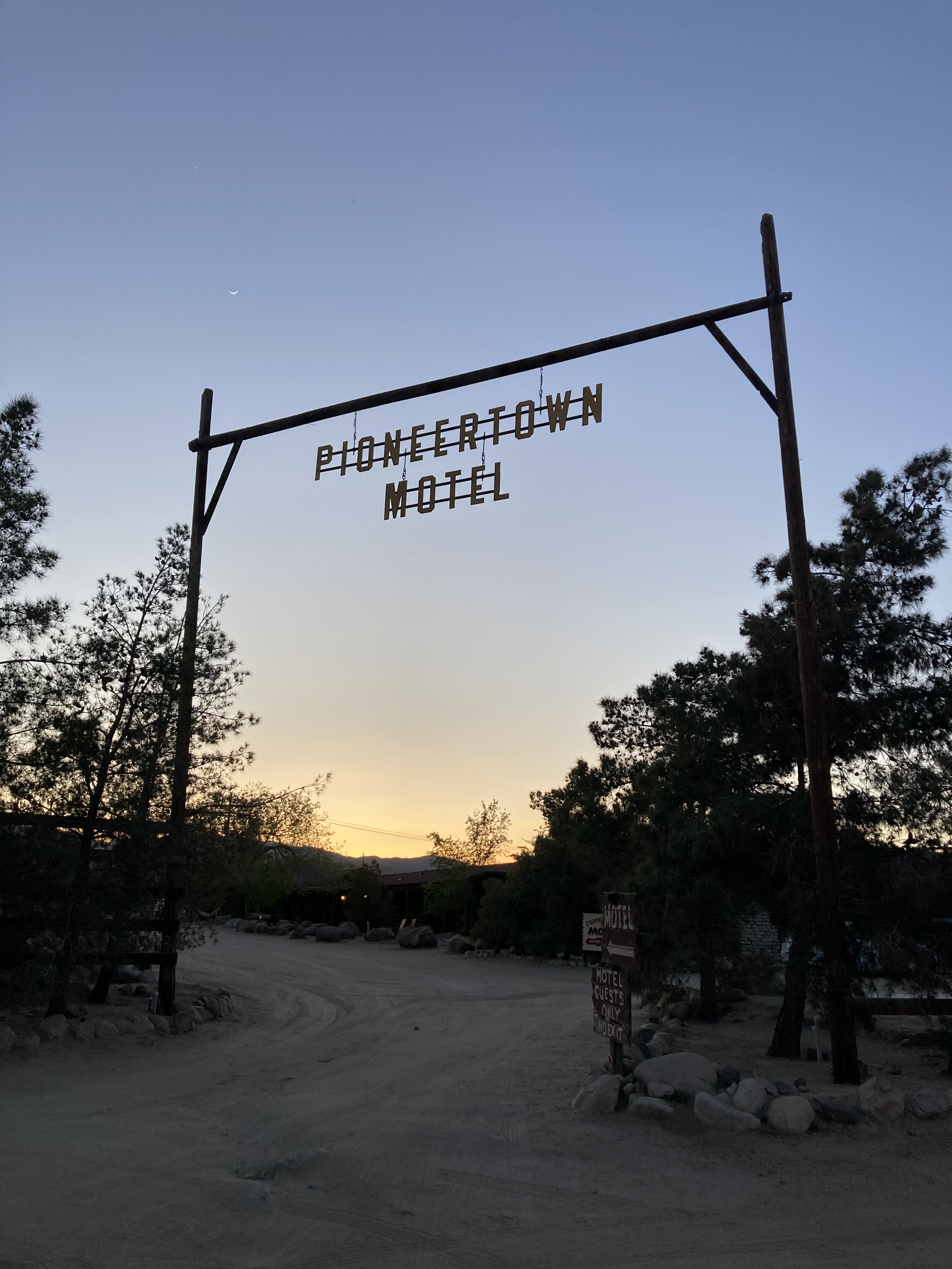
Pioneertown
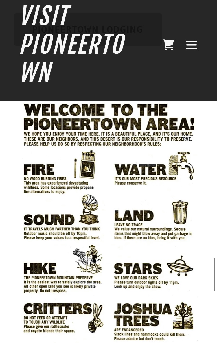
How The West Was Once.
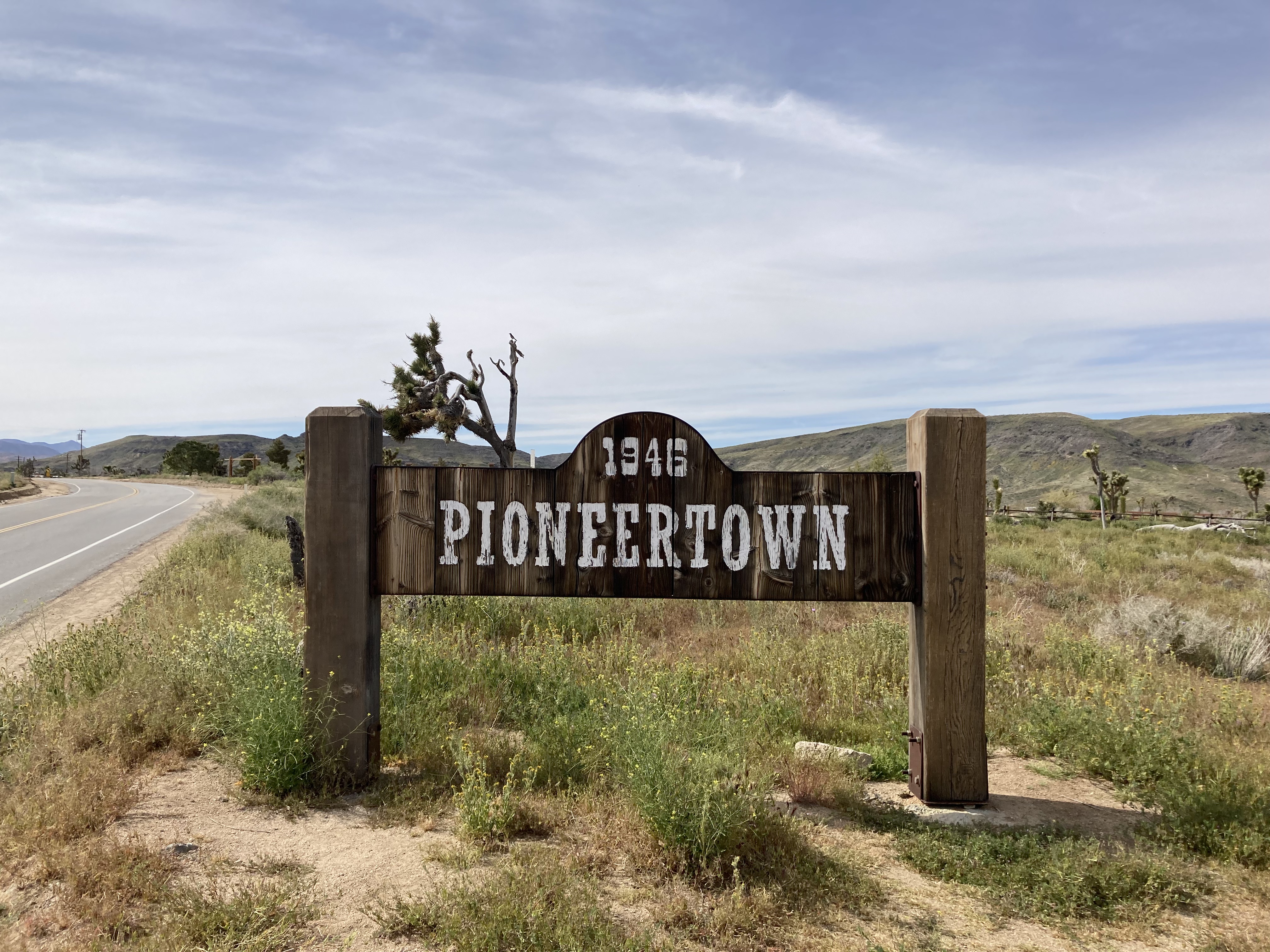
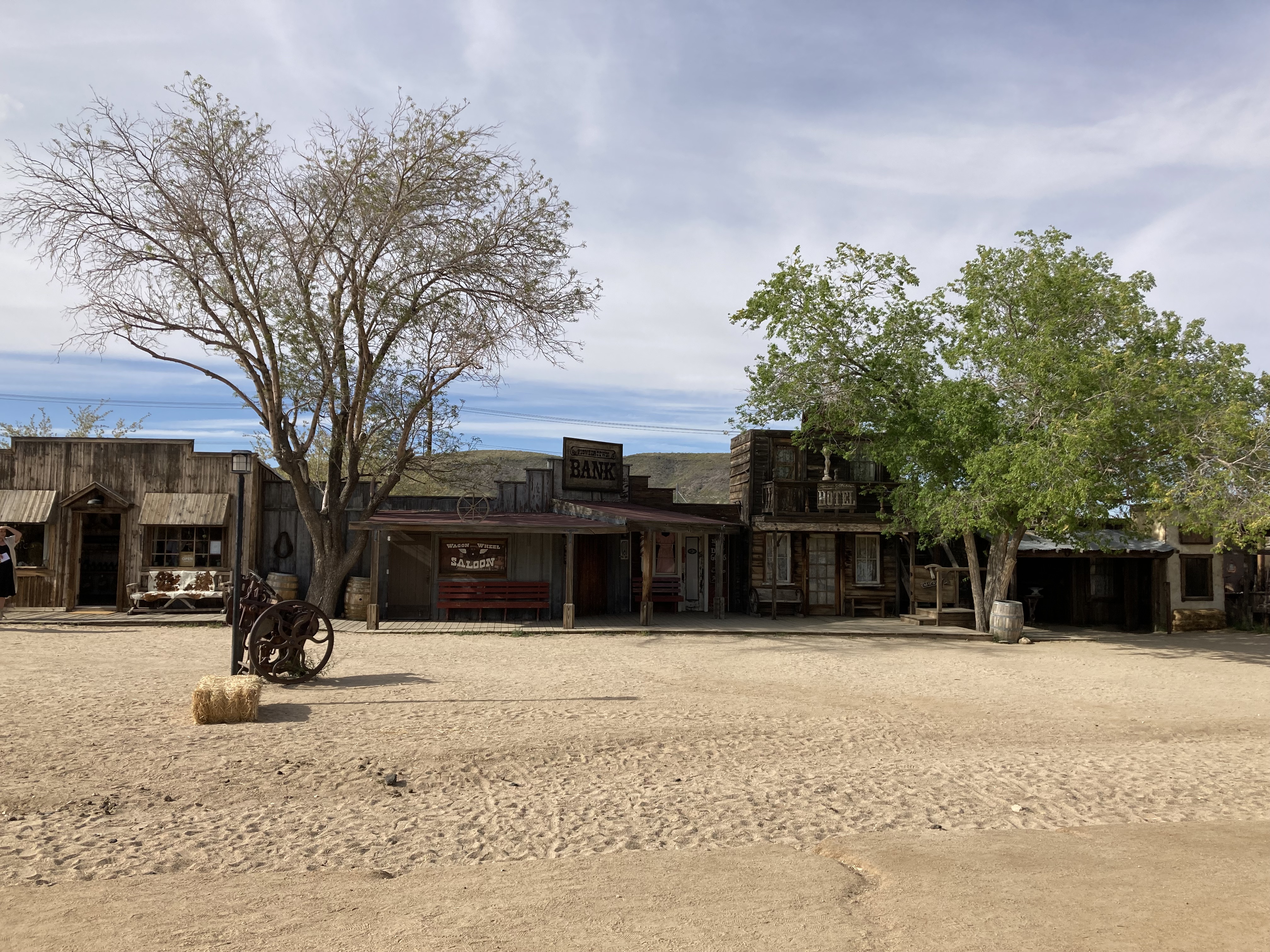
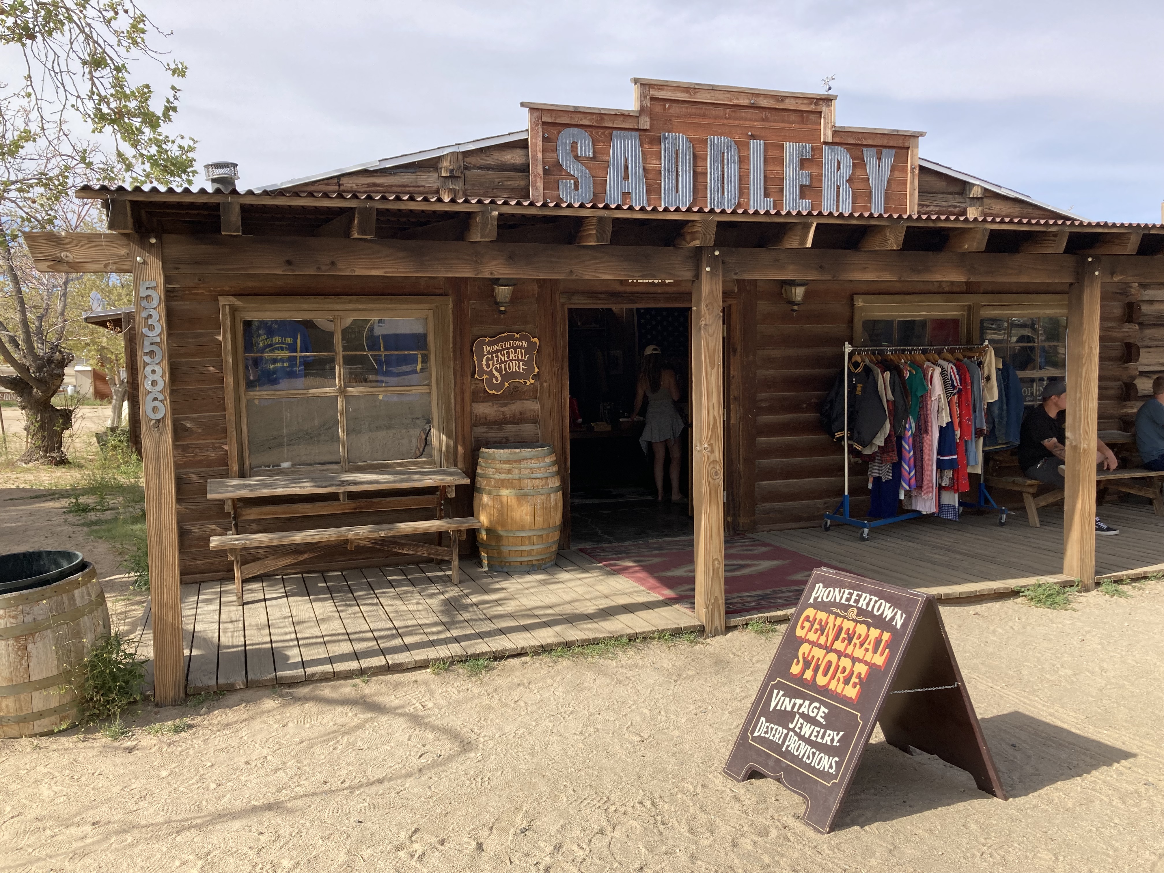
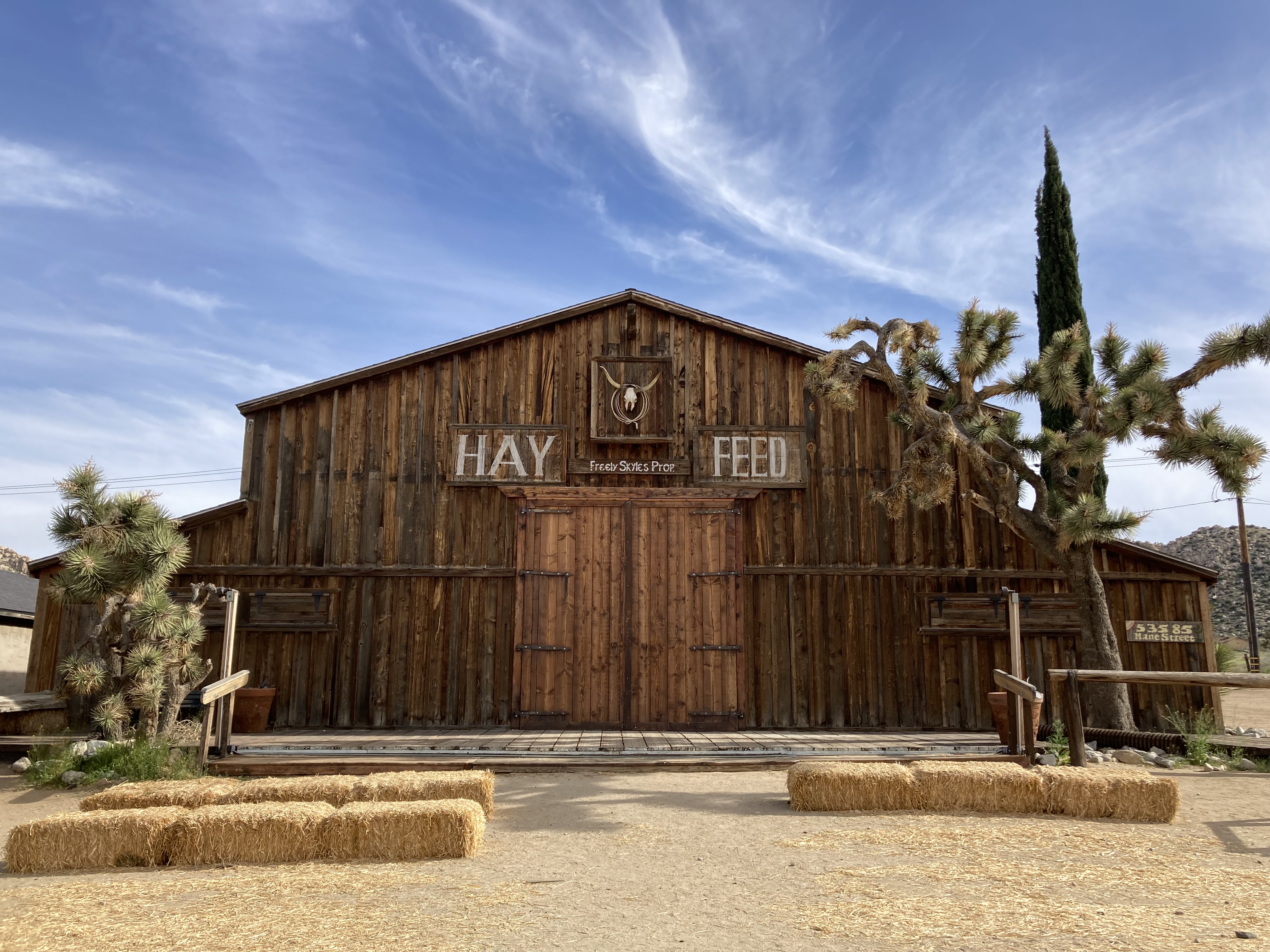
Pioneertown (a 20 minute drive west from Joshua Tree) was founded in 1946 by Hollywood actors as a permanent 1880s old western town movie set. Mane Street is a sandy pedestrian wash lined with charming western-style buildings, old sets, and shops, like Pioneertown General Store and The Red Dog Saloon. Pioneertown is located a few miles northwest of Yucca Valley and a little over 400 people are residents of the unincorporated community.
Fun fact: an unincorporated community is an area where people live, often rural, that does not have their own municipal government. They tend to be governed by a higher authority, such as government at a county level, and typically have lower taxes and fewer zoning restrictions. In case you were curious, like me.
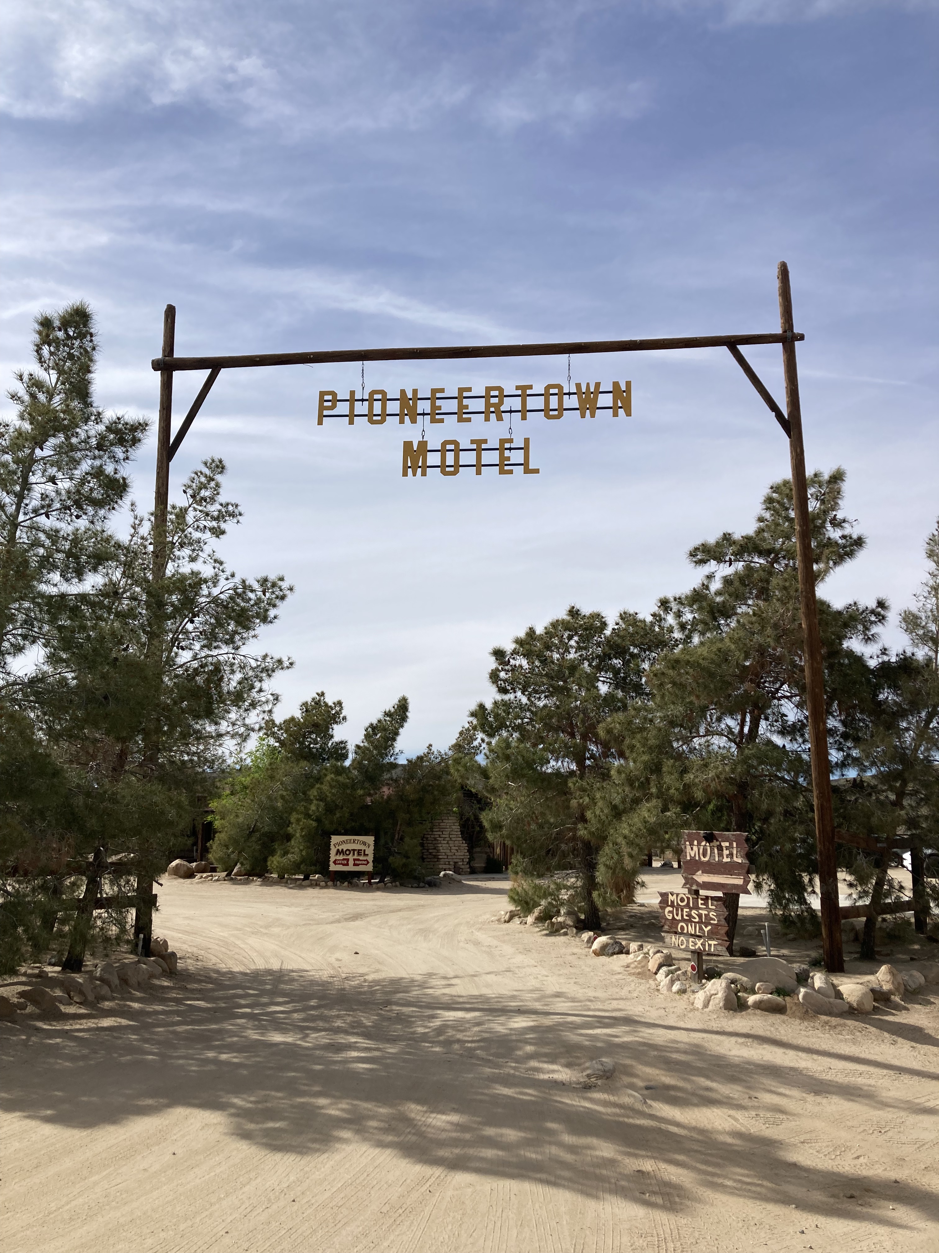
Just off Mane Street are a couple of gems. One is the Pioneertown Motel (trust me, the lodgings have character and style). I stayed here several years ago and I fell in love. I would love to stay here again in the future. And while on the topic of lodgings, there is also The Joshua Tree House, which has several beautiful lodging options in both Joshua Tree and Tuscon, AZ.
While I’ve never been huge into old westerns or country music, there seems to be something about these types of places that calls to me. Just as I was drawn to The Rosedeer Hotel & Last Chance Saloon near Drumheller, Alberta, so too am I drawn to Pioneertown, the desert, and these kinds of rough around the edges locations (that also seem to attract bikers and fringe personalities). Maybe there is something a little rock and roll, and not just country, about these desert havens.
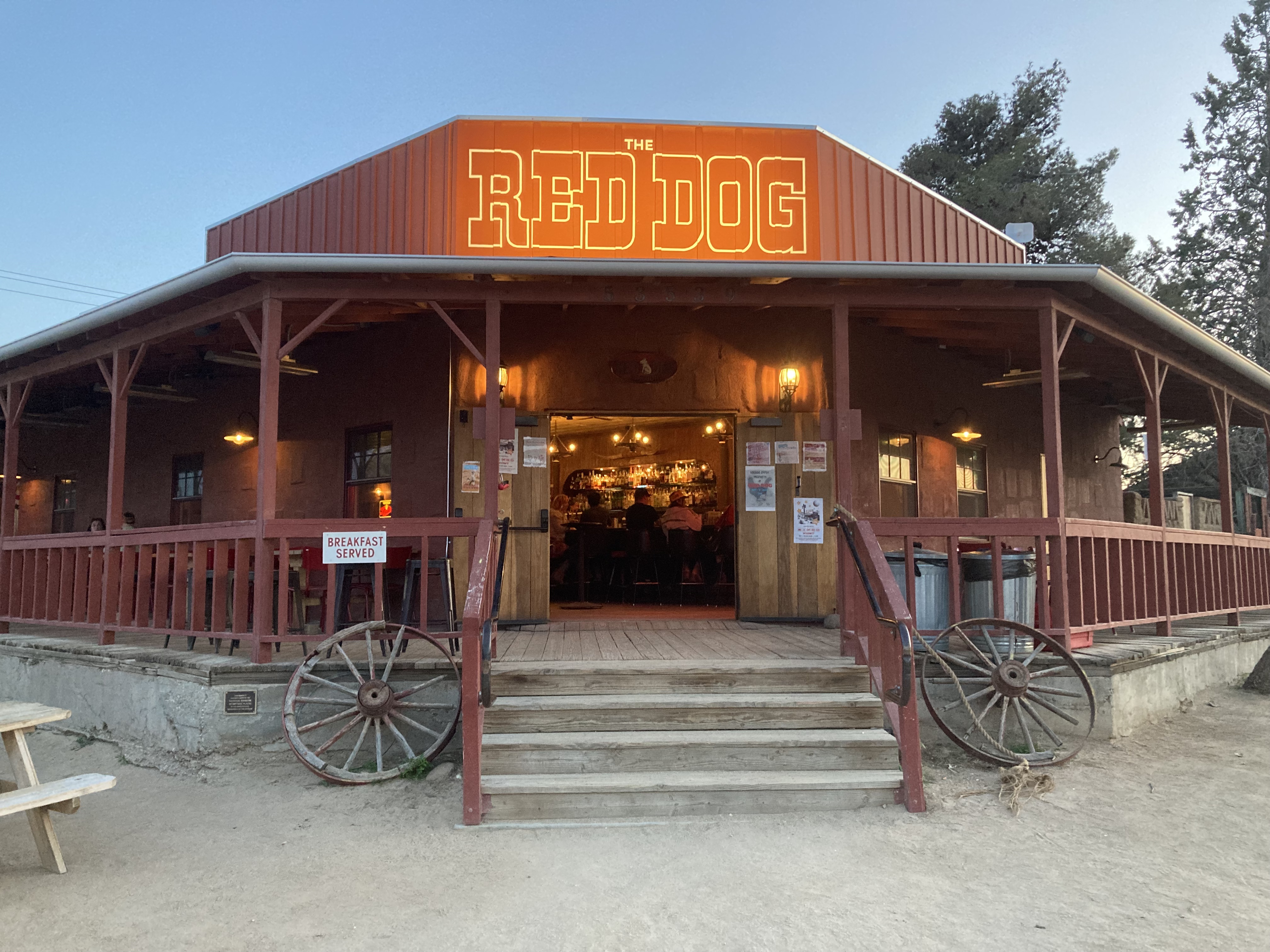
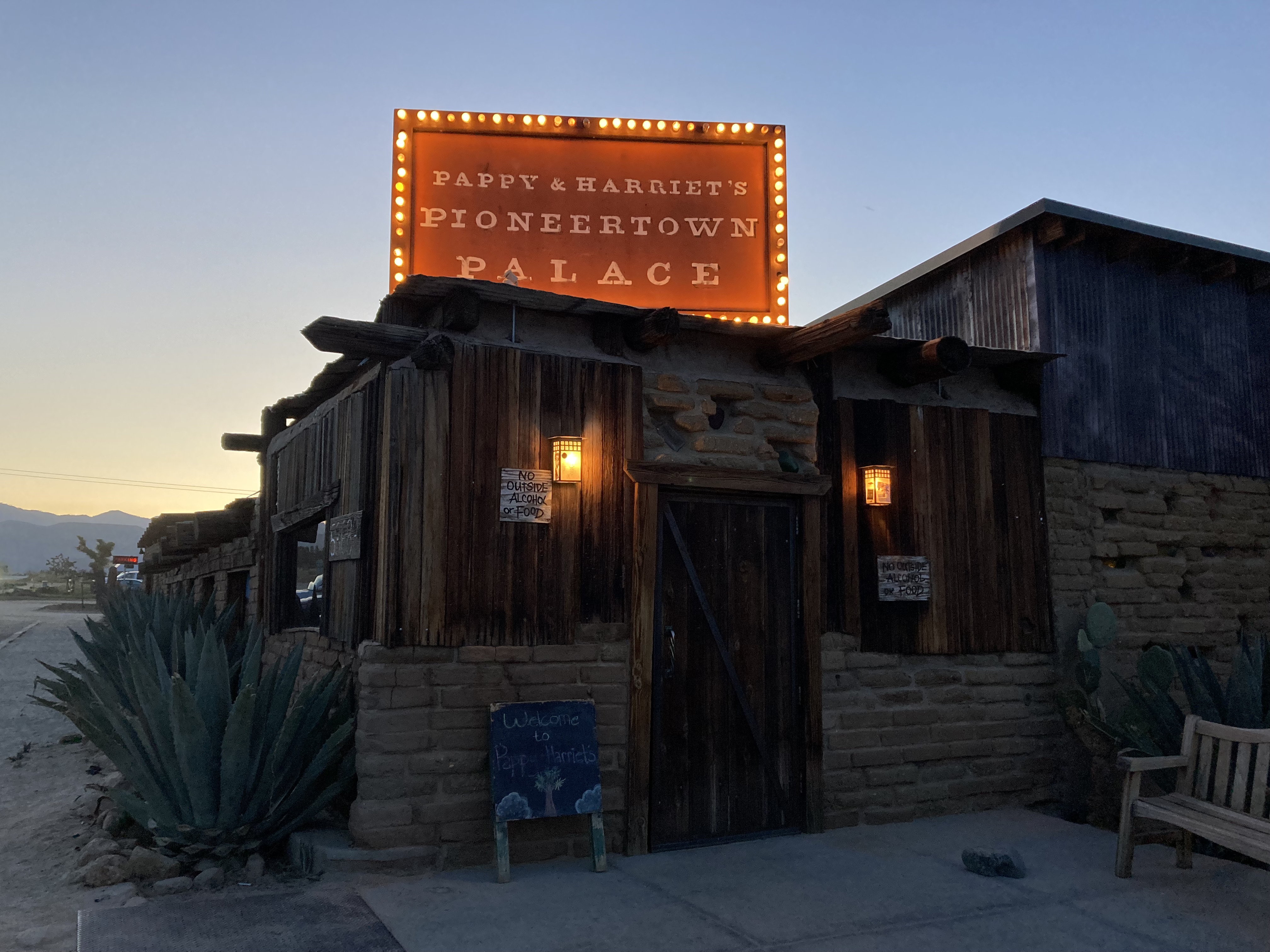
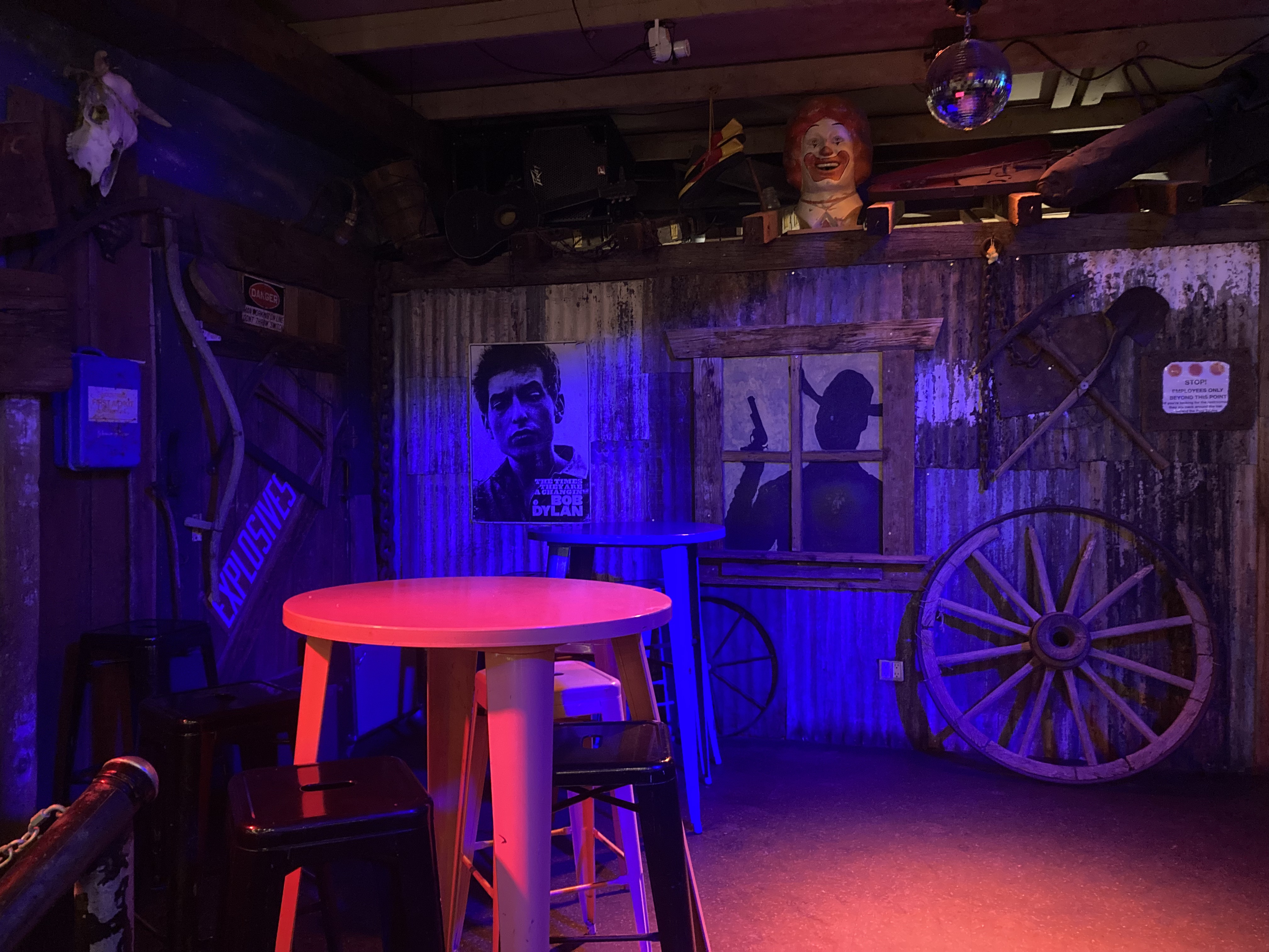
The second gem is Pappy & Harriet’s Pioneertown Palace. I first heard of this place via Anthony Bourdain’s No Reservations on an episode where Joshua Homme takes him there. It’s rustic, homey, edgy, and host to great live music.
If I’m being honest, Homme played a sizeable role in my initial draw to Joshua Tree. I love the high desert in general, and I think there is something uniquely special about JTNP, but knowing that this place is also steeped in music history that resonates so deeply with me – it contributes to that “X factor” that makes visiting a place extra impactful. I also feel like Queens of the Stone Age’s first album sounds like the desert (especially the track Spiders & Vinegaroons for an instrumental middle of nowhere ambiance).
I visited Pioneertown twice while I was in the area. On one afternoon I took my time walking along Mane Street and taking everything in. I bought some souvenirs and gawked over the weird, wonderful, vintage, and rustic. I finished the day off with some food and drink at Pappy & Harriet’s. Specifically, I got the Boilermaker, because that’s the name of a good song, and it gave me a chance to sample some local mezcal (which, I could be wrong, but I think must be a staple here in the high deserts of California), as well as a good beer.
On my second visit (because if you love a place you should definitely visit more than once), I went back to Pappy & Harriet’s, took the area in some more, and popped in to The Red Dog for a beer.
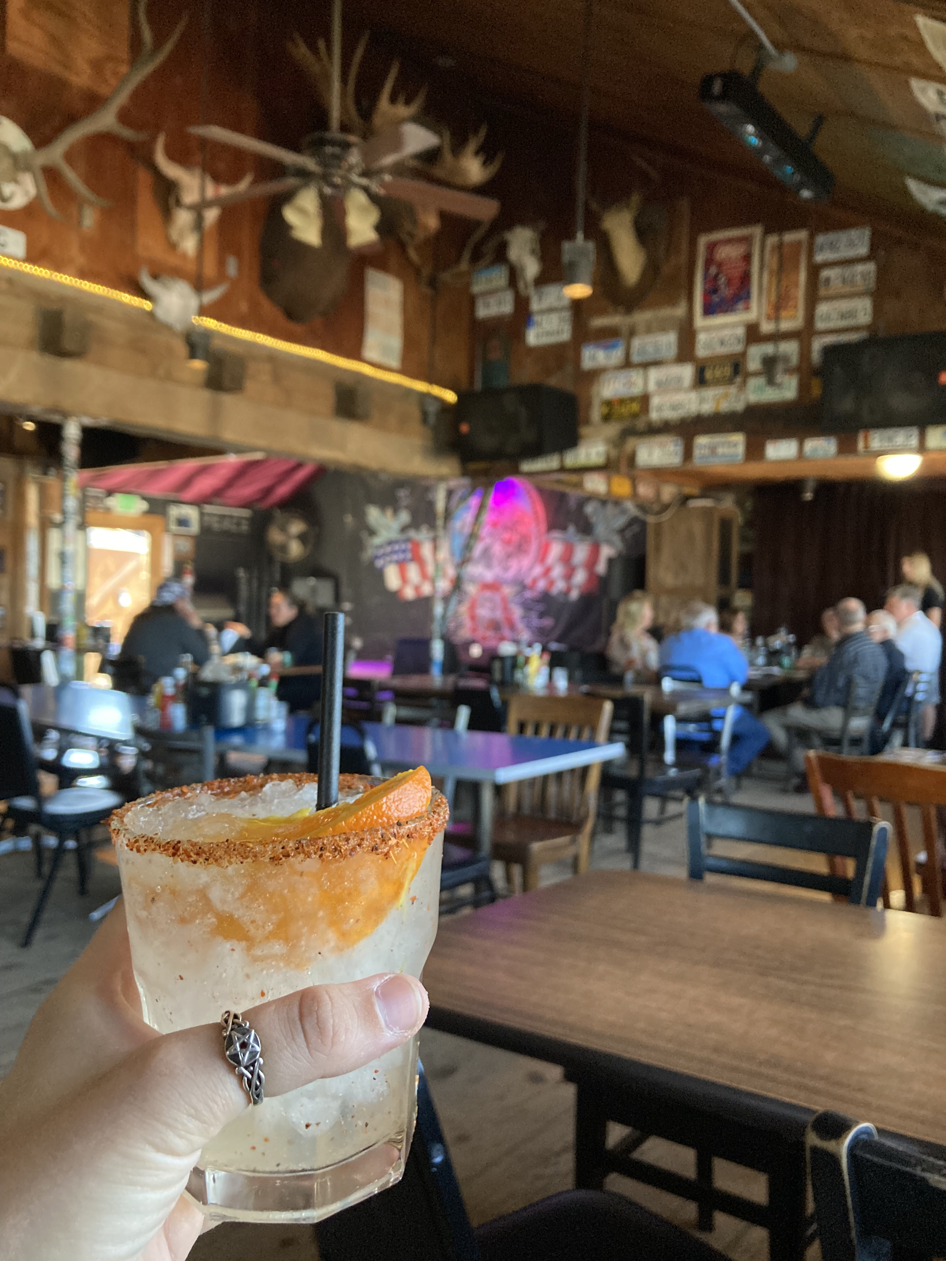
I should have gotten some barbeque at P&H’s, but I did try the Rancho Ranch Water, as I was on a mission while in Joshua Tree to get my hands on Rancho de la Luna Mezcal, of which this contained, and I wanted to sample it. I love to try local offerings, but this mezcal was extra special, as it is made by the same gentlemen (including Dave Catching) involved with Rancho de la Luna Recording Studio out here in Joshua Tree. There is a lot of music history associated with that place (like the Desert Sessions), but I just think the dudes involved are cool (there’s also their band Mojave Lords) and I wanted to take a piece of these layers of local artistry home with me.
The Integratron
Situated in Landers, CA, about 25 minutes north of Joshua Tree, is a place like no other: The Integratron.
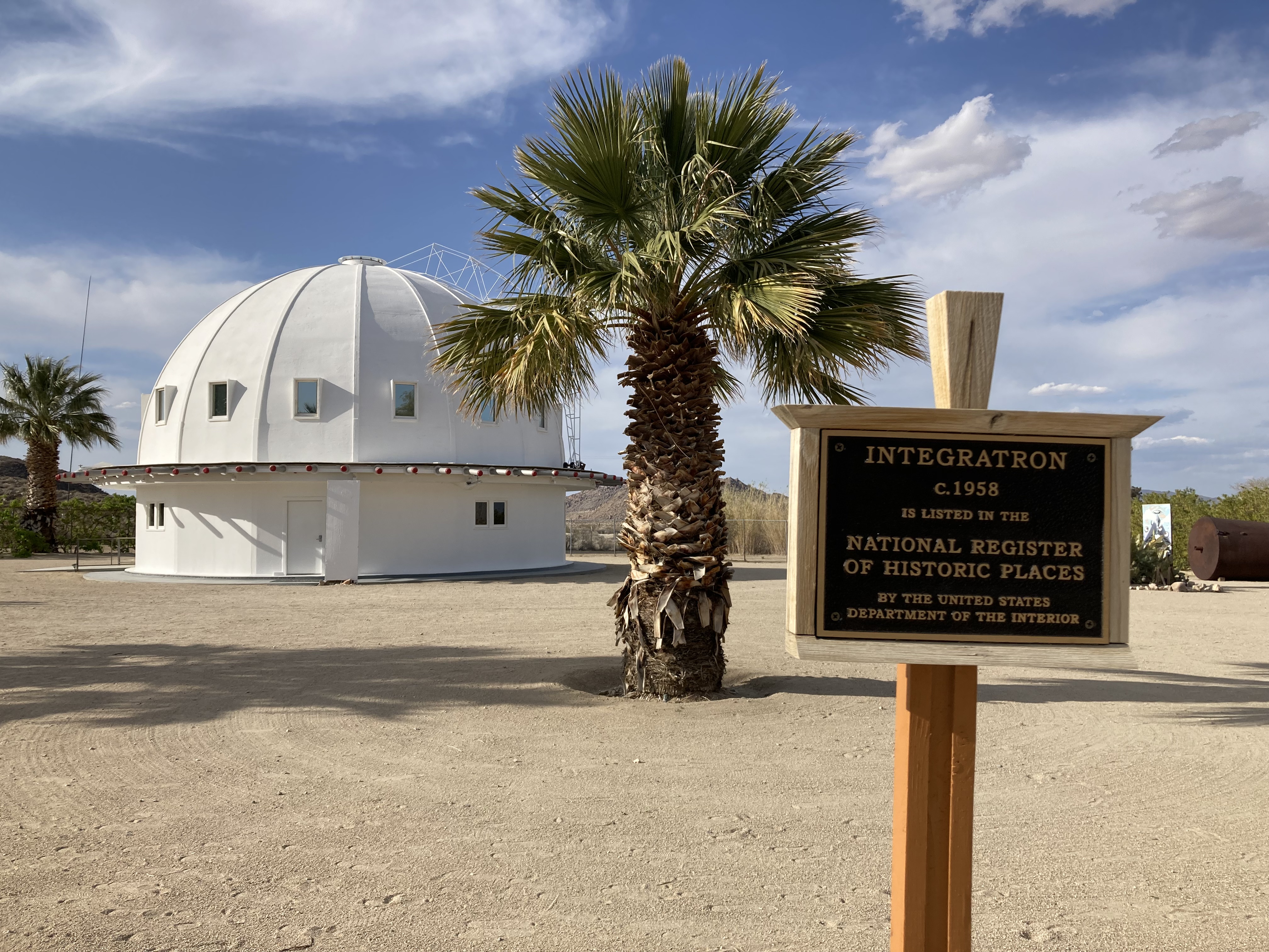
It all started at Giant Rock, possibly the largest freestanding boulder in the world, which sits a few miles north of the Integratron. This rock is 7 stories high and is thought to have been a spiritual meeting place between native tribes in the late 19th century. Around the mid-twentieth century a man by the name of George Van Tassel came into ownership of the land. He started holding meditations in a space under the rock, which led to claims of UFO contacts, from which were conveyed (allegedly) instructions on how to build the Integratron.
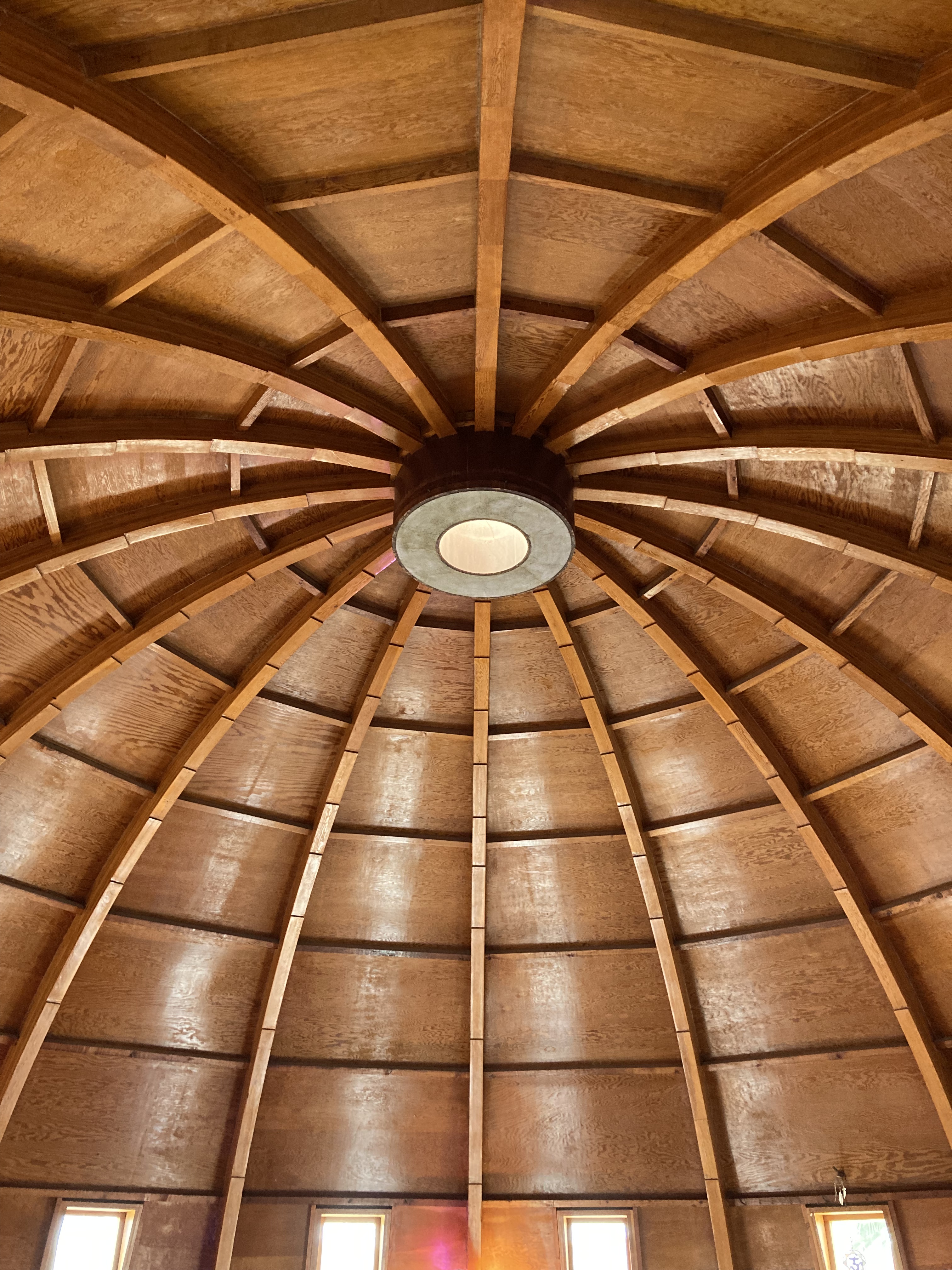
The wooden structure of the Integratron is said to be located at an important intersection of geometric forces, where the earth’s magnetic field is magnified by the geometry of the building. Van Tassel built this structure believing that it would allow for time travel and healing. Today, the Integratron hosts sound baths. Giant Rock was a site for UFO conventions for many years. Both are worth visiting if you are curious about this side of history and the world.
I did not drive all the way to Giant Rock sadly, as the drive requires overlanding, and my van is not 4WD. But I did do the sound bath at the Integratron (this is my second time doing the sound bath actually) – and I would recommend! You get to take in art and infographics on the lower level, and then climb to the upper level of the dome where you lie in a circle and the facilitator plays crystal bowls. The Integratron’s shape is such that it can do interesting things with sound (like when standing in the middle – sounds are amplified). It was a really unique, relaxing, and even emotional experience.
The Integratron grounds have art installations, bathrooms, and a lovely gift shop, too.
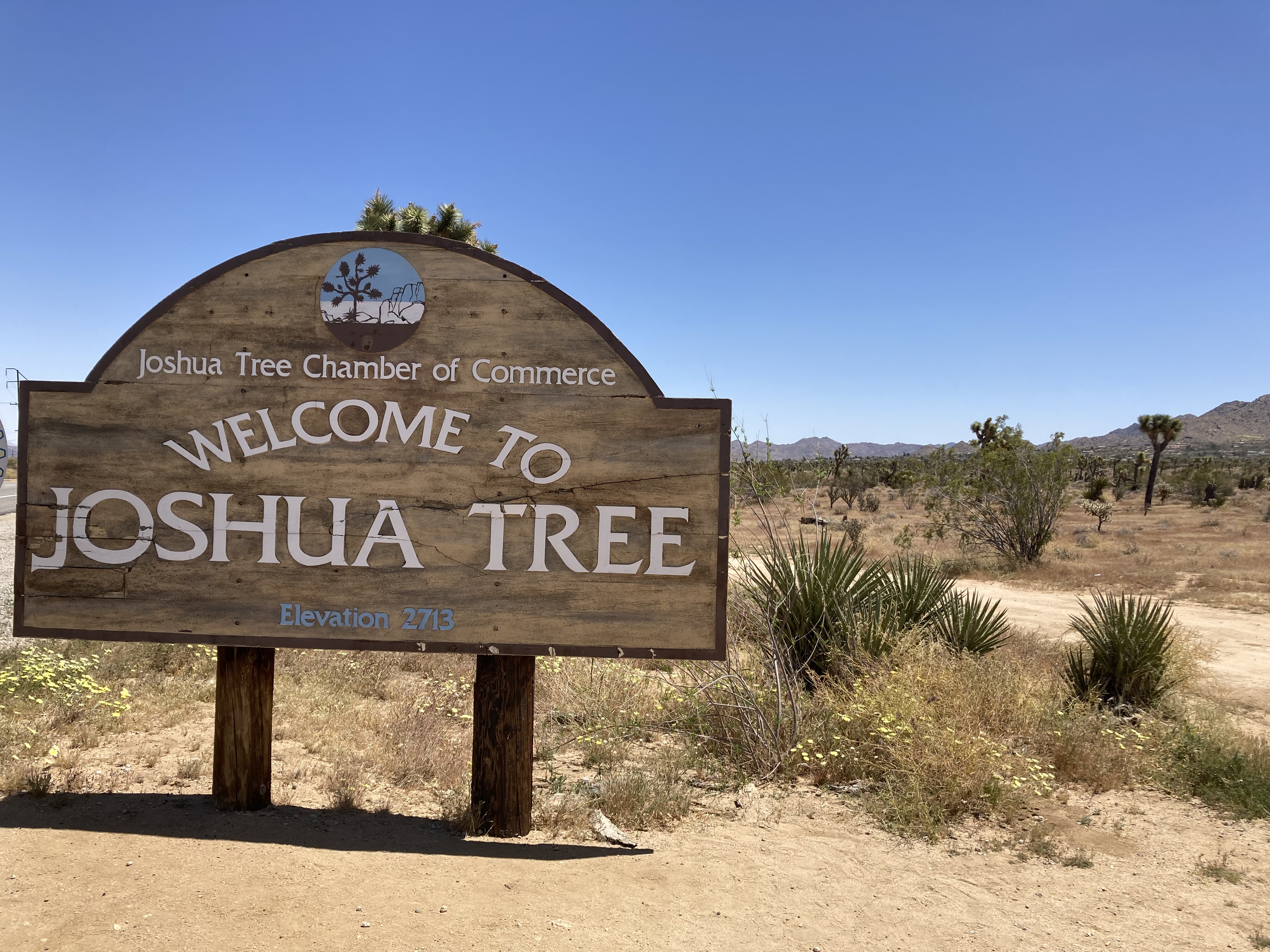
Joshua Tree
Joshua Tree is a small town of ~6,800 residents in California’s high desert (891m above sea level), located north of JTNP / at the western park entrance (Park Boulevard at 29 Palms Highway). Twentynine Palms (27,000 residents) lies 15 miles to the east and is home to the north JTNP park entrance, while Yucca Valley (22,000 residents) lies 8 miles to the west, home to a Walmart.
I think one of the charms of a place like this, which on the surface may appear to not have much to offer, is that if you open your mind, and dig a little deeper, there are a lot of gems to be found.
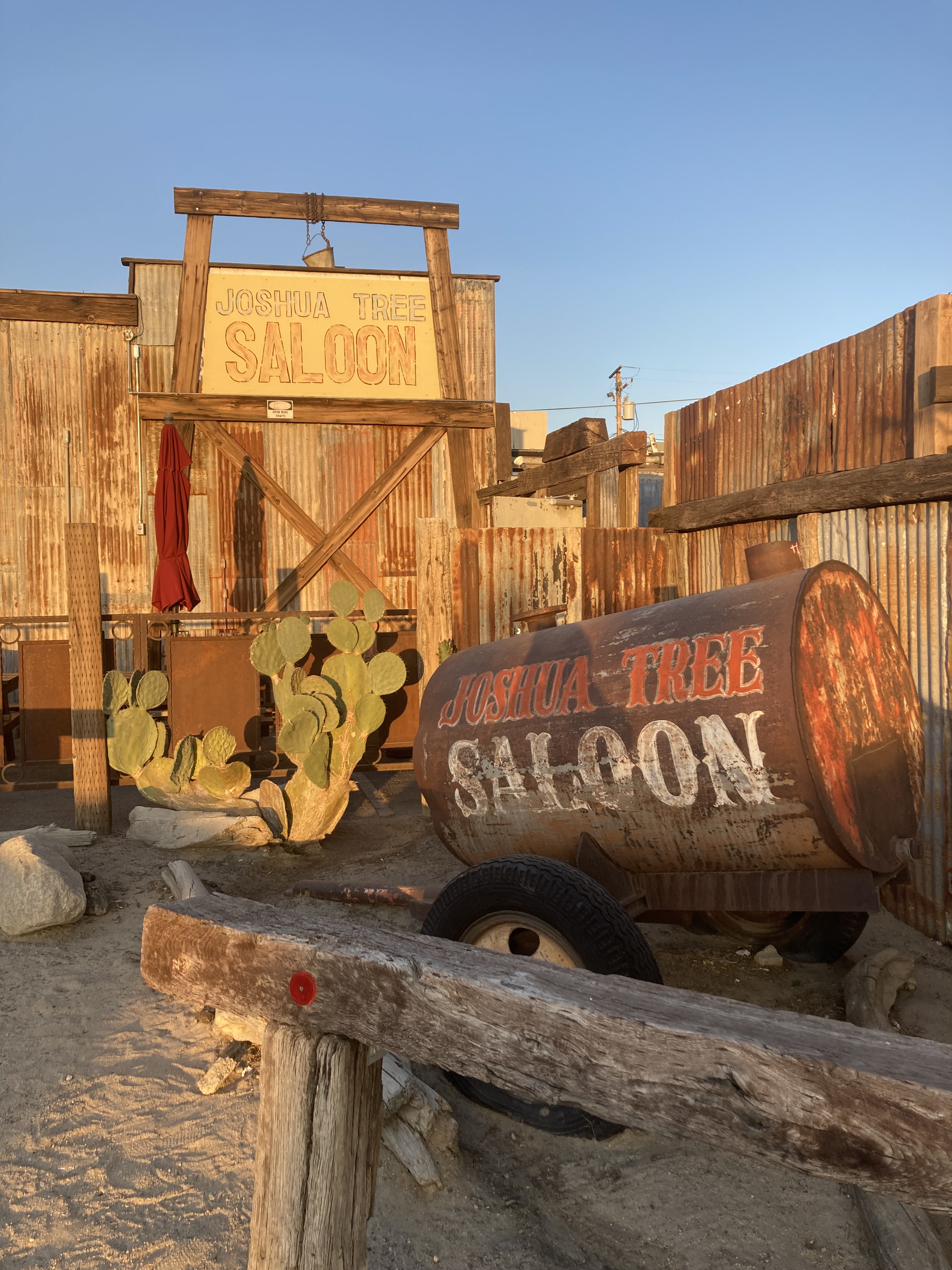
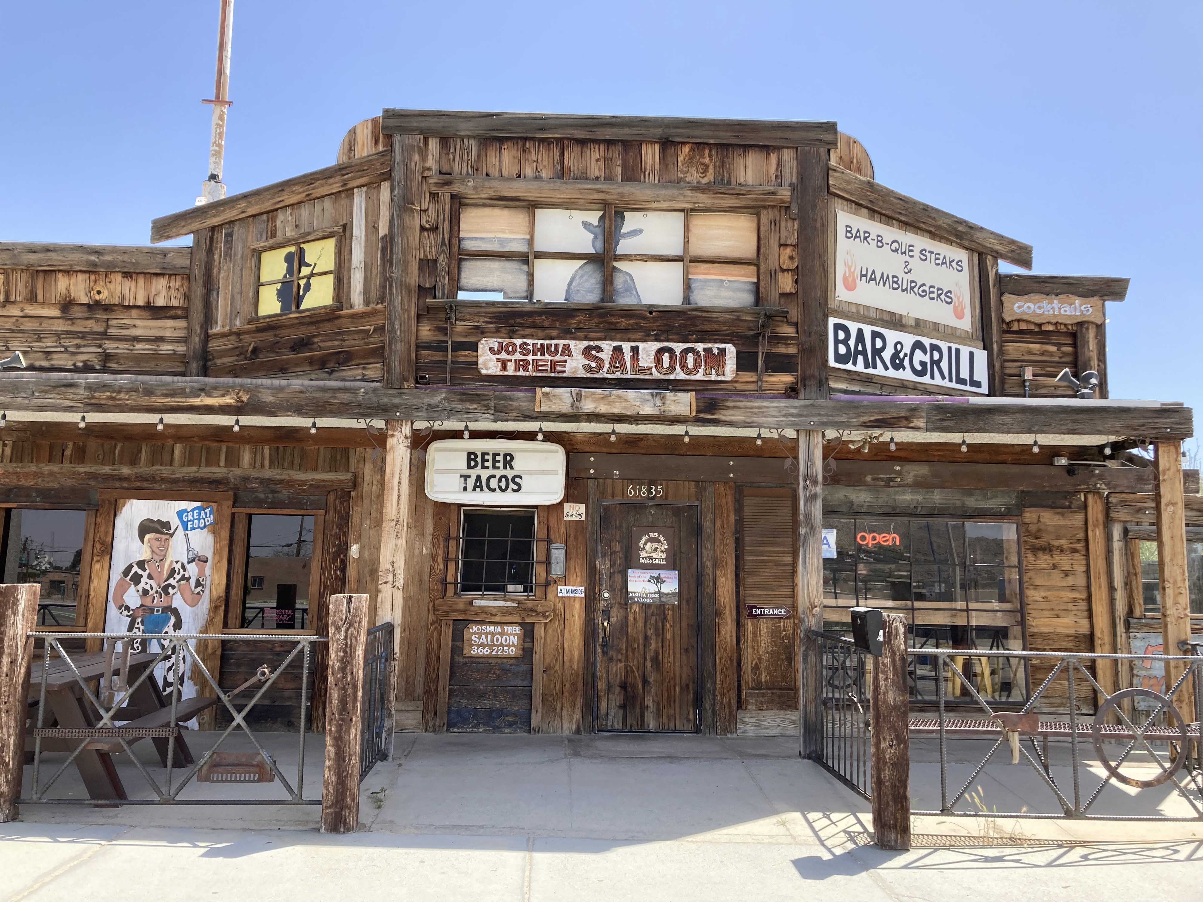
A nice little hub to branch out from is at the intersection of Park Boulevard and 29 Palms. You’ve got the Joshua Tree Saloon, a rustic restaurant for drinks and food. This seemed like a haunt for locals. I enjoyed a fish taco here and a pretty good Mexican Lager.
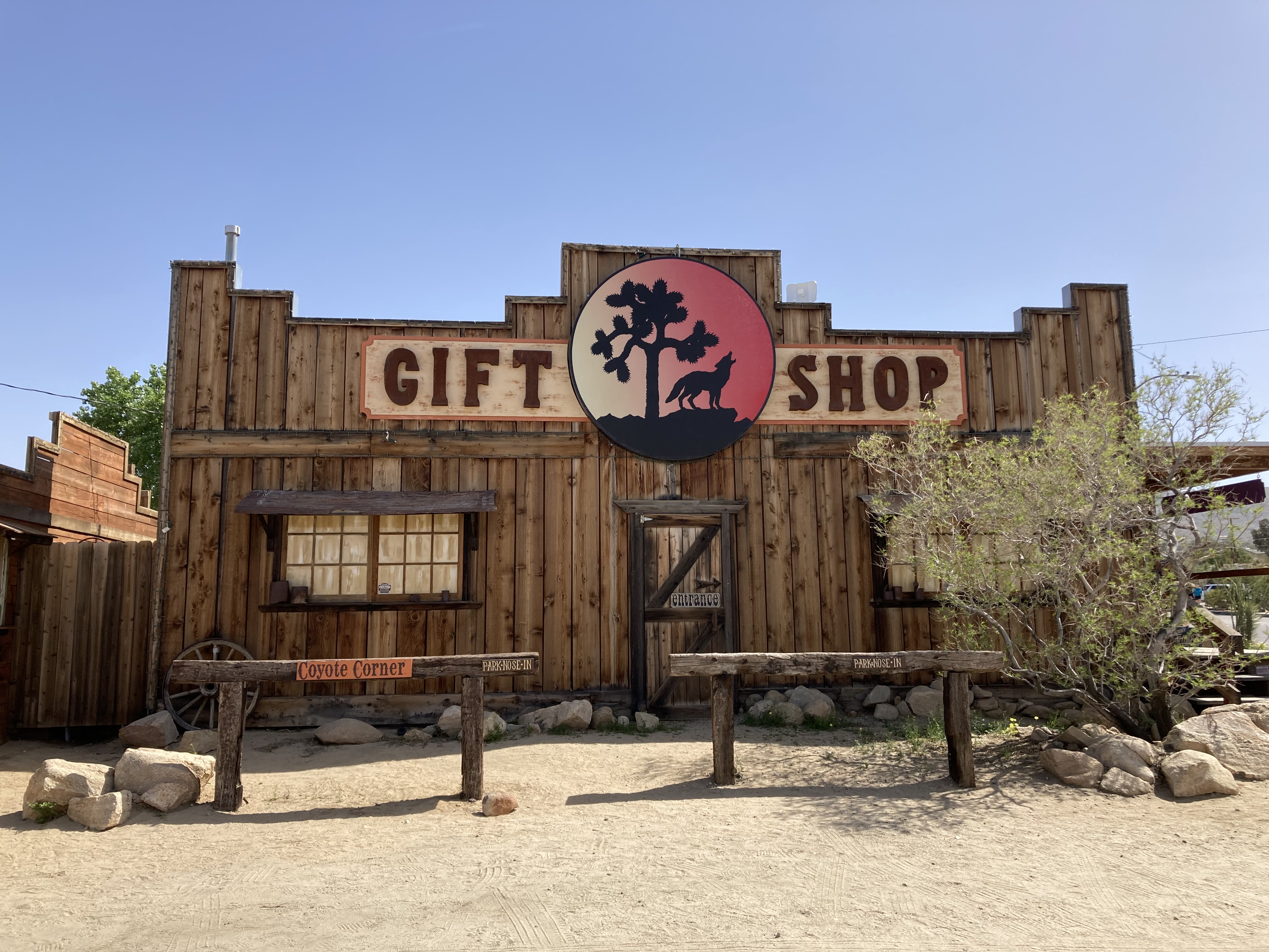
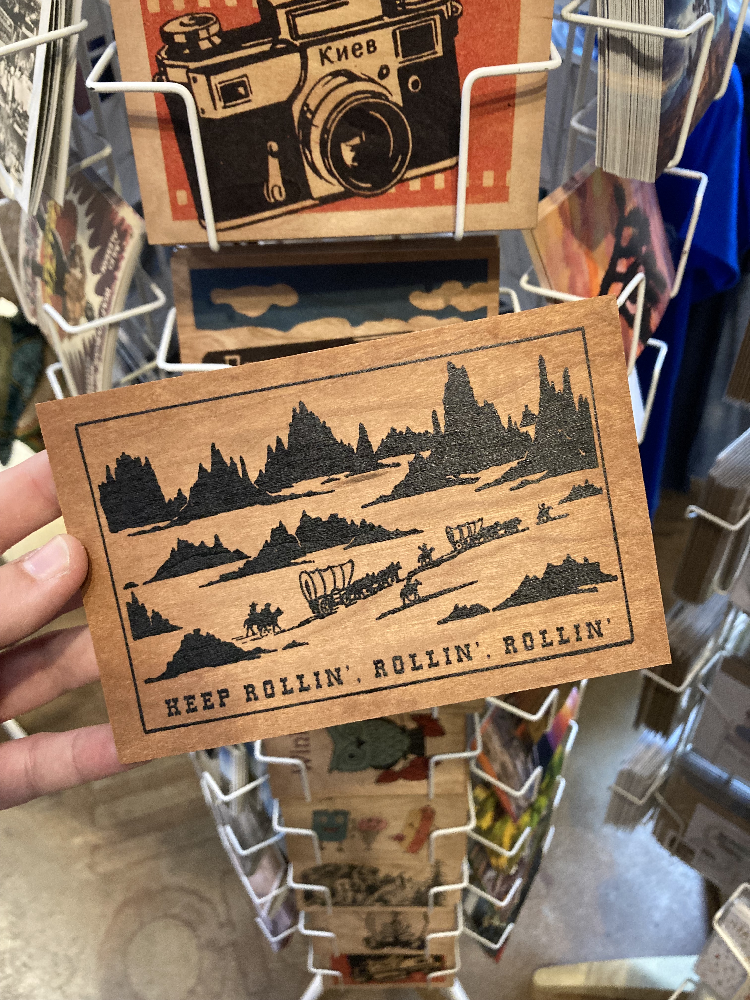
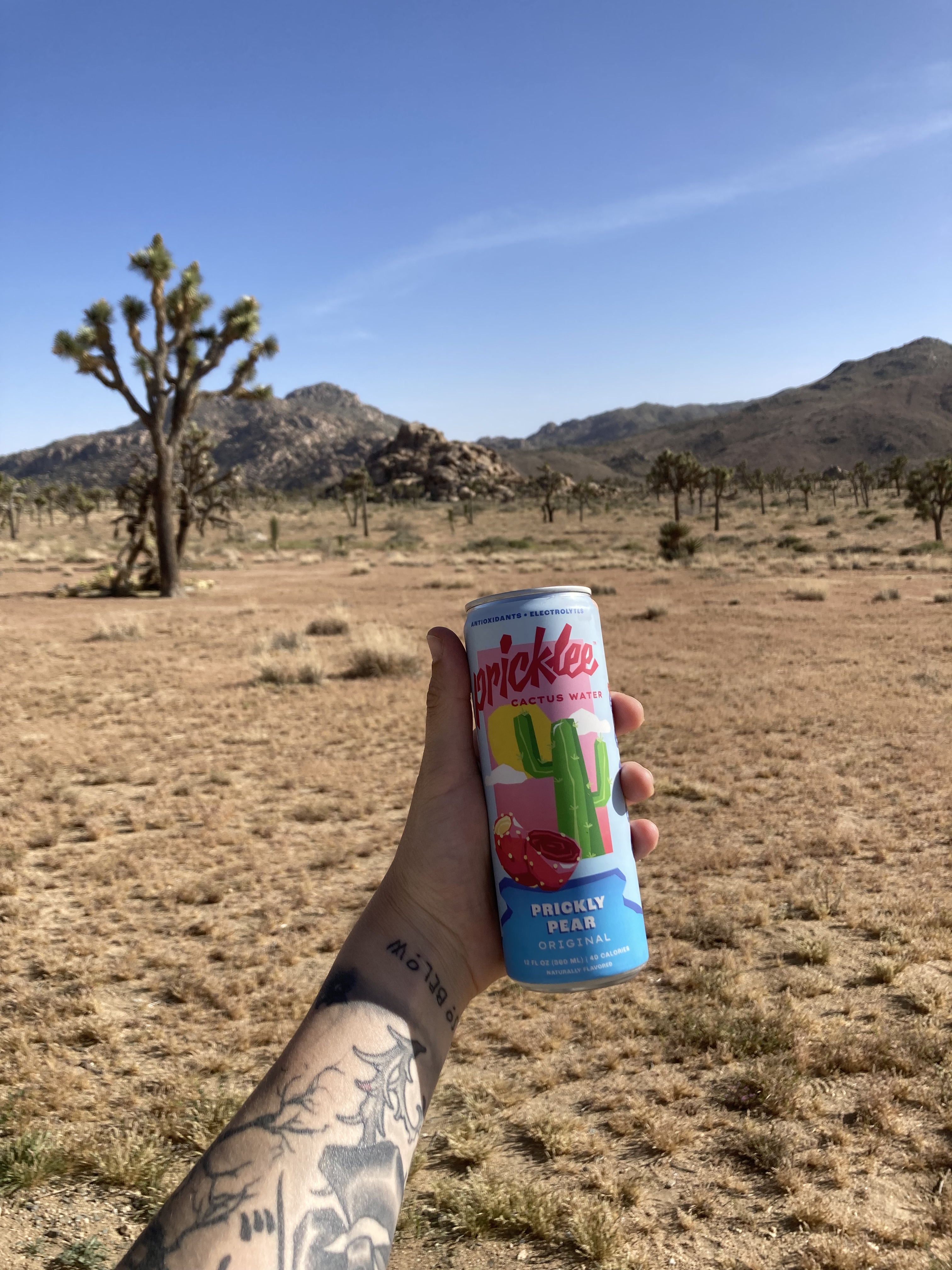
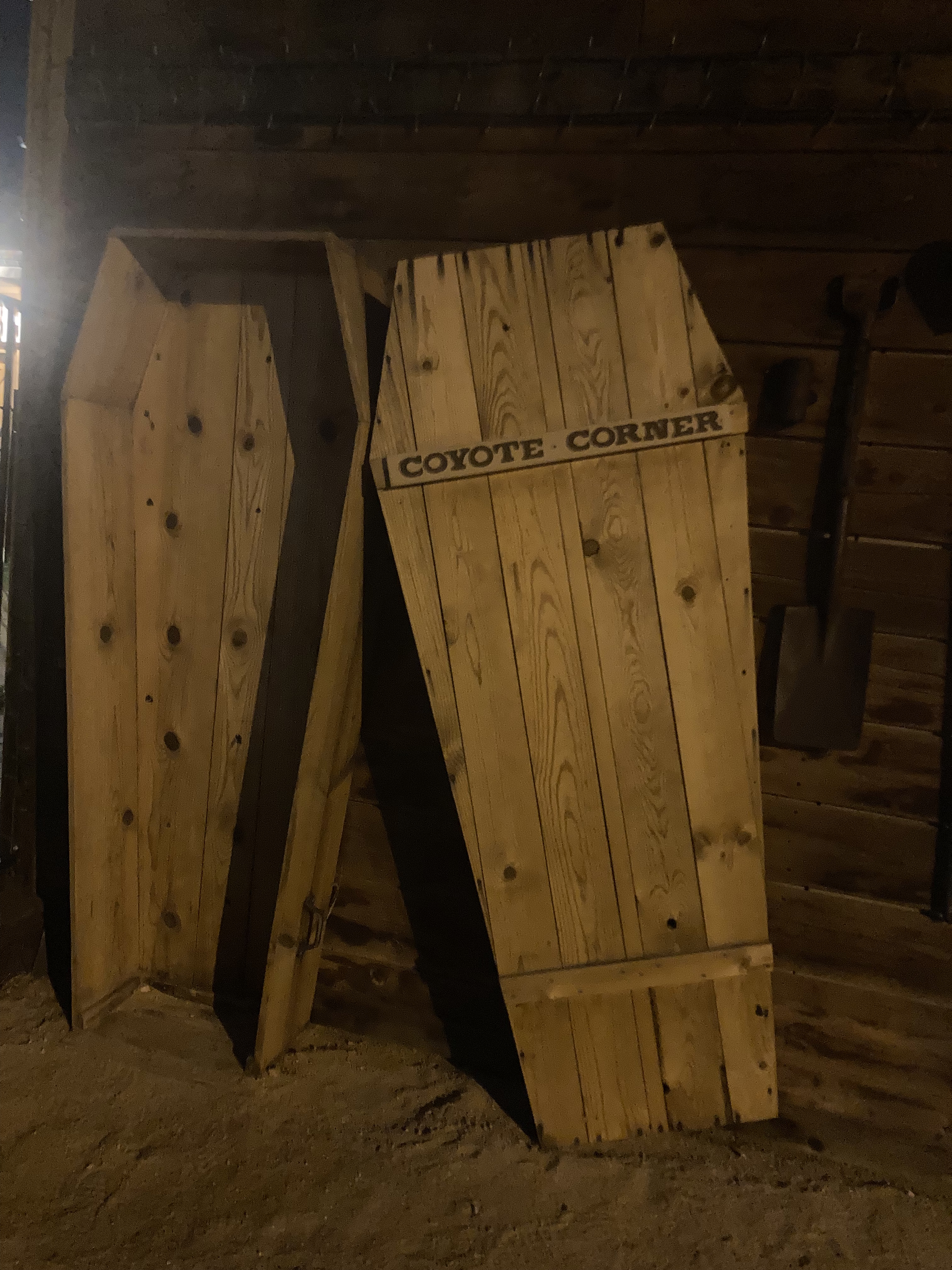
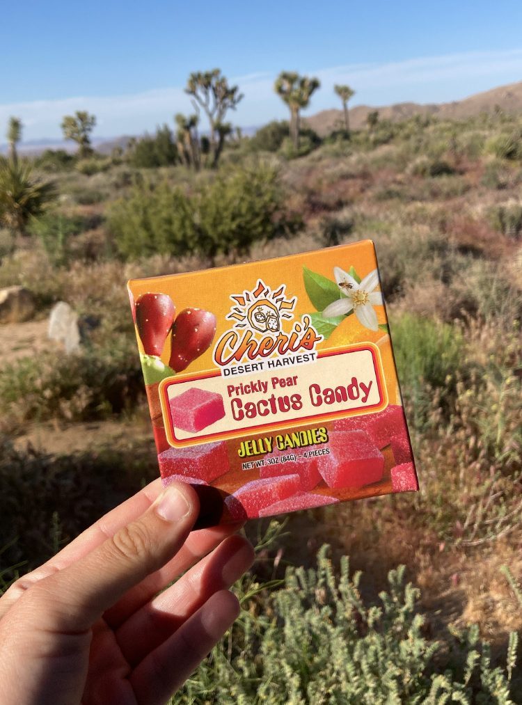
Next door is Coyote Corner, possibly the best little Joshua Tree and JTNP souvenir shop in town. They used to have showers that you could use, but those have been closed. I picked up some keepsakes and discovered prickly pear cactus water here – I tried to find a full case of the stuff, but it was not possible. It was so good.
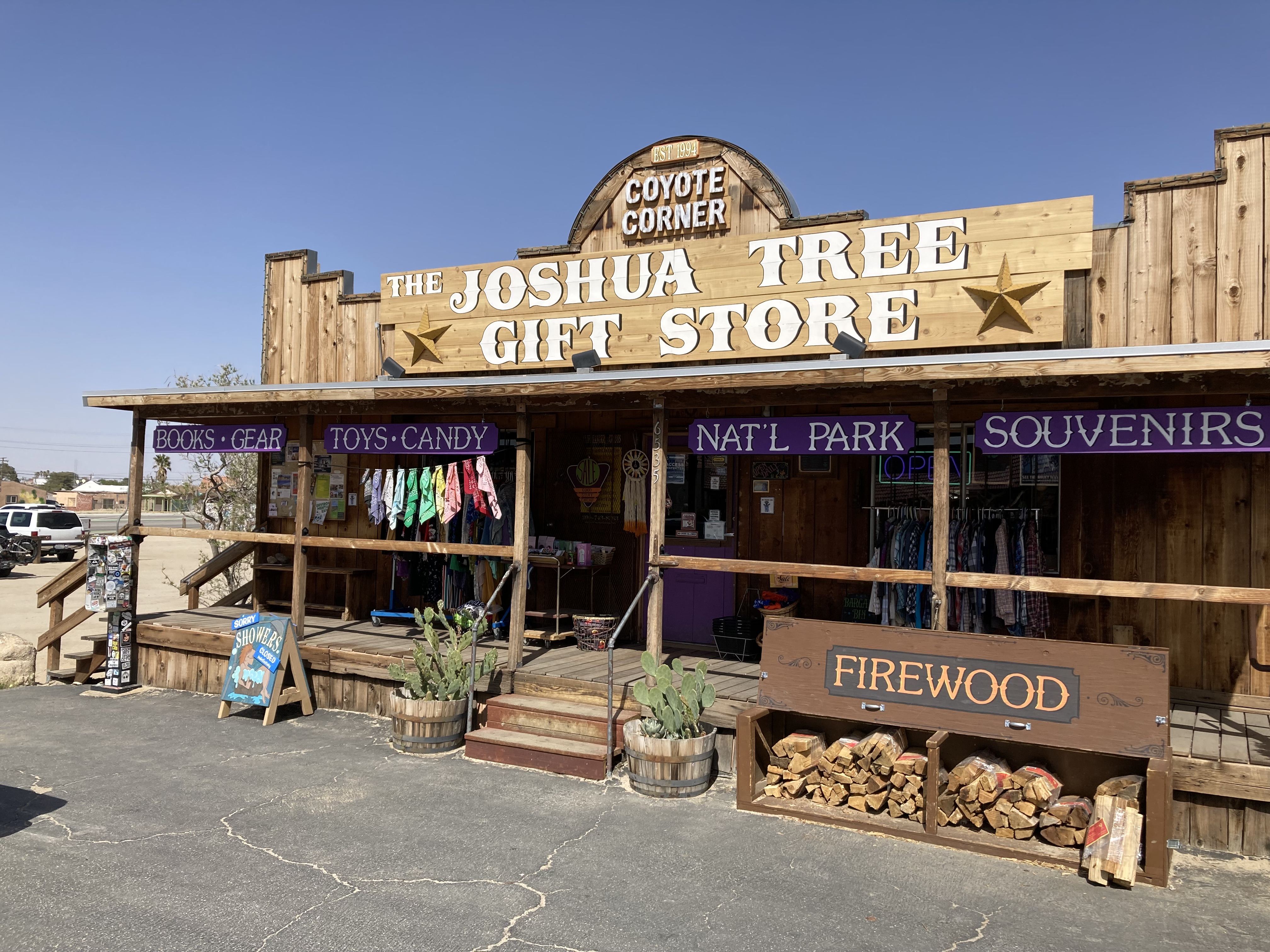
Across Park Boulevard from Coyote Corner you also have the Joshua Tree Visitor Centre and Roadrunner Grab+Go (good coffee – I loved their Mexican mocha cold brew, and they had sandwiches, and even bags of Joshua Tree Coffee Company coffee beans).
You can walk along the sidewalk on 29 Palms to more shops, like modern stylish general stores and bottle shops. It was along this strip that I found some unique beer at the JT Bottle Shop, and a bottle of Rancho de la Luna Mezcal at Mike’s Liquor (which was cheaper than the same bottle at the bottle shop). I planned to only break out this bottle when visiting with friends, to create moments with them, where I could mix them a drink and we could spend time together, inspired by the ethos of Anthony Bourdain. And I found a great recipe that would incorporate this mezcal, along with prickly pear syrup and lime juice, over ice – very tasty and felt like a treat from the desert.
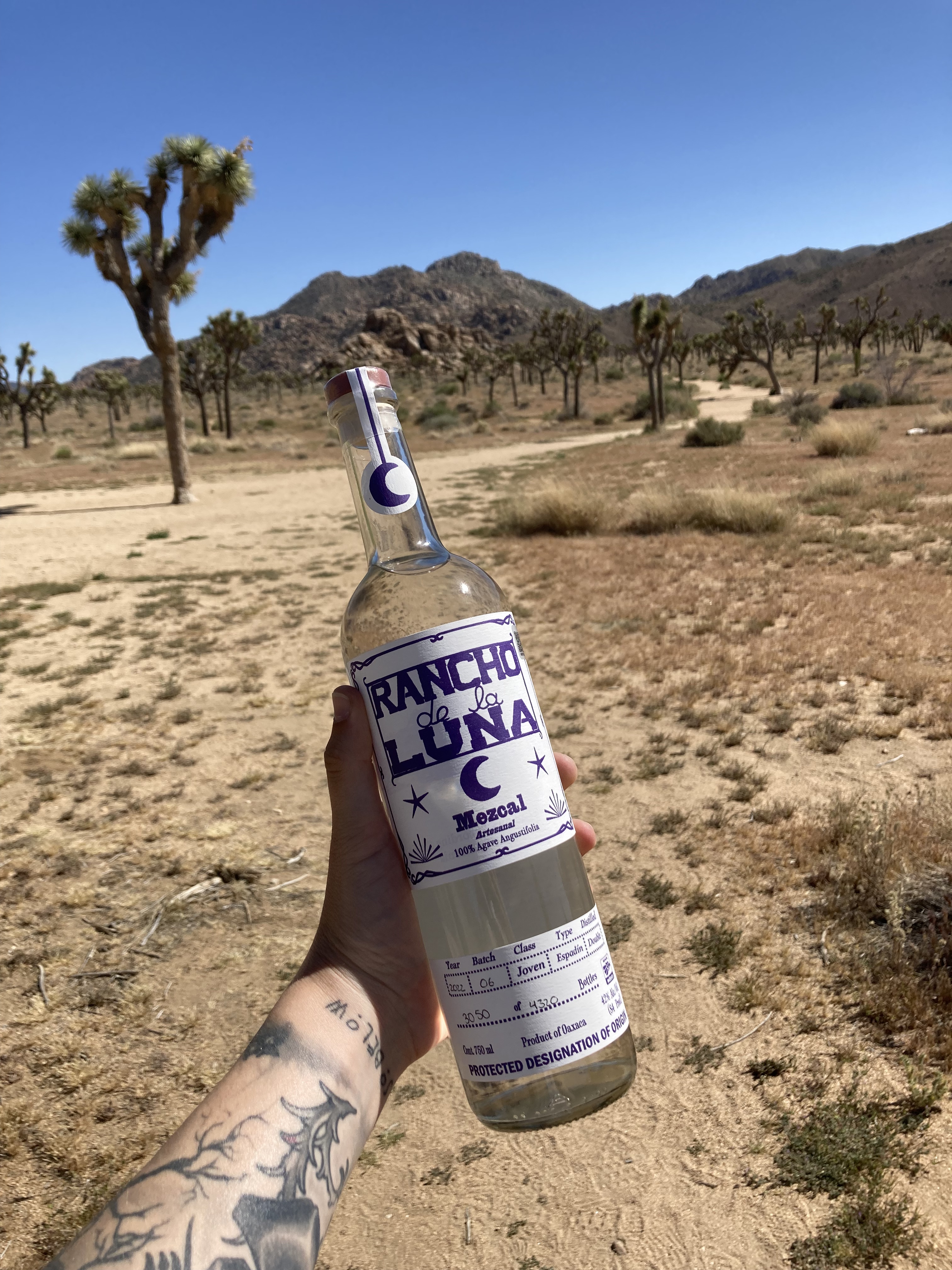
As I mentioned before, this mezcal feels special to me because it is created in conjunction with those who are involved with Rancho de la Luna recording studio, the Desert Sessions, and the Mojave Lords. If ever this recording studio were to give tours – I would absolutely check them out. As is, Rancho de la Luna is on private land, and unless you’re lucky enough to record there as a musician, seeing the place is probably not in the cards.
Also in this area along 29 Palms is a laundromat – which I used during my time here. As well as Joshua Tree Rock Shop and Brewja Elixir (hemp, CBD, adaptogens, herbs, tea), both of which I checked out. There’s also Grateful Desert Herb Shoppe, which I would go to in the future.
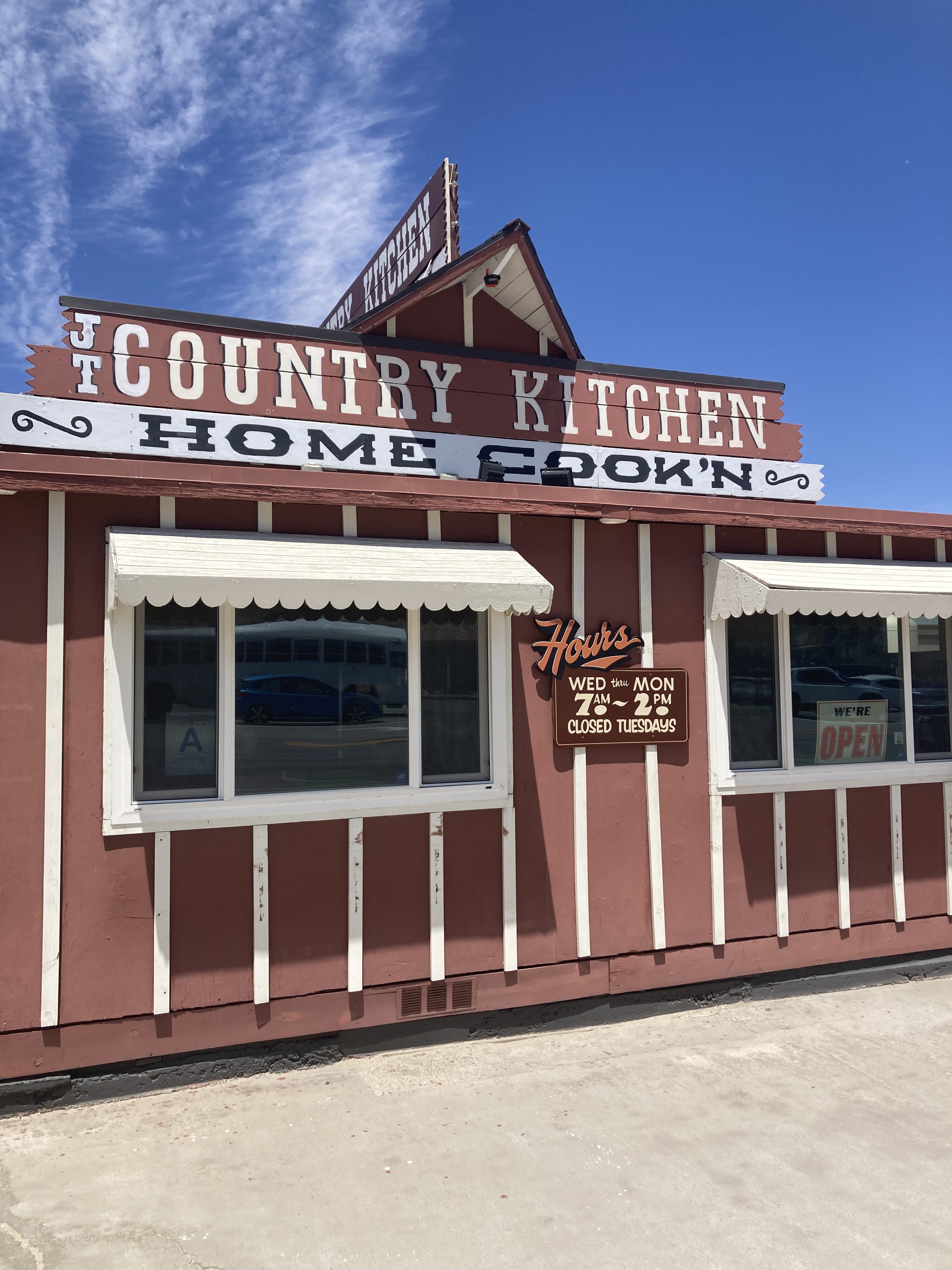
Across 29 Palms is Joshua Tree Coffee Company and JT Country Kitchen – which was also featured on Anthony Bourdain’s No Reservations with Josh Homme.
I’m sure there are many more places and things that I have yet to experience in Joshua Tree, and have not mentioned here. But I have made note of the Noah Purifoy Outdoor Desert Art Museum (open air folk art desert museum – once called junk art, now called assemblage art, reminding me of East Jesus in Slab City) and Joshua Tree Music Festival, which happens every May and October at JT Lake Campground.
There used to be a swap meet by the name of Sky Village Outdoor Marketplace in Yucca Valley. I’ve been there before, but they had limited hours this time so I missed them. Unfortunately, they’ve since closed (after decades of operation). It was another unique desert place that really put character on display and brought community together.
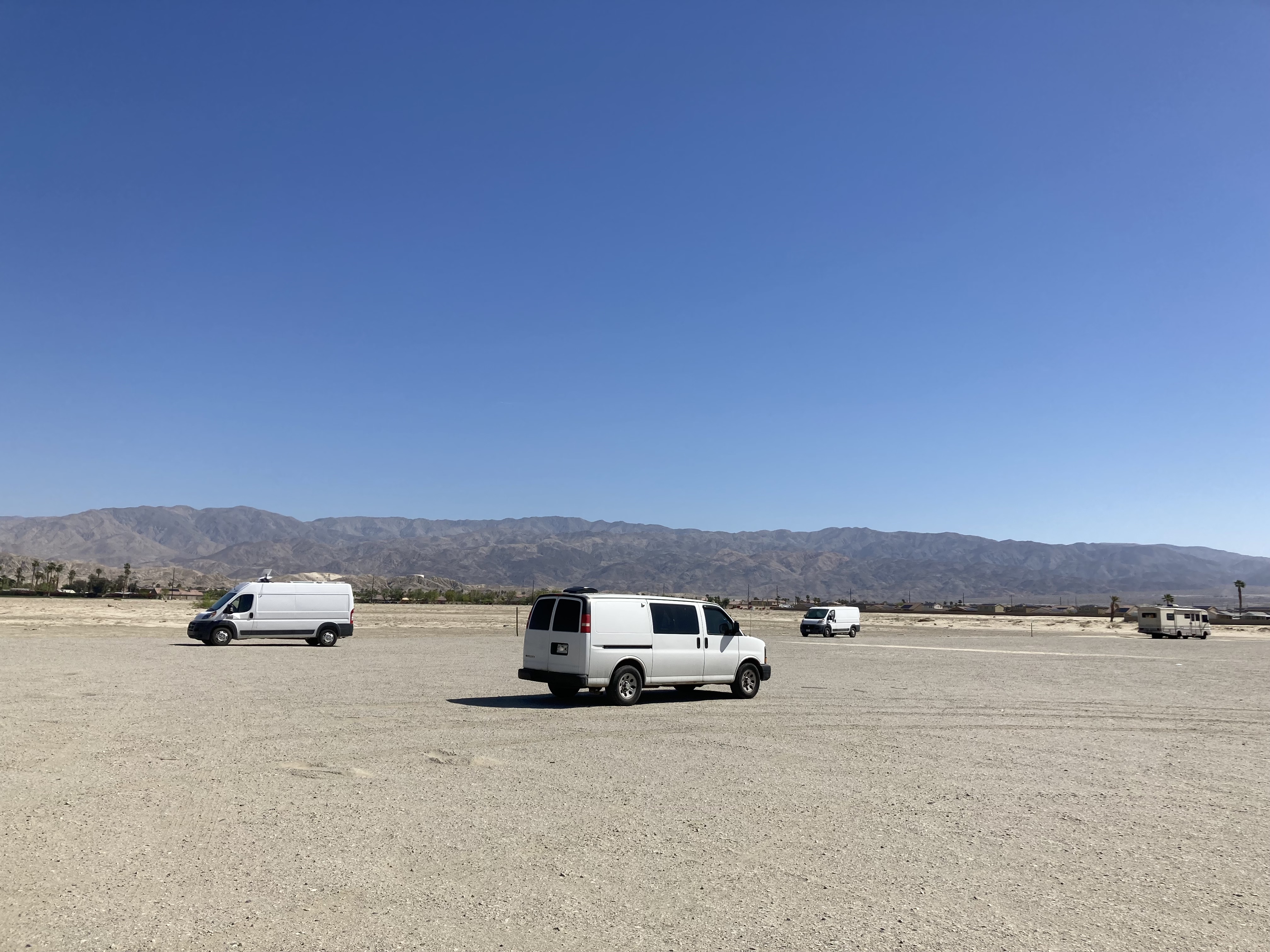
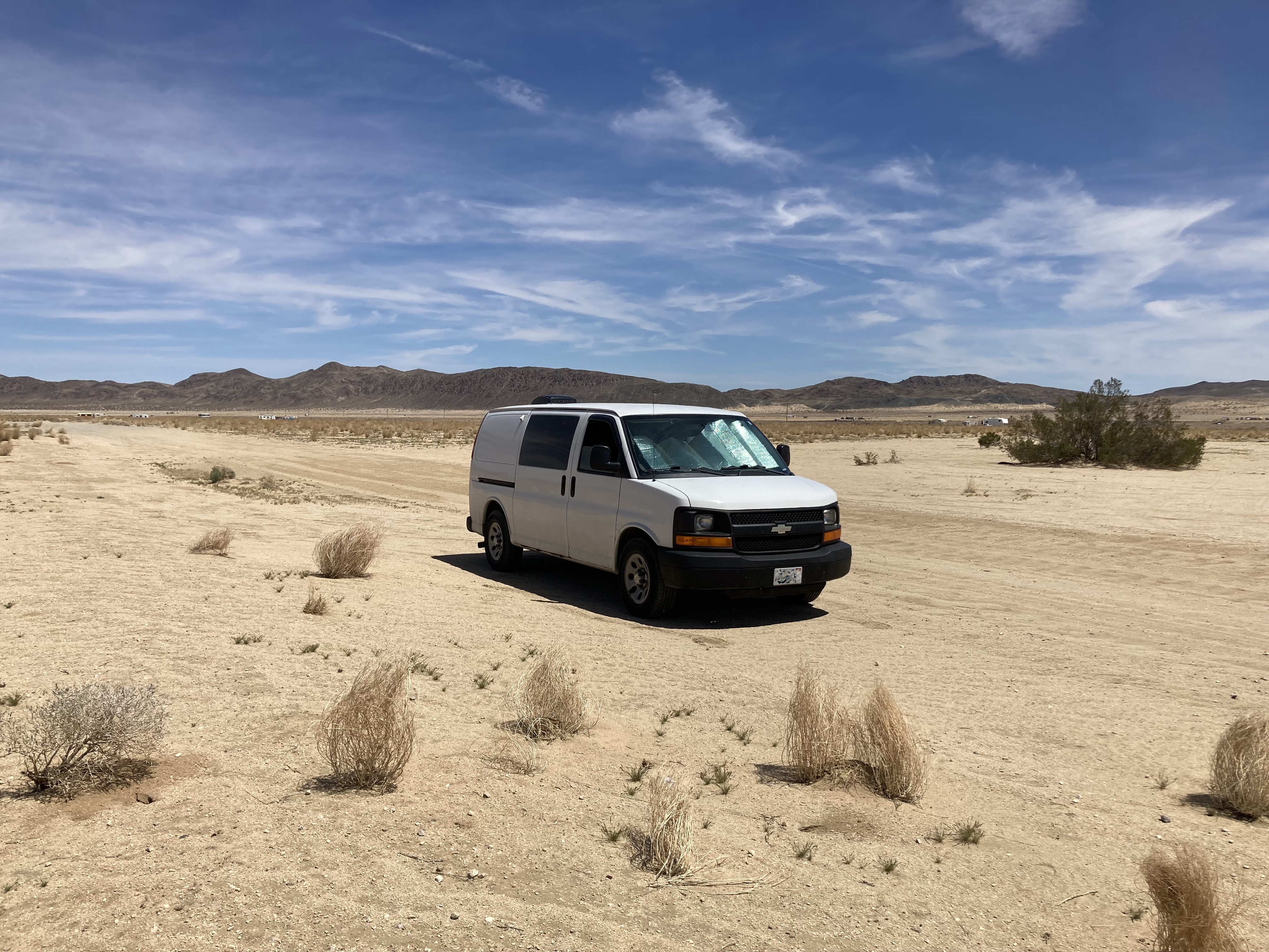
My JT BLM Spot
After my first day in JTNP I made my way to Joshua Tree for the night, finding BLM land which would become my home base for my time in JT. It’s a huge dried up lake bed where you are sure to find many other travellers, in vans, RVs, cars, and even tents. It’s been a few years since I was there, but now that I’m looking at the area on iOverlander it seems several spots in this general area have been marked as private property and have noted issues with homeless camps. But there are BLM areas around Joshua Tree, it just might require some extra research to make sure that’s the land you’re on.
You can stay up to 14 days within a 28 day period on most BLM land, so rather than vary my overnight spots in Joshua Tree I was able to simply stay in this one area each night. It was really nice to have a break from not knowing where I’d be sleeping or last minute scouting of spots. After being on the road for a while the constant unknowns and changes and adaptation can wear you down. Knowing where you’re going to lay your head at night takes a load off.
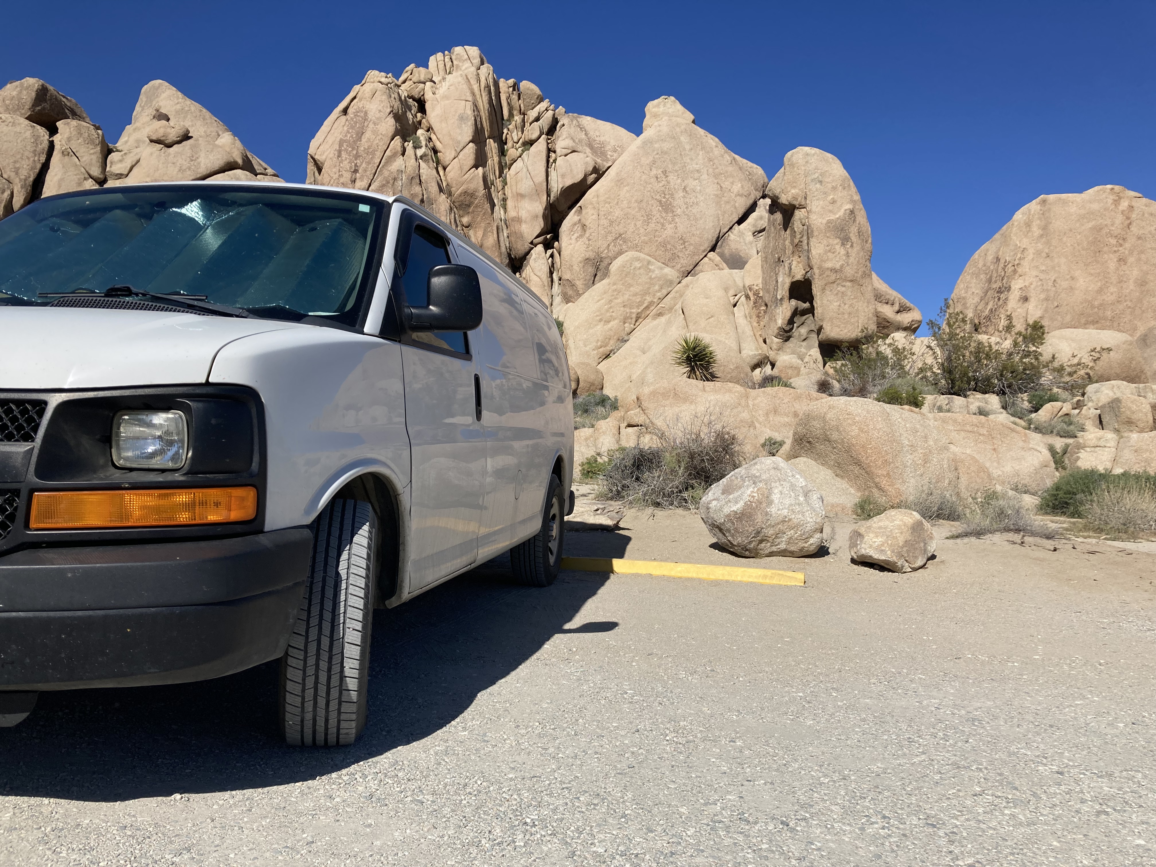
This spot was largely flat, but did have bumpy land and potholes (especially on the main track), but I just took the driving slow. Cargo vans are not factory made for overlanding.
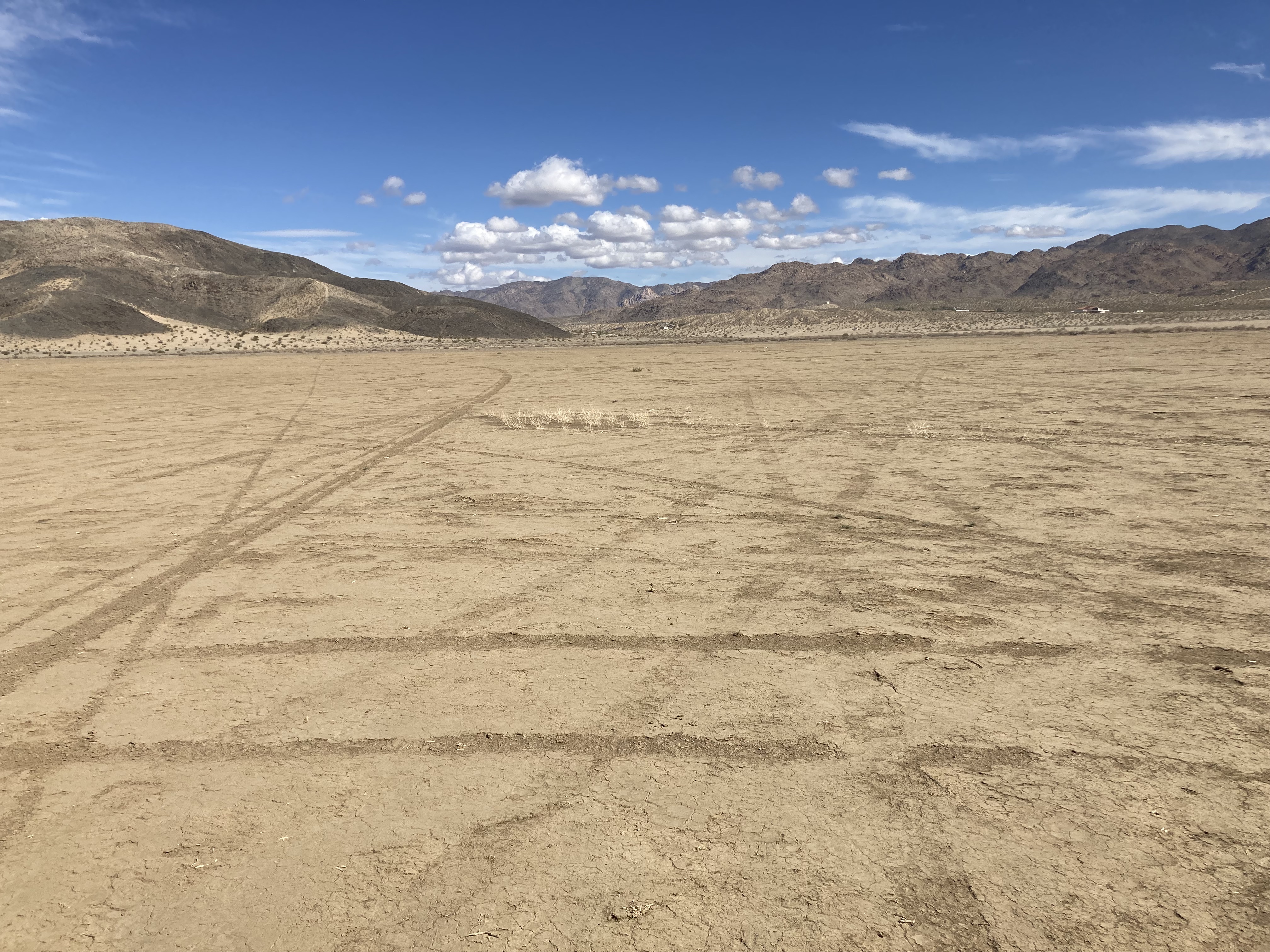
While it is necessary to be careful of sandy land so you don’t get stuck, this land was really dry, hard, and packed down.
My first night or two at this spot I stayed closer to the entrance – partly because I arrived after dark and hadn’t had the chance to explore in daylight what my options were. Eventually I would settle on a spot further in, away from others, where I could feel like I had my own space. It was glorious.
Two notable things happened here. First, there was one night where shortly after I’d arrived I heard a vehicle pull up next to me. This is the sort of thing that puts me on edge – because why would someone park right next to you when there is so much open space? It just feels sketchy. I’ve had this happen on multiple occasions in Walmart parking lots where smaller vehicles pull up to the side of my van opposite the store entrance (and I’m usually at the back of the lot) – so it seems like they’re hiding behind me. Every time this happens it stresses me out. It just feels suspicious. Nothing happened, and the guy in the car waved at me in the morning. But beyond the safety concerns I’m also a person who wants my space. Don’t get me started on the way people will park right next to you in a deserted grocery store parking lot, when they could have parked anywhere else.
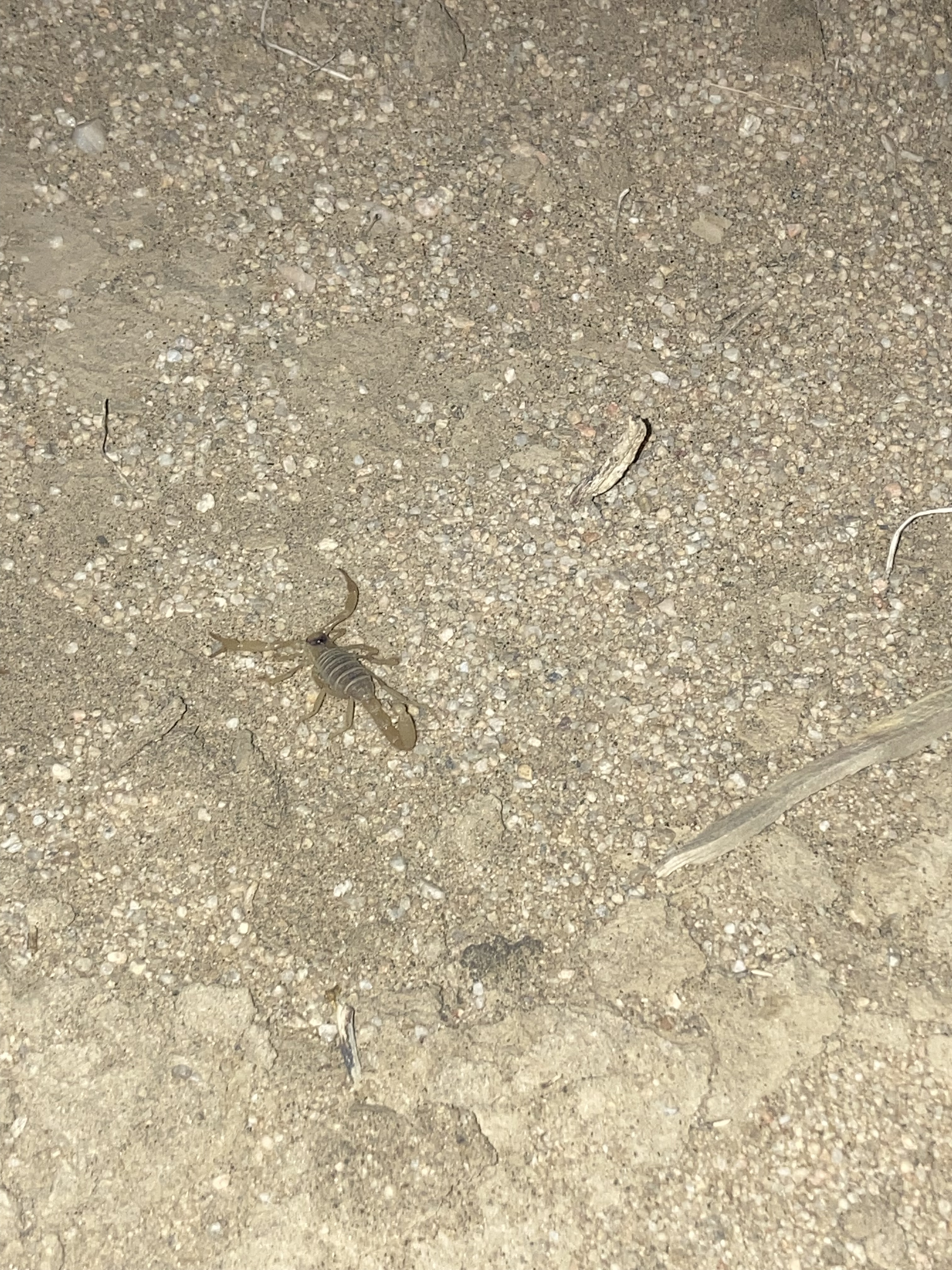
The next notable event at this BLM lakebed was that I saw a scorpion! I had been hoping that at some point in Joshue Tree and the desert I’d see a cool animal, ideally a scorpion, even a tarantula, in the wild. And in the most unlikely scenario, I was pulling in to the BLM land, it was pitch black so I was driving slowly, and in my headlights I see something moving not far ahead of the van. I realize it’s a scorpion, put the van in park, and cautiously run over with my phone flashlight (which was not a huge help). I crept closer to the scorpion and I could feel the adrenaline. Because I was so excited, but also feeling a primal fear that I would imagine is built in to every human being and creature in the face of an animal that can wreck you. I knew that the most deadly scorpions are typically the smaller ones, and this was a smaller one. It was a rush. It was so cool. The scorpion paid me no attention, it must have been focused on its night hunt. I was so happy!
I did wonder whether scorpions could somehow find their way into the van. But none did.
Obviously, this is a super open and exposed place with no shade whatsoever. So I started parking in the evenings directly facing the sunsets, so that in the mornings the back of the van would face the sun as it rose. This kept the sun’s warmth on a smaller surface area and not shining in through any of the non-tinted side windows up front (I only had reflectix covers for the tinted cargo bay windows). I found that this delayed the heating of the inside of the van. And of course I had the front window cracked and roof fan up so I had a draft flowing through overnight to keep things cool. And on that note, I will say that it was wonderful to be in an arid climate where the van could dry out and I didn’t have to worry about condensation or mold in the van.
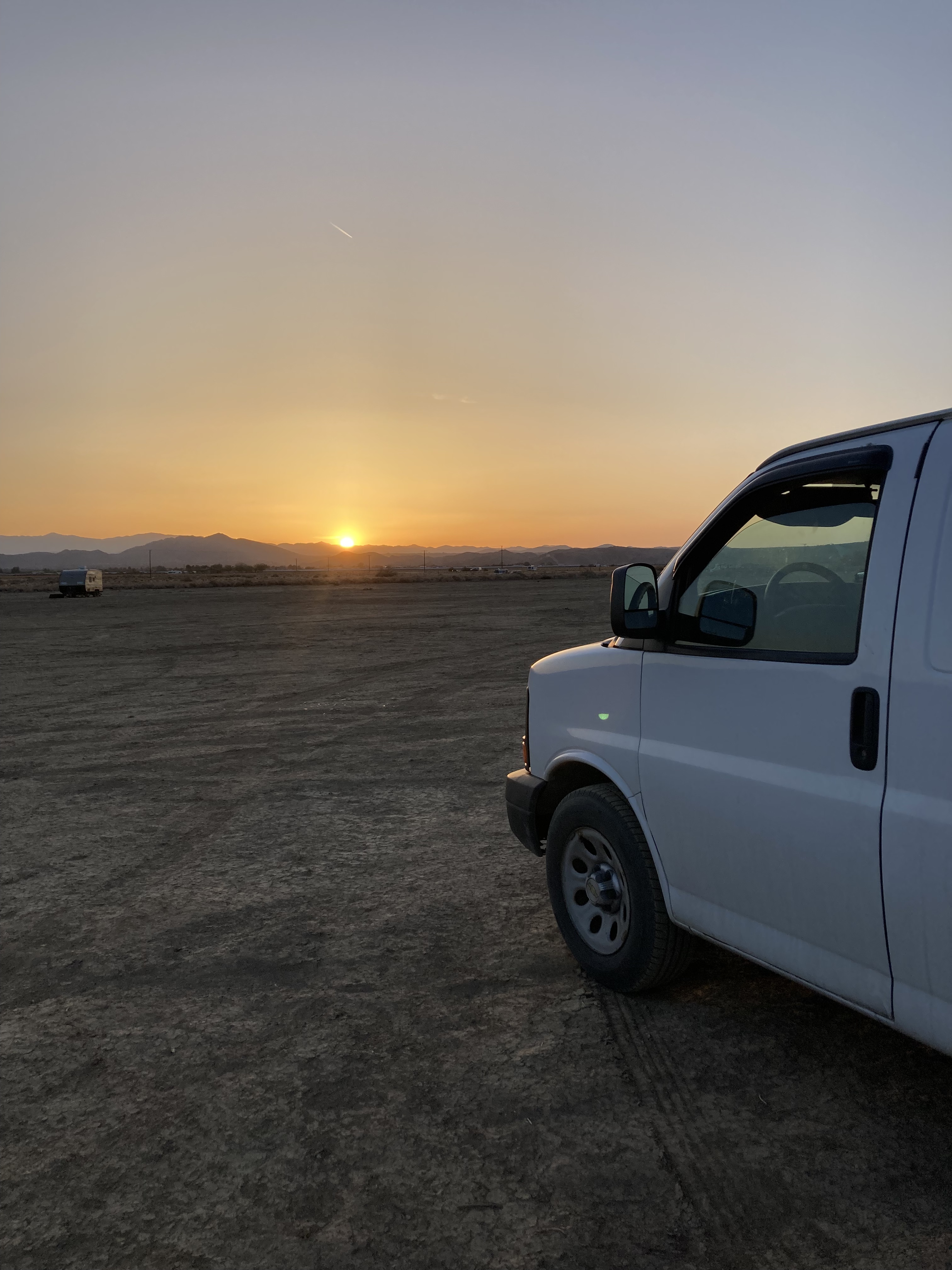
I thought I would miss the ocean sunsets – and I did – but I also enjoyed these desert sunsets!
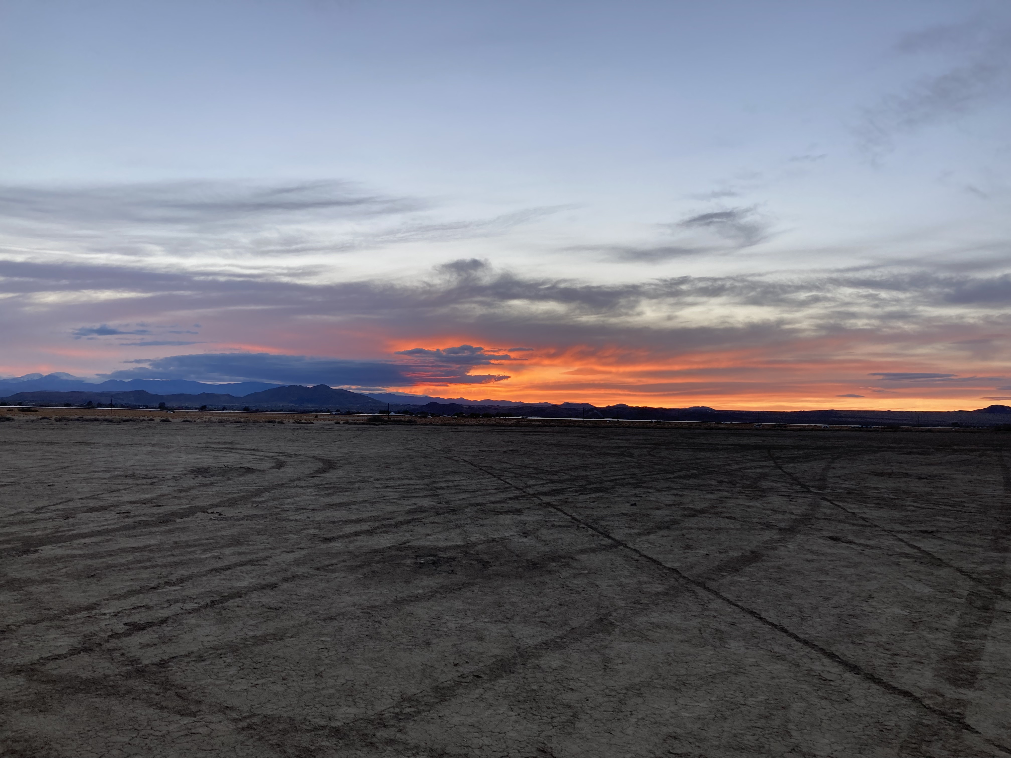
This was a haven where I could just relax. It was so peaceful to not have to worry about prying eyes or busy roads or a midnight knock. It felt liberating and restorative.
I definitely grew attached to this spot and was sad to leave.
Misc
There were a couple of days in Joshua Tree that got up to about 35 degrees C. Some nights didn’t cool down below 20. One thing that helped a bit in getting away from the heat was going into JTNP, where it was a few degrees cooler due to the elevation. I did find that I’d acclimatized remarkably well to the heat though (and it helped that it was dry). I think I was there during a heat wave – because of course my last couple of days in Joshua Tree the highs were only around 20-21 degrees C (with an overnight low of 9)! A far cry from 32-35 degrees C.
I had found a mead by Joshua Tree Brewing Company at the bottle shop in Joshua Tree, but I didn’t go to any breweries in Joshua Tree. There also is no brewery in Joshua Tree itself. If you go over to Twentynine Palms, Joshua Tree Brewing Co. has limited hours on the weekends, and there’s also 29 Palms Beer Company. I’ve seen a place called Desierto Alto in Yucca Valley mentioned, which is a wine store that apparently has a good selection. But other than that it’s not a big brewery scene.
After someone else pointed out the connection to me, I got to wondering if Joshua Tree was, in an odd way, a place where I could feel close to my Dad. He’d never been here, to my knowledge. But he’d worked with NASA and used to take us star gazing as kids. He also worked as a camp counsellor when he was young and would point out constellations to the kids. JTNP being a dark sky zone, ideal for seeing the stars – it’s kind of a nice tie in.
Mezcal Drink Recipe
Having been on the hunt for a mezcal, and never having tried mezcal, you know that I looked into what it is. Mezcal is like the smokey sibling to tequila. One key difference is that tequila is only made with Blue Agave, while mezcal can be made with various Agave species. The word mezcal comes from the Nahuatl word mexcalli which means “cooked agave”. Agave hearts are roasted in an earthen pit, crushed, fermented, and distilled. Flavours can range based on the Agave species used – smoky, earthy, herbal, savoury, fruity. It is recommended to sip mezcal neat, to get the full flavour profile. While I would try this (and did), I am not a fan of straight spirits, so I found a simple cocktail recommended by an internet acquaintance that was really good (similar to a margarita):
- 1/4 cup mezcal
- 1/8 cup lime juice
- 1/8 cup prickly pear syrup
- Pour ingredients into a mason jar with ice, shake until the jar gets very cold, strain into a glass with fresh ice.
You can choose another type of syrup, but while I was in Coyote Corner, they had a sign with a cocktail recipe and were selling prickly pear syrup. I thought it would be so perfect to not only have a regional drink (mezcal is from Mexico), but also use a syrup from a local plant. This way I would really feel like the drink was special, like I was bringing a piece of Joshua Tree with me.
I remember while I was in Joshua Tree I was also listening to the band 3TEETH, who were from the area, and had just released some new music. I remember not long after leaving Joshua Tree the band’s vocalist posted to his stories and I swear it was the lakebed BLM I’d been staying at. The identifying feature? Sheep noises in the background! I could be wrong, but it was interesting to me to be able to see how a local navigated the Mojave, while I was also in the Mojave.
Anything else I’d want to see? Possibly the Transmission Sculpture, The Station (souvenir shop), JT Trading Post, or ARM Alien Robot Museum.

You love a place enough and you feel like you’re leaving a piece of yourself behind when you leave it. But I took my time in the Joshua Tree area, and for that I’m grateful.
I look forward to my next visit.
A Change In Direction
It was finally time to start driving back north.
Somehow, I’d made it down the entire California coast. While I hadn’t really had a plan as I travelled south, just that I was mostly sticking to the coast and heading south and playing things by ear – things were a bit different as I headed north. I was more pressed for time, and being aware of that meant that I was no longer going with the flow as much. I couldn’t just go to places because I felt like it, or stay as long as I’d like. I had to choose places with intention, and prioritize. I’d been really lucky to have gone with the flow for as long as I had though. In a way that seems poetic – that I went with the flow along the ocean, but inland, where there was more solid ground, desert and mountains, I had to have more solid plans.
The time of year also factored in to where I was able to go. Leaving Joshua Tree, I really wanted to go to Death Valley National Park. DVNP is know as the hottest and driest place in the world, with areas below sea level, located west of Las Vegas and east of Sequoia NP in California’s Sierra Nevada mountain range. Was I drawn to the name of the park in all its morbid glory? Yes, yes I was. But maybe also just the desert inviting me to explore one of the most harsh environments there is. Alas, it was too hot, hanging around highs of 39 degrees C if memory serves. And it was only going to get hotter. So this destination remains on my bucket list, for when I can get there in the winter. I was also due for an oil change (at the least) and didn’t want to go into such an extreme and desolate environment without being totally prepared.
So I drove out of Joshua Tree, northwest in the direction of Bakersfield, skirting the south and west sides of the Sierra Nevada – a mountain range that extends 400 miles along California’s eastern border, roughly from Bakersfield to northeast of Sacramento. The Sierra Nevada is home to Sequioa NP and the General Sherman Tree, Lake Tahoe – the largest alpine lake in North America, Mount Whitney – 14,505ft and the tallest peak in the contiguous United States (there are 10 peaks that are taller in Alaska, the tallest being Mount McKinley – the tallest in North America – which is 20,310ft), and Yosemite NP.
It’s moments like these, with a big shift, when you are acutely aware of the drastic change that is afoot, that can really make you feel something. I felt this when I left the coast, but I was also heading toward somewhere that was one of my favourite places. Leaving Joshua Tree was different, I was heading back into unknown territory, I was heading north, and the end of my travels in California was looming.
But first – a Flying J’s truck stop shower.
I drove an hour and a half through the desert terrain on this sunny day to the Flying J’s near Barstow, which was pretty big, and pretty busy. I then picked out a BLM spot off the highway about an hour west of here. And I enjoyed one last night in desert landscape as I watched the moon rise on the horizon.
The next day I drove west towards Bakersfield and then north towards Visalia (about 2 hours), which would have been a perfect place to enter Sequoia National Park. I really wanted to see the biggest tree in the world – the General Sherman Tree, here. But the roads in the park were still closed (covered in snow).
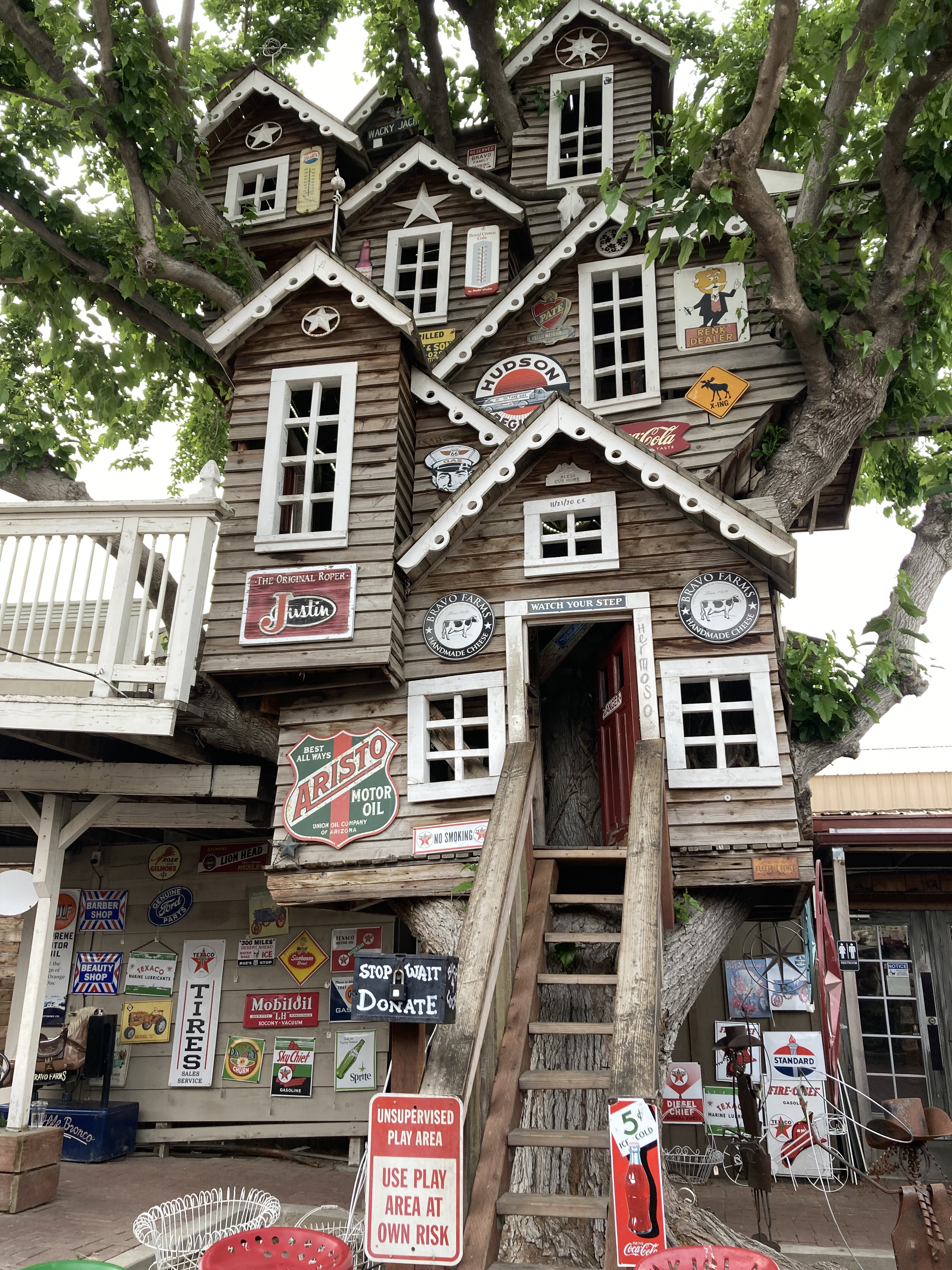
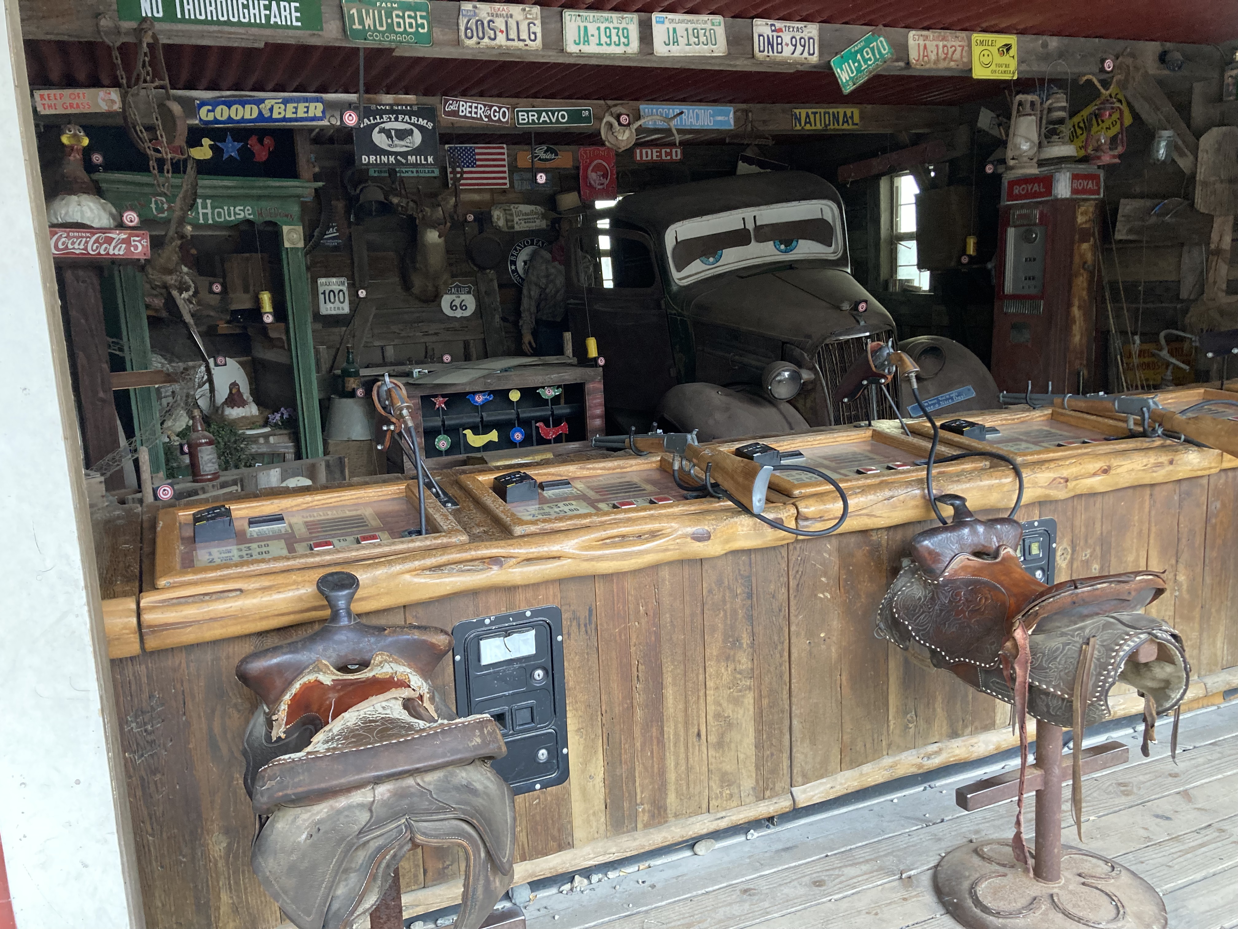
I pulled off the highway a little north of Visalia to get gas and found myself in Traver, at a place called Bravo Farms. It felt like this random little place in the middle of nowhere. I got gas then walked around – there were animals, some shops, a treehouse, and a restaurant.
I picked up dinner and headed to a nearby rest area in Kingsburg for the night (a little south of Fresno).
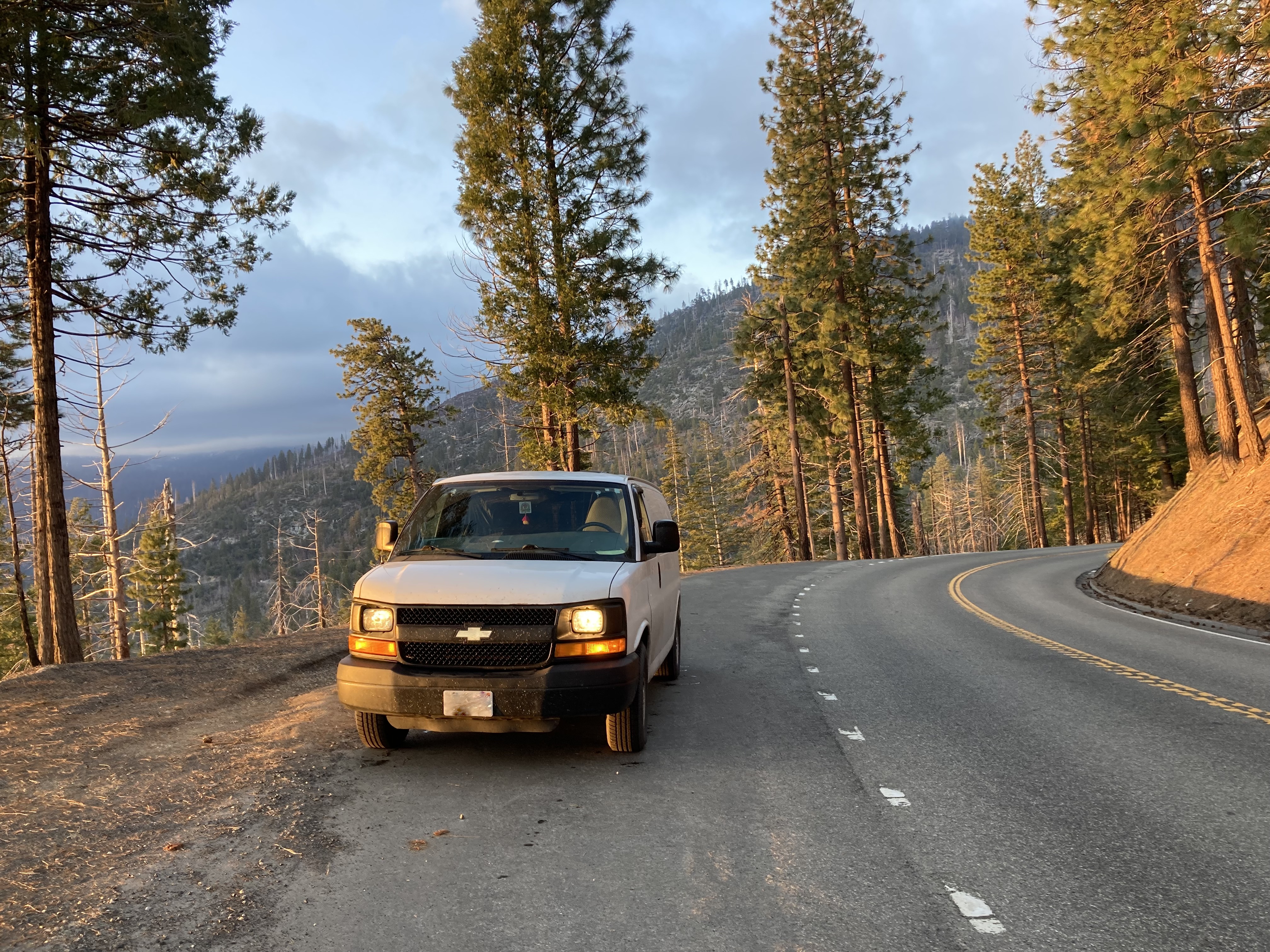
The next morning I backtracked south to Visalia to get a drive through oil change (Valvoline). I’d been needing one, and could feel the difference it made in how Strider drove with more ease afterward.
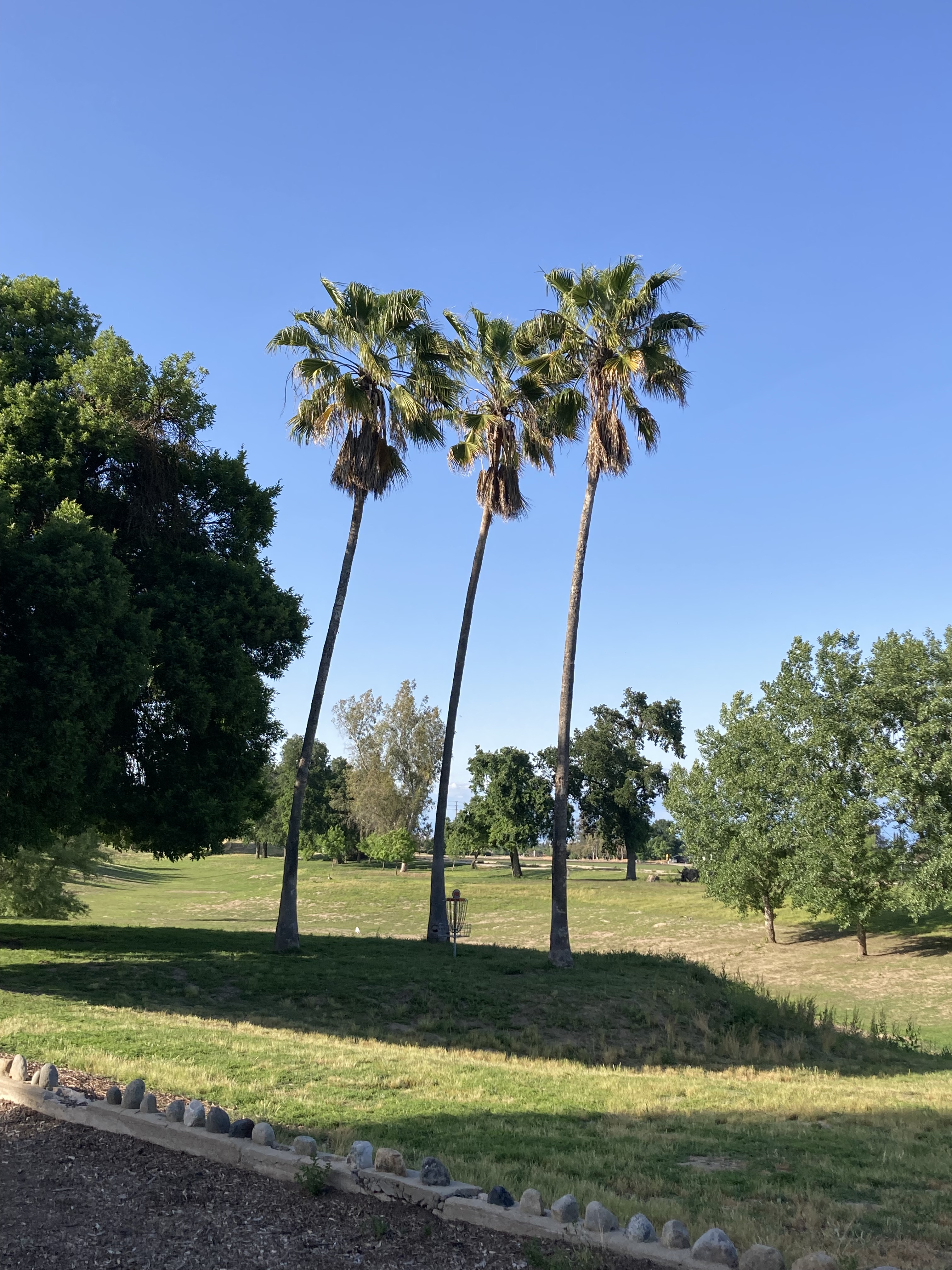
I ran errands in Visalia and went to Mooney Grove Park – I needed a place to chill while I did some research on Yosemite – my next stop. I parked in the shade and looked up at some palm trees, wondering if this would be the last time I saw them.
I found an overnight spot just outside of Yosemite (a little over an hour from Yosemite Valley) in Mariposa and drove there (2 hour drive from Visalia) for the night.
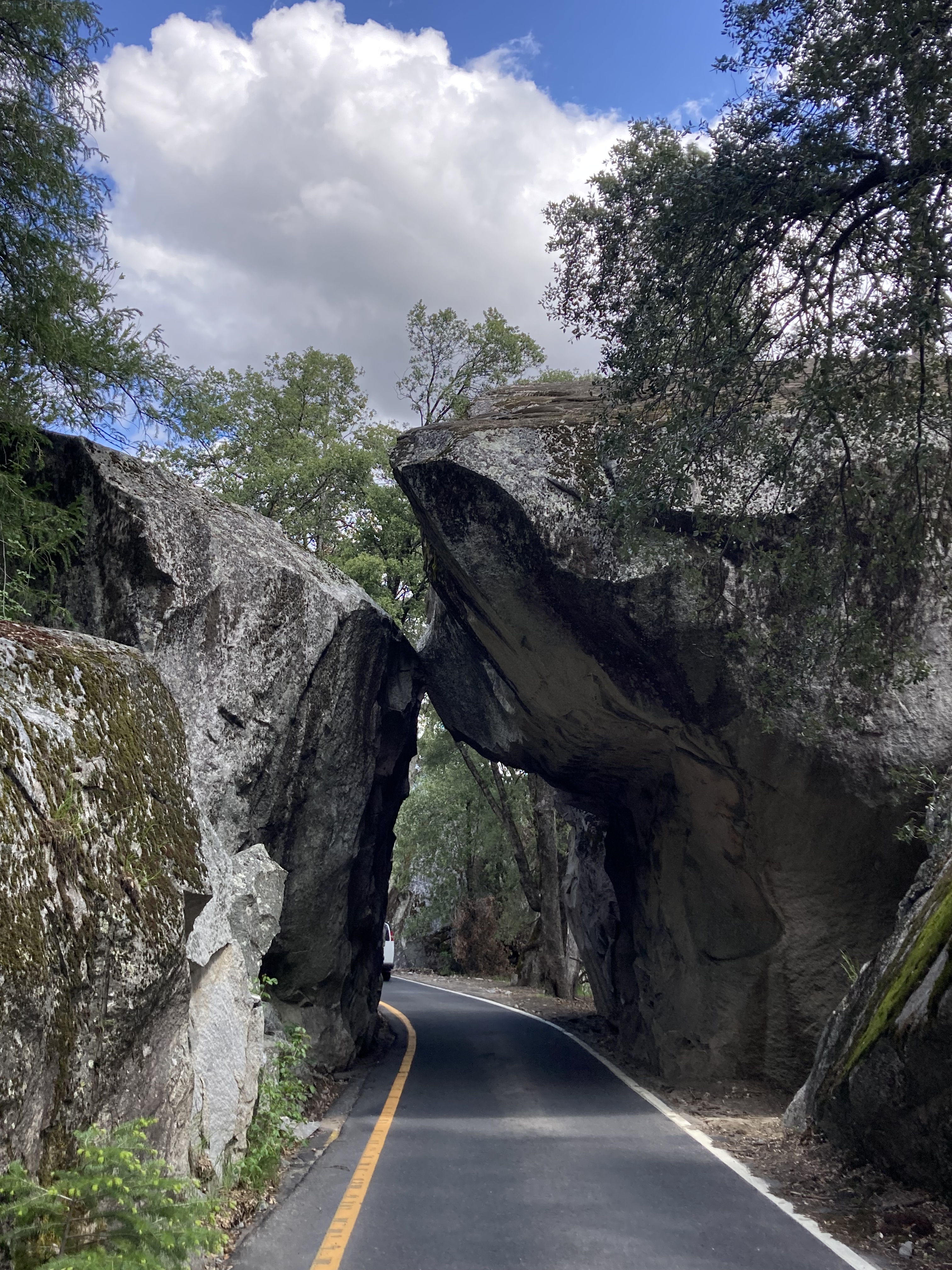
It was kind of weird, driving north so quickly, undoing the slow progress I’d made down the coast of California in a much smaller timeframe. I’d taken my time on the coast, which made it feel bigger maybe, seeing most of what it had to offer. But heading north through the interior, I was covering a decent amount of ground fairly quickly, bypassing a lot of places. Here I was, a couple of days after leaving Joshua Tree, already halfway up the state, entering northern California again. No more ocean, no more hot desert. I was about to be in the mountains, with pine trees and snow. I would be cold again! Of course these extremes of landscape are part of California’s charm. But in these moments, it just felt odd, how things were changing so fast.
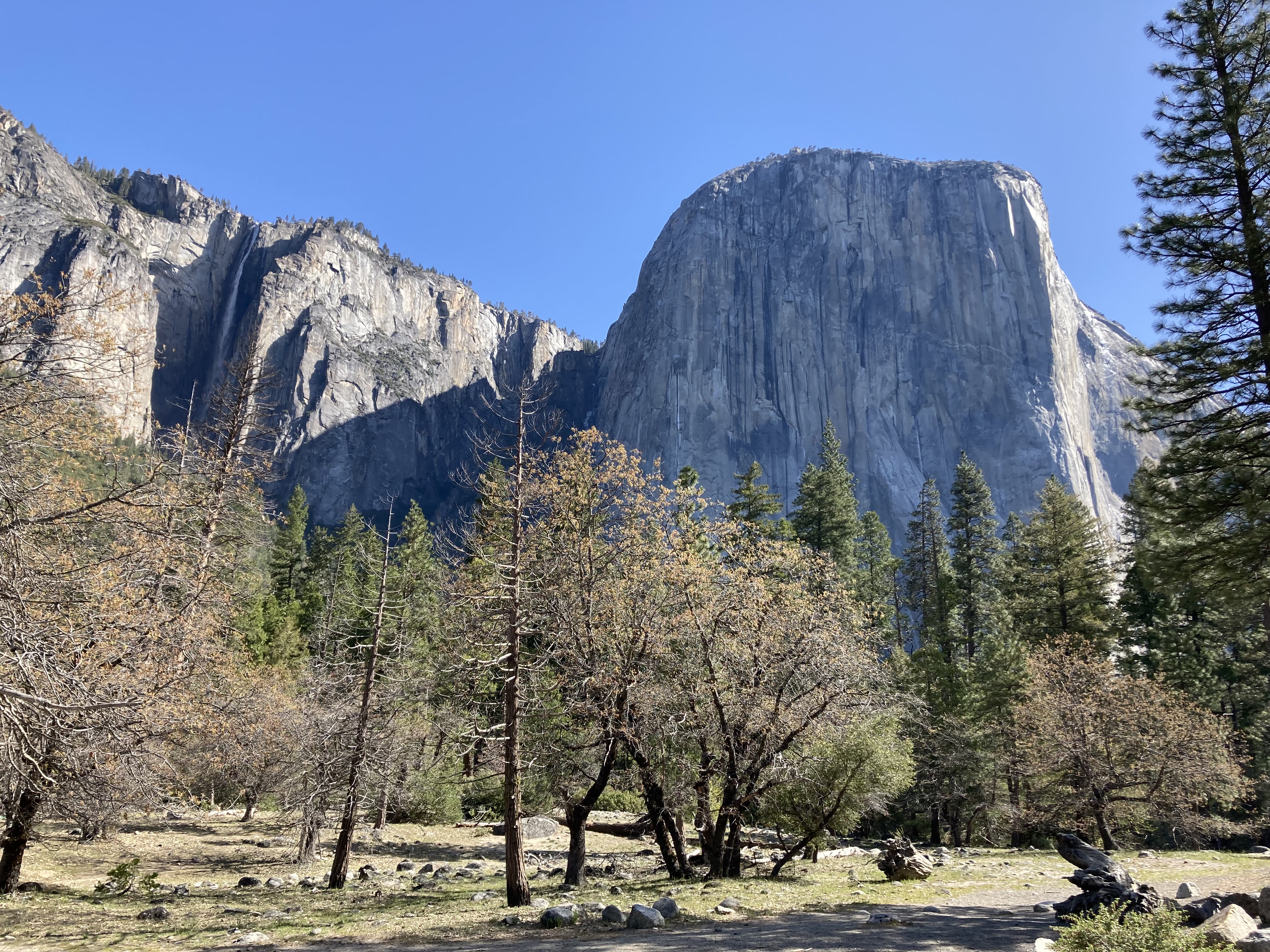
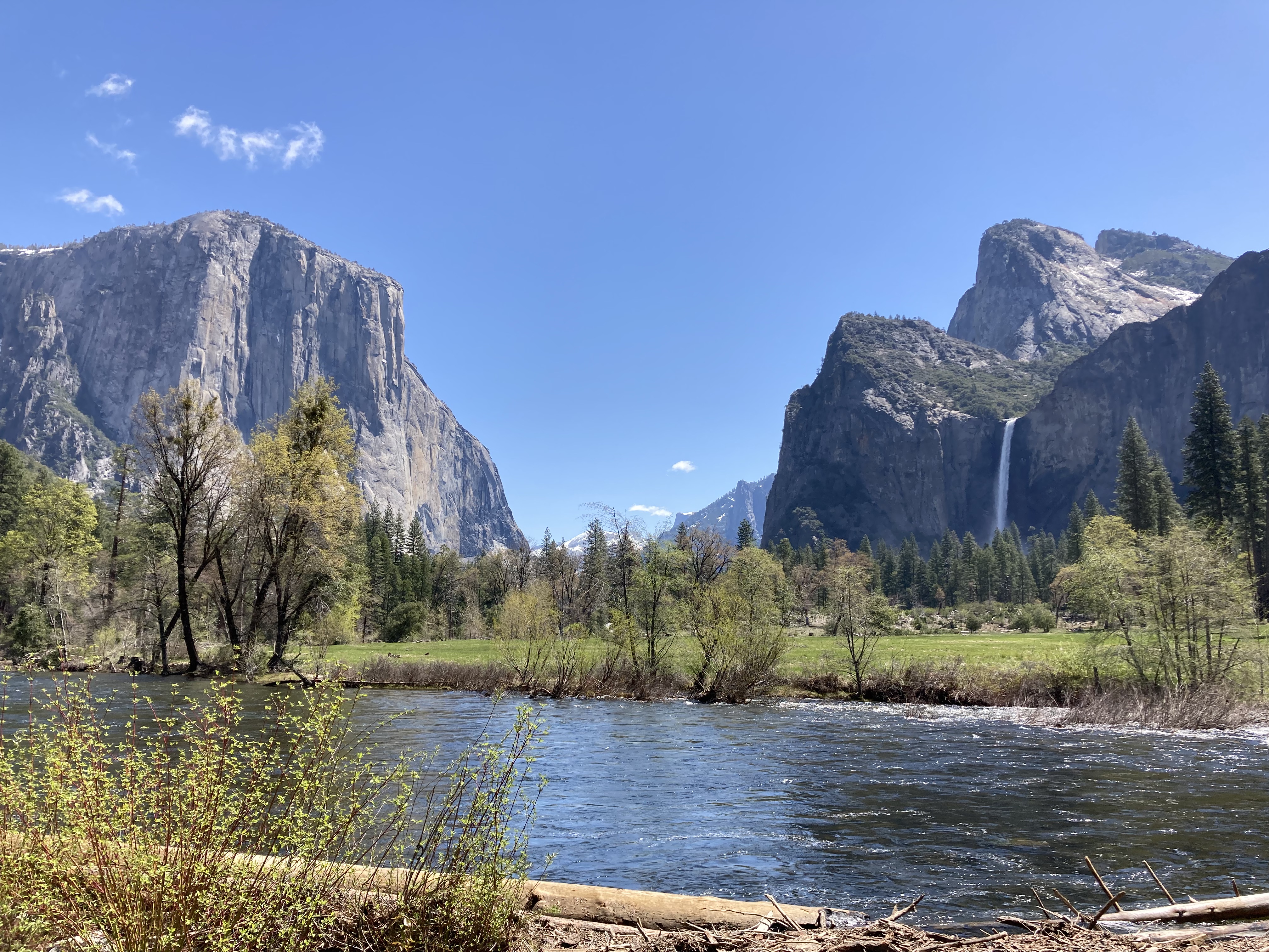
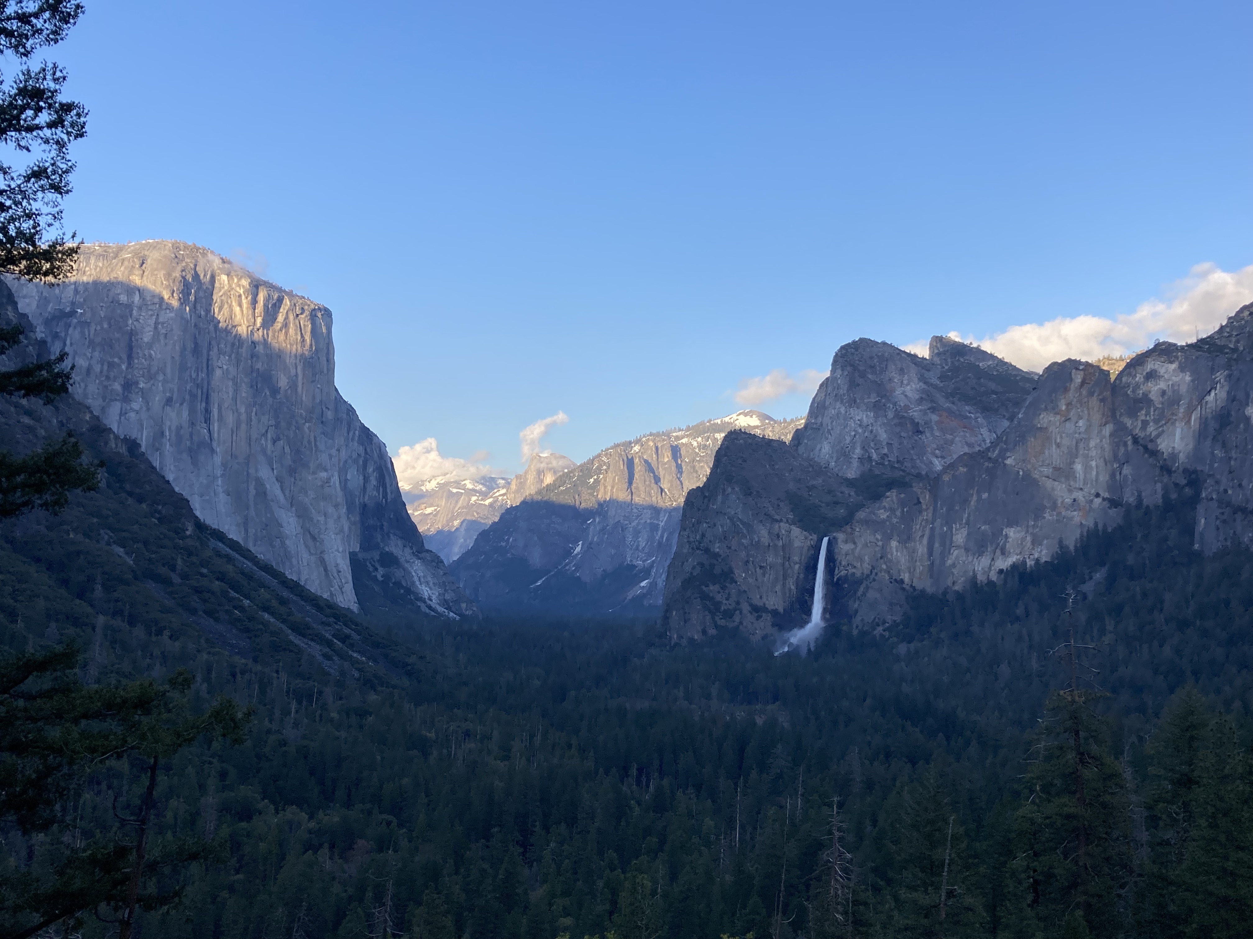
Yosemite
The drive in to a place like Yosemite is wondrous, with mounting anticipation. Watching how the land transforms, peering around every corner, bracing yourself for the big views that will make you feel small in the best way. These places that you can’t fully grasp in their magnitude until you see them with your own eyes, in person, and probably not even fully then.
Day 1 in Yosemite, I still had some research to do in the morning, waking up in Mariposa. Before getting into the park I also wanted to get rid of any trash or recyclables in the van, to limit what could attract bears, as the park had strict rules about food and scented items in vehicles (mostly at night).
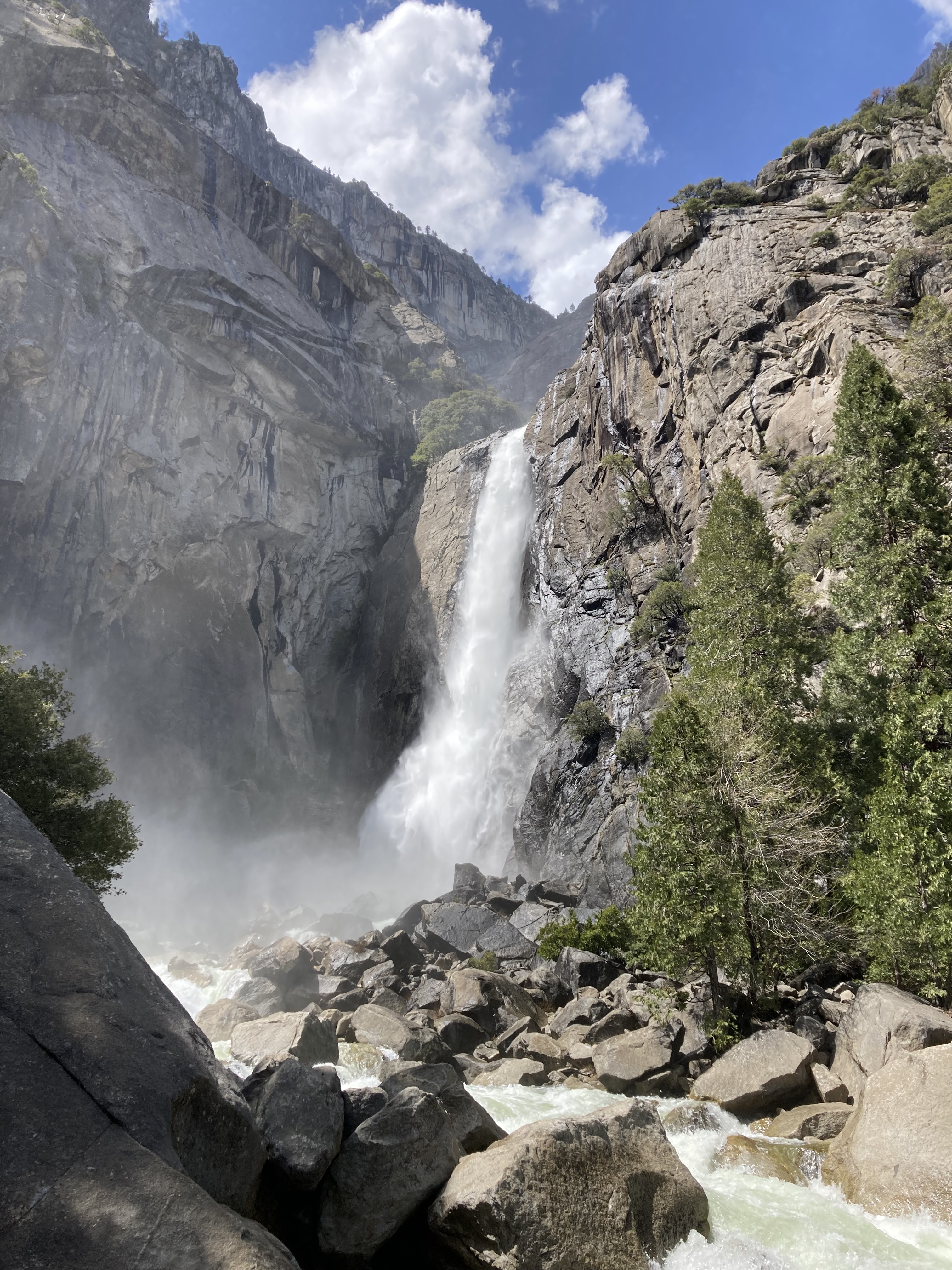
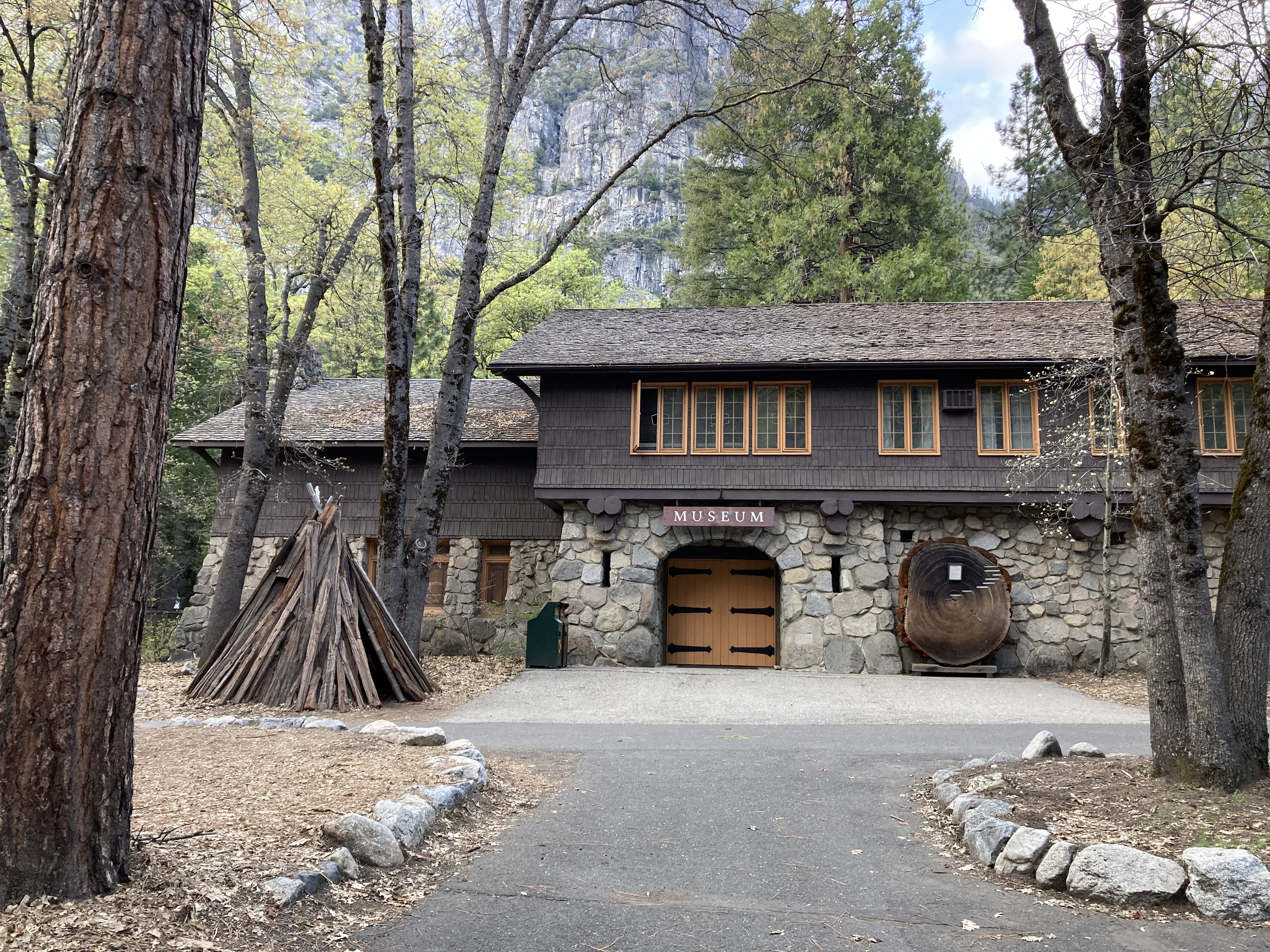
The world really is quite small, as an aunt of mine happened to be visiting Yosemite at the same time that I was, so we met up for lunch in Yosemite Valley/ Village and a walk by Lower Yosemite Falls. It’s always nice to see someone you know on the road, but it’s also a bit strange when flying solo and not knowing a soul has been your norm for so long.

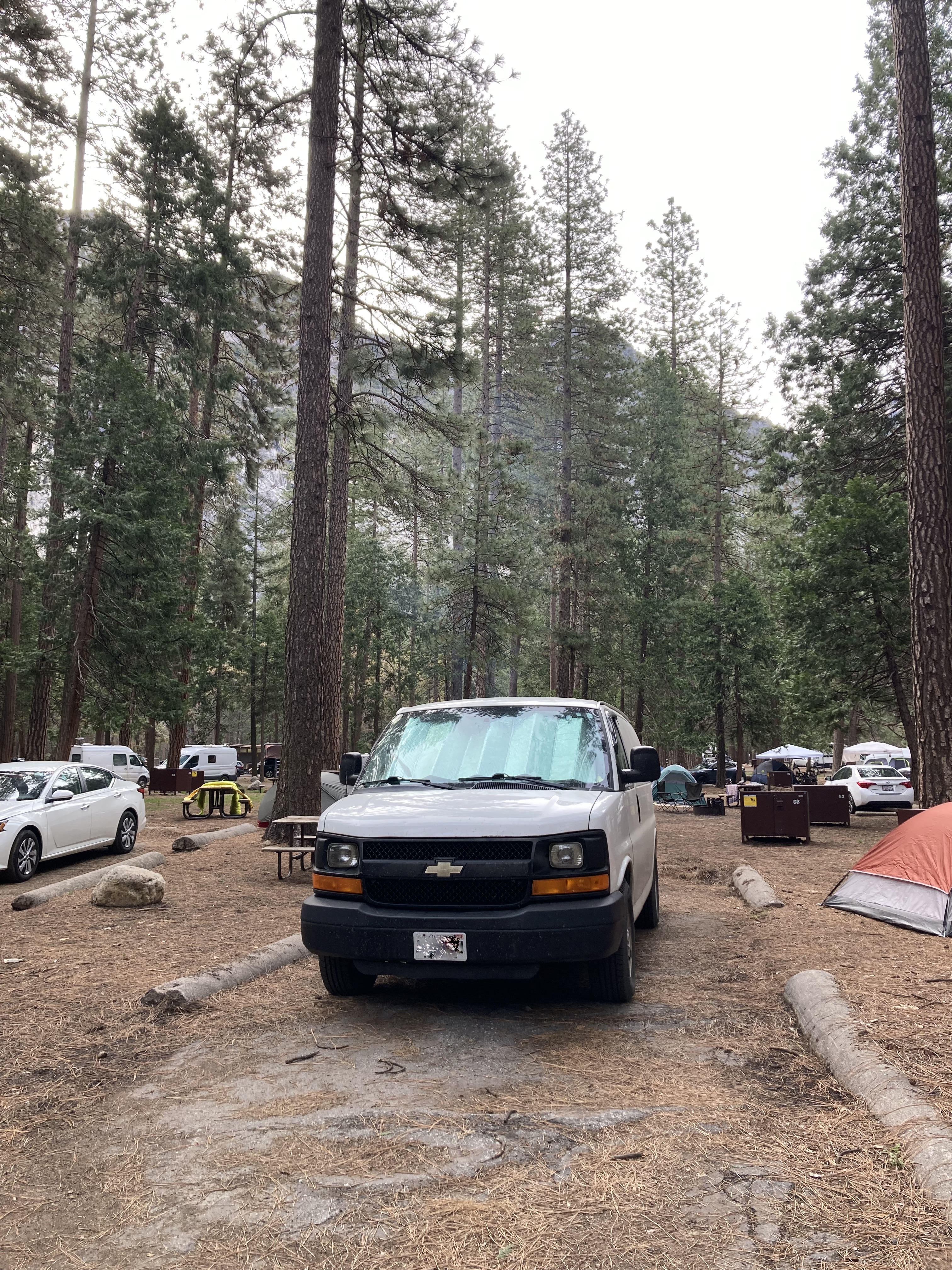
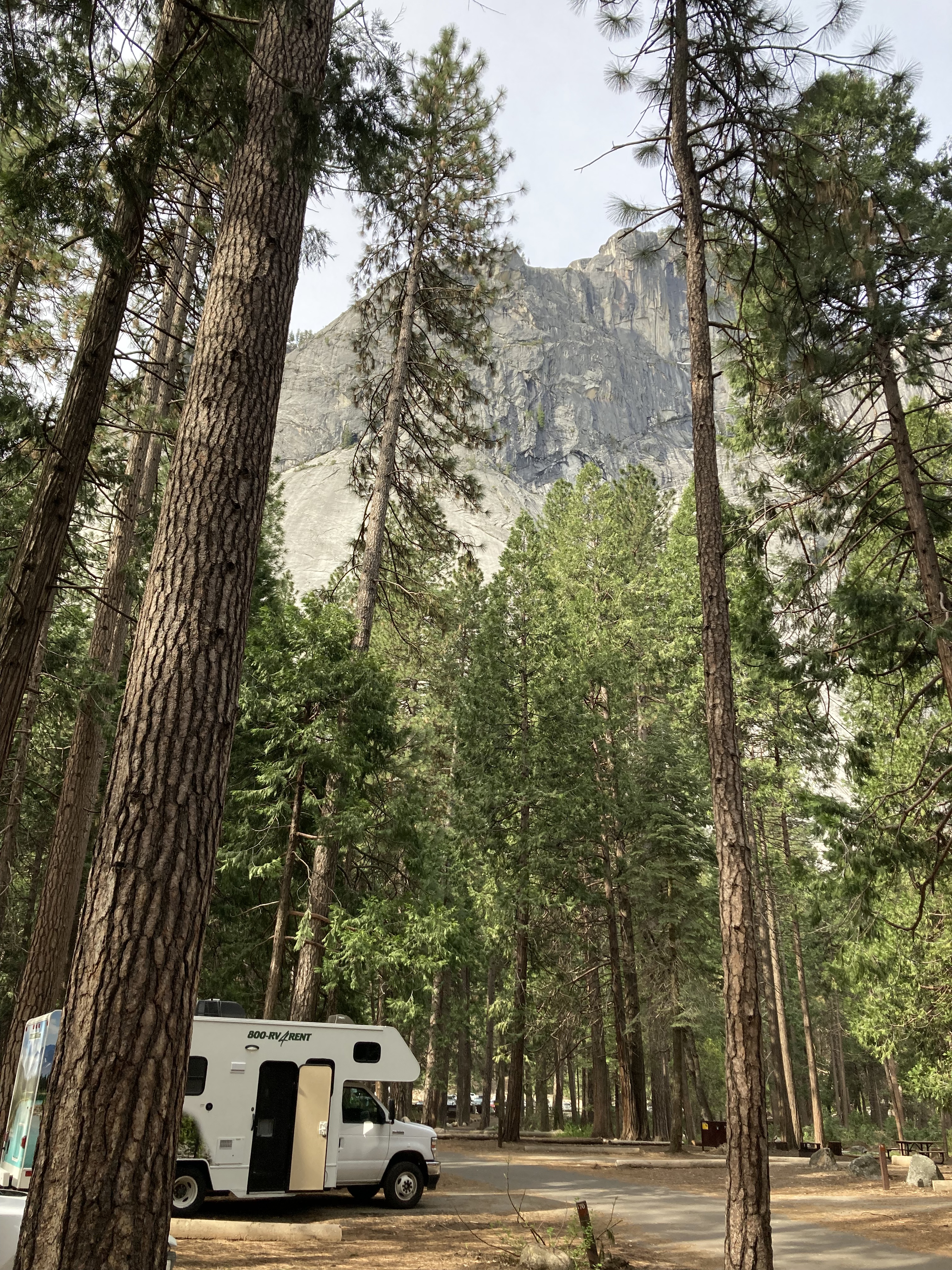
I ended my first day in Yosemite settling in to the Upper Pines Campground. It was a very minimal campground (no soap in the washrooms, no showers, no laundry, no privacy between sites). And you could not have any food or toiletries in your vehicle at night – they had bear proof food lockers on each campsite where you had to store anything smelly. Defying these rules could lead to a $5,000 citation.
There was nothing about this campground that would make me go out of my way to stay there again. But it was nice to be able stay in the park for a night, and I’m glad I got to experience one of Yosemite’s campgrounds.
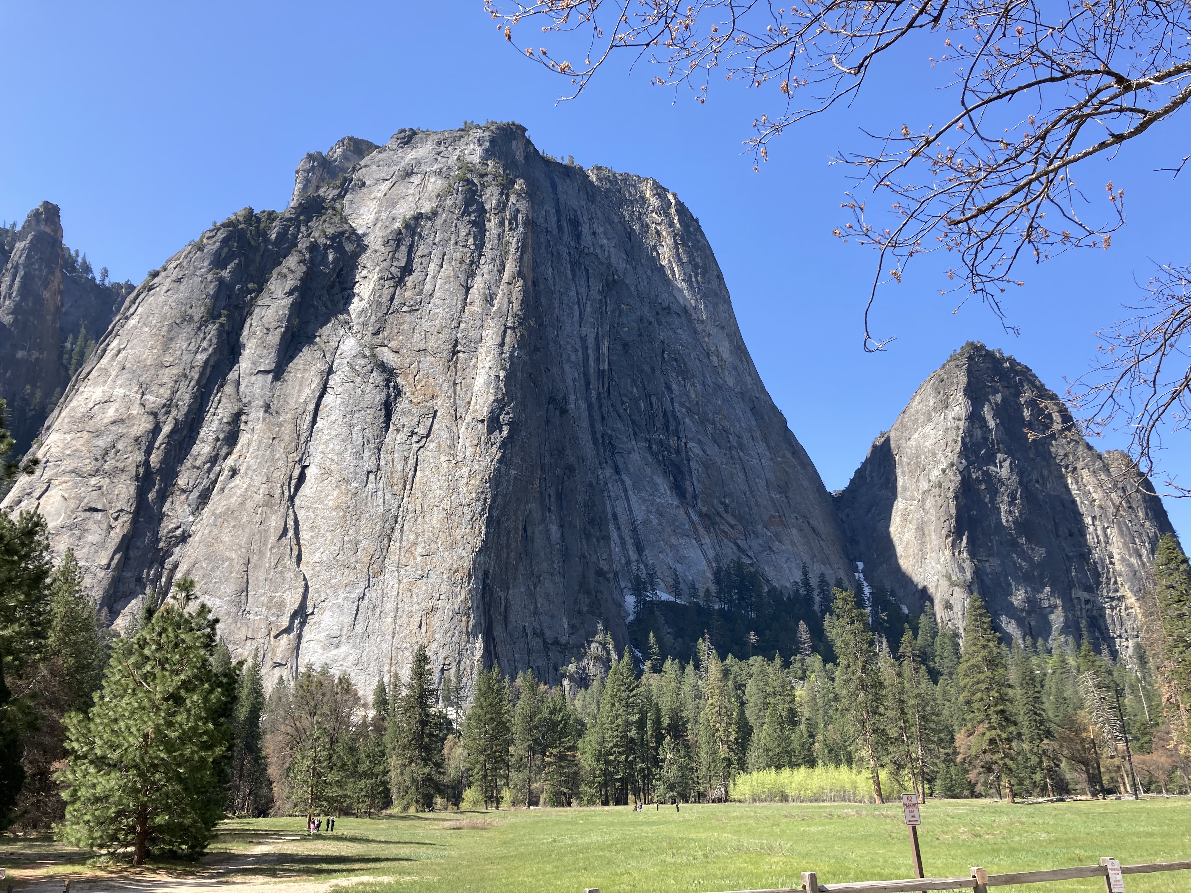
I walked around a bit as the sun went down, taking in the valley’s views and the walls of rock that towered above me, walking to the river to get a cell signal so I could download a show to watch with dinner. I know, I know, it seems wrong to watch a show rather than read a book or gather around a campfire while in the great outdoors – but I was flying solo, it’s hard to read after dark, and I’d been on the road for months – always being on the move can drain you, so a brainless activity before bed can be nice.
The days were sunny and comfortable, not too hot or cold, though there was a chill in the air while the sun was behind the mountains at dusk and dawn.
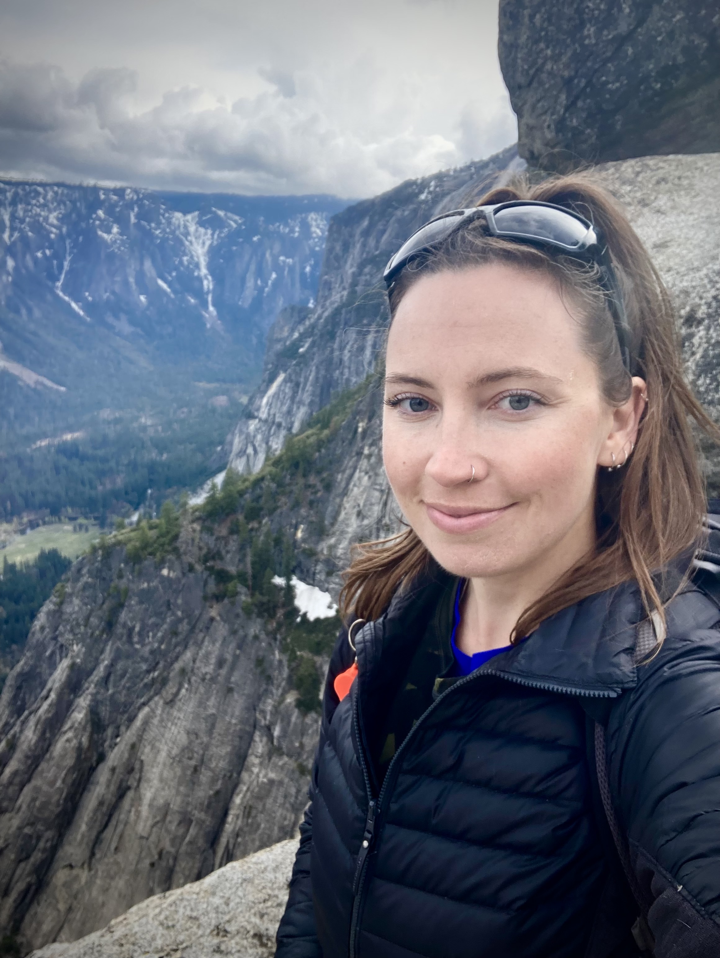
Day 2 in Yosemite was all about the hike to the top of Yosemite Falls!
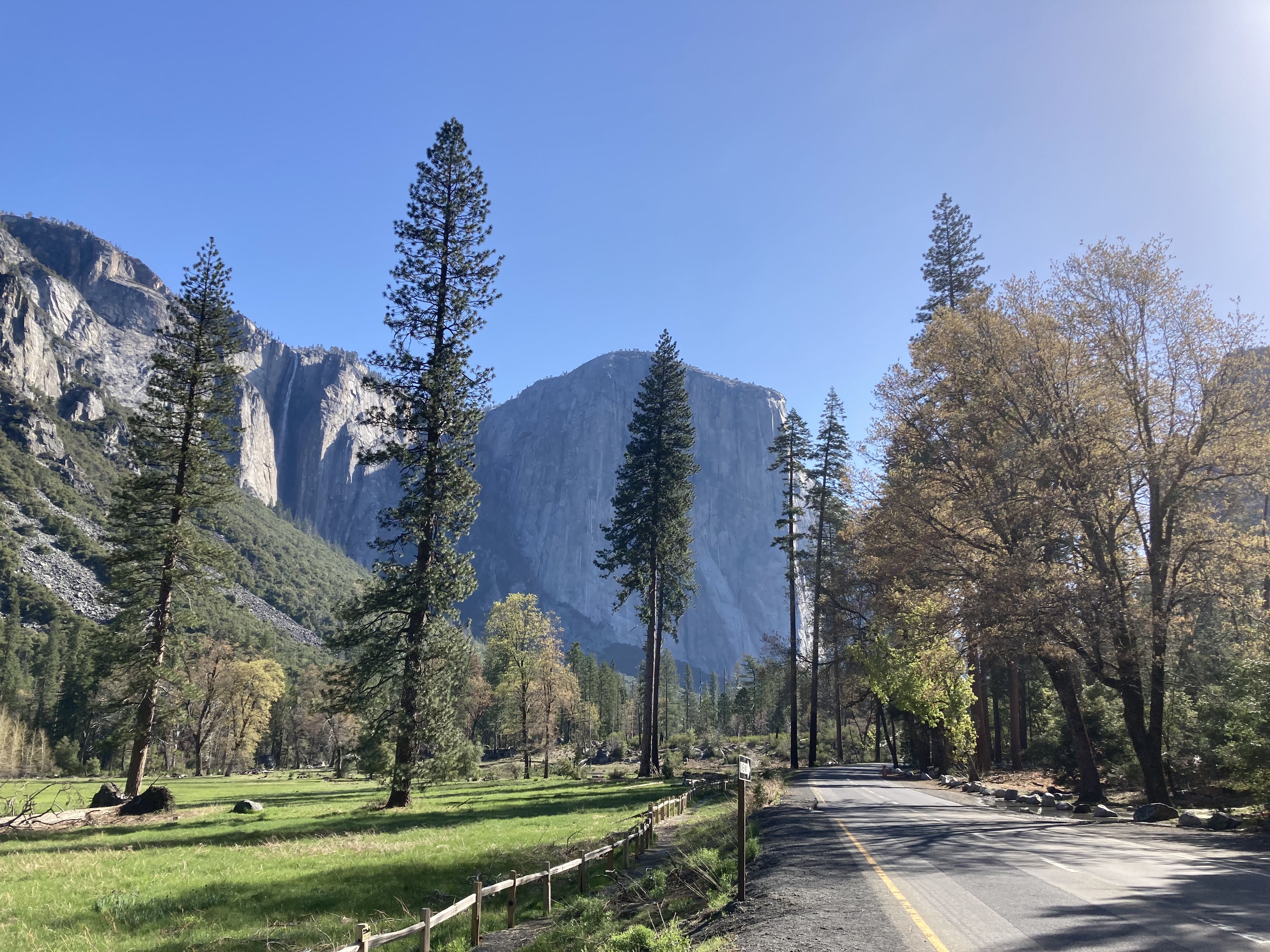
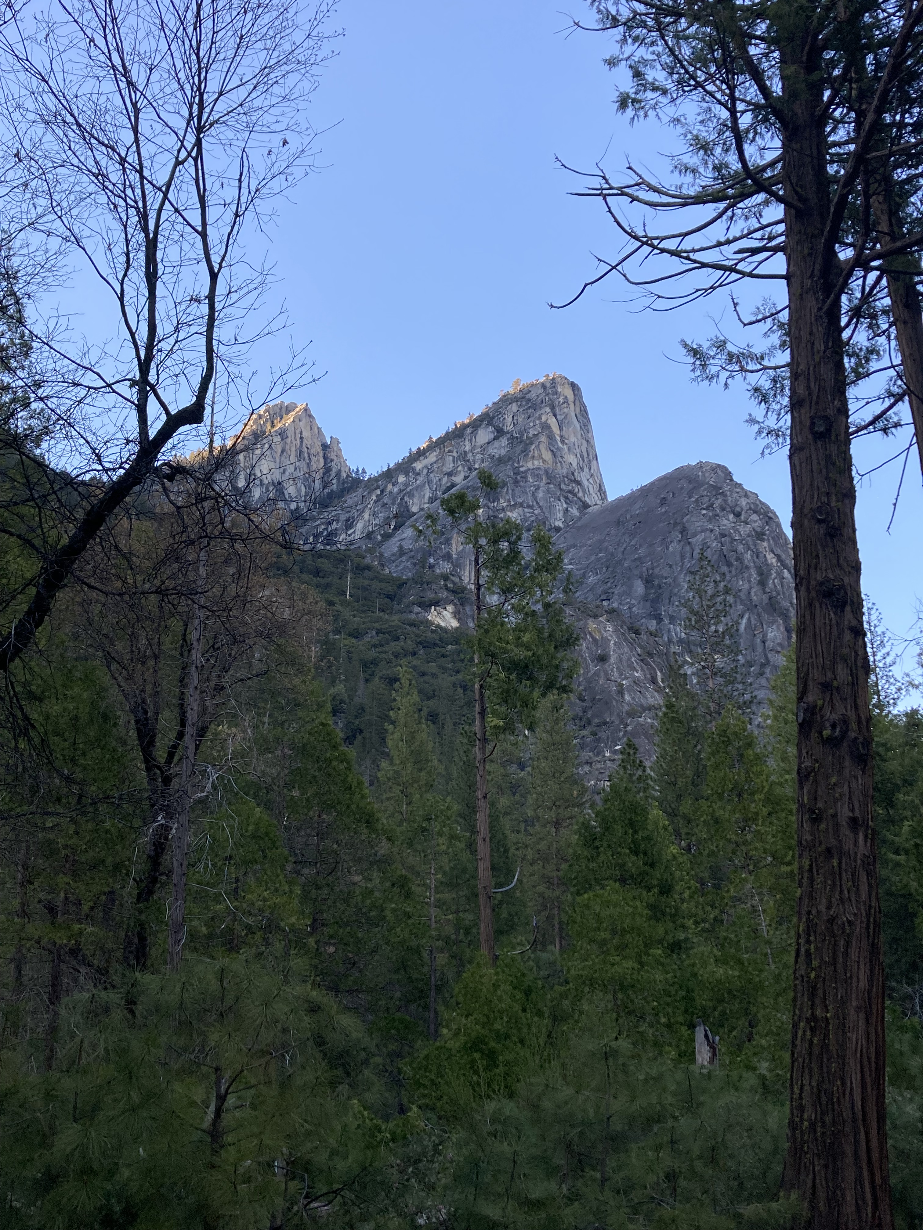
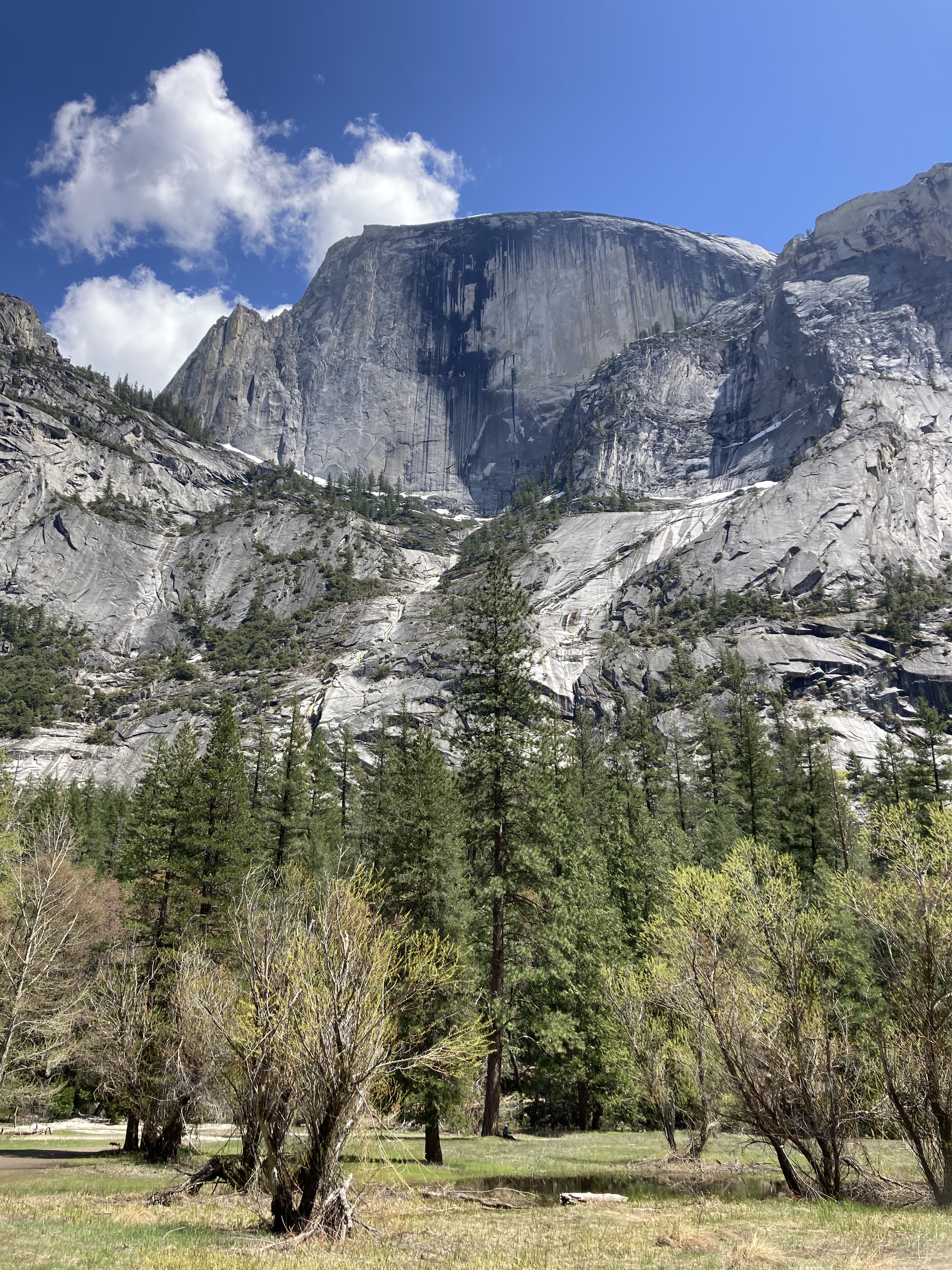
This is a pretty popular hike and there were plenty of people on it when I did it. The first half you spend climbing with views out over the valley, towards Sentinel Rock opposite you. Then you get to an overlook before turning a corner, which is a popular spot to take a break, take photos, and either keep going or turn back. This is also where you get great views of Half Dome.
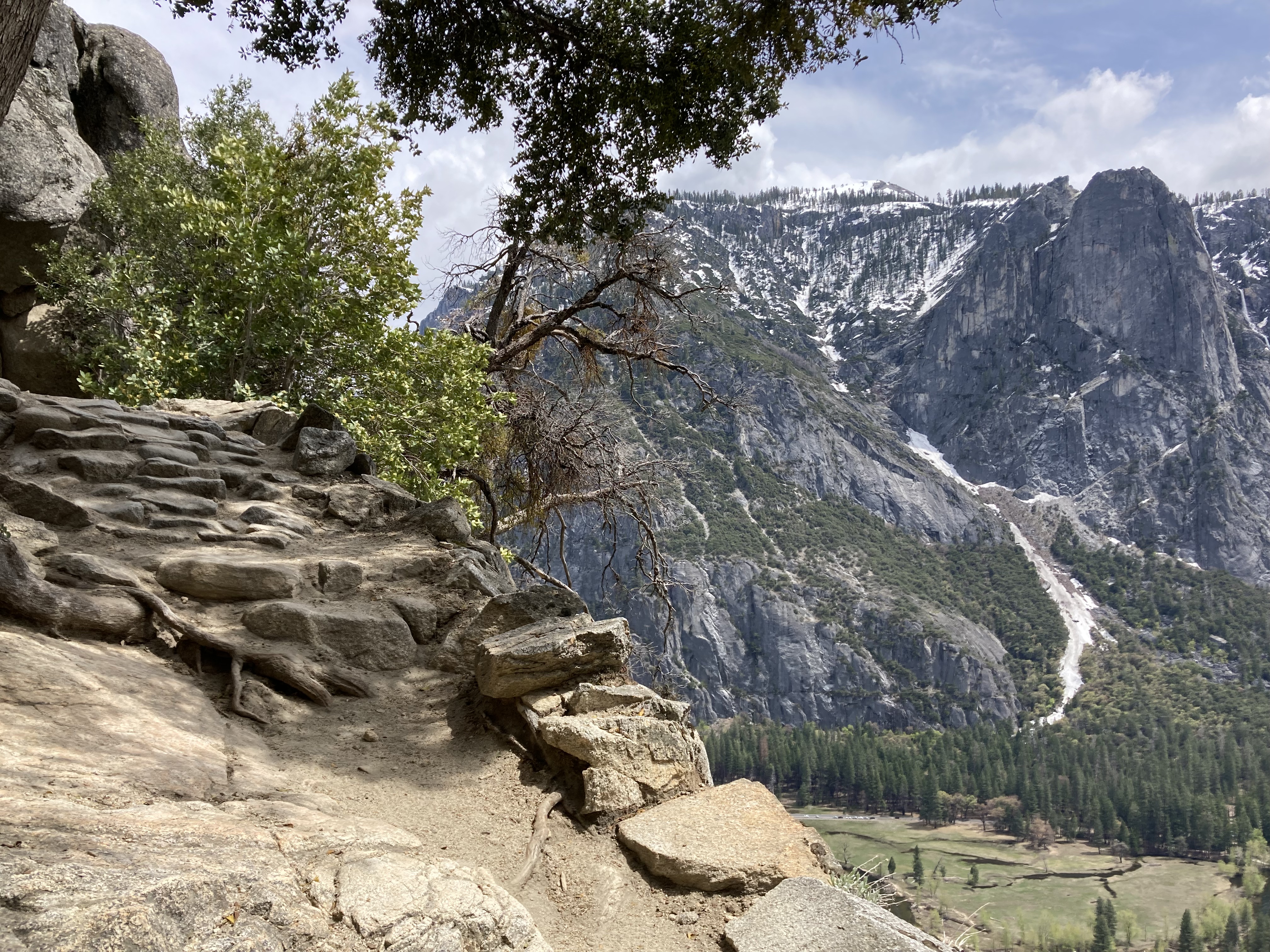
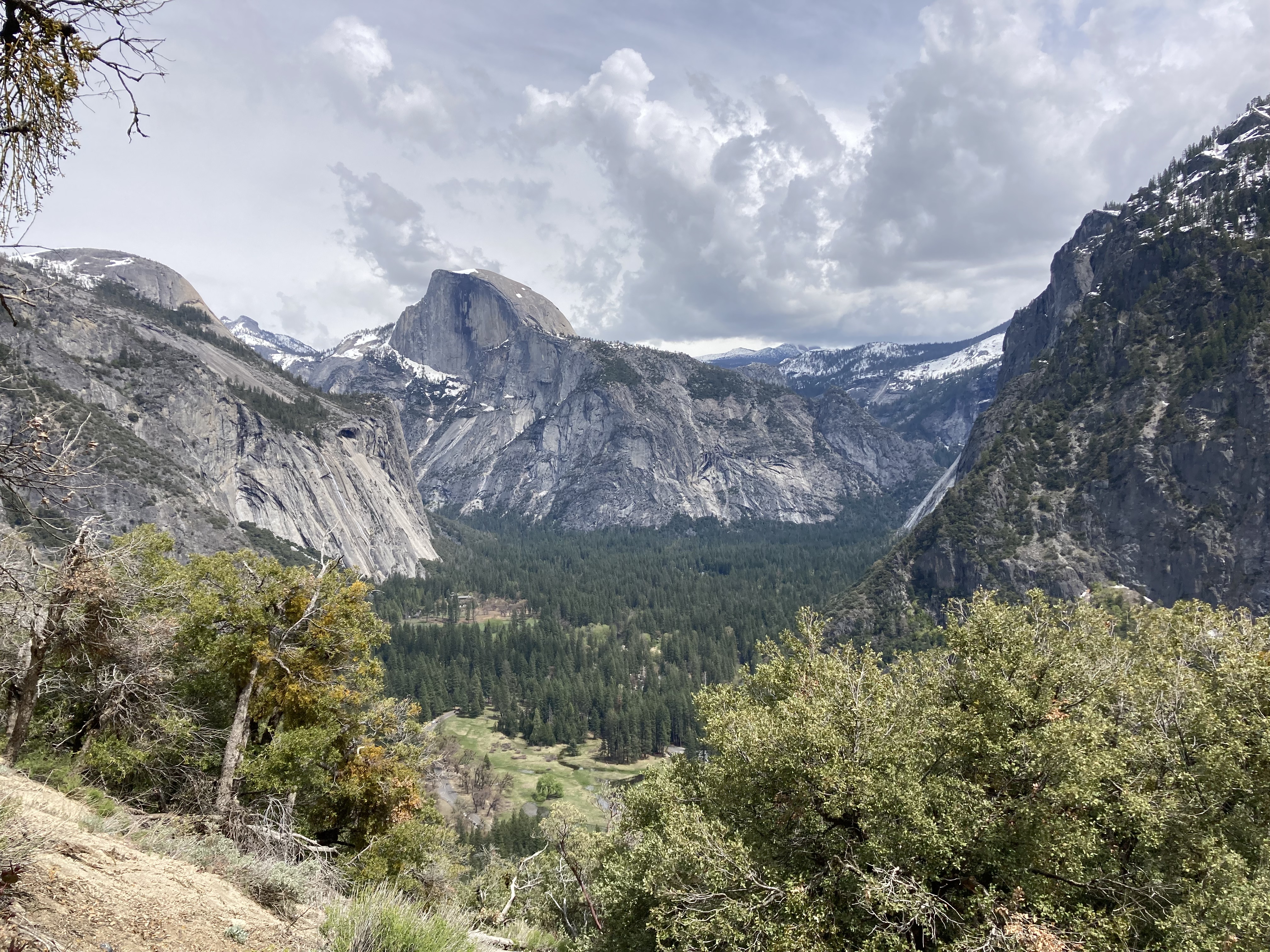
Half Dome is a looker, but there is something about Sentinel that I really like. I suppose we all have our favourite rock formations…
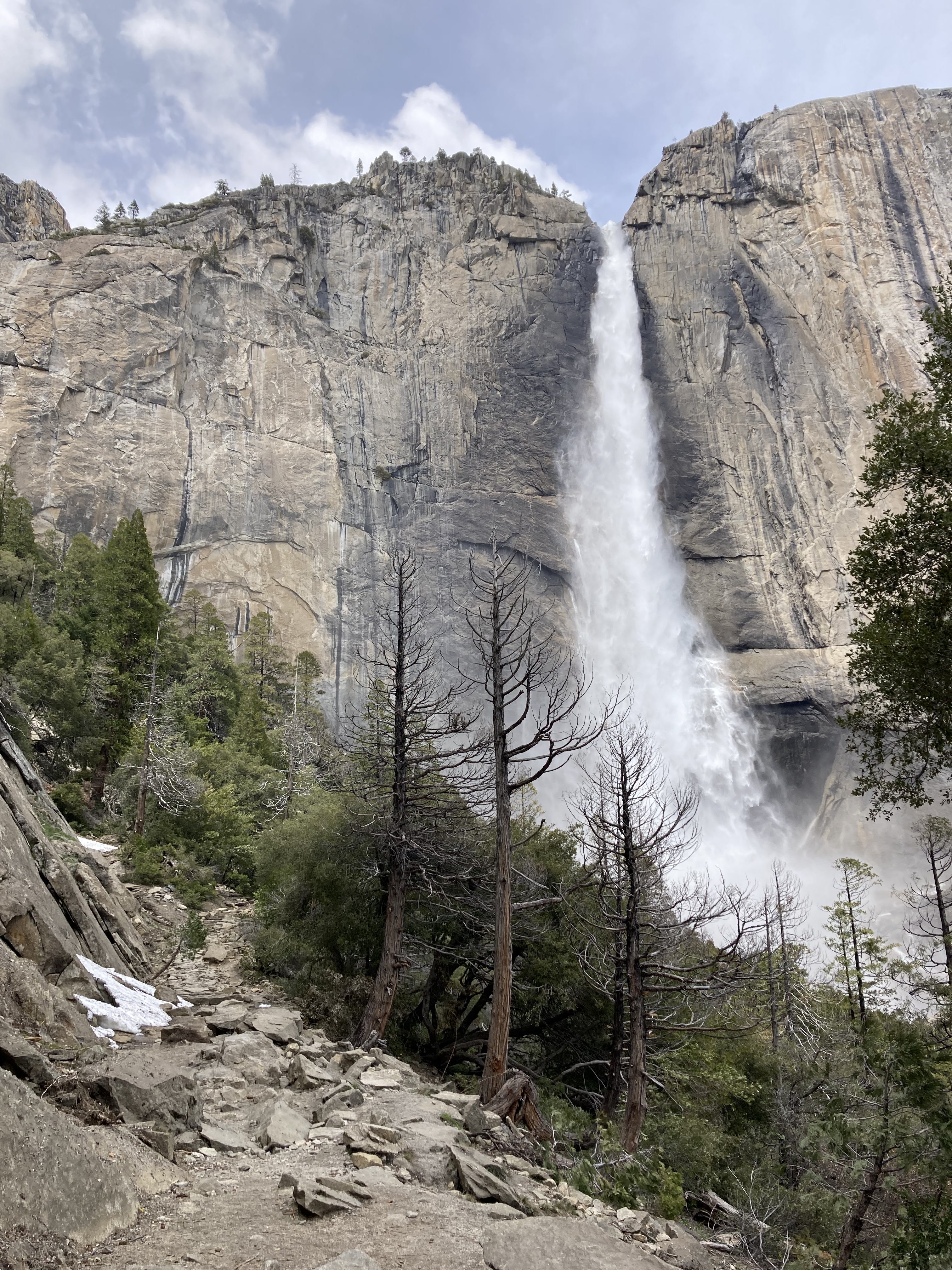
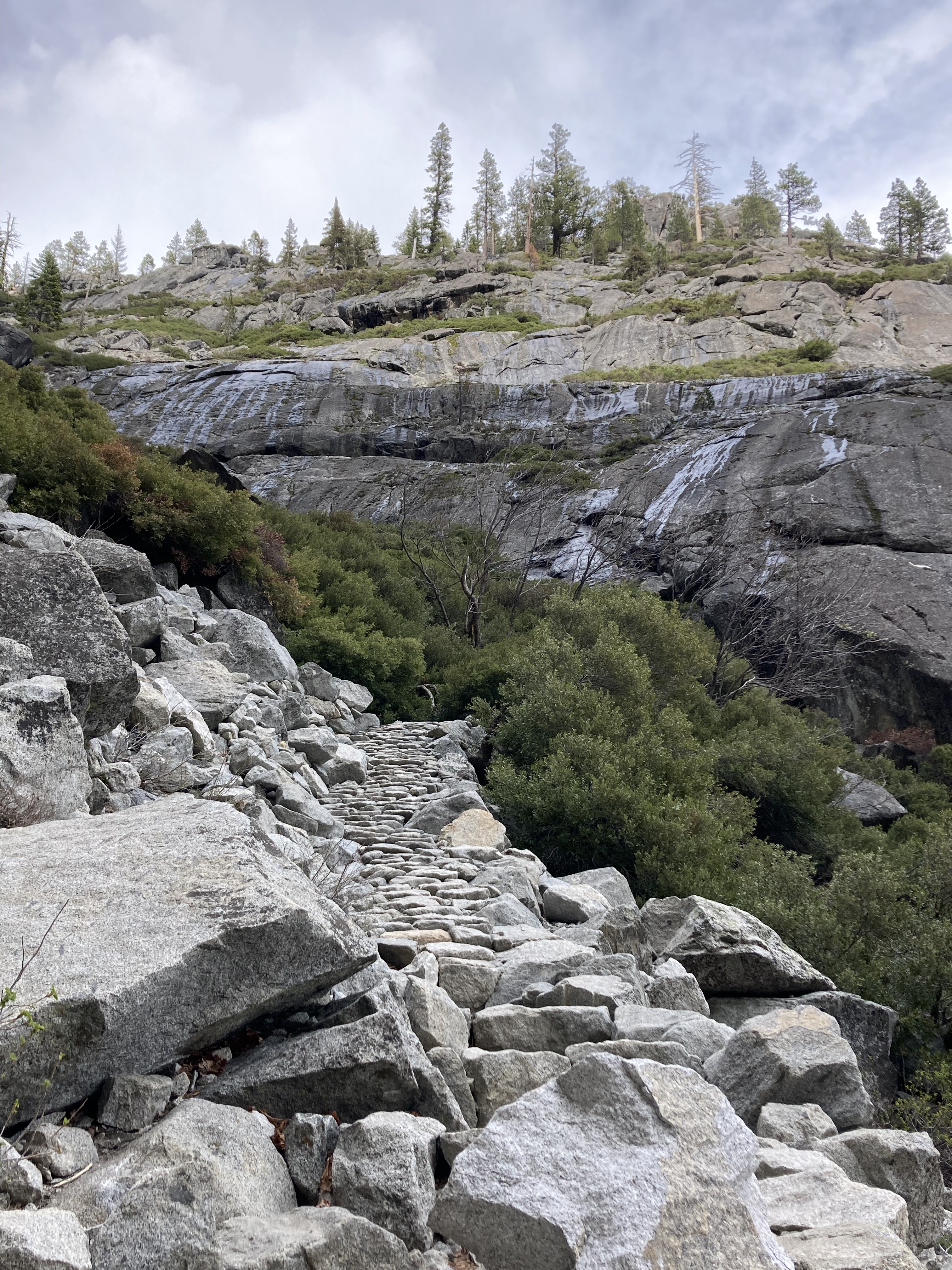
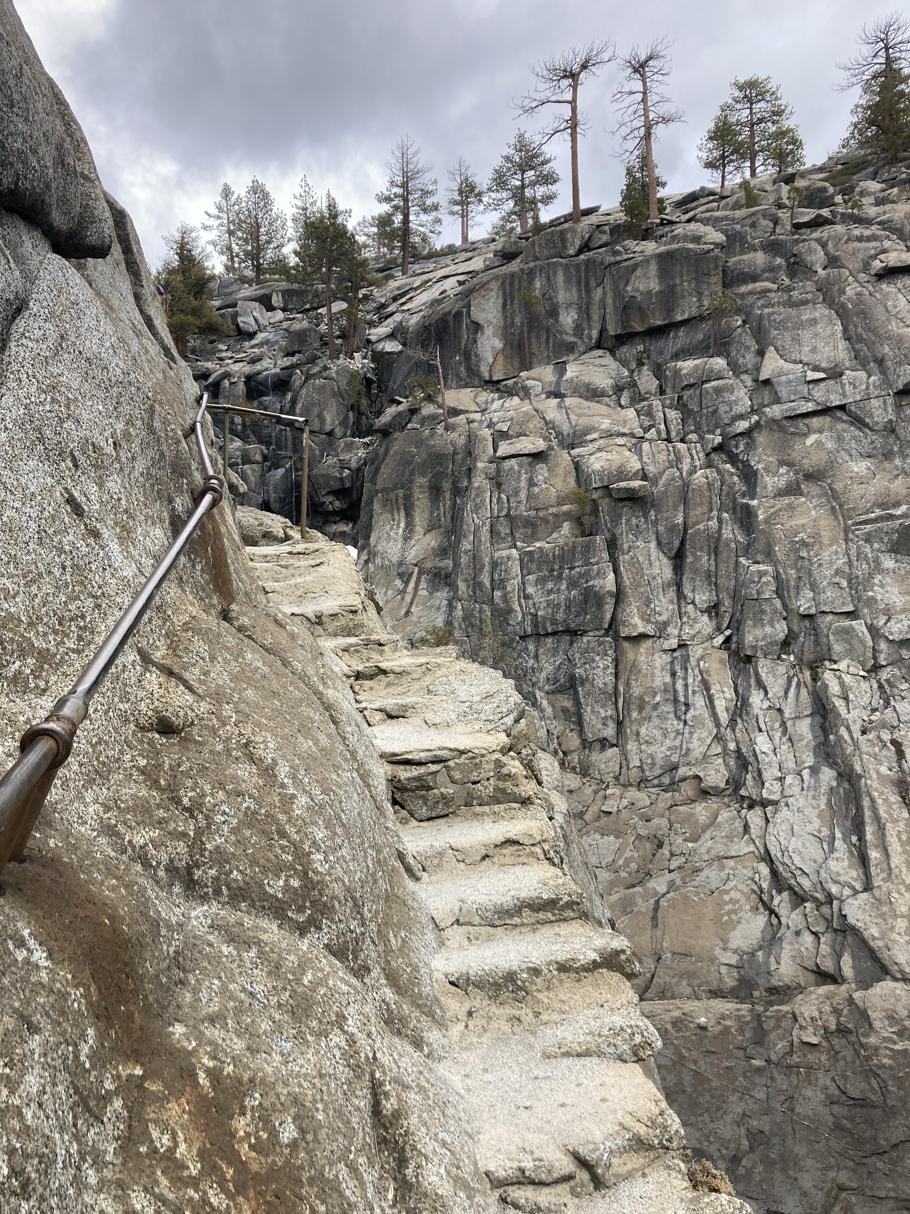
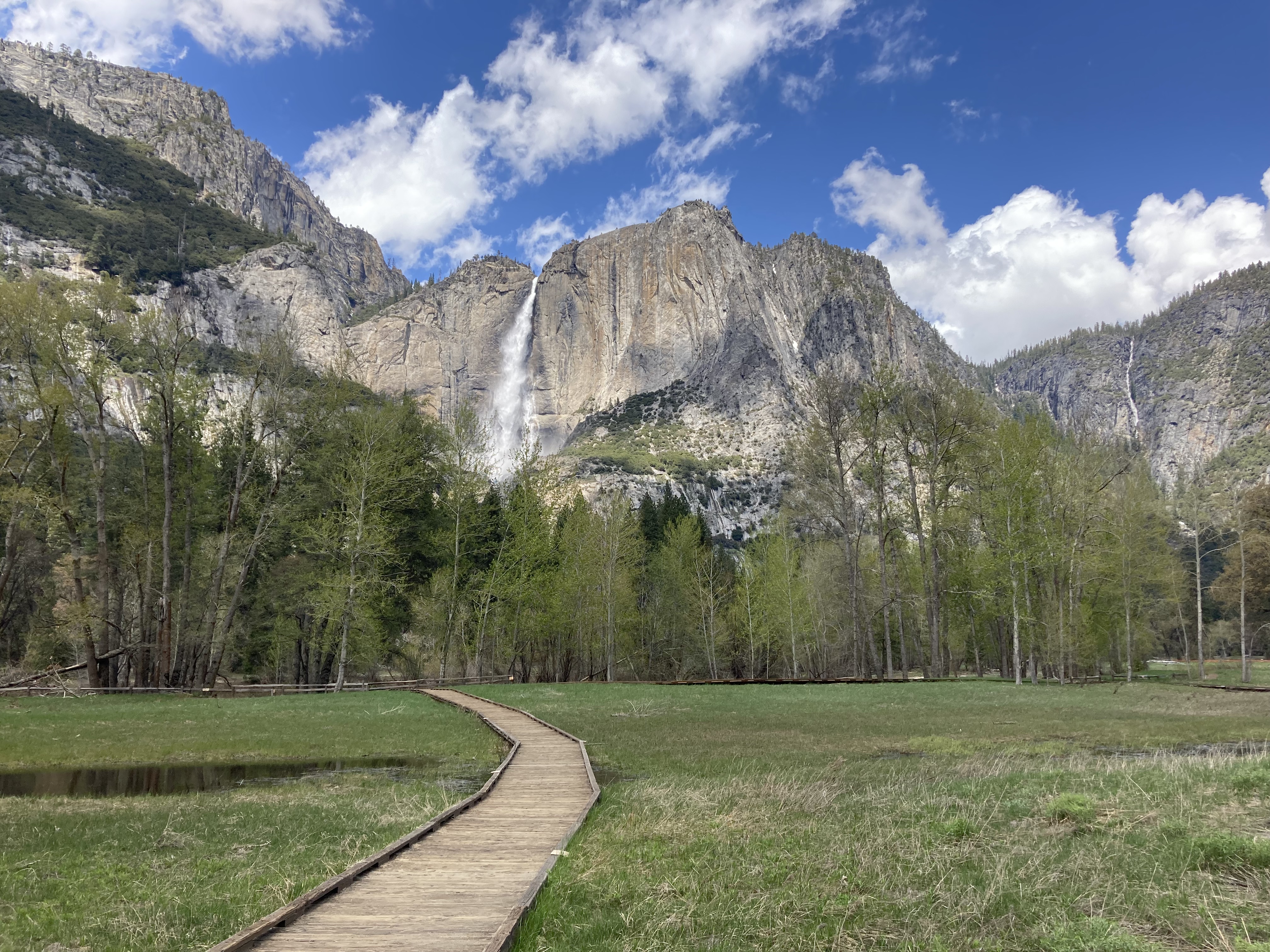
The trail levels out for a bit as you approach the base of Upper Yosemite Falls. You get up close to the falls and walk through some spray (probably depending on time of year – the falls were powerful at this time as it was spring and there was snow runoff). Then the trail takes you up steep switchbacks as you climb to the top of the falls.
This hike is 3.4 miles one way, with an elevation gain of 823m. It’s a slog and a really rewarding hike. Nearing the top there was snow, so while you can continue hiking to other points up here, I don’t think most people were trekking through the snow at this point in the season. It was just a little ways through the snow to where Yosemite Creek cascades down as (upper) Yosemite Falls, and here you’ll find some lookouts and suitable rocks for a sit down, snack, and a drink (maybe even a peak beer).
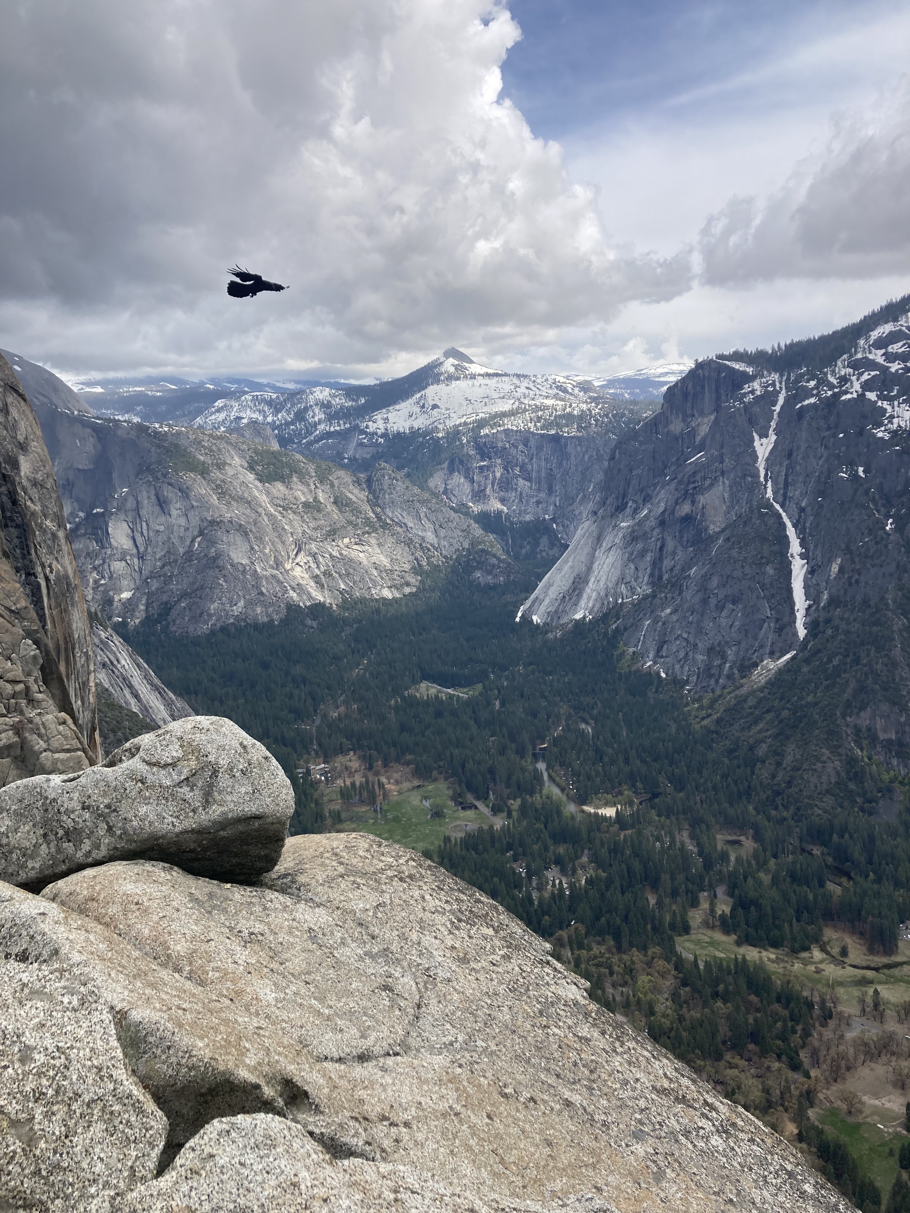
I was one of the last ones up top for the day. It was nice to just sit and relax while taking in the valley from above. It was so high up and hard to believe I’d climbed that distance vertically. It took me a little over two hours to hike to the top, and 1.5hrs to hike back down.
I soaked in the views of Sentinel on my descent. By the end of the hike my legs were shaking. I’d pushed my body to the limit, sore and tired the next day, but it felt good, it was worth it. Considering I wasn’t running all that regularly while on the road, I was pleased with my fitness level.
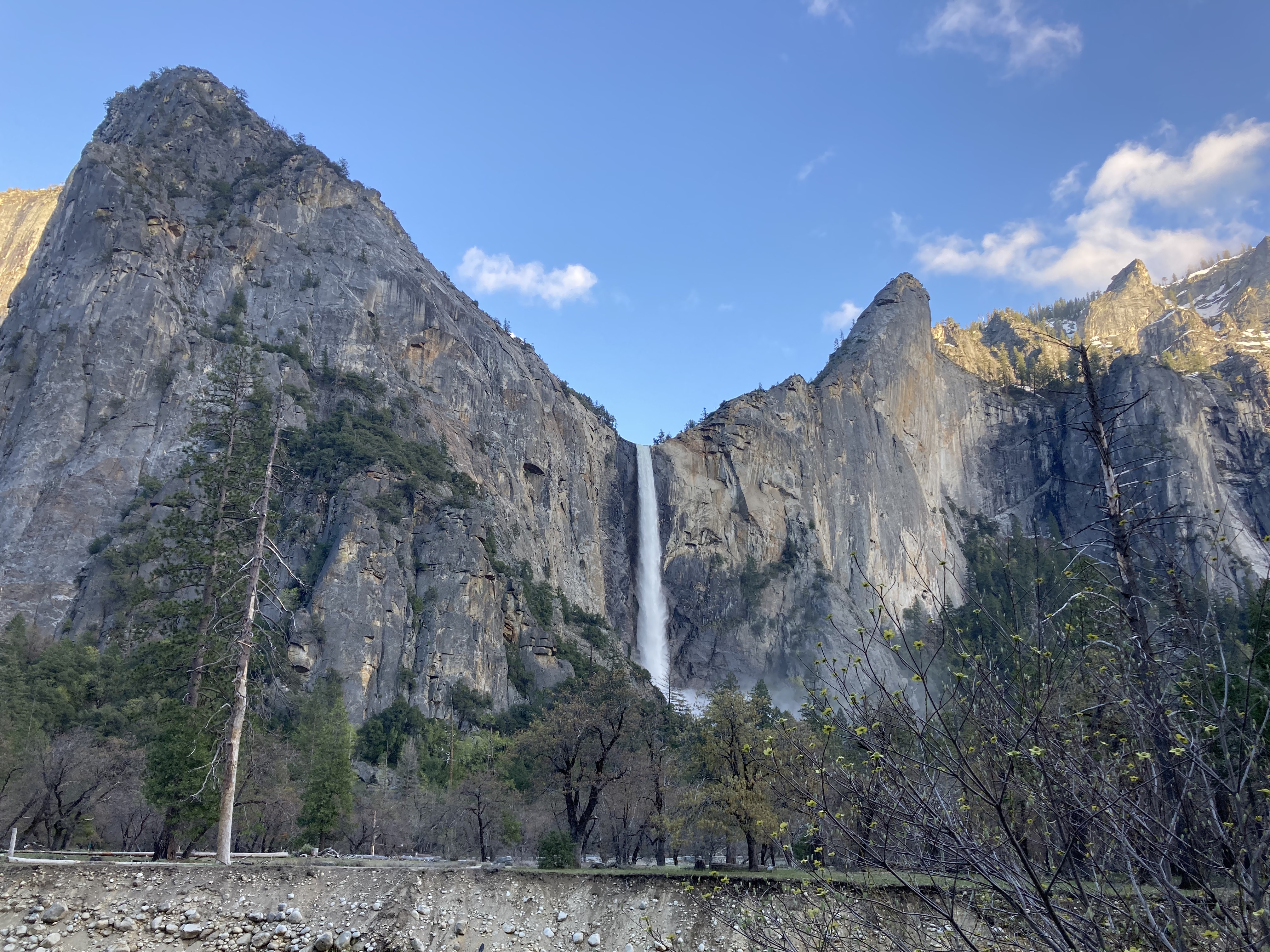
I walked back through the valley, past some of the buildings, past Lower Yosemite Falls, and made my way to the Village Store, where I picked up some beer, treats, souvenirs, and postcards.
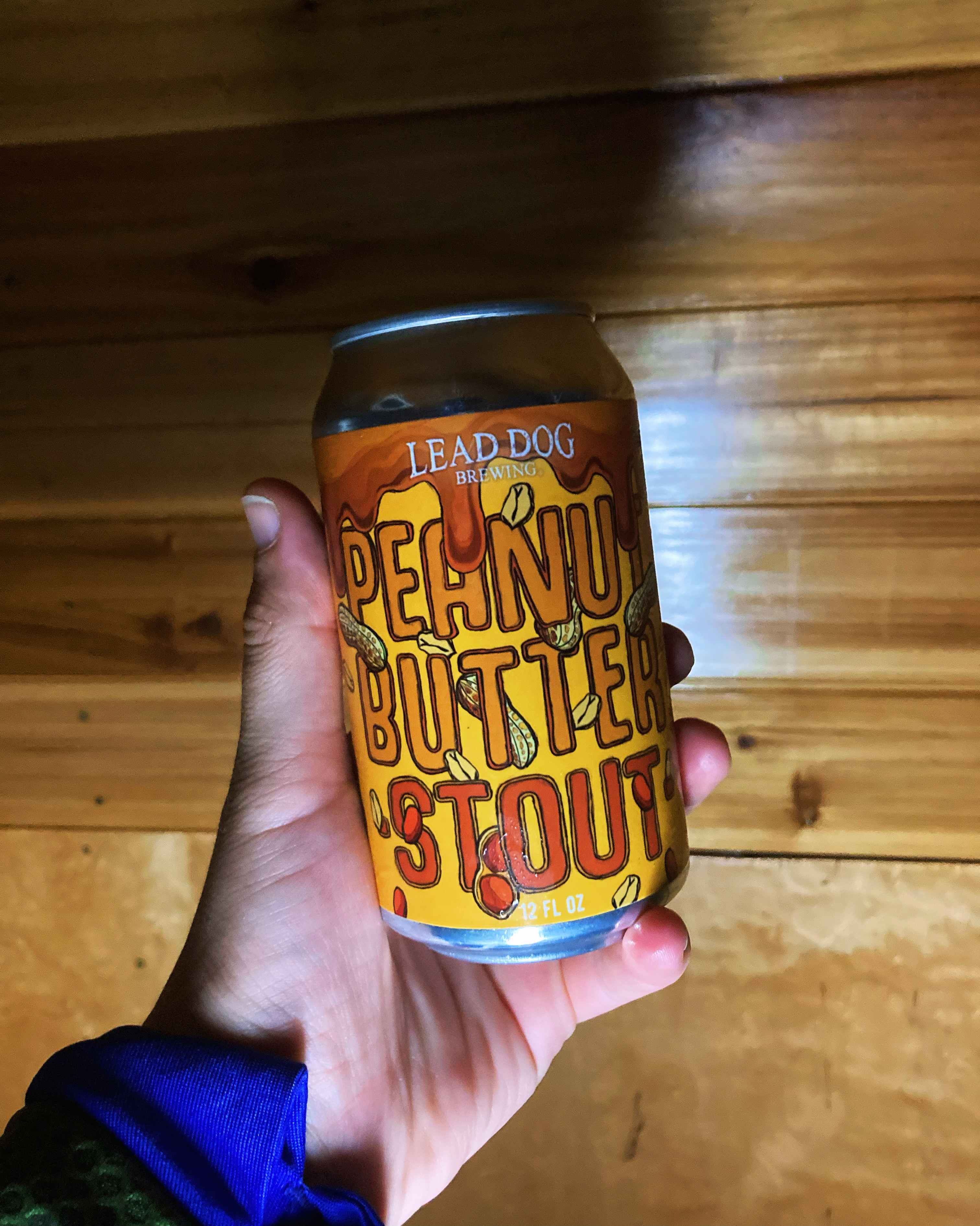
That Peanut Butter Stout was to die for. I’m not even a big peanut butter fan, and I decidedly don’t like it in desserts, but somehow this beer surpassed any expectation I could have had. So much so that had I opted to go over to the eastern side of the Sierra Nevada, over to Lake Tahoe, I probably would have gone into Reno, NV, to try Lead Dog Brewing – they’re clearly doing something right.
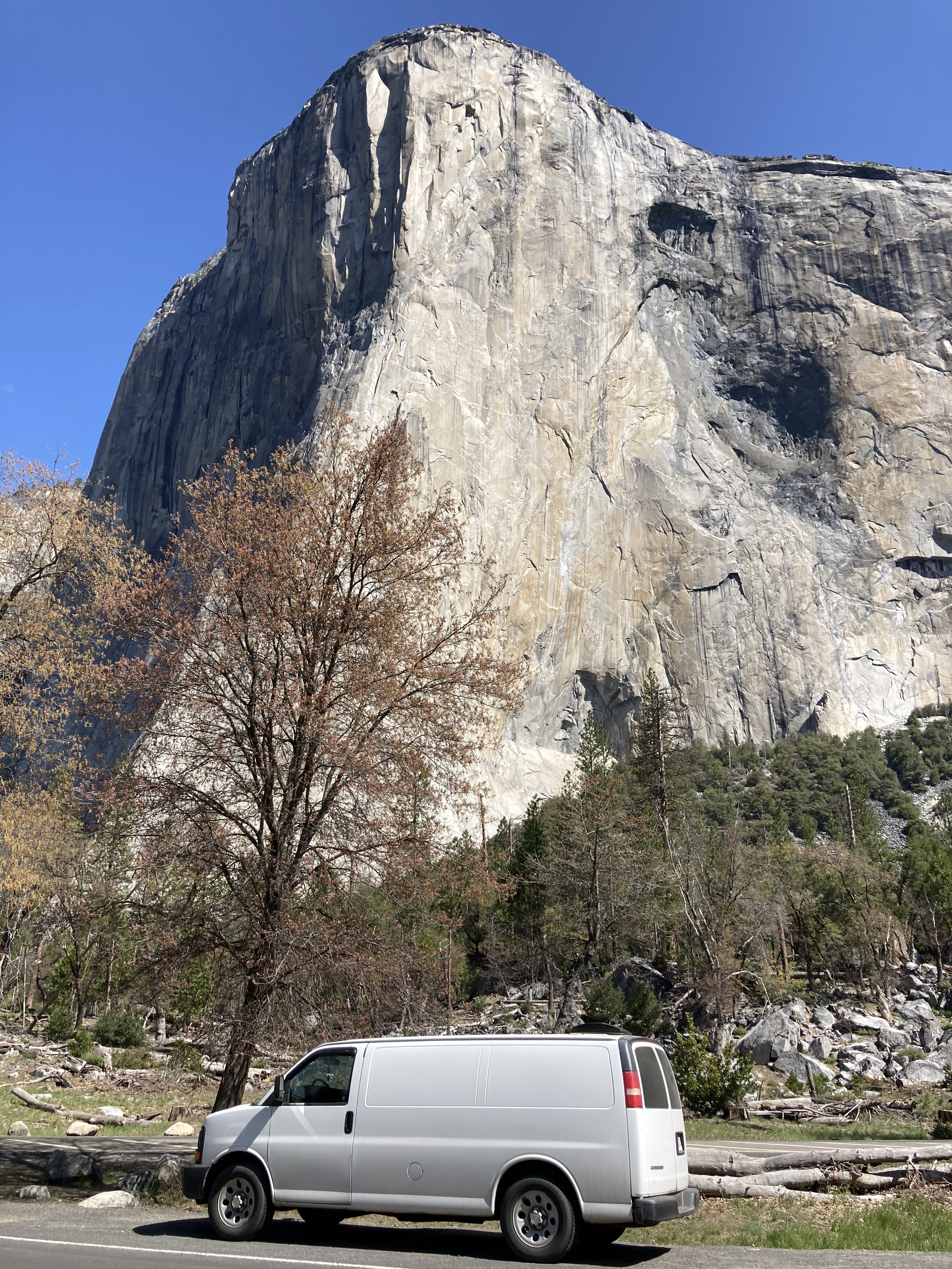
I’d found a spot on iOverlander just outside the park boundary, near El Portal. Literally as I drove out of the park, just past signage, there was a line of vehicles on the shoulders of either side of the road. I got one of the last spots. It was mostly vans, and a couple of RVs. Surprisingly, we weren’t told to move. Though I tried to look up the spot on iOverlander to link it here and it’s no longer there, so I would imagine the powers that be started cracking down.
My third and final day in Yosemite Valley started with a drive around the valley loop to sightsee (lots of areas to stop at). At this point in the year, the whole upper portion of the park/ highland roadways were still closed. There was minimal access beyond the valley. So sadly I missed out on a good portion of the park. I would have loved to hike the Four Mile Trail in particular – but it was closed. As was Glacier Point. That said, I made the most of what I did have access to.
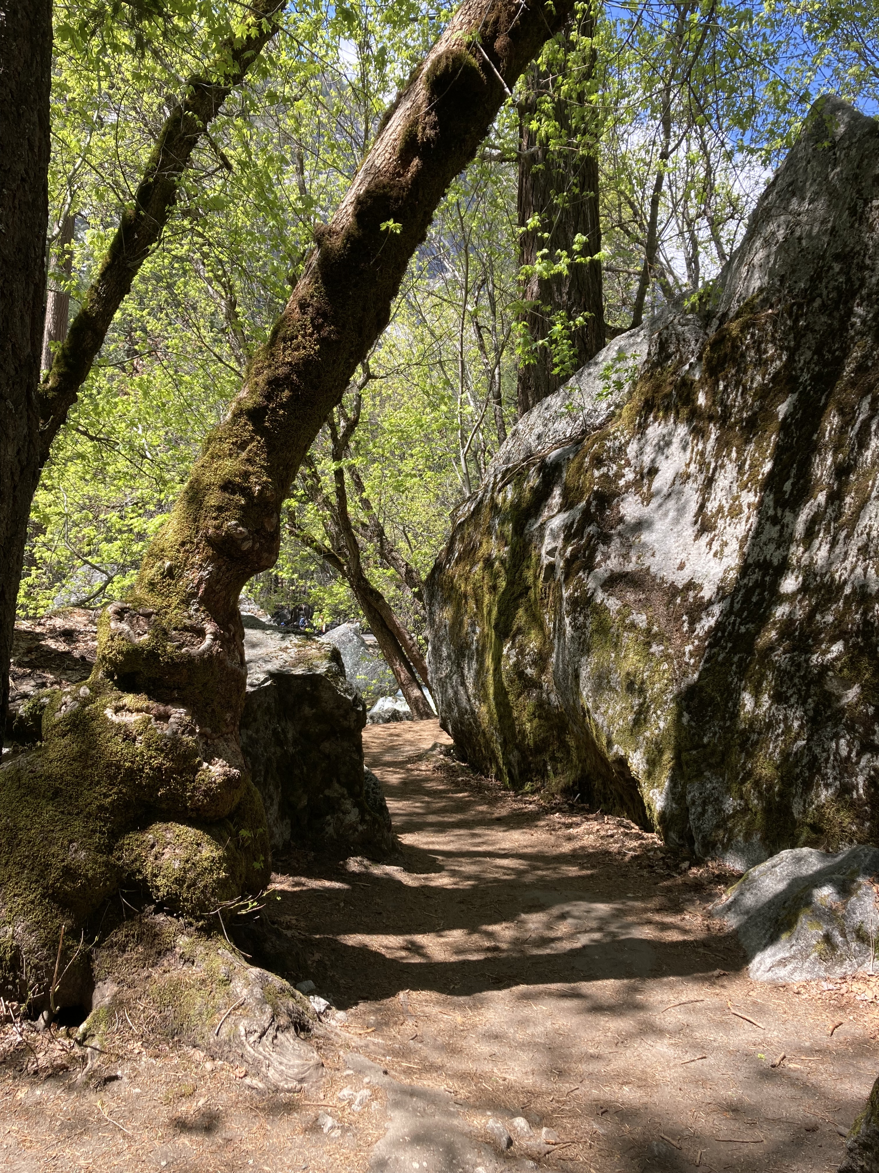
There’s lots to take in around the valley.
I did a short hike to Mirror Lake (not the full loop), which was mostly flat and took me to a meadow right in front of Half Dome for a close up look. I remember there being signs about being in mountain lion habitat and feeling more on edge about big cats here than I was on the previous day’s hike. In the meadow a deer walked by, grazing, unconcerned.
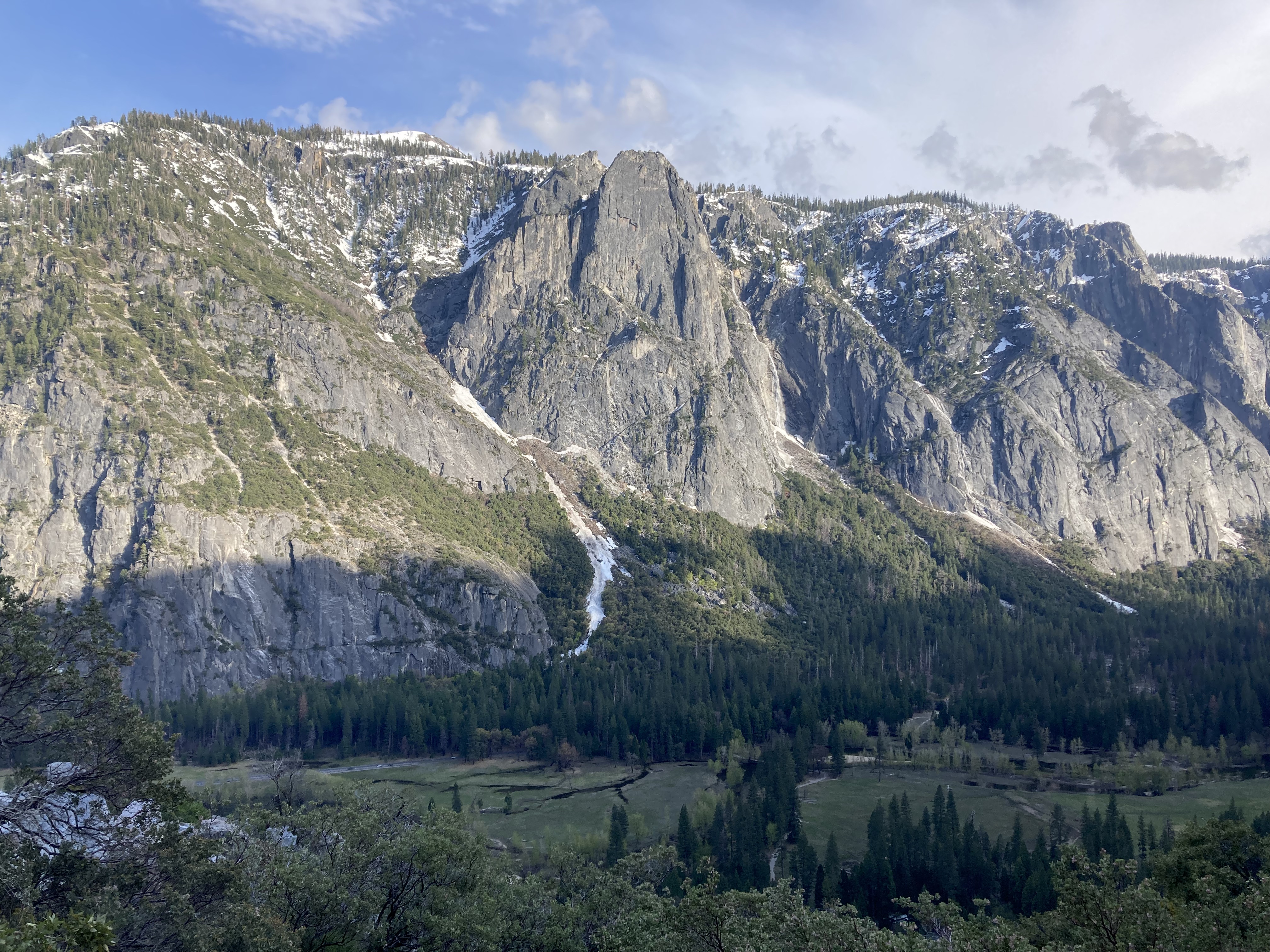
I revisited the park store for some final provisions and keepsakes (and more of that peanut butter stout) and popped in to Ansel Adams Gallery. Then I drove to Tunnel View:
I continued south on Wawona Road to Goat Meadow Trailhead & Snowplay Area as the sun went down, a typical winding mountain road at higher elevation. I pulled over at a turnout to take in the sunset over the valley.
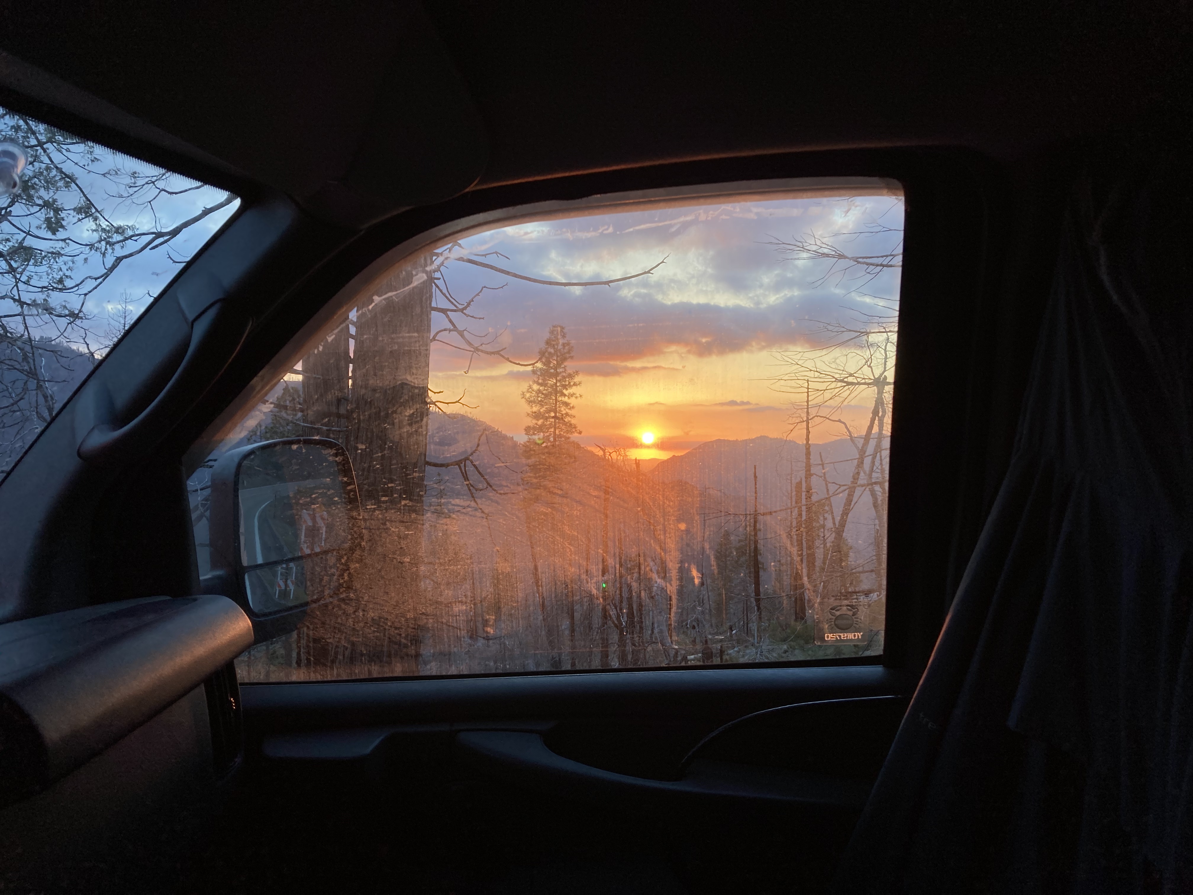
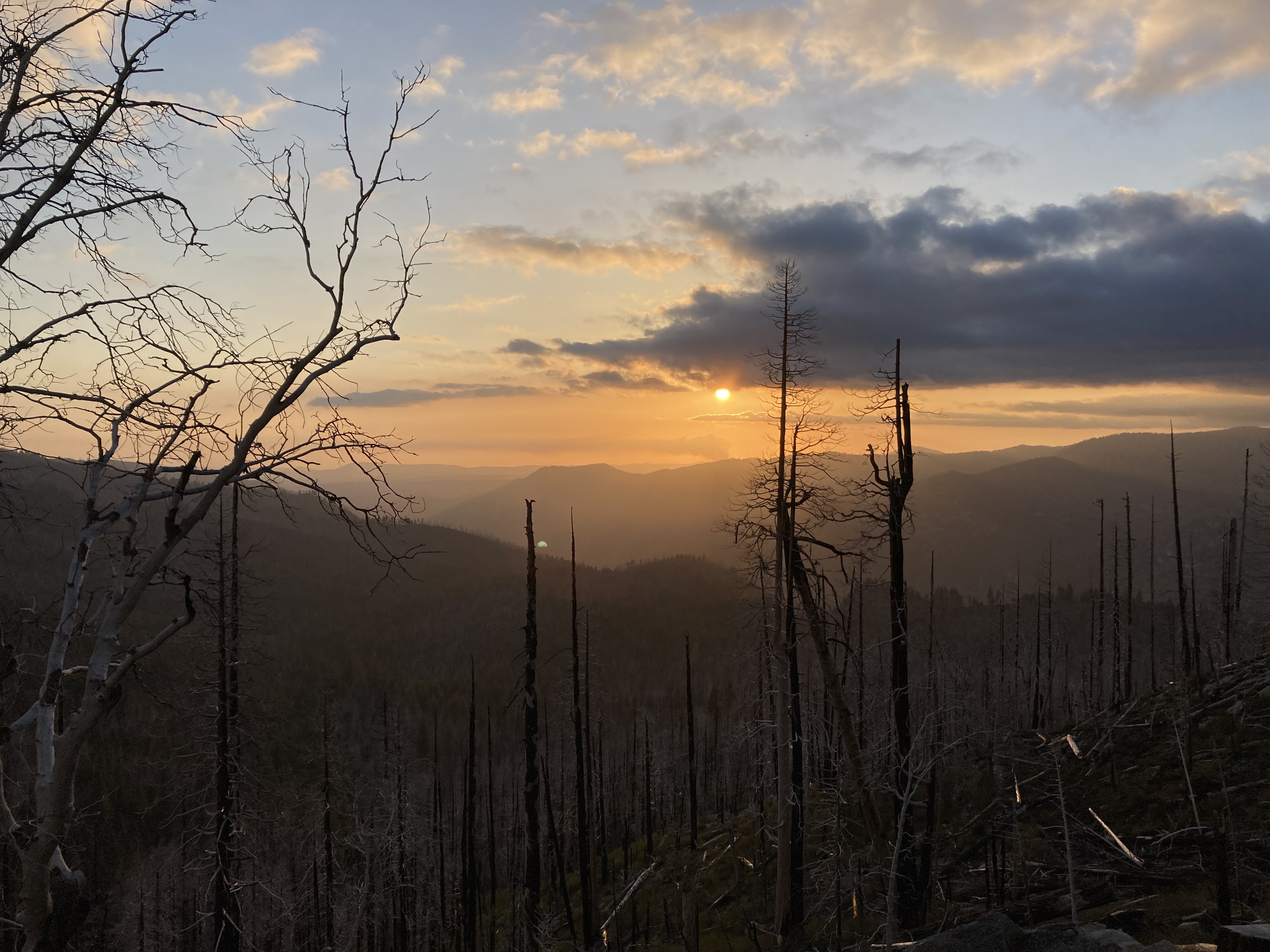
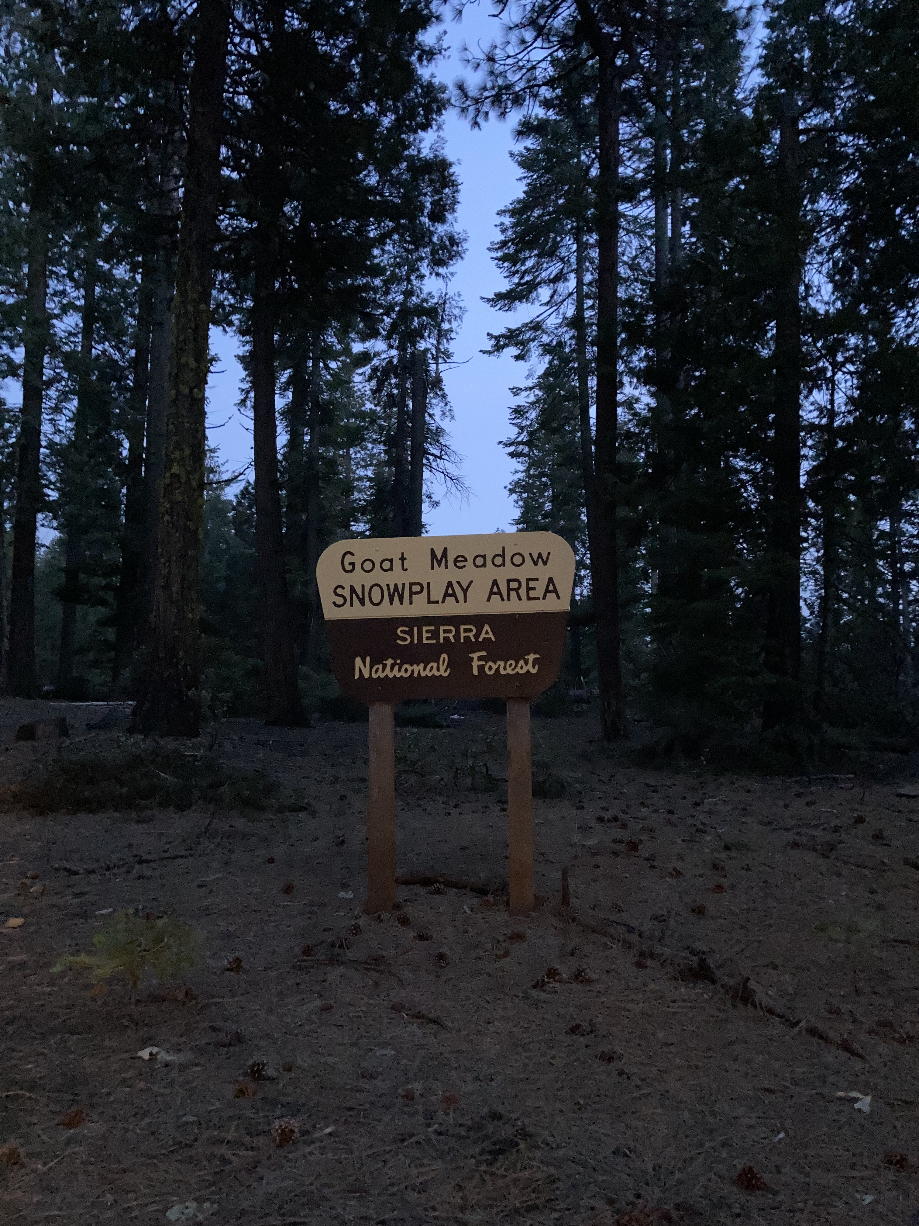
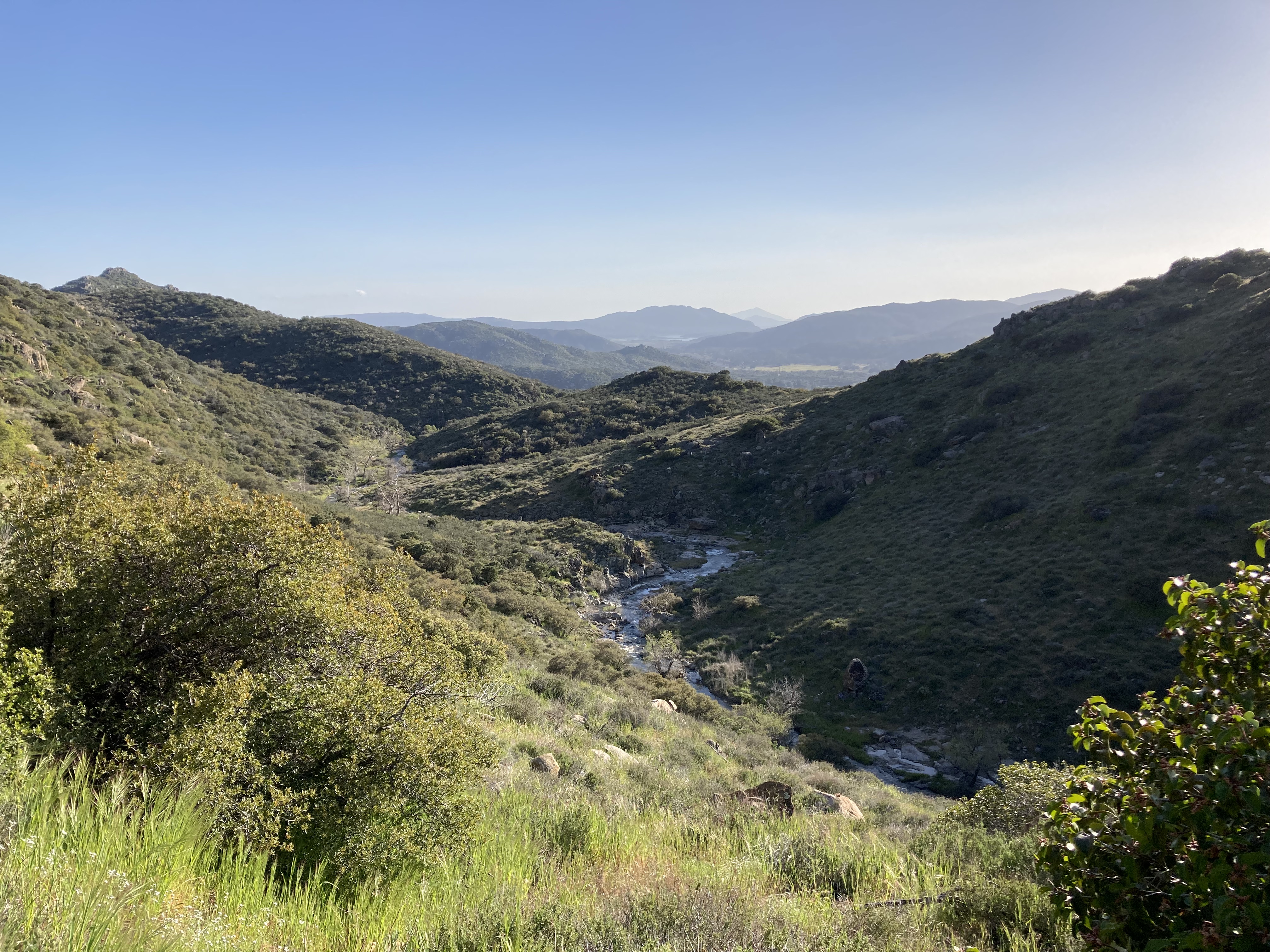
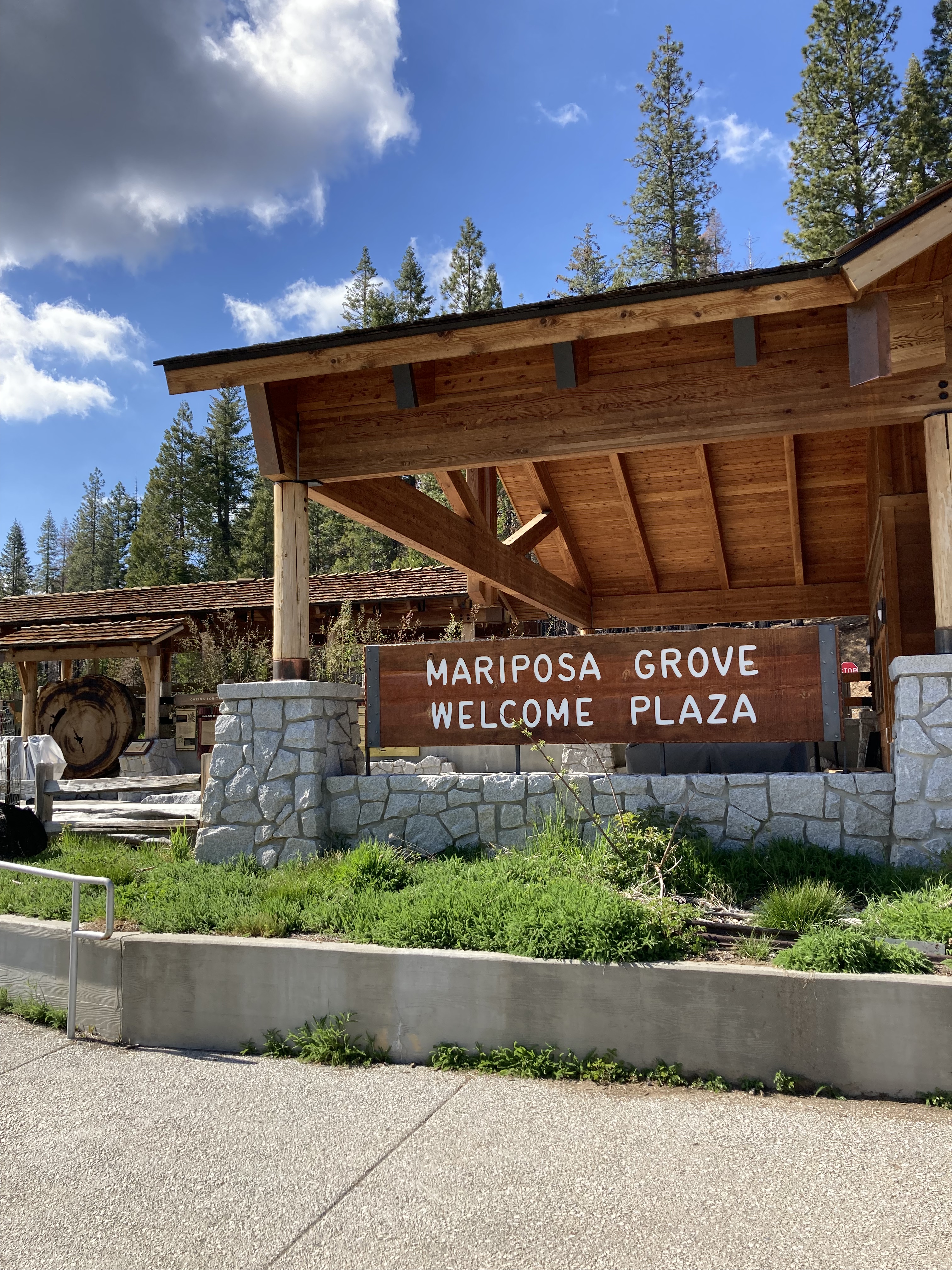
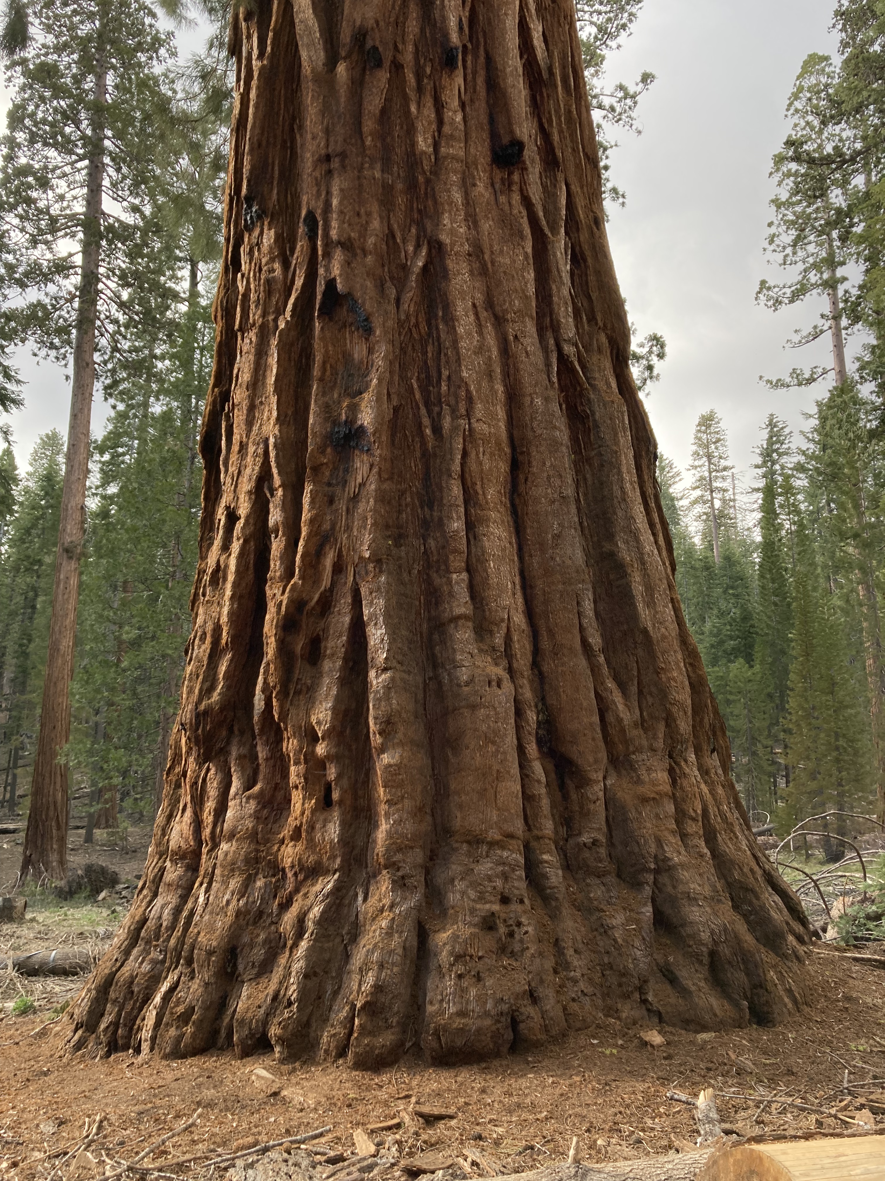
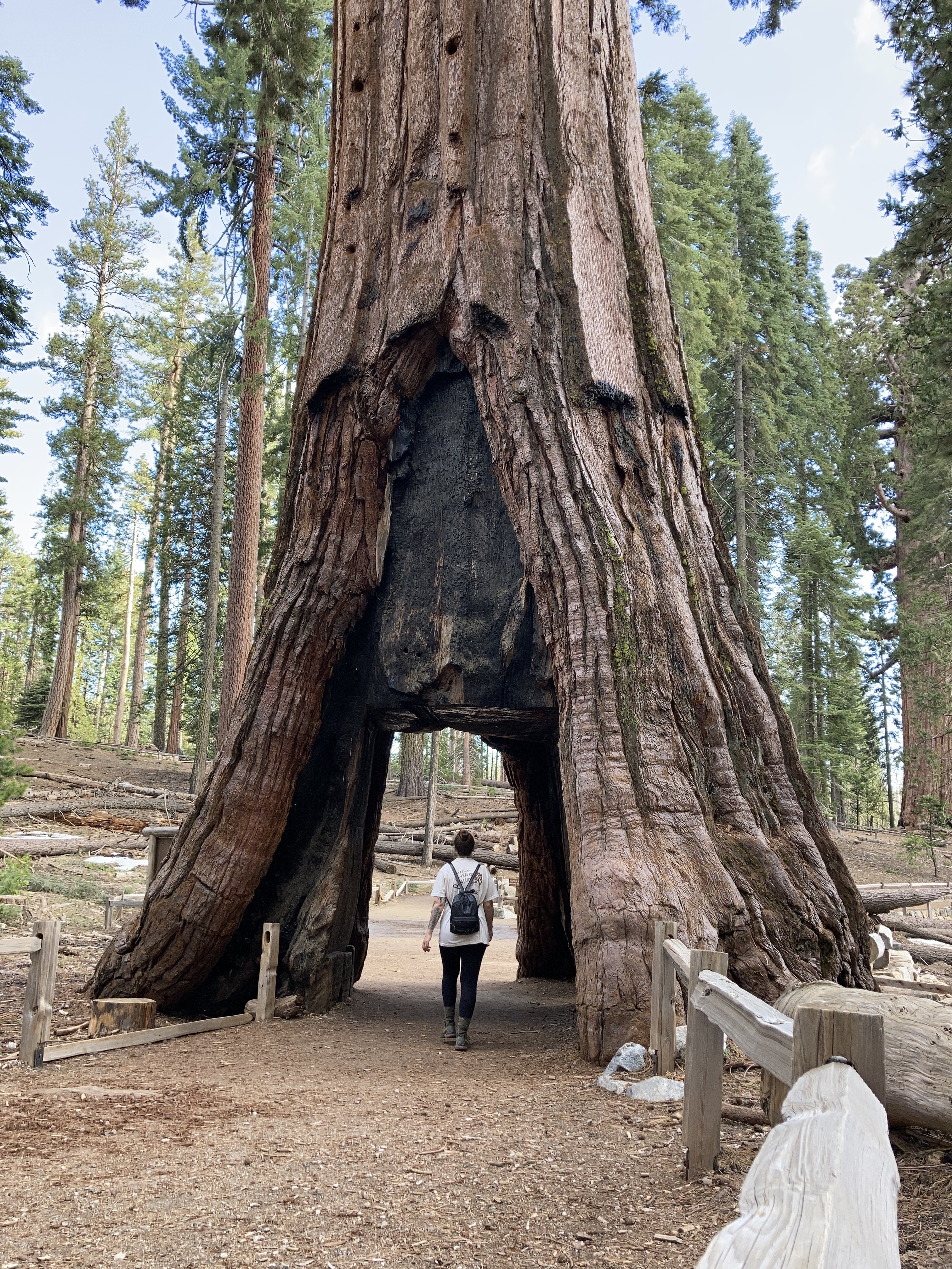
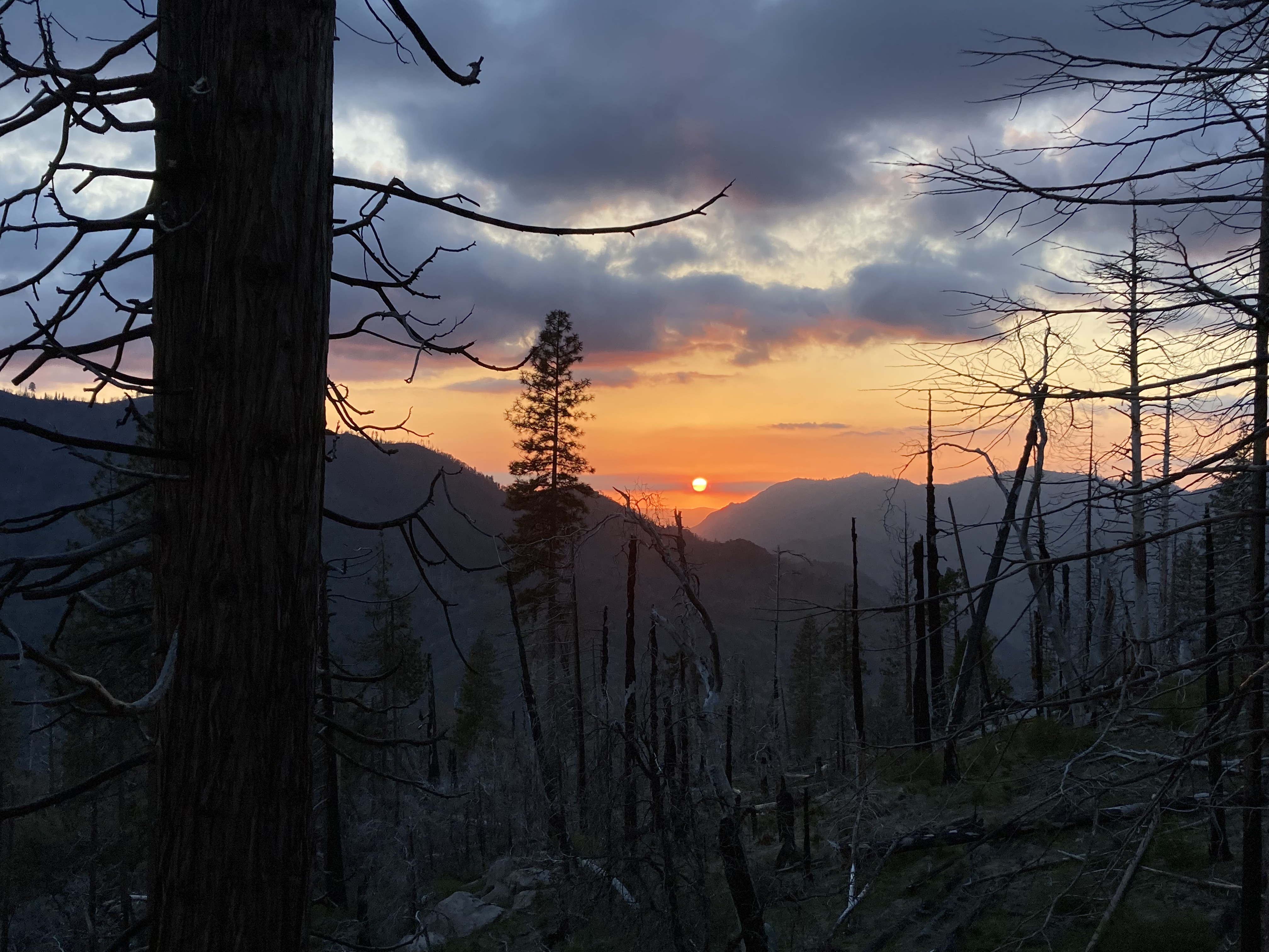
As it got darker a deer bolted out in front of the van, causing me to swerve slightly, which was not fun, and reminding me why I don’t usually drive at night, especially in the mountains (also to have my wits about me). But it wasn’t a long drive (maybe an hour) till I got to Goat Meadow, which had a dirt parking lot where I would be staying for the night. A couple of others were here, too. It was not far outside of the park boundary, in the Sierra National Forest, close to Mariposa Grove – which would be my substitute for the big trees I’d missed in Sequoia NP.
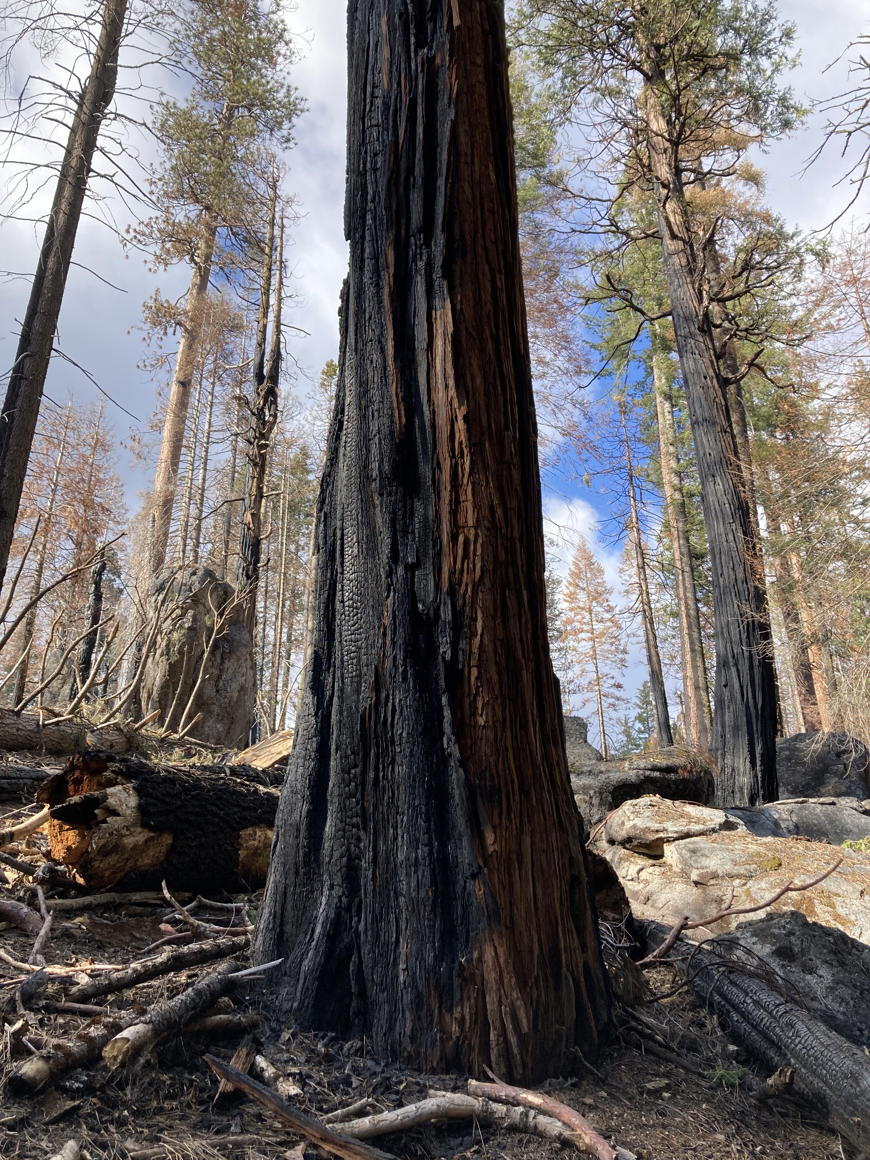
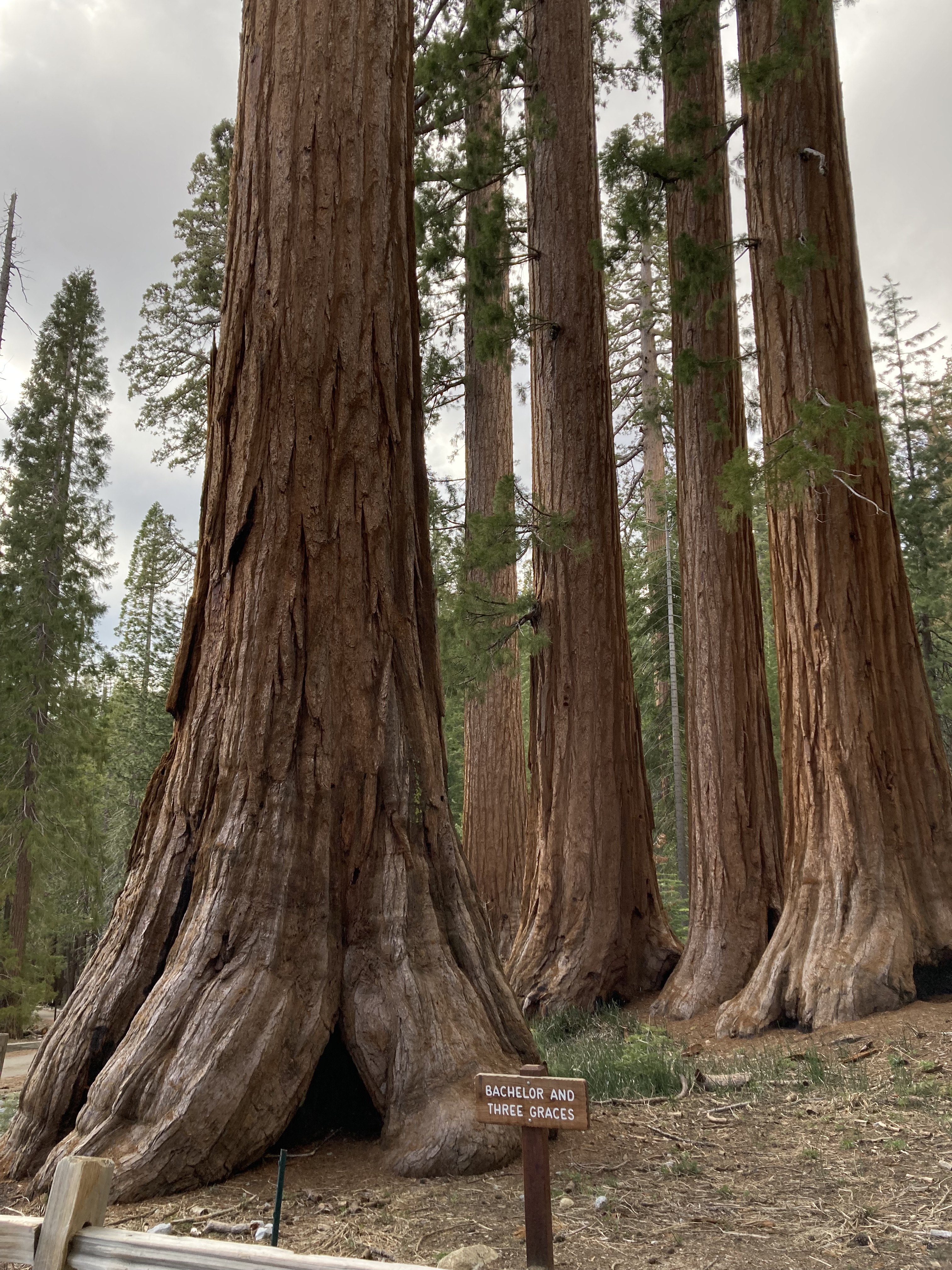
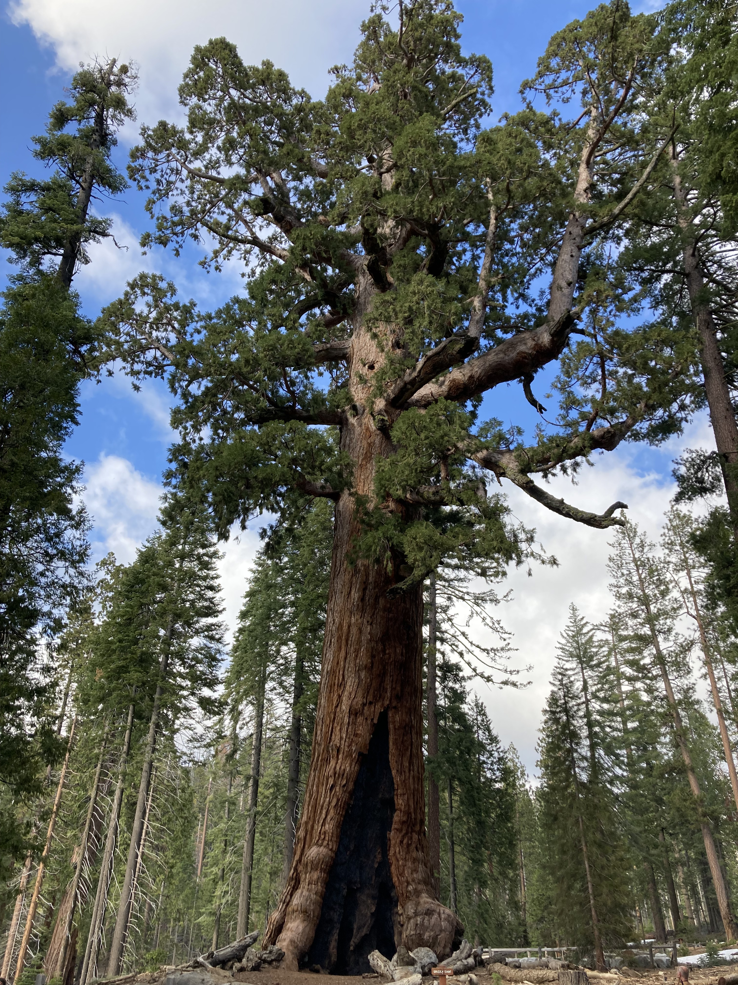
Mariposa Grove has ample parking and a little visitor centre / gift shop, plus bathrooms. It’s a nice hike – 2 miles to mariposa grove and the famed Grizzly Giant and Tunnel Tree, with several big sequoias with character along the way. The hike had some areas that had been touched by forest fires, some sparse areas, some trees with bark charred black. The hike was not strenuous, and it was just a lovely afternoon.
If I can get to Yosemite again I’d love to be there in the warmer months when the highlands are open. While you can drive to Glacier Point (many say this is the best view in the park), I’d love to hike Four Mile Trail, which takes you from the valley floor in front of Sentinel Rock right to the top of Glacier Point (16.6km there and back/ 8.3km one way, 1,042m elevation gain). Not a hike for the faint of heart, but you’ll feel like you’ve earned the views as a reward at the top, and certainly a celebratory beer and hearty meal. If ambitious you can take a different path back down to the valley via Panorama and Mist Trails.
Hetch Hetchy is a popular spot in the northwest area of the park. I’d also just like to drive along Tioga Road when it’s open, which runs north of the valley in the highlands, visiting spots along the way, like Olmsted Point, Tenaya Lake, and Tuolumne Meadows. National parks can be overwhelming in how much there is to do and see.
Leaving California
I spent a second night at Goat Meadow, which had been a relaxing spot where I did a bit of research for the upcoming travel days. Then headed out the next morning for a big drive day heading north.
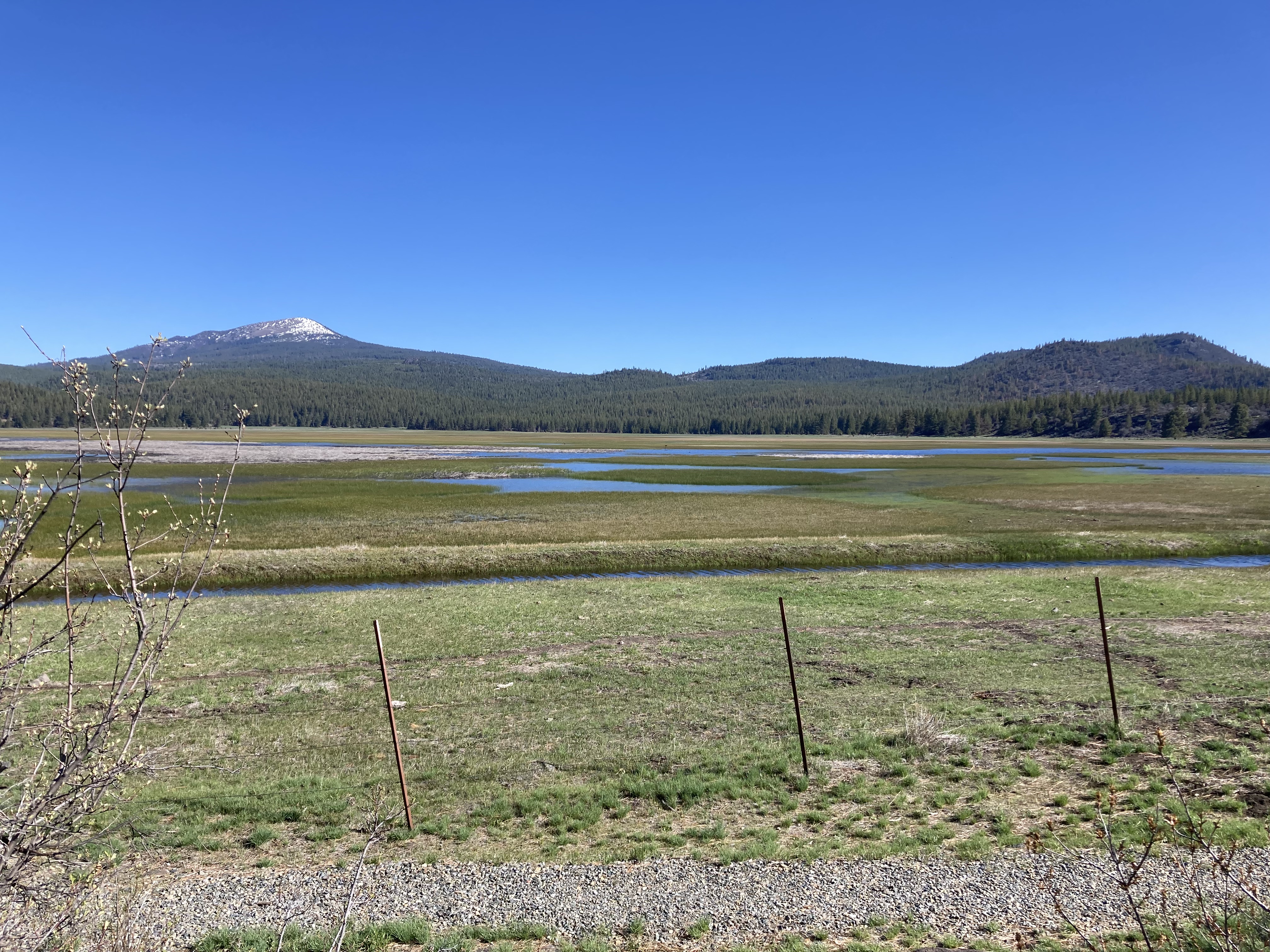
I drove west from Yosemite/ Mariposa Grove/ Sierra National Forest to get back onto highway 99. Then north through Stockton, onto the I-5, through Sacramento, and northwest from here where I stopped at a rest area for a break. It was a scorcher, with a high of 32 degrees C, which you feel in a vehicle with no AC. I thought I’d left behind that kind of weather in the desert! I was so wrong.
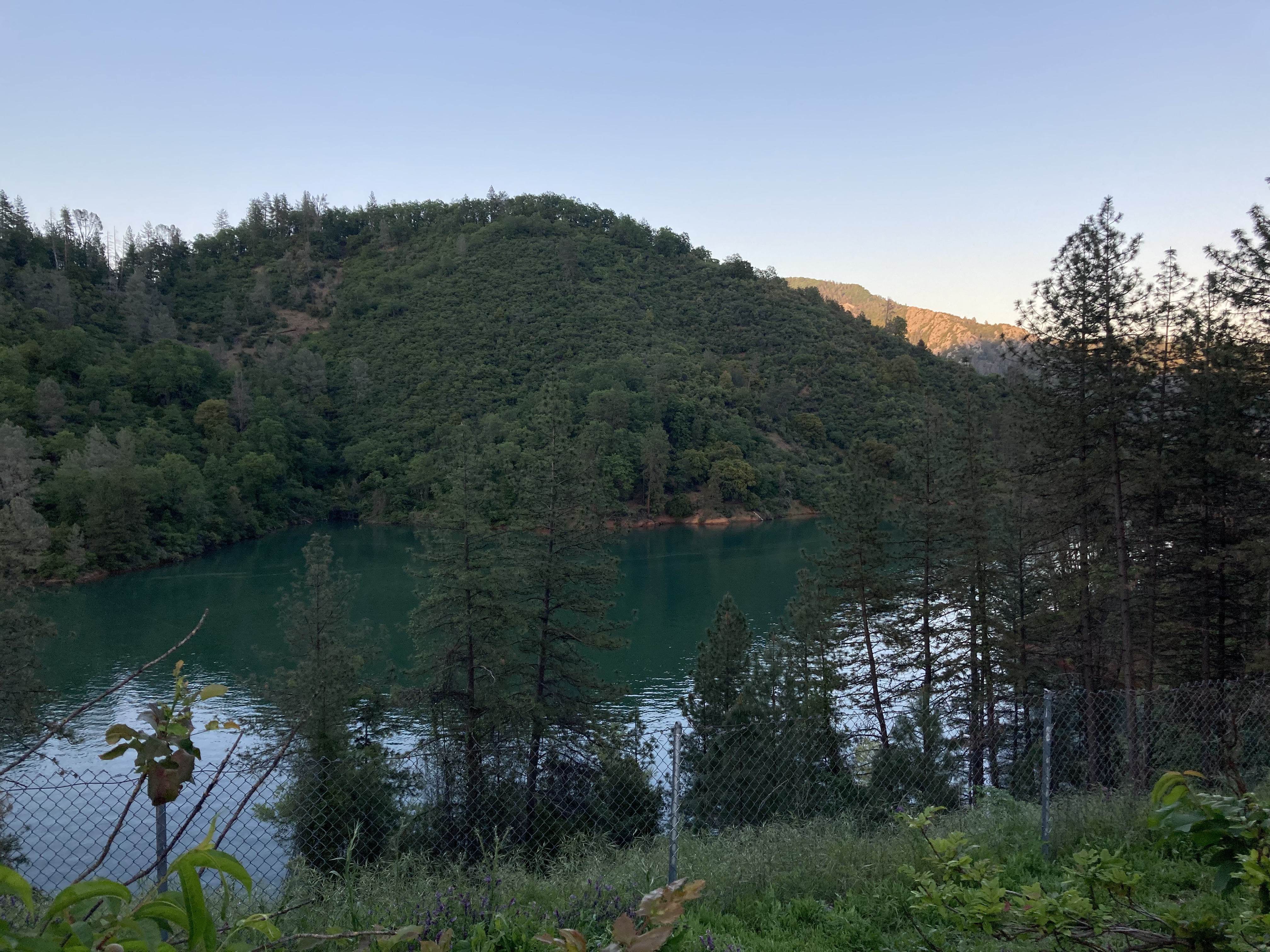
I cued up some podcasts and continued north on the I-5, through Redding, past Lassen Volcanic National Park, towards Mount Shasta. Another rest area to stretch my legs and use the bathroom. A stop for gas. The area around Shasta Lake was beautiful.
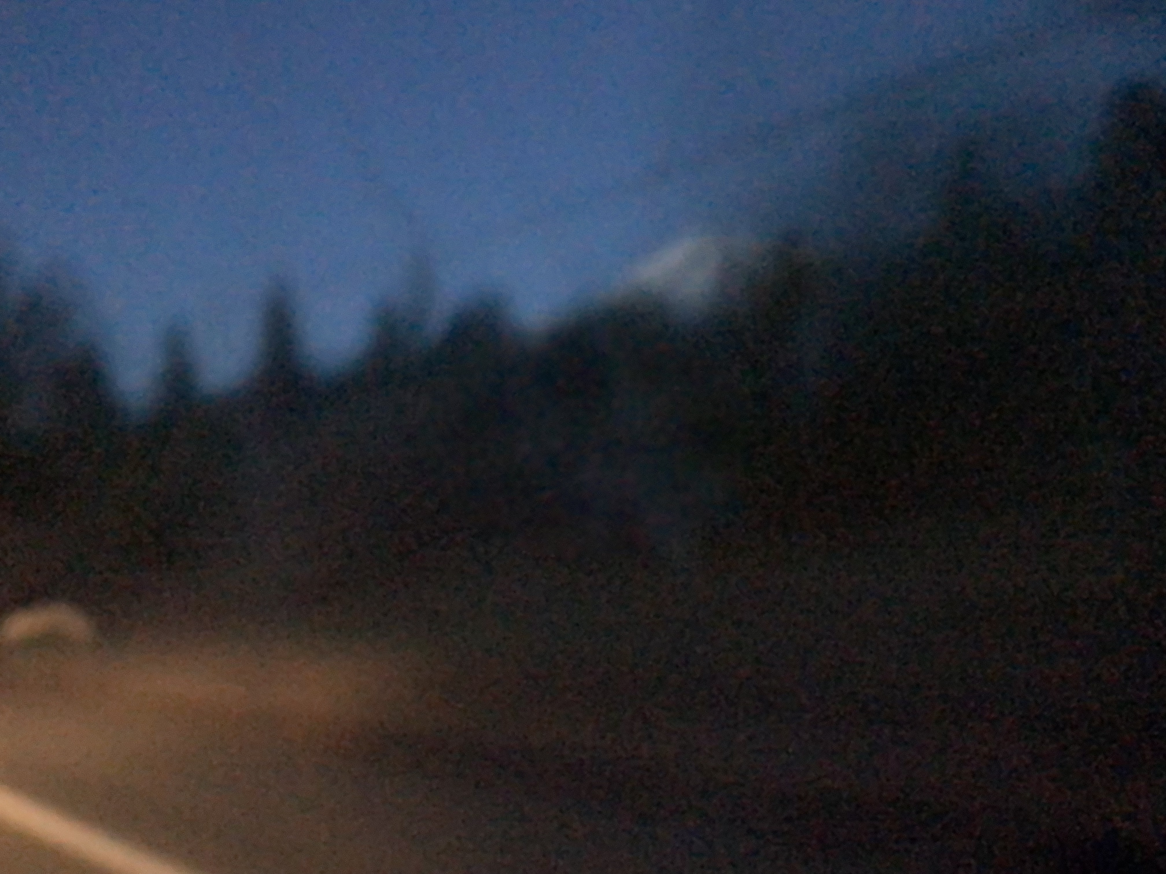
It felt absolutely blasphemous to bypass Mount Shasta. That blurry picture is all I got.
It had gotten dark, so I stopped for the night at Grass Lake Rest Area, just 30 miles south of the Oregon Border. I’d driven 7.5 hours that day, quickly putting the rest of California behind me. It was my last night and morning in California and I couldn’t believe it.
I was mentally preparing myself to cross the border, as I’d been in California for what felt like so long, and I always find crossing borders to require an adjustment period. Plus, I wouldn’t be able to pump my own gas anymore…
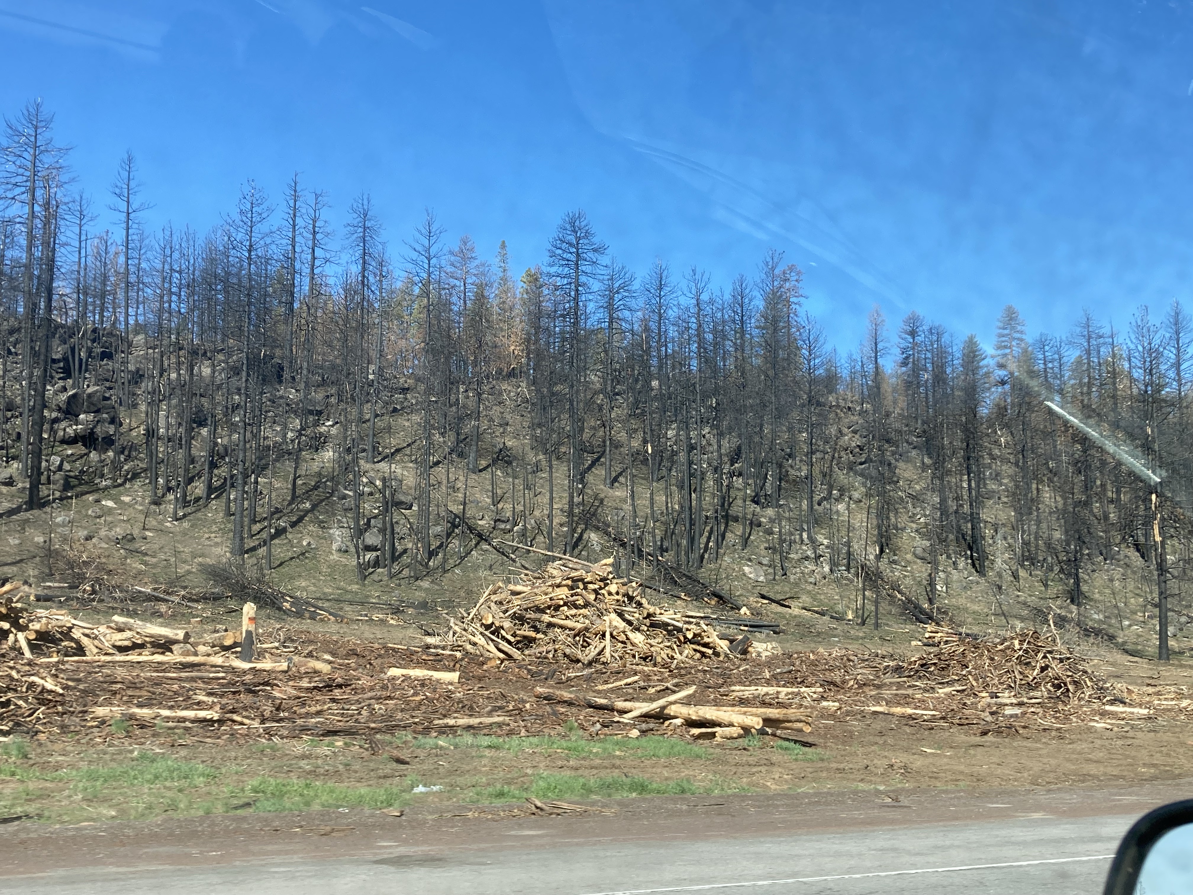
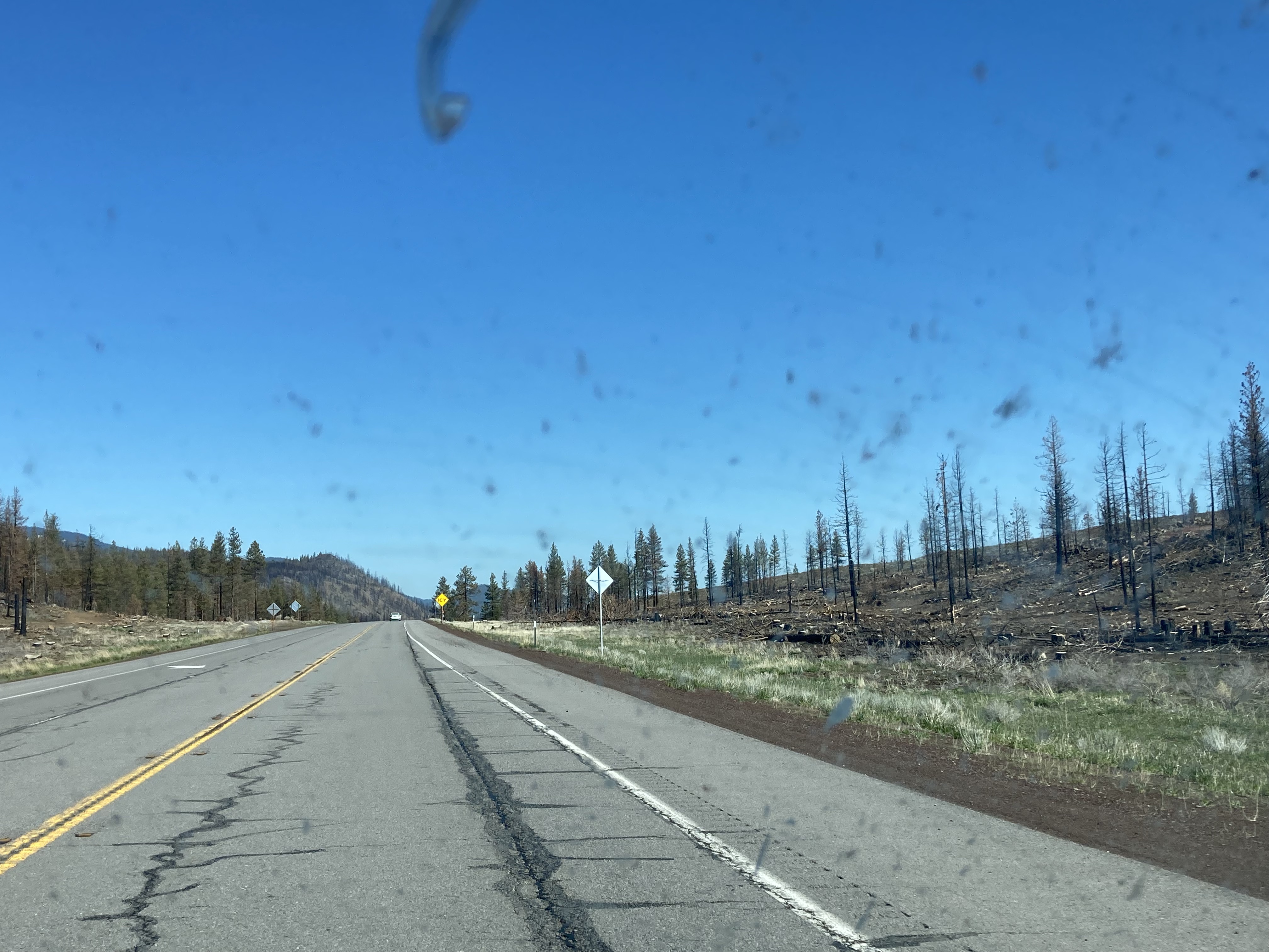
The landscape already didn’t feel like California. I remember the drive towards the Oregon border felt like these ghostly forests, sparse, the remains of wildfire carnage.
The California-Oregon border had its checkpoint to pass through, and then I was back in Oregon, about to take on its interior.
An era had come to an end.
Other
Next Time In Cali
Looking back at my time in California, I covered a lot of ground, but there are always going to be places you don’t get to. I would maintain that not everywhere is worth going. But sometimes you don’t know that until you check it out for yourself. Here are some places I missed and might consider in the future (some more than others):
- Redwood National Park (near Crescent City and extending down the coast towards Eureka).
- *Napa Valley (wine, north of SF).
- Sacramento? (2 hours NE of SF).
- San Jose? (SE Bay Area, tech city).
- Mavericks Beach (south of SF just north of Half Moon Bay, destination for surfers)?
- Manhattan Beach, Hermosa Beach, & Redondo Beach are next to each other south of Santa Monica and before Palos Verdes.
- Laguna Beach (Orange County, south of Newport Beach and north of Dana Point and San Clemente).
- Lake Arrowhead & Big Bear Lake (between LA and Joshua Tree in the San Bernardino Mountains).
- Palm Springs.
- *Route 66, to drive along a section of it.
- **Death Valley (North of Joshua Tree, east of Sequoia NP and the southern Sierra Nevada mountain range).
- *Mount Whitney (Sierra Nevada range, by Sequoia NP, near Lone Pine, CA).
- *Methuselah – the oldest known tree in the world, a 4,856 year old pine tree in the White Mountains of California!
- Mammoth Lakes (town in the Sierra Nevada near Mammoth Mountain, a base for Devils Postpile National Monument, east of Yosemite and Sierra National Forest, Mammoth Brewing Company).
- *Lake Tahoe (Sierra Nevada, on the border between California and Nevada, near Reno, water nearly as pure as distilled water; 170 mile Tahoe Rim Trail around the lake, 1929 Nordic-style mansion Vikingsholm).
- *Lassen Volcanic National Park (a little south of Mount Shasta, east of Redding, NE California; Lassen Peak Volcano, hydrothermal sites, bubbling mud pots, lava rocks, PCT).
- *Mount Shasta.
Safety
In my previous posts I broke down the crime rates that I referenced heading into new areas and cities. I used a resource that provided information by state, county, and city, including population, population density, reported crimes, rate of crimes per 1,000 people, and broke the crimes down into violent and property crimes. Rate per 1,000 people for violent and property crimes were the two numbers I focused on, and as I travelled and got a feel for places and cross-referenced to the numbers, I started being able to gauge what the numbers meant from how places felt.
For example, a violent crime rate of 3 or 4 or less did not feel too worrisome. But I would see big cities with violent crime rates around 8 or 9, and that or higher meant that I would aim to be more aware of my surroundings. With property crime rates anything in the low 20s or less felt pretty good. The 30s felt like a middle ground where I would want to be more aware. With big cities I often saw property crime rates around 50 (per 1,000), which felt high, and anything above that I might want to steer clear.
Of course, in big cities the safety and feel of a place can vary widely based on neighbourhood, even down to the block.
The above resource is from 2014 and rates have probably shifted, though I felt it was a good enough source to give me an idea, and I found it to be user friendly.
Here is a roundup of crime rates for some of the cities I visited or passed by in the California interior:
| Location | Violent crimes per 1,000 people | Property crimes per 1,000 people |
| Cathedral City | 2.40 | 22.37 |
| Indio | 5.51 | 26.14 |
| Coachella | 3.80 | 26.40 |
| Palm Springs | 6.32 | 58.33 |
| Twentynine Palms | 2.39 | 11.61 |
| Yucca Valley | 3.53 | 25.11 |
| San Bernardino | 9.92 | 43.05 |
| Visalia | 3.77 | 29.54 |
Unfortunately, places like Slab City, Joshua Tree, Pioneertown, and Yosemite Village don’t have stats in the above resource. But they are probably just too small, or not really classified as cities. The only one of those that I really pondered safety with regards to was Slab City, but I think if you have your wits about you and mind your own business you’d be fine.
I didn’t go to or through San Bernardino but I included it in the table for reference as I had a conversation with someone about it being a very high crime place, which made me reflect as I’d been there several years ago, when I was young and a bit more clueless – and I’d had no idea. In that conversation the view was shared with me that San Bernardino was not as bad as Baltimore, MD, with its high violent crime, but close. Baltimore as a place where people hold cars at red lights at gun point and often shoot whether you comply or not. It was shared that the police are not effective so most people conceal carry guns. A “failed city”. And that suburbs outside a dangerous city are often perfectly safe.
This was a chilling conversation – you don’t worry about being held up at gunpoint at red lights in Canada. It also prompted me to want to look into which states were conceal carry/ open carry.
A final point in terms of safety that I’ll mention is going into areas without cell service. Having a satellite device, like a Garmin Inreach, as thru hikers do, can be useful. Or GPS navigation on your vehicle. I always made sure to map out places beforehand. It is prudent to carry an extra container of gasoline. You never know if you could get lost hiking or break down on backcountry roads. I was lucky in that nothing like this has happened to me. But you have to plan for the possibilities.
Hiking / PCT
Just for reference, here’s an article with some day hike suggestions for the PCT. I could have planned my PCT day hikes better, but found my way onto the trail where our paths crossed.
Best Sunsets
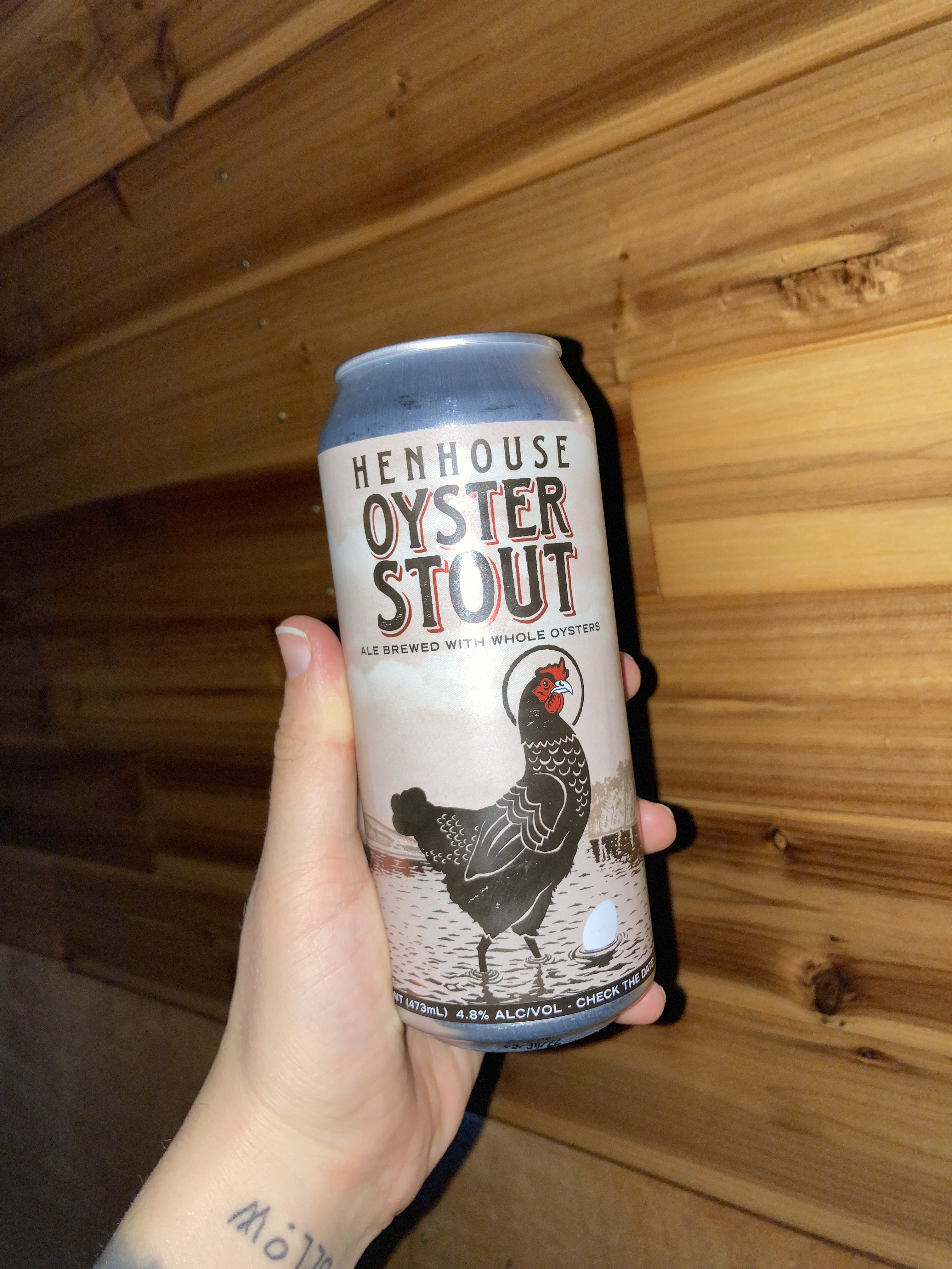
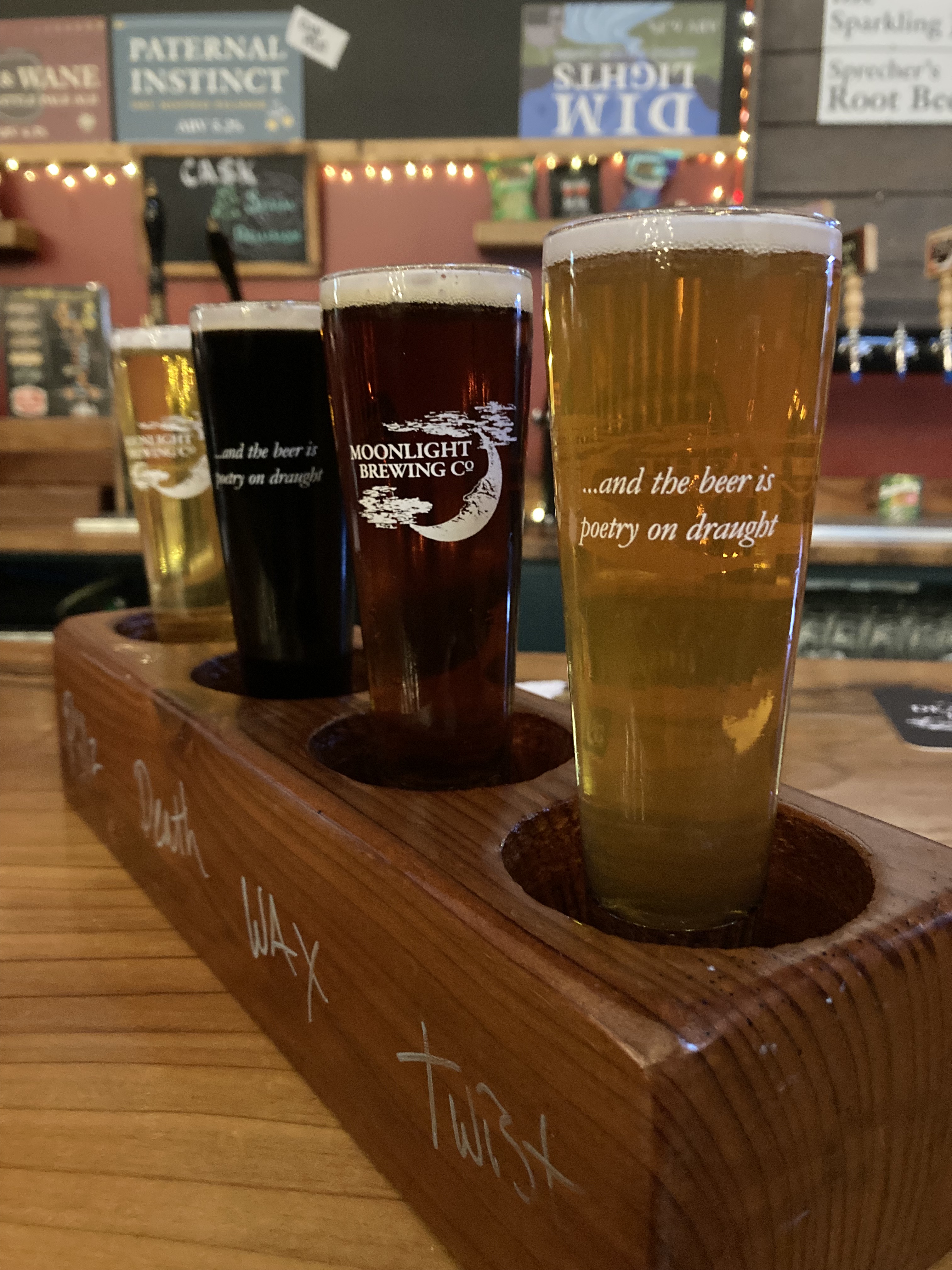
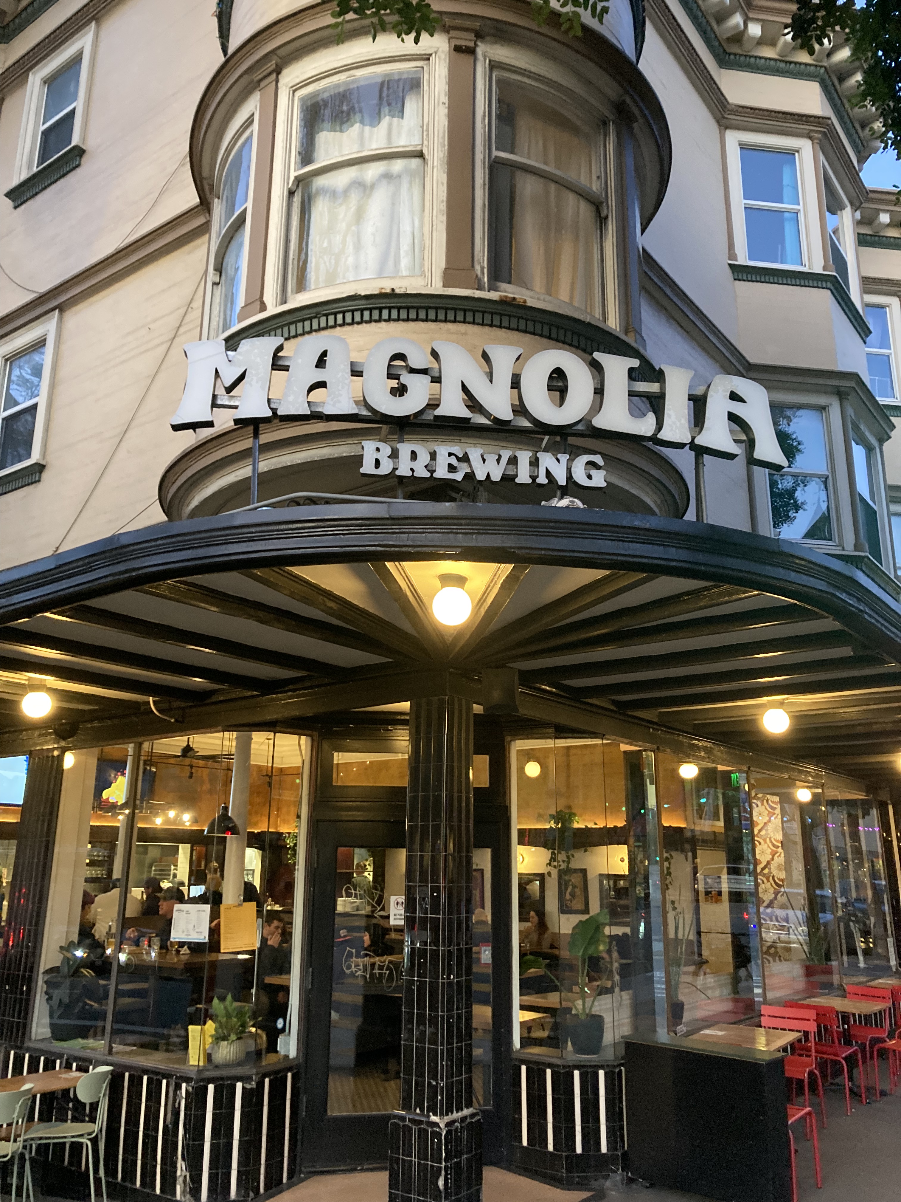
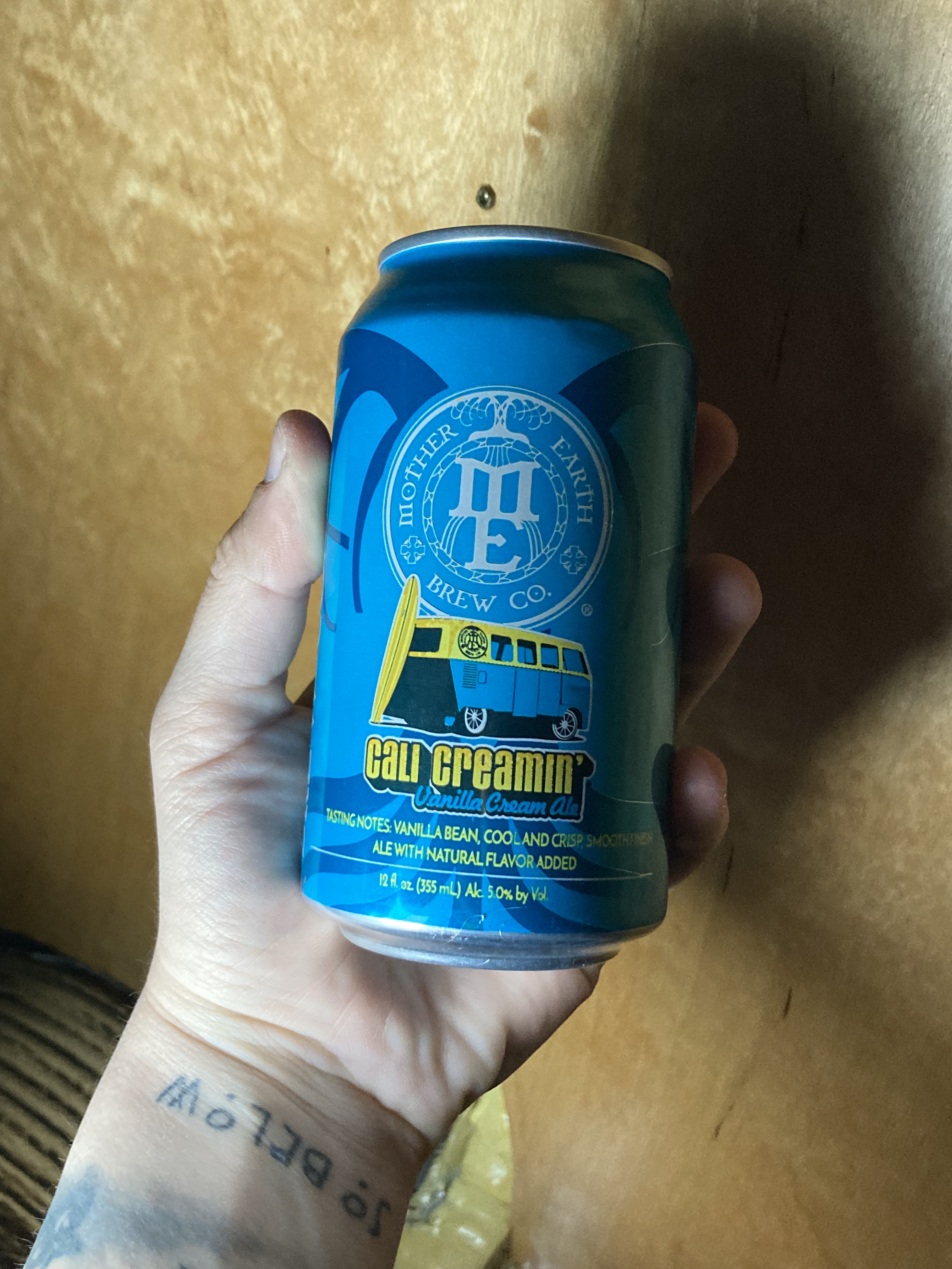
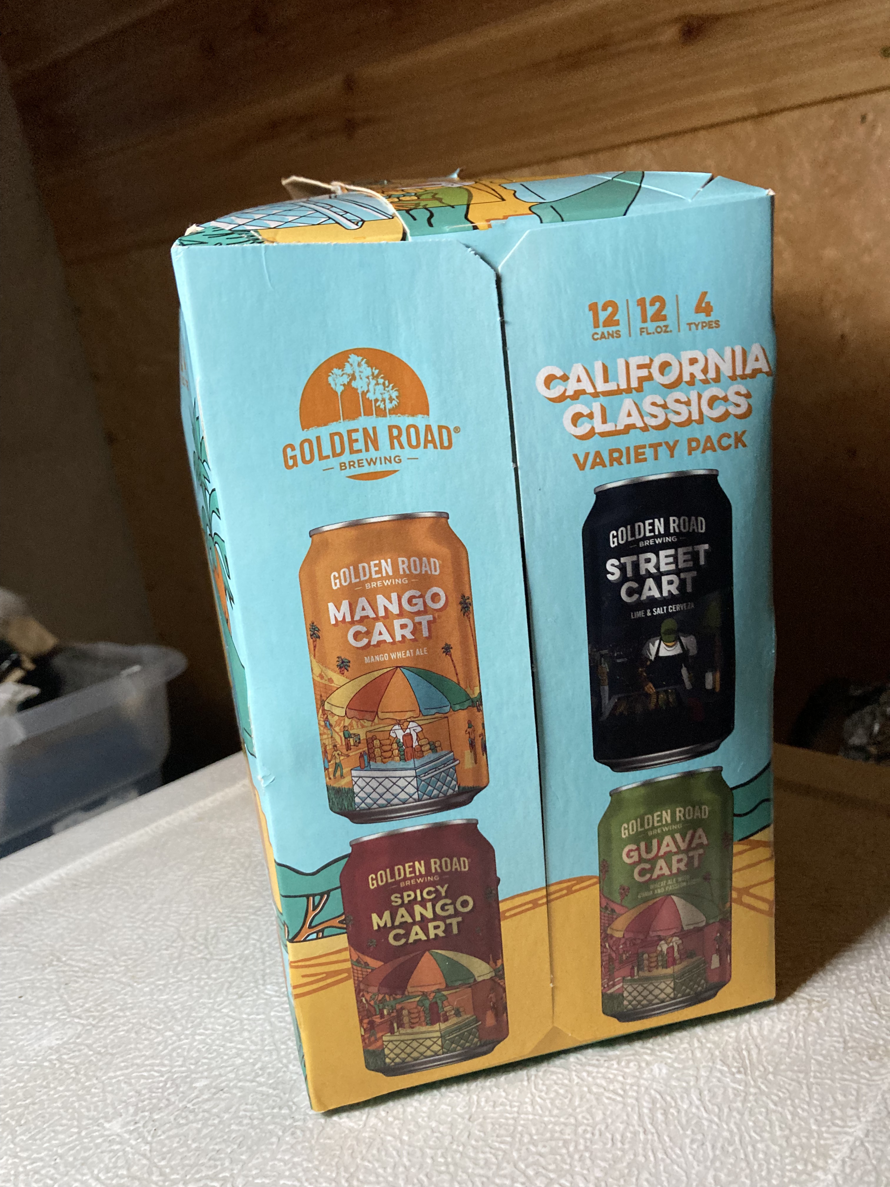
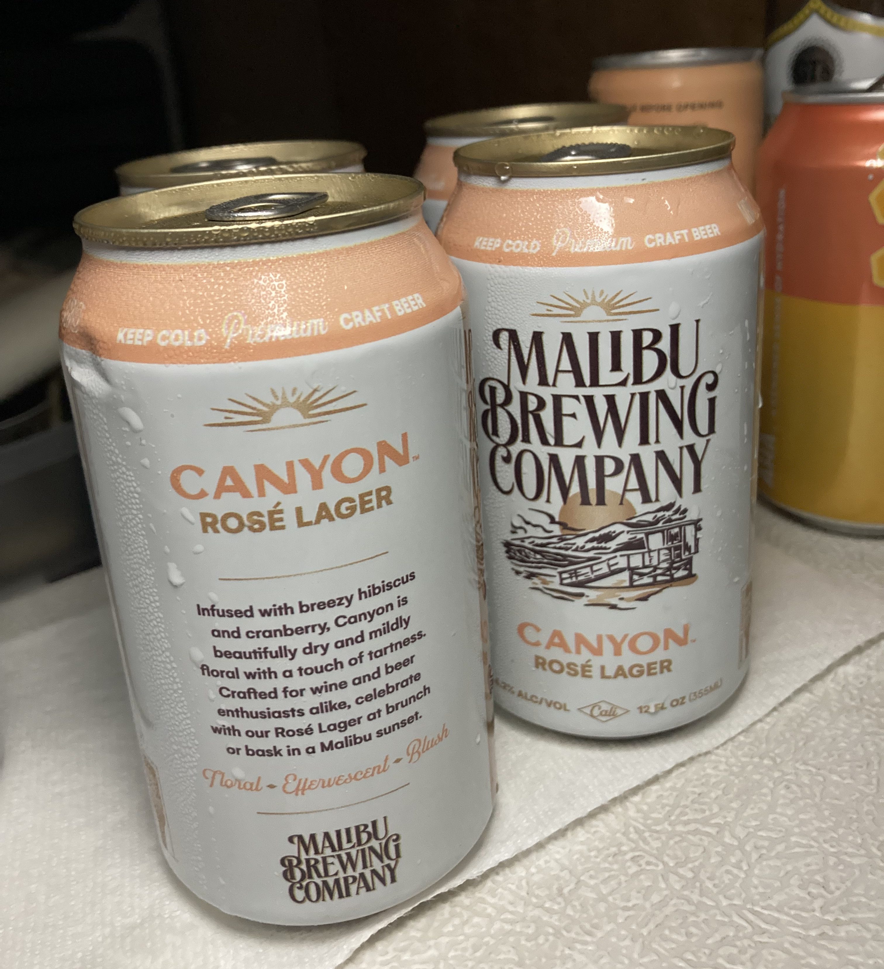
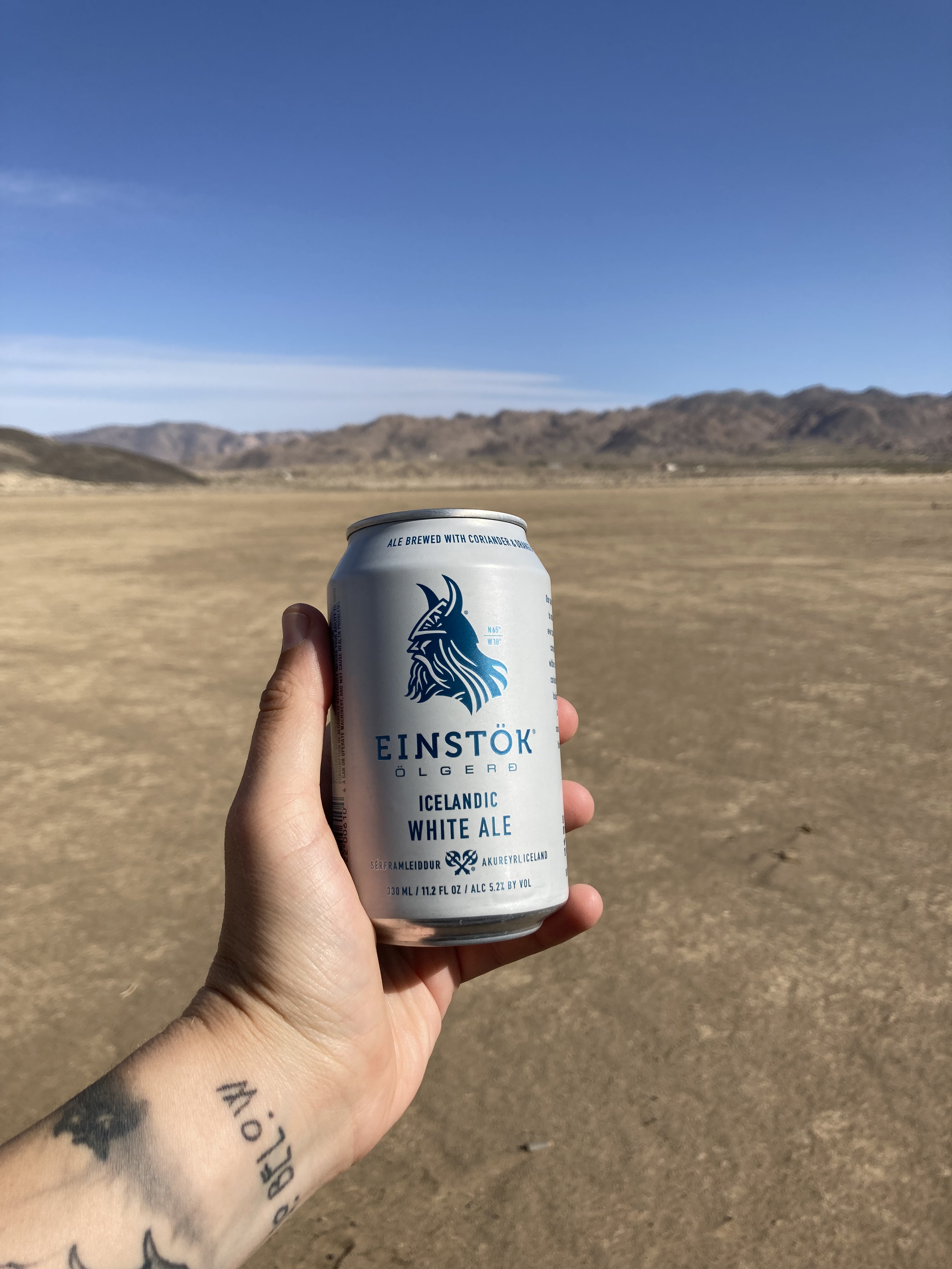
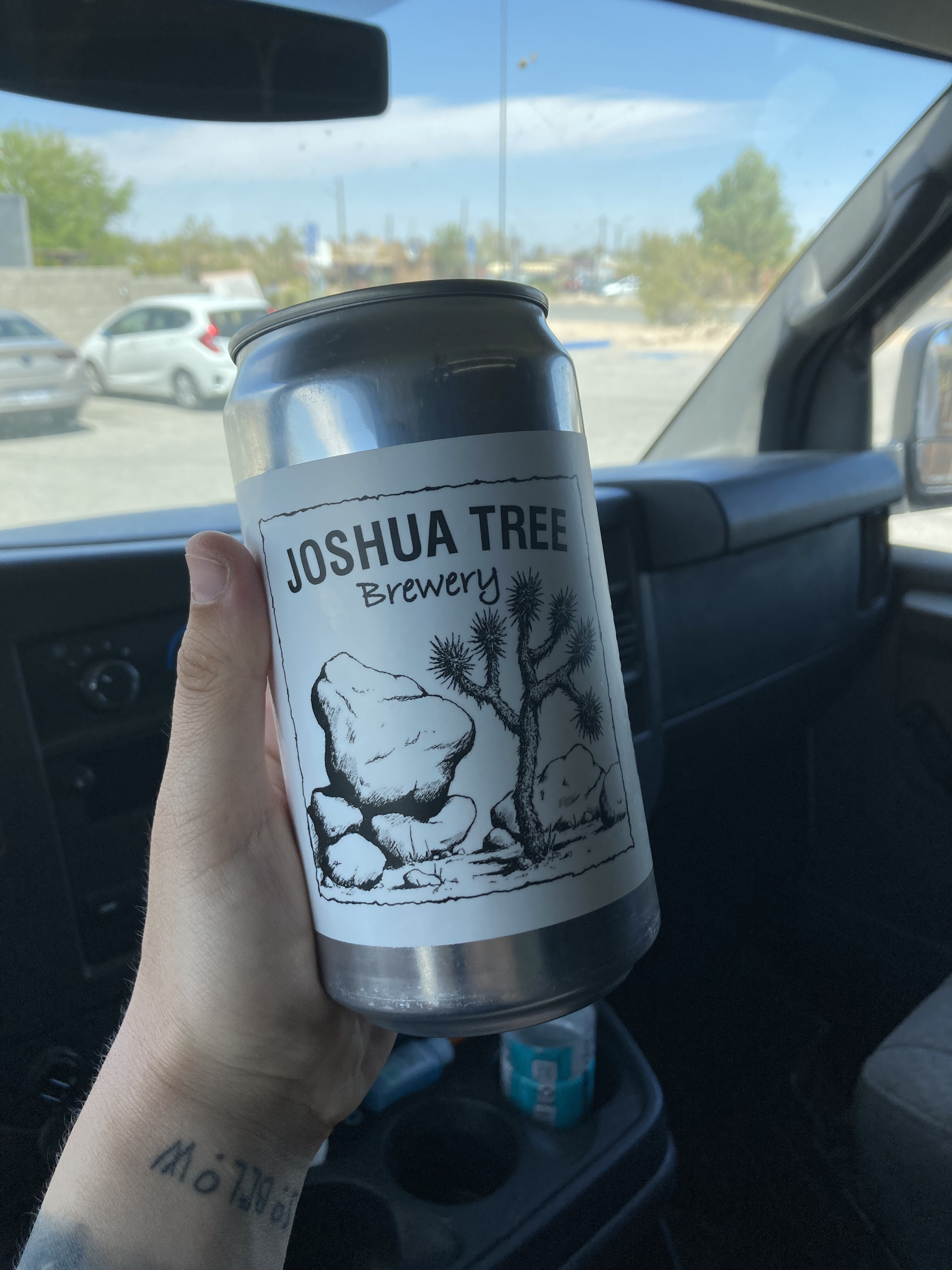
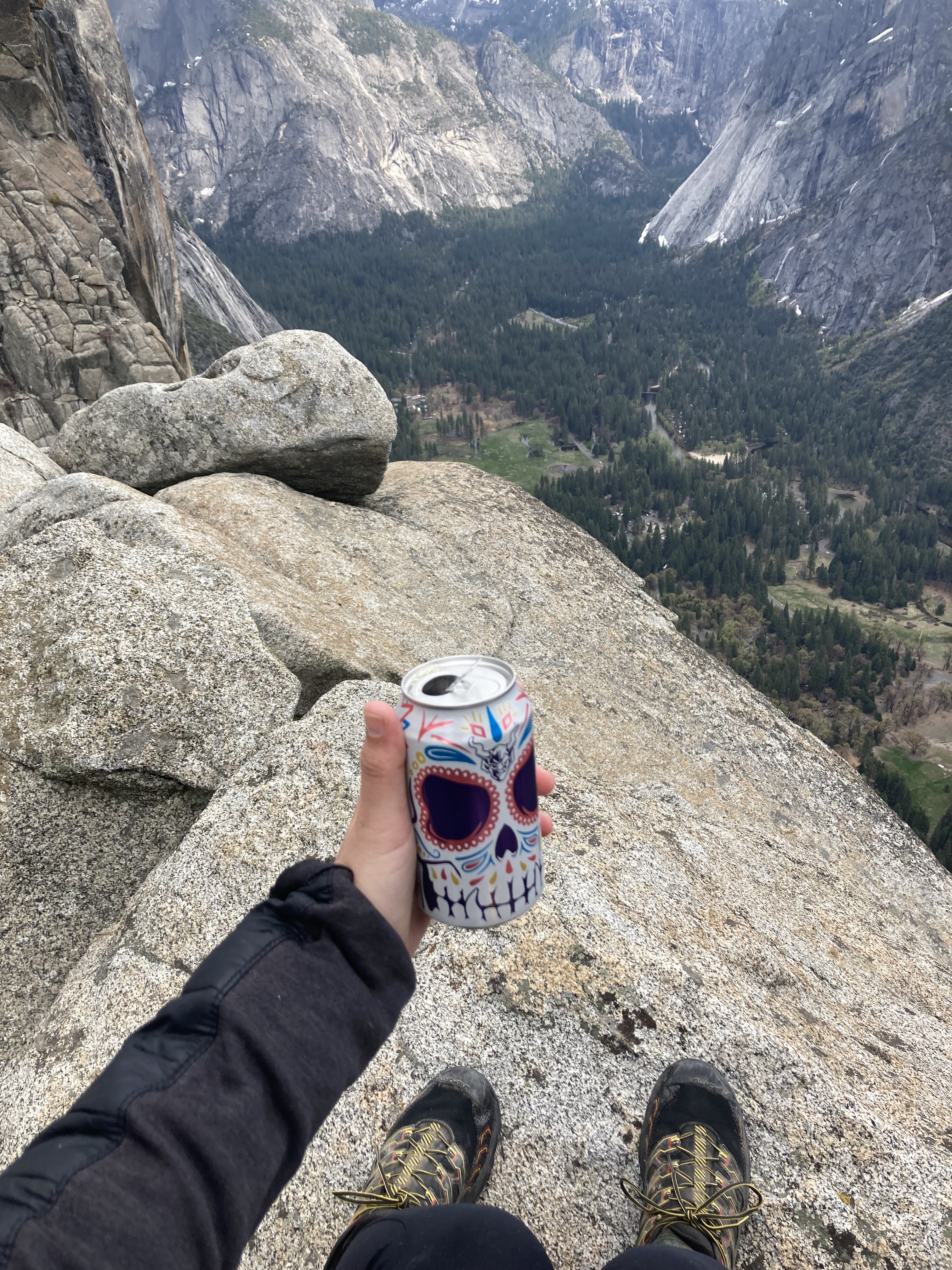
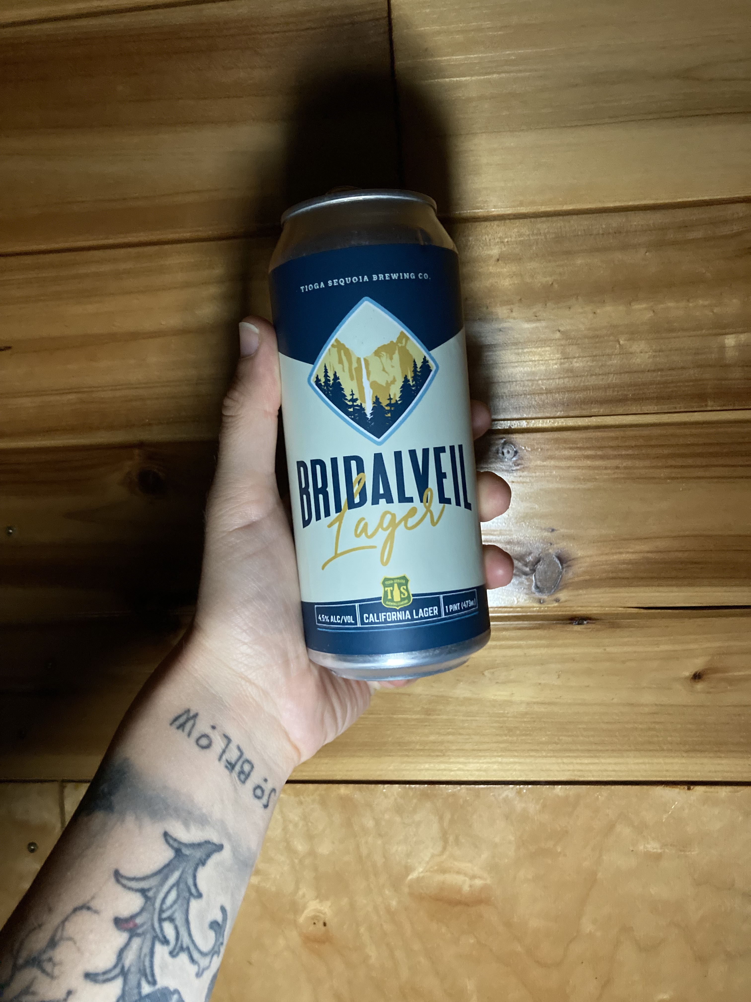
Cali Beer
I was planning on doing a standalone post for beer in California, but to be honest I didn’t seek out that many breweries while I was in the Golden State. I don’t (yet) know enough about the beer scene. I think because I’d never heard of a beer scene in California (like how I did with Oregon’s Portland and Bend “Beervana”), perhaps I assumed there wasn’t much of one. All I know is that beer was not a huge focus for me in California the way it has been in other places.
That said, I might do some research and round up of my experiences in a post at a later date, but for now here are some of the memorable and standout beers/ beer experiences I had during my time in California:
The End

Next up: Oregon.
ChronicXRoads on Instagram
Copyright © 2026 Chronic X-Roads. All Rights Reserved.

2 thoughts on “A Change In Direction: The California Interior”